|
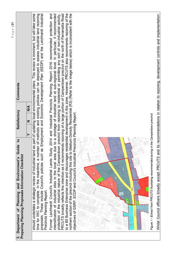
AGENDA R |

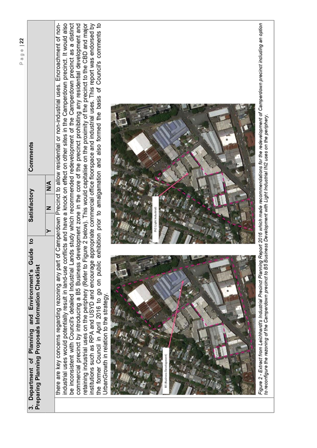
Council Meeting
TUESDAY 30 OCTOBER 2018
6.30pm
|
|
Council Meeting 30 October 2018 |
Live Streaming of Council Meeting
In the spirit of open, accessible and transparent government, this meeting of the Inner West Council is being streamed live on Council’s website. By speaking at a Council meeting, members of the public agree to being recorded and must ensure their speech to the Council is respectful and use appropriate language. A person who uses defamatory, discriminatory or offensive language may be exposed to liability for which Council takes no responsibility. Any part of this meeting that is held in closed session will not be recorded
Pre-Registration to Speak at Council Meetings
Members of the public must register by 2pm of the day of the Meeting to speak at Council Meetings. If you wish to register to speak please fill in a Register to Speak Form, available from the Inner West Council website, including:
Are there any rules for speaking at a Council Meeting?
The following rules apply when addressing a Council meeting:
What happens after I submit the form?
Your request will then be added to a list that is shown to the Chairperson on the night of the meeting.
Where Items are deferred, Council reserves the right to defer speakers until that Item is heard on the next occasion.
Accessibility
Inner West Council is committed to ensuring people with a disability have equal opportunity to take part in Council and Committee Meetings. At the Ashfield Council Chambers there is a hearing loop service available to assist persons with a hearing impairment. If you have any other access or disability related participation needs and wish to know more, call 9392 5657.
Persons in the public gallery are advised that under the Local Government Act 1993, a person may NOT tape record a Council meeting without the permission of Council.
Any persons found recording without authority will be expelled from the meeting.
“Record” includes the use of any form of audio, video and still camera equipment or mobile phone capable of recording speech.
An audio recording of this meeting will be taken for the purpose of verifying the accuracy of the minutes.
|
|
Council Meeting 30 October 2018 |
|
PRECIS |
1 Acknowledgement of Country
2 Apologies
3 Notice of Webcasting
4 Disclosures
of Interest (Section 451 of the Local Government Act
and Council’s Code of Conduct)
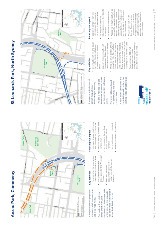
5 Moment of Quiet Contemplation
6 Confirmation of Minutes Page
Minutes of 9 October 2018 Council Meeting 5
7 Mayoral Minutes
Nil at the time of printing.
8 Condolence Motions
Nil at the time of printing.
9 Staff Reports
ITEM PAGE #
C1018(2) Item 1 Financial Statements 2017/18 18
C1018(2) Item 2 Draft Dawn Fraser Baths Master Plan: Feedback from Public Exhibition 19
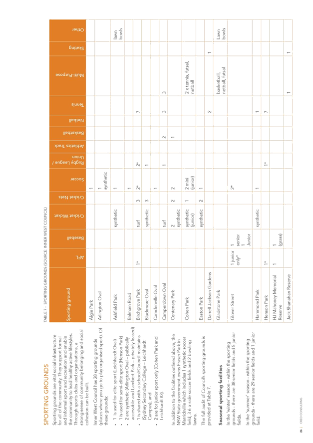
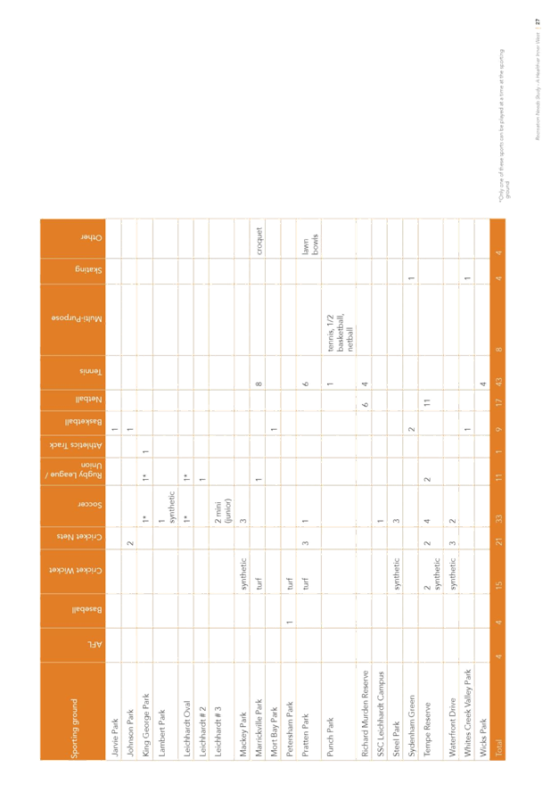
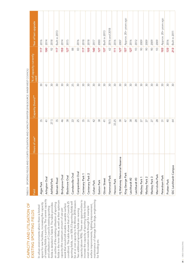
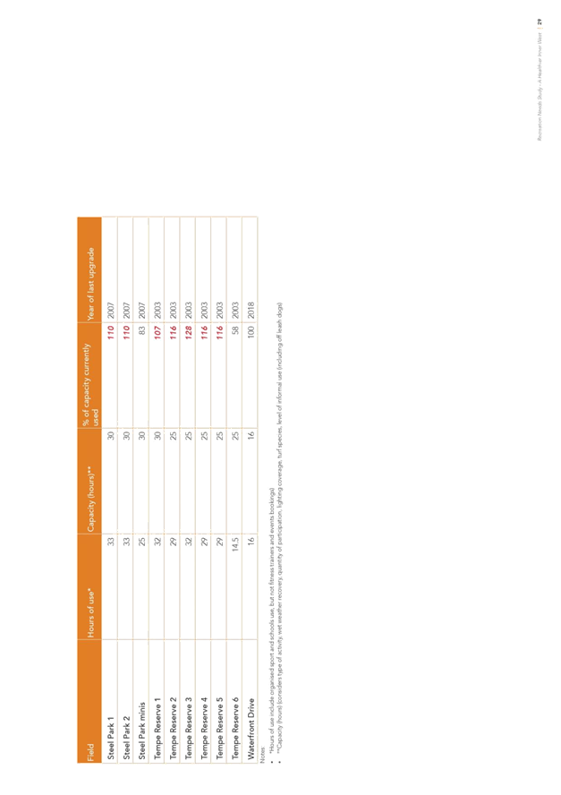
C1018(2) Item 3 A Healthier Inner West - Office of Sport 110
C1018(2) Item 4 Alternative Sites for a Regional Skate Park Facility in the North of the Inner West LGA 113
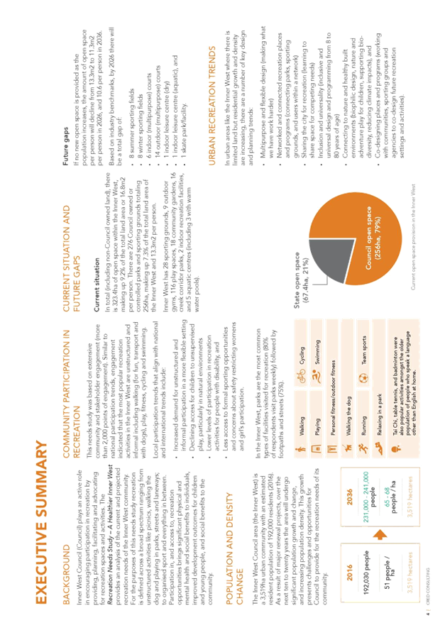
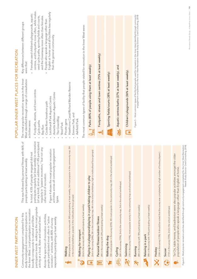
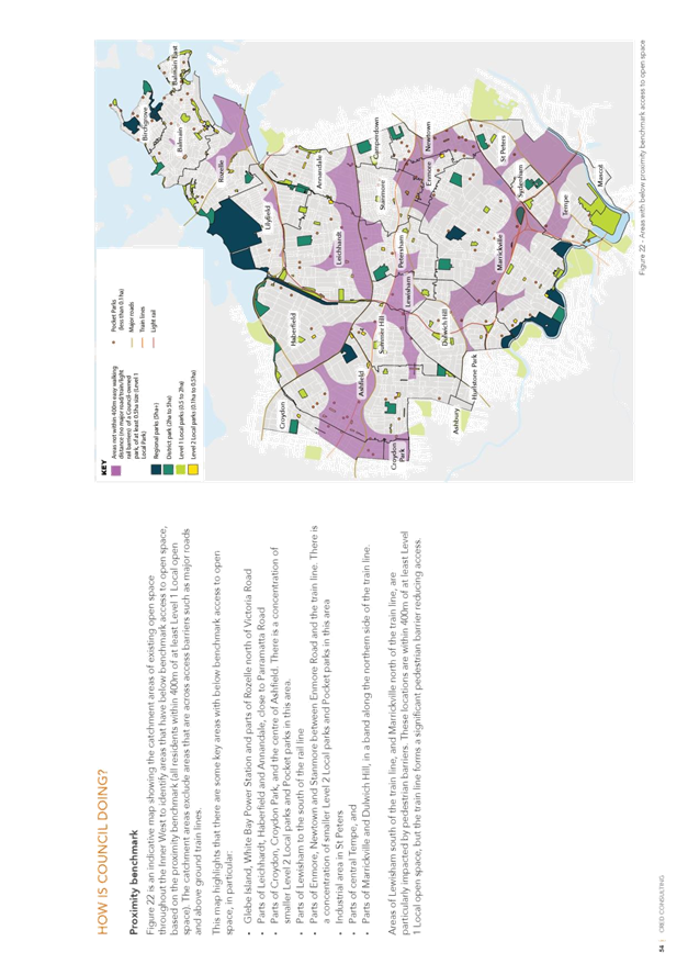
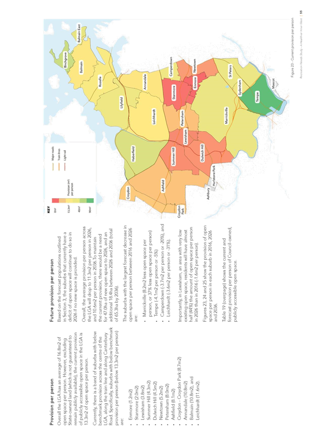
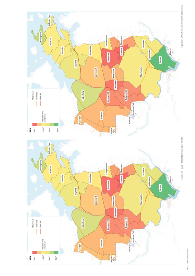
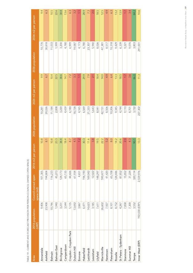
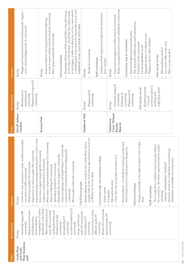
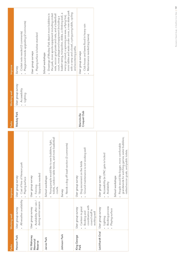
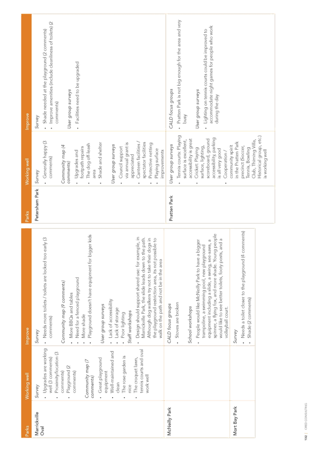
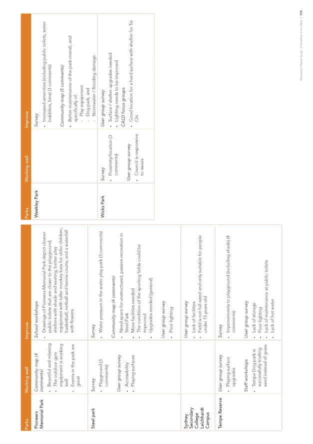
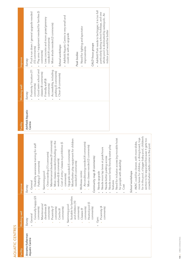
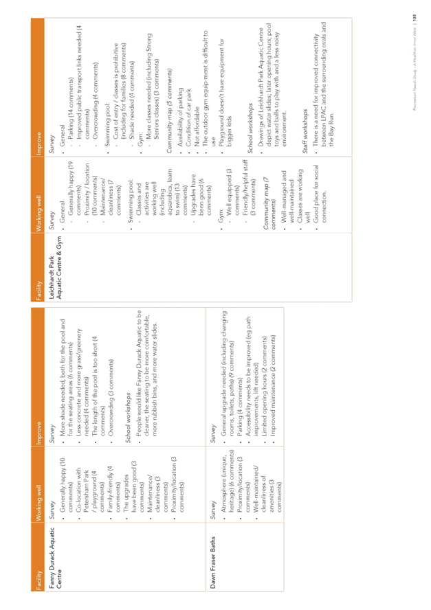
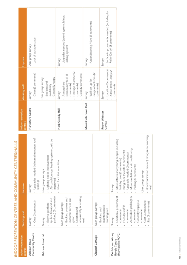
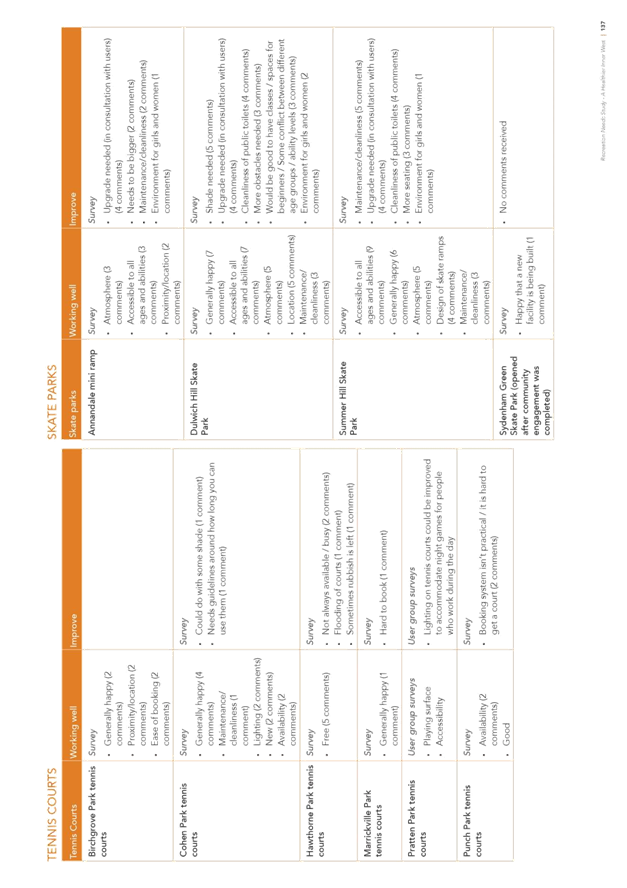
C1018(2) Item 5 Outcomes from the public exhibition of the Recreation Needs Study: A Healthier Inner West. 124
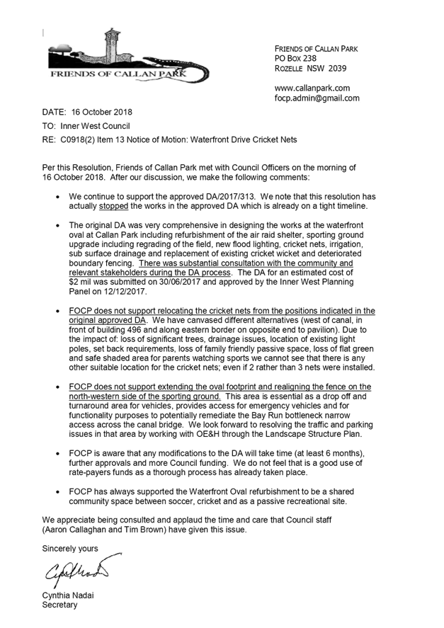
C1018(2) Item 6 Waterfront Sporting Ground-Cricket Nets Location 273
C1018(2) Item 7 Swimming In Parramatta River - New Site for Inner West 280
C1018(2) Item 8 Zero Waste Strategy and Transition Plan for a common customer focussed resource recovery and waste management service 290
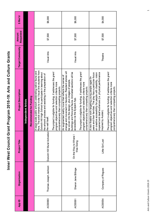
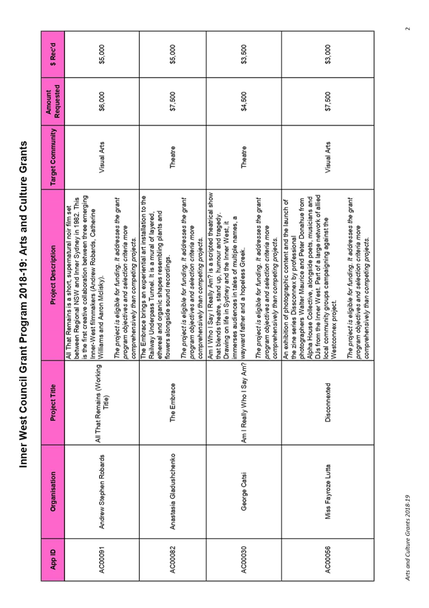
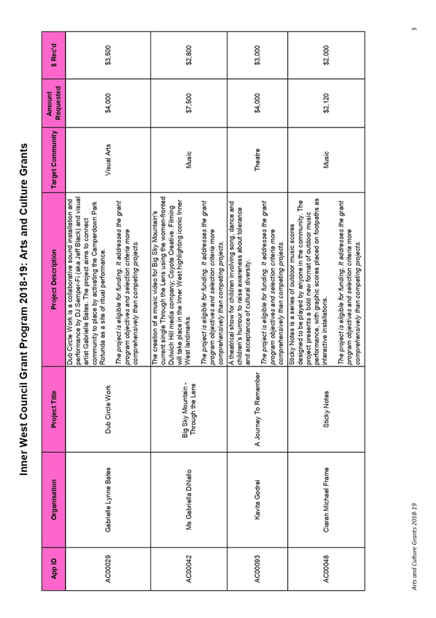
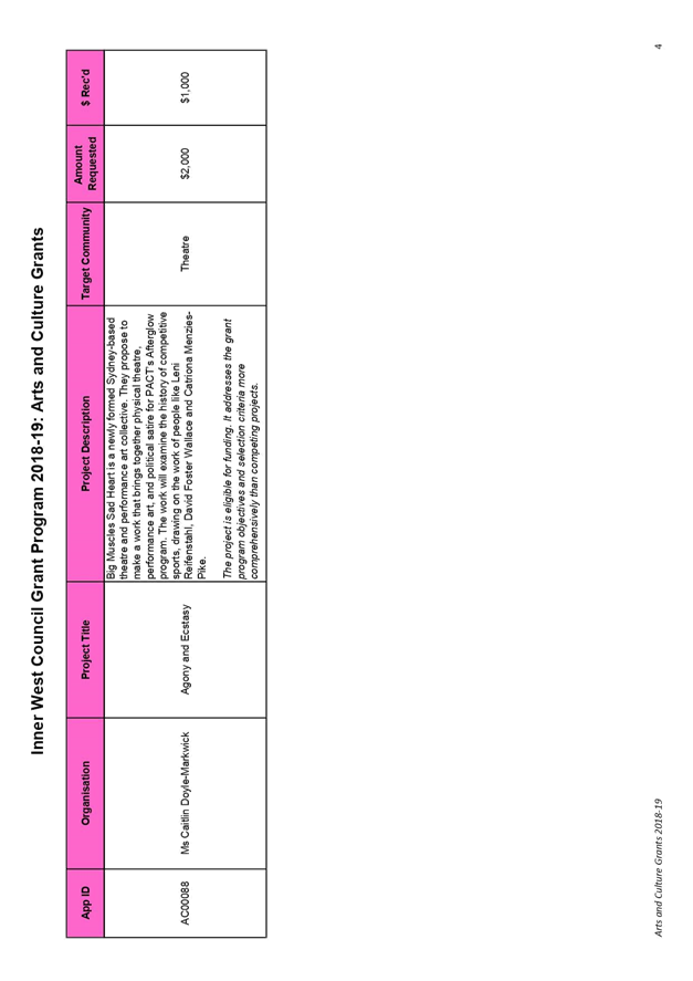
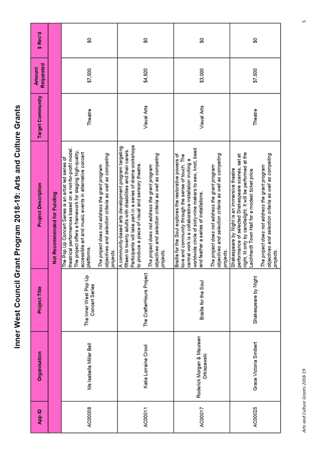
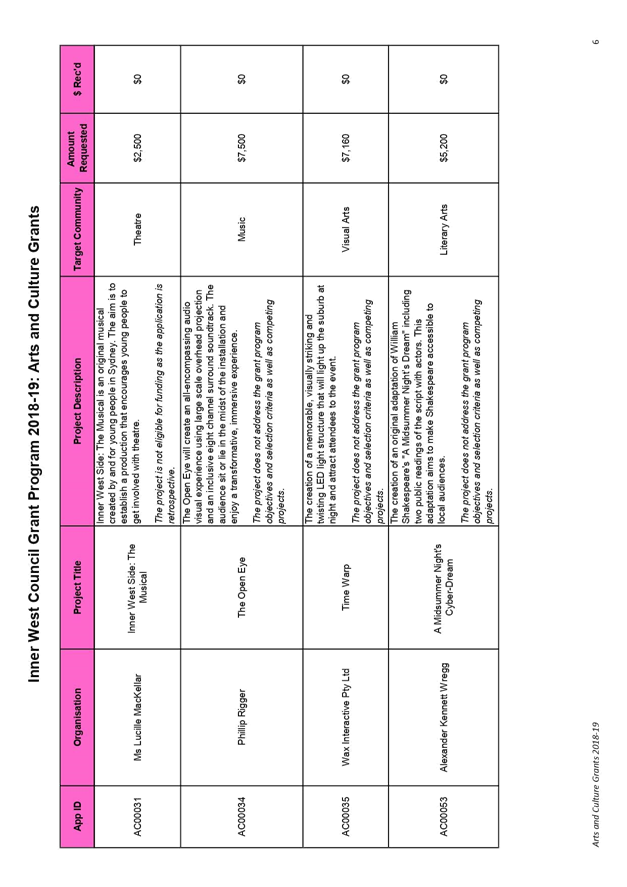
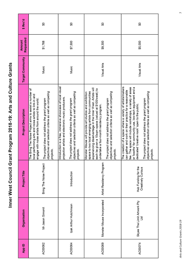
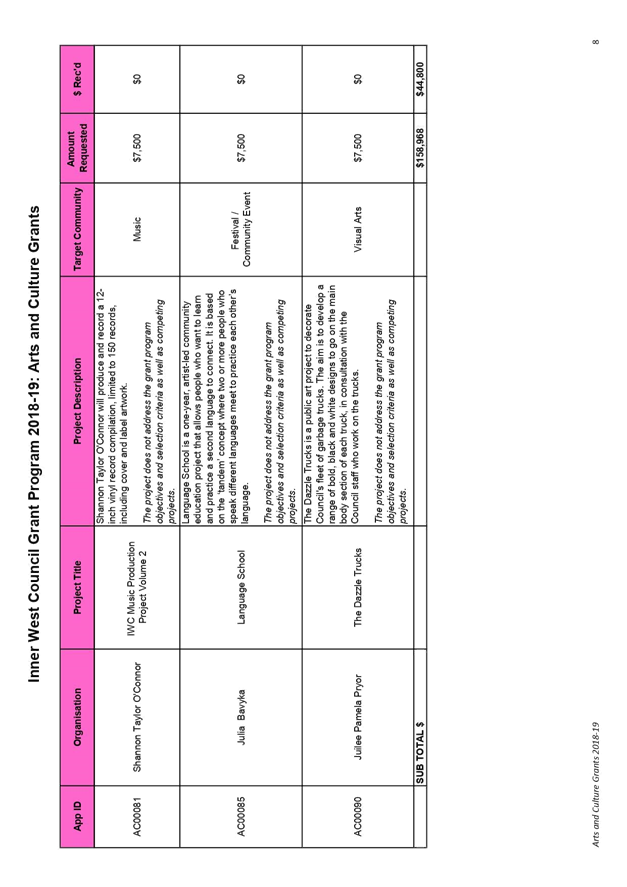
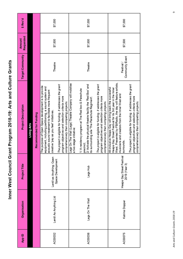
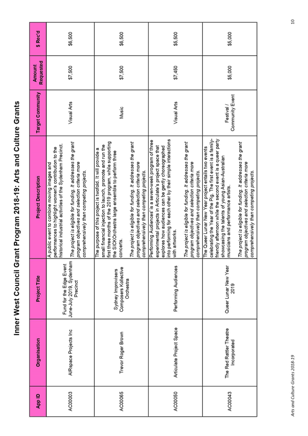
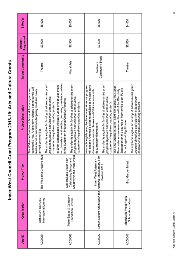
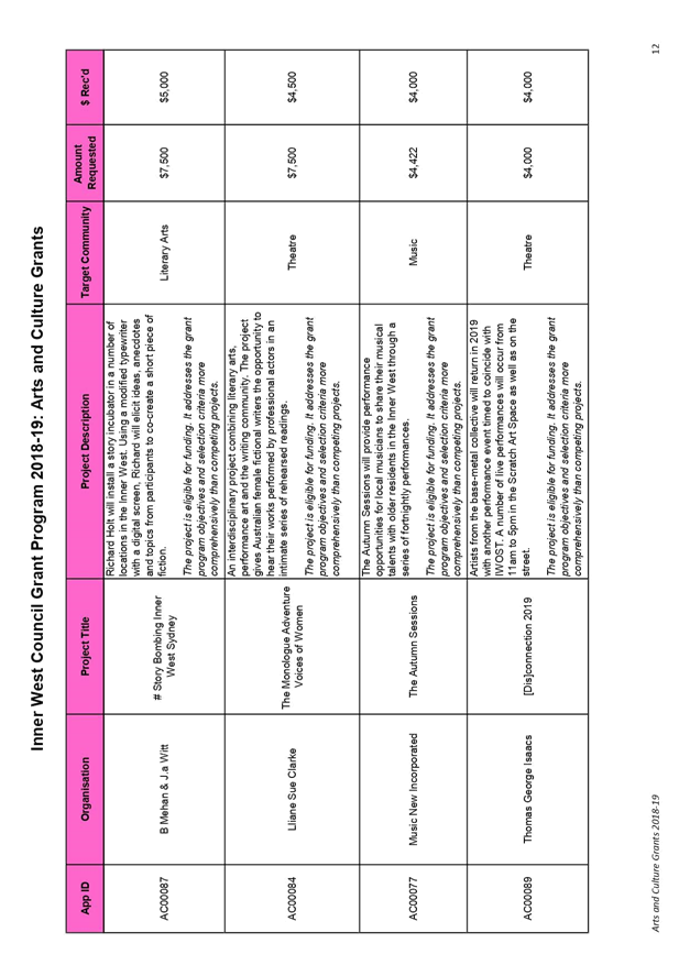
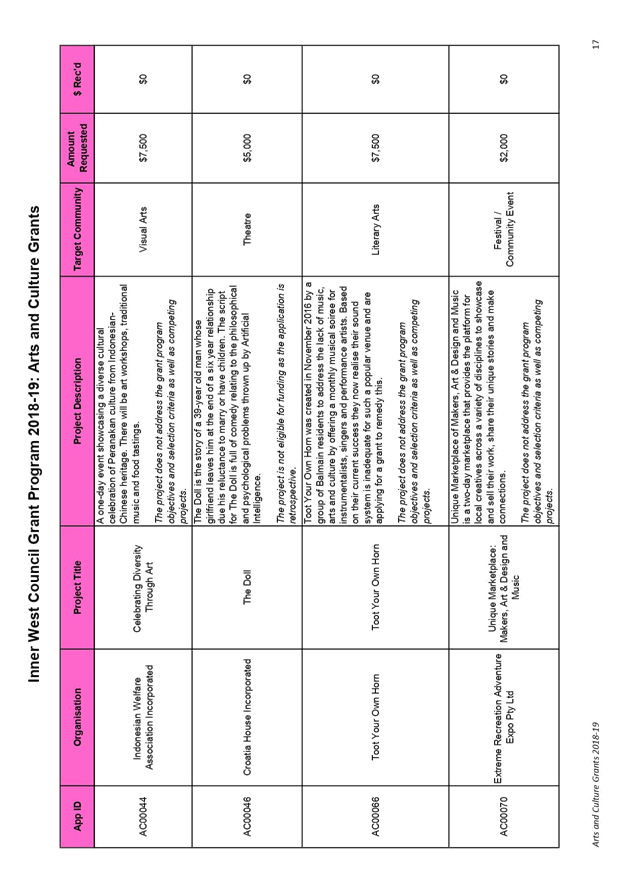
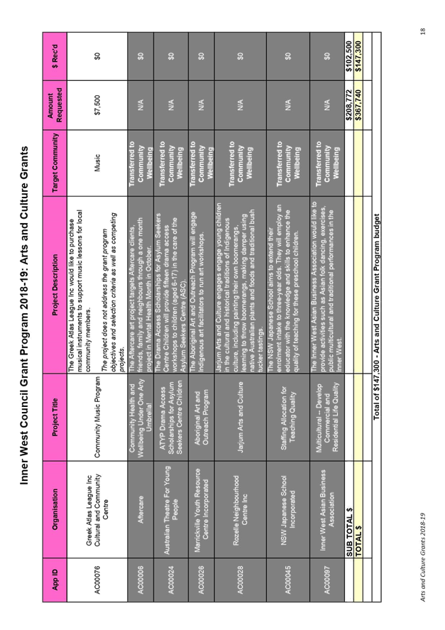
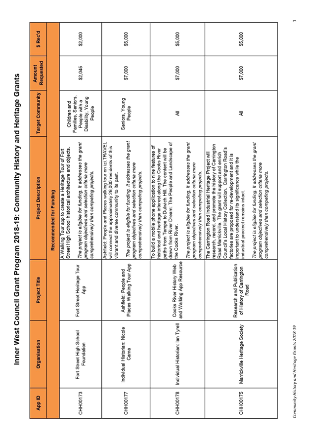
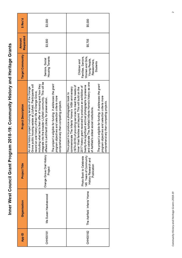
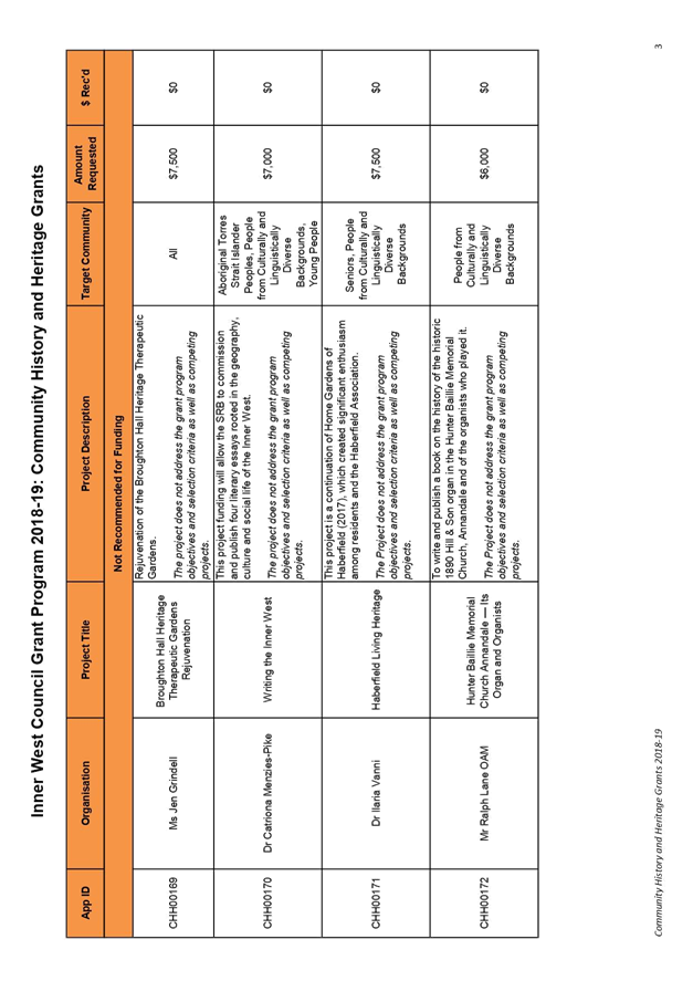
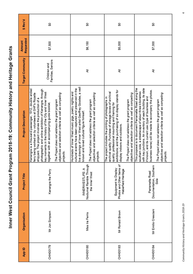
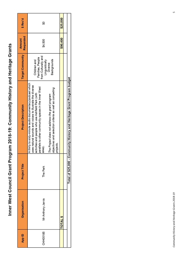
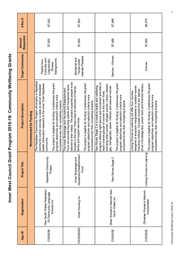
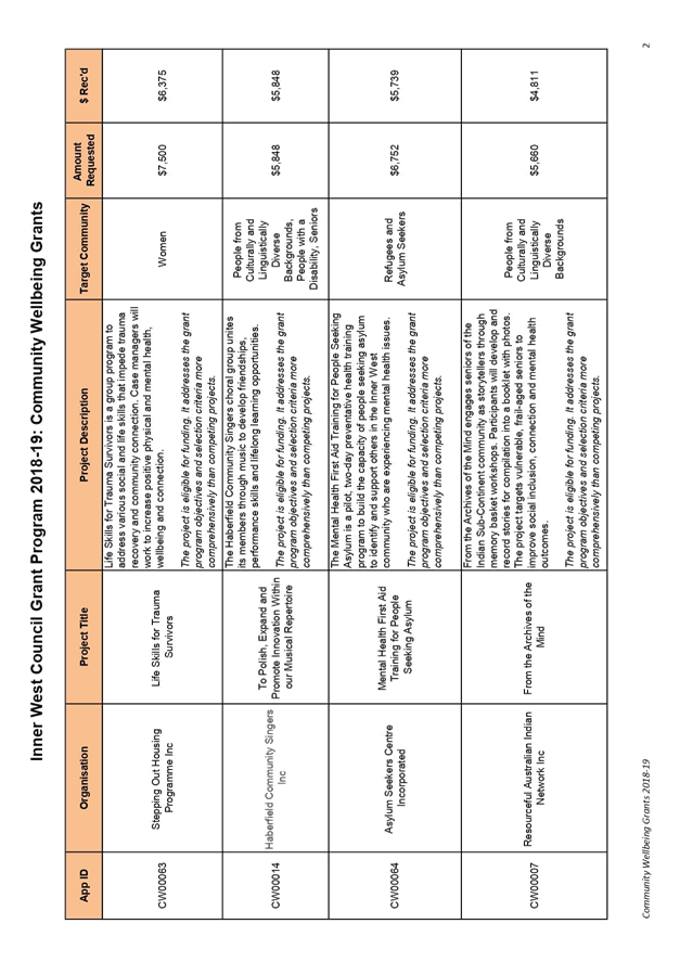
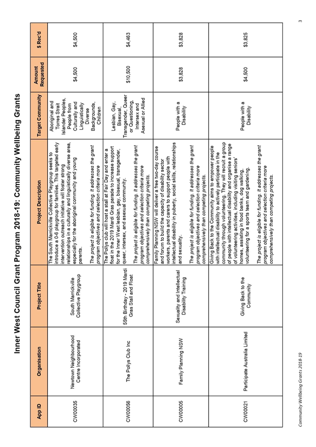
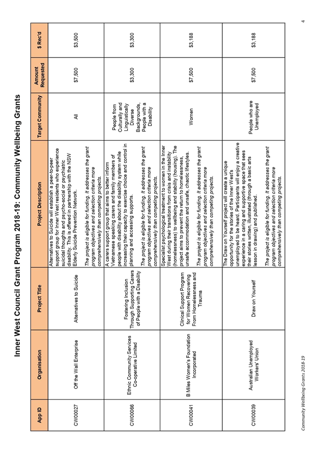
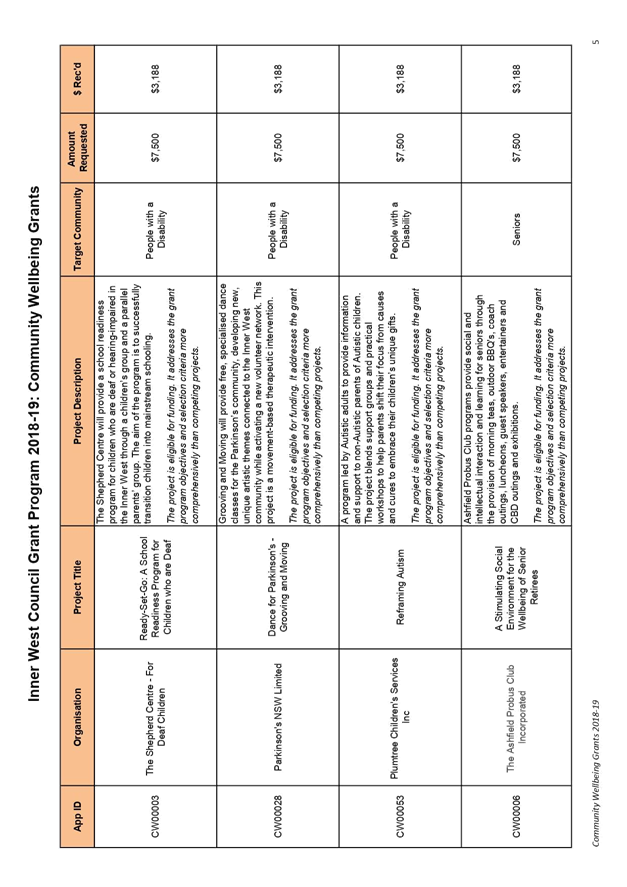
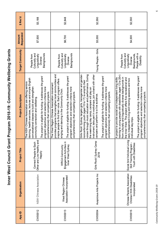
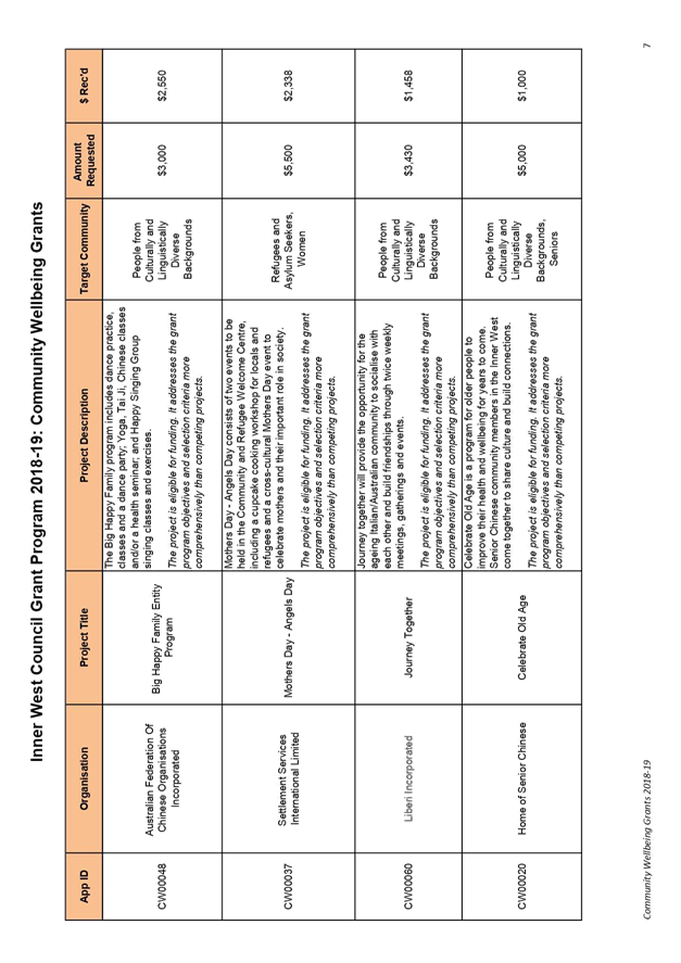
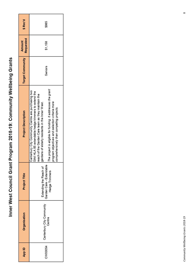
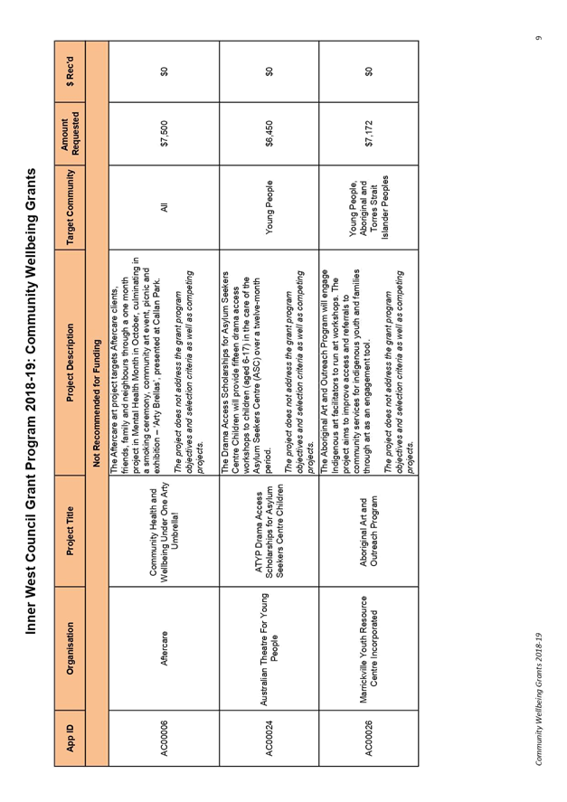
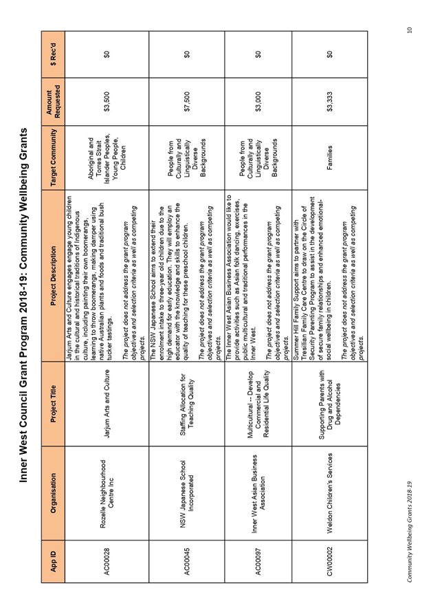
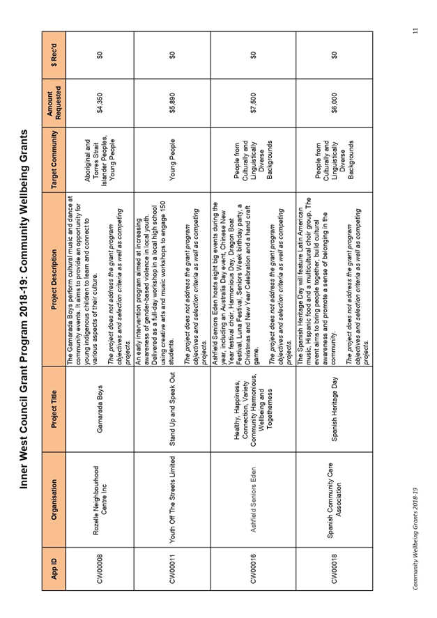
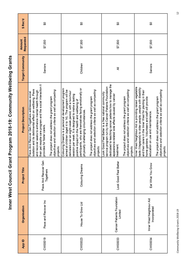
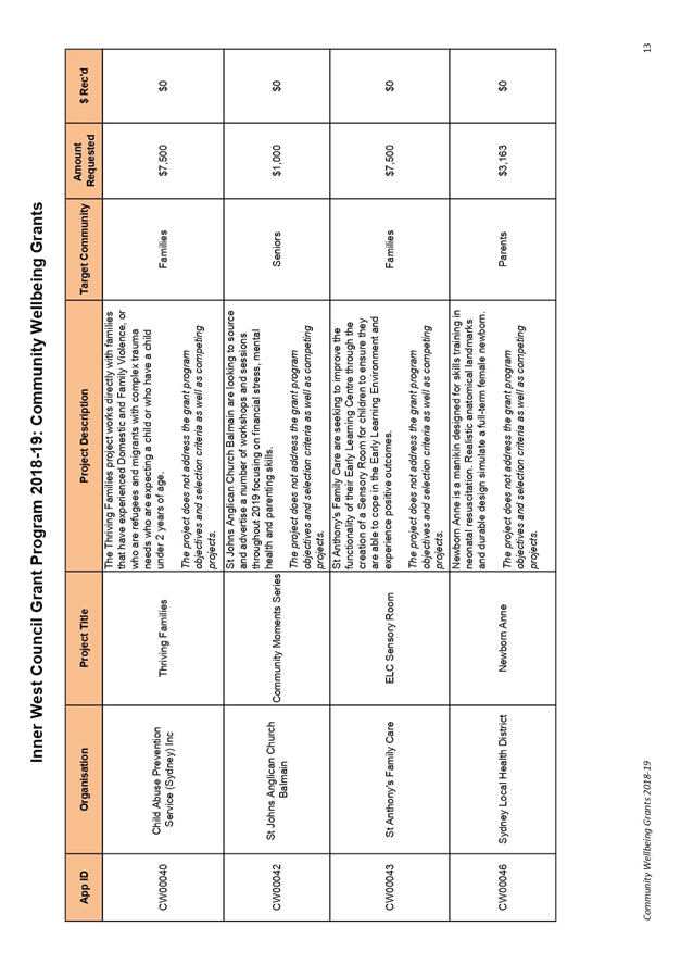
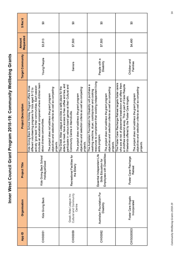
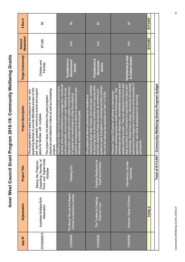
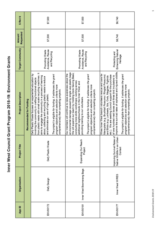
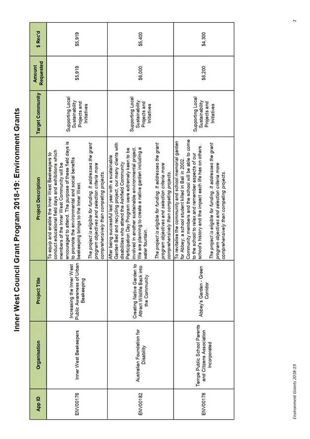
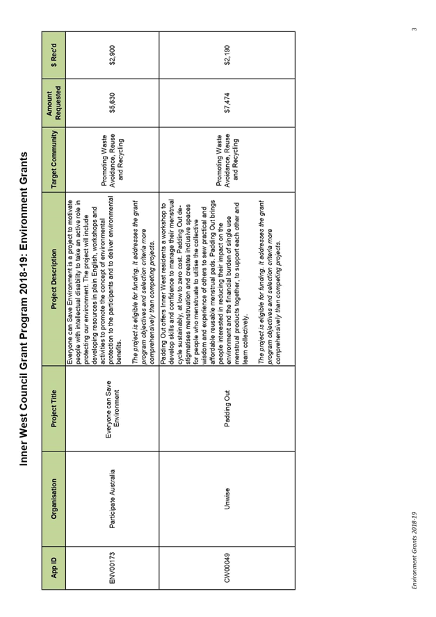
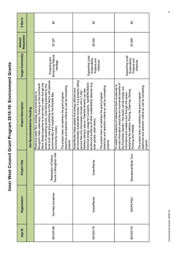
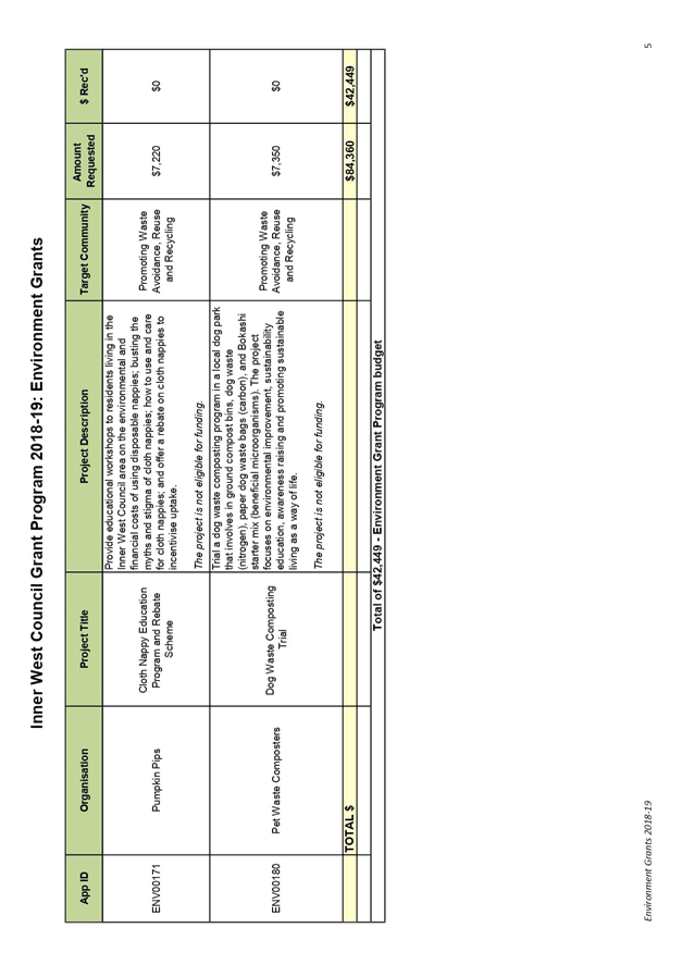
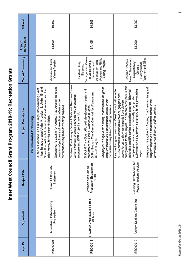
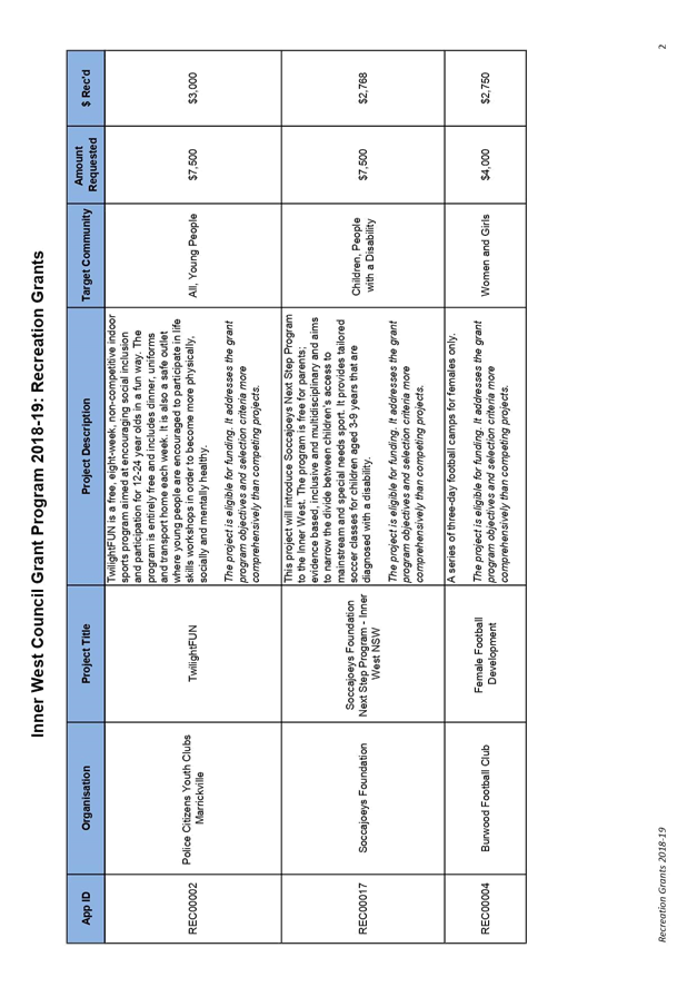
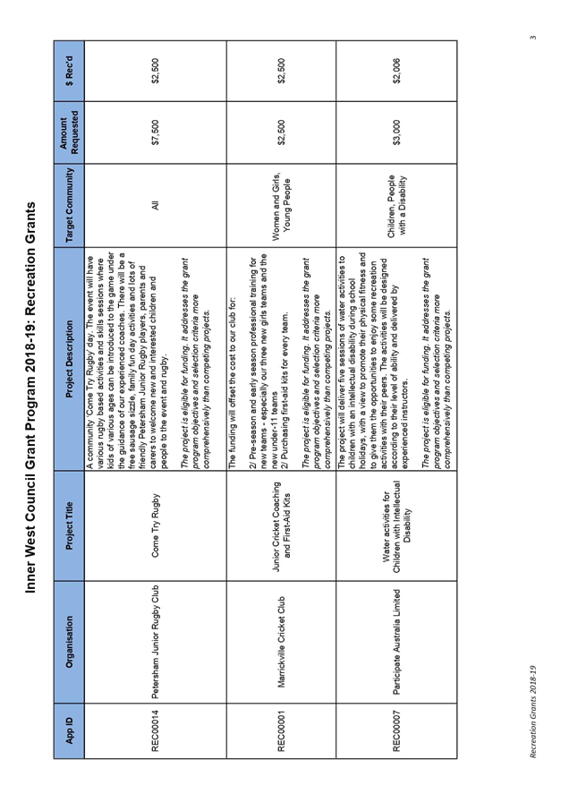
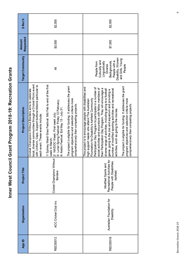
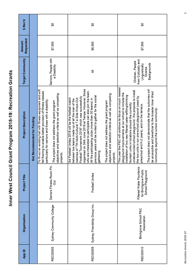
C1018(2) Item 9 2018/19 Inner West Council Grants Program 309
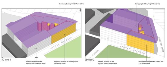
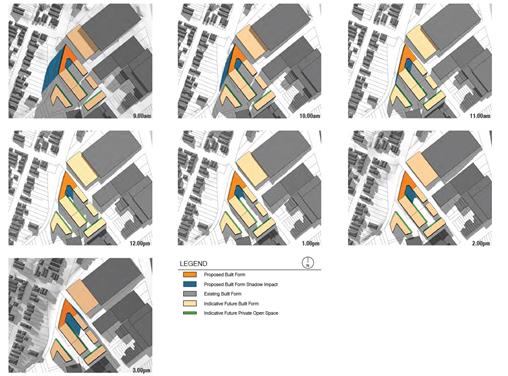
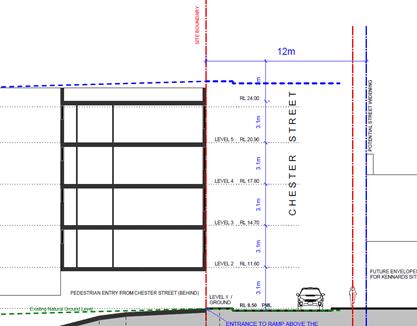
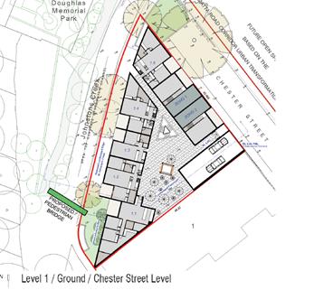
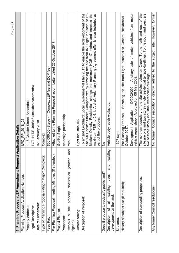
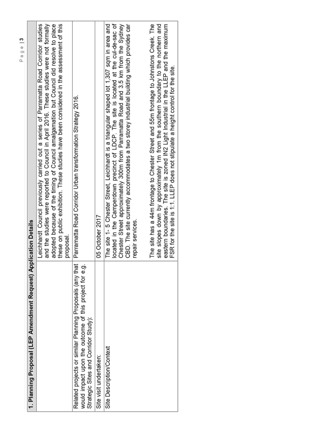
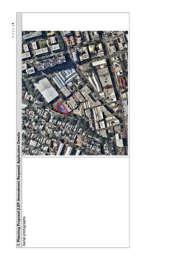
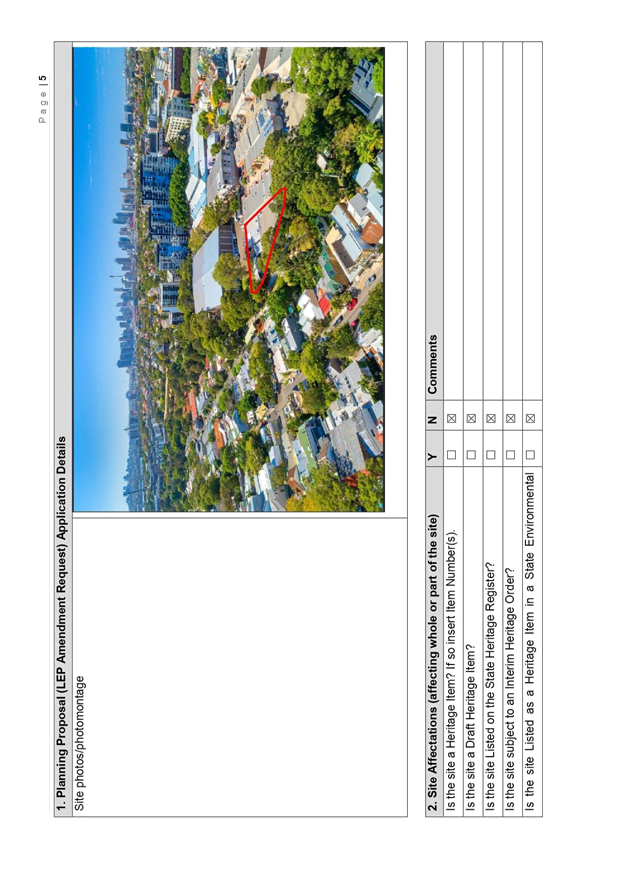
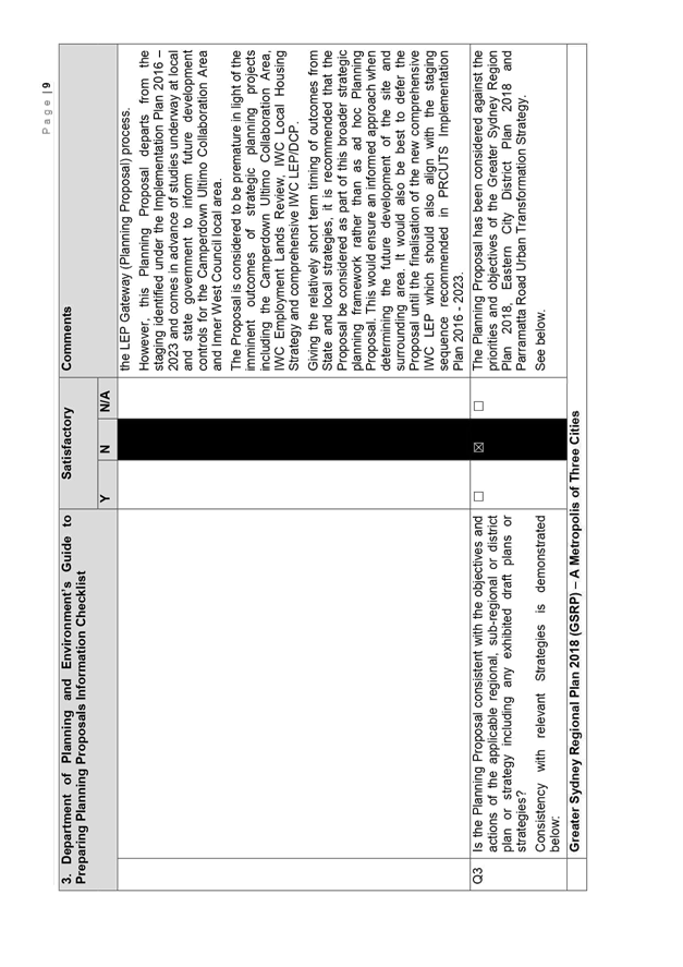
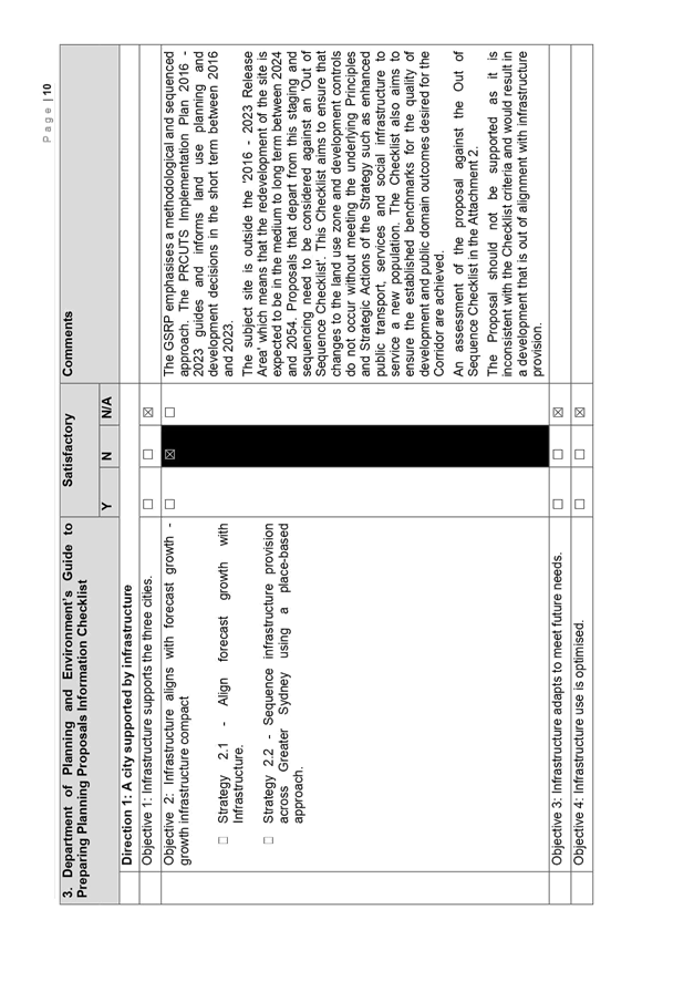
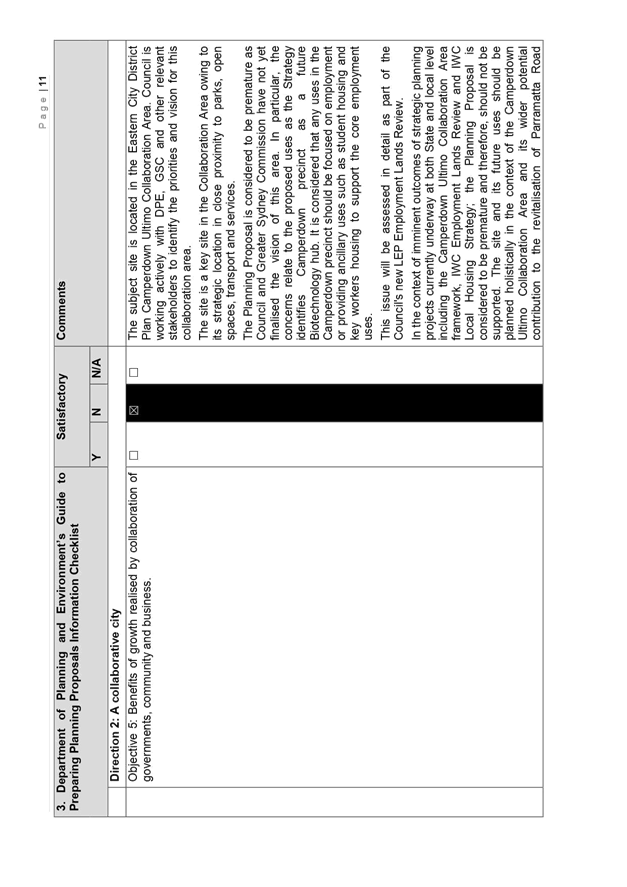
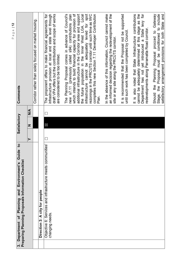
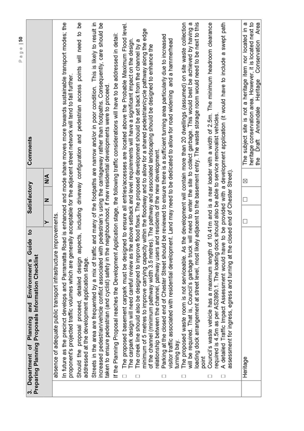
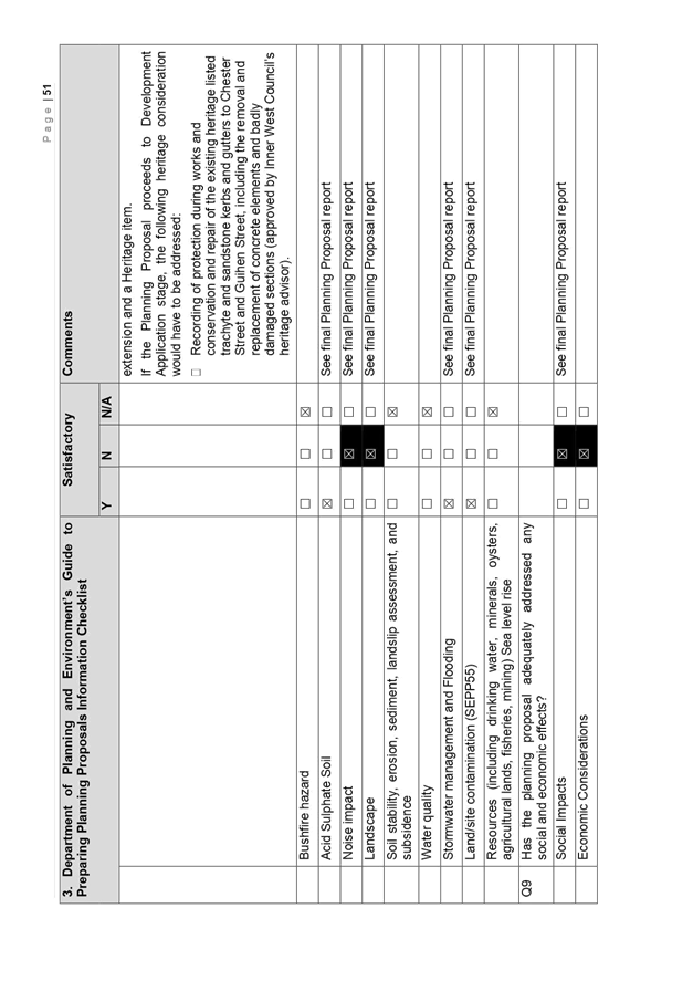
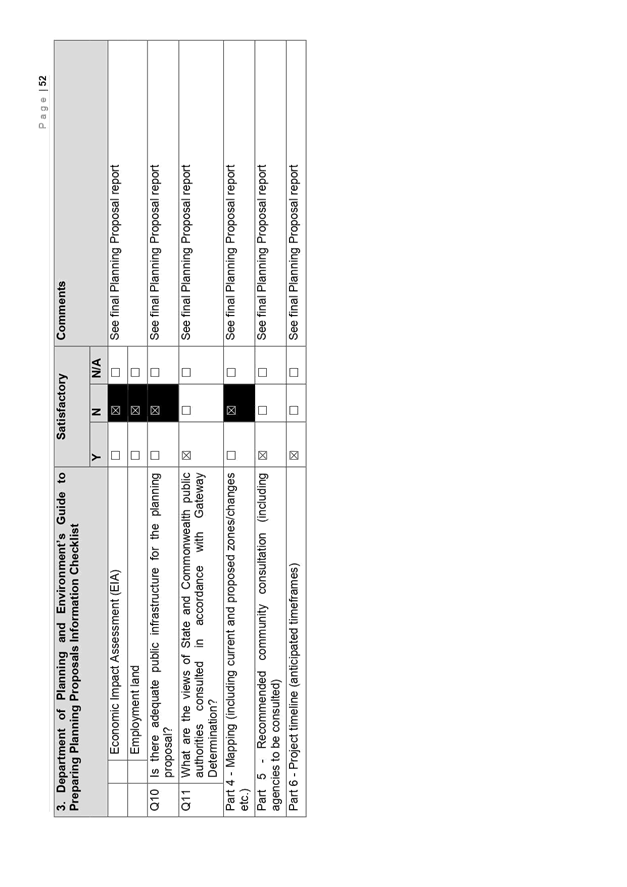
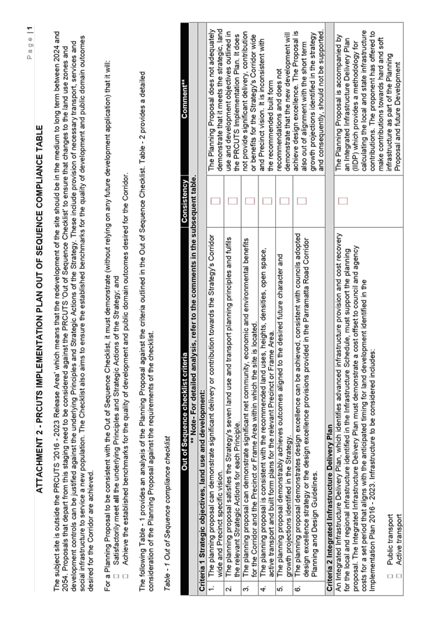
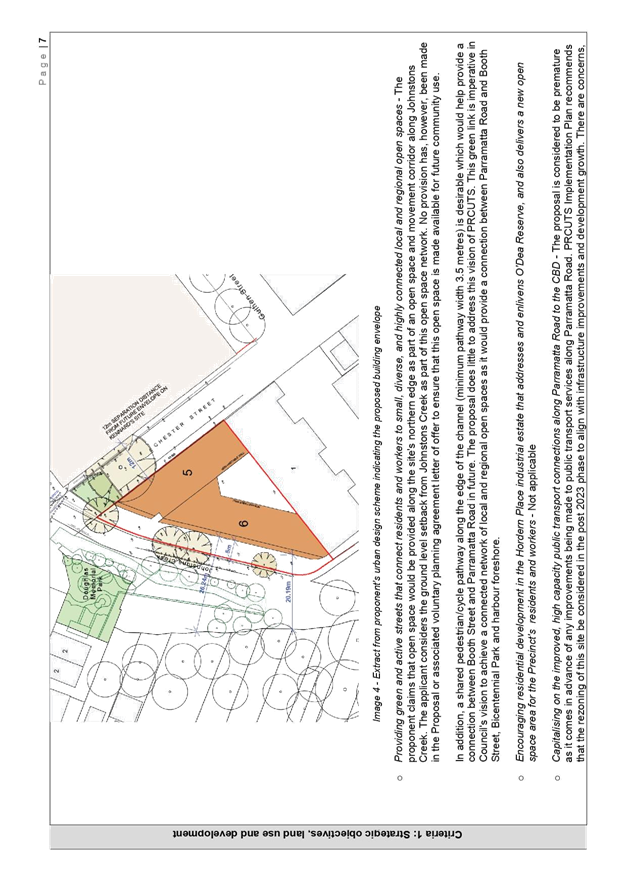
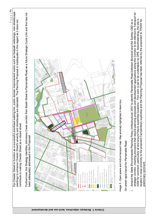
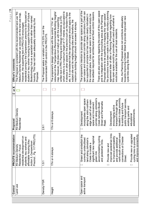
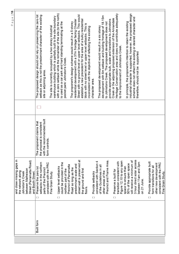
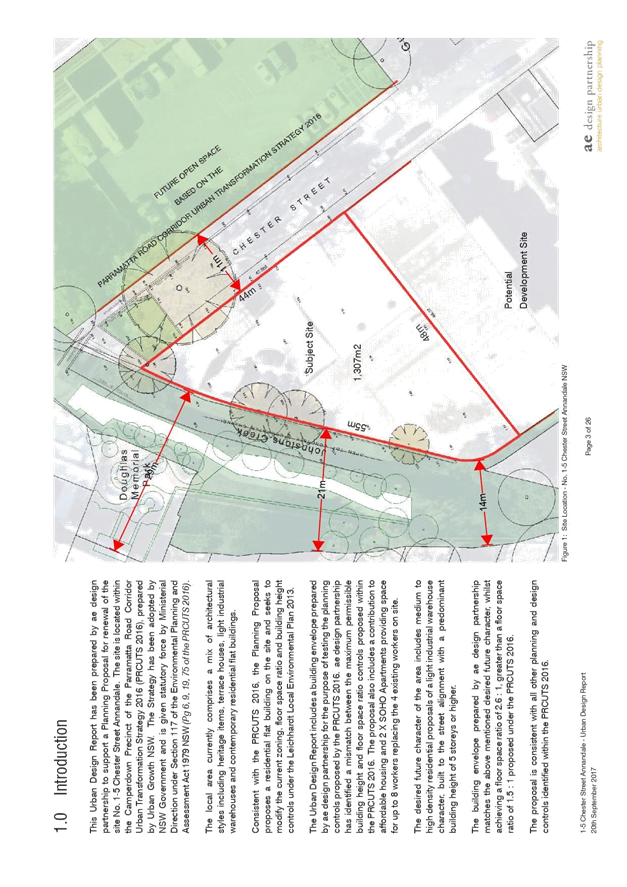
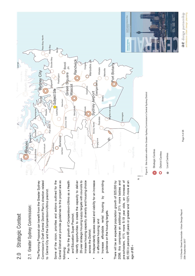
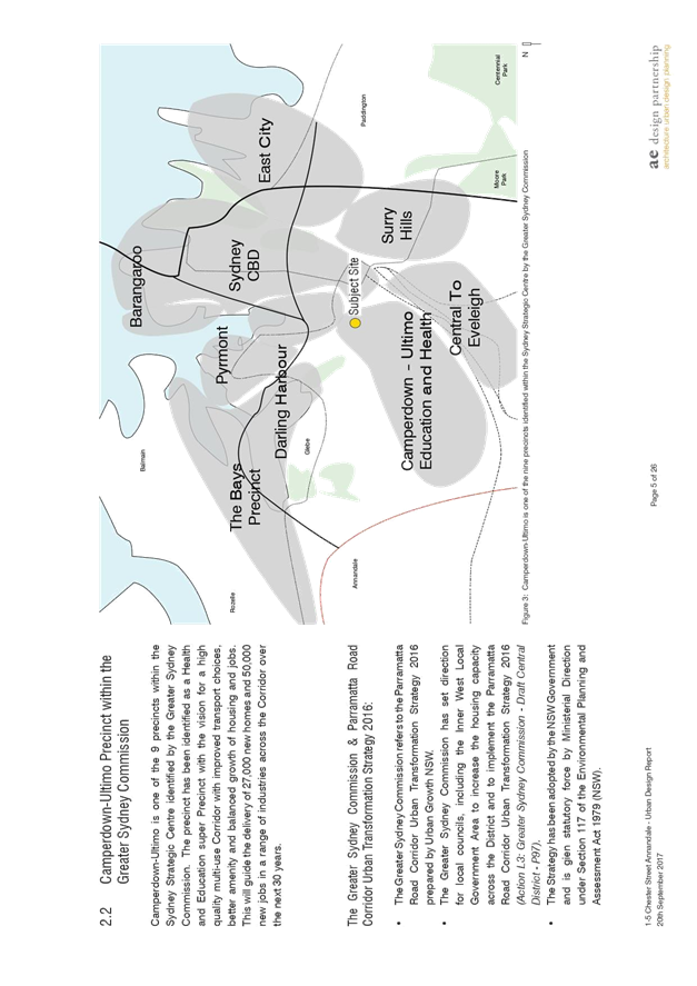
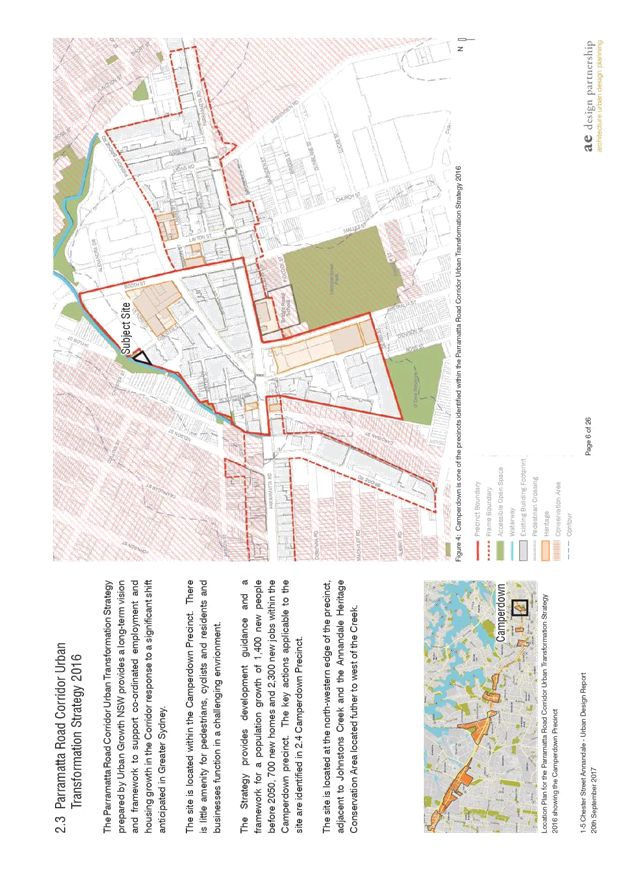
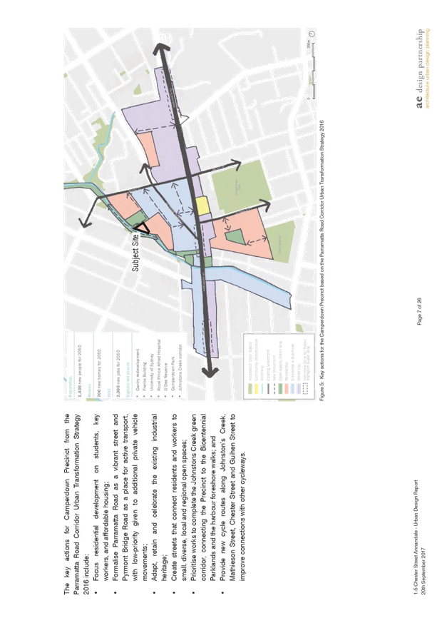
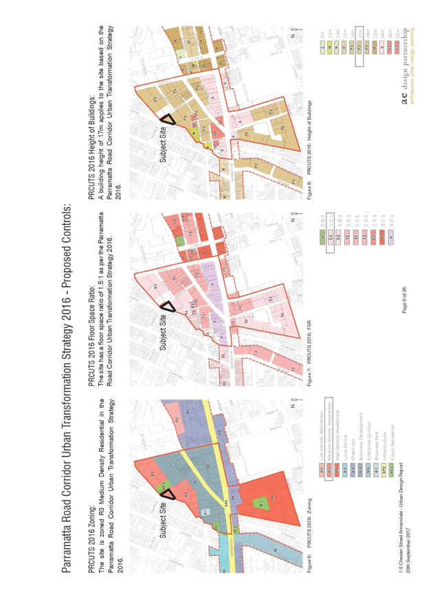
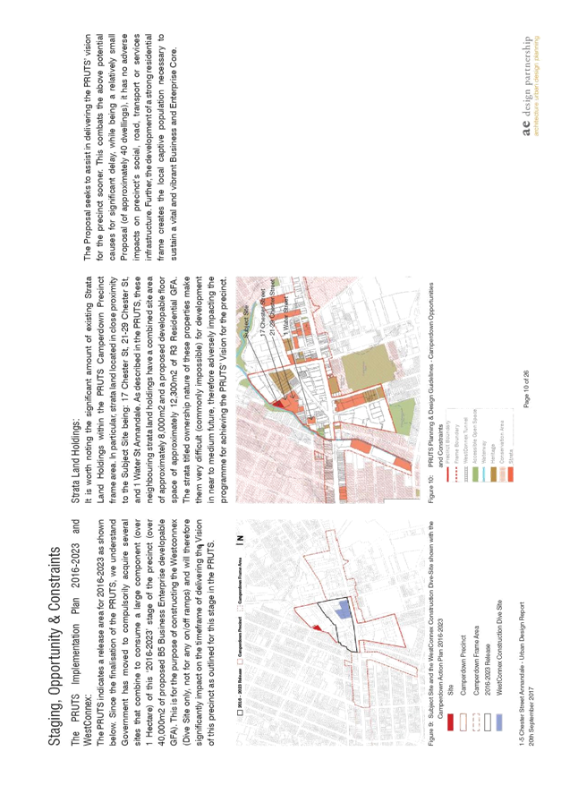
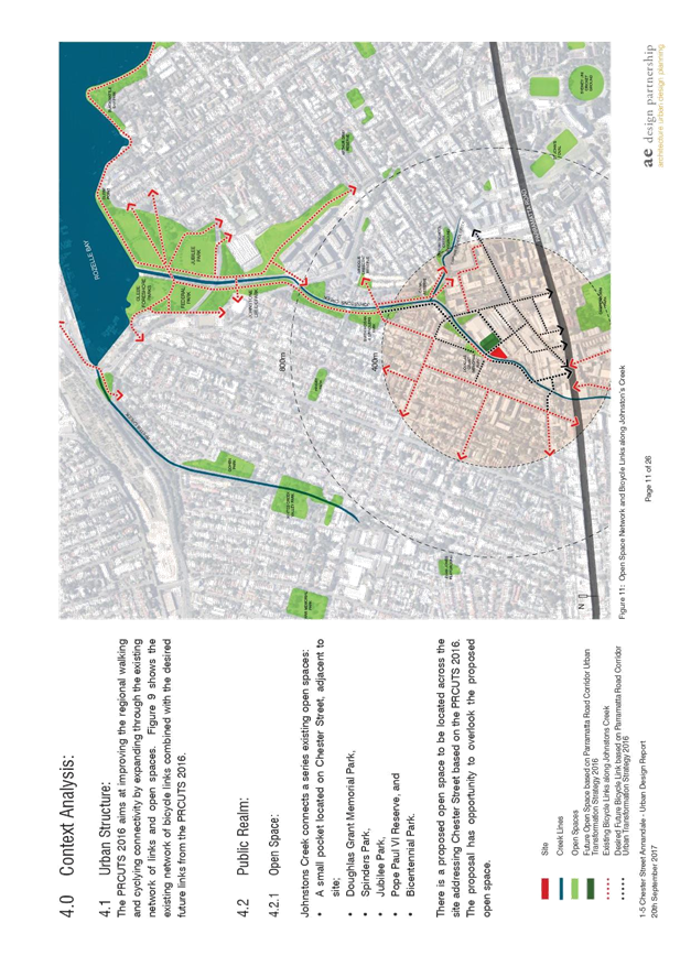
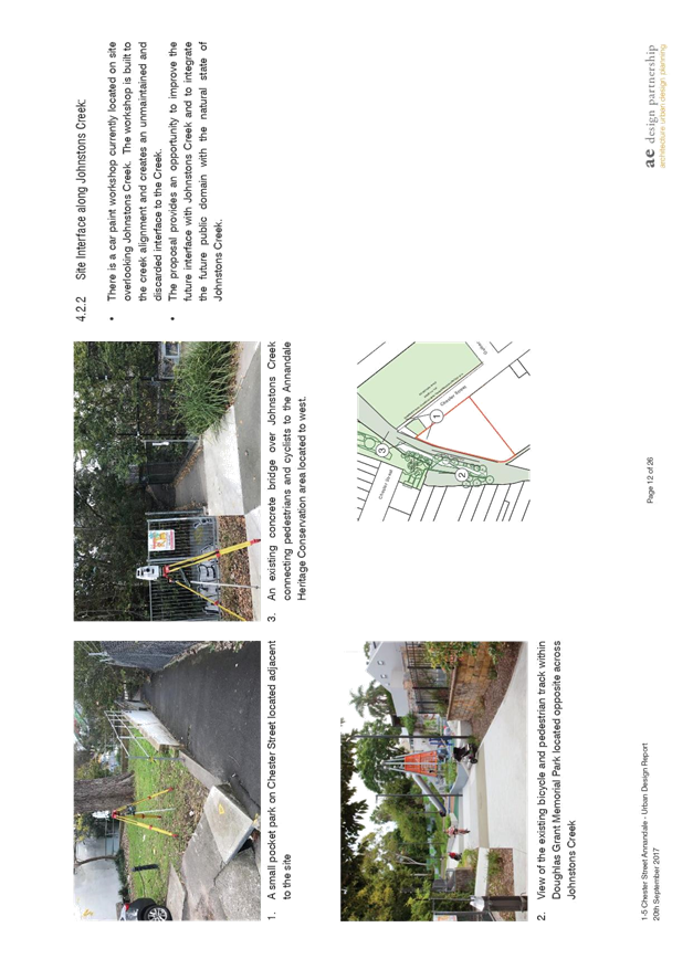
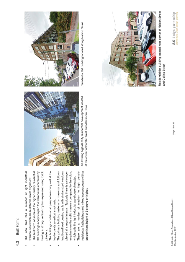
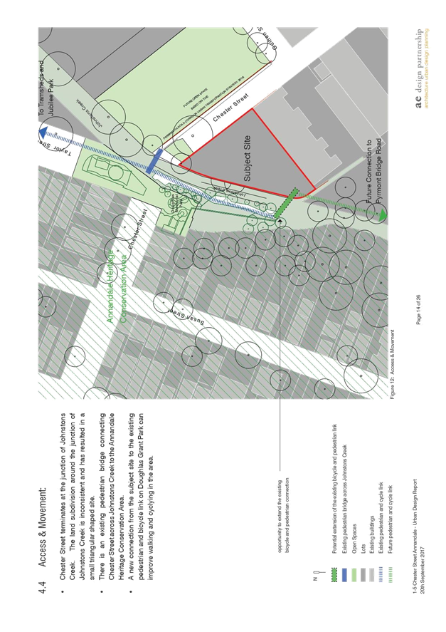
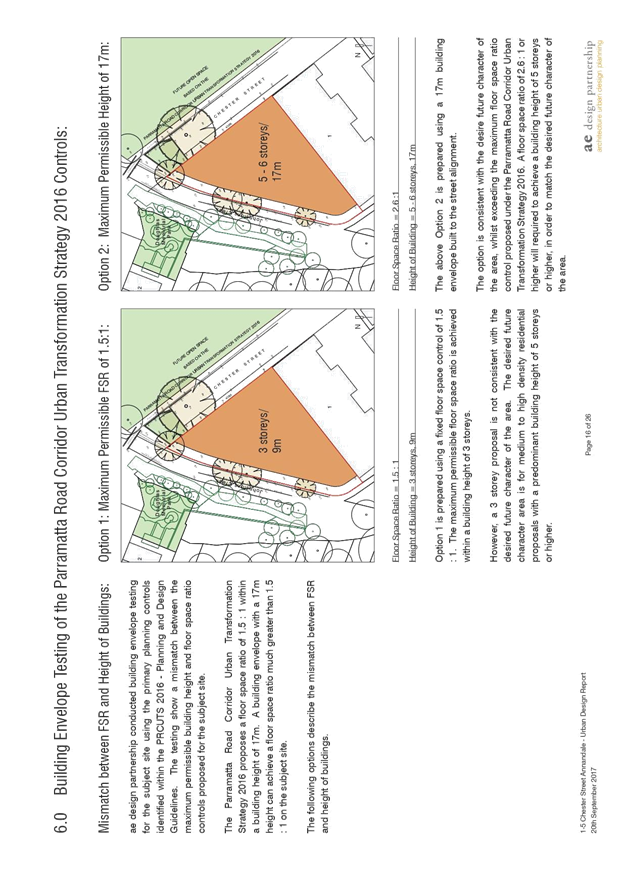
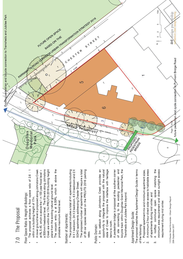
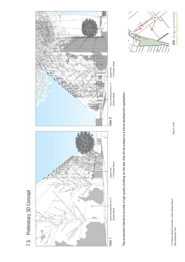
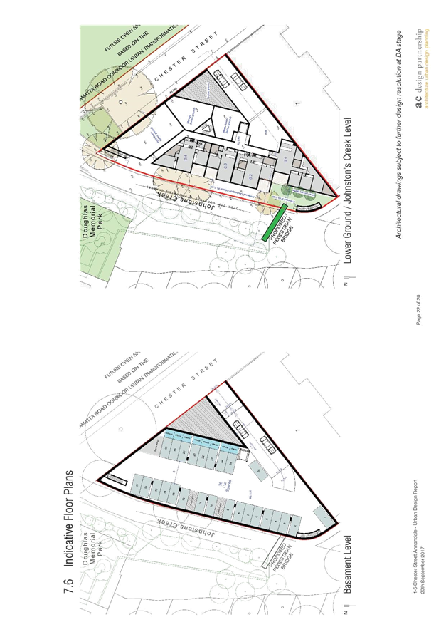
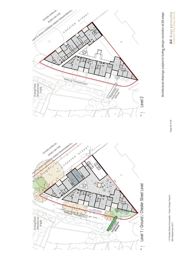
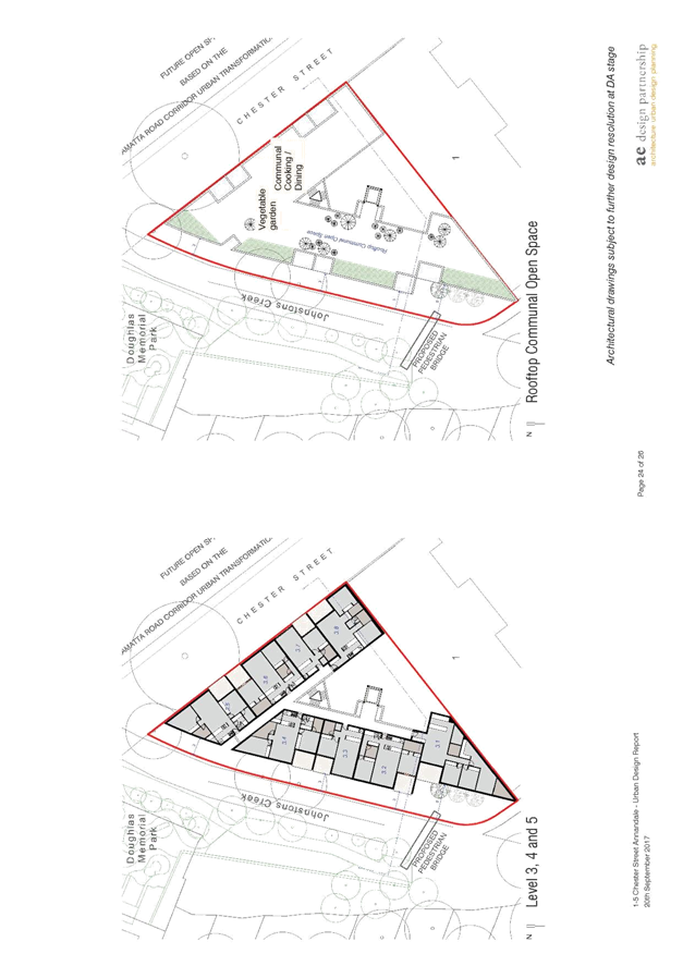
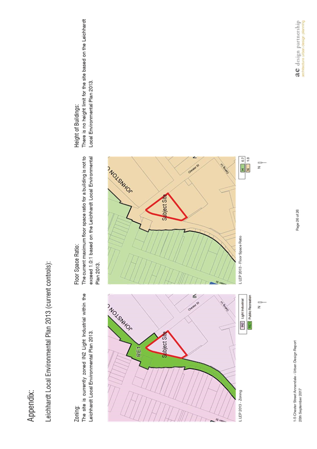
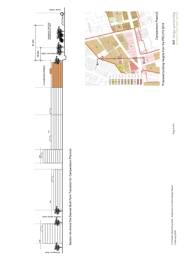
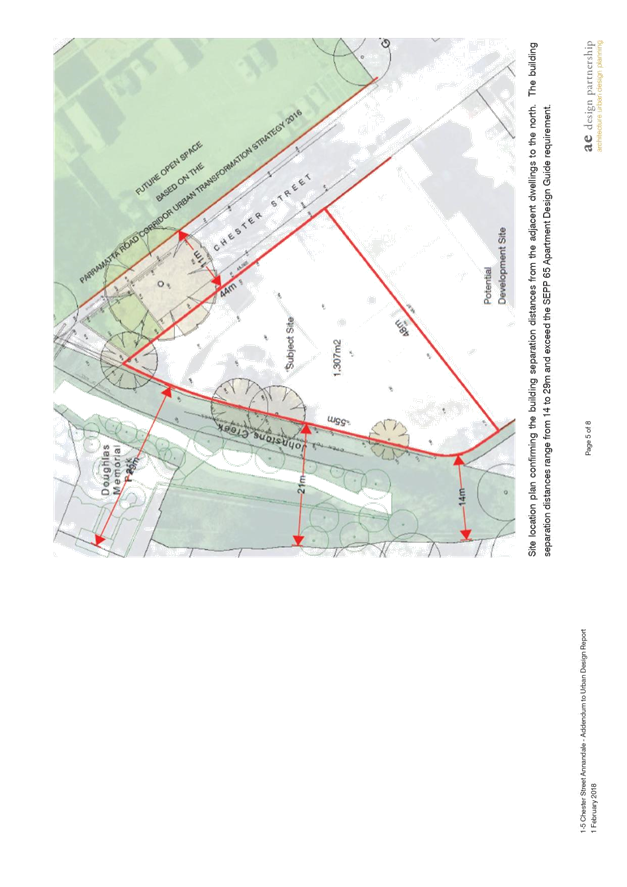
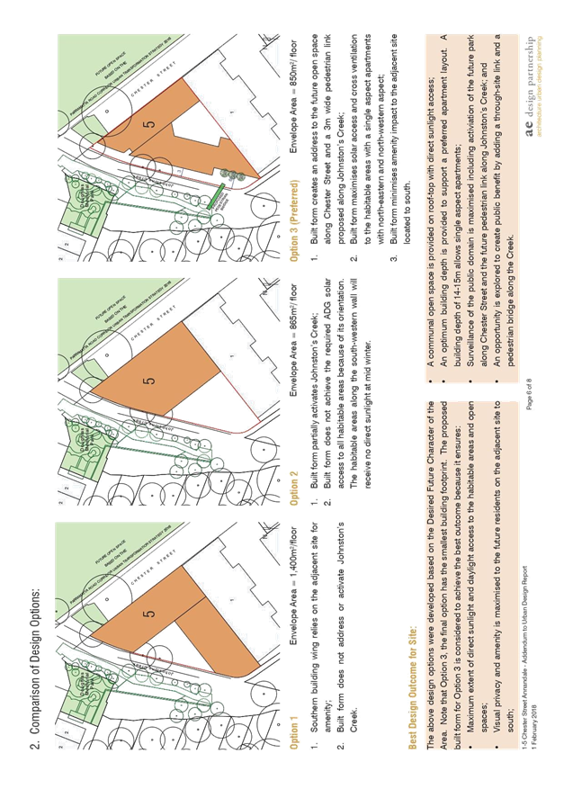
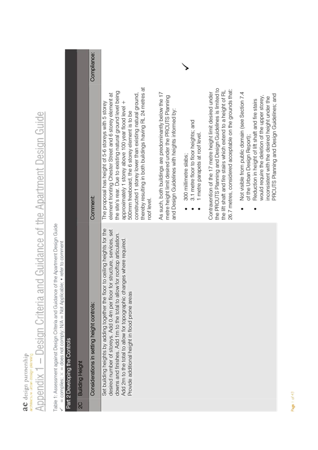
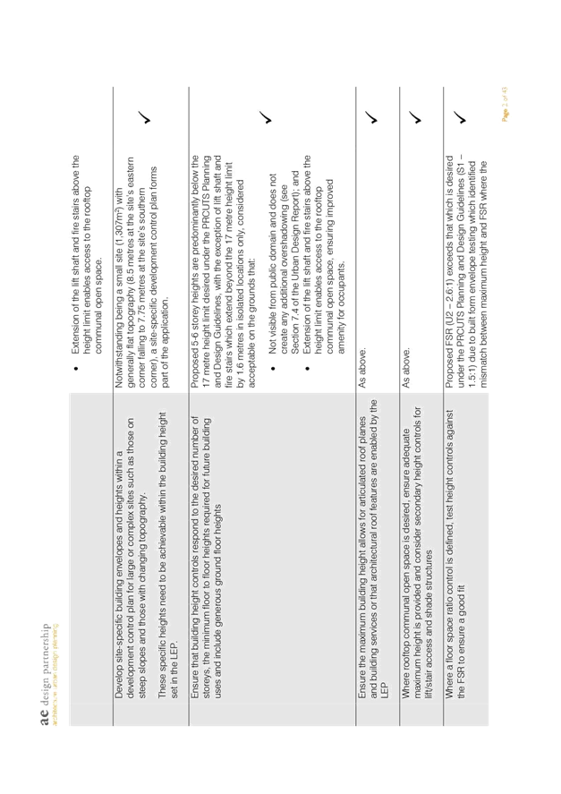
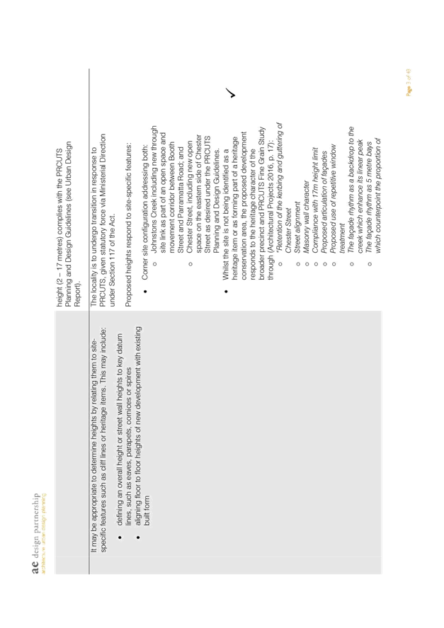
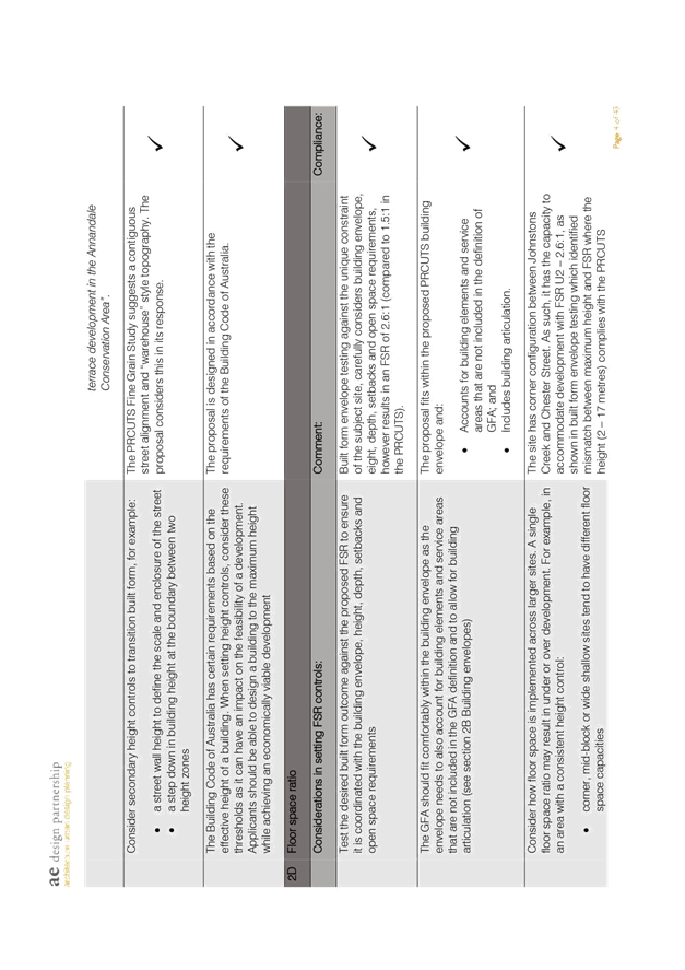
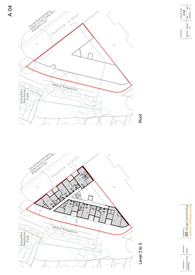
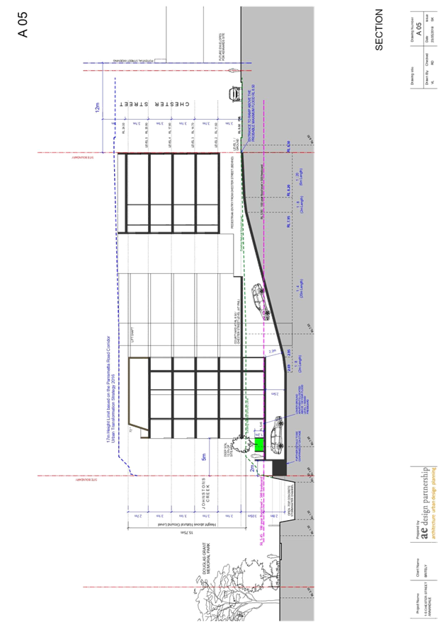
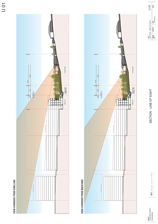
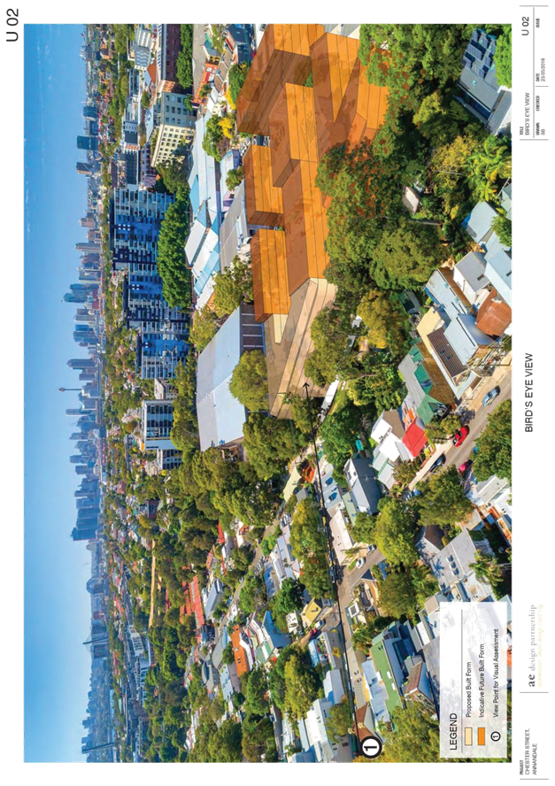
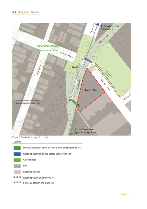
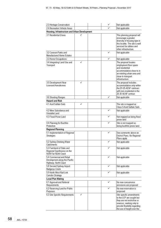
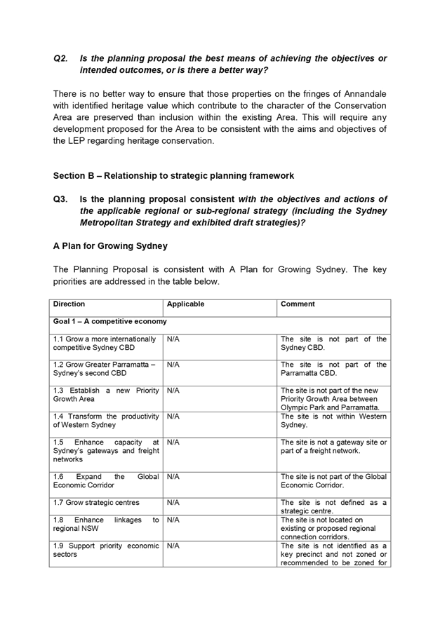
C1018(2) Item 10 Planning Proposal Assessment Report - 1-5 Chester Street, Annandale 362
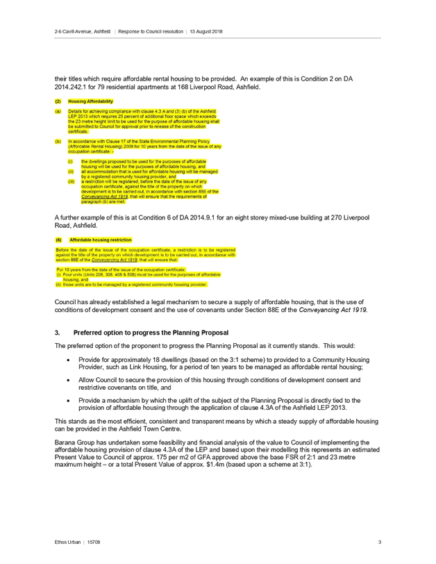
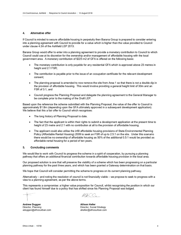
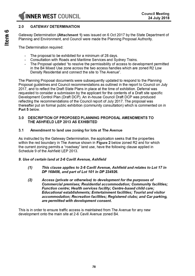
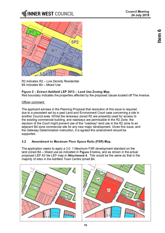
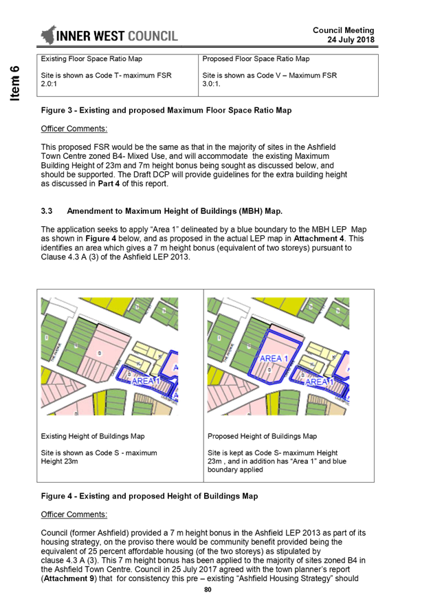
C1018(2) Item 11 Planning Proposal for 2-6 Cavill Avenue, Ashfield - Supplementary Report on Affordable Housing Delivery Mechanisms 713
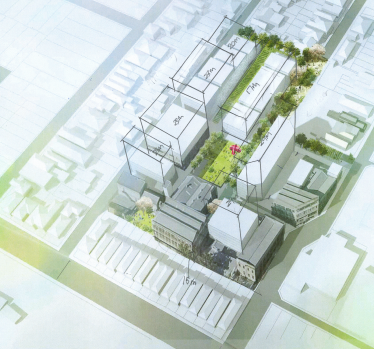
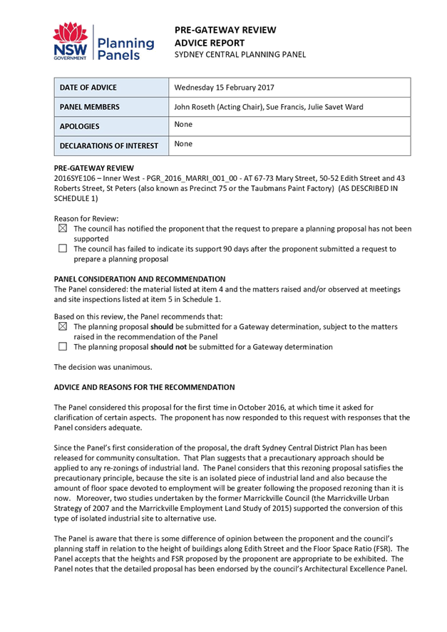
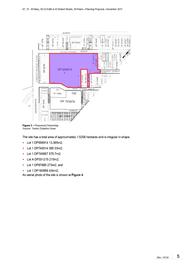
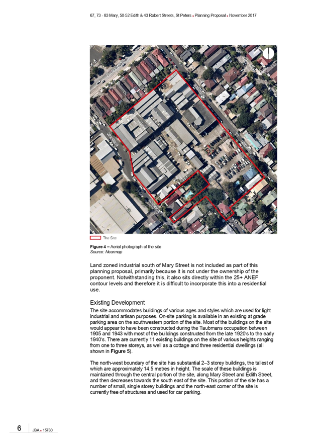
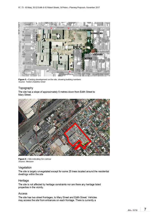
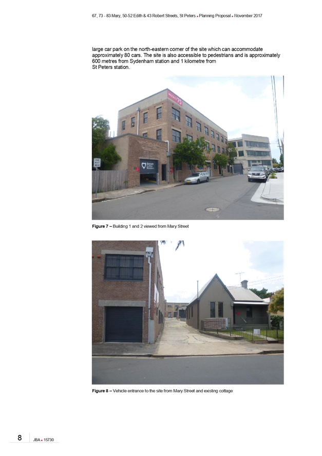
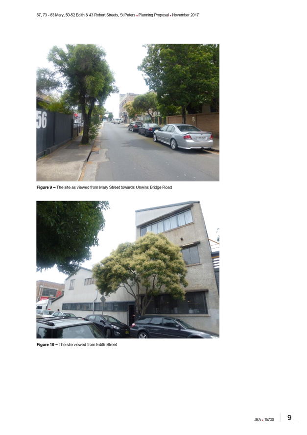
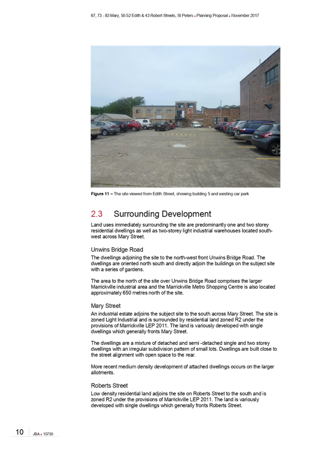
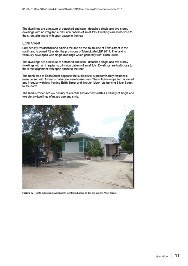
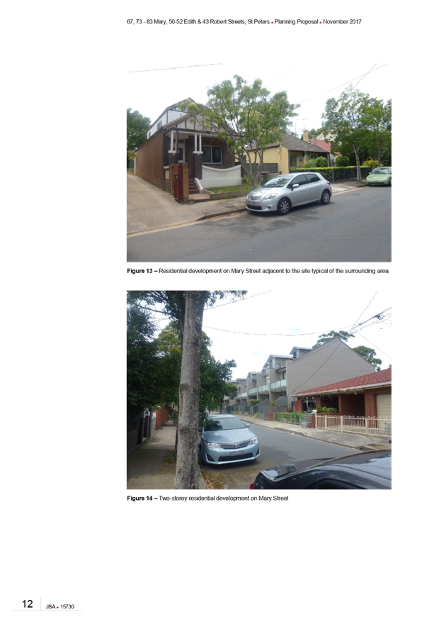
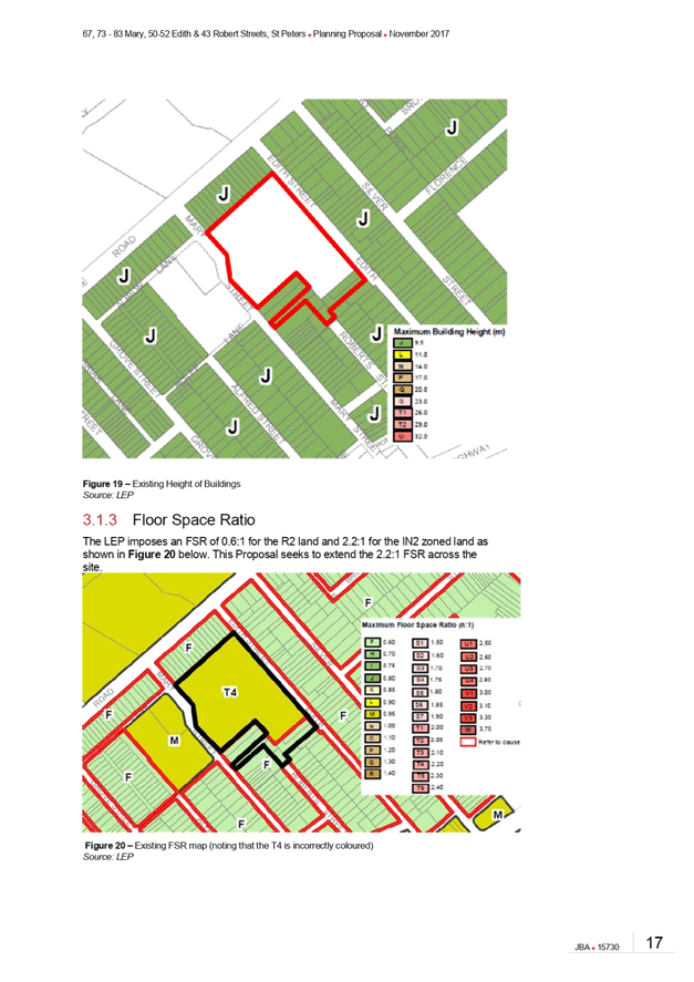
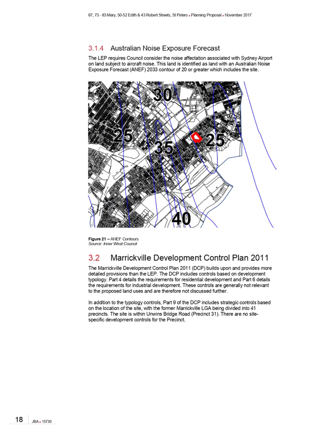
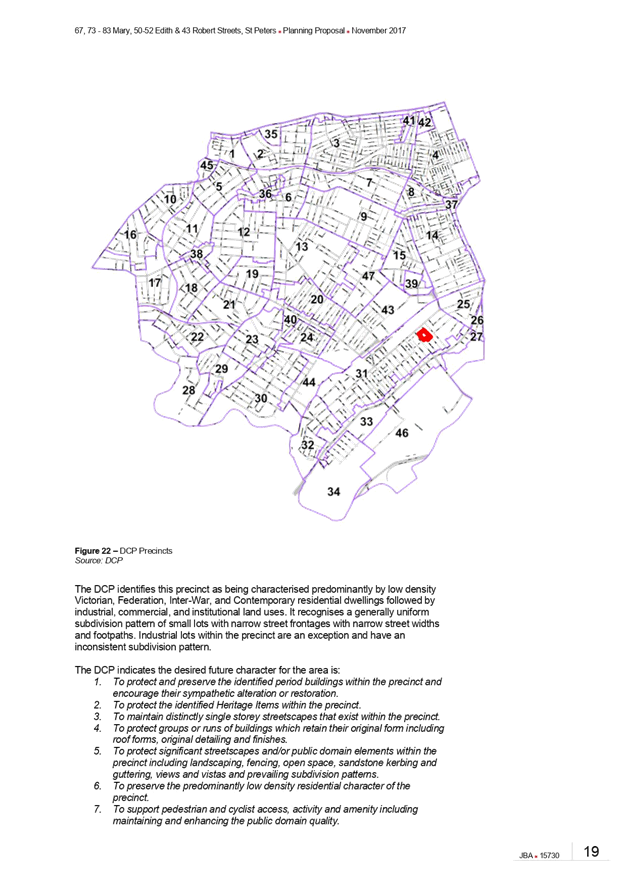
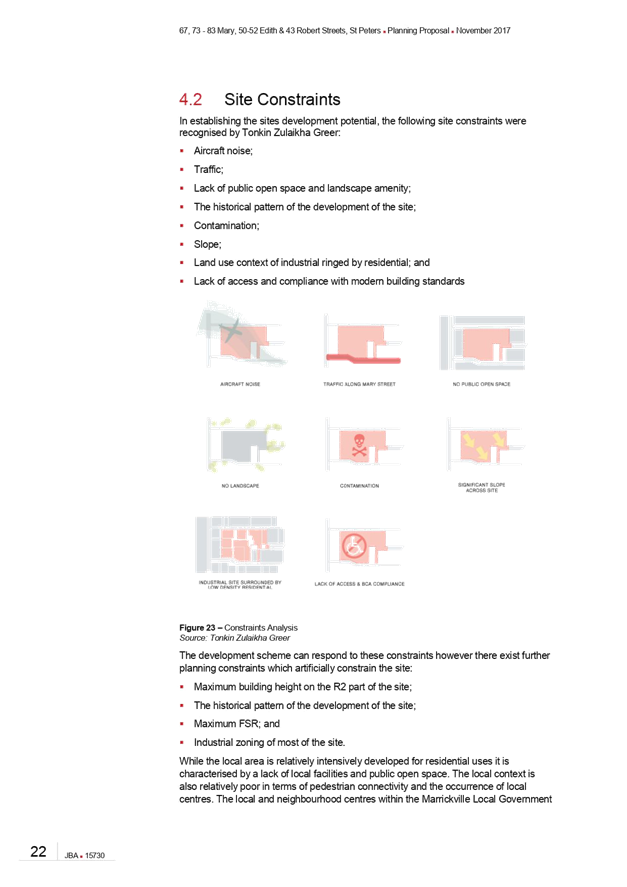
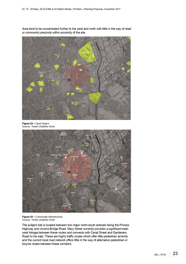
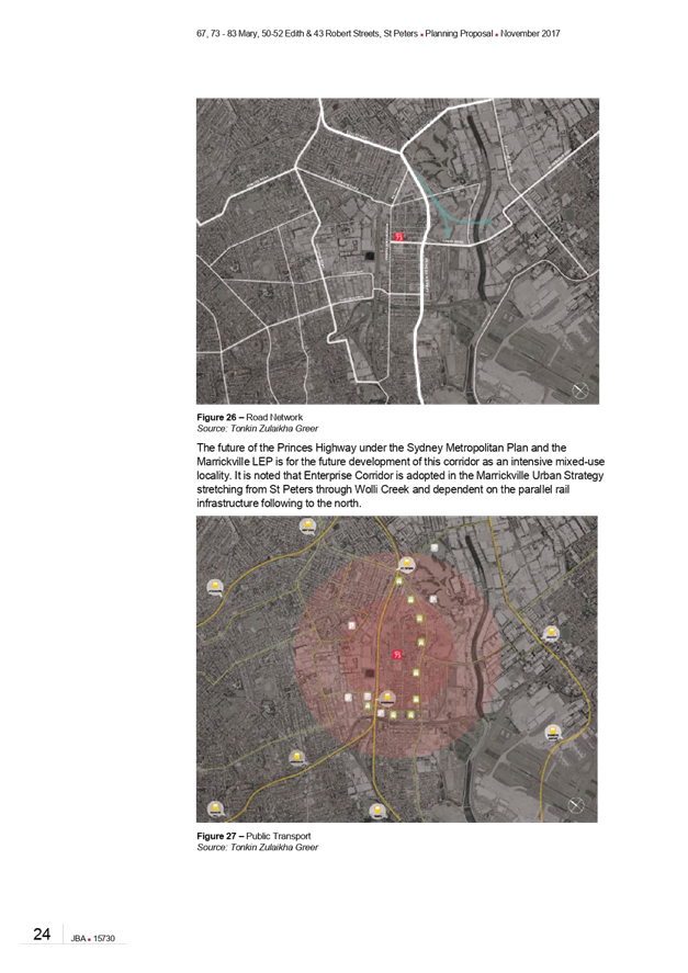
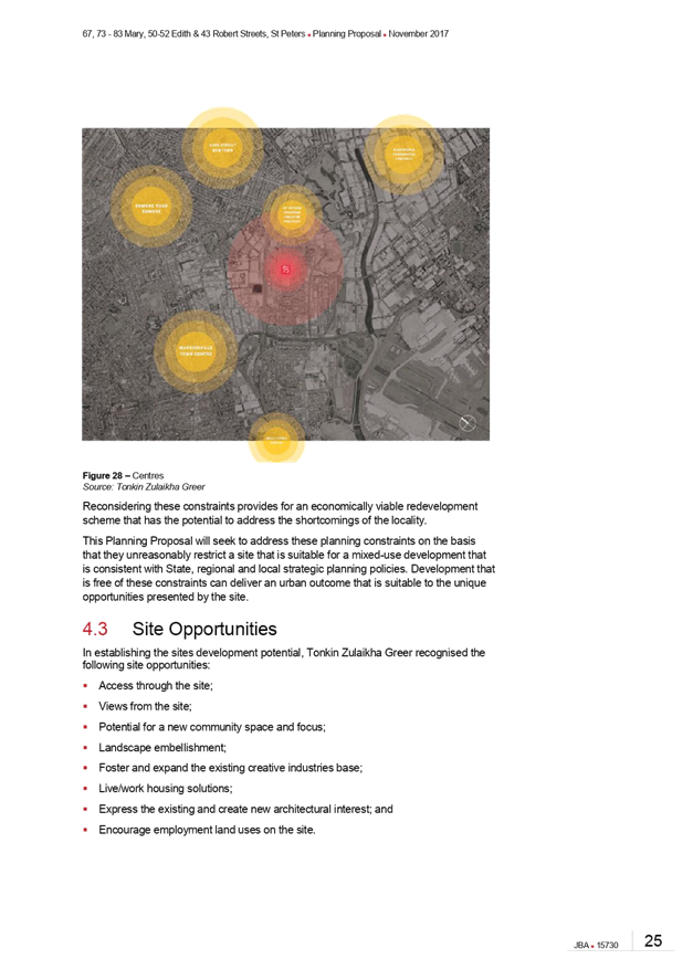
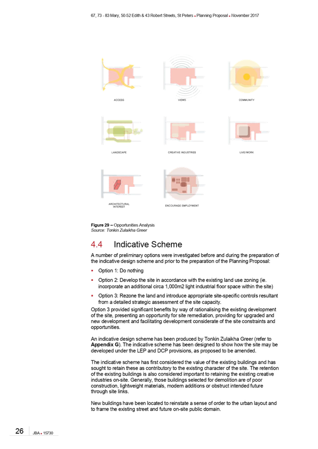
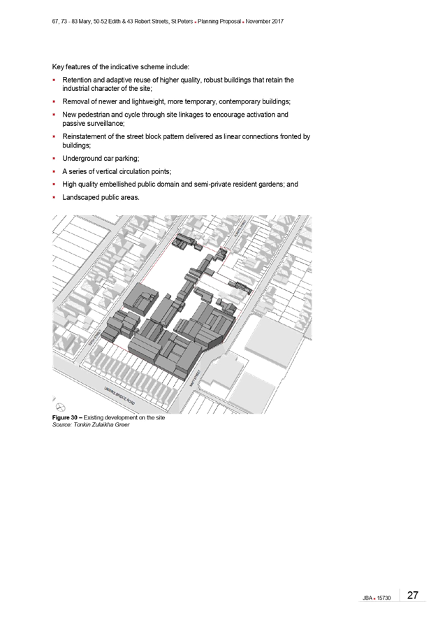
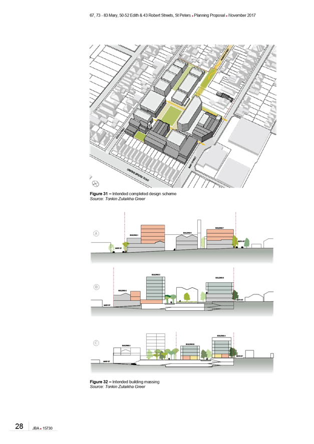
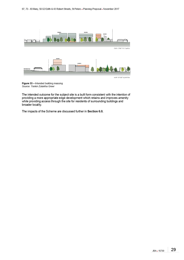
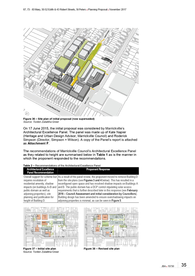
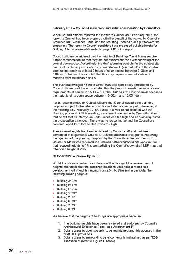
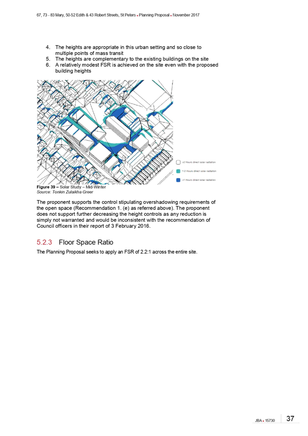
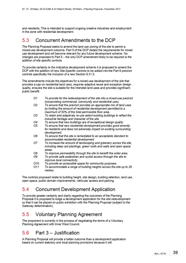
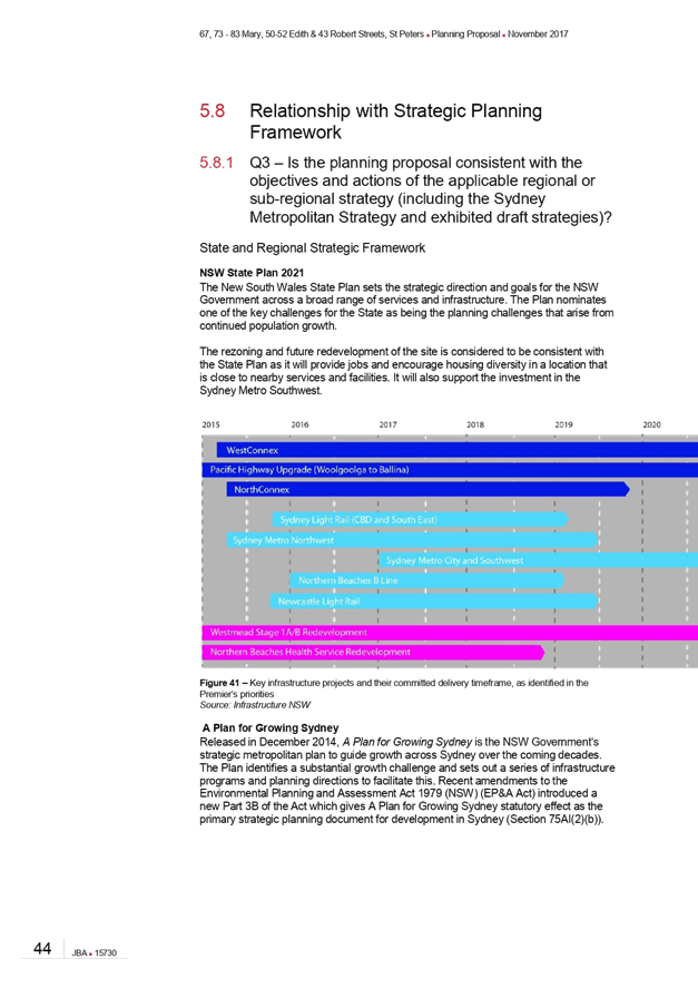
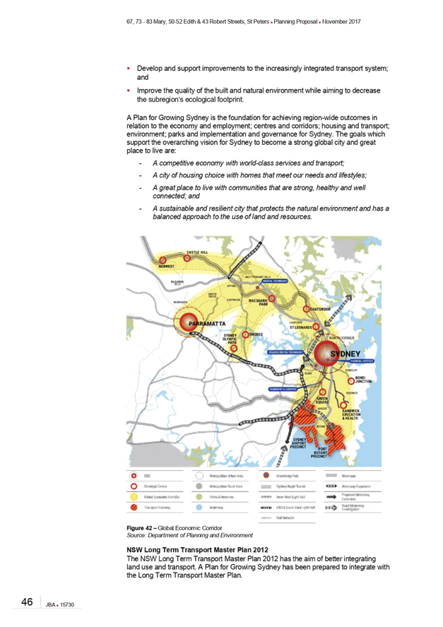
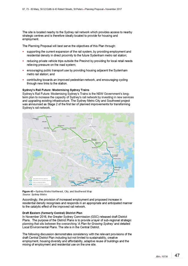
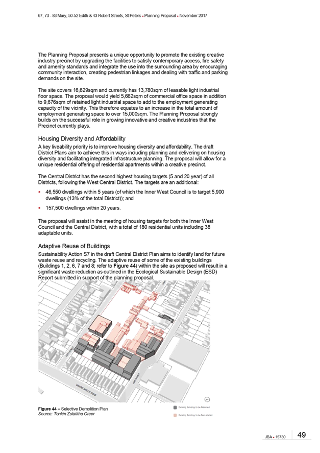
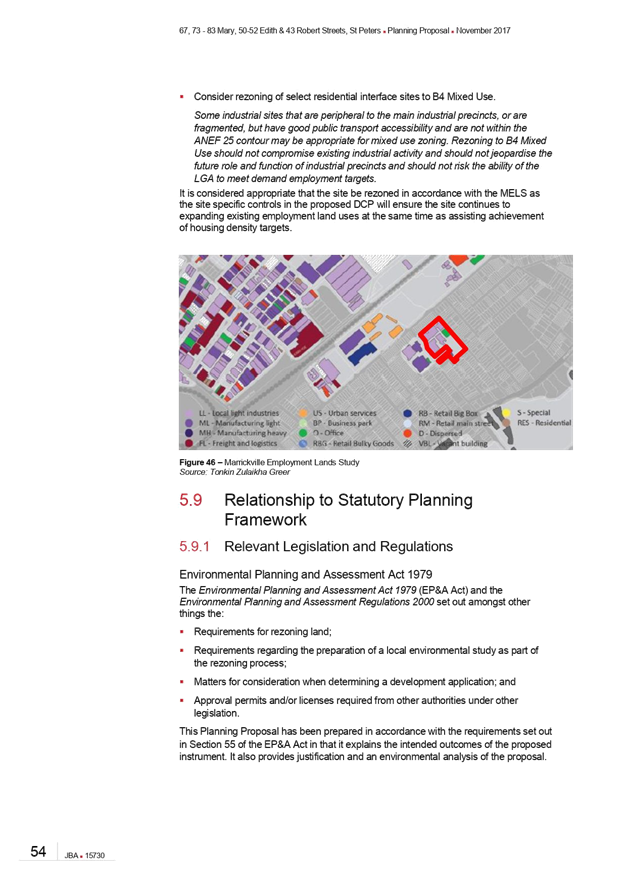
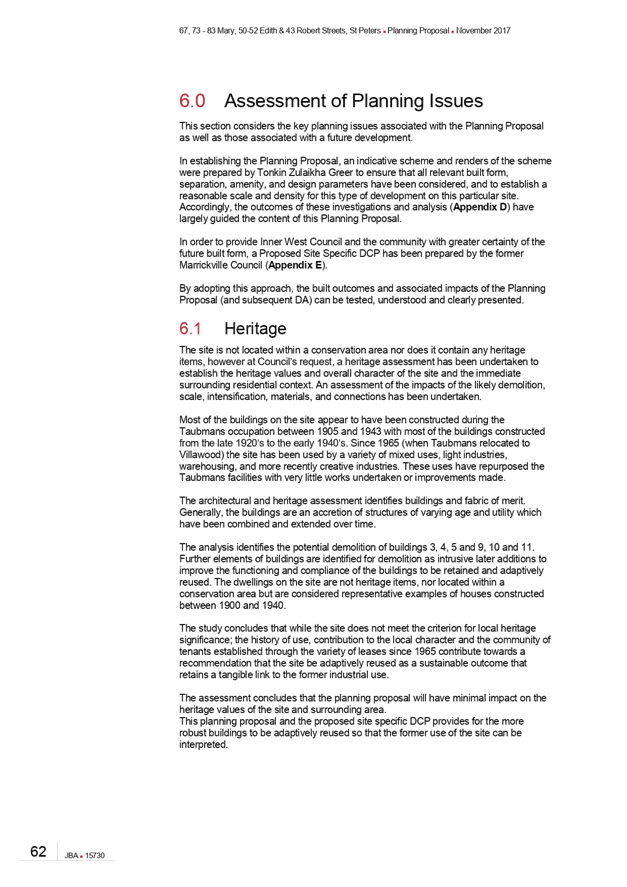
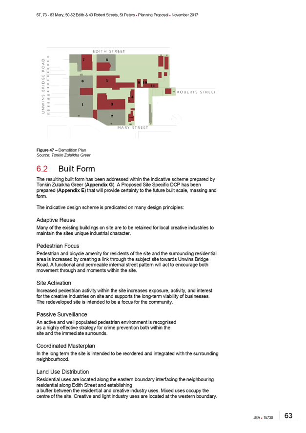
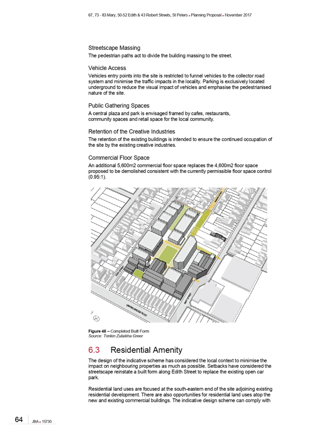
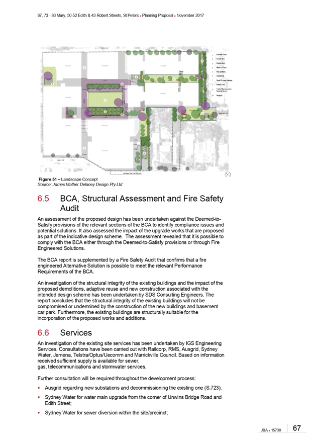
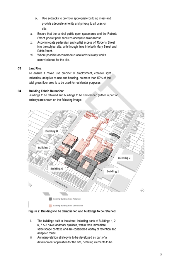
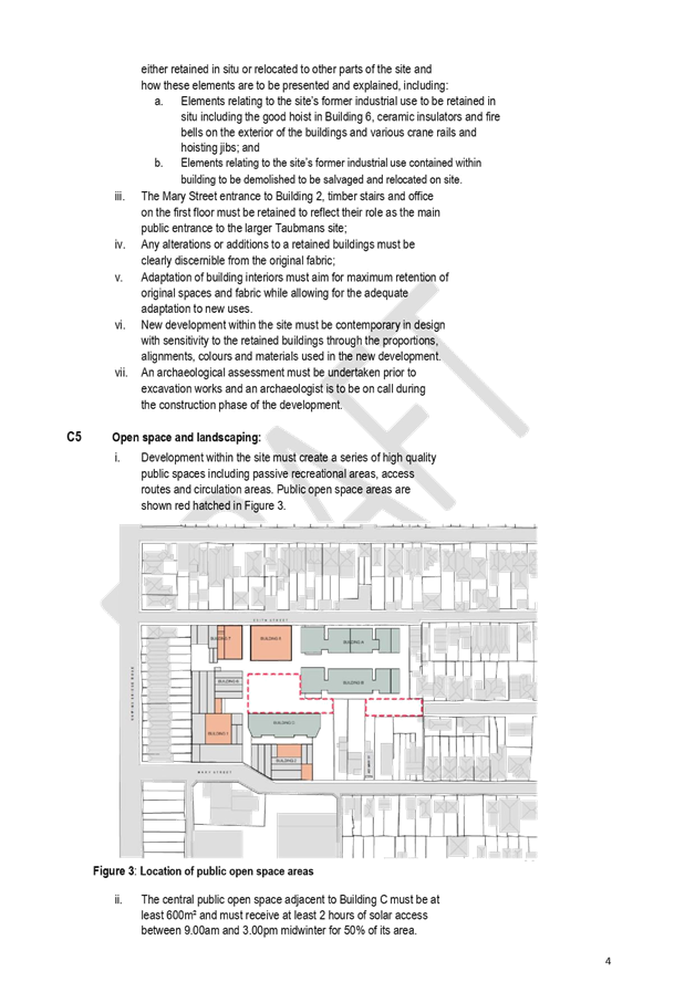
C1018(2) Item 12 Planning Proposal - Precinct 75- Mary, Edith,Roberts Streets, St Peters 744
C1018(2) Item 13 Affordable Housing for Victoria Road Precinct 914
C1018(2) Item 14 WestConnex update report 920
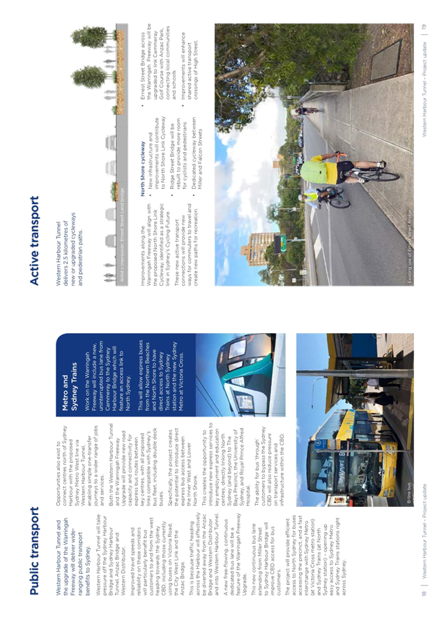
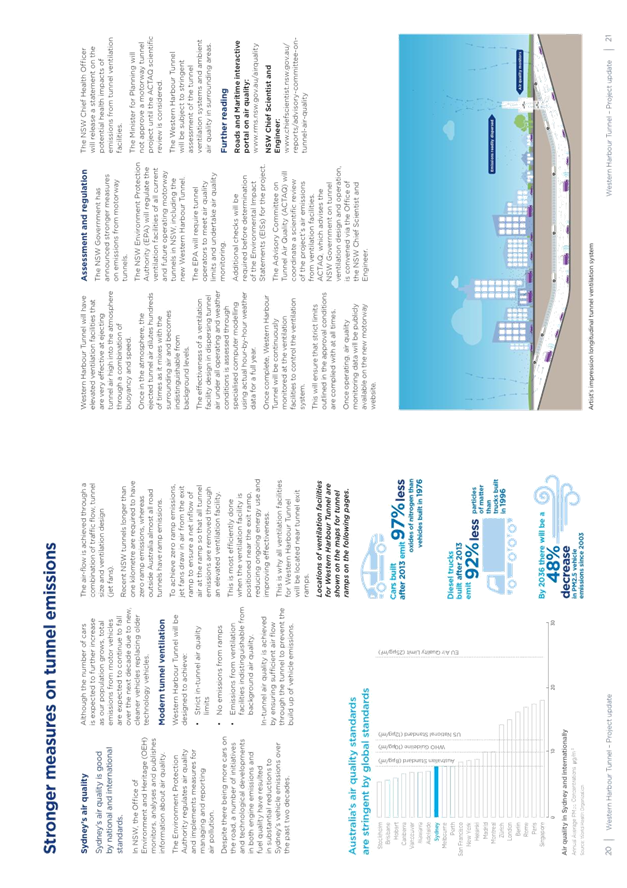
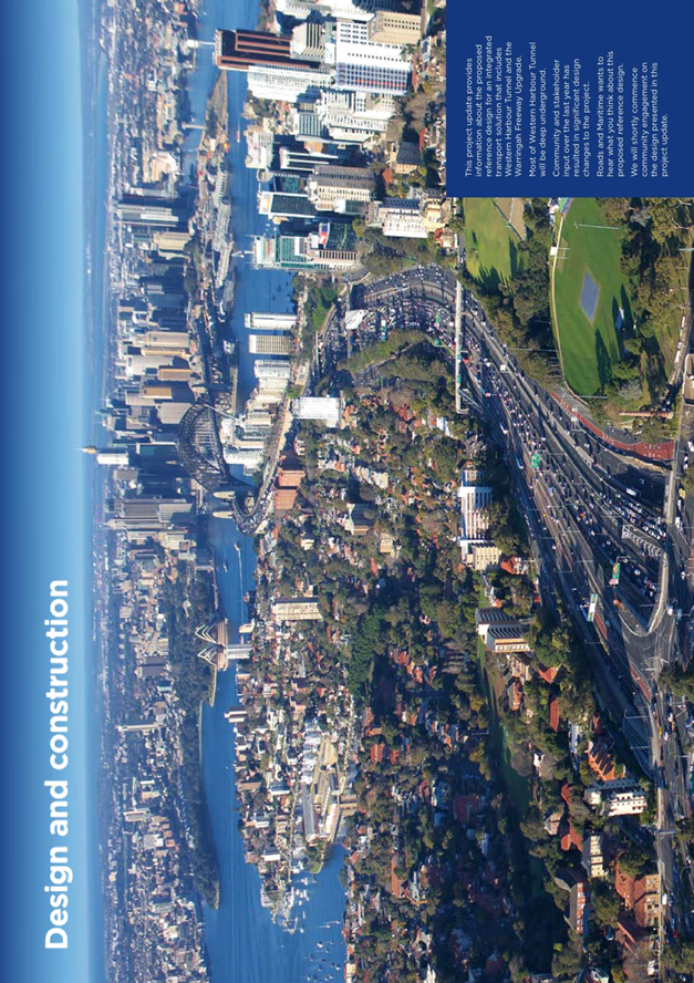
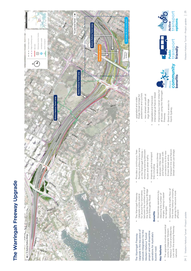
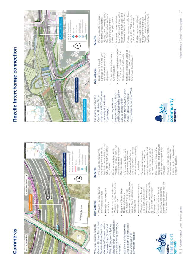
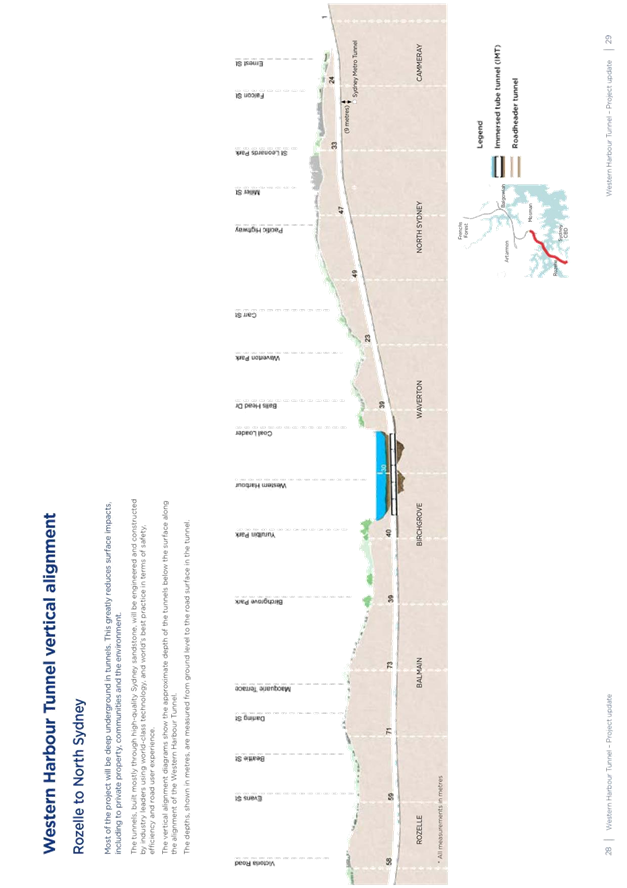
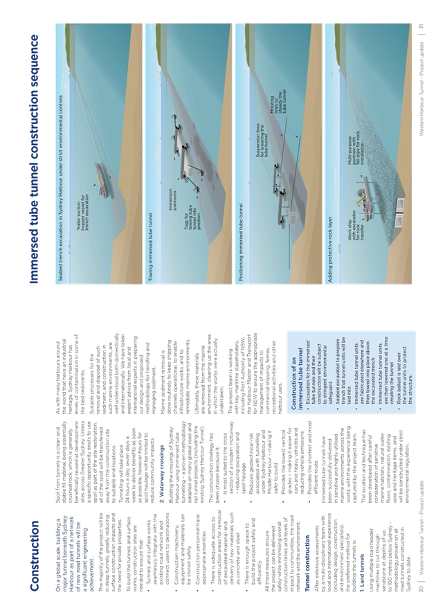
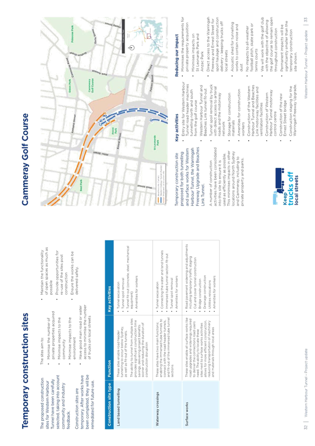
C1018(2) Item 15 Western Harbour Tunnel Reference Design 944
C1018(2) Item 16 City West Cycle Link - Progress Report 978
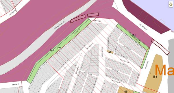
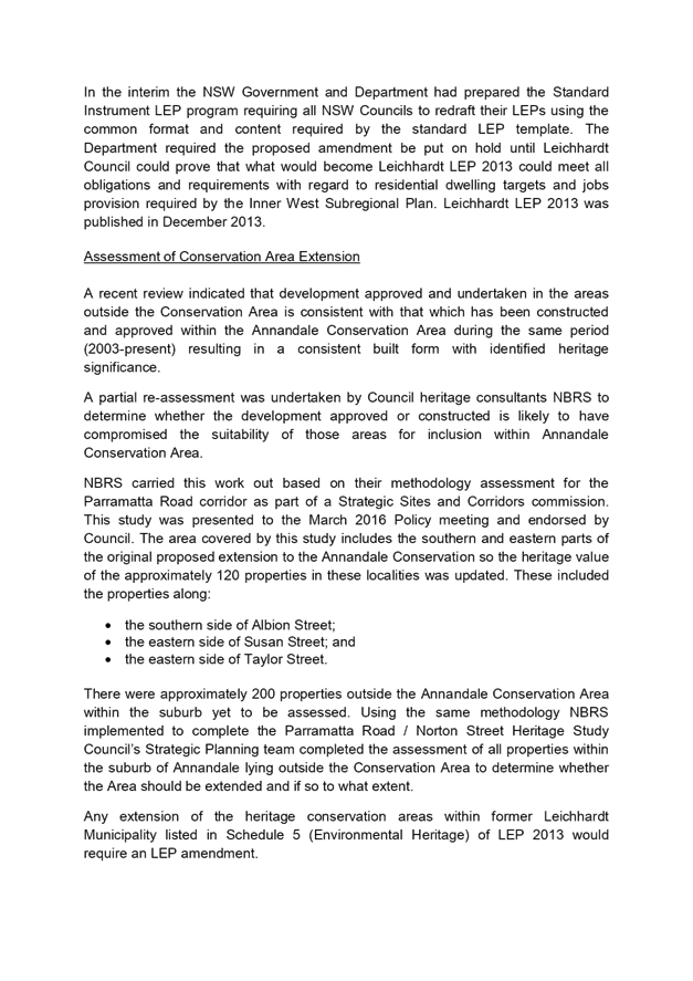
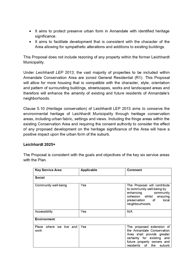
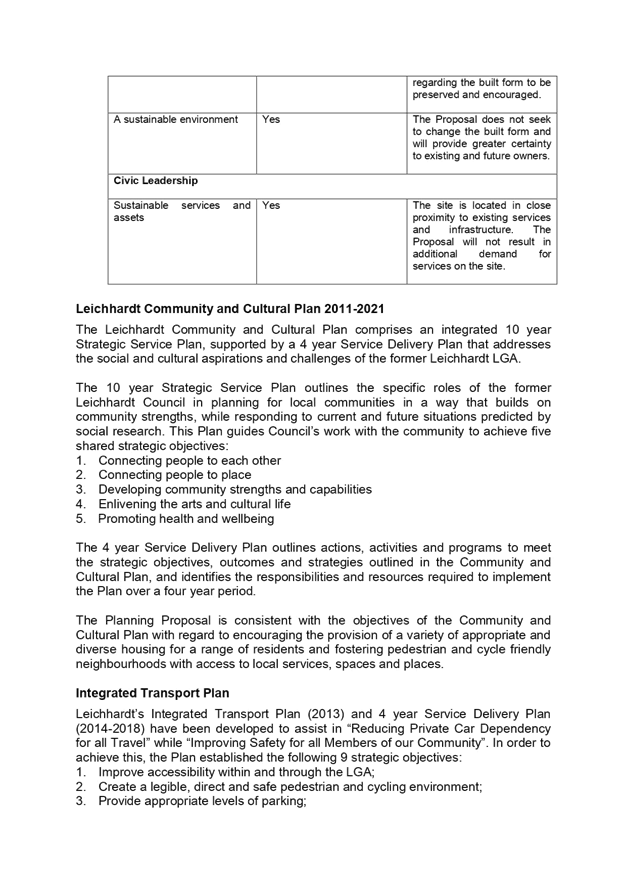
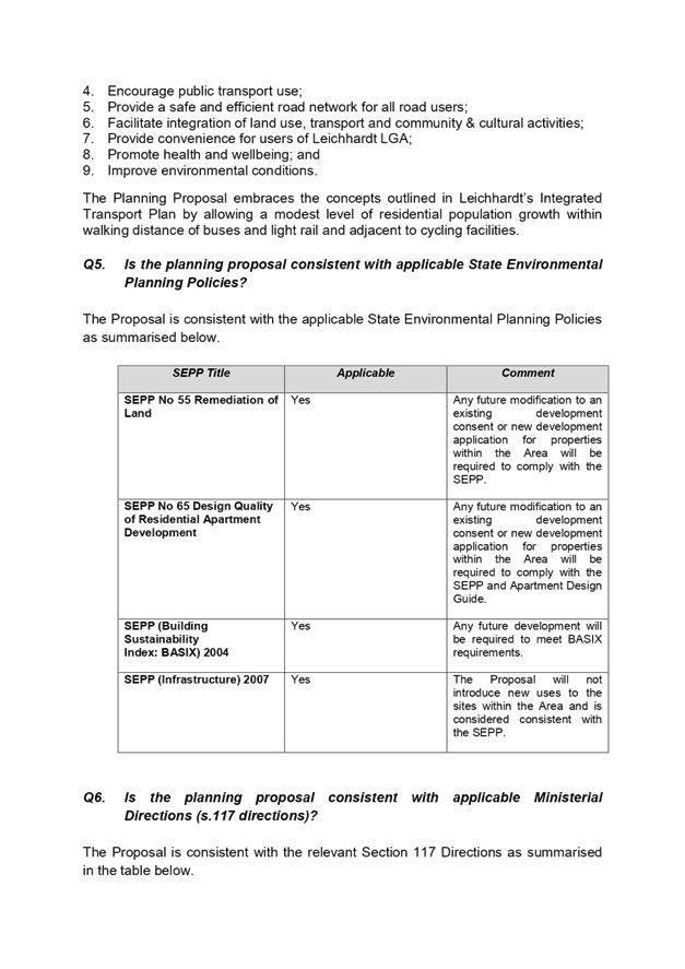
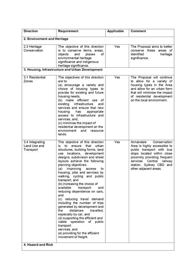
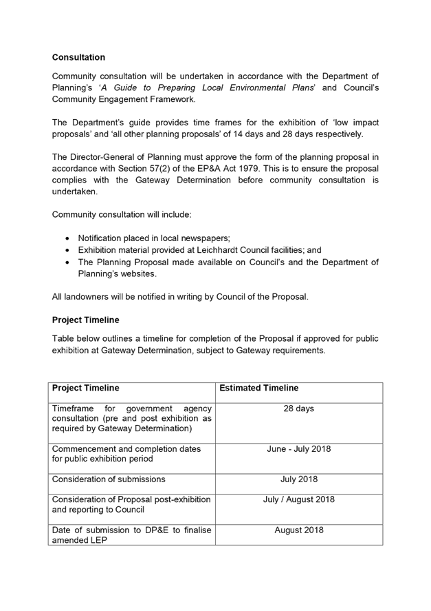
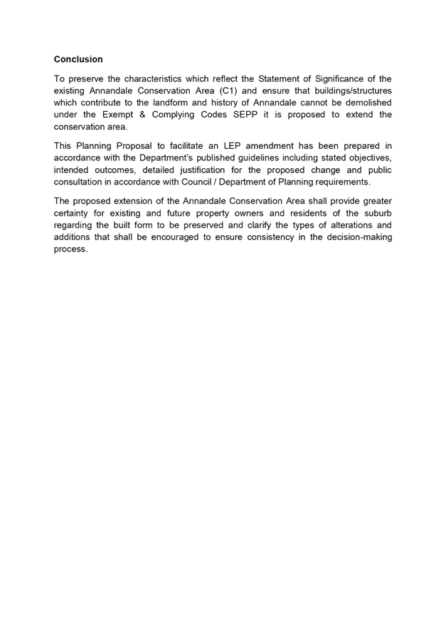
C1018(2) Item 17 Annandale Conservation Area Extension - Public Exhibition 984
C1018(2) Item 18 Local Traffic Committee Meeting held on 2 October 2018 1023
C1018(2) Item 19 Compliance and Enforcement Policy and Protocol 1058
C1018(2) Item 20 Asbestos Policy Update 1079
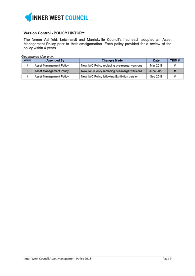
C1018(2) Item 21 Adoption of Asset Management Policy 1081
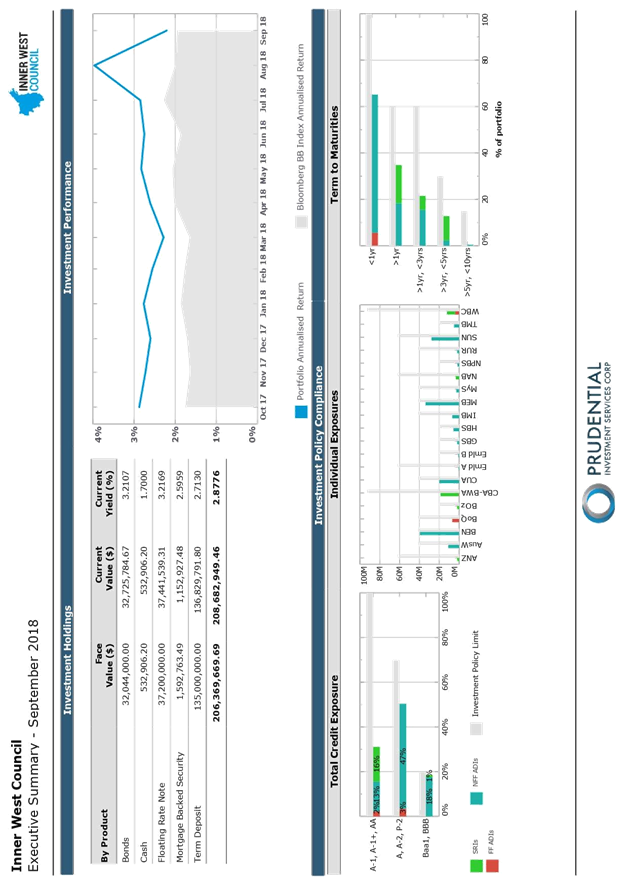
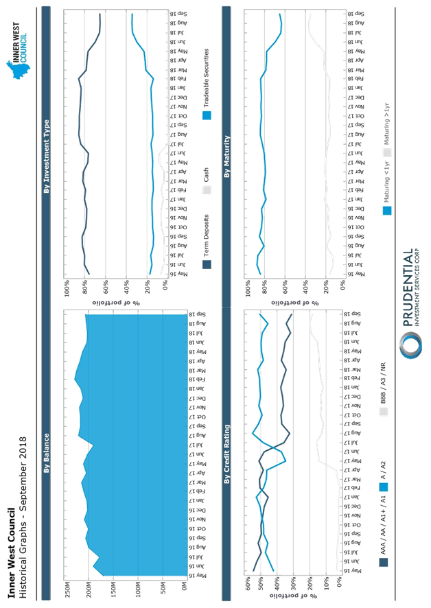
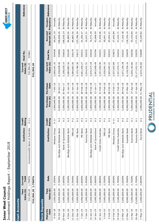
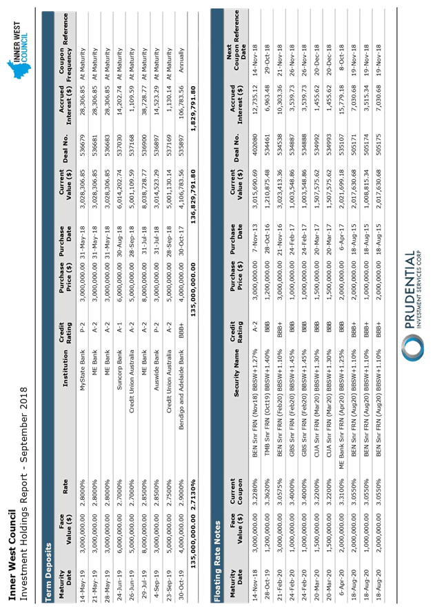
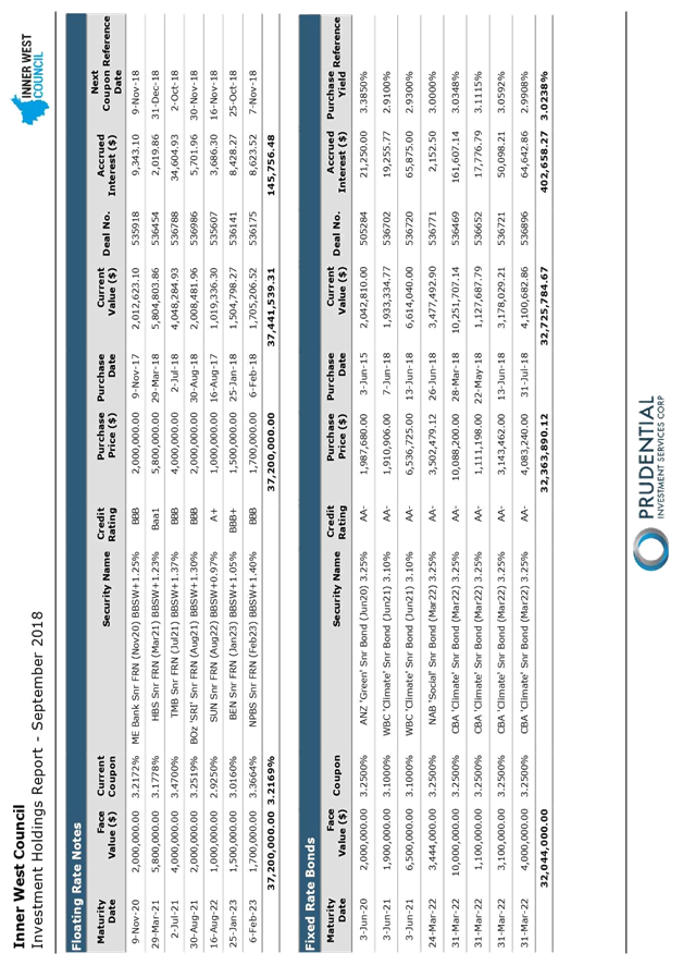
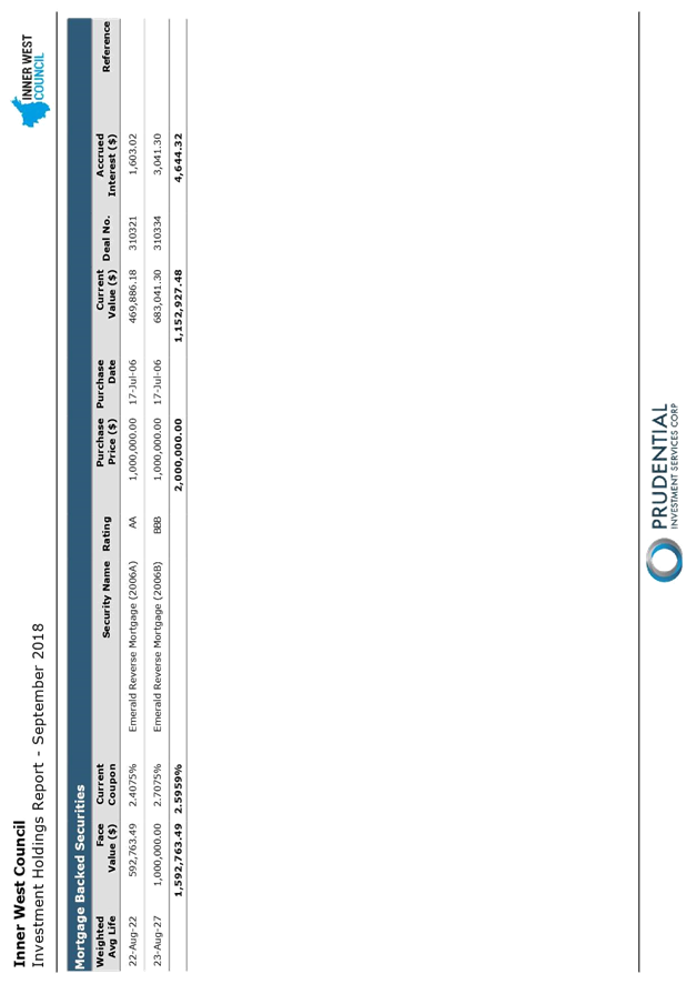
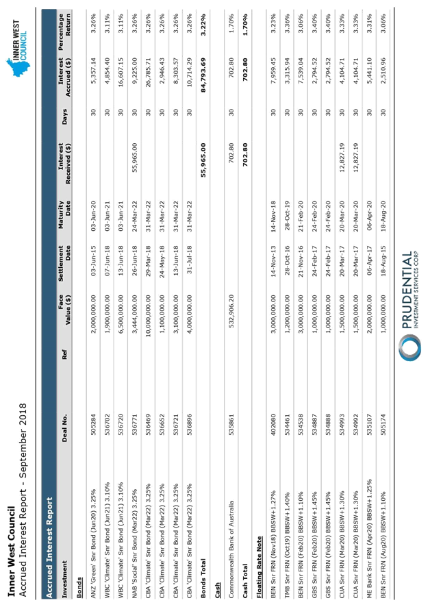
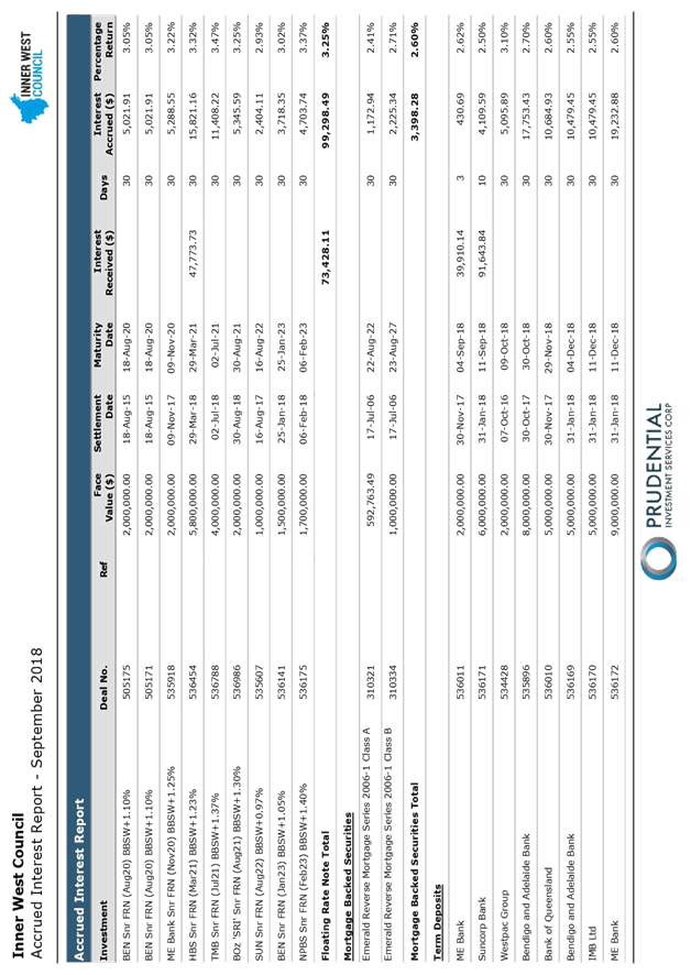
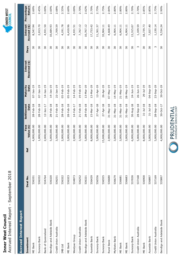
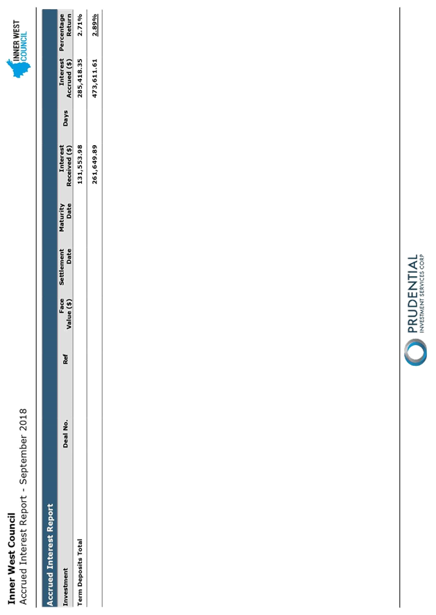
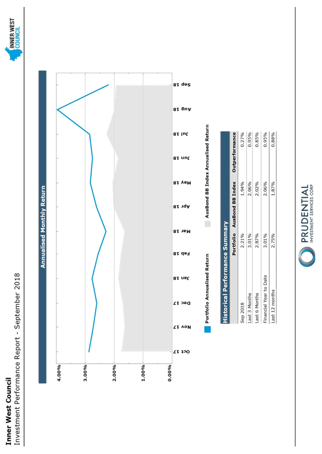
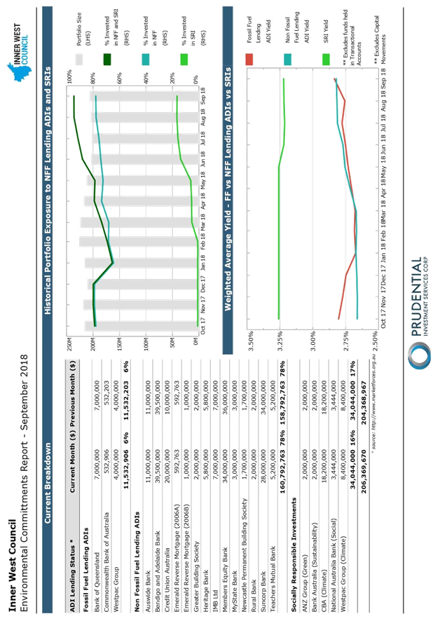
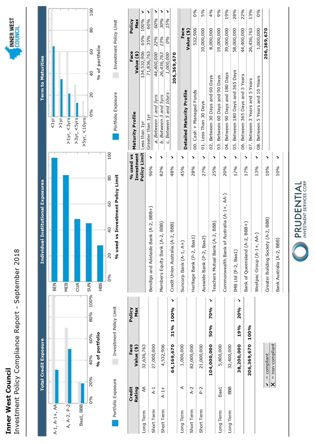
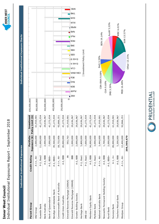
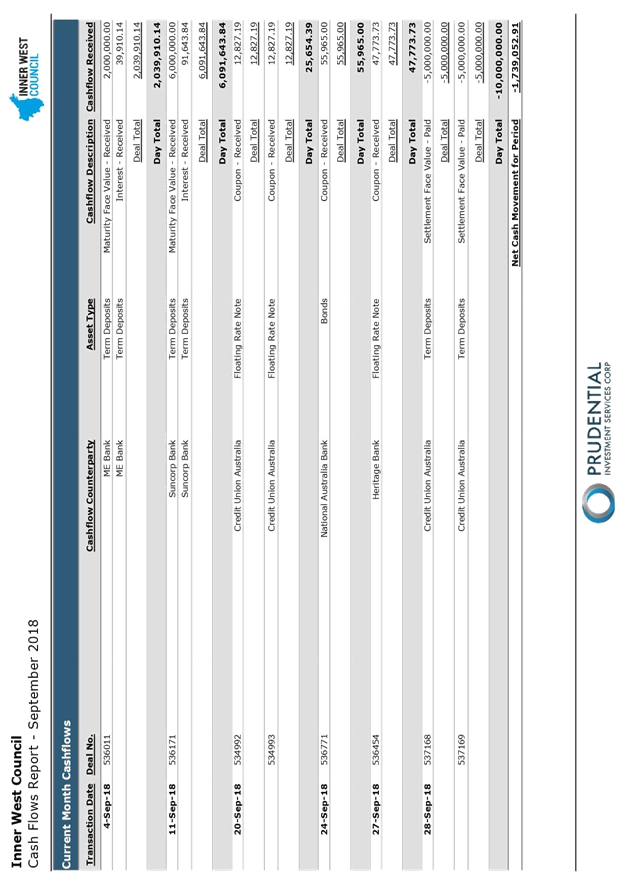
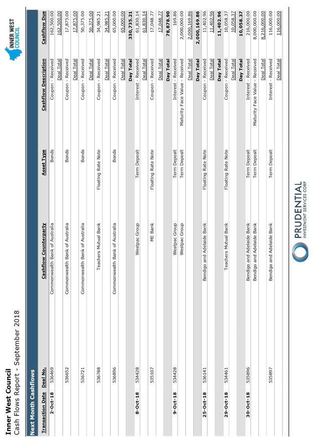
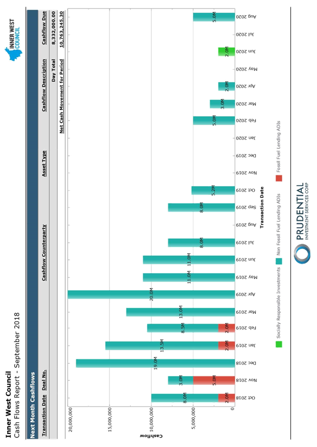
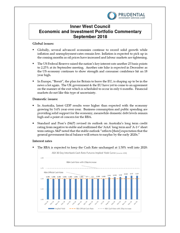
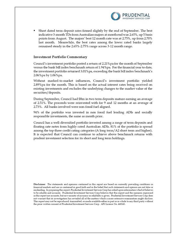
C1018(2) Item 22 Investment Report as at 30 September 2018 1094
C1018(2) Item 23 Former Council Legacy Policies Rescission 1122
C1018(2) Item 24 Adoption of Public Access to Information held by Council Policy 1125
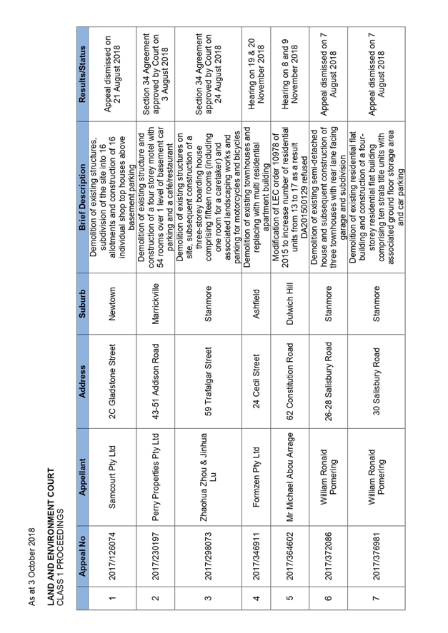
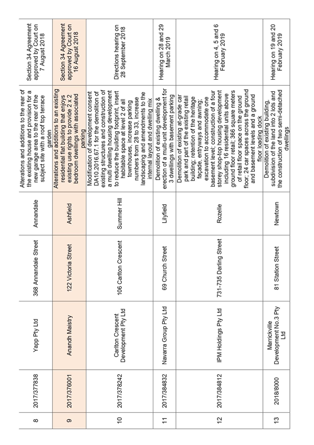
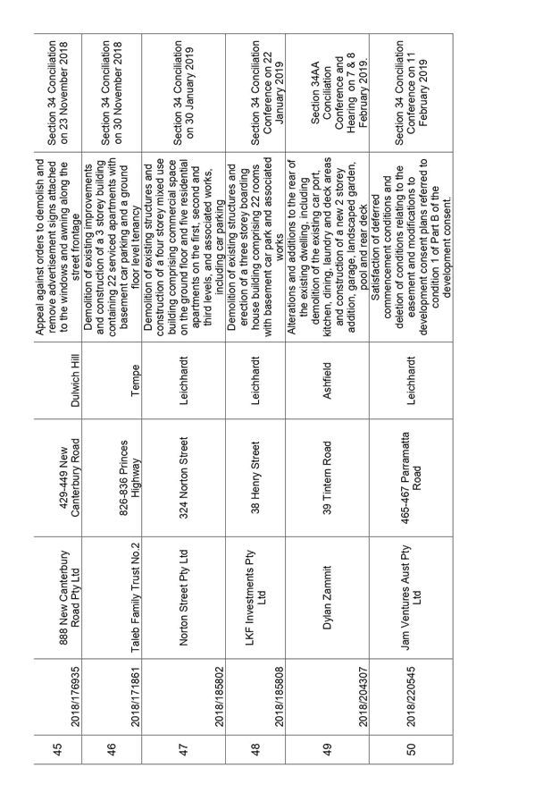
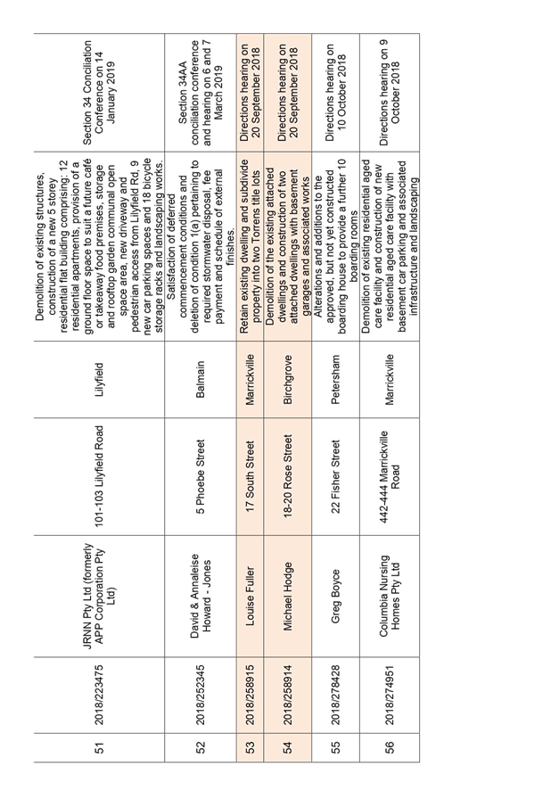
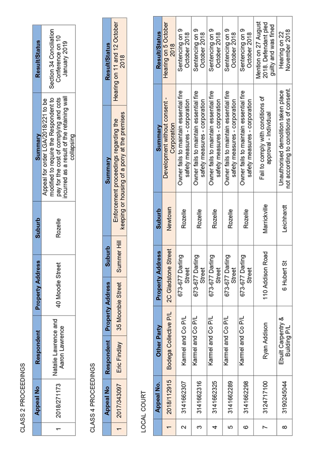
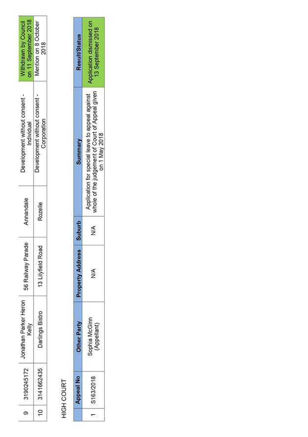
C1018(2) Item 25 Status of Legal Proceedings 1132
C1018(2) Item 26 Land and Environment Court Proceedings - Council ats Eric Findlay – Order to Remove Pony 1143
10 Notices of Motion
ITEM PAGE #
C1018(2) Item 27 Notice of Motion: Councillor Professional Development 1145
C1018(2) Item 28 Notice of Motion: Pocket Park upgrade 1146
C1018(2) Item 29 Notice of Motion: Report on the use of Round Up in Council Parks, Sporting Fields and Playgrounds and Near Waterways 1147
C1018(2) Item 30 Notice of Motion: Prevention of Carparking on Tempe Reserve Recreation Areas 1149
C1018(2) Item 31 Notice of Motion: Summer Hill Public School Spring Fair 1150
C1018(2) Item 32 Notice of Motion: Ashfield Pool - Ashfield District Historical Society 1151
C1018(2) Item 33 Notice of Motion: Reducing Waste 1153
11 Reports with Confidential Information
Reports appearing in this section of the Business Paper are confidential in their entirety or contain confidential information in attachments.
The confidential information has been circulated separately.
ITEM PAGE #
C1018(2) Item 34 Cooks River Parklands Upgrade Tender Report 1155
|
|
Council Meeting 30 October 2018 |
Minutes of Ordinary Council Meeting held on 9 October 2018
Meeting commenced at 6.32pm
|
Present: |
|
|
Darcy Byrne Victor Macri Marghanita Da Cruz Mark Drury Colin Hesse Sam Iskandar Tom Kiat Pauline Lockie Julie Passas Rochelle Porteous John Stamolis Louise Steer Elizabeth Richardson |
Mayor Deputy Mayor Councillor Councillor Councillor Councillor Councillor Councillor Councillor Councillor (6.35pm) Councillor Councillor General Manager Deputy General Manager Assets and Environment |
|
Michael Tzimoulas |
Deputy General Manager Chief Financial and Administration Officer |
|
John Warburton |
Deputy General Manager Community and Engagement |
|
Nellette Kettle
Harjeet Atwal Cathy Edwards-Davis David Milliken Harin Perera Ian Naylor Katherine Paixao |
Group Manager Civic and Executive Support, Integration, Customer Service and Business Excellence Group Manager Development Assessment & Regulatory Services Group Manager Trees, Parks and Sports Fields A/Group Manager Strategic Planning Group Manager, Information & Communications Technology Manager Civic and Executive Support Business Paper Coordinator |
APOLOGIES:
Motion: (Stamolis/Kiat)
THAT apologies from Clrs McKenna OAM, Raciti and York and lateness from Clr Porteous be accepted.
Motion Carried
For Motion: Crs Byrne, Da Cruz, Drury, Hesse, Iskandar, Kiat, Lockie, Macri, Passas, Stamolis and Steer
Against Motion: Nil
DISCLOSURES OF INTERESTS:
Clrs Iskandar and Macri declared a significant, non-pecuniary conflict of interest in Item 5 - Sydney Eastern City Planning Panel Report: DA201700185: 728 Princes Highway, Tempe as they are members of the Sydney Eastern City Planning Panel.
Motion: (Byrne/Passas)
THAT the declarations of interest be received and noted.
Motion Carried
For Motion: Crs Byrne, Da Cruz, Drury, Hesse, Iskandar, Kiat, Lockie, Macri, Passas, Stamolis and Steer
Against Motion: Nil
Clr Porteous entered the meeting at 6.35pm
CONFIRMATION OF MINUTES
|
THAT the Minutes of the Council Meeting held on Tuesday, 25 September 2018 be confirmed as a correct record, subject to the following change: - An amendment to the voting on the amendment for Item 10 – Councillor Representation on Committees, relating to the nomination of Clr Da Cruz as the representative on the Local Traffic Committee, Clr Lockie voted for the Motion and Councillor Raciti voted against the Motion. Motion Carried For Motion: Crs Byrne, Da Cruz, Drury, Hesse, Iskandar, Kiat, Lockie, Macri, Passas, Porteous, Stamolis and Steer Against Motion: Nil
Amendment (Passas/Porteous)
THAT the Minutes of the Council Meeting held on Tuesday, 25 September 2018 be deferred to allow staff to check whether Councillor Stamolis moved a Motion of Dissent in the chairs ruling in Item 6 - Report on the Council Review of the Organisation Structure. Motion Lost For Motion: Crs Da Cruz, Passas, Porteous and Steer Against Motion: Crs Byrne, Drury, Hesse, Iskandar, Kiat, Lockie, Macri and Stamolis |
Councillor Passas left the Meeting at 7:19 pm
|
THAT Council:
1. Write to the Minister for Transport requesting confirmation in writing of ongoing funding for the Lilyfield Road cycleway; and
2. Be provided in with a report to the first Council meeting in November with an update on the outcomes of the initial public meetings, at which alternate proposals were initially presented to the community and a summary of expenditure to date on the project.
|
|
Motion Carried For Motion: Crs Byrne, Da Cruz, Drury, Hesse, Iskandar, Kiat, Lockie, Macri, Porteous, Stamolis and Steer Against Motion: Nil Absent: Cr Passas |
Suspension of Standing Orders
Motion: (Hesse/Porteous)
THAT Council bring forward Item 5 to hear from the members of public who registered to speak and then this matter be dealt with at this time.
Motion Carried
For Motion: Crs Byrne, Da Cruz, Drury, Hesse, Iskandar, Kiat, Lockie, Macri, Porteous, Stamolis and Steer
Against Motion: Nil
Absent: Cr Passas
Councillor Passas returned to the Meeting at 7:28 pm.
Councillors Iskandar and Macri left the Meeting at 7:28 pm as they had declared a significant, non-pecuniary conflict of interest in Item 4. They did not participate in discussion or vote on the item.
Resumption of Standing Orders
Motion: (Byrne/Lockie)
THAT Standing Orders be resumed.
Motion Carried
For Motion: Crs Byrne, Da Cruz, Drury, Hesse, Kiat, Lockie, Passas, Porteous, Stamolis and Steer
Against Motion: Nil
Absent: Crs Iskandar and Macri
Councillors Iskandar and Macri returned to the Meeting at 7:46 pm.
ADJOURNMENT
8.04pm - The Mayor, Clr Byrne adjourned the meeting for a short recess.
8.16pm– The Mayor, Clr Byrne resumed the meeting.
|
THAT:
1. The draft Sporting Grounds Allocation Policy be placed on public exhibition for a period of 28 days;
2. The 46 Clubs currently utilising sporting grounds in the Inner West be advised by email that the draft Sporting Grounds Allocation Policy is on public exhibition; and
3. The results of the public exhibition and community engagement process are presented to Council along with a final Sporting Grounds Allocation Policy for adoption.
|
|
Motion Carried For Motion: Crs Byrne, Da Cruz, Drury, Hesse, Iskandar, Kiat, Lockie, Macri, Passas, Porteous, Stamolis and Steer Against Motion: Nil
|
|
Amendment (Da Cruz/Steer)
THAT:
|
|
Motion Lost For Motion: Crs Da Cruz, Hesse, Porteous and Steer Against Motion: Crs Byrne, Drury, Iskandar, Kiat, Lockie, Macri, Passas and Stamolis
|
|
Amendment (Kiat/Hesse)
THAT the public exhibition of the draft policy include for consideration the following alternate proposal for capital contributions: that clubs making capital contributions to be eligible for increased tenure must also make an equal contribution to Council to be used at Council’s discretion to improve a sportsground in most need of an upgrade or urgent maintenance.
|
|
Motion Lost For Motion: Crs Da Cruz, Hesse, Kiat, Porteous and Steer Against Motion: Crs Byrne, Drury, Iskandar, Lockie, Macri, Passas and Stamolis |
Councillor Passas retired from the Meeting at 8:59 pm.
ADJOURNMENT
9.10pm - The Mayor, Clr Byrne adjourned the meeting for a short recess.
9.13pm– The Mayor, Clr Byrne resumed the meeting.
Matter Arising - Dawn Fraser Pool Funding (Porteous)
THAT:
1. Council in regards to the restoration works for the Dawn Fraser Baths notes that:
a) urgent works are estimated to cost $6.7 million and there is a current shortfall of $2.2 million in funding for these works.
b) Council ‘s current position (Byrne/Drury) is to:
Consider options for funding the remaining $2.2 million shortfall once the outcome of current grant applications for the project is known, noting that there must be no delay to implementation of the aforementioned essential works
c) In line with the above Council has applied for a $4.2 million Greater Sydney Sports Facility Grant
d) Council has already seen fit to reduce investment funds by approximately 30 million in this financial year to deliver a significant capital works program.
2. Council therefore allocates a further 2.2 million funds from the investment funds budget in this financial year to the Dawn Fraser Pool restoration works to provide assurance to the community that the works will proceed.
3. These investment funds are to be used in event that council is not successful in its application for the Greater Sydney Sports Facility Grant.
They Mayor ruled the Matter Arising Out of Order as it did not relate to the business being discussed in Item 7 being the Quarter 3 and 4 progress against the 2017/18 Operational Plan and the Matter Arising did not identify a source of funds to undertake the work as required by Clause 5.1(1) of the Code of Meeting Practice.
|
THAT the following legacy policies rescinded as they are deemed obsolete:
a) Audio Recording of Council Meetings Policy;
b) Council Committee Structure and Terms of Reference;
c) Councillor Expenses and Facilities Policy;
d) Provision of Information to Councillors Policy;
e) Councillor Policy For Payment Of Expenses & Provision Of Facilities;
f) Meetings Between Councillors & Members Of Parliament and/or Government Departments;
g) Precinct Committee System Policy;
h) Precinct Committee System Policy;
i) Social Media Policy;
j) Media Relations Policy;
k) Community Engagement Policy; and
l) Social Media Strategy.
|
|
Motion Lost For Motion: Crs Byrne, Drury, Iskandar, Lockie and Macri Against Motion: Crs Da Cruz, Hesse, Kiat, Porteous, Stamolis and Steer Absent Cr Passas
|
|
Foreshadowed Motion (Porteous/Da Cruz)
THAT this item be deferred so that Councillors can be provided with a copy of the Policies proposed to be rescinded.
|
|
Motion Carried For Motion: Crs Da Cruz, Hesse, Kiat, Porteous, Stamolis and Steer Against Motion: Crs Byrne, Drury, Iskandar, Lockie and Macri Absent: Cr Passas |
Confidential Session
Motion: (Byrne/Stamolis)
THAT Council move into Confidential session to consider Items of business containing Confidential Information.
Motion Carried
For Motion: Crs Byrne, Da Cruz, Drury, Hesse, Iskandar, Kiat, Lockie, Macri, Porteous, Stamolis and Steer
Against Motion: Nil
Absent: Cr Passas
Members of the public were asked to leave the Chamber.
Motion: (Byrne/Hesse)
THAT Council return to open session to read out the recommendations from the
Closed Session.
Motion Carried
For Motion: Crs Byrne, Da Cruz, Drury, Hesse, Iskandar, Kiat, Lockie, Macri, Porteous, Stamolis and Steer
Against Motion: Nil
Absent: Cr Passas
The Mayor read out to the Meeting the recommendation from the Closed Session of
Council.
Reports with Confidential Information
|
THAT:
1. The tender submitted by the vendor recommended in the confidential section be accepted for RFQ50-18 Desktop Replacement for Inner West Council; and
2. The General Manager be delegated the authority to sign and execute the contract.
Motion Carried For Motion: Crs Byrne, Da Cruz, Drury, Hesse, Iskandar, Kiat, Lockie, Macri, Porteous, Stamolis and Steer Against Motion: Nil Absent: Cr Passas |
Urgency Motion
Councillor Porteous requested that the meeting consider an Urgency Motion with regards to a report on the use of Round Up in Council parks, sporting fields and playgrounds and near waterways.
Motion: (Porteous)
THAT the motion be considered as a matter of urgency.
The Mayor declared this matter was not urgent in accordance with Clause 2.7(3) of the Code of Meeting Practice.
Urgency Motion
Councillor Kiat requested that the meeting consider an Urgency Motion with regards to Advertising for the Everest Horse Racing Event on the Opera House.
Motion: (Kiat)
THAT the motion be considered as a matter of urgency.
The Mayor declared this matter was not urgent in accordance with Clause 2.7(3) of the Code of Meeting Practice.
Meeting closed at 9.26pm
Public Speakers:
|
Item #
|
Speaker |
Suburb |
|
Item 5: |
Katrina Widauer |
Tempe |
|
|
Dr Angus Hughson |
Tempe |
Subject: Financial Statements 2017/18
Prepared By: Pav Kuzmanovski - Group Manager Finance
Authorised By: Michael Tzimoulas - Deputy General Manager Chief Financial and Administration Officer
|
SUMMARY To adopt the Financial Statements for 2017/18. |
|
A report with details on the adoption of the Financial Statements for 2017/18 will be circulated prior to the Meeting. |
|
|
Council Meeting 30 October 2018 |
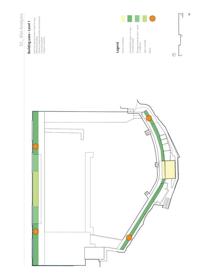
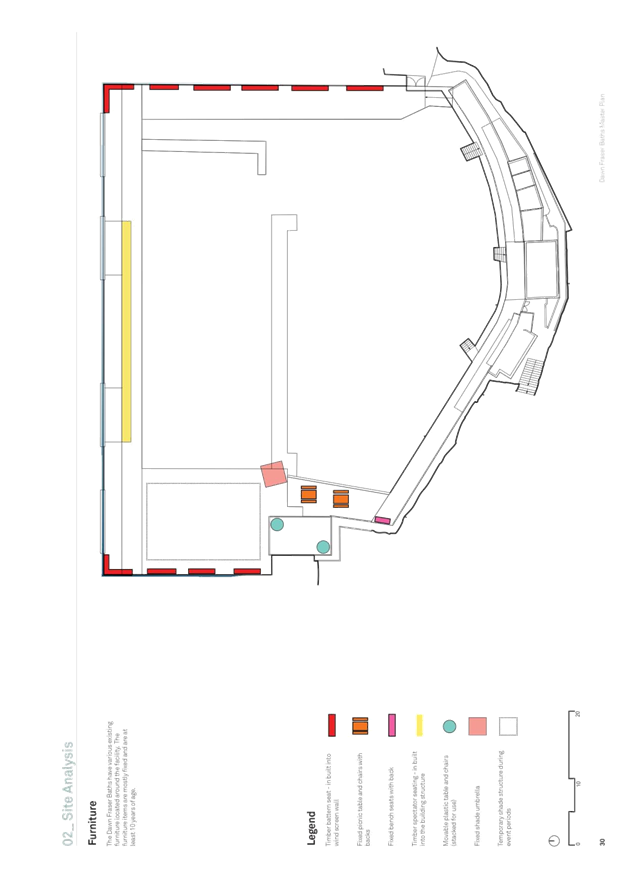
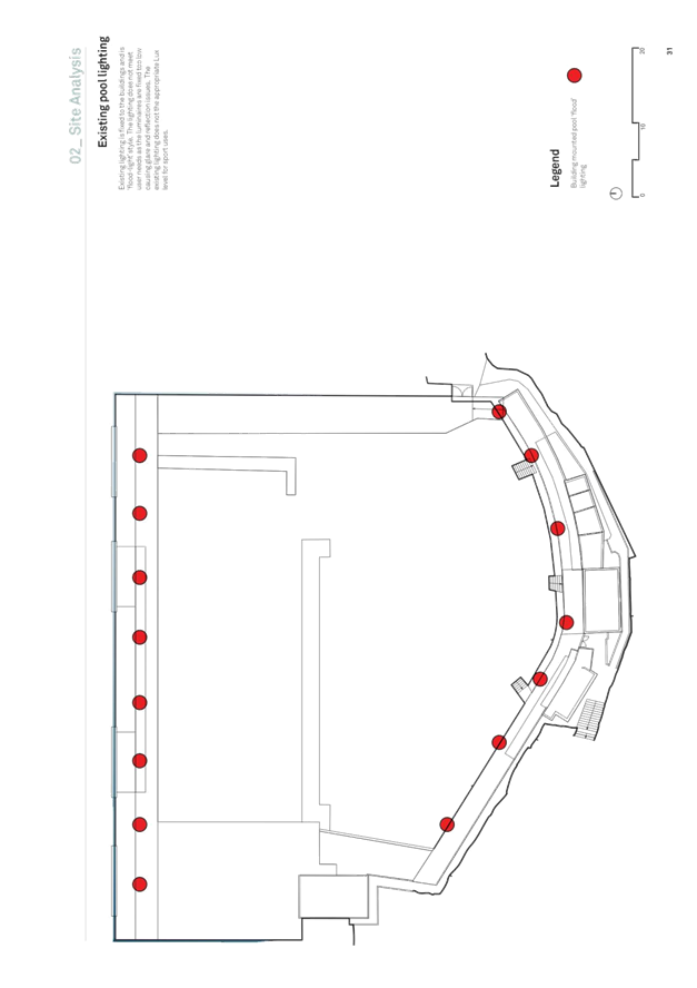
Subject: Draft Dawn Fraser Baths Master Plan: Feedback from Public Exhibition
Prepared By: Vanessa Phillips - Landscape Architect
Authorised By: Cathy Edwards-Davis - Group Manager Trees, Parks and Sports Fields
|
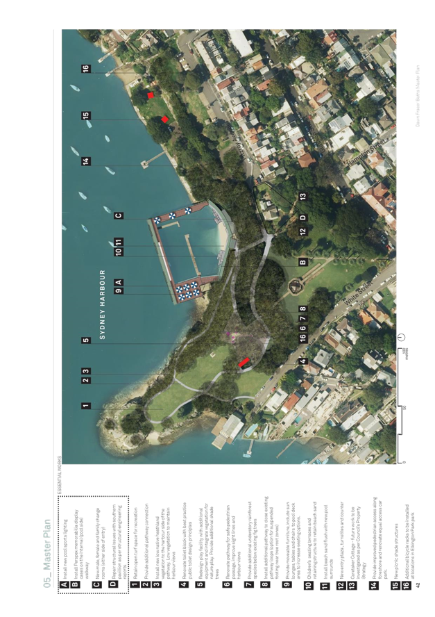
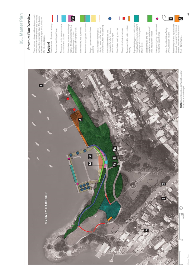
SUMMARY The Draft Dawn Fraser Baths Master Plan was on public exhibition from 31 August 2018 to 28 September 2018. The plans received more than 93% approval from the community. Minor changes were requested during the exhibition period and these have been included in the revised plan to better meet community needs. This report provides an overview of the revised plan, the design process and the feedback received from the community. This report is seeking Council’s endorsement of the master plan so the plans can inform improvements at the Dawn Fraser Baths. |
|
RECOMMENDATION
THAT:
1. Council adopts the draft Dawn Fraser Baths Master Plan (ATTACHMENT 1);
2. All residents and stakeholders who made submissions during the public exhibition period be notified of Council’s determination; and
3. The master plan informs future capital upgrades at the Dawn Fraser Baths. |
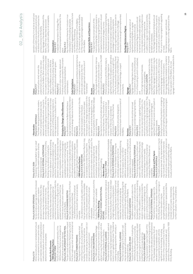
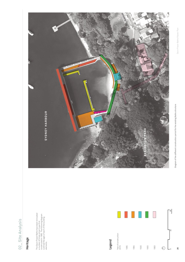
BACKGROUND
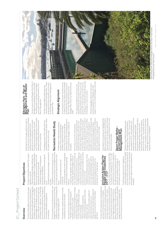
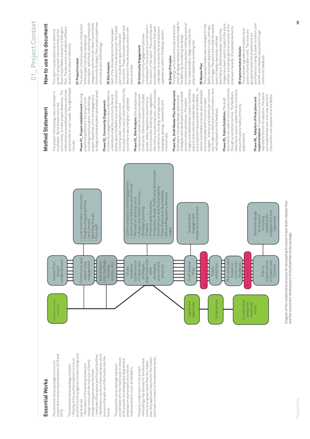
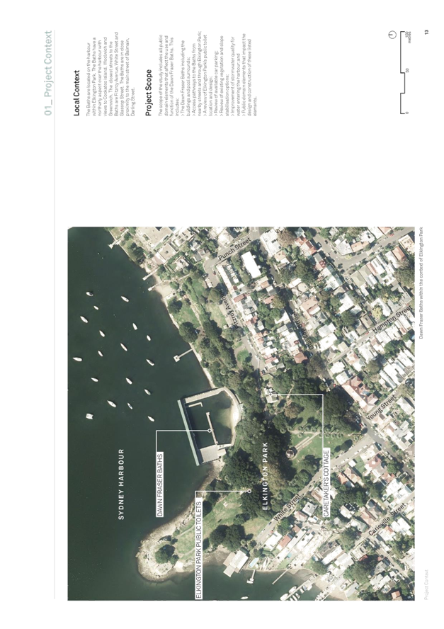
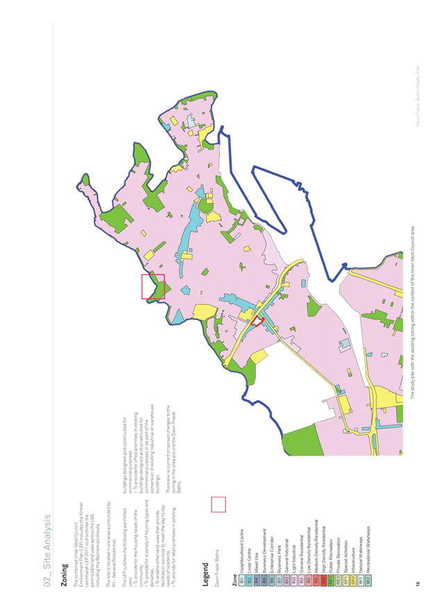
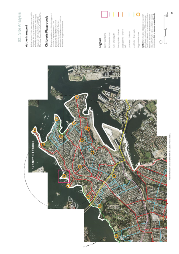
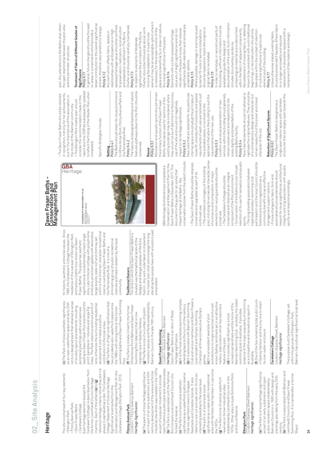
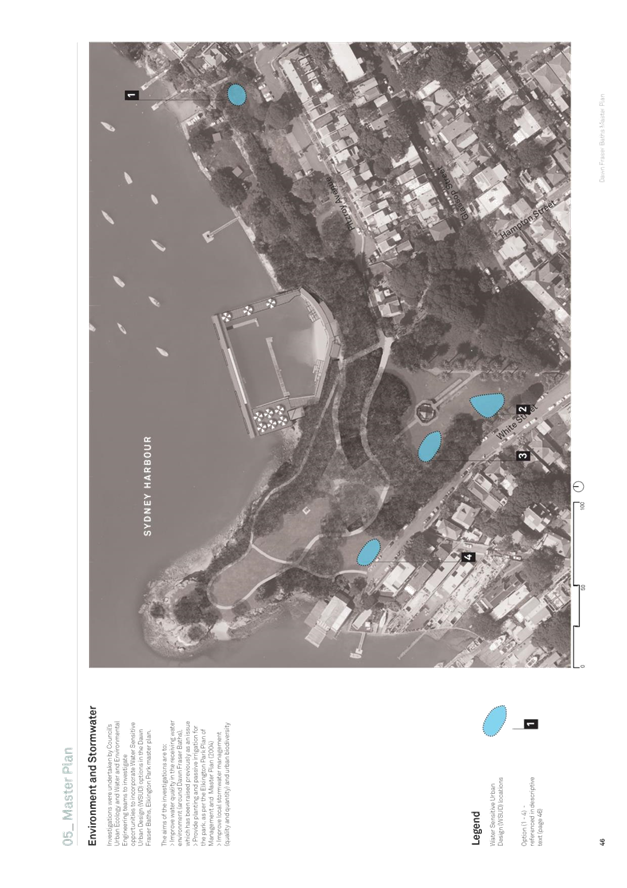
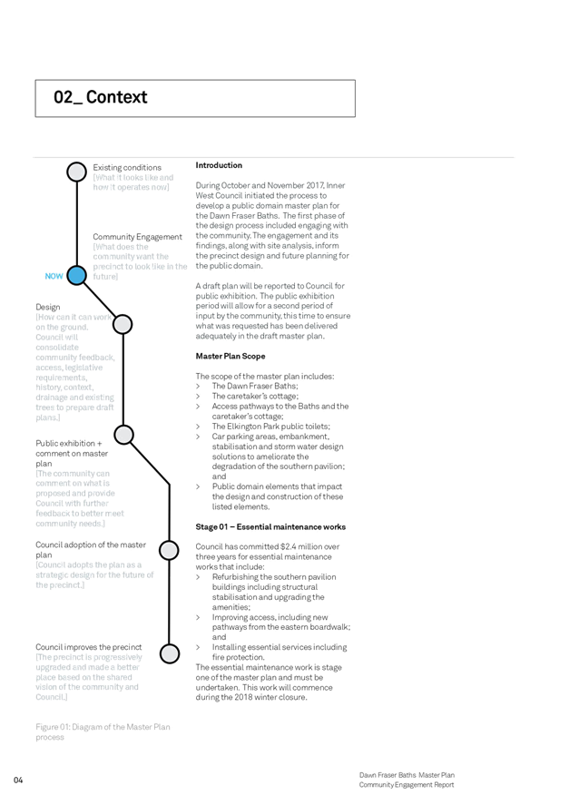
The Public Domain Planning team has engaged across Council, with the community, businesses and State Government Agencies to develop an integrated public domain master plan for the Dawn Fraser Baths.
The draft plan was endorsed for public exhibition at the 28 August 2018 Council meeting. The minutes relating to the master plan from the meeting note that:
1. The draft Dawn Fraser Baths Master Plan be placed on public exhibition for a period of 28 days;
2. The results of the public exhibition and community engagement process are presented to Council recommending further action;
The plan was on exhibition for 28 days, during which the plans obtained much support with over 93% from the community in favor of the plan. Comments received have informed a revision of the plan to ensure it better reflects the community’s vision for the Dawn Fraser Baths.
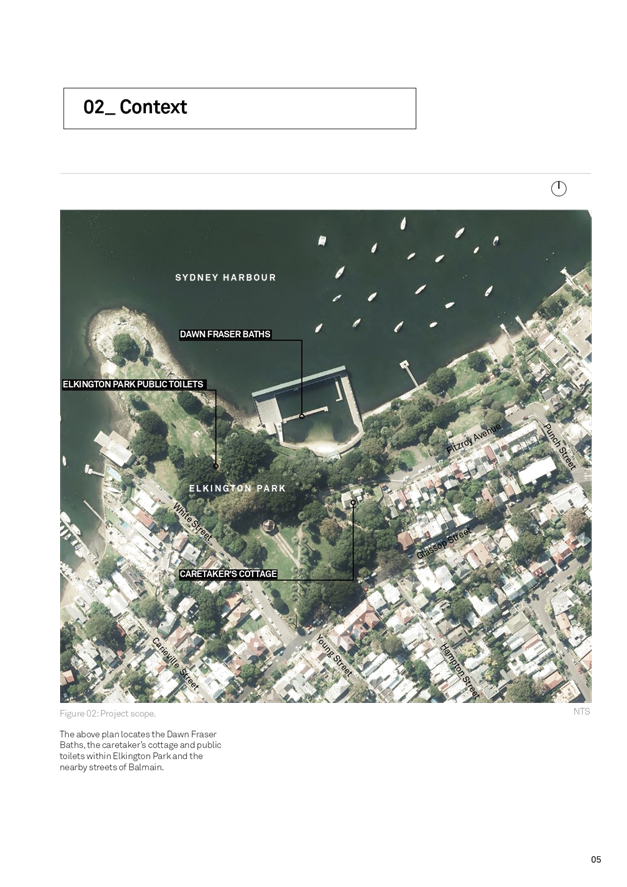
Project Scope
The scope of the master plan includes:
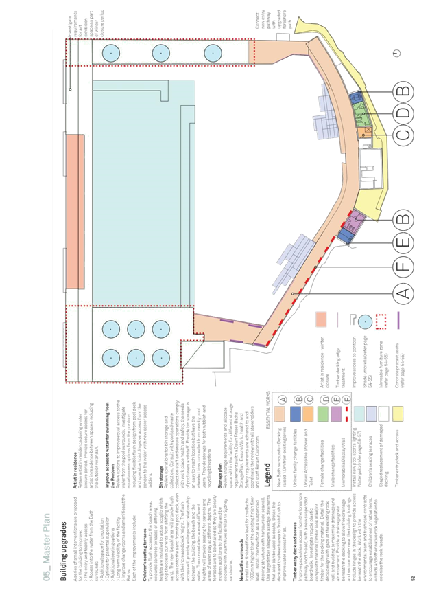
· The Dawn Fraser Baths including the buildings and pool surrounds
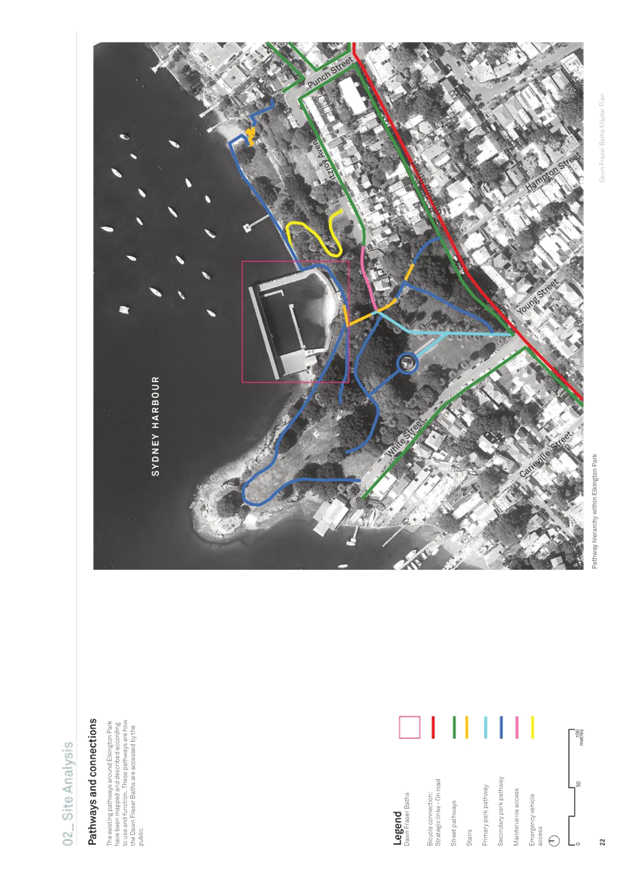
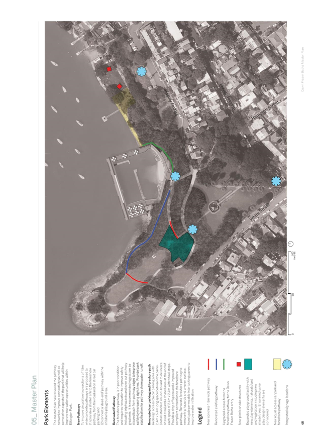
· Access pathways to the Baths from nearby streets and through Elkington Park
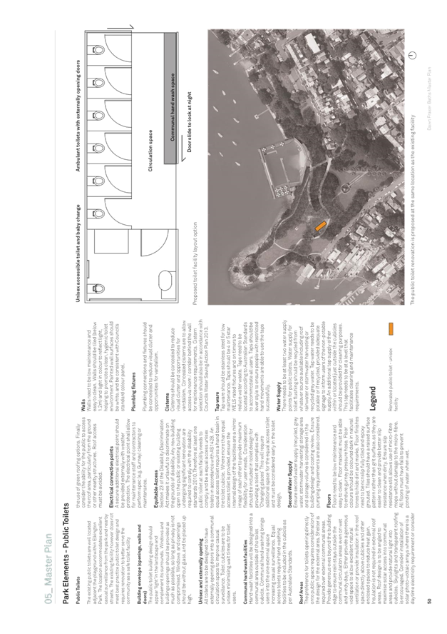
· A review of Elkington Park’s public toilet location and design
· Park elements raised by the community during community engagement
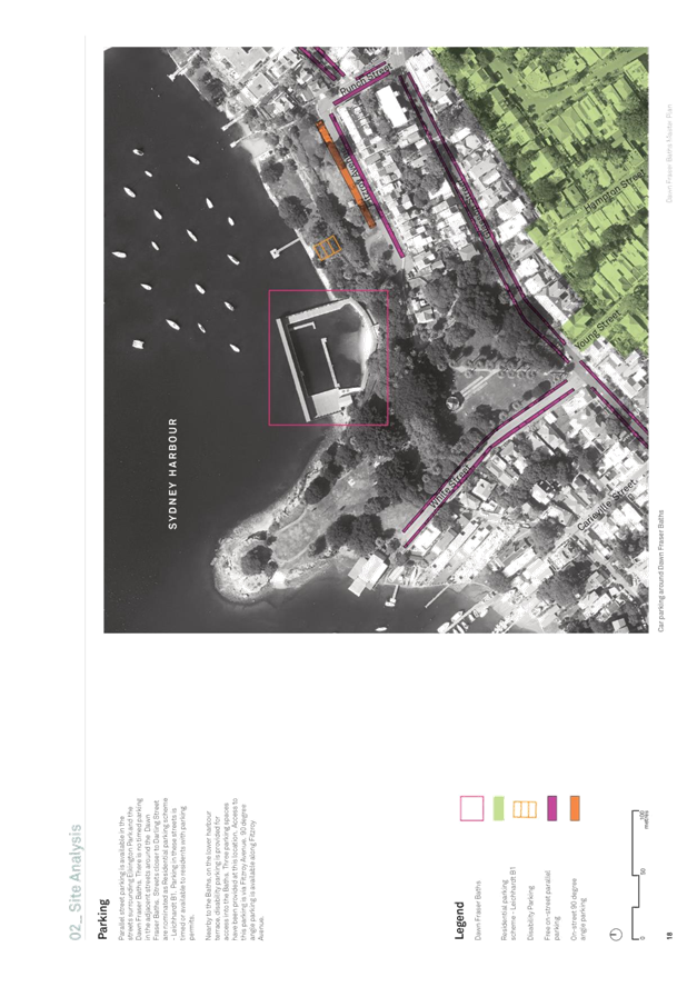
· Review of available car parking
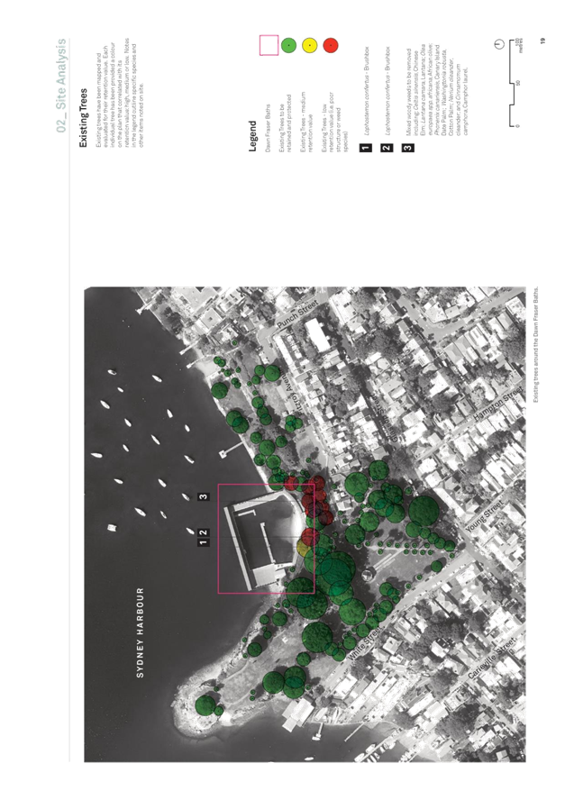
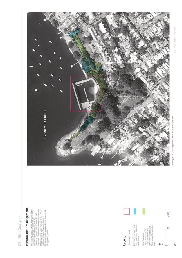
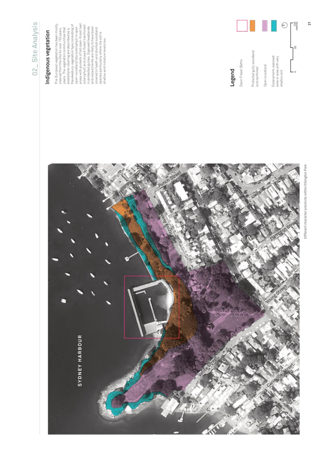
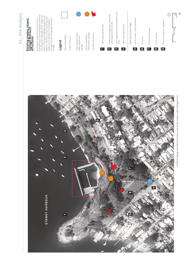
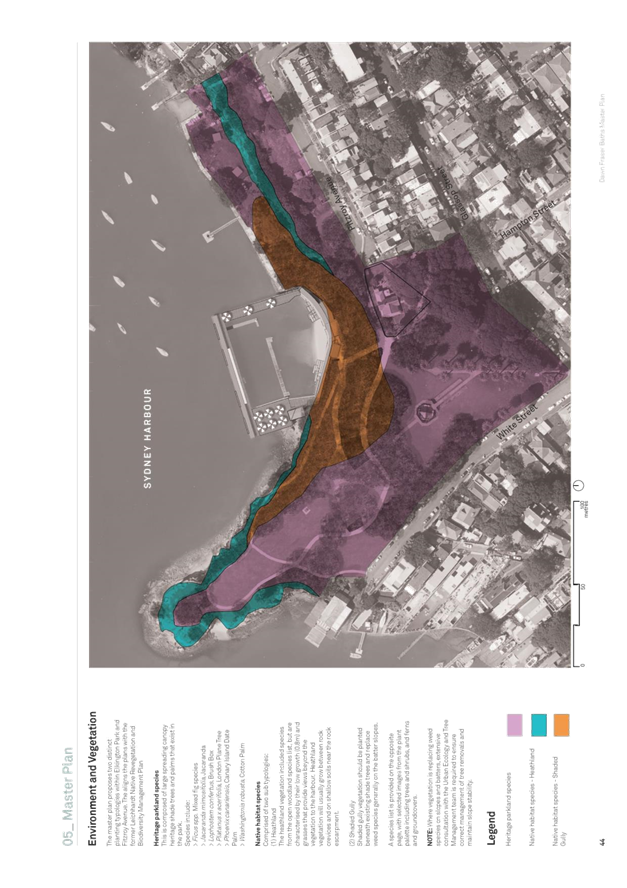
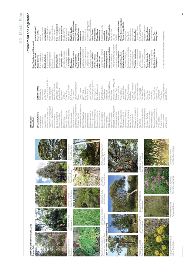
· Review of existing vegetation and slope stabilization options
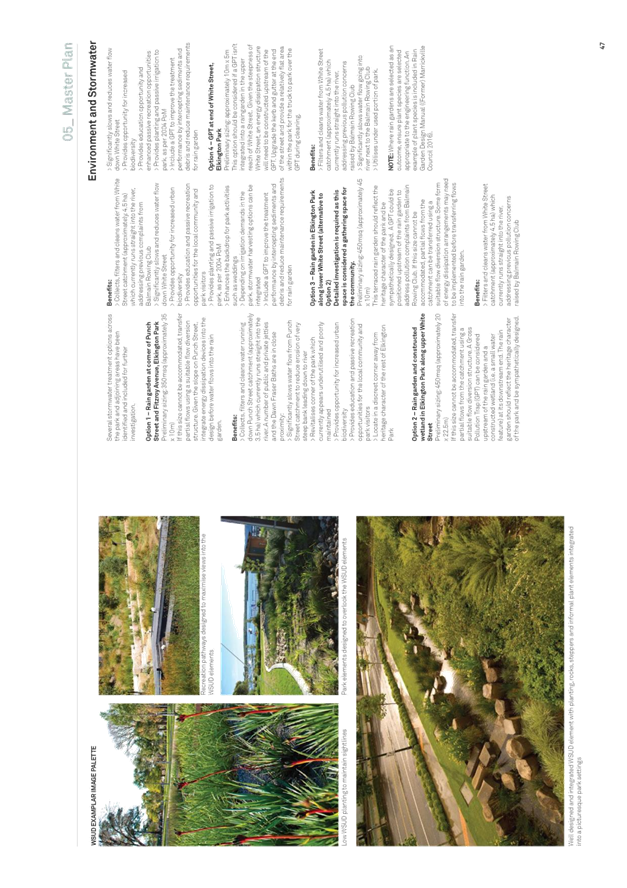
· Improvement of stormwater quality for water entering the harbour
· Public domain elements that impact the design and construction of these listed elements.
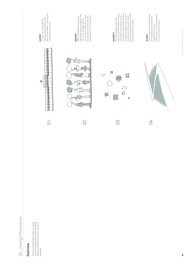
The aim of the master plan has been to develop a ten year plan of improvements at the Baths for users and staff, while maintaining the existing character and sense of place. The master plan provides an illustrative representation of the proposed improvements and includes text, images, plans and diagrams that are easily understood by a variety of audiences. The master plan is fully costed to understand budget requirements and integrated with Council’s forward financial and asset plans.
Master Plan Process
Public Domain Planning has used its internal design team to develop the public domain master plan. Staff worked collaboratively with Council stakeholders and the community to develop a master plan for the Baths. Detailed site analysis reviewed site history, zoning, stormwater and drainage design, active transport connections, pathway and access networks, existing trees, existing parking, indigenous vegetation types, biodiversity and revegetation strategies, park furniture. The combination of site analysis and stakeholder input produced opportunities and constraints that were used to establish the master plan design strategies. The strategies were costed to understand financial implications of proposed upgrades and the integrated into Council forward capital budget.
Master Plan Proposals
The draft master plan proposes strategies aim to improve the user experience at the Baths and in Elkington Park, while maintaining the existing character and sense of place. Some of the master plan strategies include:
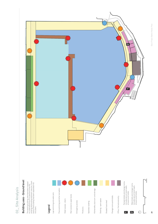
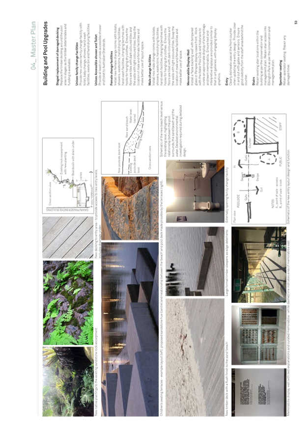
· Renovate the male and female showers, toilets and change rooms
· Provide unisex family change rooms
· Provide at an equal access toilet, shower and change room
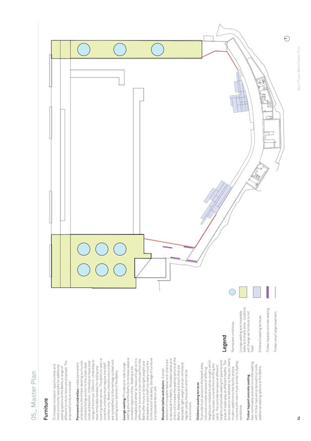
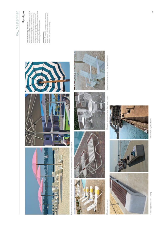
· Provide additional seating options with moveable tables, chairs and sun lounges around the pool deck
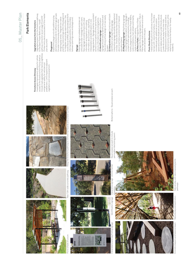
· Install pool-side shade umbrellas
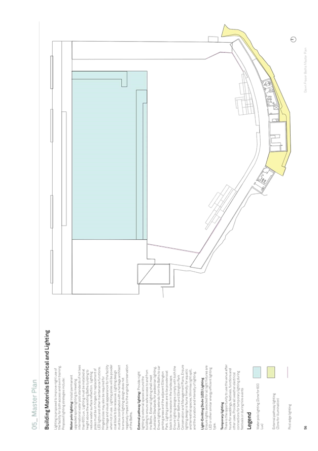
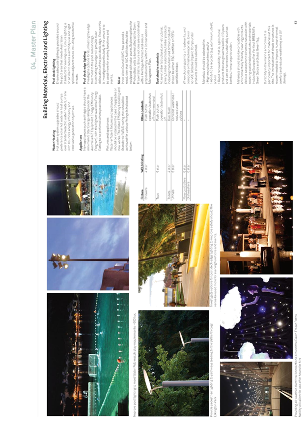
· Upgrade the existing lighting at the Baths to meet water polo match play requirements
· Install a curated memorabilia display area
· Improve the entry configuration and access from the harbour foreshore
· Renovate the foreshore car park to improve equal access car parking and drop off area and provide an accessible route from the car park to the Baths entry
· Improve the vehicle access driveway from Fitzroy Avenue
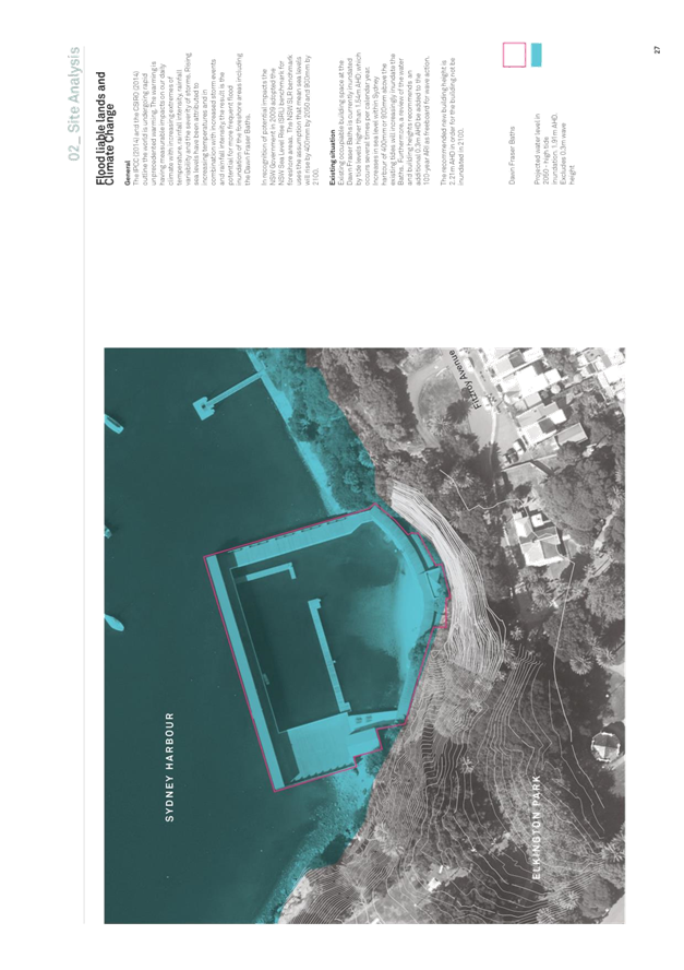
· Raise the Baths floor level to mitigate climate change and sea level rise
· Raise the beach area so entry is flush with the pool deck and install children’s seating terraces at the beach edges
· Undertake weed removal and bank stabilisation with new locally native tree, shrub and groundcover plantings on the escarpment immediately behind the Baths
· Improve the playground within Elkington Park and include nature play and planting
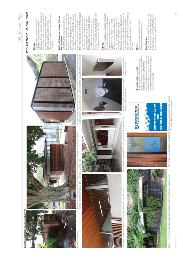
· Renovate the public toilet facility within Elkington Park
· Include Water Sensitive Urban Design (WSUD) options to improve quality of stormwater entering the harbour
Update on Dawn Fraser Baths ‘Essential Works’
The essential works scope includes: Design for sea level rise and raising the boardwalk, South Pavilion and Central Pavilion by approximately 1 metre; Demolition and reconstruction of the South Pavilion and Central Pavilion and re-using as much original fabric/ timber; New compliant bathroom and change rooms on ground floor; Upgrade electrical switchboard; BCA compliance; Sprinkler system to entire baths; Storm water upgrade; Improve accessibility; Refurbishment of piers; and Waterpolo lighting.
This is an update further to the 28th August 2018 report to Council. A Development Application for the essential works at Dawn Fraser Bath was lodged on 27 August 2018 with an extended notification period closing on 24 October 2018 due to the school holidays. It is estimated that the DA will be determined at the end of November, however this relies on an approval from the Office of Heritage and Environment (OEH).
The current project cost estimate is $6.7 million, however the identified risks that may increase project costs are:
- Office of Heritage and Environment (OEH) conditions of approval/ refusal with the proposed works;
- Complexity of site access and location of the works on and near the water;
- Tender pricing due to specialised works (piers/ heritage fabric) and limitation of qualified firms to carry out the works;
- Unforeseen conditions during the works;
- Design development identifying uncosted issues;
Detailed design has progressed to 50% with a complete design anticipated by the end of November. At this stage, there have been no further major issues identified with the design development impacting on the project cost. The project estimate including cost escalation and contingencies will be updated through the design process with a further cost check at 75%, 90% and pre-tender estimate.
An expression of interest procurement process requesting submissions from suitably qualified contractors will commence with a select tender process to follow once the DA is approved and the design is finalised.
Monitoring of the structural integrity and flood inundation continues for public safety.
FINANCIAL IMPLICATIONS
Masterplan
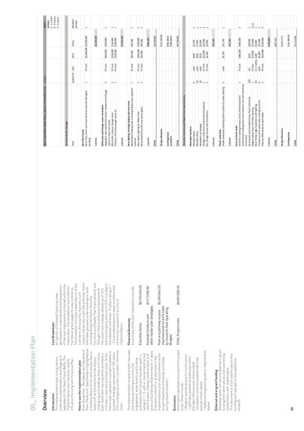
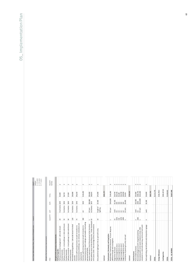
The master plan costs have been estimated to total $9,857,900.00. The master plan costs have been grouped under six headings relating to the area and type of improvements proposed. The cost breakdown associated with each grouping is listed below:
|
Stage |
Amount |
|
Essential works |
$6,700,000 |
|
Poolside furniture and other master plan strategies |
$1,117,058 |
|
Park and pathway access improvements |
$2,040,842 |
|
|
|
|
Total |
$9,857,900 |
‘Essential Works Project’
A grant application for $4.2 million to the Greater Sydney Sports Facility Grant was submitted. The outcome of the grants process will be available in February 2019.
In accordance with the previous resolution of Council, $2.1 million was transferred to the Essential works project from the Leichhardt Section 94 funds previously allocated to an indoor sports centre.
The funding gap is currently $2.2 million.
Options for funding were provided in the 28th August 2018 council report. In summary these include;
1. Grant: An application for the Greater Sydney Sports Facility Grant program for $4.2million was submitted pending advice.
2. Loan: A loan for the Ashfield Aquatic Centre is required and it can be extended to cover the shortfall for Dawn Fraser. This is not recommended without also undertaking a review of other council projects in both capital and operating budget to ensure that the Current Ratio does not go below the benchmark of 1.5.
3. Repriotitise the budget: Review the entire capital works program to identify if there are funding sources or projects that can be reprioritised. This has commenced and will continue through the budget process.
4. Allocate Surplus Funds: Surplus from end of financial year
Further to point No.3 above, a review of the long-term Capital Works program has identified that options exists to:
5. Redistribute Aquatics Centre Renewal funding from outer years of the LTFP (years 5+) and allocate to Dawn Fraser Baths in the relevant year. This option ensures that we are using Aquatics renewal funds and maintains the renewal ratio for aquatics assets. It will result in other (as yet unidentified) aquatic centre renewal projects not being funded;
6. Redistribute Leichhardt s94 Open Space funds from outer years of the budget to fund Dawn Fraser. Unallocated VPA monies could be used to fund the projects that are identified that may have received Open Space funding in those years.
STAFF COMMENTS
The development of the master plan required collaboration with all disciplines across Council. Staff input occurred multiple times and included a variety of forums including one on one meetings, design workshops, email correspondence, telephone discussions and a final review of the draft master plan. The collaborative process has resulted in the development of multifunctional outcomes that benefit multiple users. The internal stakeholders across Council included representatives from:
· Development Assessment and Regulatory Services
· Trees, Parks and Sport fields
· Environment and Sustainability
· Roads, Traffic and Stormwater
· Properties, Major Building Projects and Facilities
· Finance
· Strategic Planning
· Library and History Services
· Recreation and Aquatics
· Community Services and Culture
· Communications, Engagement and Events
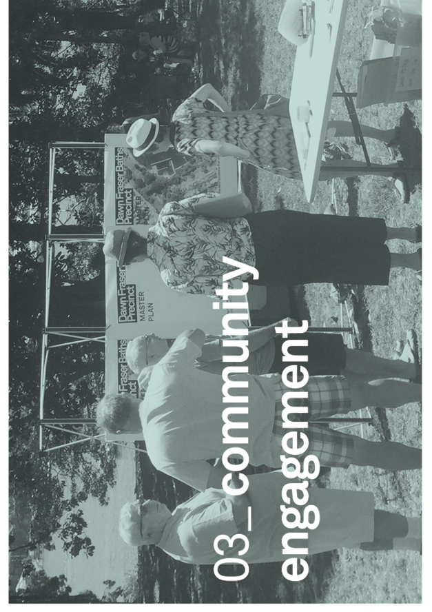
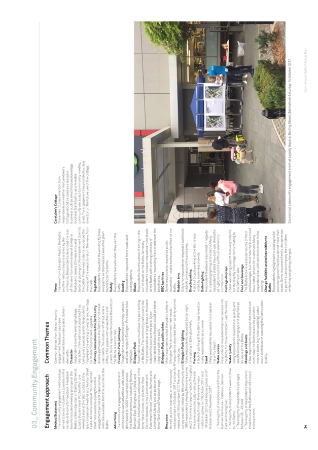
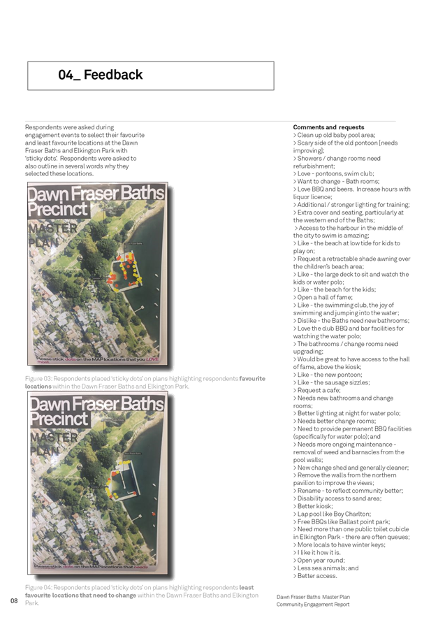
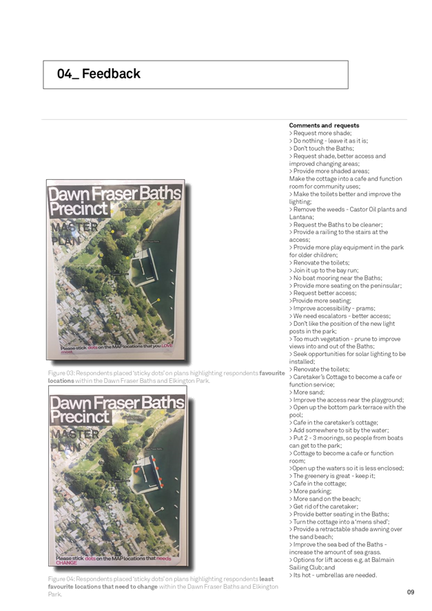
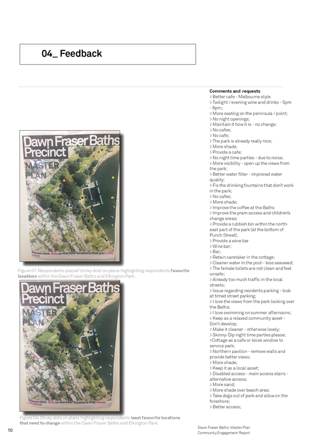
PREVIOUS COMMUNITY ENGAGEMENT
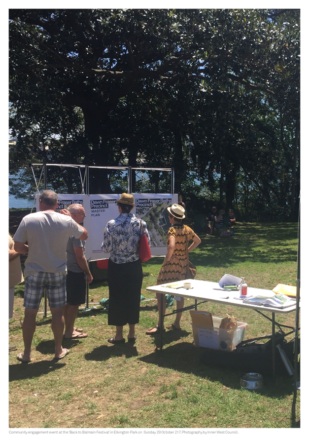
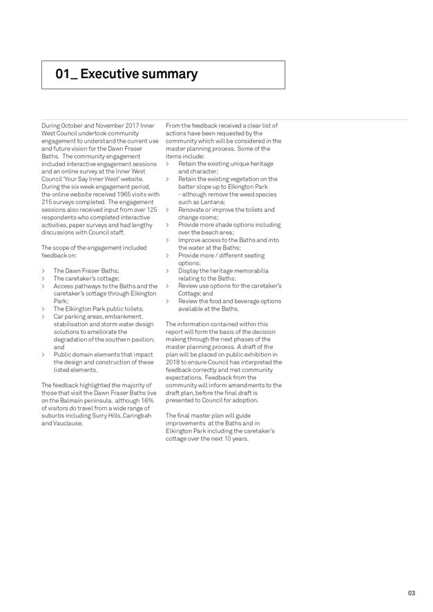
During October and November 2017 Inner West Council undertook community engagement to understand the current use and future vision from the community for the Dawn Fraser Baths. The community engagement included interactive engagement sessions and an online survey at the Inner West Council ‘Your Say Inner West’ website. During the six week engagement period, the online website received 1965 visits with 215 surveys completed. The engagement sessions also received input from over 125 respondents who completed interactive activities, paper surveys, had lengthy discussions with Council staff and submitted letters to Council.
The scope of the engagement included feedback on:
· The Dawn Fraser Baths;
· The caretaker’s cottage;
· Access pathways to the Baths and the Caretaker’s Cottage through Elkington Park;
· The Elkington Park public toilets;
· Car parking areas, embankment, stabilization and storm water design solutions to ameliorate the degradation of the southern pavilion; and
· Public domain elements that impact the design and construction of these listed elements.
· Information on how attendees use the space and from where attendees travel from.
The feedback highlighted the majority of those that visit the Dawn Fraser Baths live on the Balmain peninsula, although 16% of visitors do travel from a wide range of suburbs including Surry Hills, Caringbah and Vauclause.
From the feedback, a clear list of actions has been requested by the community which has been considered in the master plan. The Community Engagement Report is included as ATTACHMENT 2. Some of the feedback includes:
· Retain the existing unique heritage and character of the Baths and Elkington Park;
· Complete upgrades at the Baths once and do the works properly;
· Retain the existing native vegetation on the slope between the Baths and Elkington Park - although remove the weed trees and Lantana;
· Improve access pathways to the Baths and into the water at the Baths;
· Renovate or improve the toilets and change rooms. Provide family change rooms at the Baths;
· Provide more shade options including over the beach area;
· Provide more / different seating options;
· Display the heritage memorabilia relating to the Baths;
Additional engagement was completed with stakeholders including the Balmain Swimming Club and Water Polo Club. The feedback included a written submission that along with the other feedback from the community has been used as a layer of analysis (e.g. proposed flood levels or building structural condition) and design direction to progress the designs for both the essential works package and master plan.
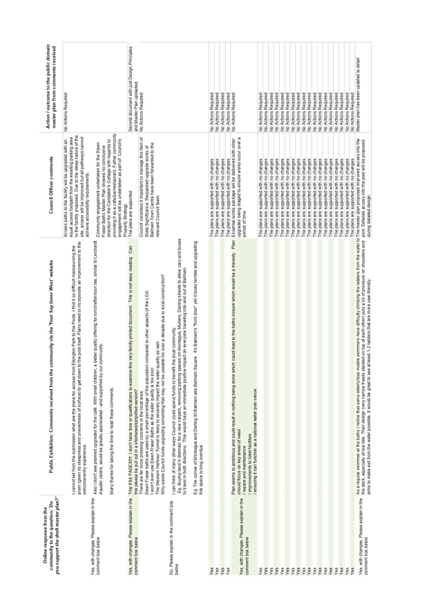
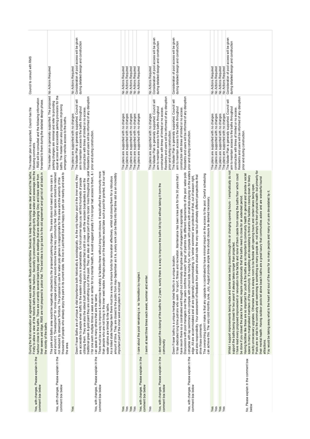
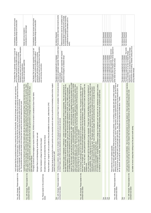
PUBLIC EXHIBITION
During the 28 day public exhibition period from Friday 31 August 2018 to 28 September 2018, advertising material directed the community to review the master plan and complete a short survey at the ‘Your Say Inner West’ website. Advertising material included Facebook posts, advertising in the Inner West Courier newspaper, Tweets on Twitter and cover sheets (on copies of the master plan) in each of the Customer Service Centres.
During the exhibition period the online documents received 663 visits and 96 submissions. From the 96 submissions Council received over 93% support for the plans. Some respondents provided comments and feedback. The feedback has been used to amend the plans so they better align with community sentiments.
A summary of key themes from the community include:
· Maintaining access to the baths throughout construction works
· Improved access into the baths from the pontoon
· Request for additional detailed business case to be undertaken
· Detailed geomorphic investigation undertaken prior to the import of additional sand
· Intensification of water polo usage was not supported
Most comments were positive and others reiterated processes that had already been completed in the development of the plans. The feedback was used to review and amend the draft master plan design strategies. The full list of submissions with Council’s comments and listed requested amendments are included as ATTACHMENT 3.
CONCLUSION
The draft Dawn Fraser Baths Master Plan has been developed through a collaborative process to establish the values consistent with the views of the local community and stakeholders. This has been demonstrated through the high levels of support during the public exhibition process. The high level of community support and the amendments to the plans post exhibition to address community feedback has established a detailed 10 year plan that is consistent with the community vision and values.
|
1.⇩ |
Dawn Fraser Baths Master Plan Report |
|
2.⇩ |
Community Engagement Report |
|
3.⇩ |
Improving Dawn Fraser Baths - Community Engagement Response |
|
Council Meeting 30 October 2018 |
Subject: A Healthier Inner West - Office of Sport
Prepared By: Cathy Edwards-Davis - Group Manager Trees, Parks and Sports Fields
Authorised By: Elizabeth Richardson - Deputy General Manager Assets and Environment
|
SUMMARY This report proposes the creation of an Office of Sport to assist and partner local sporting clubs and organisations to strategically address community health and wellbeing in the Inner West. |
|
THAT:
1. Council appoint an Office of Sport Coordinator to assist and partner local sporting clubs and organisations to strategically address community health and wellbeing and actively promote this service;
2. That the position be be temporarily appointed for a trial period of two years initially. The effectiveness and success of the Office of Sport shall be evaluated at the end of the two year period.
3. The Office of Sport Coordinator strategically partner with the sporting clubs and key partners to increase participation of girls, women, people from lower socio economic backgrounds and people with disabilities as informed by the Recreation Needs Study: A Healthier Inner West. |
BACKGROUND
At the Extraordinary Council Meeting on the 31 October 2017 it was resolved (in part):
THAT for the February 2018 meeting the General Manager provide reports on how Council can:
1. Establish an Inner West Office of Sport to provide assistance to clubs and transform the Council’s relationship with sporting clubs from one based on ground hire only into a strategic partnership to improve the health and wellbeing of our community;
2. Work with clubs to identify bold targets for increasing the participation of women and girls across all sports and implement ways of increasing participation from people from lower socio-economic backgrounds;
A report was presented to the 27 March 2018 Council meeting where it was resolved (in part):
Council defer the appointment an Office of Sport Coordinator until after the completion of the Recreation Needs Study;
The Recreation Needs Study: A Healthier Inner West is on the agenda for consideration at the Council meeting on the 30 October 2018. This report on the Office of Sport is therefore presented concurrently.
The Council resolution identifies the need for Council to lead the development of a Healthier Inner West by providing the following:
· Advance the health of our residents by increasing their opportunities to engage in community sport and recreation to combat the threat of increasing incidence of lifestyle related diseases such as diabetes, cardiovascular disease and obesity.
· Promote and encourage a healthy lifestyle for school age children specifically and the community generally through sports participation. Work with local community sporting bodies to increase participation levels in sport for people from lower socio-economic backgrounds to remove economic or social barriers.
· Transform the Council’s relationship with sporting clubs from one based on ground hire only into a strategic partnership to improve the health and wellbeing of our community. Work with local clubs to set ambitious targets for increasing the participation of women and girls in sport.
· Drive participation in community sport, which helps to build our community, community cohesion and social wellbeing. Encourage community sports clubs, which are the largest network of volunteers in our community, and ensure they get the recognition, support and investment they need.
It is proposed to create the position of Office of Sport Coordinator to work strategically with sporting clubs to achieve these operational and strategic objectives. The Office of Sport Coordinator will liaise with local sporting clubs and relevant Council officers, regarding:
· Using Parks and Sportsgrounds
- Seasonal Hire
- Casual Hire
- Commercial Fitness Training
- Lighting
- Sportsfield maintenance
- Building maintenance
· Assistance for Clubs
- Council grants
- Assistance applying for grants
- Club development including volunteer support, capacity building
· Sports Forum
· Policy and Planning
- Recreation Needs
· Other resources
- ClubSpot
- RecPost
· A liaison point to Parks Planning & Engagement – sportsfields allocations (seasonal and casual bookings), sportsfield lighting, parks planning and master planning, capital works within parks, assistance with the preparation of grant applications to external bodies.
· A liaison point to Recreation - strategic recreation matters including increasing participation in sports and the need for new facilities, and awareness of and assistance with grant funding opportunities.
· A liaison point to Properties, Major Building Projects & Facilities – maintenance matters for buildings within parks, cleaning of buildings/ facilities within parks, and leasing and licencing of parks/ sportsfields (greater than one season).
In order to promote the newly appointed Office of Sport Coordinator, it is proposed that the Coordinator develop and implement a community engagement strategy, which will allow the Office of Sport to reconnect and build stronger relationships with the clubs, including:
· Dedicated section on Inner West Council website;
· Mail out to all local sporting and recreation organisations promoting the service in detail;
· Follow-up meetings with clubs;
· Updates through the Inner West Sports Forum, which meets at least twice per year; and
· Dedicated online resource providing email support, training for volunteers and template documents (checklists, letters etc.)
It is proposed that the Office of Sport Coordinator be temporarily appointed for a trial period of two years initially. The effectiveness and success of the Office of Sport will be evaluated at the end of the two year period to determine whether to continue the service.
Targets to Increase Participation
Based on the recommendations from the Recreation Needs Study: A Healthier Inner West, the Office of Sport Coordinator would work strategically with local sports clubs and other key partners to actively increase the participation of girls, women, people from lower socio economic backgrounds and people with disabilities.
The Office of Sport Coordinator will also develop a calendar of grant funding opportunities and promote awareness of this to sporting clubs and assist them with the development of applications for projects consistent with Council’s strategic objectives.
FINANCIAL IMPLICATIONS
The position of Office of Sport Coordinator will cost approximately $120,000 including on-costs per annum. Funding for this position has been identified in the 2018/2019 budget.
OTHER STAFF COMMENTS
Parks Planning & Engagement, Recreation and Finance staff were consulted in the development of this report.
PUBLIC CONSULTATION
Extensive public consultation was undertaken as part of the Recreation Needs Study.
CONCLUSION
It is recommended that an Office of Sport be created to assist and partner local sporting clubs and organisations to strategically address community health and wellbeing in the Inner West.
|
|
Council Meeting 30 October 2018 |
Subject: Alternative Sites for a Regional Skate Park Facility in the North of the Inner West LGA
Prepared By: Aaron Callaghan - Parks Planning and Engagement Manager
Authorised By: Cathy Edwards-Davis - Group Manager Trees, Parks and Sports Fields
|
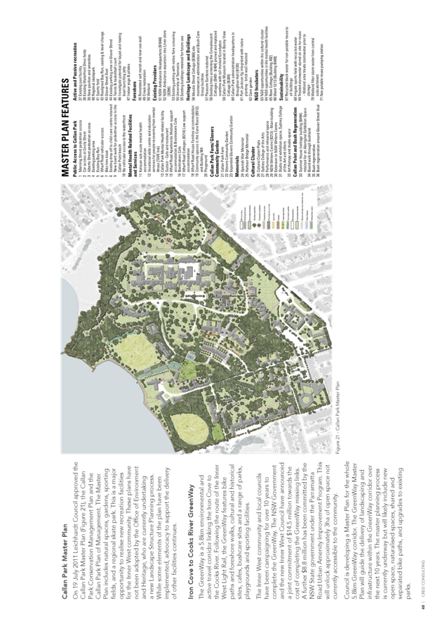
SUMMARY This report outlines the history of investigation into a regional skate park in Callan Park. The report identifies opportunities for the skate park within the north of the Inner West local government area. |
|
RECOMMENDATION
THAT:
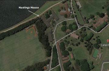
1. Council seek an urgent meeting with the Minister of Health and the Minister for Environment and Heritage to discuss in principal approvals for the development of a regional skate park on the footprint of Hastings House (B505) adjacent to the Iron Cove Bay Run at Callan Park;
2. Council include in this proposal the demolition of Hastings House (B505) and Palm Court (B514) which will facilitate the opening up of the Waterfront precinct in this area of Callan Park; and
3. Should the Hasting House Site (B505) not be supported by Government in writing by December 2018, that Council investigate an alternative location and proceed to undertake community engagement on the development of a skate park facility adjacent to Leichhardt #3.
|
BACKGROUND
Since 2011, Council has tried unsuccessfully to design and deliver a regional skate park facility at Callan Park. There is significant community support for the project, which included engagement with local youth in the design process. To date, the NSW Government has not provided owner’s consent to allow Council to proceed with the lodgment of a Development Application on a revised location for a regional skate within Callan Park. The background and time lines involved in the development of a regional skate park are provided in Table 1.0 below:
Table 1.0 Chorological Timeline of Events-Callan Park Regional Skate Park Development
|
August 2011 |
Council writes to the Premier of NSW seeking care and control of site for Skate Park in Callan Park |
|
November 2011 |
Council submits Callan Park Master Plan after community consultation, including provision for Skate Park |
|
June 2013 |
Council approves $50,000 funding for the design and approval of skate park, intention to build in 2014/15 |
|
Dec 2014 |
Council completes design plans for Skate Park near Balmain Road sporting ground Exhibited until late Feb 2015 and reported to Council. |
|
February 2015 |
Council begins the process of a DA approval for the site. |
|
June 2015 |
Council approves $907,000 for construction of the skate park |
|
July 2015 |
Council meets with Minister Speakman and requests help to progress the Skate Park |
|
December 2015 |
Council given approval to lodge Development Application |
|
March 2016 |
Heritage Council does not support the Development Application |
|
9th November 2016. |
Meeting held with Minister Speakman’s Chief of Staff and OEH Advisors on rational for Heritage Council determination. Delegation of Council staff and Council’s Administrator attend meeting. Council advised to explore options for an alternative location within Callan Park. |
|
January 2017 |
New site identified near the NSW Ambulance base in the park. Informal approval provided from OEH staff, but contingent on the completion of their landscape structure plans. |
|
February 2017 |
Council develops new design plans for Skate Park in highly modified area of the park (Adjacent to the NSW Ambulance Centre). |
|
2nd August 2017 |
Council presents skate park plans on site at Callan Park to the NSW Heritage Council at their August 2016 meeting. |
|
24th August 2017 |
Council receives minutes from the NSW Heritage Council meeting confirming in-principal support for the regional skate park and the new location. |
|
5th December 2017 |
Council receives verbal confirmation that OEH will not support the new site, nor will it provide owner’s consent. |
|
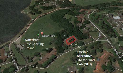
31st January 2018 |
OEH outline an alternate site within Callan Park at the rear of the Waterfront Drive sporting ground. Council officers highlight significant concerns regarding lack of passive surveillance and proximity to public transport. Council officers request from OEH formal correspondence on alternative sites. None received. |
|
28th August 2018 |
Mayoral correspondence sent to Minister Upton (Minister of Environment, Minister for Heritage) seeking an urgent meeting to progress the regional skate park adjacent to the NSW Ambulance Centre and requesting a written response from Government on the adoption of the Callan Park Master Plan and the formation of the Trust model. Clarification on the purpose and the scope of the Landscape Structure Plan was also sought. |
An earlier report on skate park options was considered at the Council meeting on the 12 June 2018. A copy of this report is attached. Council resolved (in part):
THAT Council:
1. Seek an urgent meeting with the NSW Minister for the Environment to advocate for support from the State Government for the development of a Regional skate park in Callan Park, adjacent to the NSW Ambulance Centre. At this meeting if agreed to, in addition, at this meeting Council requests:
a) The Government’s written response to adoption and implementation of the 2011 Callan Park Masterplan and the establishment of the Callan Park and Broughton Hall Trust;
b) Clarification on the purpose and scope of the Landscape Structure Plan (LSP) for Callan Park;
c) In relation to the Landscape Structure Plan (LSP) that council and the community be provided with:
· An outline of all further community consultation planned and how that will be promoted widely across the community;
· A process outlined on how written submissions will be received and assessed by the consultants;
· A formal closing date for receipt for submissions to the Landscape Structure Plan; and
· A commitment to put any preferred landscape plan on exhibition to allow for further consultation with the community.
In recent weeks OEH staff have verbally advised that are prepared to consider a compromise site within Callan Park, subject to support from their Landscape Structure consultants and subject to future approvals. The new and alternative site within Callan Park is located in the waterfront precinct and is considered in Table 1.1.
Council staff have requested that in principle support for this location is provided in writing. At the time of preparing this report, this written advice has not been provided. This advice will be tabled at the Council meeting should it be received in the meantime.
REPORT
Four potential alternative sites have been identified by Council officers as future locations for a regional skate park facility in the North of Inner West Council Local Government area. These are highlighted in Table 1.1 below:
Table 1.1 Alternative Sites for a Regional Skate Park in the North of the LGA
|
Location |
Opportunities |
Risks |
|
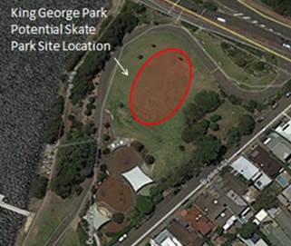
King George Park Northern Section of adjacent to the Iron Cove Bridge |
Highly visible site with excellent passive surveillance.
Site is under utilised in terms of open space use.
Located next to major transport routes and the Iron Cove Bay run.
|
Likely to be opposition from local residents |
|
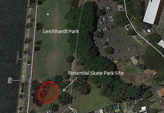
Leichardt Park -Site adjacent to Leichhardt 3 Sporting Ground |
Highly visible site with excellent passive surveillance.
Site is under utilised in terms of passive recreation.
Site is located next to the La Montage Function Centre, Café, the junior sporting ground and the Iron Cove Bay Run.
Site has the ability to be floodlit.
Residential impacts will be minor.
|
At least 20 Casurina trees and 2 Gum trees would be required to be removed however this could be balanced with improved landscaping as part of the overall project.
Plan of Management for Leichhardt Park would need to be amended to provide for the skate park proposal. Permission from the Office of Crown Lands would be required (land is Crown Reserve).
The size of the skate park would be half the size of the new Sydenham Green Skate Park (therefore not fully regional). |
|
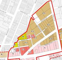
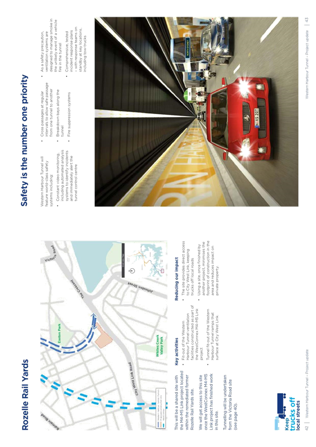
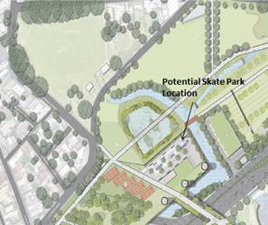
Rozelle Goods Yards
Site near the Lilyfield Light Rail Station |
Site is currently utilised by RMS as part of the WestConnex M4-M5 Link Rozelle Interchange project. Government announced in July 2016 a new park will be developed on this site.
Site has previously been advocated by Council and community groups as a site for a regional skate park.
NSW Government has identified and supported this site for a skate park facility along with open space provision as part of its visioning for the future of the Rozelle Good Yards site, once the WestConnex project is completed.
|
Site is not owned by Council .
Any development is at least five to ten years away.
High risk that Government vision for this area may not proceed. |
|
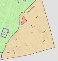
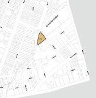
Callan Park-Hasting House (B505) Site |
Site is located on the footprint of Hastings House (B505)
Site has high passive surveillance from the Iron Cove Bay Run and the current design of the regional skate park could be modified to support this location .
Site is located in front of the Refugee Welcome Centre. Youth activities could be supported from this building further activating the space in the longer term.
With associated landscaping, the proposed skate park would enhance the waterfront precinct and attract a greater diversity of users to the park.
As per the previous proposal at the NSW Ambulance site, Council could consider as part of the project demolishing two buildings on the waterfront (Hastings House and Palm Court) to support and create a more harmonised open space setting which supports the concept of an urban parkland. Note: The previous proposal included demolishing three houses adjacent to the Balmain Road Sporting Ground.
Significantly, both buildings have been identified as intrusive to the park setting in adopted Conservation Management Plans and removal is supported. |
Site is not owned by Council. Support would be required from OEH for the proposal to proceed and a DA would need to be lodged and heritage approvals received.
May be opposition from some residents and community groups. |
Site Photos and Diagrams
King George Park
Leichhardt Park
Rozelle Goods Yards
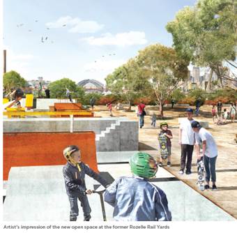
Artists Impression of the Proposed New Inner West Park and Skate Park Facility Rozelle Rail Yards
Callan Park Site-Hastings House (B505)
FINANCIAL IMPLICATIONS
Council has allocated a budget of $1,275,000 for the regional skate park facility in the north of the LGA.
OTHER STAFF COMMENTS
The development of a regional skate park in the north of the LGA has been highlighted in the Draft Recreation and Needs Study “A Healthier Inner West” and as a priority in the Callan Park area.
PUBLIC CONSULTATION
Future Community Engagement will be required on any of the new sites which have been identified. Key stakeholder engagement with Government is required to move this project forward on the Callan Park site.
CONCLUSION
Callan Park remains the preferred location for a skate park in the northern part of the Inner West LGA.
Council has previously received in principal support from the NSW Heritage Council for the development of a regional skate park at Callan Park. The Office of Environment and Heritage (OEH) who manage the park on behalf of Government have raised concerns in relation to the revised location of the skate park near the NSW Ambulance Centre and have notified Council that they won’t support this site.
OEH staff have however indicated informally that they may consider a proposal in the Waterfront precinct in an area where intrusive buildings have been identified to be removed. Council officers are awaiting a formal response from OEH on this matter.
It is recommended that Council seek an urgent meeting with the respective Ministers in this regard. It is noted that this site has significant potential and could result in positive outcomes for Council, the community and Government.
Given the substantial delay in delivery of this project, should the preferred site at Callan Park not be forthcoming in the short term, it is recommended that Council move to the second preferred option. Therefore, should Council not receive written commitment from the state government to support the regional skate park at the Hastings House site by the end of December 2018, it is recommended that Council proceed to investigate the site adjacent to Leichhardt #3.
|
1.⇩ |
Former Council Report 12 June 2018 |
|
|
Council Meeting 30 October 2018 |
Subject: Callan Park Regional Skate Park Project
Prepared By: Aaron Callaghan - Parks Planning and Engagement Manager
Authorised By: Cathy Edwards-Davis - Group Manager Trees, Parks and Sports Fields
|
This report highlights recent verbal advice received from the Office of Environment and Heritage (OEH) on the proposed regional skate park at Callan Park. OEH have recently advised that the skate park proposal will not be supported by OEH in the revised location which Council has suggested.
OEH is currently developing a Landscape Structure Plan for Callan Park and has advised that specialist landscape architectural advice will be recommending that the skate park be located behind the Waterfront sporting ground. This site has poor visual surveillance and as such Council officers do not support this concept. The site being recommended by OEH’s principal architects appears to negate any prospect of a youth facility of this nature being developed in Callan park into the future.
The report also provides Council with a summary of other sites in the northern section of the LGA which have been assessed by Council officers as alternative locations for a skate park facility and the significant issues associated with any future planning and community engagements on these sites. |
|
RECOMMENDATION
THAT Council:
1. Seek an urgent meeting with the NSW Minister for the Environment to advocate for support from the State Government for the development of a Regional skate park in Callan Park, adjacent to the NSW Ambulance Centre.
2. Note the significant planning issues associated with developing a skate park at alternative park locations.
|
BACKGROUND
On 19 July 2011, after 18 months of community consultation, the former Leichhardt Council adopted the draft Callan Park Master Plan, along with the Conservation
Management Plan and Plan of Management for Callan Park.
Callan Park is owned by NSW Health and is under the stewardship of the Office of Environment and Heritage.
One of the key community projects in the draft Callan Park Master Plan is the development of a regional skate park. During the master planning work statistical community support for a skate park within Callan Park was well received, with 70% online responses in favor of such a development.
Specific recommendations to facilitate a skate park included:
· Removal of intrusive buildings to create the skate park site
· Regional skate park with minimal structure to be constructed above the existing ground level to reduce visual impact.
Regional Skate Park Planning
Timeline
November 2011: Council submits draft Callan Park Master Plan, including a provision for a skate park, to the State Government.
December 2011-2018: The State Government has
provided no formal response to the draft Callan
Park Master Plan.
December 2014: Council completes
design plans for Callan Park skate park (first location).
December 2015: Council given land
owner’s consent from the State Government to lodge Development
Application for the skate park (first location).
March 2016: Heritage Council refuses
to support the Development Application for the skate park (first location).
Development Application is withdrawn by Council.
January 2017: New site for the skate
park (second location) identified in Callan Park, near Balmain Road, adjacent
to the NSW Ambulance car park. Concept plans revised to fit new location.
Informal in principal support from OEH staff and the NSW Heritage Council.
December 2017: Council receives
confirmation that OEH will not support the new site for the skate park.
February 2018: OEH informs Council it will not support a skate park on the revised Balmain Road site and that a location for this type of facility may be considered as part of the Landscape Structure Planning programme of works.
Revised Site Location Proposed Regional skate park Facility Callan Park
The revised location which OEH is considering as part of its Landscape Structure Plan is the demolition of B496 Foundation House (into the future) and the possible location of a skate park in this area. This site has poor visual surveillance, which may allow anti-social behaviour to occur and as such Council officers do not support this concept. In addition any such development could be many years away.
Review of Other Potential Sites
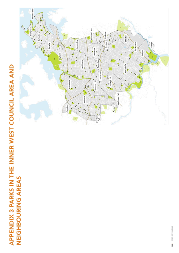
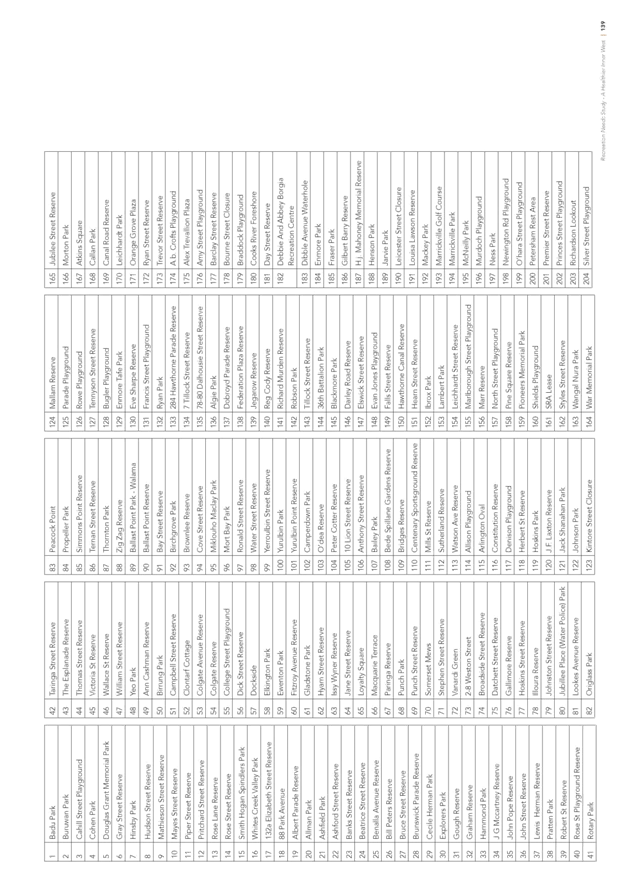
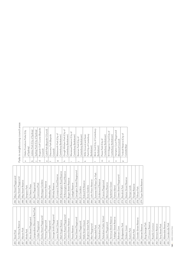
As part of a desktop review Council officers have reviewed a number of park areas in the north of the local government area which could potentially support a regional skate park. Table 1.0 below highlights these sites and outlines planning issues which Council would need to resolve should it wish to pursue an alternative site to Callan Park. Photos of each of the sites listed as part of the desktop review can be viewed in Attachment 1.
Table 1.0 Alternative Park Sites.
|
Park |
Area Reference |
Existing POM |
Positive Attributes |
Areas for Concern |
Recommended for Further Review |
|
Shields PlaygroundDarley Road |
Large Area of Passive Open Space adjacent to Darley Road light rail station |
No |
Located adjacent to the Hawthorne light rail station. |
Likely to be community opposition - as was the case when the netball courts were proposed at this site. |
No |
|
King George Park |
High ground in the northern section of the park (adjacent to Victoria Road) |
No |
Located adjacent to Victoria Road bus services. Good passive surveillance. |
Site is very close to residential properties and there is likely to be community concerns associated with noise. |
No |
|
Hawthorne Canal Reserve |
Southern section of the park which is a dedicated dog on-leash area. |
No (Being considered as part of the Greenway Master Plan) |
Located adjacent to the Hawthorne light rail station. |
One tree would need to be removed. The majority of the facility would need to be above ground due to the low water table in this area. Likely to be opposition from dog walkers. |
No |
|
Bridgewater Park |
Large area of flat open space currently used for passive recreation and a dog off-leash park |
Yes |
Located adjacent to Victoria Road bus services. Good passive surveillance. Large area of flat open space |
Site is very close to residential properties and there is likely to be community concerns associated with noise and perceived loss of greenspace. The park is currently zoned off-leash. |
No |
|
Peace Grove (Leichhardt Park) |
Linear section of passive open space adjacent to Le Montage in Leichhardt Park. |
Yes |
Good passive surveillance. |
Site is very close to residential properties and there is likely to be community concerns associated with noise. |
No |
|
Leichhardt Park |
Area between LPAC and Leichhardt Oval #2 |
Yes |
Good passive surveillance. No residents are immediately adjacent. |
The space available is too constrained for a skate park. |
No |
While it is may be possible for Council to construct the regional skate park at the sites listed in Table 1.0, each location presents areas of concern. From previous experience, opposition has often stemmed from perceived changes in use and a lack of acknowledgement of the wider community benefits that such facilities support.
Council has received representations from a resident suggesting the construction of micro skate parks in the Inner West. Similarly, to larger facilities, it is anticipated that smaller skate parks would receive considerable community concerns primarily associated with noise.
FINANCIAL IMPLICATIONS
Council has allocated a budget of $1,275,000 for the regional skate park facility in Callan Park.
OTHER STAFF COMMENTS
Nil
PUBLIC CONSULTATION
No consultation has been carried out on the alternative site being considered by OEH, to date.
Should Council consider any of the alternative sites viable then there would need to be detailed and robust community engagement undertaken to assess community support for an alternative location.
CONCLUSION
This report highlights recent verbal advice received from the Office of Environment and Heritage (OEH) on the proposed regional skate park at Callan Park. OEH have recently advised that the skate park proposal will not be supported by OEH in the revised location which Council has suggested.
OEH is currently developing a Landscape Structure Plan for Callan Park and has advised that specialist landscape architectural advice will be recommending that the skate park be located behind the Waterfront sporting ground. This site has poor visual surveillance and as such Council officers do not support this concept. The site being recommended by OEH’s principal architects appears to negate any prospect of a youth facility of this nature being developed in Callan park into the future.
The report also provides Council with a summary of other sites in the northern section of the LGA which have been assessed by Council officers as alternative locations for a skate park facility and the significant issues associated with any future planning and community engagements on these sites.
|
Council Meeting 30 October 2018 |
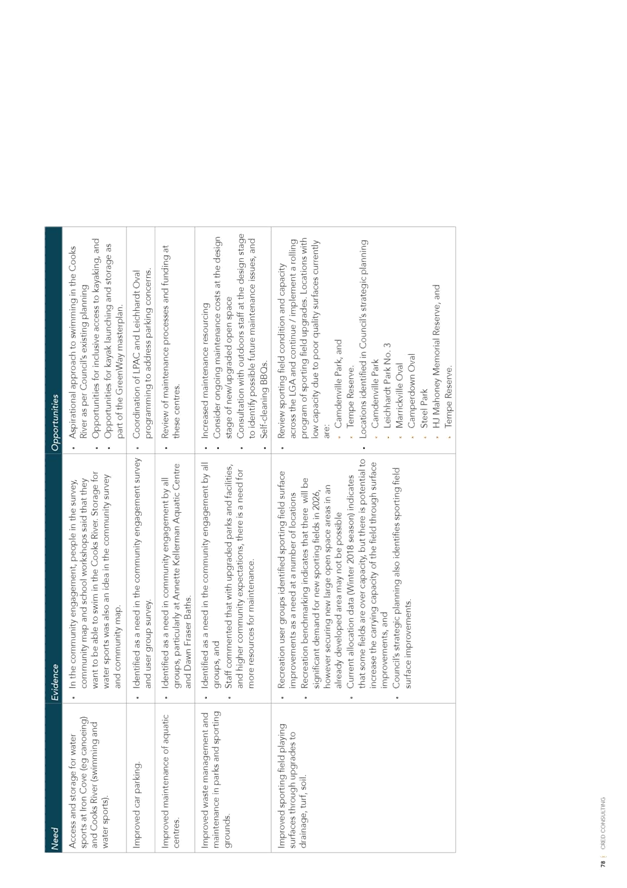
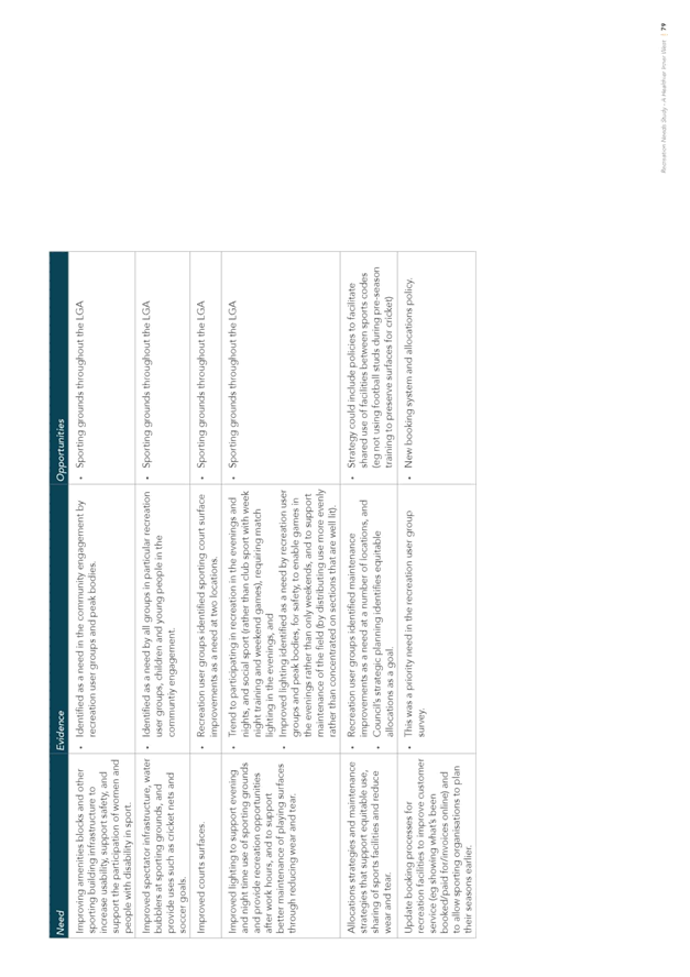
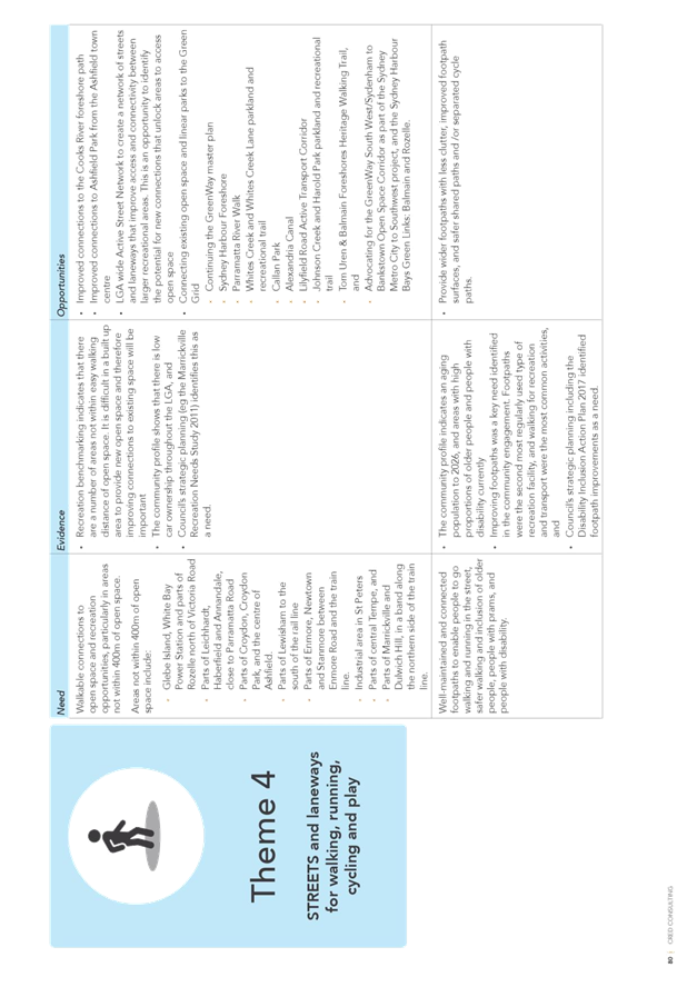
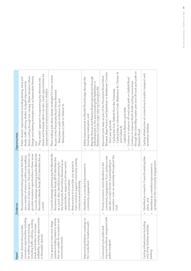
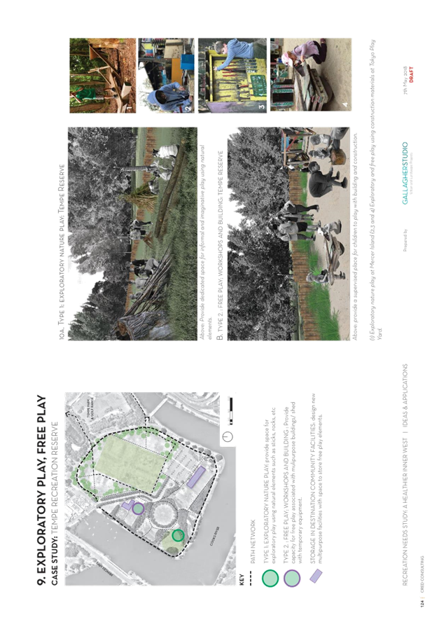
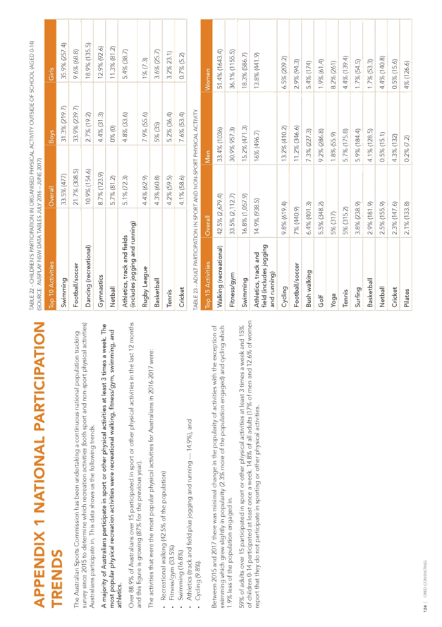
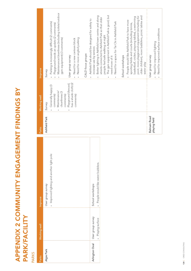
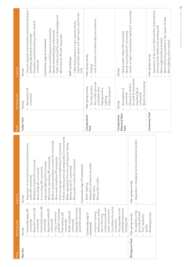
Subject: Outcomes from the public exhibition of the Recreation Needs Study: A Healthier Inner West.
Prepared By: Peter Montague - Recreation Planning and Programs Manager
Authorised By: John Warburton - Deputy General Manager Community and Engagement
|
SUMMARY Further to the public exhibition of the draft Recreation Needs Study: A Healthier Inner West, this report details the outcomes and analysis from the exhibition process, the resulting changes and presentation of the amended final report to be considered for Council’s endorsement. |
|
RECOMMENDATION
THAT:
1. Council endorse the Recreation Needs Study: A Healthier Inner West report;
2. The Recreation Needs Study: A Healthier Inner West report is used to inform the development of a Recreation Strategy, Section 7.11 Contributions Plan and other relevant Council planning documents; and
3. All residents and stakeholders who expressed an interest are notified of Council’s decision and thanked for their contribution.
|
BACKGROUND
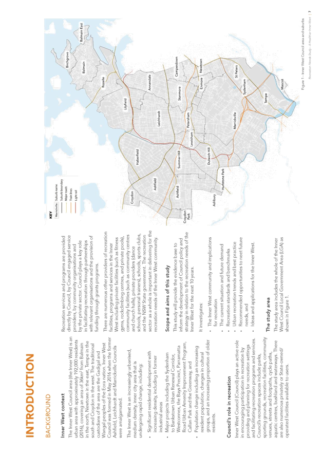
The merger of three local government areas to form the Inner West Council over the past two and half years highlighted the need for Council to undertake a study on recreation needs to inform a strategic position for the provision of recreation facilities, services and programs, that includes planning priorities, new Section 7.11 (formerly Section 94) Contributions Plan, recreation programs and services, and asset management for the equitable and relevant allocation of recreation resources to meet the present and future requirements of the local community.
Cred Consulting were engaged to research a range of specific factors relating to local recreation including:
· Strategic document review and development of Engagement Plan;
· Implementation of the engagement with community and stakeholders and presentation of the findings in a Community Engagement Report.
· Quantitative research including condition audits of current recreation and sporting facilities, recreation activity undertaken in the LGA including the streets and streetscape as a recreation resource.
· The development of an informed view of the future recreation and open space needs in the Inner West Council.
· The findings from the analysis of current and future needs including identifying areas of unmet need and the implications for recreation facilities and services.
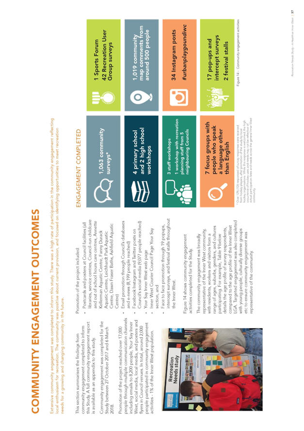
Community Engagement
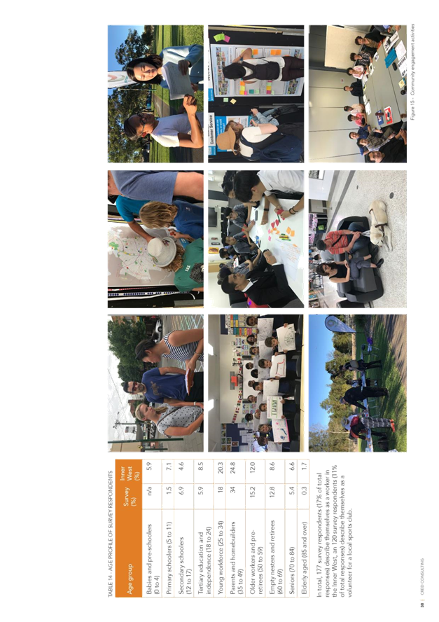
A robust engagement process was an essential component of the project to provide an evidence base to inform future recreation and other planning. An extensive community engagement process was undertaken from October through December 2017 and targeted engagement with stakeholders continued in early 2018. Promotion of the engagement reached over 17,000 people through a variety of media and over 2,000 people participated in engagement activities through a range of engagement methods. A Community Engagement Report (CER) detailed the outcomes of the engagement process. This report was published on Council’s website in April 2018, notification sent to residents who had expressed an interest during the engagement process and a presentation of the CER undertaken at the Sports Forum in April 2018.
Cred Consulting undertook further targeted engagement, condition audits and data analysis throughout the early part of 2018 and the findings were brought together to form the draft Recreation Needs Study: A Healthier Inner West report which was presented to Council on 22 May 2018. Council determined that:
1. Council endorse the draft report Recreation Needs Study: A Healthier Inner West for public exhibition for 6 weeks;
2. That the public exhibition is widely promoted and all stakeholders and residents who expressed an interest are notified of the opportunity to provide further input; and
3. Following public exhibition, the feedback and amended Recreation Needs Study: A Healthier Inner West be reported back to Council.
Related items were reported to the meeting of 27 March 2018, when Council considered the resourcing of recreation needs and the potential position of an Office of Sport Coordinator. It was determined that:
1. Council invest $65 million in park and aquatic capital facilities over the next three years, subject to the development and adoption of the 2018/2019 Budget;
2. Council defer the appointment an Office of Sport Coordinator until after the completion of the Recreation Needs Study;
3. The Recreation and Aquatics Service Unit and Office of Sport Coordinator strategically partner with the sporting clubs and key partners to increase participation of girls, women, people from lower socio economic backgrounds and people with disabilities as informed by the Recreation Needs Study: A Healthier Inner West;
4. Council progress the Recreation Needs Study: A Healthier Inner West to investigate the need and best location for hockey and netball facilities and a hydrotherapy pool; and
5. Council progress the development of the Inner West Sporting Ground Allocation Policy, in consultation with the sporting clubs and that the draft Policy be reported back to Council for adoption.
Public Exhibition
The draft Recreation Needs Study: A Healthier Inner West (RNS) was placed on public exhibition from 15 June until the 27 July 2018. The opportunity for further engagement on the draft report was widely promoted to all internal and external stakeholders and residents. This included direct email, distribution to patrons at Council owned recreation and aquatic facilities, to sporting organisations that use Council facilities through relevant newsletters and hard copies placed at Customer Service Centres.
The public exhibition demonstrated substantial interest from the community and stakeholders with a total of 951 responses received comprising 796 from residents and external organisations in addition to 156 items of feedback from internal Council departments.
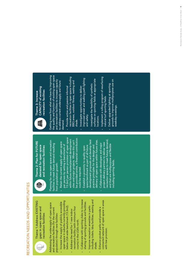
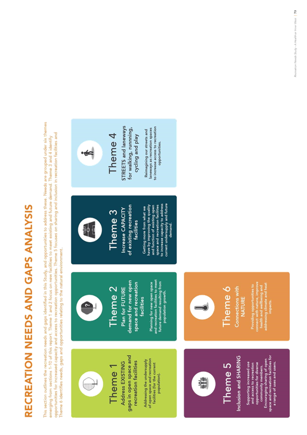
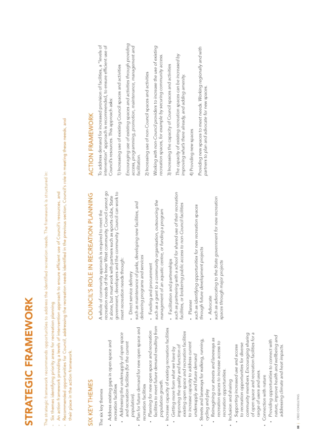
Respondents were asked to comment on the 6 themes of the strategic framework proposed to inform the development of the draft Recreation Strategy:
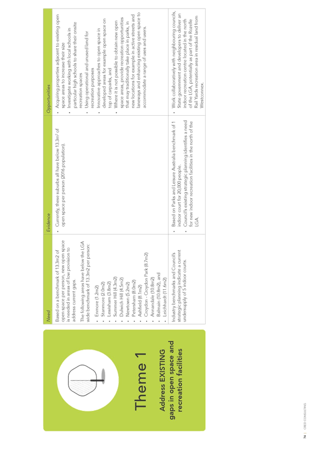
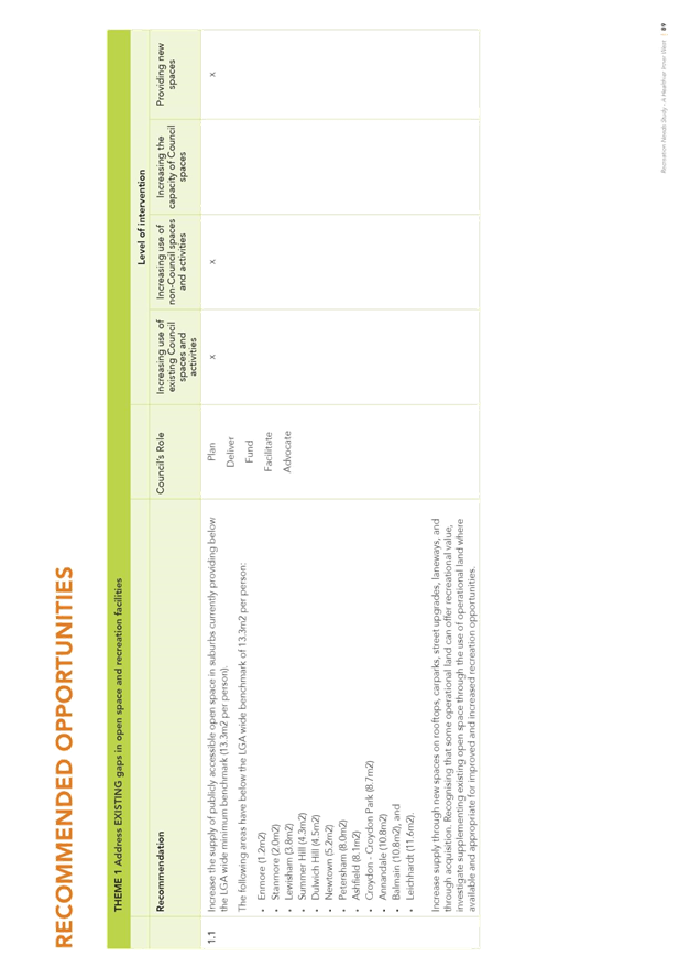
· Theme 1 – Existing gaps in open space and recreation
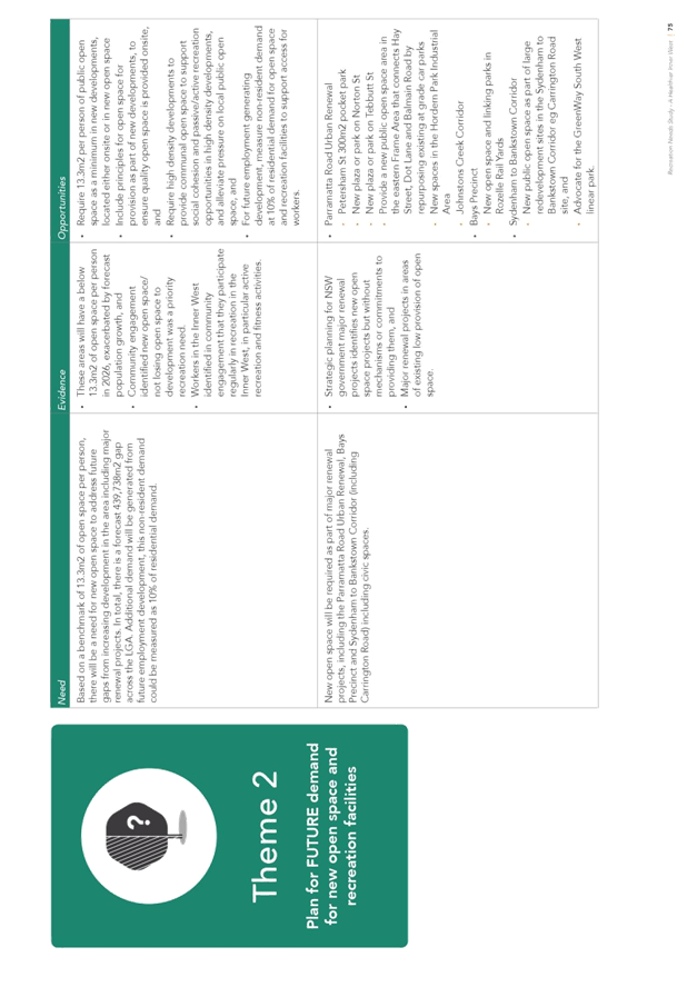
· Theme 2 – Future demand for open space and recreation
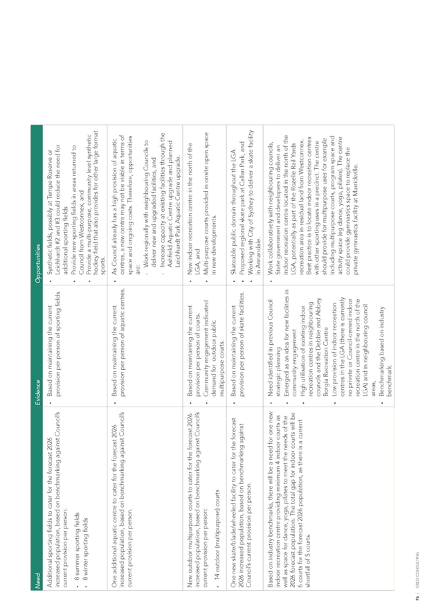
· Theme 3 – Capacity for sports and recreation
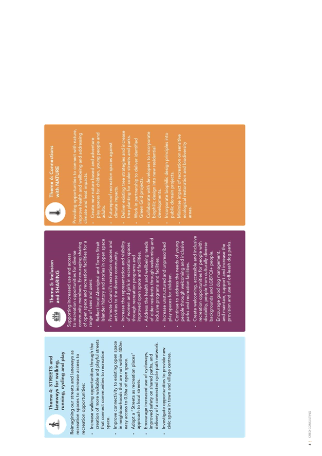
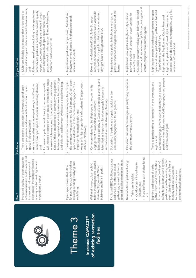
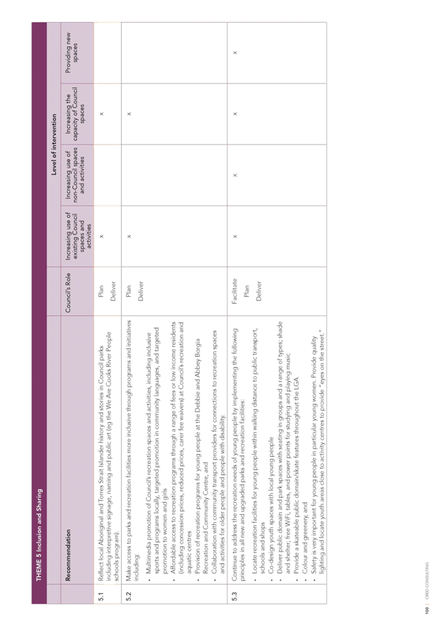
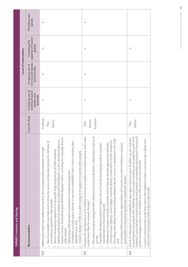
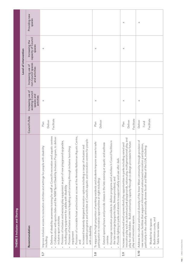
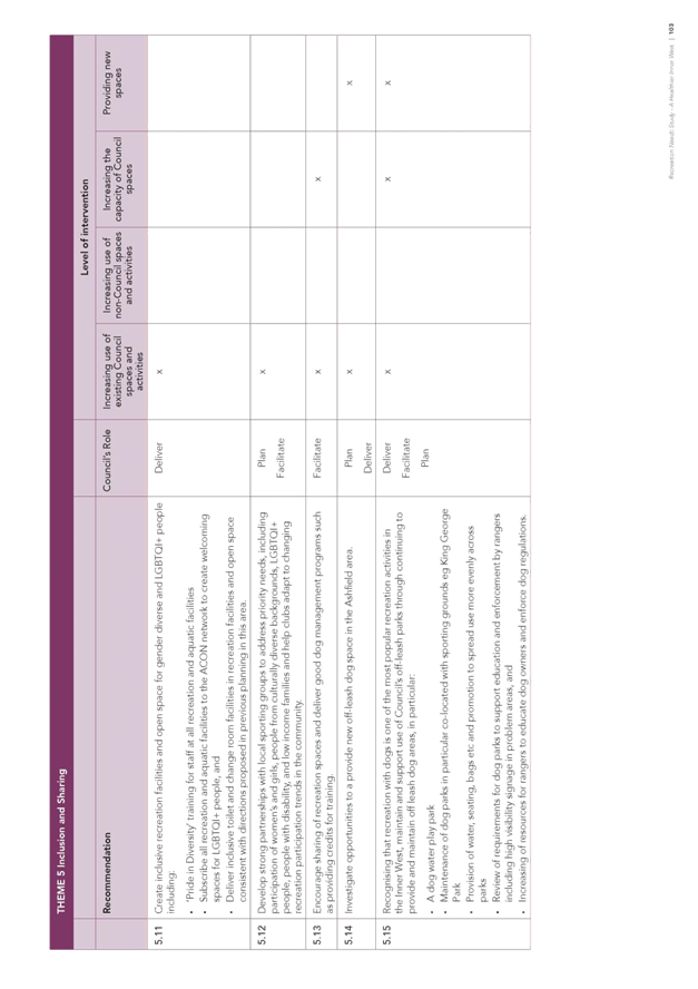
· Theme 4 – Inclusion and sharing
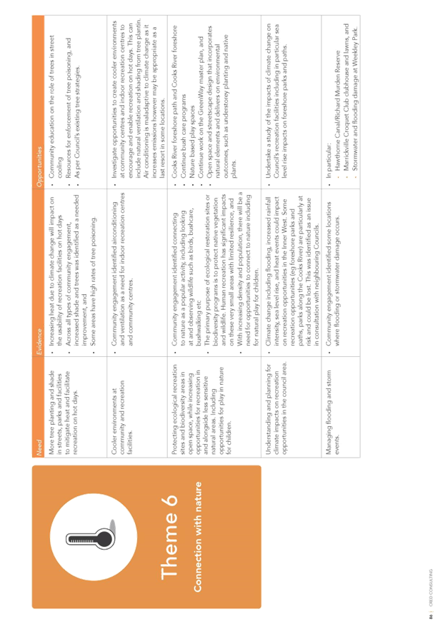
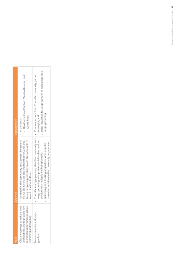
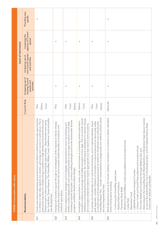
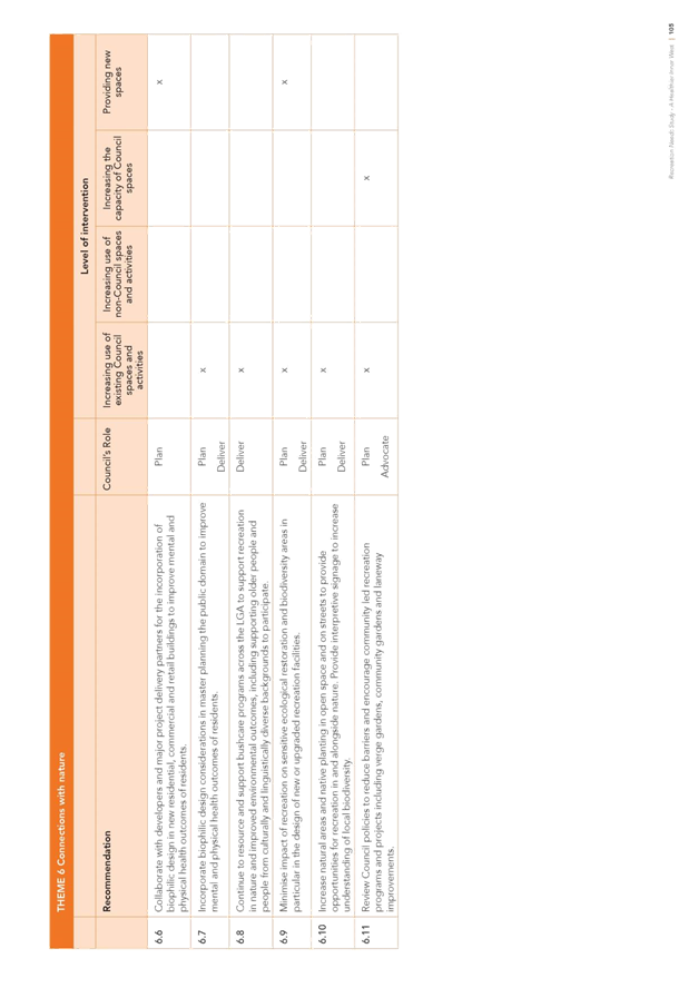
· Theme 5 – Connections with nature
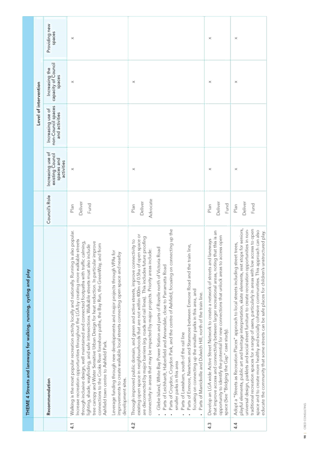
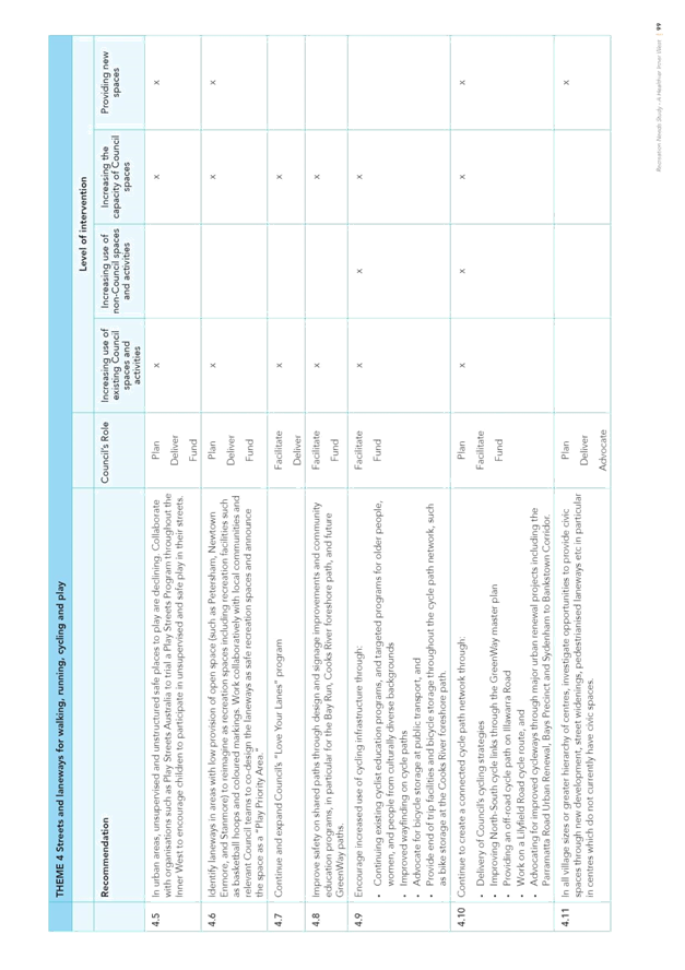
· Theme 6 – Streets and laneways for walking, cycling and play
Respondents were also asked if they wish to comment on any of the recommended opportunities and proactively provide any other comments.
Analysis was undertaken on the topics covered in each submission (many submissions included multiple topics) resulting in identification of 969 topics. These have been summarised below to provide a snapshot of the most frequently identified topics under each theme.
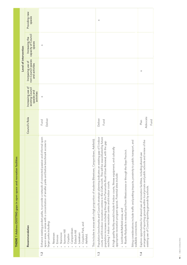
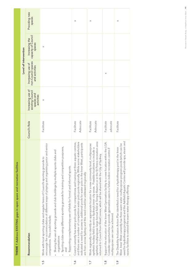
Theme 1 – Existing gaps in open space and recreation
A total of 130 responses were received covering 163 topics. The most frequently mentioned topics were:
|
Sporting grounds |
81 |
|
Open space |
19 |
|
Sporting amenities |
11 |
|
Footpaths / Trails |
10 |
|
Play facilities |
6 |
Despite extensive promotion, the initial engagement process in 2017 did not receive the level of interest hoped for from organised sporting groups. The renewed interest from sporting participants and organisations is evident in the public exhibition process with “sporting grounds” being the most frequently mentioned topic by some margin with considerable interest in synthetic turf surfaces and a multipurpose hockey field and sporting amenities.
Also evident in feedback was the importance to the community of retaining and improving open space as well as walking and cycling along footpaths / trails.
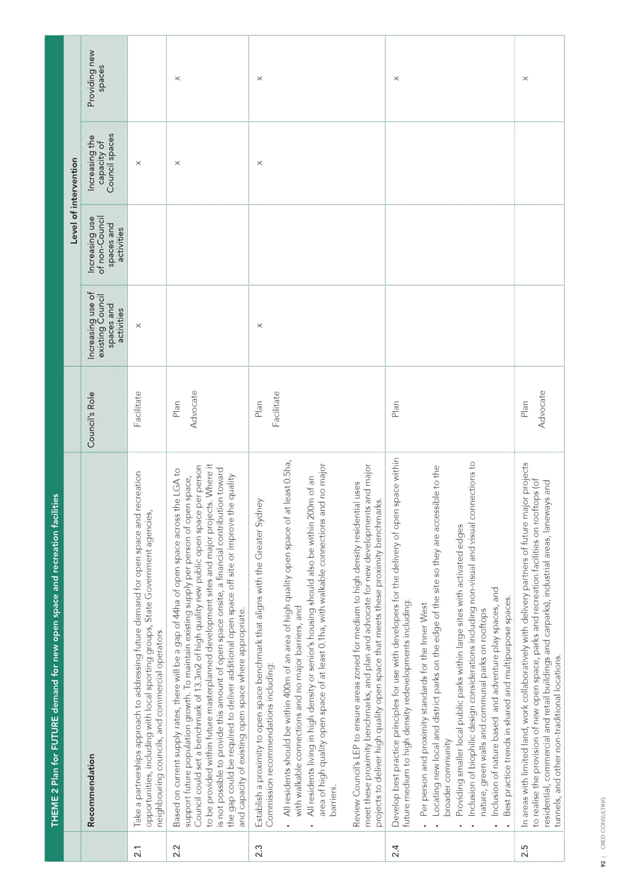
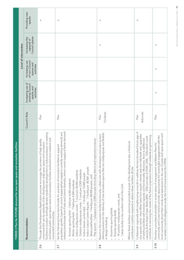
Theme 2 – Future demand for open space and recreation
A total of 128 responses were received covering 164 topics. The most frequently mentioned topics were:
|
Sporting grounds |
55 |
|
Open space |
47 |
|
Multipurpose open space and facilities |
16 |
|
Footpaths / Trails |
7 |
|
Sporting amenities |
5 |
As with Theme 1, sporting grounds and open space dominated the majority of responses. It is worth noting the community understands of the importance of multipurpose open space and facilities as a mechanism to deliver on the broad spectrum of recreation needs.
Theme 3 – Capacity for sports and recreation
A total of 140 responses were received covering 165 topics. The most frequently mentioned were:
|
Sporting grounds |
96 |
|
Open space |
13 |
|
Sporting amenities |
8 |
|
Multipurpose open space and facilities |
8 |
|
Footpaths / Trails |
5 |
Unsurprisingly, responses were dominated by feedback on sporting grounds, a key focus of this theme and also an indication of the high level of engagement from sporting groups in the public exhibition process.
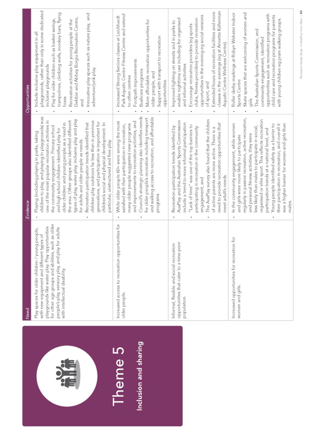
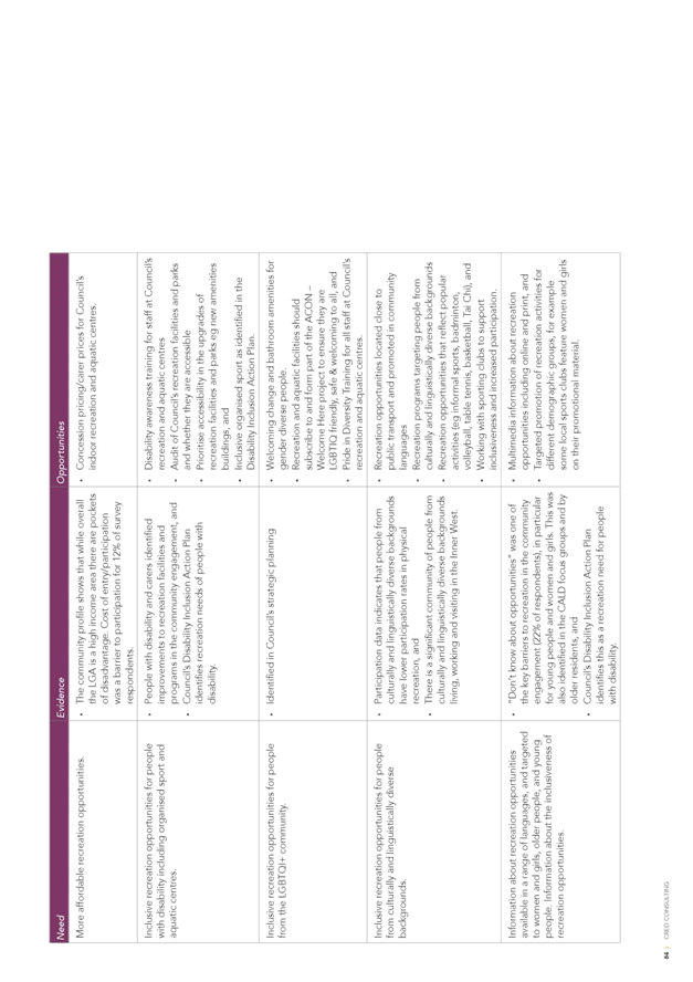
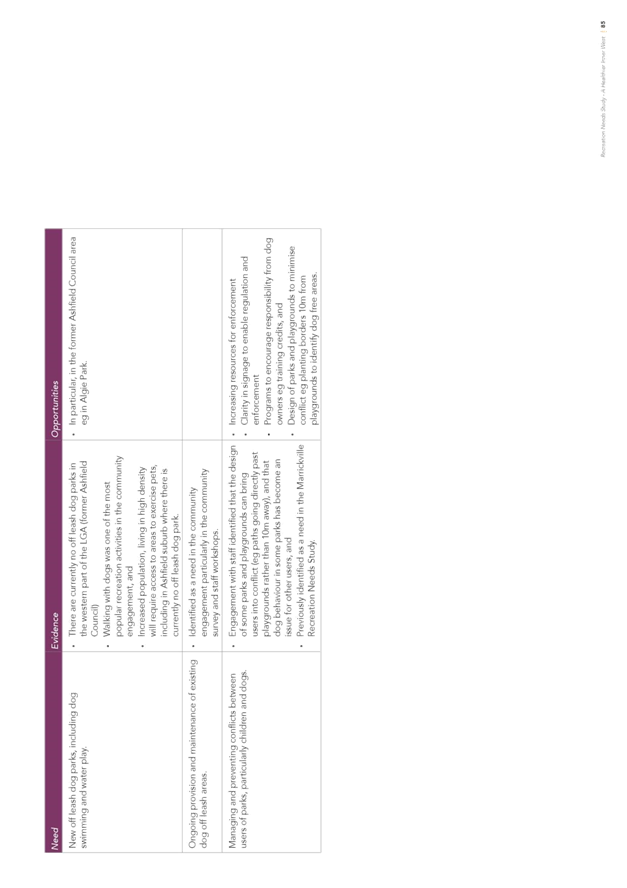
Theme 4 – Inclusion and sharing
A total of 88 responses were received covering 96 topics. The most frequently mentioned topics were:
|
Sporting grounds |
23 |
|
Inclusive recreation opportunities |
22 |
|
Dogs |
8 |
|
Multipurpose open space and facilities |
5 |
|
Footpaths / Trails |
3 |
It is encouraging that the need to share sporting facilities and the provision of recreation opportunities for all members of the community was recognised. Dogs were more evident in this theme with views typically polarised which is consistent with previous feedback on this topic.
Theme 5 – Connections with Nature
A total of 82 responses were received covering 96 topics. The most frequently mentioned topics were:
|
Greening / Trees |
29 |
|
Sporting grounds |
8 |
|
Footpaths / Trails |
7 |
|
Nature / Adventure Play |
6 |
|
Biodiversity |
5 |
|
Informal recreation |
5 |
|
Open space |
5 |
Responses were more evenly spread under this theme though there was evident support for greening the inner west.
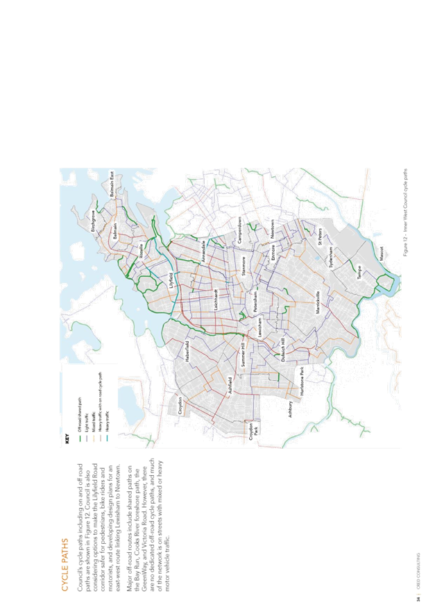
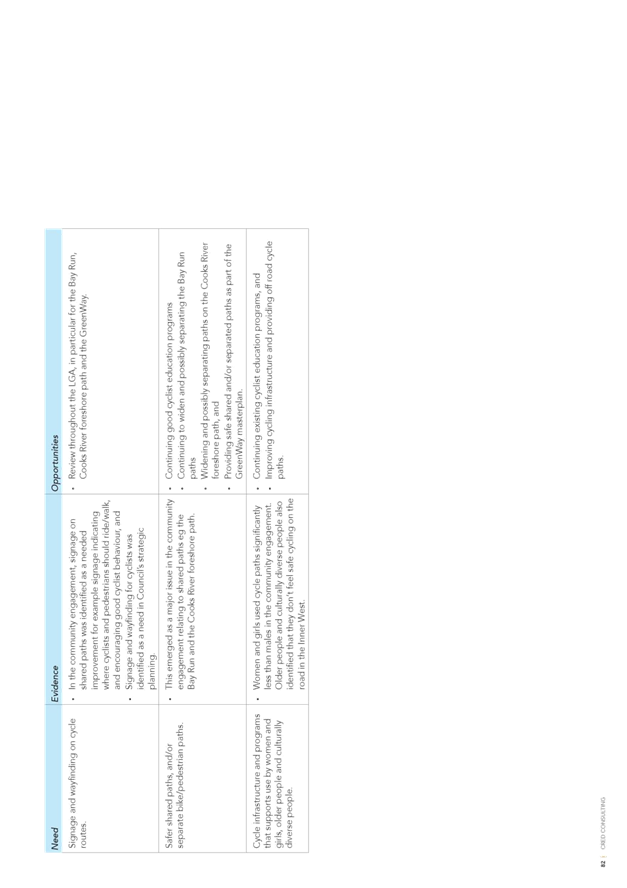
Theme 6 – Streets and laneways for walking, cycling and play
A total of 86 responses were received covering 127 topics. The most frequently mentioned topics were:
|
Cycleways / Cycle education |
38 |
|
Footpaths / Trails |
25 |
|
Connectivity |
14 |
|
Greening |
10 |
|
Streets for recreation |
8 |
This theme was dominated by cycling and walking with cycleways and footpaths / trails being the two most frequently mentioned responses. The importance of creating connections was recognised as well as opportunities to connect with nature through greening.
Comments on Recommended Opportunities (Comments 1)
A total of 69 responses were received covering 84 topics. The most frequently mentioned topics were:
|
Sporting grounds |
39 |
|
Support |
4 |
|
Sporting amenities |
4 |
|
Connectivity |
3 |
|
Roller Derby |
3 |
|
Open Space |
3 |
The lower overall response in this section may indicate that respondents had adequately reflected their feedback under the earlier themes and much of the feedback reflected a reproduction of previous comments.
Other Comments (Comments 2)
A total of 62 responses were received covering 74 topics. The most frequently mentioned topics were:
|
Sporting grounds |
21 |
|
Open space |
10 |
|
Support |
6 |
|
Connectivity |
5 |
|
Multipurpose open space and facilities |
4 |
As with the comments on recommended opportunities, there was a much lower overall response, possibly indicating that people feel they have been provided sufficient opportunity for input.
Key Findings
Despite extensive promotion, the initial engagement process in late 2017 did not receive the level of interest hoped for from organised sporting groups. The public exhibition process demonstrates a significantly higher level of engagement from sports participants and organisations with sporting grounds being the most frequently mentioned topic and considerable interest in synthetic turf surfaces and a multipurpose hockey field. Many responses indicated the preferred location of a future multipurpose hockey facility in the north of the LGA with many mentioning the Rozelle railyards as a potential site. This will be further explored through the development of the Recreation Strategy.
The majority of feedback was consistent with the recommended opportunities identified in the draft RNS and did not necessitate many changes to the draft final report. The process also helped highlight items which were discussed in the body of the draft report but which had not translated through into the ‘Recommended Opportunities’ section.
While the feedback from form the public exhibition did not result in many changes to the final draft report, the scale of feedback, along with the Community Engagement Report will be a significant determinant in the prioritisation of actions in the draft Recreation Strategy.
In conjunction with the Community Engagement Report, the feedback from the public exhibition will be used to prioritise actions in the development of the Recreation Strategy.
Changes to the draft Recreation Needs Study: A Healthier Inner West
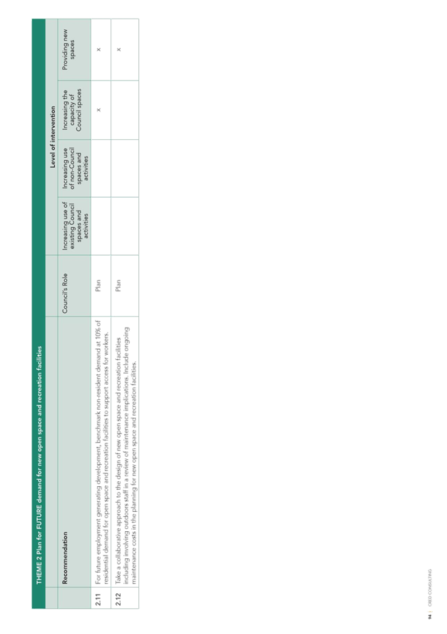
The following list summarises key changes made to the RNS as a result of the public exhibition process:
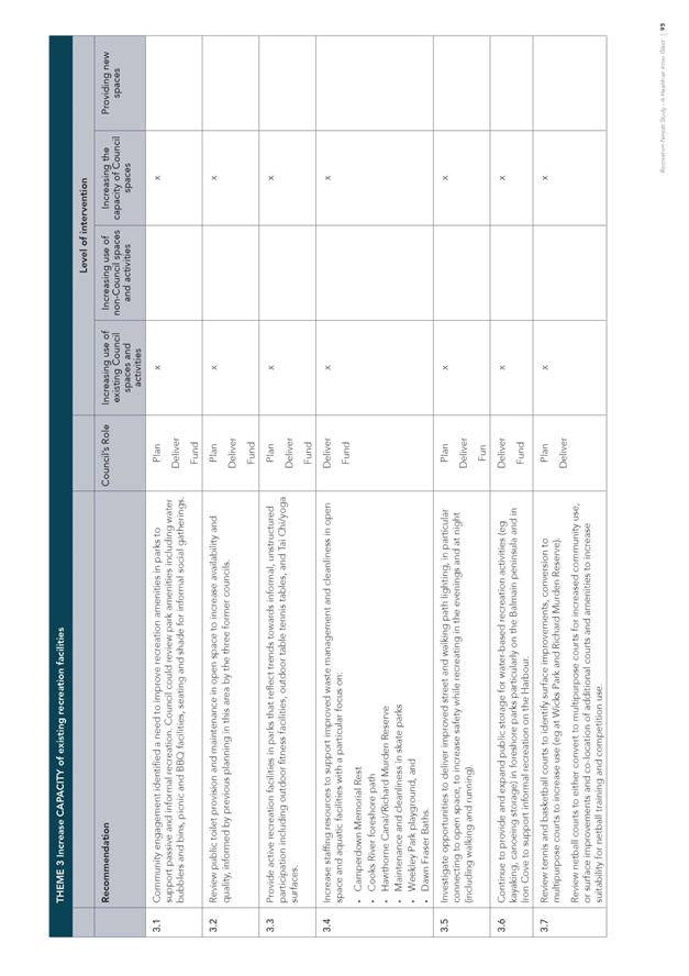
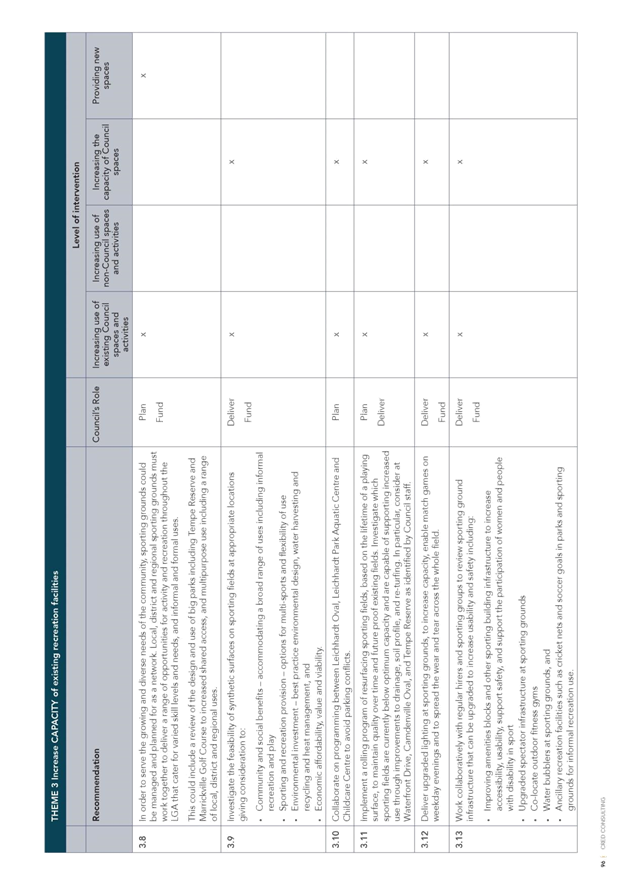
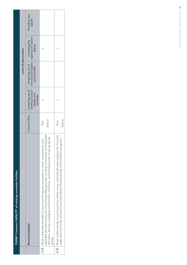
· Inclusion in recommended opportunities of improved lighting based on community engagement outcomes;
· Inclusion in recommended opportunities of consideration of recurrent maintenance costs during design and increased maintenance resourcing as a result of new facilities;
· Inclusion in recommended opportunities of further investigation of netball needs and facilities;
· Reference to Gymnastics included in existing recreation facilities as well inclusion in existing and future needs;
· Inclusion in recommended opportunities of outdoor exercise equipment at appropriate locations;
· Inclusion in recommended opportunities to review the provision of dog off leash areas in Ashfield;
· Inclusion in recommended opportunities of continuation and growth of bushcare programs;
· Increased reference to facilitation of running in recommended opportunities;
· Include reference to biodiversity features in signage;
· Increased reference to inclusive design in recommended opportunities;
· Inclusion in recommended opportunities for promotion across all target population groups;
· Increased emphasis on inclusive public toilet facilities in recommended opportunities;
· Strengthened reference to passive recreation in recommended opportunities;
· Inclusion of community gardens in recommended opportunities;
· Change of description of small parkland areas from ‘Urban Landscape Amenity’ to ‘Pocket Park’.
· Inclusion in the body of the report of reference to the social benefit of volunteers and noting the significant numbers involved in organised sport;
· Broaden recommendation for laneway use to consider public art and multiple use; and
· Inclusion of worker population in future recreation needs.
The public exhibition indicated that there was some confusion as to the 6 themes and the intention and distinction between each. A description of each theme has been added to clarify this as follows:
Theme 1 - Address existing gaps in open space and recreation facilities
Addressing the undersupply of open space and recreation facilities (for the current population) through new facilities.
Theme 2 - Plan for future demand for new open space and recreation facilities
Planning for new open space and recreation facilities to meet future demand resulting from population growth.
Theme 3 - Increase capacity of existing recreation facilities
Getting more from what we have by improving the quality and function of existing open space and recreation facilities to increase capacity to address current undersupply and future demand.
Theme 4 - Streets and laneways for walking, running, cycling and play
Reimagining our streets and laneways as recreation spaces to increase access to recreation opportunities.
Theme 5 - Inclusion and sharing
Supporting increased use and access to recreation opportunities for diverse community members. Encouraging sharing of open space and recreation facilities for a range of users and uses.
Theme 6 - Connection with nature
Providing opportunities to connect with nature, improve health and wellbeing and addressing climate and heat impacts.
The order of the themes in the final document has been changed from the draft public exhibition report so that Theme 3 (Increase capacity of existing recreation facilities) is followed by Theme 4 (Streets and laneways for walking, running, cycling and play), as they both relate to increasing the capacity of what we have rather than the provision of new facilities. Specifically, Theme 4 focuses on increasing the capacity of streets to provide for recreation.
All the above changes are reflected in the amended final RNS attached to this report (ATTACHMENT 1).
Given the quantity of response from the community and stakeholders, the quantity of changes proposed to the final draft RNS are proportionately low with many changes as a result of multiple responses on the same item. The relatively low number of changes is indicative that the coverage of recreation needs in the final report closely matches community and stakeholder needs.
The feedback also highlighted numerous operational items or matters related to current projects and these have been passed onto the relevant areas of Council to be followed up. There were also multiple suggestions for actions and projects which will be considered in the development of the Recreation Strategy.
Current projects and programs
It is worth noting that throughout the development of the draft RNS and public exhibition process, a number of initiatives have been undertaken concurrently which are consistent with the needs identified in the RNS. Relevant items include:
· Recreation Programs
- Women and girls (Mums Get Active, Girls Get Active)
- Culturally and Linguistically Diverse (CALD) communities – noticeably programs targeting refugees and activating the Welcome Refugee Centre;
- Seniors activities – Council currently has a total offering of 169 program opportunities for seniors per week and development of a brochure is underway to promote this to a wider audience;
- Free fitness classes for the community in parks at two locations across the LGA.
· Skate activities – three events have been scheduled at Sydenham Green skatepark in October 2018 plus a series of clinics targeting female skaters funded through the Recreation Grants program;
· Investigations have commenced with NSW Department of Education on potential access to school facilities for community recreation;
· Sportsground Allocation Policy – this was recently reported to Council and has been endorsed for public exhibition;
· Review of management options for Annette Kellerman and Fanny Durack Aquatic Centres;
· A project to investigate the feasibility of synthetic turf at locations across the inner west;
· Design and delivery of multipurpose courts at Richard Murden Reserve;
· Development and adoption of the Greenway Master Plan;
· Investigations for a regional skatepark in the north of the LGA;
· Delivery of Waterfront sporting ground at Callan Park; and
· Plan of Management and Master Plan for Marrickville Golf Course.
While the development of the Recreation Strategy is underway, a number of projects delivering on identified needs in the final RNS have been included in staff work plans for 2018/19:
· Development of the Recreation Strategy;
· Play Streets pilot program;
· Nature Play Space pilot program;
· Development of a centralised booking system;
· Activation of skateparks through events and promotion;
· Review of the management of the Robyn Webster Sports Centre;
· Improved information on and promotion of recreation opportunities in the inner west, especially to CALD communities;
· Harmonisation of fees and charges for parks and sporting grounds;
· Development of a Parks Plans of Management Strategy to prioritise their review and development; and
· Plan of Management and Master Plan for Dulwich Hill Parklands.
Office of Sport
Council has resolved to investigate an Office of Sport to partner with sporting clubs to achieve increased participation in sport and in particular among target groups identified in the RNS. A separate report will be prepared for Council’s consideration on this matter.
FINANCIAL IMPLICATIONS
A part of the project a report was completed by Jones Lang La Salle providing an analysis of the recreation needs identified in the RNS and indicative costs for land acquisition for potential open space, community facilities and sporting grounds upgrades including synthetic turf. This will inform the development of the Recreation Strategy which will develop a 10 year plan of prioritised and costed actions and projects across Council including capital costs and increased maintenance, operational and long term renewal costs. This will inform the future 4 year Delivery Programs, Asset Management Plans and the Long Term Financial Plan.
OTHER STAFF COMMENTS
Extensive engagement has been undertaken with internal staff throughout the RNS project including a Project Working Group made up of key internal stakeholders and extensive liaison with a broad cross section of relevant areas of Council during the early phases of the project and once again through the more recent public exhibition period.
PUBLIC CONSULTATION
A robust engagement process was an essential component of the project to provide the evidence base for future planning. An extensive community engagement process was undertaken from October through December 2017 and targeted engagement with stakeholders continued in early 2018. Promotion of the engagement reached over 17,000 people through a variety of media and over 2,000 people participated in engagement activities through a range of engagement methods.
Further opportunity for input has been provided through the public exhibition process with the community and stakeholders demonstrating substantial interest with a total of 796 responses from residents and external organisations.
CONCLUSION
The independent Recreation Needs Study: A Healthier Inner West takes a holistic view of the recreation spectrum and presents a detailed analysis of the current recreation landscape in the Inner West, emerging trends and issues, and an extensive range of recommended opportunities.
The extensive level of engagement with the community and stakeholders has provided a robust evidence base to inform future planning across Council and the identification of recreation needs in the final report closely matches those identified by the community and stakeholders. The ongoing engagement of key internal teams through the Project Working Group has ensured that needs identified in the final report will readily transfer into future planning documents, notably the 7.11 Contributions Plan (formerly Section 94) and the Recreation Strategy.
|
1.⇩ |
Recreation Needs Study: A Healthier Inner West - Final Draft Oct18 |
|
Council Meeting 30 October 2018 |
Subject: Waterfront Sporting Ground-Cricket Nets Location
Prepared By: Aaron Callaghan - Parks Planning and Engagement Manager
Authorised By: Cathy Edwards-Davis - Group Manager Trees, Parks and Sports Fields
|
SUMMARY This report highlights the outcomes of discussions between respective sporting clubs, Balmain South Sydney Cricket Club and Balmain and District Football Club, along with the Office of Environment and Heritage on a new location for cricket nets on the Waterfront Drive Sporting Ground at Callan Park. The new location advocated by the sporting clubs and supported by OEH represents a departure from the approved Development Application. Consultation on a possible departure from this proposal has also been undertaken with the Friends of Callan Park. |
|
RECOMMENDATION
THAT Council:
1. Proceed with the installation of the cricket nets in the original Development Application approved site as per DA/2017/313, noting the significant risks associated with departing from this location;
2. Note the significant number of heritage listed trees which will need to be removed should the proposal proceed and the detrimental impacts this will have on the open space qualities of the Waterfront Precinct;
3. Consider revisiting the location of the cricket nets at a future time when either:
(a) an adopted Landscape Structure Plan is completed for Callan Park or (b) the Callan Master Plan is adopted and the Callan Park and Broughton Hall Trust is established.
4. Retain the current alignment of the fence on the north-western side of the sporting ground noting that this area is a turning area for vehicles leaving the Waterfront Precinct and as a site for emergency parking for ambulances which may need to service the sporting field; and
5. Note that a formal review of the current alignment of the fence on the north-western side of the sporting ground could be undertaken in the future, once car parking arrangements and realignment of the Bay Run are addressed as part of a landscape and traffic management plan for this area.
|
BACKGROUND
During the preparation of a Development Application for the Waterfront Drive Sporting Ground upgrade project, Council officers engaged with the Balmain South Sydney Cricket Club (BSSCC) regarding the club’s requirements in relation to the location of the cricket nets. For some 12 years the club has been advocating for the delivery of cricket training facilities within this area of Callan Park. Cricket was the inaugural sport played on the Waterfront Drive playing field in the early days of the asylum facility.
As part of the original DA, the cricket club requested and supported the need for three cricket nets.
The design associated with this work was focused on an evidence based assessment process which included:
· Cricket Australia Guidelines for Outdoor Training Facilities (Cricket Nets)
· Location of existing heritage listed trees
· Location of existing facilities (sport & non-sport)
· Current and proposed sporting ground use
· Cricket Club needs
· Available budget
· Safety factors for sporting ground use
Importantly the Development Application recognised the need for a shared community facility and one which was not dominated by one sport in particular.
Approved Development Application (D-2017/313)
The approved DA specifies the location for the Waterfront Drive Sporting Ground cricket nets. The nets are located on the southern side of the Waterfront Sporting Ground (Refer to Fig1.0). The approved site was assessed and supported by the NSW Heritage Council and was also deemed an acceptable location by the Inner West Local Planning Panel. Both Balmain and District Football Club (BDFC) and BSSCC participated in the DA process. It is noted that the soccer club was dissatisfied at the time with the determination on this matter.
Previous Council Resolution
At the Council meeting on the 25 September 2018, Council resolved:
THAT Council:
1. Note the concerns regarding safety and use of the cricket nets in their current and proposed location;
2. Note that discussions are currently ongoing between the Balmain District Football Club, Balmain South Sydney Cricket Club and the Office of Environment and Health (OEH) regarding an appropriate location for the cricket nets at Waterfront Oval;
3. Consult with the Friends of Callan Park on the location for the cricket nets; and
4. Receives a report back regarding:
a. the relocation of the cricket nets pending completion of discussions between the Balmain District Football Club, Balmain South Sydney Cricket Club and OEH;
b. the proposal to realign the fence on the north-western side of the sporting ground to improve functionality of the grounds; and
c. the process to submit a 4.55 (2) modification application.
Landscape Structure Plan
The Callan Park site is owned by NSW Health, with the office of Environment and Heritage (OEH) being the delegated and responsible government agency for the day to day management of Callan Park. OEH are currently in the process of developing a Landscape Structure Plan for Callan Park. This plan is focused on the assessment of built form within the park and the longer term aim of the creation of urban parkland. The study builds on previous work by Council, including the Draft Callan Park Master Plan. The Plan once completed will identify structures within the park which are deemed intrusive and should be removed to enhance the open space qualities of the parkland and create a landscape which is unified in appearance, connectively and functionality. Government has provided no firm time line on when a draft plan will be completed or exhibited. OEH has however been working closely, as the government agent, with Council on the redevelopment of the Waterfront Drive Sporting Ground and has previously signed off on the approved development application site for the cricket nets.
Safety Concerns and Warm Up Areas
Council officers note that BDFC has recently raised concerns in relation to the safety of the cricket nets during winter training or during weekend match play. To eliminate the soccer club’s concerns, Council will install gates on the cricket nets for the facility to be locked during winter sporting events. It should be noted that at Easton Park there are similar circumstances and the cricket nets here operate successfully with soccer use of the sporting ground. In addition to this, the Waterfront Drive Sporting Ground site has ample areas for the soccer club players to warmup pre-game including on the canal side of the sporting ground and around the periphery of the sporting ground.
Alternative Location for Cricket Nets
On the 15th October 2018, Council officers received confirmation from BDFC and BSSCC on their preferred alternative location for cricket nets at the Waterfront Sporting Ground. The new proposal reduces the number of cricket nets to two nets. The alternative location as opposed to the approved DA location is highlighted in Fig 1.0 below:
Fig 1.0 Approved DA Location and Alternative Location for Cricket Nets Waterfront Drive Sporting Ground
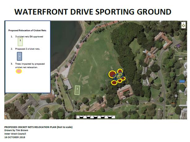
Sporting Club’s Position
The two representative sporting clubs have highlighted the following in support of the alternative location:
The alternative site was chosen with reference to the consultant's design principles as it:
1. Is directly accessible to the sports fields but does not impact any facet of them (warm-up and spectator areas);
2. Will be accessible all year round, ensuring better utilisation of a community facility;
3. Allows significant run up and run-off zones into safe space;
4. Is complimentary to the possible future creation of an active zone in and around B496 and allows for an open area of approximately 30m between the nets and B496;
5. Is in keeping with the OEH consultants' desire to maintain sight-lines and views from significant areas and buildings on the site (the original location works directly against this intention and, once the Pavilion is removed, would be a blight on the important views and access from Building 497 and Military Rd to the Waterfront
OEH Positon
The alternative location for the cricket nets has been supported in principal by OEH staff.
OEH has indicated that they support a compromise position on this matter and that the revised location broadly meets the aims of the Landscape Structure Plan under development. OEH has also indicated that they have no issues with the approved DA location for the Cricket nets.
Consultation with the Friends of Callan Park
As per the Council resolution, the Friends of Callan Park have also been consulted on the alternative location and have advised that they do not support the revised location of the cricket nets. The Friends of Callan Park have provided a detailed submission (Attachment 1) on the proposal. In summary, the Friends of Callan Park support the original DA approved location for the cricket nets and highlight that the new location is a community space that should be shared by the wider community. The Friends of Callan Park support the retention of heritage listed trees.
Council Officer Comments
The new proposed location was referred to Council’s Urban Forest team. The proposal is not supported by Council officers on the following grounds:
· The proposed relocation of the cricket nets will have a significant impact on a number of significant trees within that location so much so that, seven trees (including three significant trees) will require removal and, a major large diameter first order branch of one tree will need to be pruned back to the branch union with the trunk. Council’s Tree Management Controls and Urban Forest Policy have a focus on protecting and maintaining trees unless there is strong justification to support their removal. This is particularly relevant to a site such as Callan Park (an item of State Heritage Significance) whereby the tree canopy forms an integral part of the site’s curtilage.
· The area proposed was observed to be largely undisturbed and as such, it is considered that there would most likely be many feeder roots within this area. In addition, a number of large diameter surface roots were noted (particularly where the Liquidambar is located) suggesting that the soil profile may be quite low. The anticipated scope of works would include the raising of soil levels and the installation of a large concrete slab within the TPZ. It is considered that these works would hamper the trees’ ability to thrive and as such, it would have a detrimental impact on their long term viability. Furthermore, given the existing site constraints, adequate and appropriate compensatory tree planting within this area to offset tree removal will not able to be achieved.
· This area of the park has high value as an area of passive open space and is currently used and enjoyed by the wider community including spectators enjoying watching summer sports under the shade of the tree line canopy. Removing established mature trees in this area of the park will be detrimental to the landscape structure of the waterfront precinct and in terms of planning approvals there is a high risk that the proposal will be declined both in terms of landscape and heritage assessment phases of a revised development application.
Given the above, the proposal cannot be supported in its current format and it is recommended that the existing proposed location of the cricket nets (an area where no trees will be affected) be retained.
Realignment of Current Fencing Arrangements
In terms of realigning the current fencing arrangements on the north-western side of the sporting ground to improve functionality of the grounds, this proposal is not supported given the current status of car parking arrangements along the Waterfront and immediately to the north west of the pavilion. The current use of this site as a turning area needs to be retained as does its use for emergency vehicles and importantly as a safe drop off zone for children utilising the sporting facilities. Any future plans to realign this area could be considered once a traffic and landscape plan is finalised for the Waterfront area by Government.
Section 4.55 (2) Process
Should Council resolve to proceed with lodging a Section 4.55 (2) application for the proposed alternative location for the cricket nets, the following process would apply:
· New plans for the alternative site would need to be developed;
· Amend Heritage Impact Statement to address the proposal’s compliance with the Conservation Management Plans (already in place) applicable to the site and submit with the application;
· Amend the hydraulics plans and details and submit with the application;
· The State Government would need to sign owner’s consent on the Section 4.55 (2) application, which would then be lodged;
· The Section 4.55 (2) application would be referred to NSW Heritage for approval, as an integrated development;
· Public notification of the Section 4.55 (2) application;
· Comments would be sought from relevant technical experts, including arborist comments;
· An independent planner would be engaged to consider the proposed Section 4.55 (2) application and to prepare the planning report; and
· The Section 4.55 (2) application would be considered independently by the Inner West Planning Panel.
The Section 4.55 (2) application is likely to take at least six months to determine.
FINANCIAL IMPLICATIONS
The estimated cost to prepare and lodge the Section 4.55 (2) application is $20,000.
Should Council resolve to proceed with the Section 4.55 (2) application, this will require a senior Council officer to be taken from their current duties and it will result in delays to the delivery of other parks capital works projects, including the Cooks River Parklands upgrade and the Richard Murden netball courts.
OTHER STAFF COMMENTS
Council’s Urban Forest team has provided comments which are outlined in the report.
PUBLIC CONSULTATION
The Friends of Callan Park, The Office of Environment and Heritage and the representative sporting bodies have been consulted in the preparation of this report.
CONCLUSION
During the original Development Application process there was significant opportunity for the community sporting bodies to comment on the redevelopment proposals for the Waterfront Drive Sporting Ground upgrade. The DA which has been approved for the Waterfront Drive Sporting Ground was assessed independently by Council officers, the NSW Heritage Council and final determination on the DA was made by the by the Inner West Local Planning Panel.
Council received an alternative proposal for the location of cricket nets by the respective sporting clubs. The location proposed has a high risk of not proceeding and is not supported by Council officers or the Friends of Callan Park. The location proposed involves the removal of a significant number of mature and highly valued park trees which support the landscape values in this area of the park. It is therefore recommended that the existing proposed location of the cricket nets (in an area where no trees will be affected) be retained and works on delivering the cricket nets continue to proceed. Safety issues associated with use of the nets have been addressed. Finally, Council officers note that there is ample room for soccer warm up around the periphery of the sporting field.
The construction program for Waterfront Drive Sporting Ground has the concrete slab for the DA approved cricket nets due to be installed within the next few weeks. Council staff intend to proceed with the works unless Council resolves otherwise.
|
1.⇩ |
Attachment 1-Friends of Callan Park Submission. |
|
|
Council Meeting 30 October 2018 |
Subject: Swimming In Parramatta River - New Site for Inner West
Prepared By: Jean Brennan - Urban Ecology Manager
Authorised By: Jan Orton - Group Manager Sustainability and Environment
|
SUMMARY Inner West Council has supported the Parramatta River Catchment Group’s aim of making Parramatta River swimmable by 2025 since the Our Living River initiative made it a goal in 2014. The joint effort has culminated in the Draft Ten Steps to a Swimmable River - the Parramatta River Masterplan, launched on Thursday 18 October for Public Exhibition. This report responds to Council’s recommendation at the 24 April 2018 meeting regarding C0418 Item 3, Improving Inner West Waterways, to provide a report following the endorsement of the Parramatta River Master Plan on investigations into a swim site at Callan Park. It outlines progress and steps needed to activate a swimming site at Callan Park, describing what needs to occur to deliver this goal as soon as practicable.
|
|
RECOMMENDATION
THAT Council:
1. Promotes opportunities for comment on the Draft Ten Steps to a Swimmable River - the Parramatta River Master Plan by the Parramatta River Catchment Group via Council’s usual communications and media; 2. Notes that the Parramatta River Catchment Group and Council will use the National Health and Medical Research Council 2008, Guidelines for Managing Risks in Recreational Water and NSW Health guidelines as the risk and evidence based approach for confirming a swim site in Callan Park; 3. Notes that the preferred site to investigate for swimming in Callan Park is the Callan Park Seawall site as the Callan Park Beach site is not recommended for activation as a swimming site due significant Aboriginal and ecological heritage in the surrounding area; 4. Considers an allocation of funding of $45,000, to support chemicals in water and sediment testing to inform the decision-making process for swim site activation at the Callan Park Seawall site. |
BACKGROUND
Inner West Council has been an active member of the Parramatta River Catchment Group (PRCG) since it formed in 2008. The PRCG has 14 financial members, comprising 11 councils, Sydney Water Corporation, the Department of Planning and Environment and the NSW Environment Protection Authority. It has coordinated catchment-wide strategy and planning, focusing on all-of-catchment approaches for greater improvements than individual agencies working separately.
Our Living River with Masterplan for swim sites
Since its launch in 2014, Inner West Council has provided continuous support for the Our Living River initiative (with Councillor Drury as the current Chair of the Parramatta River Catchment Group) that aims to make the Parramatta River a ‘living river’ and swimmable by 2025.
To achieve the Our Living River mission, the PRCG has developed the Draft Ten Steps to a Swimmable River - the Parramatta River Masterplan, launched during the Parramatta River Study Tour on Thursday 18 October, 2018 for public exhibition. The Masterplan’s objectives are to:
· Improve the health of the river
· Strategically tackle issues of sewer and stormwater pollution
· Provide tangible benefits to the local community
· Provide the best cost-benefit for the community
The Masterplan outlines three priority sites that have commitment from their councils to create swimming sites, with the next steps already underway to activate these sites:
· Bayview Park and McIlwaine Park in City of Canada Bay, and
· Putney Park in the City of Ryde
The other nine proposed ‘shortlisted’ locations in the Masterplan are being considered further, including Callan Park, which is continuing to be investigated due to the high level of interest for activating it for swimming.
Callan Park is owned by the NSW Health. On 29 May 2015, responsibility for the Callan Park (Special Provisions) Act 2002 transferred to the Minister for the Environment. The Office of Environment and Heritage (OEH) is responsible for the care, control and management of most of Callan Park, including the seawall area proposed as a potential swim site.
This report addresses the recommendation from C0418 Item 3 Improving Inner West Waterways at Council meeting 24 April, 2018 that Council:
1. Receives a further report following the endorsement of the Our Living River Masterplan by the Parramatta River Catchment Group - on investigations into the Callan Park swim site.
It provides an update on investigations and describes the next steps, focusing on the immediate action to be taken.
REPORT
SWIM SITE AT CALLAN PARK
Selecting and activating a site at Callan Park has involved/involves the steps outlined in the Parramatta River Swim Site Activation Framework, 2018 summarised here, and detailed further in the Investigations section of the report.
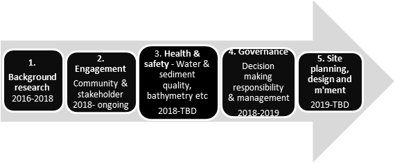
1. Background research - Between 2016 and 2018, potential sites along Parramatta River were investigated for water quality, community desirability, ecological health and swim site activation, including sites at Callan Park by the PRCG and councils/landowners interested in swimming sites.
2. Engagement - Discussions between land managers, owners, and users (on Aboriginal and colonial heritage, community uses and needs) have commenced and are ongoing.
3. Health and Safety - Complying with the relevant risk-based approaches (National Health and Medical Research Council 2008, Guidelines for Managing Risks in Recreational Water guidelines and NSW Health guidelines) and building on initial investigations, more detailed and long-term water and sediment quality testing for pathogens and chemicals, assessments of bathymetry and bed hazards and seawall/bank stability.
4. Governance - Responsibility for decision making, resourcing, and ongoing management and operation of the selected site are to be discussed and agreed following the formation of an interagency group after approval for activation is received.
5. Site Activation and Management Plan – Discussions to agree on the responsibility and resourcing of the development and implementation of the site activation plan and subsequent management plan following the formation of the interagency group. An options study will be done before development of concept and detailed designs leading to construction, and the management plan for operations and management.
Inner West Council’s Immediate focus
To work towards a swimming site in Callan Park, two immediate steps need to be addressed:
1. Confirming the site - Two sites were proposed for further investigation – the Callan Park Seawall west of Callan Point and the old baths ruins, and Callan Park Beach to the east of Callan Point.
The Callan Park Seawall site has been given in-principle support by OEH, and is the preferred long term site for activation as a swim site, subject to the water and sediment quality meeting the health and safety requirements (confirmed in pers. communication 10-10-18). The Beach site is not recommended as a swimming site by Council staff and OEH as following engagement with the community and a review of technical information, the site has been found to have significant Aboriginal and ecological heritage.
2. Making certain water quality is suitable - OEH has initiated its Beachwatch program at the site; however, its current approach will take two years to get the required number of samples. Council could supplement this testing to ensure adequate samples can be taken within a shorter timeframe – see report below.
INVESTIGATIONS FOR AN INNER WEST SWIM SITE
1. Background Research
Site activation framework
Three sites at Callan Park were identified and assessed between 2016-2018 with the following two options proposed for potential activation as reported in the Parramatta River Swim Site Activation Framework, 2018.
1. Callan Park Beach - east of Callan Point
The natural rocky and beach shore area with fringing native vegetation was identified as having some potential activation for swimming but limited in catering for significant numbers. The site assessment identified that the beach is used by local dogs and their owners, to store boats, and is not far from moored boats.
Although Beachwatch is currently monitoring water quality (pathogens) at this site, following engagement regarding the Aboriginal heritage, the beach is not recommended due to its proximity to sensitive and significant Aboriginal Heritage, and potential impacts on the local ecology.
2. Callan Park Seawall - west of Callan Point
The seawall area to the west of Callan Point and the old bath ruins, and immediately adjacent to the open lawn and scattered trees, has significant potential for activation for swimming. It has received support from Aboriginal officers in relation to its appropriateness with the area’s Aboriginal heritage, and in-principle support from OEH.
Opportunities here are the:
1. high activation potential due to its location on the popular Bay Run
2. excellent potential for ecological sea wall restoration
3. the large number of fish
4. significant potential for relatively easy activation for swimming
The site assessments identified:
1. erosion of the sea wall in some locations
2. significant fill of varying quality at the site
3. hazards on the sea bed in this area
4. large services and submarine cables which need to be considered
5. potentially many different users needing to be accommodated, including people using the Bay Run for walking, running, cycling and recreation, and sports clubs and their players
6. the need to consider the important heritage of the site
7. governance as an important consideration
The Site Activation Framework report identifies the key strategic next steps as seeking State Government support (as the owners and managers of the land) for activation of the selected site and developing a plan to develop the sites. The plan would be to activate the seawall area for ‘splash’ contact in the short term and for swimming in the medium to long term.
2. Engagement
Since April 2018, Council officers have continued to work with the PRCG Coordinator, relevant Aboriginal Heritage advisors, NSW Office of Environment and Heritage (OEH) staff and university researchers on investigations to keep the Callan Park site activation progressing as outlined below.
Aboriginal Heritage
At an on-site meeting in June, the Callan Point Seawall site was supported by Aboriginal advisors. It was also noted that this area is on reclaimed land. The Callan Park Beach site as mentioned above was not supported due to the need for access routes which would impact on sensitive areas, including significant heritage middens and carvings.
State Government
The PRCG Coordinator and Council officers have been in ongoing discussions with OEH and Environment Protection Agency (EPA) staff regarding assisting with water quality testing and determining roles and the way forward to swim site activation.
University of NSW
Discussions are ongoing with University of NSW (UNSW) researchers regarding:
· water and sediment testing for chemicals and supplementing the Beachwatch data
· doing a bathymetry study
· developing the site management plan.
Inner West Council
Preliminary advice and input has been sought internally on Council’s relevant policies, plans and resources.
Community
Community engagement is planned to seek feedback on the Draft Ten Steps to a Swimmable River - the Parramatta River Master Plan. Following approval to progress the swim site, further community engagement will occur.
3. Health and Safety
The OEH has provided in-principle support for the Callan Park Seawall site, acknowledging that west of Callan Point has the best potential. However, OEH requires health risks to be investigated and managed in accordance with the National Health and Medical Research Council’s Guidelines for Managing risks in Recreational Waters (national guidelines) prior to activation approval (pers. communication 21-9-18).
Practical steps to activate the site for splash contact and swimming can continue to be made once the water and sediment quality has been determined as suitable in terms of pathogens and chemical contaminants.
1. Water and Sediment Quality testing
Pathogens - Beachwatch
Water samples are collected as part of OEH’s routine Beachwatch monitoring program in Sydney Harbour/lower Parramatta River with data collected weekly from October to April, and monthly from May to September. Water samples test for the bacteria Enterococci as an important indicator of faecal contamination and exposure pathways in recreational waters based on concentration benchmarks.
At the request of the PRCG, Beachwatch has been monitoring water quality at the two sites originally proposed on the Callan Park waterfront at Callan Park Seawall and Callan Park Beach, shown on the maps below, since July 2018.
Consistent with NHMRC national guidelines, Beachwatch relies on the long-term assessment of water quality before determining whether the site is suitable for swimming, ensuring water quality is assessed in all weather conditions. Water quality is mainly assessed through faecal indicators with concerns predominantly focused on sewer overflows.
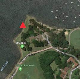
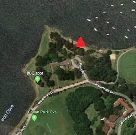
Callan Park Seawall water quality sampling site Callan Park Beach water quality sampling site.
Sampling requirements
The national guideline recommends at least 100 water samples are included in the risk assessment. Under the current Beachwatch sampling regime, it will take at least two years to collect the amount required. While swim sites can be assigned a provisional beach grade using less data, it is noted the analysis is incomplete due to limited bacterial data. Beachwatch does not have the capacity to collect data more frequently but has agreed that if the data has proven quality assurance for collection and analysis methods, it could also be included in the assessment to reduce the amount of time taken to collect the 100 data points required.
Professor Stuart Khan from the UNSW is able to assist with this data collection if Council resolves to expedite the process. His team could supplement the Beachwatch data at a cost of approximately $5,000. There are savings in the Urban Ecology budget this year that cacn voer this work and fast tracking the sampling and once all parties (OEH, Council, PRCG and UNSW) agree on collection and laboratory analysis methods, implementation and quality assurance standards, this work could be completed by 30 June, 2019.
Beachwatch has indicated it would not be able to promote Callan Park as a swimming site until sufficient data has been analysed to provide the evidence to show that it is suitable for swimming. Nonetheless, it recognises that since there are no major stormwater drains discharging near the site, and that the location is in the lower part of the embayment, it would expect water quality to be suitable for swimming in dry weather conditions.
Sydney Water is investigating running a Riverwatch program. However, timeframes and associated costs have not been established.
Chemicals in water and sediment - UNSW
To accord with the NSW Health requirements for swimming sites, Professor Khan from UNSW is also working with the PRCG and Council to measure the most appropriate chemical contaminants in water and sediment that may impact suitability for swimming for the three sites outlined in the draft Parramatta River Masterplan, and for the Callan Park site.
To fast-track the data collection at Callan Park, Council has been in discussions with Professor Khan regarding commencing this work as soon as practicable and has received a cost estimate based on pricing schedules from the National Measurement Institute analytical laboratory (Table 1 below).
The table below shows the relevant chemical contaminants for the risk assessment for swimming suitability. Sufficient toxicity data exists for these chemicals to provide analysis to determine whether any positive samples are at safe concentrations levels.
Table 1. Chemicals and costs for water and sediment analysis by National Measurement Institute for UNSW (4/10/18).
|
|
Chemical |
Per sample |
No. Samples |
Total |
|
Water |
PFAS (Perfluoroalkyl Sulfonate) |
$180 |
10 |
$1,800 |
|
|
BTEX etc. (from crude oil - benzene, toluene, ethylbenzene and xylene) |
$135 |
10 |
$1,350 |
|
|
Pesticides (Organochlorine, Organophosphorous, Polychlorinated Biphenyls) |
$70 |
10 |
$700 |
|
|
Dioxins (TCDD and PCBs) |
$2,355 |
8 |
$18,840 |
|
|
|
|
|
|
|
Sediment |
PAHs (Polycyclic Aromatic Hydrocarbons) |
$55 |
10 |
$550 |
|
|
Dioxins + PCBs |
$2,355 |
8 |
$18,840 |
|
|
Heavy metals |
$28 |
10 |
$280 |
|
|
Pesticides (Organochlorine, Organophosphorous, Polychlorinated Biphenyls) |
70 |
10 |
$700 |
|
TOTAL |
|
|
$43,060 |
Given its proximity to Iron Cove and its industrial history of contaminations, a rigorous assessment that meets the requisite National and NSW Health guidelines needs to be ensured in assessing chemical contaminants. Monitoring and analysis of the contaminants listed in Table 1 should provide a sufficiently comprehensive and detailed assessment of the water and sediment from an ecosystem and human health perspective in a manner appropriate to the historical land use context of the seawall location. It is possible that the work could be done within a three month period and completed by 30 June 2019 at a cost to Council of less than $45,000, should Council resolve this project.
2. Bathymetry and riverbed hazards
Assessing the bathymetry (depths) and riverbed hazards would also involve NSW Roads and Maritime Services. Potential for UNSW to do this work has been suggested and is being explored.
The bathymetry (depths) is not known so a study needs to be done. There are a range of hazards on the bed at the Callan Park Seawall site including oysters, rocks, fill and dumped material (e.g. concrete, reo, bricks, and glass). This requires a visual check of the area at low tide and a dive study of the river bed for physical hazards. The use of shark netting may also need to be explored.
This work would commence following the assessment of water quality.
4. Governance
Callan Park management
Callan Park is owned by NSW Health. A large portion of the park, including the areas originally proposed as potential swim activation sites, is managed by the National Parks Division of OEH on an interim basis. Roads and Maritime Services is responsible for the adjacent riverbed.
OEH is sympathetic to the Seawall site activation providing it supports the objectives of Callan Park and is activated using an evidence and risk-based approach as required by the national guidelines. Its officers have been working with the PRCG Coordinator to set up the Beachwatch program there and supporting her and Council staff to determine the processes involved for the future stages. While approval to proceed with the activation of the seawall site is pending, OEH is supportive of Council proceeding to expedite the water quality and to plan the timetable for development of the activation project.
No other commitment from OEH for the seawall site has occurred at this stage.
Interagency group
If and when OEH approves a site for activation, a Callan Park swim site interagency group will be formed. It will determine matters such as:
· planning controls (e.g. Heritage)
· ownership, operation and maintenance of the resulting infrastructure
· funding sources (no funding currently available from OEH, nor allocated in Council budgets)
· ongoing integration of water and sediment quality data to understand the complete picture
5. Site Activation and Management Plan
Developing the seawall site activation plan for short-term and longer-term activation will include:
1. Engagement: community and stakeholder engagement to understand the existing site uses and needs
2. Feasibility studies including (but not limited to):
a. Confirming water and sediment quality assessments;
b. Investigating bathymetry and bed hazards, and potential options for a constructed swimming pool type option
c. River dynamics including flow conditions and high velocity rates in wet weather
d. Land availability study to determine any heritage and service constraints
e. Assessing the seawall condition and stability
3. Governance: agreeing on governance arrangements for the selected swim site.
Design and construction
The swim site options report will be informed by the engagement and feasibility studies and potentially developing on existing Callan Park plans including the landscape structure plan. Following the selection of the preferred option for the site activation approach, concept plans and detailed designs for the construction of the seawall swim site will be developed.
Management plan
Reflecting the agreed governance arrangements, a multistakeholder approach needs to be used to develop the site management plan for the ongoing management and operation of the swim site.
UNSW has identified a potential research partnership with a PhD student from the Faculty of the Built Environment able to undertake this work, and would need approval from OEH.
NEXT STEPS
1. Confirm water quality monitoring and sediment testing for chemicals and complementing the Beachwatch pathogens monitoring
2. Engage with community and other stakeholders on the draft Parramatta River Masterplan and Callan Park Seawall area uses and needs
3. Seek a partnership with OEH to develop the swim site activation plan - continue to work with OEH and other stakeholders on governance and planning the steps and securing funding for bathymetry (depths) and riverbed hazards, site planning, design and management.
FINANCIAL IMPLICATIONS
Immediate costs
Immediate costs to Council of expediting data collection by mid-2019 through UNSW will be less than $50,000 (Table 2).
Table 2.
|
Sampling and analysis |
Approach |
Total |
|
1. Supplement Beachwatch collection |
Additional Enterococci samples |
$5,000 |
|
2. Chemical data collection |
Water and sediment data collection as per Table 1. |
$43,060 |
A $5,000 is available for monitoring in the Urban Ecology program budget for 2018/19. This can cover the monitoring to supplement the Beachwatch collections. However there is no budget for the additional Chemical data collection for water and sediments and Council will need to identify a funding source in order for the analysis to be complete.
Longer-term cost considerations
There will be financial implications for feasibility studies, including bathymetry, and the site assessment, detailed design, and capital works and ongoing management and monitoring. However, until an options report of potential action scenarios is completed, these costs are not able to be estimated.
OTHER STAFF COMMENTS
Advice was sought and received from the Parks Planning Manager, Recreation Manager, Aquatic Facilities Manager. Matters raised include:
· the need to take a risk management approach as per national guidelines
· liability – understanding the risks for Council in an open water setting
· concern regarding the ownership and basis if Council operates and maintains a swim site (lease, licence)
· the recreation needs study has not identified this as a need - existing sites nearby, including Dawn Fraser Baths, are already available for swimming; a swim site for activation is already identified in Sydney Harbour in the Mort Bay Masterplan
· net shortfall in funding for the capital upgrade Dawn Fraser Baths of approximately $2 million which have been costed as part of an integrated master plan for the pool
· Dawn Fraser Baths should be the foremost priority of Council in terms of a swimmable Parramatta River
· resources required, including need for upkeep
CONCLUSION
The steps to activate the Callan Park Seawall site are dependent on approvals being given that are reliant upon satisfactory water quality results being in line with the national guidelines targets for recreation in waterways and NSW Health guidelines. Council can potentially shorten the timeframe for gaining sufficient results by supporting additional water quality monitoring for pathogens to the current Beachwatch program. UNSW can augment this work with the chemical sampling and exposure pathways risk assessment.
For UNSW to collect and analyse the chemical and supplementary pathogen water quality data by mid-late next year, the cost to Council is estimated to be less than $50,000.
Taking a partnership approach with UNSW (that includes very significant in-kind support) rather than waiting for Beachwatch and future Riverwatch Program results may be the best approach to take. It optimises benefits from the costs expended in terms of time and budget. Co-funding the Riverwatch Program would also require additional sources of funding from Council, where seeking additional sources of funding (grants etc.) would involve more and unpredictable delays.
Making the river swimmable requires successfully addressing water and sediment quality issues first. Following that, it depends on Council and its catchment partners working towards the collective vision through coordinated interagency efforts.
References
McGregor Coxhall, 2018, Parramatta River Swim Site Activation Framework, report commissioned by the Parramatta River Catchment Group. Available: http://www.ourlivingriver.com.au/content/uploads/2018/08/Parramatta-River-Swimming-Site-Activation-Framework-Final-Report-180713.pdf;
National Health and Medical Research Council 2008, Guidelines for Managing Risks in Recreational Water https://nhmrc.gov.au/sites/default/files/images/guidelines-for-managing-risks-in-recreational-water.pdf
|
|
Council Meeting 30 October 2018 |
Subject: Zero Waste Strategy and Transition Plan for a common customer focussed resource recovery and waste management service
Prepared By: Jan Orton - Group Manager Sustainability and Environment
Authorised By: Elizabeth Richardson - Deputy General Manager Assets and Environment
|
SUMMARY Inner West Council (IWC) was created on 12 May 2016 from the merger of Ashfield, Leichhardt and Marrickville councils. Serving the new, inner west community of over 185,000 residents across 26 suburbs, Inner West Council is 1,250 staff strong. As part of the development of a single IWC approach to resource recovery IWC through the Community Strategic Plan has as one of its key objectives to become: A zero waste community with an active share economy by 2036. Under the IWC Delivery Program and Operational Plan the Resource Recovery Planning and Services teams provide the administrative, education, communication, collection and processing services – at the kerb side and at other facilities – on a daily basis, to more than 75,000 households and businesses. Each week Council staff and contractors service close to 150,000 bins. The resource recovery services are still operating as three separate service areas due to the complexity of staffing and contract collection, differing processing / disposal contracts, staff protections as a result of the amalgamations and a Council resolution, in December 2017, to extend staff protections to May 2021. The IWC generates over $40 million per year in domestic and other waste charges. Funds are allocated to planning, education, communication, collection and disposal/processing on an annual basis and to future capital and plant expenditure over a ten year financial plan. The purpose of this report is to: 1. outline the steps to planning for the longer term resource recovery services 2. plan for the transition to a common sustainable resource recovery service (and domestic waste charge) 3. outline the service areas that are targetted for redesign in creating a common Inner West resource recovery service. |
|
RECOMMENDATION
THAT Council:
1. Note the proposed steps in developing the Zero Waste Strategy and Transition Plan;
2. Endorse the planned redesign over the next 12 – 18 months, of key resource recovery and waste management services to allow Council to transition to and establish a common Inner West domestic and commercial service;
3. Endorse the use of up to $200,000 from the Domestic Waste Management Reserve to fund the development of the Zero Waste Strategy and Transition Plan;
4. Note that a report/s on redesigned services for the following will be presented to Council for consideration in early-mid 2019/2020: a. Kerbside domestic food and garden organics and landfill services, b. Kerbside domestic recycling services, c. Kerbside Household Clean Up including illegal dumping and other kerbside booked collections e.g. metals, white goods, mattresses, d. Drop off services including e-waste, problem wastes, the weekend transfer station and Community Recycling Centre/s, e. Reuse and Recycling Centre, and f. Kerbside commercial services (recycling, organics and landfill); 5. Further to Council’s previous resolution to immediately commence consideration of the option of the collaboration with industry and universities on recycling micro factories. and in accordance with that resolution Council support the allocation of $10,000 from the domestic waste charge (currently within the resource recovery planning budget), over the next three years to partner with the UNSW on micro-recycling;
6. Consider releasing, at the next quarterly budget review $100,000 of the allocated funds for the Reuse and Recycling Centre from the Domestic Waste Reserve to allow this project to recommence its planning and design.
|
BACKGROUND
As part of the development of a common approach to resource recovery and waste management, Inner West Council (IWC) through the Community Strategic Plan has as one of its key objectives, to become:
A zero waste community with an active share economy by 2036.
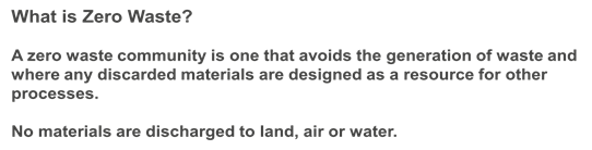
Figure 1: IWC definition of Zero Waste
Under the IWC Delivery Program and Operational Plan the Resource Recovery Planning and Services teams provide the administrative, education, communication, collection and processing services – at the kerb side and at other facilities – on a daily basis, to more than 75,000 households and businesses. Each week Council staff and contractors service close to 150,000 bins.
The resource recovery and waste management services are still operating as three separate service areas due to the complexity and differences in staffing and contract collection, processing / disposal contracts, and fees and charges, as well as staff protections as a result of the amalgamations and a Council resolution, in December 2017, to extend staff protections to May 2021.
The IWC generates over $40 million per year in domestic and other waste charges. Funds are allocated to planning, education, communication, collection and disposal/processing on an annual basis and to future capital and plant expenditure over a ten year financial plan.
The purpose of this report is to inform Council about the stages (already underway) to develop a Zero Waste Strategy and Transition Plan for a common, customer focussed resource recovery service and outline the anticipated results of service redesign for the key domestic and commercial resource recovery and waste management services.
The amalgamation and the objective to become a zero waste community gives IWC an opportunity to redesign its waste services for maximum diversion of material from landfill, to innovate and partner with others in best practice management and to introduce a common customer focussed service to supports community with a zero waste lifestyle.
Ultimate objectives of the Zero Waste Strategy and Transition Plan are to:
1. Align the IWC resource recovery planning and services to the Our Inner West 2036 plan and vision of becoming a zero waste community with an active share economy
2. Establish a common domestic resource recovery and waste management service and charge for IWC
3. Establish a common commercial waste and recycling service and charge for IWC
Council resolutions on waste management and resource recovery
In addition to the objective to become a zero waste community, IWC has considered reports and Notices of Motion regarding resource recovery and waste management that will be addressed over the development of the Zero Waste Strategy and Transition Plan.
The resolutions relating to resource recovery and waste management that will be covered by the redesign of key services as part of the Strategy development are outlined in table 1 below.
Table 1: summary of Council resolutions relating to resource recovery and waste management
|
Item |
Resolved |
Action |
|
C0518 Item 21 Recycling Contract with VISY - former Marrickville area |
THAT Council Immediately commence consideration of the option of the collaboration with industry and universities on recycling micro factories. |
This matter will be included in the redesign of the Recycling Service and as part of the redesign of the Household Clean Up and Drop-off Services and the development of a Reuse Centre. Staff are working actively with the UNSW on introducing ‘Reform’ to IWC recycling – reform is a new term being used to describe the reforming of recyclable materials into high value materials , a report on this matter will be presented to Council in early 2019/2020. In order to implement this resolution Council has an opportunity to partner with the UNSW in the UNSW SMaRT Hub for micro-recycling factory for a $10,000 p.a. contribution for three years |
|
C0518 Item 19 Notice of Motion: Dumping Prevention and Control Policy |
THAT Council prepare a report toward a dumping prevention and control policy, including a strategic and evidence-based approach to general and scheduled pickups, education and communication (especially in areas with high resident turnover), and responding to illegal dumping when it occurs. |
These service approaches will be investigated in the redesign of the Household Clean Up and Drop-off Services.
A report on these matters will be presented to Council in early 2019/2020.
|
|
C0718 Item 12 Notice of Motion: Expand Waste Booking Services |
THAT Council provide advice on options for assisting residents without access to vehicles to be able to make use of e-waste and chemical disposal service. This should include an assessment of the most cost effective model and any external organisations can assist with the coordination of the service. |
|
|
C0818(2) Item 17 Notice of Motion: Review of Food Organics Waste Management |
THAT: 2. Work with leaders in the organics and waste management field on best practice organics management and divert most organic material from landfill; 3. Council officers contact the producers of the War on Waste TV program to identify whether there are any opportunities for collaboration; 4. Council officers report back following the review with the options for food organics services and funding; 5. Council adopt an objective of leading local governments across the nation in the separation of organic waste from domestic waste taken to landfill; and 6. The review look at ways local schools, business premises community gardens and other interested organisations could establish food organics programs with council support such as the ‘food scrap Friday’ program set up by Camdenville public school. |
This will be the subject of the redesign of the kerbside domestic services, specifically greenwaste, landfill and food organics and the redesign of home and community composting programs and services.
A report on the future organics and landfill services will be presented to Council in early 2019/2020.
Council has also commenced a research partnership with the Institute for Sustainable Futures on organics – ‘Organics Evolution – Planning for 2036 and Beyond’. This project will see for the first time all organic outputs from the IWC area mapped – this will include dog poo, domestic garden and food organics, business organics – fats, oils, greases food and sewer. The map will then provide information about the quantity and location of organics and assist IWC and other key stakeholders (Sydney Water and the EPA) to determine the best immediate, medium and long term management of organics. |
|
C0818(2) Item 18 Notice of Motion: Recycling at Inner West Council |
THAT: 2. Council note that Inner West Council is committed to the continuation of kerbside recycling; 3. Council acknowledge and encourage Inner West residents for their commitment to kerbside recycling which resulted in over 16,000 tons of recycling being diverted from landfill in 2016-17; 4. Officer produce a report into steps that can be taken to increase the quality of material recycled, and further options to help Council maintain a high quality recycling service without burdening Inner West ratepayers; and 5. The report include discussion of Council's capacity to provide recycling services to commercial premises in Marrickville and Leichhardt. |
This will be the subject of the redesign of the kerbside domestic recycling and kerbside commercial services. A report will be presented to Council on this matter in early 2019/2020.
IWC is also participating in the NSW Government Taskforce which was set up in response to the China ban on recyclables. Strategic directions from State and Federal Government to stimulate a market for recycled materials is essential and will have significant influence on decisions made by Council in this area. |
|
C0918(1) Item 21 Notice of Motion: Single Use Plastics Reduction |
A report on the reduction of single use plastics be incorporated in the next report to Council on Zero Waste in October 2018. |
Officers are working to quantify the amount of single use plastics used across Council in directly controlled events, meetings and workplaces. Officers will work within the current procurement policy and events policies and facility managers to put plans in place to eliminate, phase out or significantly reduce single use plastics. |
REPORT
The project to develop the Zero Waste Strategy will be completed in house with support from expert consultants brought in for specific technical areas. The project is divided into four stages:
STAGE ONE: Preparation of the Current State – Discussion Paper (complete)
STAGE TWO: Review, research and engagement – review, stakeholder engagement and redesign of IWC services including:
a) Kerbside domestic food and garden organics and landfill services,
b) Kerbside domestic recycling services
c) Kerbside Household Clean Up including illegal dumping and other kerbside booked collections e.g. metals, white goods, mattresses
d) Drop off services including e-waste, problem wastes, the weekend transfer station and Community Recycling Centre/s,
e) Reuse and Recycling Centre,
f) Kerbside commercial services (recycling, organics and landfill)
STAGE THREE: Decision Making – briefings and reports to Council on:
a) service options and recommended service standards for a common IWC resource recovery service,
b) changes to current systems
c) community impact,
d) impact on Domestic Waste charges and
e) the draft Transition Plan – timing for roll out of new/changed services and associated policies, fees and charges.
STAGE FOUR: Public Exhibition and Adoption of the IWC Zero Waste Strategy
This report outlines some of the key information from the Current State - Discussion Paper and highlights the activities planned for Stage 2 – review, research and engagement.
Timeframes
The work is planned to be carried out over 2018/2019 and into 2019/2020, see figure 1. It is expected that options for the key services will be ready for Council to consider as part of Stage 3 (Decision Making) in mid-2019.

Figure 2: Draft time lines for the Zero Waste Strategy and Transition Plan
STAGE ONE – CURRENT STATE DISCUSSION PAPER
This stage is complete. The Discussion Paper is intended for use internally and has brought all the information about the current state of waste management and resource recovery together for the three services areas and for the IWC area as a whole.
The information contained in this paper has been used for this report and will be used to brief consultants, community, Councillors and other stakeholders as we move through the project. It identifies the relevant National and State waste policies and strategies and directions adopted by Ashfield, Leichhardt and Marrickville councils.
Summary information from the Current State Discussion Paper:
What policy environment are we working in?
Inner West Council
IWC has a newly adopted Community Strategic Plan that sets the major direction for Council as outlined above. In addition there are two key legacy documents that outline the approach to resource recovery and waste management:
· Rethink Waste Strategic Plan and Action Plan
· Leichhardt Environment Strategy and Action Plan.
These documents vary in their specific use of targets however are aligned in their interest in reducing materials to landfill through organics management, reuse and empowering the local community to take action and responsibility for materials they generate.
NSW Government
The NSW government adopted its Waste Avoidance and Resource Recovery Strategy in 2014. The targets for NSW are:
· avoiding and reducing the amount of waste generated per person in NSW
· increasing recycling rates to
o 70% for municipal solid waste
o 70% for commercial and industrial waste
o 80% for construction and demolition waste
· increasing waste diverted from landfill to 75%
· managing problem wastes better, establishing 86 drop-off facilities and services across NSW
· reducing litter, with 40% fewer items (compared to 2012) by 2017
· combatting illegal dumping, with 30% fewer incidents (compared to 2011) by 2017
Australian Government
The National Waste Policy was developed in 2009. Since that time little action has been seen from the national level. The most significant work was product stewardship legislation for televisions and computers. Introduced in 2011, it changed the face of e-waste recycling from a linear process, with Council responsible for the materials at the end of their life, to a circular process that sees manufacturers taking product back and designing for recycling. The diversion from landfill for televisions and computers collected at the IWC e-waste drop off is 98%.
The China restriction on contaminated recycling has however promoted action, there is now a draft discussion paper from the Australian Government to inform and update the National Waste Policy, Updating the 2009 National Waste Policy: Less waste, more resources: http://www.environment.gov.au/protection/national-waste-policy/consultation-on-updating-national-waste-policy
A submission was made on behalf of local government in NSW by LGNSW and SSROC. IWC contributed to both these submissions with the following points:
· Circular economy and ensuring language and intentions are well understood by all players
· Behaviour change and adequately funding and supporting a national education and information campaign
· Economic instruments / legislation to support product stewardship and extended producer responsibility
· Coordination across the national, state and local government and industry sectors
What materials come from IWC?
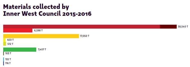 In 2015/2016
the IWC had an overall diversion from landfill of 36%. Figure 2 below outlines
the weight of materials collected by Council and how they were processed or
disposed.
In 2015/2016
the IWC had an overall diversion from landfill of 36%. Figure 2 below outlines
the weight of materials collected by Council and how they were processed or
disposed.
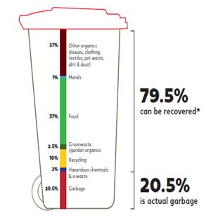
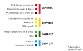
Figure 2: baseline year materials by weight and process and what is in the IWC Red Bin
What IWC spread of services looks like
The domestic and commercial services across the three service areas share many common elements, table 2 however highlights the differences that have evolved over many years.
Table 2: Current services across the three service areas
|
Service Area |
West (Ashfield) |
North (Leichhardt) |
South (Marrickville) |
|
Red Bin – Landfill |
weekly |
weekly |
weekly |
|
Yellow Bin – recycling comingled |
fortnightly |
û |
fortnightly |
|
Yellow Bin – recycling containers |
û |
fortnightly |
û |
|
Blue Bin – recycling paper |
û |
fortnightly |
û |
|
Green Bin – Garden Organics |
fortnightly |
fortnightly; |
fortnightly |
|
Green Bin – FOGO |
û |
û |
weekly to 1000 properties per week (trial); |
|
Burgundy Bin - Food Organics |
û |
weekly 5,200 multi-unit dwellings |
û |
|
Composting |
Compost Revolution |
Compost Revolution |
Compost Revolution Compost Collective Compost Huts trial |
|
Clean up – general household |
2 scheduled / year |
2 scheduled / year |
û |
|
|
4 book-in general household / year |
|
weekly book-in |
|
|
û |
û |
weekly book-in bundled garden organics |
|
|
û |
additional general household collections – fee based |
additional general household collections >2m3 – fee based |
|
Whitegoods |
û |
book-in collection |
book-in collection |
|
Mattresses |
scheduled clean up and booked service |
weekend drop-off to Transfer Station – fee based |
weekly booked service |
|
E-waste – all IWC |
drop off – monthly (Wed) and four Saturdays a year |
weekend drop off Community Recycling Centre; |
drop off – once/quarter |
|
Problem wastes (6 categories - CRC) all IWC |
û |
weekend drop off Community Recycling Centre |
quarterly Clean Out |
|
Hazardous Household Chemical Waste (EPA Clean Out) all IWC |
û |
û |
quarterly |
|
Garden Organics drop off |
û |
weekend drop off – fee based |
û |
|
Bin Maintenance |
yes last bin roll out 2017 |
yes no large scale bin roll outs |
yes last bin roll out 2014 |
|
Lanes / Dumping |
reactionary |
monthly service and reactionary |
3 week cycle; hot-spot service and reactionary |
|
Commercial services – landfill |
weekly 600 businesses – Mon-Fri service |
various frequencies – Mon-Fri service - fee per lift invoiced XX |
û |
|
Commercial services – recycling |
fortnightly 600 businesses – Mon-Fri service |
û |
û |
|
Misc services - schools, events |
included in service - reactionary |
fee for service |
fee for service |
Current integration and IWC focussed activity
The following activity is currently underway to assist with integration and the redesign of a common IWC service.
Procurement
Tenders for common processing and specific service area processing are complete, underway and or in development for the 2018/2019 year. This work will greatly assist with integration and will give IWC the information it needs to redesign and plan for new services across key areas:
· Food and Garden Organics Processing (all IWC)
· Clean Up / Dry Waste Processing (all IWC)
· Mattresses Processing (all IWC)
· Recycling (South service area – will align contract dates with other service areas)
· Landfill (South service area – will align contract dates with other service areas)
Financial Management
· Inner West Council - DWMC Audit 2017/2018 – an external review of practice to ensure IWC management of the Domestic Waste funds is in line with the Local Government Act.
· Inner West Council - DWMC financial model 2018/2019 FY – this financial model allows IWC to input all current and planned costs for the domestic waste service and predict current and future expenditure and associated impacts on the Domestic Waste Charge.
Industrial Relations and Operational Service review
· Operational Service Review –Council is concurrently undertaking a review of all of its ‘outdoor’ operations including Resource Recovery services. The objectives of the review are to develop a consistent service delivery and operational model across the Inner West and ensure Council’s services are being provided in the most effective and efficient manner possible.
· Workplace agreement review – harmonisation of workplace agreements being managed by Human Resources will also be integrated with the development of the Strategy
Communications and Engagement
· Promotion of E-waste recycling across IWC
· Waste Info App and online service calendar
· Waste Avoidance, Reuse and Recycling communications
· Plastic Free July – GLC campaign
· Home / community composting online education and subsidised compost bins/worm farms
· Clean Up/Illegal Dumping – Regional Program (SSROC)
· Clean Up/Illegal Dumping – Waste Inspectors – targeted sites (hot spots)
· Footprints Eco-Festival
Services Assessment
It is essential that the IWC understands the service standards, costs and immediate opportunities for integration and longer term implications of service changes. Each current service offering is described with the following information:
· Current processing / disposal contracts
· Collection model
· Baseline year data (2015/2016)
· Tonnes collected (2017/18)
· % diversion
· Total cost of service per household (for the former council areas and for the IWC as a whole)
· Total kg of material generated per person per year
Additional information regarding the services has also been assessed including:
· Relevant targets
· Known best practice
· Barriers to zero waste
· Community perceptions / willingness for change
· What is on offer from Industry now / future
· Gaps in knowledge / information
STAGE 2 - REVIEW, RESEARCH AND ENGAGEMENT
This stage will involve a significant amount of work on the redesign of a common resource recovery and waste management service.
This stage involves the engagement of external consultants and creation of in-house project teams to work on the redesign of the following services:
1. Kerbside domestic food and garden organics and landfill services
2. Kerbside domestic recycling services
3. Kerbside Household Clean Up including illegal dumping and other kerbside booked collections e.g. metals, white goods, mattresses
4. Drop off services including e-waste, problem wastes, the weekend transfer station and Community Recycling Centre/s
5. Reuse and Recycling Centre
6. Kerbside commercial services (recycling, organics and landfill)
Each service will be reviewed across the three service areas and a number of new service scenarios/options will be developed to assist Council determine the future common IWC service. The following will be used as a guide to each service redesign:
1. Review the existing services on offer across the IWC and identify best practice
2. Research best practice services in other council areas that could apply to IWC
3. Prepare a range of scenarios/options for a new resource recovery or waste management service for IWC with each scenario outlining:
a. degree to which it addresses the zero waste and diversion from landfill objective and Council resolutions
b. market readiness including current and or planned facilities and access
c. costs – capital and recurrent and potential impact on the DWMC for each service area and the IWC as a whole
d. impact on other services on offer by IWC - collection, frequency
e. communications required i.e. how different from current service
f. recommended timing considering contracts, current or new policy, staffing and industrial issues, plant and asset management
4. Provide a summary of the analysis for each scenario with a focus on diversion of material from landfill, costs/savings, ease of implementation and other issues specific to each service area
5. Provide recommendations that will assist IWC prepare the Zero Waste Strategy and Transition Plan for a common resource recovery service.
The following table provides an overview of the current state of the services and the areas the redesign will be focusing on:
|
Kerbside domestic food and garden organics and landfill services |
|||
|
Current State |
|||
|
Service Mix |
|||
|
Service Area |
West (Ashfield) |
North (Leichhardt) |
South (Marrickville) |
|
Red Bin – Landfill |
weekly |
weekly |
weekly |
|
Green Bin – Garden Organics |
fortnightly |
fortnightly |
fortnightly |
|
Green Bin – FOGO |
û |
û |
weekly 1000 properties (trial) |
|
Burgundy Bin - Food Organics |
û |
weekly 5,200 multi-unit dwellings |
û |
|
Composting |
Compost Revolution |
Compost Revolution |
Compost Revolution Compost Collective to > 90 multi-unit dwellings Compost Huts trial – two huts |
|
The greenwaste service is an opt-in service, currently IWC does not have comprehensive data across the LGA about the number of households that have a green bin. In the South service area for example only 59% of households have a green bin. The contents of the red bin are disposed to: · landfill (South) and · landfill via a MBT (mechanical biological treatment) facility at Woodlawn (North and West). Organic material makes up approximately 37% of the red bin and it is this material IWC would be seeking to collect and process as a valuable re-useable product via an organics service. IWC is currently tendering for garden organics, FOGO and FOO processing. This will give IWC vital information for the future service in terms of: 1. whether there are any facilities that can take the organic material from the IWC area, (this has been a barrier in past tender processes with very few if any able to process organic material) 2. location of tipping organic material, 3. price per tonne for processing |
|||
|
Challenges |
|||
|
Council has resolved (C0818(2) Item 17) to work with leaders in the field to divert most organic material from landfill. A research project with the Institute for Sustainable Futures (ISF - UTS) Organics Evolution – Planning to 2036 and Beyond, has commenced. This project will influence the future of organics management in the area over the short medium and longer term. The challenges for IWC are to design an organics service that is: · effective in its diversion of material from landfill · is acceptable to the community with respect to frequency of the service, cost, impact on space for bins, its convenience and ease of use · as close as possible to cost neutral – currently organics processing is approximately $100 per tonne more costly than landfill · able to be accommodated by processing contracts in the Sydney region, the current greenwaste tender process will identify if there are any facilities willing or able to take the volume of organics, where facilities are and what impacts processing at those facilities will have on current collection methods, costs etc. Current disposal and processing contracts also present a challenge to achieving a common service across IWC. Current contracts oblige IWC to send the organics material to Woodlawn MBT for the West (Ashfield) area (IWC is free to extract organics from the North (Leichhardt) area). The contract with the Woodlawn facility expires in June 2027. A decision to change that contract to allow extraction of organic materials may incur penalties – this will be explored as part of the service redesign. The community recognises the value of organic material and are increasingly demanding that government do better in its management of this material. The current MBT processing at Woodlawn (red bins from North and West service areas) extracts organics however the volume extracted is below expected and the quality of the organics extracted is low. Organics extracted through Woodlawn are currently only suitable for landfill cover or mine site rehabilitation. At this stage it is unclear whether there are adequate processing facilities in the Sydney basin to accommodate the organics from IWC residents and potentially businesses. |
|||
|
Focus of redesign |
|||
|
IWC has a number of existing organics programs and services: · Food Only Organics (FOO) in 5200 units in Leichhardt · Food Organics and Garden Organics (FOGO) trial in 1000 households in Marrickville · Home composting via Compost Revolution (all IWC) · Green waste booked collections and drop off at the weekend Transfer Station – Catherine St. · Home composting – subsidised bins and worm farms and workshops · Community composting – Compost Collective for Units and Composting Huts trial in Marrickville · Support for community composting in community gardens and schools The kerbside service will be the major focus of this service redesign and options that will be considered include for example a roll out of FOO to units and FOGO to single houses with a shift in the frequency of collection of the red bin from weekly to fortnightly. Operationalising composting at home and in the community will be an important element of the IWC service. Composting avoids collection and processing costs and will deliver the most sustainable and lasting impacts if it is adequately resourced. |
|||
|
Kerbside domestic recycling services |
|||
|
Current State |
|||
|
Service Mix |
|||
|
Service Area |
West (Ashfield) |
North (Leichhardt) |
South (Marrickville) |
|
Yellow Bin – recycling comingled |
fortnightly |
û |
fortnightly |
|
Yellow Bin – recycling containers |
û |
fortnightly |
û |
|
Blue Bin – recycling paper |
û |
fortnightly |
û |
|
A fortnightly comingled (paper and all containers) recycling service is common to the West and South service areas. The recycling service in the North service area has a weekly collection of recycling: · week 1 – containers only in the yellow bin · week 2 – paper only in the blue bin Processing is currently contracted to VISY Recycling across all service areas. IWC has recently entered into a 12 month contract for recycling processing for the South service area. VISY has approached IWC to renegotiate the gate rates for the current contracts for North and West service areas. No agreement has been reached. IWC is also pursuing an agreement with VISY on the refund sharing from the NSW Container Deposit Scheme. An agreement for a share of the refunds is in both VISY and Council’s interest and it is anticipated that an agreement will be reached before December 2018. It is yet unknown the value of that agreement. |
|||
|
Challenges |
|||
|
The challenges for IWC are to design a recycling service that: · builds on good behaviours and expectations of the IWC community and is therefore effective in its diversion of material from landfill · is acceptable to the community with respect to frequency of the service, cost, impact on space for bins, its convenience and ease of use · builds trust in the community that all materials collected will be recycled · demonstrates the best value for money and innovation in recycling and Council’s and communities role in contributing to the circular economy The recycling industry has been significantly affected by the change in policy from China in the import restrictions of recyclables. This has highlighted the lack of planning and policy at the National and State level for a robust and resilient recycling industry / circular economy for Australia. Immediate impacts for IWC are the increase to processing fees for our current contracts. IWC has negotiated a new 12 month contract for the processing of recycling from the South (Marrickville) service area at an increased rate per tonne, an increase of $138,000 per year. Council is still in negotiation around the contract for the West (Ashfield) and North (Leichhardt) service areas with respect to rates per tonne for processing. There is a significant financial impact on these two contracts as both were attracting a rebate for part of the recycling processing – cost increases for recycling of between $500,000 - $800,000 a year are being sought, Council is challenging the proposed increases. These contracts are current and expire in 2020 with an option (at Council’s discretion) to extend to 2023. The change in global movement and trade in recycling will see future contracts seeking to share the risk between the recyclers and councils. Council is anticipating that new generation contracts will need to be more innovative and be more focussed on partnerships however significant leadership from the State and Federal governments is crucial if this is to be successful. The financial implications (costs and benefits) of risk sharing contracts are unknown. |
|||
|
Focus of the redesign |
|||
|
The redesign of the recycling service will need to assess the diversion, costs and benefits of a separated service (paper and containers) versus a comingled service or combinations of the two. Industry has indicated that with cleaner, source separated streams of material comes greater diversion and recycling, and less stockpiling of unrecyclable materials. The efforts of State and National governments and innovators such as UNSW Smart labs, are crucial in this space. IWC is participating in the National Taskforce (hosted by the EPA) into recycling. IWC therefore has a seat at the table with government and industry however we are operating in a vacuum with a significant lack of policy direction and legislative support at the State and Federal level. |
|||
|
Kerbside Household Clean Up Including illegal dumping and other booked collections e.g. metals, white goods, mattresses |
|||
|
Current State |
|||
|
Service Mix |
|||
|
Service Area |
West (Ashfield) |
North (Leichhardt) |
South (Marrickville) |
|
Clean up – general household |
2 scheduled / year |
2 scheduled / year |
û |
|
|
4 book-in general household / year |
|
weekly book-in |
|
|
û |
û |
weekly book-in bundled garden organics |
|
|
û |
additional general household collections – fee based |
additional general household collections >2m3 – fee based |
|
Whitegoods |
û |
book-in collection |
book-in collection |
|
Mattresses |
scheduled clean up and booked service |
weekend drop-off to Transfer Station – fee based |
weekly booked service |
|
The major differences in the services for kerbside Clean Up are: · booked (South and West) clean up · scheduled (North and West) whole-of-community clean up The majority of materials put out in the Clean Up are disposed to landfill. Some recovery (between 10 – 25%) is reported by the supplier however materials are collected in the back of a compactor so reuse and recovery of good quality items is not possible. Illegal dumping in the South service area has a hot spot run for known dumping sites with a separate crew and truck dedicated to collection of dumped materials. In the North and West service areas dumping had been managed and investigated differently and materials only collected following an inspection. IWC has recently introduced two new Waste Inspector positions, there are now four staff focusing on illegal dumping and compliance with local education, information and where needed enforcement they work across all of the service areas. |
|||
|
Challenges |
|||
|
The challenges for IWC are to design a service for household materials that sees: · individuals encouraged to change purchasing and disposal behaviours e.g. using the share economy (libraries and cooperatives) · a shift to a drop-off culture rather than a collection culture (more resources from Council spent on reuse and recycling rather than collection) · Council seeking and responding to industry changes e.g. in the design and manufacturing processes so that materials are recyclable and more durable – circular economy, product stewardship · Council providing a service that is acceptable to the community with respect to access to the service (there may be a perception that a shift from the 52 booked services per year will be seen as a service reduction in the South service area), · As close as possible to cost neutral service that is easy to use · Council develop a service that is equitable, and provides a mix of services at both the kerbside and at designated reuse/recycling facilities |
|||
|
Focus of the redesign |
|
The redesign of the Clean Up service will assess the diversion, costs and benefits of booked versus a scheduled clean up or combinations of the two. At this stage research suggests that a booked service is preferred over a scheduled model. A booked service allows Council to plan the collections by zone, manage costs and manage the volume of material sent for disposal. It also allows IWC to become more innovative and proactive in managing reusable items and using the Waste Inspectors programs to better distinguish between illegal dumps and booked Clean Up items. Work on the redesign of the Clean Up will be done in conjunction with the following: · E-waste drop-off · Problem Wastes drop-off · Community Recycling Centres and Catherine St weekend Transfer Station and · The Reuse and Recycling Centre. Partnering with others, community, businesses and not-for-profits in delivery of these services will be crucial. It is anticipated that a future policy on the household clean up will seek a ban on materials that have recycling services in place e.g. e-waste, greenwaste. This will be explored as part of the project. Services to assist residents without access to a vehicle will also form part of this work. |
|
Drop off services Including e-waste, problem wastes, weekend t’fer station and Community Recycling Centre/s |
|||
|
Current State |
|||
|
Service Mix |
|||
|
Service Area |
West (Ashfield) |
North (Leichhardt) |
South (Marrickville) |
|
E-waste – all IWC |
drop off – monthly (Wed) and four Saturdays a year |
weekend drop-off Community Recycling Centre |
drop-off – once/quarter |
|
Problem wastes (6 categories - CRC) all IWC |
û |
weekend drop-off Community Recycling Centre |
quarterly Clean Out |
|
Hazardous Household Chemical Waste (EPA Clean Out) all IWC |
û |
û |
quarterly |
|
Garden Organics drop off |
û |
weekend drop-off – fee based |
û |
|
E-waste events and problem waste chemical Clean Out events have also been managed differently at each council. All E-waste and Chemical Clean Out events, the Community Recycling Centre and the Transfer Station have been open and available to all IWC residents since soon after amalgamation. E-waste covers all electronic waste, however only televisions and computers are covered under the Product Stewardship Act 2011. Other e-waste is recycled at Council’s cost. Problem waste Chemical Clean Outs are funded by the EPA. Chemical Clean Outs are offered four times a year at the St Peters depot – two events funded by the EPA and two at Council’s cost. 99.6% of the e-waste collected at our events is recycled.
11,000 vehicles dropped off e-waste last year at IWC’s drop off facilities - St Peters, and Summer Hill depots and Leichhardt Community Recycling Centre. These are great examples of how successful a drop-off facility can be for diversion of materials from landfill. |
|||
|
Challenges |
|||
|
These services are very linked to the Clean Up services and are being managed together in the redesign project. The greatest challenge for this area is being able to provide adequate facilities (physical space and land) for the community to easily drop-off items for recycling. A second CRC is being planned for the St Peters Depot – this will take problem wastes and is part funded by the EPA, it is anticipated that the CRC will be open by December 2018. Staffing needs and opening hours will be addressed as part of the service. |
|||
|
Focus of the redesign |
|||
|
The focus of this service redesign is in: · aligning the operations of the drop-off facilities to assist in growing the drop-off culture · shifting Council resources from collection focussed mostly on disposal and some recycling to facilities and collection focussed on reuse and recycling and as a last resort disposal · clearly communicating to the community about the service and what goes where · investigating support for residents without transport |
|||
|
Reuse and Recycling Centre |
|
Current State |
|
IWC currently has an allocation of funds (in the Domestic Waste Reserve) for the development of a Reuse and Recycling Centre at Tempe Lands, Swamp Rd, Tempe. The intention is for a centre that would facilitate a shift from the current collection culture to a drop-off culture and where more materials from the household clean up can be reused, repaired, repurposed or recycled rather than being crushed in the compactors and sent to landfill. The objectives were for a centre that: 1. Increases reuse and recycling and reduces the materials sent to landfill coming from households, businesses and construction sites 2. Is socially, economically and environmentally sustainable and is loved by the community 3. Enables local employment and social enterprise and is well connected to the local economy 4. Supports creative industries 5. Is developed through and run in partnership and participation with not-for profits 6. Provides opportunities for community participation 7. Is organised, contemporary and adaptable for growth 8. Provides access to permanent drop-off / reuse / recycling facilities 9. Encourages the culture of “drop off” rather than kerbside collection 10. Eliminates presence of problem wastes from landfill 11. Offers life-long learning 12. Looks to innovative solutions e.g. trial new systems and technologies
The project has developed concept designs for the site and a ten year operations plan that phases in services as Council and the community increases their understanding of the reuse space. There is a link between this proposal and the introduction of innovations in micro-recycling. These are currently being explored with the University of NSW. |
|
Challenges |
|
Challenges associated with this project were with the amalgamation of councils and the resulting loss of momentum for the project. The impacts of Westconnex are also present with the Tempe site. The project can be reignited with direction from Council and release of funds from the Domestic Waste Reserve, $500,000 was allocated for the detailed design and $1M for the construction of the centre. Following amalgamation it was clear that the Tempe site was not the best location given it is location on the periphery of the IWC area. Other sites in the LGA would be more suitable to encourage maximum accessibility. The site on Swamp Rd is also restricted due to the proximity of the flight path. Council cannot, for example, combine a drop off site for problem wastes in this location. Ideally a reuse centre would have the capacity for a one-stop shop for reuse and recycling. A review of property and lands available across IWC may result in a new location being found for a reuse centre. Release of $100,000 into this years budget would allow Council to: · confirm a preferred site · review the previous operations planning and concept designs, · integrate the Reuse Recycling Centre into service redesign for Clean Up and drop off facilities |
|
Kerbside commercial services (recycling, organics and landfill) |
|||
|
Current State |
|||
|
Service Mix |
|||
|
Service Area |
West (Ashfield) |
North (Leichhardt) |
South (Marrickville) |
|
Commercial services – landfill |
weekly 600 businesses – Mon-Fri service |
various frequencies – Mon-Fri service - fee per lift invoiced |
û |
|
Commercial services – recycling |
fortnightly 600 businesses – Mon-Fri service |
û |
û |
|
At present IWC offers two different commercial services. A general waste service in both North and West service area and a recycling service in West service area. The services are administered differently. In the West service area landowners are charged for the waste and recycling services as part of the annual rates (much like the domestic waste charge), the waste and recycling is included in the collection contract. In the North service area businesses are charged directly for each bin lift. IWC staff operate this as an in-house service. There are no commercial services offered in the South service area. |
|||
|
Challenges |
|||
|
The biggest challenge with this service is getting a common administrative approach to the charging and service delivery. Council is currently working with the property owners and businesses in the West service area to shift from a rates-based fee to a fee for each business for each bin lift. This new approach will commence on 1 July 2019 and businesses will have more than six months to decide whether they wish to continue with a Council delivered service and the frequency of the service they need. |
|||
|
Focus of the redesign |
|||
|
Getting a common approach to the administration of the commercial service for the current services in the West and North service areas is the initial focus. Following this Council will seek interest from businesses across IWC for a full waste and recycling service. Once Council has an idea of the interest a service can be designed. This element will not commence until early-mid 2019. |
|||
FINANCIAL IMPLICATIONS
Zero Waste Strategy
The Zero Waste Strategy will guide the establishment of a common IWC resource recovery and waste management service/s. The strategy will include a review of every service and associated costs such as plant replacement and consistent bin stock across the IWC area as we transition to a common harmonised service. The financial outcome of the Zero Waste Strategy will see a harmonised Domestic Waste Management Charge and strategic management of the Domestic Waste Management Reserve. The project to develop a Zero Waste Strategy will be largely completed in house. Some funding is already allocated in the current budget for consultants and external support for the service redesign of Clean Up and associated services. This funding will cover the initial consultants fees for the Organics and Recycling service redesign.
However it is estimated that $200,000 will be required, to be drawn from the Domestic Waste Reserve, to support the stages two, three and four of the project and to fast track external and internal reviews, engagement of stakeholders, community and Councillors and to complete project documentation, graphic design and final Strategy development. There are currently unallocated funds in the Domestic Waste Reserve to fund this initiative.
Reuse and Recycling Centre
Funding is also needed to continue work on the Reuse and Recycling Centre. An allocation of $500,000 was made by Marrickville Council for the detailed design of a Reuse and Recycling Centre at Tempe. To continue with this project, funds of $100,000 will need to be released from the Domestic Waste Reserve as a budget adjustment to allow for a review of the planning and design work done to date and to recommence the project. In line with the Council resolution to immediately commence consideration of the option of the collaboration with industry and universities on recycling micro factories. Council has the opportunity to partner with the UNSW on micro-recycling. To take advantage of this opportunity Council has been invited to make a financial contribution to the UNSW SMaRT Hub with an allocation of $10,000 over the next three years. There is funding available in the recurrent budget in Resource Recovery Planning to cover this.
OTHER STAFF COMMENTS
An internal Project Control Group (PCG) has been established for this project with members focussed on Environment and Sustainability, Finance and Customer Service. The PCG has been involved in the project planning and risk assessment phases and will meet on a regular basis throughout the project. There will be considerable engagement with staff around this project.
PUBLIC CONSULTATION
A communications and engagement plan is currently being developed for the project. Engagement with the Environment Strategic Reference Group, as part of the development of the Community Strategic Plan was carried out in 2017.
|
|
Council Meeting 30 October 2018 |
Subject: 2018/19 Inner West Council Grants Program
Prepared By: Tess Newton-Palmer - Community Resourcing and Research Supervisor,
Authorised By: Erla Ronan - Group Manager Community Services and Culture
|
SUMMARY This report proposes projects for funding by Council approval from the Inner West Council 2018-19 Grant Program. Council’s Grant Program comprises five different grant streams and the recommended projects address Council’s vision and priorities and individual grant program guidelines. In total, $362,225 has been recommended to support 91 projects in the Inner West community. |
|
RECOMMENDATION
THAT Council approve the funding recommendations for the Inner West Council Grant Program 2018-19 contained in Attachments 1-5 |
BACKGROUND
The Inner West Council Grants Program provides assistance to groups and individuals to enable them to deliver programs and services that address identified needs and improve community wellbeing. The grants enable Council to support the diverse range of community and volunteer groups in the Inner West to achieve shared objectives. The following five grant programs are offered:
· Arts and Culture grants (Living Arts and Independent Artist grants): grants of up to $7,500 available to not-for-profit organisations, social and creative enterprises, and individual artists. The grants support projects and initiatives that provide opportunities for creative participation and the celebration of local stories; enhance creativity and connection to place in the public sphere; develop skills; and strengthen the sustainability and capacity of Inner West cultural and creative industries.
· Community History and Heritage grants: grants of up to $7,500 available to support and enrich Council’s local history collection, with a focus on organisations or persons to undertake projects about people, events and places of historical significance to the Inner West area. Projects may include research; collections; archiving; conservation; publications; and exhibitions about the Inner West’s social and cultural history.
· Community Wellbeing grants: grants of up to $7,500 available to not-for-profit community based organisations or community groups auspiced by an organisation for sustainable local projects which address local issues; promote social justice; enhance wellbeing; strengthen the sustainability and capacity of the Inner West community and foster inclusion and social connection.
· Environment grants: grants of up to $7,500 available to support groups that benefit the environment and community through projects focused on environmental improvement; sustainability education; awareness-raising; and the promotion of sustainable living as a way of life. Grants support projects that address issues such as climate change; sustainable transport; water sensitive urban design; biodiversity; recycling and reuse.
· Recreation grants: grants of up to $7,500 available to community sporting and recreation groups and non-government community recreation organisations offering recreation programs and services to residents in the Inner West area. The grants support projects that address barriers to participation; create positive and meaningful involvement in neighbourhoods and communities; ensure inclusive and best practice access to recreation so that all members of the Inner West community can enjoy activities that appeal to their interest and form closer connections.
Delivery of the 2018-19 Grants Program
The 2018 Grants Program round opened on 7 June and closed on 16 July 2018. To support prospective applicants during this period, Council officers hosted four information sessions at Ashfield Civic Centre and Petersham Service Centre. The information sessions included an initial presentation on the Grant Program, followed by a series of one-on-one discussions between Council staff and applicants to provide tailored advice and support. 160 prospective grant applicants attended these sessions.
Council officers advised and coached individuals and groups to clarify their ideas and develop their applications. This included a focus on Aboriginal and Torres Strait Islander and Culturally and Linguistically Diverse communities in response to an identified lack of representation of these groups in the 2017 Grants Program.
The Grant Program was publicised via the Multicultural NSW email broadcast service (8,000 recipients). Grant information was also translated into the top six community languages for targeted advertising in community press.
External Panel Representative
As required by Notion of Motion C0318 Item 8, each Inner West Grant Program assessment panel include an external representative and each of the five grant streams engaged an external representative as a member.
The Assessment Process
In the 2018 Grants Round, all applications underwent a three-stage assessment process before final funding recommendations were formulated.
Firstly, all applications are screened through an eligibility check conducted by grant administrators of the five rounds. This included an organisations status, previous grant compliance and completeness of applications.
Secondly, eligible applications were assessed and ranked against the evaluation criteria by Council staff with subject matter expertise. A score against each of the evaluation criteria is tallied to arrive at a total score for each application.
Based on this total score, staff assessors rank each application from high to low priority. Staff assessment sheets for each grant round are then reviewed by the appropriate senior staff of each unit to ensure accuracy and completeness.
Thirdly, for each of the five rounds, an assessment panel comprised of managers, executives and a community representative reviewed all the applications and the assessments. This panel then confirmed or fine-tuned scores and rankings, and developed funding recommendations.
In this third step, the assessment panel reviewed the project proposals, evaluations (total score and priority ranking), amount requested, target audience, previous funding including from Stronger Communities and previous Council grant rounds, the intersecting issue of any Council venue fee waivers, and whether the project could proceed with partial funding.
The Panel recommends funding based on highest to lowest scores until the total funding pool is exhausted. Due to the high volume of applications, only those projects receiving the highest scores are recommended for full funding. For the mid scoring projects that can proceed with partial funding, the panel then recommends funding based on a consistent percentage across the board. Those projects not recommended for funding are those where the applicants confirm they cannot proceed with partial funding, or do not meet the grant objectives and/or eligibility criteria.
Staff from across Council participated in assessing a total of 160 applications. Staff from the following Council teams participated: Community History and Heritage Community Wellbeing, Community Operations, Living Arts, Parks Planning and Engagement, Planning and Programs, Recreation, Resource Recovery Planning, Social and Cultural Planning, Urban Ecology and Urban Sustainability.
Funding Recommendations
Recommendations for the five grant panels’ funding allocations are proposed in Attachments 1-5. In many cases, the amount recommended for specific projects is less than the amount requested. This reflects a policy to support as many worthwhile projects as possible within the limited budget available. In addition, some applications budgeted for items that are ineligible under the guidelines for the particular grant, resulting in these amounts being removed or reduced from the grant funding recommended.
Summary of the 2018-19 Inner West Council Grant Program
|
Grant Program |
Business Unit |
Available Budget |
Applications Assessed |
Applications Recommended |
Amount Requested |
Amount Recommended |
|
Arts and Culture: Independent Artists |
Community Services and Culture |
Combined Arts & Culture Budget $150,000 |
27 |
12 |
$158,968 |
$44,800 |
|
Arts and Culture: Living Arts |
Community Services and Culture |
34 |
25 |
$208,772 |
$102,500 |
|
|
Community History & Heritage |
Library and History Services |
$25,000 |
15 |
6 |
$90,400 |
$25,000 |
|
Community Wellbeing |
Community Services and Culture |
$113,700 |
53 |
29 |
$315,961 |
$113,647 |
|
Environment |
Environment and Sustainability |
$43,000 |
13 |
8 |
$84,360 |
$42,449 |
|
Recreation |
Aquatic and Recreation |
$33,829 |
18 |
11 |
$110,805 |
$33,829 |
|
Total |
|
$365,529 |
160 |
91 |
$969,266 |
$362,225 |
FINANCIAL IMPLICATIONS
Nil. Grants recommended can be funded from within existing budget allocations.
OTHER STAFF COMMENTS
Nil.
PUBLIC CONSULTATION
Nil.
CONCLUSION
|
1.⇩ |
2018-19 Arts and Culture Grants (Independent Artists and Living Arts) |
|
2.⇩ |
2018-19 Community History and Heritage Grants |
|
3.⇩ |
2018-19 Community Wellbeing Grants |
|
4.⇩ |
2018-19 Environment Grants |
|
5.⇩ |
2018-19 Recreation Grants |
|
Council Meeting 30 October 2018 |
Subject: Planning Proposal Assessment Report - 1-5 Chester Street, Annandale
Prepared By: Gunika Singh - Strategic Planner
Authorised By: David Birds - Group Manager Strategic Planning
|
SUMMARY Council received a Planning Proposal from ae design partnership on 2 February 2018 for 1 - 5 Chester Street, Annandale, requesting an amendment to the Leichhardt Local Environmental Plan (LLEP) 2013. The Proposal seeks to rezone the site from Light Industrial (IN2) to Medium Density Residential (R3), increase the floor space ratio to 2.6:1 and introduce a new height control of 17m. This would enable a six storey residential flat building development with approximately 44 apartment units. A site-specific development control plan is also proposed as part of the application. The site is located in the Camperdown Precinct of the Parramatta Road Corridor Urban Transformation Strategy (PRCUTS), but is not earmarked for redevelopment until after 2023.
This report recommends that Council should not refer the Proposal to the NSW Department of Planning and Environment for Gateway Determination in accordance with s3.33 of the Environmental Planning and Assessment Act 1979 (the Act).
The report was presented to the Inner West Planning Panel for advice on 11 September 2018. This referral is required under the new s2.19 of the Act. The Panel supported the Council officer's conclusions not to support the subject Planning Proposal. The Panel's advice has been taken into consideration when making a recommendation to Council in this report.
A Strategic Merit assessment has been carried out against the Department of Planning and Environment's "A Guide to preparing Planning Proposals". The Planning Proposal fails to meet the requirements of this strategic merit test. It is also inconsistent with the key objectives of Greater Sydney Region Plan 2018, Eastern City District Plan 2018 and the recommendations of PRCUTS.
This Planning Proposal application has been submitted at a critical time in strategic and infrastructure planning for the broader Inner West Council area and the Parramatta Road Corridor. There are several relevant strategic planning projects currently underway at local and State level, most notably the new Inner West Local Environmental Plan (LEP) and Development Control Plan (DCP), Local Housing Strategy, Local Infrastructure Contributions Plan and the Camperdown Ultimo Collaboration Area Place Strategy.
These broad-scale strategic planning projects are the best means of reviewing the planning controls for the subject site and other sites in urban renewal areas such as Parramatta Road and the Sydenham to Bankstown Corridor particularly where ad hoc private planning proposals would undermine systematic forward planning. This is an additional reason that the Planning Proposal should not be supported.
For the same reason, this report also recommends that Council should take a policy position to decline to accept new private planning proposals in the urban renewal areas of Parramatta Road and Sydenham to Bankstown Corridor until the new Inner West LEP, DCP and Contributions Plan are completed. This recommendation is reinforced with another recommendation that the Minister for Planning be requested to suspend rezoning review requests in these corridors for the same period.
If the Minister for Planning does not accept this request and Council as Planning Proposal Authority does not accept such private planning proposals, it would have to address potential rezoning reviews by submissions to the Sydney Eastern City Planning Panel. |
|
RECOMMENDATION
THAT:
1. Council does not support the Planning Proposal for the reasons outlined in the report including that: a) It fails the Strategic Merit Test of "A guide to preparing planning proposals" as it is inconsistent with key objectives and priorities of the Greater Sydney Region Plan 2018; Eastern City District Plan 2018; and Parramatta Road Corridor Urban Transformation Strategy (PRCUTS) 2016. Specifically, the Planning Proposal is inconsistent with the following elements of PRCUTS: i. Policy context and the Strategy's vision for the Corridor and especially for the Camperdown precinct which is for residential development including affordable, student and key workers accommodation to support biotechnology and employment uses; ii. Implementation Tool Kit including the Implementation Plan 2016-2023, Planning and Design Guidelines, Infrastructure Schedule and Urban Amenity Improvement Plan; iii. Reference Reports including the Precinct Transport Report, Fine Grain Study and Sustainability Implementation Plan; iv. Exceeds the Planning and Design Guidelines recommended density by 73.3% without satisfactorily demonstrating that the proposal would achieve better built form outcomes or design excellence; and v. Does not meet the requirements of the Parramatta Road Implementation Plan 2016 - 2023 'Out of Sequence Checklist' criteria. b) It is inconsistent with the Ministerial Directions issued under Section 9.1 of the Environmental Planning and Assessment Act 1979 including Directions No. 1.1 - Business and Industrial Zones, 7.1 - Implementation of A Plan for Growing Sydney and 7.3 - Parramatta Road Corridor Urban Transformation Strategy; c) It is inconsistent with the Inner West Council Community Strategic Plan 2018; d) It is inconsistent with Leichhardt Employment and Economic Development Plan 2013 - 2023, Leichhardt Employment Lands Study 2014 and Leichhardt Industrial Precinct Planning Report 2016 and would result in loss of employment and urban services land; e) It is premature in the light of the prospective outcomes of strategic planning studies and projects underway at State and Local Government levels; f) It does not demonstrate that it will make an adequate contribution towards the provision of affordable housing which is inconsistent with the objectives of the Greater Sydney Region Plan 2018, Eastern City District Plan 2018 and Council's Affordable Housing Policy; and g) Support of this Planning Proposal would result in a premature and adverse development precedent in the Camperdown Precinct and for other sites in the Parramatta Road Corridor Strategy area. 2. Should the proponent request a Rezoning Review by the NSW Department of Planning and Environment, delegation is given to the Group Manager of Strategic Planning to lodge a submission to the review process in accordance with this report and Council's related resolution. 4. Council prioritise preparation of a Masterplan for the Camperdown Precinct in collaboration with health and education stakeholders to support the development of innovative and incubator biotechnology activities in the area. 5. Council resolves as the planning proposal authority for the Inner West LGA to not accept any new private planning proposals in the urban renewal areas of Parramatta Road Corridor and Sydenham to Bankstown Corridor until the completion of the Inner West LEP, DCP and Infrastructure Contributions Plan. 6. Council write to the Minister for Planning to request a similar arrangement to that provided for the City of Ryde Council whereby the rezoning review process is suspended for planning proposals in the Parramatta Road and Sydenham to Bankstown Corridors from 30 October 2018 to 1 November 2020. |
1.0 OVERVIEW OF PROPOSAL
The Planning Proposal (Attachment 3) submitted to Council by ae design partnership seeks to amend LLEP 2013 to establish R3 Medium Density Residential controls to facilitate redevelopment of 1 - 5 Chester Street, Annandale. The Planning Proposal is accompanied by a proposed amendment to Leichhardt Development Control Plan (LDCP) 2013 (Attachment 6) which also includes site specific controls for the property.
The key components are:
· Rezoning the subject site from Light Industrial (IN2) to Medium Density Residential (R3).
· An uplift in Floor Space Ratio (FSR) from 1:1 to 2.6:1.
· Introduction of a new height control of 17m for the site resulting in a 5 storey building facing Chester Street and a 6 storey building facing Johnstons Creek.
2.0 APPLICATION HISTORY
· D/2002/292 - Development Application - Ancillary sale of motor vehicles from motor vehicle repair shop - Approved on 10 August 2002.
· Pre-Planning Proposal - Lodged on 24 July 2017 - Rezone the site from IN2 Light Industrial to R3 Medium Density Residential with a maximum Floor Space Ratio of 2.4:1 and a maximum building height of 17m - Advice provided on 26 October 2017.
· Planning Proposal (Current application) - Lodged on 2 February 2018 - Rezone the site from IN2 Light Industrial to R3 Medium Density Residential with a maximum Floor Space Ratio of 2.6:1 and a maximum building height of 17m - Reported to the Inner West Planning Panel on 11 September 2018.
3.0 SITE AND SURROUNDING CONTEXT
The site is a triangular shaped 1,307 sqm lot in the Camperdown precinct of LDCP (Figure 1). The site is located at the end of the Chester Street cul-de-sac, approximately 300m from Parramatta Road and 3.5 km from the Sydney CBD (Figure 2).
The site has a 44m frontage to Chester Street and 55m frontage to Johnstons Creek. The site slopes down by approximately 1m from the southern boundary to the northern and eastern boundaries.

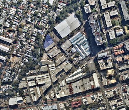
Figure 1- Location of site (shown in blue) in the context of Camperdown precinct (shown in red).
![]()
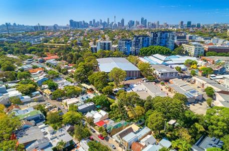
Figure 2 Aerial view of the site (shown in red) looking towards the CBD.

![]()
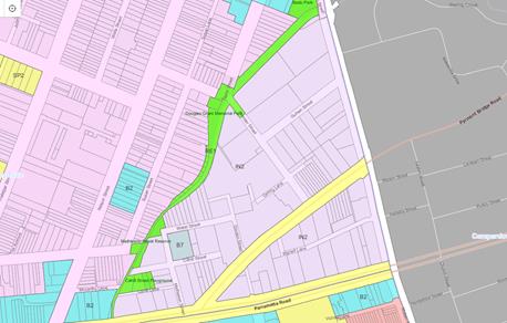
Figure 3 - Extract from the zoning map of LLEP 2013. Subject site shown in red.
The site currently accommodates a part one and part two storey industrial building, which provides car repair services (Figure 4). The northern boundary of the site adjoins Johnstons Creek. There are one and two storey single residential terrace dwellings to the north and east of the site and two or three storey industrial warehouse buildings to the south and west.
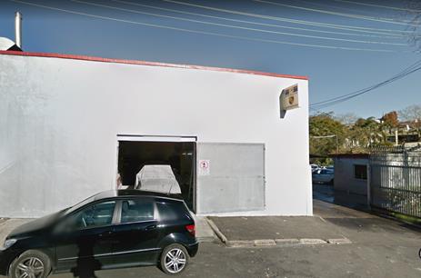
Figure 4 - Existing warehouse when viewed from Chester Street.
![]()
![]()
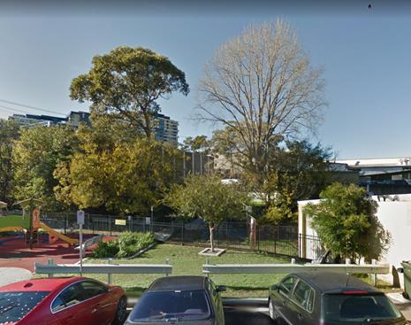
Figure 5 - Subject site when viewed from Douglas Grant Memorial Park.
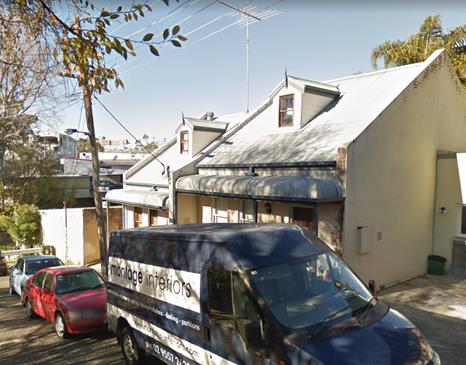
Figure 6 - Surrounding residential buildings to the north of Johnstons Creek.
Figure 7 - Kennards Storage Warehouse at 1 - 19 Booth Street opposite the subject site
The site is in an IN2 Light Industrial zone under LLEP 2013 which states the following objectives for the zone:
· To provide a wide range of light industrial, warehouse and related land uses.
· To encourage employment opportunities and to support the viability of centres.
· To minimise any adverse effect of industry on other land uses.
· To enable other land uses that provide facilities or services to meet the day to day needs of workers in the area.
· To support and protect industrial land for industrial uses.
· To retain existing employment uses and foster a range of new industrial uses to meet the needs of the community.
· To ensure the provision of appropriate infrastructure that supports Leichhardt’s employment opportunities.
· To retain and encourage waterfront industrial and maritime activities.
· To provide for certain business and office premises and light industries in the arts, technology, production and design sectors.
The site has a maximum permissible FSR of 1:1 and no height control in the LLEP 2013. The public reserve to the north of the site is zoned RE1 Public Recreation. The application proposes to rezone the site to R3 Medium Density Residential, increase the FSR of the site to 2.6:1 and introduce a height control of 17m.
The site is a Flood Planning Area and has a 100 year Flood Planning Level plus 500mm freeboard requirement, which indicates that the minimum freeboard floor level of the development including units/ dwellings should be a minimum of RL5.45.
The basement carpark needs to be protected up to the Probable Maximum Flood (PMF) level which is RL8.40. There is no minimum RL for the basement; however any part of the basement below the flood level will have to be flood proofed up to the PMF level.
The site does not contain heritage items and is not within any conservation area but is adjacent to the Draft Annandale Conservation Area extension.
3.0 BACKGROUND
The site is in the Camperdown precinct of Parramatta Road Corridor Urban Transformation Strategy (PRCUTS) which is a State Government endorsed strategy for the revitalisation of Parramatta Road corridor given statutory force via a Section 9.1 Ministerial Direction in November 2016 (Figure 8).
PRCUTS is a plan to drive and inform land use planning and development decisions as well as long term infrastructure delivery programs in the Parramatta Road Corridor. The Strategy is supported by an Implementation Tool Kit and comprises the following documents:
· Parramatta Road Urban Transformation Strategy
· Implementation Tool Kit:
Ø Implementation Plan 2016 - 2023
Ø Planning and Design Guidelines
Ø Infrastructure Schedule
Ø Urban Amenity Improvement Plan
Delivery of the Strategy relies on the implementation of the principles in PRCUTS and will occur over 30 years in the following indicative timeframes:
· Short term - 2016 - 2023
· Medium term - 2023 - 2036
· Long term - 2036 - 2050
The site is outside the PRCUTS '2016 - 2023 Release Area' which means that the redevelopment of the site should ideally be in the medium to long term between 2024 and 2054.
The Strategy will be implemented through:
· State Environmental Planning Policies for priority precincts (in the corridor to the west of the IWC local government area)
· Planning proposals prepared by landowners or developers
· Comprehensive LEP reviews undertaken by councils
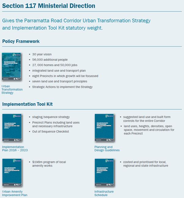
Figure 8 - Structure of Parramatta Road Strategy Documents.
The key targets in the Strategy for the Camperdown area are:
· 1,400 new people by 2050
· 700 new homes by 2050
· 2,300 new jobs by 2050
Figure 9 illustrates the broad PRCUTS land use policy directions for the Precinct.
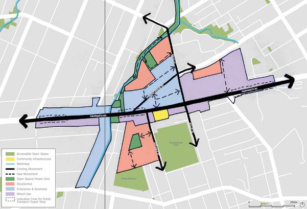
Figure 9 - Structure plan for the redevelopment of Camperdown precinct
PRCUTS sets out key actions associated with land uses; transport and movement; place-making; and open space, linkages and connections; and makes recommendations for future zoning, height and density controls to ensure a place-based approach for future development of the Corridor. Key actions related to the subject site and Camperdown precinct are considered in more detail later in this report.
The PRCUTS Implementation Plan 2016 - 2023 provides a methodological and sequential approach for growth and the alignment of infrastructure provision with that growth. As noted earlier, the site is outside the PRCUTS '2016 - 2023 Release Area' which means that the redevelopment of the site should ideally be in the medium to long term between 2024 and 2054. (Refer to the Figure 10 below).
![]()
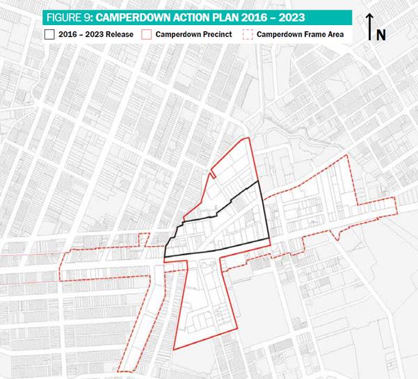
Figure 10 - Extract from the PRCUTS Implementation Plan - Camperdown Action Plan 2016 - 2023. Subject site out of the 2016 - 2023 release area shown in blue.
Proposals that depart from this staging need to be assessed on their merit against the PRCUTS 'Out of Sequence Checklist' criteria to ensure that changes to the land use zones and development controls are timely and can be justified against the Principles and Strategic Actions of the Strategy.
PRCUTS recommendations and requirements have been taken into consideration in the assessment of this Planning Proposal.
4.0 THE PLANNING PROPOSAL
The Planning Proposal seeks to amend the provisions of LLEP 2013 for land use, FSR and height of building as they apply to the site. The application is supported by information as follows:
· Urban Design Report by ae design partnership for a residential building of part 5 part 6 storeys and one level of basement;
· Site-specific LDCP 2013 amendment;
· Letter(s) of offer - Local and State contributions by ae design partnership;
· Traffic and Transport Assessment by Varga Traffic Planning;
· Economic Impact Assessment by AECOM;
· Environmental Assessment Report and Remedial Action Plan by Covas Pty Ltd;
· Heritage Impact Assessment by Architectural Projects Pty Ltd;
· Social Impact and Housing Affordability Assessment Report by Cred Consulting;
· Flooding and Stormwater Management Planning Report by Sparks and Partners;
· Acoustic Assessment by Corvas Pty Ltd;
· PRCUTS Out of Sequence documents:
Ø Design Excellence Statement by ae design partnership and DKO Architecture;
Ø Stakeholder Engagement Report by Ethos Urban; and
Ø Integrated Infrastructure Delivery Plan by Northrop.
The application primarily relies on the land use and development controls recommended in the PRCUTS including zoning and height recommendations to justify the Planning Proposal. The Proposal heavily relies on the recommended height control (17m) in PRCUTS to justify the increased FSR of 2.6:1 which would breach the recommended PRCUTS FSR of 1.5:1. The proposal would result in a part 5/ part 6 storey development with 42 units and one level of basement car parking.
The following table provides a comparative analysis of the site's current controls, PRCUTS recommended controls and the proponent's proposed controls:
|
Criteria |
Current LEP controls |
PRCUTS recommendations |
Proposed Controls |
|
Zoning |
IN2 Light Industrial |
R3 Medium Density Residential - Focus residential development on student, key worker and affordable housing.
|
R3 Medium Density Residential - Market Housing. |
|
|
|
|
|
|
FSR |
1:1 |
1.5:1 |
2.6:1 |
|
|
|
|
|
|
Height |
No control |
17m (or 4 storeys) |
17m (or 6 storeys) |
|
|
|
|
|
Table 1 - Comparison of the site's existing, recommended (PRCUTS) and proposed controls.
5.0 ASSESSMENT OF THE PLANNING PROPOSAL
The Planning Proposal application including the supporting documentation has been assessed with consideration given to current planning strategies and controls at State and local level, strategic planning projects currently underway and the Department of Planning's A Guide to Preparing Planning Proposals.
Overall, it is considered that the Planning Proposal provides adequate documentation for Council to determine whether the Planning Proposal has merit to proceed to the Gateway Stage. However, there are key issues with the Planning Proposal as discussed further in this report which indicate that the Planning Proposal should not be supported in its current form. A detailed assessment of the Planning Proposal is also provided in the Planning Proposal assessment checklist attached to this report (Attachment 1).
Without prejudicing the final conclusion of this assessment, the detailed level of information provided by ae design for the proposed medium density residential development is thorough and comprehensive. However, the proposal does not adequately pass the overall strategic test and should not be supported in its current form. The following discussion highlights the key issues.
The tabulated analysis below assesses the adequacy of the supporting information supplied with the Planning Proposal and whether it meets the aims and objectives of the strategic framework in DPE's 'Guide to preparing planning proposals.'
Part 1 Objectives and intended outcomes
|
|
Guideline Requirements |
|
2.1 |
Requires a concise statement setting out the objective or intended outcomes of the planning proposal. |
|
|
The proponent's stated objectives or intended outcomes are unsatisfactory because:
· 'A guide to preparing planning proposals' requires a concise statement setting out the objectives or intended outcomes of the planning proposal. The proponent's statement is not specific enough to reliably define the likely outcome of the proposal.
· In terms of overall strategic merit, it is agreed that the subject site has potential to accommodate residential uses, increased FSR and height controls. The site is located in Parramatta Road Corridor Urban Transformation Strategy (PRCUTS) area which has a recommendation for rezoning from industrial to medium density residential. However, the Planning Proposal is inconsistent with a number of other key recommendations of PRCUTS as detailed later in this report and consequently, should not be supported.
· The Proposal suggests it would provide affordable/ student housing in accordance with the development incentives available in State Environmental Planning Policy (SEPP) (Affordable Rental Housing) 2009, but only in the context of a future development application. The proponent's objective is misleading as affordable housing that might be provided at the development application stage subject to the bonus floor space provisions of the SEPP 2009 is not directly related to the intent of this Planning Proposal.
· The Proposal also seeks to provide open space along the site's northern edge as part of an open space and movement corridor along Johnstons Creek between Booth Street and Parramatta Road. The proponent's objective is considered to be acceptable; but no clear provision has been made in the Proposal to make this useful public open space as explained later in this report. |
Part 2 Explanation of Provisions
|
|
Guideline Requirements |
|
2.2 |
Requires a more detailed statement of how the objectives or intended outcomes are to be achieved. |
|
|
The proponent has addressed this requirement but the Planning Proposal is not supported for the reasons expressed above and in other sections of this report. |
Part 3 Justification
|
|
Guideline Requirements |
|
2.3 |
Requires adequate justification documentation to be provided for the specific land use and development standards proposed to the LEP. |
|
2.3.1 |
Questions to consider when demonstrating the justification |
|
Section A - Need for Planning Proposal |
|
|
Q1 |
Is the planning proposal part of any strategic study or report? |
|
|
The subject site forms part of the PRCUTS which recommends future development controls for the site. However, as detailed later in this report, the Proposal is inconsistent with the requirements of PRCUTS including the Implementation Plan 2016 - 2023 Out of Sequence checklist and its Planning and Design Guidelines and should not be supported. |
|
Q2 |
Is the planning proposal the best means of achieving the objectives or intended outcomes, or is there a better way? |
|
|
The PRCUTS includes the Parramatta Road Corridor Implementation Toolkit which recommends that one of the pathways to implement the recommended land uses and development controls identified within the Strategy is the LEP Gateway (Planning Proposal) process.
However, this Planning Proposal departs from the staging identified under the Implementation Plan 2016 – 2023 and comes in advance of studies and strategies underway at local and State government to inform future development controls for the PRCUTS corridor, the Camperdown Ultimo Collaboration Area, and the new Inner West Council local area.
The future of the Proposal site should be considered as part of the broader strategic planning framework rather than an ad hoc Planning Proposal. This would ensure that a systematic approach will be taken when determining the future development of the site and the surrounding area. It would be best, therefore, to defer the Proposal until the finalisation of comprehensive IWC LEP, DCP and Infrastructure Contributions Plan which would also potentially align with the staging sequence recommended in PRCUTS Implementation Plan 2016 - 2023. |
|
Section B - Relationship to strategic planning framework |
|
|
Q3a |
Does the proposal have strategic merit? Is it: |
|
i. |
Consistent with the relevant regional plan outside of the Greater Sydney Region, the relevant district plan within the Greater Sydney Region, or corridor/precinct plans applying to the site, including any draft regional, district or corridor/precinct plans released for public comment. |
|
|
The following regional/district/corridor plans apply to the site:
· Greater Sydney Region Plan 2018 (GSRP) - A Metropolis of Three Cities · Eastern City District Plan (ECDP) 2018 · Parramatta Road Corridor Urban Transformation Strategy (2016)
The Planning Proposal is consistent with some of the objectives and actions of GSRP and ECDP but fails to achieve sufficient consistency with following key objectives of GSRP and priorities of ECDP. A detailed analysis of the Proposal against these directions, objectives and priorities is provided in Attachment 1.
Direction 1: A city supported by infrastructure
· Objective 2: Infrastructure aligns with forecast growth - growth infrastructure compact. · Strategy 2.1 - Align forecast growth with Infrastructure. · Strategy 2.2 - Sequence infrastructure provision across Greater Sydney using a place-based approach.
· E1: Planning for a city supported by infrastructure.
Direction 2: A collaborative city
· Objective 5: Benefits of growth realised by collaboration of governments, community and business.
· E2: Working through collaboration. o Action 7: Identify, prioritise and deliver Collaboration Areas.
Direction 3: A city for people
· Objective 6: Services and infrastructure meets communities' changing needs. · Objective 9: Greater Sydney celebrates the arts and supports creative industries and innovation. · E3: Providing services and social infrastructure to meet people's changing needs. Direction 4: Housing the city
· E5: Providing housing supply, choice and affordability with access to jobs and services.
Direction 7: Jobs and skills for the city
· Objective 23: Industrial and urban services land is planned, retained and managed. · Strategy 23.1: Retain, review and plan industrial and urban services land in accordance with the principles for managing industrial and urban services land. · E11: Growing investment, business opportunities and jobs in strategic centres. · E12: Retaining and managing industrial and urban services land. Direction 8: A city in its landscape
· Objective 27: Biodiversity is protected, urban bushland and remnant vegetation is enhanced. o Strategy 27.1 - Protect and enhance by: § Managing urban bushland and remnant vegetation as green infrastructure § Managing urban development and urban bushland to reduce edge effect impacts.
· Objective 31: Public open space is accessible, protected and enhanced. · Objective 32: The Green Grid links parks, open spaces, bushland and walking and cycling paths. · E15: Protecting and enhancing bushland and biodiversity. · E17: Increasing urban tree canopy cover and delivering Green Grid connections. · E18: Delivering high quality open space. Direction 9: An efficient city
· Objective 33: A low-carbon city contributes to net-zero emissions by 2050 and mitigates climate change. · Objective 34: Energy and water flows are captured, used and re-used. · Objective 35: More waste is re-used and recycled to support the development of a circular economy. · E19: Reducing carbon emissions and managing energy, water and waste efficiently. The Planning Proposal is also inconsistent with Strategy documents in the following ways:
Parramatta Road Corridor Urban Transformation Strategy (PRCUTS) 2016 Policy Framework:
The Planning Proposal does not adequately contribute towards achievement of the following Key Actions:
Land Uses · Prioritise Camperdown Precinct for biotechnology and employment uses that support the growth of the nearby institutions · Focus residential development on students, key workers, and affordable housing. Open space, linkages and connections: · Provide new open spaces in the Hordern Place Industrial Area, and in the north of the Precinct adjacent to Johnstons Creek. · Prioritise works to complete the Johnstons Creek green corridor, connecting the Precinct to the Bicentennial Parklands and the harbour foreshore walks. · Provide new cycle routes along Johnston’s Creek, Mathieson Street, Chester Street and Guihen Street to improve connections with other cycleways. PRCUTS Implementation Plan 2016 - 2023: The Planning Proposal departs from the staging identified under the Implementation Plan 2016 – 2023. It also does not meet the criteria of the Out of Sequence checklist as detailed in the Attachment 2 and therefore, should not be supported. PRCUTS Planning and Design Guidelines: The large bulk and scale of the proposed development in association with its approach to urban design and relationship to the surrounding area make the Planning Proposal inconsistent with the following sections of Camperdown Guidelines:
· 12.4 - Future Character and Identity · 12.5 - Open Space, Linkages and Connections and Public Domain · 12.8 - Green edge setbacks, Transitions and Activity and Commercial Zones · Recommended Planning Controls o Land use (textual) o Building Heights (textual) o Densities (Map) PRCUTS Infrastructure Schedule The Planning Proposal is supported by an Integrated Infrastructure Delivery Plan (IIDP) prepared by Northrop (Attachment 15) which attempts to populate the Infrastructure Schedule for the Camperdown precinct.
Council officers are of the view that the PRCUTS's Infrastructure Schedule cannot be readily applied to determine accurate infrastructure contributions as the Council and State Government have not yet completed the infrastructure, transport and traffic studies necessary to update the 2016 cost estimates or capture the costs of infrastructure not covered by the Schedule.
In this context, the Schedule acknowledges that it is based on a high level analysis of population, dwelling and employment projections for the Corridor that will require additional detailed investigation. There are also gaps in this Schedule which cannot adequately be addressed until such time as Council implements a new local Contributions Plan. Its preparation will require additional analysis including audits of existing facilities and preparation of needs studies for the wider local government area beyond the Corridor.
There are reservations about the methodology used; formulas applied and the conclusions of the IIDP. Overall, it is noted that the proponent has underestimated the level of construction rates for projects listed, but not quoted in the Infrastructure Schedule. The Council's Property Capital Projects team have provided the following detailed analysis of these proposed rates in the Infrastructure schedule (p. 55 of Attachment 15): Active Transport Network · Items 1-13: These works cannot be precisely estimated as the scope of works is broad and generic. Notwithstanding this the proposed base rate of $225/m is very low and the recommended rate would be approximately $350/m with some works such as site establishment being as high as $950/week. Community Infrastructure · Item 14 - Meeting Space: Proponent's rate equates to $2,500/ m2 for a new building. This is very low and is anticipated to be approximately $3,500/m2 or $1.5M. · Item 15 - Cultural space: Proponent's rate equates to $200K/ building refurbishment which is low. This is generic without knowing which buildings are chosen and the extent of the refurbishment. In Council's view the rates should be approximately $350K-$400K per building. · Item 16 - Childcare: Council recently completed a 60 places childcare building at Leichhardt park for $3.5M. Using this rate would mean 49 places equates $2.86M. The rate quoted ($2M) is poor and probably excludes landscaping, furniture, fixtures and equipment. · Item 17 - Outside of school hours: Should be the same as above. Road/ Intersection Upgrade · Item 18: This rate cannot be adequately commented until Council has completed its precinct wide traffic modelling; Open Space and Recreation · Item 19–24: All the proposed rates are too generic and may apply to other areas of Sydney, however all IWC grounds usually have some form of contamination and the remediation costs are quite high. That rate should be more like $400/m2. Camperdown Precinct Urban Amenity Improvements Program · Items 26-27 Proposed cycling link: The proposed rates for design, lighting and a proper cycling path have been very poorly quoted. Based on Council's recent works or the upgrade of the path (2.5m to 3m asphalt footpath and new lights between Marion Street and Parramatta Road, the rate ended up in the vicinity of $1,600/ m). For new work this should be more like $1,800- $2,000/m instead of the proposed rate $255/m.
Council is currently preparing its new developer contributions plan which will build financial capacity for provision of additional infrastructure in the Corridor and support future population growth in the Inner West LGA. In the absence of this critical information, Council officers are not in a position to reliably confirm the proponent's calculations and rates. Local infrastructure cannot be adequately levied for this type of proposed spot rezoning in the PRCUTS corridor until IWC adopts a new developer contributions plan.
Support of this Proposal could compromise the holistic and inclusive basis for achieving wider strategic planning objectives at local and State government level.
PRCUTS Urban Amenity Improvement Plan (UAIP) UAIP identifies the following works for Camperdown precinct: · New north-south pedestrian and cycle connection along Johnstons Creek from Booth Street to Parramatta Road (Refer to the image below). · Public domain improvements and cycle connection to Pyrmont Bridge Road between Parramatta Road and Mallett Street.
Figure 11 - Extract from the UAIP (page 35) indicating the required infrastructure improvements for Camperdown precinct. The identified works in point 1 above are the most relevant works for this Proposal site which adjoins Johnstons Creek but PRCUTS also identifies the following related projects:
· Concrete shared path between Badu Park and Chester Street playground · Lightweight cantilevered walkway over the existing channel between Chester Street playground and Mathieson Street. The proposed conceptual diagram in the above Figure 11 envisages a landscaped edge along both sides of the stormwater channel. The concept design for the Planning Proposal does not make an adequate contribution towards achieving this vision. The proposed basement setback (nil to 2m) cannot accommodate the modest to large scale trees that would be needed to create this 'landscaped edge'.
It is also envisaged that this landscaped edge would be a continuous link along the eastern side of Johnstons Creek. Support of this concept design without an adequate landscaped setback would set an adverse precedent for the landowners and developers of adjoining properties and compromise Council's vision to achieve a green corridor along the creek.
In addition, the original Planning Proposal sought to provide a new east-west pedestrian and cycling bridge at the south-western end of the site. This second bridge was considered unnecessary in light of Council's own current project to reinstate the existing bridge at the northern end of the site and would replicate its function. The proposed extra bridge also would not provide a link between any key points other than the site itself and would therefore, be superfluous. The revised Planning Proposal submitted in response to Council's preliminary comments deletes the proposed bridge and seeks to make contributions towards Council's replacement of the existing bridge.
A new north-south pedestrian and cycle link along Johnstons Creek corridor on the subject site and across the neighbouring sites is desirable as recommended in PRCUTS. Council officers are not in a position yet to confirm the finer details of the envisaged north-south Johnstons Creek link as no associated work or studies have been undertaken at this stage to identify the cost/ delivery mechanisms and design for these works.
Any monetary contributions or potential land reservations required for the delivery of these works, therefore, cannot be accurately determined at this stage. The Planning Proposal should not be supported until such time as Council completes this piece of work and other broader strategic planning works which would assist in the making of an informed decision regarding the redevelopment of this site. PRCUTS Precinct Transport Report From a transport and traffic perspective with information currently available, the projected traffic volume levels (both the applicant’s and Council’s estimates) are generally acceptable for the adjacent street network. In addition, as the precinct develops public transport along Parramatta Road should be enhanced and mode share should increasingly move toward sustainable transport modes with a reduction in private vehicle use.
The proposed design concept indicates a mix of 1 and 2 bedroom apartment units with 15 one bedroom units and 27 two bedroom units. In accordance with the recommended maximum car parking rates in the PRCUTS Precinct Transport Report for Camperdown, the Proposal should provide a maximum of 23.4 car parking spaces (calculated @ 0.3 spaces for 1 bedroom and 0.7 spaces for 2 bedroom units).
In the proponent's letter to Council dated 29 May 2018, it was indicated that the proposal would provide 24 car parking bays 'less than the maximum requirement of PRCUTS'. This calculation is incorrect as the 23.4 car parking spaces would only be acceptable if the Proposal met he PRCUTS recommendations for provision of car sharing, unbundled or decoupled parking. The proponent has indicated that car share, unbundled or decoupled parking will not be considered until the future development application stage so the proposal fails to demonstrate how these measures could be achieved at the Planning Proposal stage.
It should also be acknowledged that until Council adopts new Development Control Plan parking controls, the Proposal's parking provision does not comply with LDCP standards.
The PRCUTS Precinct Transport Report also stipulates that 'prior to any rezoning commencing, a Precinct wide traffic study and supporting modelling be completed which will consider the proposed land uses and densities, as well as future WestConnex conditions, and identify the necessary road improvements and upgrades that are required to be delivered as part of any proposed renewal in the Camperdown precinct'.
This Planning Proposal comes in advance of any such work being completed and should not be supported.
PRCUTS Fine Grain Study: The Proposal has been assessed in detail against the requirements of the Fine Grain Study in Attachments 1 and 2.
The Planning Proposal does not adequately meet the Fine Grain planning and design guidelines and should not be supported. PRCUTS Sustainability Implementation Plan The Planning Proposal relies on a future Development Application to demonstrate consistency with the relevant Sustainability and Resilience Principles. This is inconsistent with the recommendations of the PRCUTS which require a 'Planning Proposal' to sufficiently demonstrate that it would achieve or exceed the sustainability targets as identified in the Strategy. Conclusion: The Planning Proposal fails to meet the Strategic Merit test as it is inconsistent with the GSRP, ECDP and PRCUTS and therefore, should not be supported. |
|
ii. |
Consistent with a relevant local council strategy that has been endorsed by the Department. |
|
|
At this stage, there are no relevant local strategies that have been endorsed by the Department that are applicable to the site.
Inner West Council is currently preparing a wide range of broader strategic planning work including but not limited to:
· Local Housing Strategy · Local Strategic Planning Statement · Employment Lands Review · Local Infrastructure Contributions Plan · Integrated Transport Plan · Comprehensive IWC LEP and DCP · Affordable Housing Contribution Scheme · Camperdown Ultimo Collaboration area framework · PRCUTS precinct wide traffic modelling
This work is currently underway and will potentially be endorsed by the Department over the next 1 - 3 years. This work will be the key to making informed decisions in relation to the future development and rezoning of this site and other sites in the precinct.
Given the significance and timing of this strategic planning work, it is recommended that this Planning Proposal be deferred until such time as Council adopts and publishes the IW LEP and DCP. This will allow Council to apply an integrated land use and infrastructure approach across the local government area to deliver coordinated outcomes for housing, jobs, transport infrastructure, social infrastructure, open spaces and urban services land.
Support of this Proposal in its current form and timing would compromise the holistic and inclusive basis of this wider strategic planning exercise and weaken Council's decision making process.
It is recommended that the Planning Proposal should not be supported. |
|
iii. |
Responding to a certain change in circumstances, such as investment in new infrastructure or changing demographic trends that have not been recognised by existing planning controls. |
|
|
PRCUTS identifies changing demographic trends for the Corridor and provides possible future land use and built form controls to respond to these trends.
The Proposal is inconsistent with the projected demographic trends in Parramatta Road Corridor Strategy for Camperdown precinct. The Strategy forecasts that there would be 700 new dwellings in the precinct by 2050. However, there is no proposed indicative increase in residential Gross Floor Area until after 2023 as shown in the table below; in other words no new residential development is envisaged in the Camperdown precinct before 2023.
Table 2 - Extract from PRC Planning and Design Guidelines (p. 256) The Planning Proposal also comes in advance of any infrastructure improvements in the area especially for public transport on Parramatta Road.
This Proposal would result in additional dwellings in the short term without these improvements in infrastructure which would be key to realising the vision of this Strategy. The PRCUTS Implementation Plan provides an 'Out of Sequence' checklist which prescribes a merit assessment process to determine whether proposals that are not fully aligned with the Implementation Plan should proceed before 2023. As detailed in the Attachment 2, the Planning Proposal fails to meet this Out of Sequence test and should not be supported. |
|
Q3 |
Does the proposal have strategic merit with regard to the following: |
|
i. |
the natural environment (including known significant environmental values, resources or hazards) |
|
|
The Proposal is considered to be unsatisfactory in this regard. The site is affected by a significant flood risk along the Johnstons Creek boundary. The proponent's concept design provides a 5m setback on the lower ground level to the new dwellings along Johnstons Creek site boundary but the basement is only setback by nil to 2m from the creek boundary. This is insufficient to allow the planting of modest sized trees required to enhance the natural environment of Johnstons Creek.
Should the Planning Proposal proceed, the basement would have to be setback in line with the upper levels of the building to accommodate modest sized tree plantings. |
|
ii. |
the existing uses, approved uses, and likely future uses of land in the vicinity of the proposal |
|
|
These would be same specifically PRCUTS strategic merit in rezoning the site from industrial to residential.
However, the Proposal comes in advance of broader strategic planning work including preparation of the Local Housing Strategy, implementation of the Camperdown Ultimo Collaboration Area initiative and an Employment Lands Review. These studies should be completed to allow an informed decision in relation to the future uses of the site and its possible rezoning from industrial to residential.
In the absence of this important work, the Proposal does not have adequate site-specific merit to support its rezoning. |
|
iii. |
The services and infrastructure that are or will be available to meet the demands arising from the proposal and any proposed financial arrangements for infrastructure provision. |
|
|
The Planning Proposal would result in a small increase in population density which would place limited pressure on existing services and infrastructure. The Proposal is out of alignment with the proposed infrastructure delivery schedule for Parramatta Road corridor.
The Proposal does offer to make financial agreements for infrastructure provision at local and State level but its suggested contributions and scope of works are inadequate as discussed previously.
Council is currently preparing its new infrastructure contributions plan which will build financial capacity for provision of additional infrastructure in the Corridor and support future population growth in the Inner West LGA. Local infrastructure cannot be adequately levied for this type of proposed spot rezonings in the PRCUTS corridor until such time as IWC adopts a new Developer Contributions Plan.
At this stage, Council cannot make an informed decision regarding the redevelopment of the site or any site along the PRCUTS corridor.
It is recommended that the Proposal is not supported until such work has been completed by Council.
|
|
Q4 |
Is the planning proposal consistent with a council's strategy or other local strategic plan? |
|
|
The Planning Proposal is inconsistent with the following local council strategies and plans:
Inner West Council Community Strategic Plan (See Attachment 1 for assessment) · Strategic Direction 1: An ecologically sustainable inner west o 1.1 The people and infrastructure of Inner West contribute positively to the environment and tackling climate change. o 1.2 Inner West has a diverse and increasing urban forest that supports connected habitats for flora and fauna.
· Strategic Direction 2: Unique, liveable, networked neighbourhoods o 2.1 Development is designed for sustainability and makes life better. o 2.2 The unique character and heritage of neighbourhoods is retained and enhanced. o 2.3 Public spaces are high-quality, welcoming and enjoyable places, seamlessly connected with their surroundings. o 2.4 Everyone has a roof over their head and a suitable place to call home. o 2.6 People are walking, cycling and moving around Inner West with ease.
· Strategic Direction 3: Creative communities and a strong economy o 3.1 Creativity and culture are valued and celebrated. o 3.2 Inner West is the home of creative industries and services. o 3.3 The local economy is thriving. o 3.4 Employment is diverse and accessible.
· Strategic Direction 5: Progressive local leadership o 5.3 Government makes responsible decisions to manage finite resources in the best interest of current and future communities. Leichhardt Integrated Transport Plan The Planning Proposal comes in advance of the completion of traffic and transport studies to determine the cumulative traffic impacts of the Corridor transformation and what infrastructure provision is needed to accommodate these impacts. Although the Proposal is too small to have significant detrimental impacts on adjacent road intersections, there are concerns regarding the area-wide implications of the cumulative effect of PRCUTS developments. Support of this Planning Proposal ahead of the current IWC Parramatta Road Corridor traffic modelling would set a premature and adverse precedent in the area and would be inconsistent with the requirements of Out of Sequence Checklist. Detailed comments are provided in Attachment 2. Leichhardt Economic and Employment Development Plan (EEDP) - (Outcome 4 - Protect and Leverage Economic Assets) There are currently a number of contradictory policies at State and local level regarding the protection of industrial land. These include the Leichhardt EEDP. The proponent gives precedence to PRCUTS and the associated Section 9.1 direction to make the case for rezoning from industrial to residential. The proponent also claims that the proposed development would incorporate 2 Small Office, Home Office (SOHO) units creating 8 professional services jobs. It is acknowledged that the Planning Proposal for rezoning has some merit in the context of Section 9.1 Direction 7.3 ‘Parramatta Road Corridor Urban Transformation Strategy’ and the broad policy direction of the Strategy. However, the former Leichhardt Council in its 2016 approval of its Industrial Precinct Planning report for exhibition indicated serious concerns about the loss of industrial land in the LGA in general and in each precinct including Camperdown. In addition, the proponent's justification for loss of industrial land by providing SOHO units creating 8 jobs in the area is considered to be unsatisfactory. The industrial lands are required for economic and employment purposes and 2 live work units are not an adequate replacement. Furthermore, the PRCUTS recommendation to rezone the site to residential is in itself somewhat at odds with the Camperdown precinct's future role as a specialised medical and health precinct. The biotechnology hub role for Camperdown also underpins the work that Council is currently undertaking in collaboration with the GSC to inform the vision and narrative for the Camperdown Ultimo Collaboration Area. Council's support for this Proposal would be a departure from a consistently held strategic planning position to resist rezoning industrial lands for residential or mixed use purposes in former Leichhardt Council LGA. Any form of residential development within the precinct may set a precedent for further development resulting in loss of biotechnology employment generating land. Council will be reviewing all its employment lands as part of the wider LEP integration work. The Planning Proposal is considered to be premature in this respect and should not be supported. The site and its future uses should be planned holistically in the context of the Camperdown Collaboration Area and the Camperdown precinct's contribution to the revitalisation of Parramatta Road Corridor rather than in an ad hoc piecemeal manner. Inner West Council Affordable Housing Policy There are discrepancies throughout the Planning Proposal in relation to Affordable Housing. The proponent mentions that 7.5% of new GFA would be provided as affordable housing but no definite provisions have been made in the Planning Proposal report or supporting letter of offer to demonstrate how this affordable housing would be provided. Part 1 Objectives or Intended Outcomes of the Planning Proposal refers to affordable/ student housing being provided in accordance with the floor space incentives of the Affordable Housing SEPP 2009. This indicates that affordable housing would only be provided over and above the maximum sought FSR of 2.6:1 resulting in a maximum FSR of 2.67:1 (@3% bonus FSR) which would result in a bulkier built form with unreasonable amenity impacts on the surrounding area. This creates an ambiguity in relation to whether the provision of any affordable housing would be through the Planning Proposal process or a future DA. It also creates the possibility that additional FSR could be sought if the PP proceeded to the DA stage.
The proponent's letter to Council dated 31 May 2018 in response to the additional information request from Council states that the ‘Affordable Housing Contribution is provided in addition to the infrastructure contribution’. However, the revised letter of offer to Council dated 28 May 2018 only relates to infrastructure contributions and does not make any offer to provide affordable housing.
In addition, it is noted that the PP documentation refers to the dedication of affordable housing through a covenant on title with dwellings to be operated by a Registered Community Housing Provider. This is inconsistent with Council’s Affordable Housing Policy and would not be supported. The Proposal is also premature in light of Council’s recent inclusion in the SEPP 70 application area which requires Council to prepare affordable housing contribution schemes for relevant proposed developments.
In relation to the suggestion in the Planning Proposal that 7.5% of the additional GFA could be provided as affordable housing, there is no certainty that this would actually materialise in a manner that would meet the requirements of Council’s Affordable Housing Policy, Greater Sydney Region Plan 2018 and Eastern City District Plan 2018.
The Planning Proposal is therefore inconsistent with Council's affordable housing policy and requirements.
|
|
Q5 |
Is the planning proposal consistent with applicable State Environmental Planning Policies? |
|
|
A detailed analysis of the Planning Proposal against the SEPPs has been provided in Attachment 1. The Planning Proposal fails to demonstrate consistency with the following:
SEPP 65 - Design Quality of Residential Apartment Development The Planning Proposal is not adequately consistent with the following design qualities principles of SEPP 65: · Principle 1: Context and neighbourhood character · Principle 2: Built form and scale · Principle 3: Density
The Proposal is also inconsistent with elements of the planning and design criteria required by the Apartment Design Guide (ADG). The proposal raises concerns regarding potential amenity impacts on the surrounding properties as it provides inadequate building setbacks and transitions. A detailed analysis of the proposed design scheme is provided under Q8 further in this report.
SEPP 70 - Affordable Housing (Revised Schemes) IWC has recently been included in the SEPP 70 application area to secure affordable housing in accordance with the Policy. To apply IWC's Affordable Housing Policy under SEPP 70, Council will need to prepare an affordable housing contribution scheme to support each new Planning Proposal where contributions for affordable housing are required. This work has not yet been completed.
Support of this Planning Proposal in advance of Council's broader affordable housing strategic planning work would compromise Council's ability to achieve integrated planning and provide affordable housing.
|
|
Q6 |
Is the planning proposal consistent with applicable Ministerial Directions (s. 9.1 Direction previously s117)? |
|
|
A detailed analysis of the Planning Proposal against the Section 9.1 Directions has been provided in Attachment 1. The Planning Proposal fails to demonstrate consistency with the following Section 9.1 Directions:
1.1 Business and Industrial Zones This s9.1 direction intends to retain the business and industrial zones but it contradicts s9.1 direction No. 7.3 in relation to implementation of Parramatta Road Corridor Urban Transformation Strategy which recommends rezoning of the site from industrial to residential.
Former Leichhardt Council's policies and draft strategies oppose loss of existing industrial land because of the high demand for such land and its critical function in supporting a growing population and economy. Recently completed employment lands peer reviews for industrial land rezoning proposals in IWC confirmed that there is now an even higher demand for, and a shortfall of, available industrial land in South Sydney and North Shore industrial markets (Inner West is in the South Sydney industrial submarket). This is reflected by current high rents and market prices of industrial land in the area.
In the context of this shortfall of employment land at a sub-regional level, as acknowledged in the GSRP and ECDP, and the s9.1 Direction No. 1.1 in relation to protection of employment land in business and industrial zones; it is recommended that the Planning Proposal is not supported.
7.3 Parramatta Road Corridor Urban Transformation Strategy As discussed previously under Q1, the proposal does not fully comply with PRCUTS in the following ways:
· It does not adequately address the Strategic Key Actions relating to Land uses and Open spaces, linkages and connections for Camperdown precinct. · It departs from the Staging identified in the PRCUTS Implementation Plan 2016 – 2023 · It does not adequately meet the Out of Sequence Checklist merit test as: o It fails to demonstrate that it can significantly contribute towards the Strategy’s corridor wide and Precinct specific vision; o It is inconsistent with elements of all seven land use and transport transport planning principles of the Strategy and does not and cannot fulfil all the relevant Strategic Actions for each Principle. o It fails to demonstrate any significant net community, economic and environmental benefits for the Corridor and the Camperdown precinct area. o It is inconsistent with the land uses and building height recommendations in the text of the PRCUTS Planning and Design Guidelines plus others for density, open space, active transport and built form plans for Camperdown precinct area. o It fails to demonstrate that it can achieve outcomes aligned with the desired future character and growth projections for the area identified in the Strategy. o It does not achieve satisfactory design excellence in relation to its proposed built form, density and sustainability outcomes. o It cannot make an appropriate contribution towards the provision of local and state infrastructure as it comes in advance of the Council’s new local contributions plan and the State Government's State Infrastructure Contribution levy. o It does not demonstrate that it can achieve the sustainability targets of PRCUTS. In fact as an Out of Sequence Proposal, it should exceed the targets stipulated in the Strategy considering it's out of sequence nature. o It does not provide a thorough land use and development scenario to demonstrate economic feasibility with regard to the likely costs of infrastructure and the proposed funding arrangements for its delivery in the Camperdown Precinct area. o It does not demonstrate a land use and development scenario that aligns with and responds to the market conditions for the delivery of housing and employment. Unfortunately, in the absence of this information, viability appears to be the only justification driving the redevelopment of the site. · It is inconsistent with the built form envisaged in the Planning and Design Guidelines for both the Corridor as a whole and the Camperdown Precinct Guidelines. · It is inconsistent with the type of residential uses recommended in the PRCUTS which should be for key workers, affordable housing and student housing. · It exceeds the recommended density in the Planning and Design Guidelines by 73.3%.
This Planning Proposal relies on the PRCUTS for its justification but fails to satisfactorily address all the requirements of the Strategy as outlined before. PRCUTS requires a substantial contribution towards the Strategy's wider vision for proposals outside the 2016 - 2023 Implementation area. This is particularly difficult to achieve for small sites like Chester Street.
The most appropriate way to facilitate redevelopment of the site and review its land use and development controls will be as part of the broader strategic planning work for Council's new LEP and DCP.
The Planning Proposal is inconsistent with this policy direction and should not be supported at this stage. |
|
Q7 |
Is there any likelihood that critical habitat or threatened species, populations or ecological communities or their habitats will be adversely affected as a result of the proposal? |
|
|
There are no critical known habitat, threatened species, populations or ecological communities or their habitats on the subject site.
There are several trees and other vegetation on the boundary of the subject property with Johnstons Creek which contribute to this green corridor.
The proponent's concept design provides a 5m setback on the ground level to the creek boundary. However, the basement is only setback by 0 - 2m which is insufficient to accommodate medium to large size trees.
Should the Planning Proposal proceed, the proposed design would have to be revised to provide adequate basement and ground level setbacks which would contribute to the green corridor along the creek and enhance the environmental value of the area. |
|
Q8 |
Are there any other likely environmental effects as a result of the planning proposal and how are they proposed to be managed? |
|
|
A detailed analysis of the Proposal's environmental effects is provided below:
Urban Design and Built form The proposed siting strategy is acceptable in view of the irregular shape of the lot as the building form provides an opportunity to address primary and secondary street frontages (Chester Street and Johnstons Creek) (Figure 12). However, the design raises concerns regarding the proposed setbacks, building heights, landscaping, overshadowing of the adjoining properties and self-overshadowing of communal open space and the building itself.
Figure 12 - Extract from the proponent's design scheme with a 5 storey building facing Chester street, 6 storey building facing Johnstons Creek communal open space on the ground level and roof top level.
Figure 13 - Building envelope views including subject site and potential redevelopment of adjoining property. The key concerns in relation to the proposed concept design are detailed below: o Overshadowing: The proposed communal open space on the ground level of the development is completely overshadowed in mid-winter between 9 am to 3pm as shown in the image below. This would adversely impact the amenity of the future residents of the development.
Figure 14 - Overshadowing analysis of the proposed development. o Setbacks: The proposed building setbacks are insufficient. These do not meet the minimum requirements of the Apartment Design Guide (ADG) and could result in adverse impacts on the surrounding area.
o Setback to Chester Street: The proposed 5 storey development provides a nil setback to Chester Street. This would result in a large portion of the site being built to the street boundary without adequate setbacks and transitions. The proponent's intention to reinstate the industrial character of the area through zero street setbacks is acceptable in principle; however it would result in a large bulky 5 storey building on Chester Street which is inconsistent with the existing and future desired character for the area. In particular, it is noted that the proposed schematic design relies on the adjacent site across the street (at No. 8 Guihen Street) to provide an additional setback to offset its own lack of setback (as shown in the section below Figure 15).
Figure 15 - Extract from proponent's Urban Design scheme indicating the relationship of the built form along Chester Street with the adjacent building at No. 8 Guihen Street. Red blurb indicating the potential street widening on the adjacent site. The ADG requires a separation distance of 18m between habitable rooms/ balconies or 12m between habitable and non-habitable rooms for buildings between 5 to 8 storeys. In this regard, the proposal would provide an inadequate separation distance to 8 Guihen Street and restrict its development potential by assuming that this site in another ownership would accommodate any necessary widening of Chester Street. This approach is unacceptable and the proponent should work within the constraints of their own site without relying on the contribution of setbacks/ widenings from adjacent sites. Notwithstanding this 5 storey street wall height along Chester Street is also inconsistent with the character of the surrounding area. In this regard, upper levels should be setback to reinforce the desired scale of buildings at the street frontage. The proponent has also not demonstrated how the proposed development would maintain the visual privacy of future residents. The proposed units on the ground floor along Chester Street do not provide adequate visual/ acoustic privacy (as shown below in Figure 16).
Figure 16 - Indicative ground level of the proposed development. In addition, a ground level setback to Chester Street would be desirable: o to improve passive surveillance and ensure that a person on a balcony or at a window can easily see the street; and o to create a prioritised walking link along Chester Street (as required by PRCUTS) through street and footpath widening.
o Setback to Johnstons Creek: The proposed development provides a 5m setback to the ground level units facing Johnstons Creek and a 0 - 2m setback to the basement along this frontage. It is noted that the proposed design does not contribute much towards the enhancement of Johnstons Creek corridor as it only provides the minimum setback required from the site boundary to mitigate flood impacts. The proposed basement setback is insufficient to provide deep soil planting for a landscaped edge which would enhance the environmental value of Johnstons Creek.
The site's interface with Johnstons Creek is highly significant as it forms part of the future green link between Parramatta Road and Booth Street leading to Bicentennial Park and the harbour foreshore. The Proposal has the potential to contribute towards the enhancement of this corridor by providing adequate setbacks and building transition but fails to do so adequately.
o Bulk, form and scale - The proposed building height of 5 storeys along Chester Street and 6 storeys along Johnstons Creek raises concerns regarding visual/ privacy impacts on the surrounding properties. The upper levels of the development should be appropriately setback to create a gradual transition towards the lower scale dwellings to the north of the creek and reduce any potential visual/ privacy impacts.
The proposed development would result in a bulky building block facing Johnstons Creek and Chester Street without adequate transitions and articulations. The proposed building elements splayed in triangular fashion result in a poor corner building urban design outcome.
The building form and scale should be redesigned to avoid hard edge environmental outcomes and to ensure that it is not overwhelming for the residential dwellings to the north and west; and for the users of Johnstons Creek public domain corridor.
o Deep soil planting - The proposed basement setback of 0 - 2m is insufficient to accommodate modest deep soil planting including medium and large sized trees. The basement must be adequately setback in line with the upper levels of the building to provide adequate deep soil planting; and potentially enhance and expand Johnstons Creek public domain corridor. Large trees would also soften the visual impact of the building and create a green link along the corridor to provide more open space for the future residents of the development and the surrounding area.
o Communal Open Space - The proponent's design to provide communal open space on the roof is acceptable subject to any visual/ acoustic privacy impacts on the adjoining sites. However, the proposal should not rely completely on roof top open space to meet the requirements of the Apartment Design Guide (ADG) that a minimum 25% of the site area be provided as communal open space. The communal open space should ideally be co-located with deep soil areas to provide an enhanced useable space.
In order to resolve the above design issues, the proposal would have to be revised to reduce the bulk and provide adequate setbacks, articulations and transitions. The recommended density of 1.5:1 and building height of 17m in PRCUTS are appropriate development controls for the site. These would adequately resolve the above issues and achieve a built form that is consistent with the existing and desired future character of the area.
Traffic and Transport
Prior to assessing the traffic and transport impacts in detail, the Planning Proposal must adequately demonstrate that it meets all the criteria of the PRCUTS Precinct Transport Report and Implementation Plan including the current IWC PRCUTS traffic and transport study to proceed to rezoning. There are concerns regarding the potential area-wide implications of a cumulative rezoning/ up zoning of sites in the Parramatta Corridor in the absence of adequate public transport infrastructure. In future as the precinct develops and Parramatta Road is enhanced and mode share moves towards sustainable transport modes; the proponent's projected traffic volumes would generally be at acceptable levels for the adjacent street network. Should the proposal proceed, detailed design aspects, including driveway configuration and pedestrian access points will need to be addressed at the development application stage. Streets in the area are frequented by a mix of traffic and many of the footpaths are narrow and/or in poor condition. This is likely to result in significantly increased pedestrian/vehicle conflict associated with pedestrian’s using the carriageway rather than footpaths. Consequently, care should be taken to ensure pedestrian (and cyclist) safety in the neighbourhood, if this residential development were to proceed. Heritage Any proposed development on the subject site must respond appropriately to the adjoining Annandale Heritage Conservation Area (HCA) and its future extension. In this regard, the proposed development would have to provide appropriate building setbacks and transitions to respect the values and character of the HCA. Noise impact The proposal would not generate any adverse noise impact; however the site is located adjacent to an existing pocket park. The use and enjoyment of the pocket park must be considered when designing the built form. The proposed units on the ground floor along Chester Street do not provide adequate visual/ acoustic privacy for the future residents of the development and surrounding area as discussed previously. The future residents would be significantly affected by the imminent installation of a basketball hoop and concrete pad in the pocket park by Council. The proposed dwellings on the ground floor level are therefore a concern in terms of their relationship with the use and enjoyment of the pocket park. There are similar concerns in relation to the dwellings facing Johnstons Creek which will be close to the future shared path. If the Planning Proposal proceeds to the DA stage, the proposed development consent must be conditioned to incorporate acoustic walls and measures to protect the visual and acoustic privacy of its future residents and ensure long term recreational use of the park and shared path along Johnstons Creek is not compromised by complaints from these residents. Stormwater management and flooding The subject site has significant flooding issues as it is located in a flood prone area and adjoins the Johnstons Creek Stormwater channel. Any proposed development must not increase the risk of flooding of the subject site and other properties along the creek line and should also be designed to improve flood flows. All floor levels for the new development must be at or above the Flood Planning Level (100 year ARI flood level plus 500mm freeboard) or RL 5.45. The proposed basement carpark must be designed to ensure all entries/accesses are located above the Probable Maximum Flood level. The proponent has revised the concept design in response to Council's preliminary concerns. The revised design is set back from the channel by 5 metres to retain the overbank flood flow capacity. A detailed stormwater assessment would have to be provided at the development application stage to ensure that the proposed design meets DCP requirements relating to stormwater design and environmental initiatives. Landscape The site contains a number of existing trees. It is recommended that the proposal be amended to retain and protect the existing trees as per Leichhardt DCP Park C Section 1 C1.14. The lack of deep soil area in the proposal reduces the potential for increasing urban forest canopy. The zero setbacks at basement level would compromise existing trees on the property boundary with Johnstons Creek, despite the 5 metre setback at ground level.
Whilst no detailed landscape plan has been provided, the representations of shrubs shown in the ground floor courtyard, the rooftop and the green privacy buffer on the southern corner, and based on past experience of the size of plants used in such areas, an estimated canopy for the site is one percent. Combined with the possible loss of tree canopy along the boundary with Johnstons Creek the site would suffer net loss of canopy, which conflicts with the State’s urban tree canopy goals and Council’s urban forest policy objectives.
Should the Planning Proposal proceed to Gateway stage, the following design amendments would have to be made:
o An urban forest canopy target for the site of 25% should be achieved.
This reflects the Draft Regional and District Plans goals of increasing urban forest canopy, and also those of the urban forest policies of Inner West Council. 25% is considered an appropriate target for inner city multi-storey residential development.
o A minimum of 10% of the site area should be required as deep soil area, with a minimum dimension of 4 metres (either length or width).
Based on the Apartment Design Guide, Section 3E, 12% of the site would be required as deep soil area to achieve a 25% tree canopy with two large trees. Twice that area would be required for nine medium size trees. A minimum of 4 metres setback for medium size trees and 6 metres for large trees is required for the trees to achieve the desired spread.
o The basement should be setback in line with the ground floor footprint to facilitate a deep soil area and potentially retain the existing trees along the boundary.
o An Arboricultural Impact Assessment (AIA) report incorporating a tree protection plan and specification would be required to be submitted with a DA.
Development planning issues in relation to the existing trees will need to be addressed in more detail with any DA.
o The ground level building on Chester Street should be setback to improve amenity. Tree and understorey planting should be provided along the Chester Street frontage to improve amenity, increase the quality of the streetscape, improve the pedestrian environment and contribute to land value.
o WSUD principles should be incorporated as per the Leichhardt Environmental Sustainability Plan 2015 - 2025 to manage on-site overland water flows and minimse the risk of flooding on adjacent lots. Contamination The subject site has been associated with industrial uses. The proponent has provided a Remedial Action Plan prepared by EI Australia dated July 2017 which concludes that the site can be made suitable for the proposed residential use. Should the Proceed to the Development Application stage, a detailed contamination report, site management plan and hazardous building survey must be provided prior to any demolition or redevelopment. Conclusion The proposal in its current form is likely to result in unreasonable environmental impacts including setting an adverse built form precedent for the surrounding area. The proposal's built form would also be an impediment to achieving Council and UrbanGrowth's vision in relation to a new enhanced green corridor along Johnstons Creek from Parramatta Road to Booth Street.
Whilst it is acknowledged that some of these issues can be resolved by amending the FSR in the Planning Proposal and the proposed built form envelope in the DCP; given the broader strategic planning issues relating to the land use, traffic studies and the inconsistency with the Out of Sequence Checklist requirements of PRCUTS, it would be inappropriate to investigate these issues further as part of this report.
|
|
Q9 |
Has the planning proposal adequately addressed any social and economic effects? |
|
|
Social impact As discussed previously, the Planning Proposal does not make adequate contributions towards the provision of affordable housing. There are also concerns regarding the availability of sufficient social and community infrastructure if the redevelopment of corridor occurs out of alignment with the recommended PRCUTS Implementation Plan.
Economic Impact The proponent has provided an Economic Assessment Impact (EIA) report prepared by AECOM (Attachment 9) which concludes that the Proposal would have a net positive economic impact as it would contribute to the implementation of PRCUTS and assist in alleviating housing price pressure in the former Leichhardt LGA. Consideration has been given to the proponent's EIA and to the PRCUTS Economic Assessment Report which underline the importance of Camperdown Precinct as a mixed use enterprise area with diverse uses to support the education and research activities of the Royal Prince Alfred hospital and universities. As outlined in the preceding sections of this report, Council is currently preparing or participating in the formulation of wider strategic planning polices including a Local Housing Strategy, Employment Lands Review; and the Camperdown Ultimo Collaboration Area in collaboration with the Greater Sydney Commission. This core work is imperative in determining the future land use controls for the site. Whilst the change of zoning for the subject site is supported by PRCUTS, it is believed that an informed decision cannot be made until such time as Council completes this broader suite of strategic planning work. It is, therefore, recommended that the rezoning proposal should not be supported at this stage. |
|
Q10 |
Is there adequate public infrastructure for the planning proposal? |
|
|
As outlined above, there are critical issues with the timing of this Planning Proposal as it comes in advance of any public infrastructure improvements along the corridor including provision of open space, schools, public transport, hospital beds etc. The Planning Proposal is considered to be inadequate in this regard and therefore, should not be supported. |
|
Q11 |
What are the views of State and Commonwealth public authorities consulted in accordance with Gateway Determination? |
|
|
Should the Planning Proposal proceed further, a favourable Gateway determination would identify a full list of public authorities to be consulted as part of the exhibition process. |
|
2.4 |
Mapping |
|
|
The Planning Proposal is supported with a request to amend the FSR and Height of Building Maps of the LLEP.
Given the broader strategic issues and insufficient support for the Proposal, the proposed mapping amendment is not supported.
In the case that Council decides to proceed with the Gateway process, it is recommended that the Planning Proposal be revised. The most appropriate way to facilitate the redevelopment of the site is through an additional site specific local provision clause in the LLEP in place of the proposed map amendments. |
|
2.5 |
Community Consultation |
|
|
If the Planning Proposal was to be supported, given a Gateway Determination and Council was the Planning Proposal Authority; the Proposal would be formally exhibited in accordance with the requirements of the Gateway Determination and Council's Community Engagement Framework. |
|
2.6 |
Project timeline |
|
|
The Planning Proposal provides the necessary timetable. However, this would have to be updated if Council decides to submit the Planning Proposal to the NSW Department of Planning for a Gateway Determination. The Gateway Determination, if granted, would determine the actual milestones and maximum timeline required to complete the LEP amendment. |
6.0 ASSESSMENT OF AMENDMENTS TO LEICHHARDT DEVELOPMENT CONTROL PLAN 2013
As discussed in the previous sections, there are significant concerns with the proposed building envelope, setbacks, separation distances and landscaped area. The high-level assessment of the proposed controls in the draft DCP is synonymous with the assessment of environmental impacts under Q8 of the merit assessment above in relation to the urban design, built form, landscaping noise, traffic and transport and flooding impacts.
The draft DCP amendment is not supported in its current form. It is considered that the most appropriate way to amend the development controls for the site would be to do so in conjunction with the Council's broader strategic planning work in relation to the Local Character Area statements, Local Housing Strategies and a Comprehensive IWC DCP to deliver coordinated outcomes for land use and infrastructure.
7.0 VOLUNTARY PLANNING AGREEMENT (VPA)
ae design partnership has submitted a Public Benefit Offer (Attachment 7) to enter into a VPA and make monetary contributions for the provision of local infrastructure.
The draft Planning Agreement suggests that the Developer would make a contribution to local infrastructure equivalent to $25,113 per dwelling approved at the DA stage and offset by potential works in kind consisting of:
· Possible delivery of a pedestrian bridge over the adjoining Johnstons Creek on Council's behalf to form part of an open space and movement corridor along the creek between Parramatta Road and Booth Street; and
· Improvements to the adjoining existing pocket park at the terminus of Chester Street, south of Johnstons Creek, including:
o Landscaped treatment to enhance the public domain;
o Lighting (4 x pathway bollard lights) to enhance security at night ; and
o Public art including graffiti wall to replace existing graffiti-covered wall within the subject site.
This contribution would be made to the Council in lieu of a Section 7.11 Contribution Plan and separately from any contributions payable to the Department of Planning for regional infrastructure.
The proponent's calculations for infrastructure contributions are based on its own Integrated Infrastructure Delivery Plan (IIDP) prepared by consultants. There are reservations about the methodology used; formulas applied and conclusions of the IIDP. As discussed previously, PRCUTS infrastructure schedule methodology cannot be readily deployed to determine accurate infrastructure contribution rates. The PRCUTS Schedule is based on a high level analysis of population, dwelling and employment projections for the Corridor and requires additional detailed investigation.
It is noted that the estimated costs included in the Schedule are out of date and haven't been reviewed since June 2016. There are also gaps in this Schedule which cannot be adequately determined until such time as Council implements a new local contributions plan. As a part of amending/ updating its local contributions plan, the Council will be required to undertake additional analysis including audits of existing facilities and the preparation of needs studies beyond the Corridor's boundaries.
In addition, it is noted that the Proposal does not intend to make any contributions towards affordable housing which is inconsistent with Council's Affordable Housing Policy and the objectives of the Sydney Region Plan and District Plan.
If Council were to enter into negotiations on a potential VPA, the negotiations should seek the provision of:
· An adequate affordable housing contribution;
· Public domain improvements along Chester Street and Johnstons Creek including the provision of shared path along the creek corridor; and
· Green Star 5 star rating for environmental performance.
Should the proposal proceed to Gateway determination stage and be approved for exhibition, the VPA would have to be negotiated by Council and exhibited concurrently with the Planning Proposal. Council can only negotiate a VPA relating to the Planning Proposal if it is the Planning Proposal Authority.
8.0 FINANCIAL IMPLICATIONS
The proponent has paid fees for the Council's consideration of a Planning Proposal and possible submission to the Gateway process in accordance with IWC's 2017/2018 Fee Structure. An additional Stage 2 fee would be payable to progress the Planning Proposal subsequent to a Gateway determination. The proponent would also have to cover any difference between Council's current 2018/2019 fees and the previous 2017/18 fees.
The proponent would also be responsible for meeting costs associated with revising documentation or studies prior to exhibition required by a Gateway determination and for the peer review of this material or additional studies should they be deemed necessary.
9.0 PUBLIC CONSULTATION
This single site Planning Proposal in the former Leichhardt LGA is inconsistent with Leichhardt Council policies and draft policies and in accordance with the former Leichhardt Council's practice has not been subject of preliminary community consultation.
The proponent has undertaken community consultation for the preliminary Planning Proposal to comply with the Out of Sequence Checklist criteria for stakeholder engagement. This has been documented as part of the Planning Proposal application.
As a part of his stakeholder engagement process, the proponent provided letters to the surrounding business owners, residents and landowners and invited them to a community information session on 12 December 2017. This event was attended by 35 people and a total of 18 written responses were received. 5 submissions (27.77%) were in support of the rezoning proposal and 13 submissions objected to the proposal and raised the following issues:
· Insufficient parking and need for additional off-street parking;
· Concerns regarding amenity, in terms of loss of privacy, inadequate solar access and attracting of anti-social behaviour;
· Inadequate open space and lack of connectivity to other open space precincts;
· Visual and acoustic privacy impacts on the surrounding residents;
· Need to enhance the connectivity of the precinct to the surrounding area and other developments;
· The proposed building height will set an inappropriate adverse precent in the area;
· The development is not supported by adequate infrastructure, such as schools and public transport; and
· The rezoning not be supported and the FSR is inappropriate.
The above issues have been taken into consideration in the assessment of this Proposal.
Should the Planning Proposal proceed to the Gateway Determination Stage, any Council community consultation would be undertaken in accordance with the conditions of the Gateway Determination and Council's Community Engagement Framework.
10.0 INNER WEST PLANNING PANEL ADVICE
In accordance with the Local Planning Panel Direction issued under Section 9.1 of the Act which came into effect on 1 June 2018, a Planning Proposal is to be referred to the local planning panel before it is forwarded to the Minister. In accordance with the Section 2.19 of the Act, the function of local planning panel (in this instance - Inner West Planning Panel) is 'to advise the council on any planning proposal that has been prepared or is to be prepared by the council under section 3.33 and that is referred to the panel by the council'.
The Planning Proposal for 1 - 5 Chester Street, Annandale was referred to the Inner West Planning Panel for advice on 11 September 2018. The Panel report and meeting minutes are provided in Attachment 18. The Panel members agreed with the Council officer's recommendations in principle and made some minor changes to the wording of the recommendation. The Panel's advice has been taken into consideration when making a recommendation to Council in this report.
11.0 ANALYSIS: 1 - 5 CHESTER STREET, ANNANDALE PLANNING PROPOSAL
The Planning Proposal for 1 - 5 Chester Street, Annandale has been reviewed taking into consideration:
· The Parramatta Road Corridor Urban Transformation Strategy endorsed by the State Government on November 2016 and then given statutory force through Section 9.1 Direction in December 2016;
· Principles of the NSW Department of Planning document 'A guide to preparing planning proposals' and 'A guide to preparing local environmental plans'; and
· Applicant's justification to support the Planning Proposal with an FSR and timing that varies from the recommendations of PRCUTS Planning and Design Guidelines and Implementation Plan 2016 - 2023.
Council officers acknowledge the overarching recommendations of PRCUTS for the site including:
· R3 Medium Density Residential Zone
· Maximum height of 17 metres; and
· Maximum FSR of 1.5:1.
It is noted that there are several discrepancies in the recommendations of PRCUTS as the proposed maps and corresponding text do not match up. In this regard, whilst the site has been recommended for rezoning to R3 Medium Density Residential; the Key Actions in the Strategy and Planning and Design Guidelines emphasise that these residential uses should focus on key workers, affordable housing and student housing.
The Strategy also envisages a four storey development with a 17m height control which would create a gradual transition in heights from the future high Gateway building at the Camperdown Triangle where Pyrmont Bridge Road meets Parramatta Road towards the low density residential dwellings along Johnstons Creek. There are also minor anomalies relating to the short-term growth projections for proposed dwellings in the Camperdown precinct and the proposed prioritised walking link for Chester Street in the Open Space and active Transport map.
Overall, it is recognised that the site has the potential to accommodate limited greater density and height than those currently by the LLEP 2013. However, the Planning Proposal fails the Strategic Merit Test as demonstrated in this Planning Report and is inconsistent with a number of key objectives, priorities and actions of the Greater Sydney Region Plan, Eastern Harbour City District Plan and PRCUTS.
Whilst the redevelopment of site could potentially contribute towards more housing and diversity in the local area, its rezoning at this point in time is not crucial to meet the short term housing supply for Inner West LGA.
This Planning Proposal has been prepared as a response to the PRCUTS but it fails to adequately address the Strategy's Vision and Key Actions. It departs from the staging identified under the PRCUTS Implementation Plan 2016 – 2023, fails to meet the Out of Sequence Test and is inconsistent with the recommended density in the Planning and Design Guidelines.
The Planning Proposal does not provide any 'significant net community, economic and environmental benefits for the Corridor Area' nor contribute 'significantly towards the Strategy's Corridor wide and Precinct Specific vision'. It would result in net loss of jobs and reduce the availability of employment lands and urban services as it would rezone a light industrial zoned site to residential. The Planning Proposal is also inconsistent with the PRCUTS - Principle 2. - Diversity and Economy which recommends the use of innovative mechanisms when rezoning sites to broaden the role of urban support service industries.
The Planning Proposal seeks to vary the maximum permissible FSR of 1.5:1 recommended in the PRCUTS by over 70% without making any adequate contribution towards the wider vision of the Strategy or the local area. PRCUTS recommends that development incentives could be provided if urban support services are incorporated in planning proposals. However, in this instance the Planning Proposal seeks FSR incentives without considering the retention or inclusion of these uses.
The Strategy in conjunction with the Greater Sydney Region Plan and the Eastern Harbour City District Plan underlines the importance of the Camperdown Precinct as part of the broader Camperdown Ultimo Collaboration Area with the potential to contribute towards the international competitiveness of Sydney in the biotechnology sector. In this regard, PRCUTS recommends rezoning of a large part of the Camperdown precinct on the north side of the Parramatta Road for Business and Enterprise uses. However, a small section of the northernmost part of the precinct which includes the subject site has been recommended for rezoning from industrial to residential uses which is inconsistent with the wider objectives of GSRP, ECDP and Leichhardt Council's EEDP and Industrial Precincts Planning Report.
Whilst Council officers broadly accept PRCUTS and its recommendations in relation to rezoning, development controls and implementation; there are key concerns regarding rezoning any part of Camperdown Precinct to allow residential or non-industrial uses as encroachment of non-industrial uses which could result in potential land-use conflicts and have a knock on effect on other sites in the Camperdown Precinct and compromise Council's ability to realise the vision of the Camperdown Ultimo Collaboration Area.
Council intends to review all its employment lands as part of the wider LEP work. Council in collaboration with the State Government is also undertaking a range of broader Strategic planning work and studies including but not limited to:
· Local Housing Strategy
· Local Strategic Planning Statement
· Employment Lands Review
· Local Infrastructure Contributions Plan
· Integrated Transport Plan
· Comprehensive IWC LEP and DCP
· Affordable Housing Contribution Scheme
· Camperdown Ultimo Collaboration Area Framework and Masterplan
· PRCUTS precinct wide traffic modelling
The Planning Proposal is considered to be premature in relation to the completion of these strategic planning projects. These projects will provide comprehensive evidence based strategies and innovative visions to direct future strategic planning documents and design parameters for land uses, infrastructure, public domain works, urban design and place making community/social benefits; economic development and appropriate distribution of development uplift for long term sustainable changes throughout the IWC. The site and its future uses should be planned holistically in the context of the Camperdown Ultimo Collaboration Area and its contribution to the revitalisation of Parramatta Road Corridor rather than in an ad hoc piecemeal manner.
Support of this Planning Proposal in its current form and timing, in advance of this broader strategic planning work and specifically the Local Housing Strategy, Employment Lands Review and the Camperdown Ultimo Collaboration area framework would compromise Council's ability to exercise integrated land use and infrastructure planning for the delivery of coordinated outcomes for housing, jobs, transport infrastructure, social infrastructure, open spaces and urban services land.
The Parramatta Road Section 9.1 Ministerial Direction and Strategy explicitly states that 'Consent authorities must not approve planning proposals or development applications that are inconsistent with the Corridor Strategy or Implementation Tool Kit unless the consent authority considers that such a decision is justifiable in light of the circumstances of the case.' This Planning Proposal is inconsistent with the Corridor Strategy and the Implementation Tool Kit; and it fails to adequately justify the variations from the Strategy that it proposes.
It is recommended that the Planning Proposal application for 1 - 5 Chester Street, Annandale should not be supported by Council.
12.0 ANALYSIS: IMPLICATIONS OF CHESTER STREET PLANNING PROPOSAL FOR PARRAMATTA ROAD CORRIDOR, SYDENHAM TO BANKSTOWN CORRIDOR AND NEW LEP
Council officers have serious concerns about implementing PRCUTS in advance of the comprehensive LEP as it results in the lodgement of site-specific proponent led planning proposals seeking incremental 'spot rezonings' along the Parramatta Road Corridor and elsewhere. These concerns are compounded by the multi-layered and multi-faceted strategic context that Council and applicants must consider planning proposals within. It is difficult to assess the strategic merit of planning proposals against the current array of State and Council planning strategies documents, policies and studies. These do not align easily; have different time scales and sometimes inconsistent if not contradictory status and comprise the following:
· Greater Sydney Region Plan 2018 (GSRP)
· Eastern City District Plan 2018 (ECDP)
· PRCUTS and its numerous constituent documents 2016
· S9.1 Ministerial Directions 2016
· Camperdown Ultimo Collaboration Area Place Strategy 2018
· Leichhardt LEP and DCP 2013
· Leichhardt Developer Contributions Plan 2000 and 2005
· Leichhardt Draft Industrial Land Studies 2016
· Inner West Community Strategic Plan 2018
· Preparatory studies of new Inner West LEP, DCP and Infrastructure Contributions Plan.
This shifting and evolving policy base requires a review, update and consolidation of all the relevant data to inform the new LEP, DCP and Contributions Plan, It is also likely to require the preparation of site specific masterplans for some key precincts along the corridor. Private planning proposals submitted on a site by site basis at this juncture could, if approved, result in unintended cumulative impacts of development and misalignment with infrastructure provision alongside being a highly resource intensive process for Council and staff.
This ad-hoc approach is the antithesis of good planning and places a major burden on Council staff resources that would otherwise be applied to the systematic reviews of the regeneration corridors and related inputs to the preparation of the LEP and DCP which will actively rezone the corridor using PRCUTS as a springboard.
For example, the PRCUTS Implementation Plan alone has 30 Strategic Actions which have to be integrated into the preparation of the new LEP, DCP and Developer Contributions Plan. These actions include the following:
· Preparing a new Local Housing Strategy (includes a residential development strategy, affordable housing strategy and exploration of incentives for value uplift sharing)
· Preparing Local Strategic Planning Statements
· Preparing a new comprehensive Local Environmental Plan and Development Control Plan
· Updating Developer Contribution Plans to account for the local infrastructure necessitated by the increase in growth and development envisaged in the LGA
· Preparation of a Voluntary Planning Agreement Strategy
· Preparation of a Design Excellence Strategy
These core pieces of Council strategic planning work are underpinned by a suite of substantial preparatory studies currently being undertaken by Council including:
· Local housing strategy covering issues such as affordable rental housing, housing supply, diverse housing, aged care and design innovation
· Traffic and transport precinct modelling and plans
· Affordable Housing Contribution Scheme
· Economic feasibility
· Employment Lands review
· Heritage
· Environmental and biodiversity analysis
· Public domain and urban design
· Recreation, social and cultural needs analysis
These studies in turn will be complimented by the preparation of the following site specific studies:
· A coordinated approach in the Sydenham to Bankstown Corridor to delivering new homes and jobs supported by public transport, infrastructure, community facilities and open space.
· Preparation of a masterplan to establish a biotechnology hub in the Camperdown precinct and safeguard its potential for innovative incubator and research activities from unrelated commercial land uses. This reflects both PRCUTS and the Camperdown Ultimo Collaboration Area Place Strategy Priority 8 to support the role and function of employment lands.
The completion of LEP and associated strategic planning work is essential to ensure that redevelopment of the urban renewal areas in the LGA occurs in a proactive, coordinated and integrated way. A landowner and developer piecemeal push for housing rezonings will undermine this systematic approach. Given the significance of current strategic planning work, it is recommended that Council agree a policy position for a moratorium for new private planning proposals in the urban renewal corridors along Parramatta Road and Sydenham to Bankstown Corridor until the new LEP, DCP and Developer Contributions Plan are completed.
This approach would be consistent with the following key GSRP and ECDP objectives and priorities:
Direction 1: A city supported by infrastructure
· Objective 2: Infrastructure aligns with forecast growth-growth infrastructure compact
o Align forecast growth with Infrastructure
o Sequence infrastructure provision across Greater Sydney using a place-based approach.
Direction 2: A collaborative city
· Objective 5: Benefits of growth realised by collaboration of governments, community and business.
Direction 3: A city for people
· Objective 6: Services and infrastructure meets communities' changing needs.
Direction 7: Jobs and skills for the city
· Objective 23: Industrial and urban services land is planned, retained and managed.
Direction 10: Implementation
· Objective 39: A collaborative approach to city planning.
This approach will also allow Council's Strategic Planning Group to effectively utilise its resources (staff, time and financial) by focusing on the Priority LEP and DCP project.
It is noted that a normal Planning Proposal and LEP Gateway process takes approximately 12 - 18 months to be completed with the process having recently been complicated with the addition of referrals to Local Planning Panels by the Section 9.1 Ministerial Direction. The LEP Gateway process for new Planning Proposals is now likely to align relatively closely with the anticipated timeline for Council's LEP/ DCP and infrastructure contributions plan. Therefore, the reality for most prospective new planning proposals is that they would take almost as long as the new LEP to complete. Realistically, private planning proposal proponents will find it less expensive to promote their sites through submissions to the new LEP.
In this regard, it is recommended that Council write to the Minister for Planning seeking an exemption for rezoning reviews in the urban renewal areas in the Inner West LGA along Parramatta Road and Sydenham to Bankstown Corridor area in respect of new private planning proposals until the completion of IWLEP / DCP and Infrastructure Contributions Plan.
If the Minister for Planning does not accept this request and Council as Planning Proposal Authority refuses to accept new private planning proposals, it would have to address potential rezoning reviews by submissions to the Sydney Eastern City Planning Panel.
11.0 CONCLUSION
The Planning Proposal fails the Strategic Merit test as indicated in this planning report and is inconsistent with a number of key objectives, priorities and actions of State, District and Council plans and policies. It is recommended that this Planning Proposal should not be supported.
It is recommended that Council prioritise preparation of the Camperdown Precinct Masterplan. It is also recommended that Council write to the Minister for Planning seeking an exemption for rezoning reviews in the urban renewal areas along Parramatta Road and Sydenham to Bankstown Corridor in respect of new private planning proposals until the completion of IWLEP, DCP and Infrastructure Contributions Plan.
LIST OF ATTACHMENTS
Please follow the link below to directly access the relevant attachment.
Available as hard copy in Council agenda:
1. Council's planning proposal assessment checklist
2. Council out of sequence assessment checklist
3. Proponent's planning proposal
4. Original urban design report
5. Revised drawings and additional urban design information
Available online as electronic attachments:
7. Letters of offer for state and local contributions
8. Traffic and transport assessment
10. Environmental assessment report and remedial action plan
11. Heritage impact assessment
12. Social impact and housing affordability assessment report
13. Flooding and stormwater management planning report
15. Integrated infrastructure delivery plan
16. Design excellence statement
17. Stakeholder engagement report
18. Inner West Planning Panel report and minutes, 11 September 2018
The attachments are also available on the following link on Council's website: http://www.innerwest.nsw.gov.au/develop/planning/planning-proposals/current-proposals/1-5-chester-street-annandale
|
1.⇩ |
Council's Planning Proposal assessment checklist |
|
2.⇩ |
Council's Out of Sequence assessment checklist |
|
3.⇩ |
Proponent's Planning Proposal - 1 - 5 Chester Street, Annandale |
|
4.⇩ |
Original Urban Design report |
|
5.⇩ |
Revised drawings and additional urban design information |
|
6.⇩ |
Proponent's site specific draft DCP amendment |
|
Council Meeting 30 October 2018 |
Subject: Planning Proposal for 2-6 Cavill Avenue, Ashfield - Supplementary Report on Affordable Housing Delivery Mechanisms
Prepared By: Con Colot - Senior Strategic Planner & Projects
Authorised By: David Birds - Group Manager Strategic Planning
|
SUMMARY This report provides a response to Council’s resolution of 25 July 2018 that sought additional information on mechanisms for securing affordable housing for the Planning Proposal for 2-6 Cavill Avenue, Ashfield, and updates on the proponent’s new proposal for a Voluntary Planning Agreement (VPA). Seeks Council determination on whether to pursue affordable housing through the Ashfield Local Environmental Plan (LEP) provisions or a VPA. It also recommends that particular development consent conditions are applied for all development proposals in the Ashfield Town Centre that utilise Clause 4.3A(3) of the LEP to ensure affordable housing delivered is achieved in perpetuity. |
|
RECOMMENDATION
THAT Council:
1. Note this report and determine how it wishes to proceed with the making of the Planning Proposal for 2- 6 Cavill Avenue Ashfield with regard to the two following affordable housing delivery options :
(i) Proceeds to amend Ashfield Local Environmental Plan (LEP) 2013 now as indicated in the report to Council 24 July 2018, and implement the requirements of Clause 4.3A of the LEP by having future development consent conditions that ensure affordable housing is provided for management by a community housing provider while remaining in the ownership of the developer or successor; or
(ii) Defers amending Ashfield Local Environmental Plan (LEP) 2013 until a Voluntary Planning Agreement acceptable to Council is finalised as a mechanism for delivering affordable housing that will be owned by Council. If Council chooses option 1(i) above Council agrees to:
(a) Liaise with Department of Planning and Environment and Parliamentary Counsel’s Office to draft and finalise the LEP Amendment; (b) Following completion of (a) above request the Department of Planning and Environment to notify the plan; (c) Delegation be given to the Group Manager Strategic Planning to finalise the LEP amendments in accordance with the Gateway Determination and to finalise the amendments to the site specific Development Control Plan as indicated in the report to Council 24 July 2018; (d) Adopt the site specific amendments for 2-6 Cavill Avenue, Ashfield to the “Inner West Comprehensive Development Control Plan 2016 for Ashbury, Ashfield, Croydon, Croydon Park, Haberfield, Hurlstone Park and Summer Hill” as recommended in the report 24 July 2018, to come into force in the event and at the same time Planning Proposal PP_2017_IWEST_012_00 LEP amendment is published on the Legislation website. 2. Resolves that for sites within “Area 1” in the Ashfield Town Centre identified on the Maximum Height of Building Map, where development is approved pursuant to Clause 4.3 A (3) of the Ashfield Local Environmental Plan 2013, Council confirms that that development consent conditions should be applied to ensure affordable housing is achieved and appropriately managed by a registered community housing provider in perpetuity. |
1.0 Background
The proposal is for amendments to the Ashfield Local Environmental Plan 2013. For the part of the land zoned B4 Mixed Use it seeks an increase in the Maximum Floor Space Ratio from 2.0:1 to 3.0:1. It also seeks to apply a 7m height (2 storey) bonus to the site, which would be in addition to the existing 23m Maximum Height of Buildings (MHB) by being included in “Area 1”.
Council considered a post exhibition report on a Planning Proposal for 2-6 Cavill Avenue, Ashfield on 24 July 2018 (Attachment 2).
Council resolved as follows:
THAT Council defer consideration of the developer’s Planning Proposal for 2-6 Cavill Avenue Ashfield pending investigation of appropriate legal mechanisms by which Council can secure affordable housing as part of the anticipated affordable housing contribution.
This report responds to the above resolution, and in the following sections considers the two potential means of securing affordable housing at the site: under the clause 4.3A of the Ashfield LEP or under a Voluntary Planning Agreement (VPA).
The report also advises on the context in which a new affordable housing offer subsequently made from the site owner to provide a VPA could be pursued. A copy of correspondence on the VPA offer is in Attachment 1.
It should be noted that the proponent prefers to progress the Planning Proposal as it currently stands, utilising clause 4.3A of the Ashfield LEP.
2.0 Ashfield LEP 2013 and development applications
LEP clause 4.3A only applies to buildings in the Ashfield Town Centre shown in “Area 1” on the Maximum Height of Buildings map. This clause applies a bonus 7 metre height (above existing 23 m) when a development application is submitted. It is not linked to uplift in land value arising from a Planning Proposal.
Clause 4.3 A states:
4.3A Exception to maximum height of buildings in Ashfield Town Centre
(1) The objective of this clause is to increase the supply of affordable rental housing by providing height incentives for the development of certain types of affordable rental housing.
(2) This clause applies to development for the following purposes on land identified as “Area 1” on the Height of Buildings Map:
(a) residential flat buildings,
(b) shop top housing that forms part of a mixed use development.
(3) Despite clause 4.3 (2), development consent may be granted to development to which this clause applies that exceeds the maximum height shown for the land on the Height of Buildings Map (the maximum height) by no more than 7 metres if:
(a) the development will contain at least 1 dwelling used for the purpose of affordable rental housing, and
(b) at least 25% of the additional floor space area resulting from the part of the building that exceeds the maximum height will be used for the purpose of affordable rental housing.
(4) In this clause, affordable rental housing has the same meaning as in State Environmental Planning Policy (Affordable Rental Housing) 2009.
In accordance with the clause, application of 25 percent to the additional floorspace within the additional 7m height in the case of the Cavill Avenue proposal would equate to approximately 18 dwellings (a mix of one, two and three bedrooms).
It has been Council’s practise (former Ashfield Council) when assessing a development application that chooses to take up the additional height (and resulting additional floor space) under Clause 4.3A to apply Development Consent conditions requiring the site owner to provide dwellings for management by a Community Housing Provider.
The Ashfield LEP 2013 references the definition of affordable housing in Clause 6 of the Affordable Rental Housing SEPP and this does not state there is any 10 year time limit. Clause 17 of the SEPP strictly applies to “Infill Affordable Housing” which has a 10 year limit. This Planning Proposal does not seek such development and any affordable housing provided would be provided in perpetuity.
For future development applications within “Area 1” Council can improve and give more legal certainty to this outcome by using the following development approval conditions:
DA Condition Restriction as to user in relation to Clause 4.3 A (3) of the Ashfield LEP 2013
Prior to the issue of a Construction Certificate (interim or Final), a Restriction on Use shall be created over Lot X pursuant to the provisions of Section 88E of the Conveyancing Act 1919 in the following terms:
The Restrictions are:
a. A minimum of 25 percent of the floor space of Levels X and Y shall be used for the purpose of affordable Housing as defined in Clause 6 of the State Environmental Planning Policy (Affordable Rental Housing) 2009.
b. All accommodation that is used for affordable housing will be managed by a community housing provider as defined by the Affordable Rental Housing SEPP
c. The Community Housing Provider shall provide an annual report to Council identifying that the dwellings are being managed and occupied as Affordable Housing.
d. Name and authority empowered to release, vary or modify the above restrictions shall be Inner west Council
e. Evidence is to be submitted to Inner West Council that restrictions A and B have been complied with prior to issue of the Occupation Certificate.
New parts to the current condition are (c) and (e) shown in italics and would give increased certainty that the dwellings have been secured to be managed by a community housing provider. It is proposed that Council resolves that Development Assessment officers apply the above conditions for all applications in the Ashfield Town Centre utilising Clause 4.3 A (3) of the Ashfield LEP 2013.
In this scenario the provision of affordable housing is solely reliant on the land owner choosing to take up the option of the additional height and floor space.
3.0 Voluntary Planning Agreement (VPA)
3.1 VPA Policy
As advised by Council’s VPA team the current practise undertaken for any VPA negotiation using the VPA policy is to seek 50% of the uplift in land value that would arise through a successful Planning Proposal. This value capture is not solely for affordable housing, and can cover other community benefit items which are not accounted for in Section 94 contributions.
To work out the uplift in “land value” Council commissions an independent assessment to determine the current value of the land (with the current zoning) and the future value of the land if the Planning Proposal is adopted. The difference between the two values is established and Council seeks 50% of the total as a VPA value.
The VPA team can seek to apply the above method to address Council’s Affordable Housing Policy which states: “Council’s share of land value uplift will be taken as 15% of Gross Floor Area of the development for developments with Gross Floor Area of 1700 sqm or greater, or where a development results in 20 or more dwellings”.
Council’s VPA team would negotiate a suitable contribution and this would be exhibited while the LEP amendment was being finalised. A pre-requisite for the making of the LEP would be that there was a mechanism in place, such as a restriction on the land title that would ensure that Council secured ownership of the affordable units.
3.2 VPA and LEP plan making process
The procedure for incorporating the VPA into the plan making process is:
- The Planning Proposal would be amended and be presented to a future Council meeting for Council to resolve to adopt the proposed land use zoning and amended LEP development standards.
- Approval is sought from the DPE to allow Council to continue to finalise the LEP amendments without carrying out further community consultation for the Planning Proposal.
- The making of the LEP amendment is deferred to account for the VPA process. Council officers negotiate a suitable VPA with the proponent. Council then receive a completed draft VPA offer which if acceptable is placed on public exhibition. A post exhibition report is made to Council and Council can then resolve to adopt the VPA. The LEP amendment would not be made until both parties had signed the final agreement.
The Applicant’s VPA offer
Since the matter was considered by Council at its meeting on 24 July 2018 the applicant has made an offer to enter into a VPA so that Council could secure affordable housing in perpetuity – (see Attachment 1) as an alternative to the LEP approach in section 2 above. The VPA offer has been assessed as equating to the provision of three affordable housing units.
The VPA would only apply to the “uplift” of residential floor area above the existing 23 metres Maximum Building Height and above the 2.0:1 Maximum Floor Space Ratio. In this situation, (if a VPA is agreed by Council as the preferred mechanism) the proponent has requested that the site not be included in “Area 1” of the Ashfield LEP 2013 as they would have already provided their contribution to affordable housing via the VPA.
Also, the applicant is seeking to achieve the same Maximum Floor Space Ratio of 3.0:1 (as exhibited), and a Maximum Building Height limit of 30m to account for the 7m bonus (above current 23m) available under Area 1 via Clause 4.3 A of the Ashfield LEP 2013. This would be appropriate as the VPA would capture the “uplift“ in the land value and is a similar mechanism to Clause 4.3 A which gives a bonus height if affordable housing is provided. As Council is the Planning Proposal Authority this amendment is permitted in accordance with section 3.35 of the Environmental Planning Assessment Act 1979, and allows Council to finalise the Planning Proposal subject to approval of the Minister for Planning.
4.0 Comparison of Ashfield LEP 2013 and VPA delivery mechanisms
Table 1
|
Ashfield LEP 2013 |
VPA |
|
Mandatory - if Floorspace Bonus is taken up |
Voluntary – subject to negotiation |
|
Would provide approximately 18 affordable units (mix of 1,2,3 bedrooms) equating to 25 percent of the approved additional floorspace, in perpetuity. |
Would provide between 3 units (under the proponent’s offer in Attachment 1) and up to 13 affordable units (under the 15 percent of uplift of Gross Floor Area requirement in Council’s Affordable Housing Policy). |
|
Developer owns units. |
Council owns units - receives rental income - offset by annual costs for management, upkeep and levies. |
|
Managed by a community housing provider. |
Managed by a community housing provider on behalf of Council. |
|
Affordable homes are the only community benefit provided. |
VPA negotiation might deliver mixture of fewer homes and other community benefits. |
|
LEP amendment can be made quickly possibly by Feb 2019. |
LEP amendment delayed possibly to mid to late 2019. |
|
Applicant’s preferred approach. |
Applicant has offered equivalent of 3 units under a VPA. |
Additional information.
The proponent’s letter (Attachment 1) makes reference to the history of the Planning Proposal and previous time lines. The application was lodged in December 2016 which was the first time the actual Planning Proposal document was considered by Council officers. Prior to that the proponents had submitted a conceptual design for 16 storey buildings and was advised by letter in August 2016 that this would not be supported.
FINANCIAL IMPLICATIONS
Nil if Council determines to adopt the Ashfield LEP approach.
If Council determines to seek to negotiate a VPA and secures Council ownership of affordable housing units
OTHER STAFF COMMENTS
Council’s Property Team that manages VPA negotiations has been consulted.
PUBLIC CONSULTATION
Nil.
CONCLUSION
Council needs to determine which of the two delivery options identified in the report and compared in Table 1 that it wishes to pursue. The Ashfield LEP option would deliver 18 affordable housing units if the floorspace bonus is taken up. A VPA would deliver at least 3 affordable housing units, and potentially more subject to negotiation. The affordable housing units would only be transferred to Council ownership under the VPA approach.
|
1.⇩ |
Proponent letter to Council |
|
2.⇩ |
Report to Council 24 July 18 |
|
Council Meeting 30 October 2018 |
Subject: Planning Proposal - Precinct 75- Mary, Edith,Roberts Streets, St Peters
Prepared By: Con Colot - Senior Strategic Planner & Projects and Aleksandar Kresovic - Strategic Planner
Authorised By: David Birds - Group Manager Strategic Planning
|
SUMMARY Council is the Planning Proposal Authority for the Planning Proposal to make amendments to the Marrickville Local Environmental Plan 2011. This pertains to changing the land use zoning from IN2 Light Industrial and R2 Low Density Residential, to B4 Mixed Use to permit land uses such as for residential flat buildings, offices and businesses. To apply a Maximum Height of Building varying from 17 metres (4-5 storeys), 20 metres (5-6 storeys), 23 metres (6-7 storeys) to 29 metres (7-8 storeys),and to increase the Maximum Floor Space Ratio from the current 0.60:1 and 0.95:1, to 2.2:1.
Council’s role is to carry out Community Consultation, assess the application and report on State Agency submissions. Council also recommends the form of the Planning Proposal that should be supported (or otherwise) to the Department of Planning and Environment (DPE) who are responsible for determining the final content of the Planning Proposal. A large number of community objections have been received in response to Community Consultation with many of the issues of concern raised considered valid.
The report recommends that Council not support the Planning Proposal in its current form and instead advise the DPE that amendments should be made as indicated in the recommendation and explained in more detail in the report. |
|
RECOMMENDATION
THAT:
1. Council does not support the Planning Proposal in its current form for the reasons given in the planning report, including inadequate retention of existing levels of employment floorspace, stage agency submission on the adequacy of the capacity of the local street system, adverse impacts on residences, overdevelopment, and community concerns. 2. Council would support an amended proposal for: (i) Retention of the existing IN2 - Light Industrial Use zone for the part of the site affected by the ANEF contours of 25-30, as indicated in the map in this report to prevent any residential use adversely impacted by aircraft noise. The remaining part of the site being re- zoned to permit residential and also employment generating uses, and (ii) Reduced Maximum Building Height to ensure future buildings will have an appropriate scale and amenity impact on the existing house at Unwins Bridge Road, and houses between Edith Street and Silver Street. (iii) Reduced Maximum Floor Space Ratio to correspond with reduced building heights in (ii). 3. Council request the Department of Planning and Environment to confirm that it agrees with the recommended amendments to the Planning Proposal in (2) above, and requests that Council : - Make amendments to the Planning Proposal. - Forward the amended Planning Proposal to the Department for an amended Gateway Determination. - Produce a site specific Development Control Plan reflecting the amended Planning Proposal, and addressing the matters identified in the planning report to Council.
4. Should the Department of Planning and Environment not accept Recommendation 2, and support the B4 zoning for the site, Council requests the Planning Proposal be amended for: (i) B4 Mixed Use land use zone, together with a site specific clause in the Marrickville LEP 2013 to maintain at least as much employment floorspace as currently exists on the site, retains historic buildings and prohibits any residential use within the parts of the site affected by the ANEF 25-30 contours, and (ii) Reduced Maximum Building Height as identified in the Part 4.2 of the report to ensure future buildings will have an appropriate scale and amenity impact on the existing house at Unwins Bridge Road, and nearby houses between Edith Street and Silver Street, and (iii) Reduced Maximum Floor Space Ratio to correspond with reduced building heights as identified in Part 4.2 of the report.
5. The Department of Planning and Environment should be requested to confirm that Council should negotiate a Voluntary Planning Agreement with the site owner, prior to publication of the Planning Proposal on the NSW legislation website for the following: (i) Provision of affordable housing in accordance with Council’s Affordable Housing Policy. (ii) Necessary road reservation improvements in Edith Street to cater for two way traffic access to the site, and also to make public domain improvements identified in the report. (iii) Necessary footpath provision in Mary Street to ensure there is continuous safe pedestrian travel along the street. (iv) Provide for creative industries.
6. If the Department of Planning and Environment accepts Council’s recommendations above in (3) and (4) the preparation of an amended Planning Proposal and a site specific Development Control Plan is delegated to the Group Manager Strategic Planning.
7. Council defer the assessment of the current Development Application on the site pending the outcomes of (6) above. 8. Council defer the assessment of any Development Application for the site pending the adoption of a site specific Development Control Plan in accordance with the Environmental Planning and Assessment Act 1979, that supports the content of the recommended future amendment to the Marrickville LEP 2011 and addresses the issues identified in this report. |
1.0 BACKGROUND
1.1 Overview
Council is the Planning Proposal Authority for the Planning Proposal (PP) to make amendments to the Marrickville Local Environmental Plan 2013 (MLEP) for 67, 73 - 83 Mary, 50-52 Edith & 43 Roberts Streets, St Peters (the Site) shown at Figure 1. The PP seeks the following:
· Rezone the site from IN2 Light Industrial and R2 Low Density Residential, to B4 Mixed Use.
· A Maximum Floor Space Ratio (FSR) of 2.20:1
· A range of Maximum Building Heights, varying from 3 metres, 17 metres, 20 metres and 23 metres to 29 metres.
The application has a considerable history which is explained below in Part 1.2.
Council’s role is to carry out Community Consultation. Its role also includes assessing the proposal against the criteria of the Strategic Merit Test in “A Guide to Preparing Planning Proposals”. Council may recommend the form of the Planning Proposal that should be supported (or otherwise) to the Department of Planning and Environment (DPE) on Council’s position. DPE on behalf of the Minister will then determine the form of the Planning Proposal that can be supported (or otherwise).
Part 3 of this report comments on the outcomes of Community Consultation and State Agency submissions.
Part 4 of this report assesses the application and concludes what form of Planning Proposal that could be supported.
Figure 1 – Site Location within red boundary
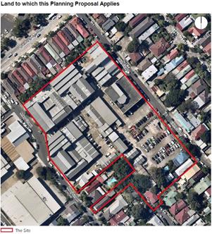
1.2 History of Planning Proposal
The following history of the application explains the context for considering the application, including previous longstanding community concerns communicated to the DPE and the role DPE has given Council for processing the Planning Proposal.
Table 1 – Planning Proposal History
|
30 September 2015- Application lodged |
Ethos Urban on behalf of JVM Holdings and Chalak Holdings Pty Limited lodged a Planning Proposal with Council for 67, 73 - 83 Mary, 50-52 Edith & 43 Roberts Streets, St Peters (the Site). |
|
3 February 2016-report to Council |
Council considered a report on the Planning Proposal at its meeting on 3 February 2016 and resolved to defer the planning proposal to enable a Councillor conference and community consultation to be undertaken. The outcomes of the Councillor conference and community consultation were reported to Council at its 15 March 2016 meeting where Council resolved to refuse the planning proposal. |
|
21 March 2016. Proponent applied to DPE for a Pre-Gateway Review |
On the 1 April 2016 Council received notice of this.
The PP was also referred by DPE to the Sydney Central Planning Panel for advice on whether the PP should be supported. |
|
April 2016 |
DPE requested Council give reasons for not supporting PP. |
|
19 April 2016 |
Council gave DPE the following reasons for not supporting the application.
- Impact on local traffic and infrastructure - Impact on parking - Distance from public transport - Outside LEP and Marrickville Urban Study Strategy - Impact on employment lands - Contamination issues - Overall heights of the development on the site be reduced to minimise impacts on surrounding residents, particularly in Edith Street. |
|
15 February 2017 |
Sydney Central Planning Panel recommended that the existing planning proposal be submitted to the DPE Department of Planning and Environment for Gateway Determination (Attachment 1) and stated that it supported the proposal on the understanding that that it has applied a “precautionary principle” to any rezoning of an “isolated piece of industrial land” because the amount of floor space devoted to employment will be greater following the proposed rezoning than it is now”. |
|
7 June 2017 |
Following a request from the DPE Council on 7 June 2017 agreed to be the Planning Proposal Authority for the Planning Proposal. |
|
10 October 2017 |
A Gateway Determination was issued by DPE on the 10th of October 2017 (Attachment 2).
It advised that it was “decided not to issue an authorisation for Council to exercise delegation to make this plan”.
Council’s role in this situation is to carry out community consultation and to assess the application as set out in “Guide to preparing local environmental plans” as a “non delegated” matter. This includes that Council recommend the form of the Planning Proposal that should be supported (or otherwise), and advise DPE of Council’s position. DPE (on behalf of the Minister) will then determine the form of the Planning Proposal that can be supported (or otherwise). |
|
21 November 2017 to 20 February 2018 |
Community consultation was undertaken. |
1.3 Site Context
This planning proposal applies to an area identified as the “Unwins Bridge Road Precinct 31” as defined under Marrickville Development Control Plan (MDCP) 2011, refer to Figure 2 below. This covers parts of St Peters, Sydenham and Tempe. It is roughly bounded by the railway land to the north-west, the Princess Highway to the south-east (properties fronting the Princess Highway are not part of this precinct), Collins and Union Streets to the south-west and Campbell Street to the north-east. Unwins Bridge Road is a major road that runs from one end of the precinct to the other mostly parallel to the Princes Highway. Sydenham Railway Station is located within the precinct. There are extensive areas of low rise residential areas to the south east of Unwins Bridge Road. The place is affected by noise from overhead flight paths from Sydney Airport.
Figure 2 - Aerial view showing surrounding locality with site in red outline.
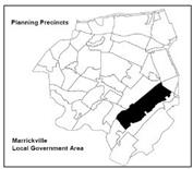
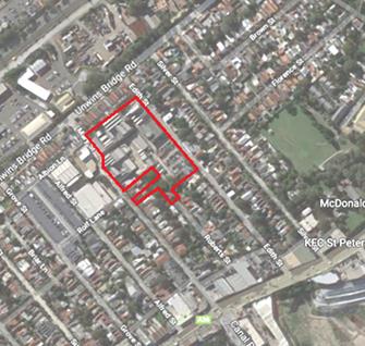
The site is between Mary Street and Edith Street and was originally the Taubmans paint factory which was used until 1965. It has various buildings ranging from one to three storeys, and a rear carpark area to the south. It is presently used by numerous small scale businesses. Most of these businesses are serviced by on grade internal street with parking (employee and visitor) and loading bays (deliveries, waste collection).
The site is surrounded on its northeast and south east side by houses as indicated in Figure 2.
Mary Street has a one way- two lane movement, and is a major distributor of traffic travelling east to west from Canal Road across the Princess Highway to Unwins Bridge Road. There is another industrial site to the south west between Mary Street and Grove Street.
Edith Street is a two way street adjacent to the site, however it is so narrow that it cannot accommodate simultaneous two way vehicular movements. Further to the south of the site Edith Street becomes narrower.
2.0 OVERVIEW PLANNING PROPOSAL AND ANCILLARY DOCUMENTS
2.1 Description of Planning Proposal
The Planning Proposal is contained in Attachment 3 and seeks the amendments to the Marrickville LEP 2013 indicated in Table 1.
Table 1
|
Existing |
Proposed |
|
Land Use zoning
IN2 – Light Industrial R2 – Low Density Residential |
Land Use zoning
B4 – Mixed Use |
|
Maximum Height of Buildings
No Maximum Height of Building applies to IN2 Light Industrial
9.5m – R2 Low Density Residential |
Maximum Height of Buildings
Varies: 3m, 9.5m, 17m, 20m, 23m and 29m.
Refer to Part 4.2 of report for maps that show the locations. |
|
Maximum Floor Space Ratio
0.95:1 – IN2 Light Industrial 0.60:1 – R2 Low Density Residential |
Maximum Floor Space Ratio
2.20:1 |
|
|
LEP provision for defining boundaries of Maximum Heights mapping
As stated in Part 5.2.4 of the Planning Proposal it is proposed “to include a provision that allows for flexibility in the application of the height limits for the site without the need for a variation under Clause 4.6 of the LEP”.
No actual LEP clause has been put forward. |
|
|
LEP Provision for retaining employment
As stated in Part 5.2.5 of the Planning Proposal : “Within the LEP, it is proposed to include a provision to support a concurrent amendment to the DCP control to retain a mixed use precinct by ensuring that a limit on the quantum of residential development permitted to 50% of total gross floor area”.
No actual LEP clause has been put forward. |
There are several documents appended to the PP. The key ones include:
- Indicative site specific Development Control Plan (Attachment 4)
- Traffic and Parking Impact Assessment (Attachment 6)
- Design Concept, showing site and building layouts, and building heights (Attachment 9)
- Remedial Action Plan (Attachment 10)
- Heritage Assessment and Statement of Heritage Impact (Attachment 11)
2.2 Ancillary site specific Illustrative Development Control Plan
The Planning Proposal includes a separate site specific indicative Development Control Plan (IDCP) (Attachment 4) which has been produced by the applicant. It has guidelines/controls which seek to support the proposed MLEP Development standards. These are derived from the Design Concept (Attachment 9) which has a site layout and building layouts.
There is no resolution from Council to support the IDCP and place it on public exhibition as required under Division 2.6 Community participation of the Environmental Planning and Assessment Act 1979. It therefore has the status of an indicative document, and Council cannot adopt it for the purposes of using it for assessment of any Development Application. Refer to Part 5 of this report which provides an assessment of the IDCP.
A separate (concurrent) Development Application has been submitted to Council which relies on the IDCP, and this application cannot be determined until such time as amendments are made to the MLEP 2013.
3.0 COMMUNITY CONSULTATION
In accordance with the Gateway Determination conditions, the Planning Proposal, and supporting documentation subject to Community Consultation for an extended period from 21 November 2017 to 30 January 2018. This was extended again to 20 February 2018 to address a statutory advertising matter. During this period, the material was made available on Council's Your Say website and in the Petersham Customer Service Centre.
The public exhibition was also advertised in the Inner West Courier and letters were sent to owners and occupiers in the vicinity of the subject site.
3.1 Community Submissions
206 members of the public used Council's Your Say Inner West website to participate in the community consultation. Their submissions are summarised in Table 2.
Table 2. Summary of submissions received.
(i) 8 submissions that support the proposal without amendments.
|
Comments |
Officers response |
|
Planning Proposal creates a mixed use outcome and provides businesses and employment opportunities. |
It is the case that a proposed B4 Land Use permits business uses. Part 4 of this report explains that the MLEP 2011 requires a clause that will lead to a minimum amount of employment generating floor space, and that this should be reflected in any site specific Development Control Plan. |
(ii) 17 submissions that support the proposal with amendments
|
Comments |
Officers response |
|
Have fewer apartments, lower building heights and more parking. |
It is considered there should be a reduction in building heights in order to be compatible with surrounding and nearby residential areas. This would result in a lower floor space ratio and less apartments. This is in discussed in more detail in Part 4.2 of the report below which indicates the particular parts of the site where this should occur. |
|
Improve the streetscape with additional street trees and vegetation. There should be a high level of architectural design not “bland straight cement walls and cladding”. |
It is agreed that as a result of the “uplift” there should be community benefits including additional street trees and vegetation. Opportunities for this occur in Edith Street. Refer to Part 5.0 of the report for more detail.
It is agreed that a high level of architectural design should be achieved. This will assessed at Development Application stage. |
(iii) 181 submissions that do not support the proposal.
|
Comments |
Officers response |
|
Aircraft noise, air quality, health and safety issues and contamination of land. These concerns were raised in relation to the following :
- the history of the site as a Paint Factory, a previous environmental report stipulated the site is not suitable for rezoning due to significant contamination of soil and groundwater
- the proposal is within the nearby vicinity of the St Peters Interchange ventilation outlets (corner of Canal Rd and Princess Highway) and subject to emissions
- the site is affected by airplane movements from Sydney Airport and concerns that building heights might affect plane movements leading to crashes, and noise issues for future residents
- impacts from the construction phase such as dust and noise to local residents, and movement of construction vehicles. |
A Stage 1 report has been provided on contamination and remediation as required in SEPP 55. The report confirms the site has substantial contamination and will need to be remediated, including addressing any leaching into adjacent sites. This will be further examined at Development Application stage and is addressed during the excavation and construction stages.
The proponent has provided an Air Quality Impact Assessment with detailed modelling of the levels of emissions/pollution generated by the ventilation stacks. This was required by Roads and Maritime Services (RMS). RMS has reviewed this and determined that the stacks are sufficiently distant from the site to not cause any significant air pollution increase above what already exists for the site. Refer to Part 3.2 of this report (RMS comments) for more detail.
The proposed building heights are technically below the minimum height plane for clearance to airplanes- refer to comments from Sydney Airport discussed in Part 3.2 of this report.
Initially Sydney Airport Corporation Limited did not raise any concerns regarding aircraft noise due to most of the site being outside the 20-25 ANEF corridor. Sydney Airport prepared a draft ANEF 2039 to replace the ANEF 2033 and that draft ANEF 2039 was endorsed by Air Services Australia on 23 August 2018. Subsequently Sydney Airport’s Preliminary Draft Master Plan 2039 the ANEF contours has been updated and majority of the site is now affected by ANEF 25-30. This means that the affected parts of the site should not have residential uses and this is taken into consideration in Part 4 below which deals with the affect this has on the proposed land use zoning.
This would be addressed at future Development Application stage by having conditions of consent applied to control these issues
|
|
Inadequate infrastructure for residents including places in local schools, open space, missing footpath in Mary Street, and site is not close to public transport.
|
Department of Education have advised there is sufficient capacity at local schools, refer to Part 3.2 of this report.
Future residential development will be required to provide 25 percent communal open space, and this will need to be reinforced in a site specific DCP. There will also need to be additional footpath area provided along Mary Street, but external to the site.
The site is within walking distance of St Peters Railway station. |
|
Lack of street parking, with submitters acknowledging there is a local residents parking scheme, and advising that:
- There is an existing problem with a take up of parking in local streets not associated with house owners, and many houses do not have their own onsite parking.
- Customers and employees of future businesses will likely use local streets for parking. |
It is agreed that it is fundamental that any future development must ensure that it caters within its site for both the required parking and vehicular servicing needs of businesses, and that those internal business areas have easy vehicular access to avoid “spill over of the problem” into local streets. The indicative Development Control Plan does not adequately address this, and Part 5 of this report discusses how to address this. |
|
Inadequate on site carparking. |
Future residential development will be required to provide the minimum amount of onsite car parking required by the Apartment Design Guide which is dictated by State Environmental Planning Policy No 65, and so the Marrickville LEP 2013 cannot require higher parking provision.
Future commercial development car parking rates will be required to comply with the Marrickville DCP 2011. This will be “designed” into a Development Application. |
|
Lack of supporting infrastructure for an increased population. Including inadequacy of Mary Street and Edith Street for traffic flows. Lack of footpath in Mary Street.
Streets are too narrow to support the proposal, and cannot accommodate the additional traffic generation. Substantial queuing occurs in Mary Street at peak hour times Monday to Saturday.
Edith Street and Mary Street is less than 12m wide. Neither cannot facilitate two way traffic movements parked vehicles make manoeuvring complex. |
Mary Street has two one way “through” lanes, and is a main distributor carrying east west traffic from Canal Road across the Princess Highway to Unwins Bridge Road. It already experiences queuing at peak hour adjacent to the site, making it difficult for cars to exit the site at Mary Street. With the completion of WestConnex, and with new developments in the surrounding area, there is likely be a substantial increase in traffic volumes. This will likely result in Edith Street being used more intensively for accessing and servicing the Planning Proposal site. This has not been addressed by the Planning Proposal and its ancillary reports in relation to actual site layout and design.
It is agreed that Edith Street is too narrow to enable two way movements of large vehicles such as garbage trucks and large delivery trucks, accommodate on street parking and have wide footpaths with significant tree planting. Refer to Part 5 of this report for more detail on how to address this by applying controls in a site specific DCP. |
|
Adverse impacts to amenity, overshadowing and privacy of adjacent and nearby houses.
|
It is agreed that the proposed 7 commercial storeys (29 m) will have a dominant and overbearing visual impact on adjacent houses in Unwins Bridge Road and increase overlooking. Six storeys (23 m) along Edith Street will have an overbearing visual impact on houses between Edith Street and Silver Street. This will also increase overlooking of houses in Unwins Bridge Road. Refer to Part 4.2 of this report which provides analytical diagrams and recommends areas where there should be a reduction of building heights.
A future site specific Development Control Plan should ensure that there is an adequate wide landscaped buffer between the adjacent house at 71 Mary Street and the proposed major driveway and ramp within the subject site, and that there are adequate building setbacks to affected houses to minimise any winter overshadowing. |
|
Loss of character for the area, which is described as low rise and consisting of “historical beautiful streets lined with cottages”.
- Excessive scale and heights of the development.
- A scale model of the development should have been provided to enable the community to understand the precise size and scale of the development.
- Proposal is an overdevelopment.
|
Currently, there is no maximum height of building in the Marrickville LEP 2013 for the majority of site due to its predominantly industrial zoning. The highest existing building is 15 m tall on the north side of the site.
The proposal seeks a range of building heights ranging from 9.5 metres to 29 metres (equivalent of 8-9 storeys).
Council previously advised DPE that the overall heights of the development on the site should be reduced to minimise impacts on surrounding residents, particularly in Edith Street and Unwins Bridge Road.
No visual impact analysis has been provided for how the proposed building heights would affect nearby residential neighbourhoods, and why the increased heights relative to existing buildings can be justified in an urban design sense and amenity for affected residences.
No physical scale model was provided. There is a rendered three dimensional depiction in the Design Concept (extract below. It is significantly inaccurate with regard to the height of new buildings being portrayed compared to existing buildings. The diagram shows pencil line maximum building heights, but the graphic suggests the proposed buildings might be the more solid blocks below the pencil line.
The proposed building heights should be compatible with the nearby residential area, have minimal visual impacts and minimal privacy impacts, and avoid changes to the character of existing neighbourhoods. This requirement accords with the Design and Amenity objectives of the EP&A Act 1979, and the objectives of the Eastern City District Plan. Refer to Part 2 of this report which assesses the proposed Maximum Building Height and recommends where there should be a reduction of building heights, a corresponding reduction in floor space.
|
|
Loss of industrial lands, employment lands and creative industries. There should be employment places for artists. |
The Sydney Eastern District Planning Panel (Attachment 1) supported the proposal on the basis that existing employment levels would be retained and increased.
Retention of employment lands is also identified in Eastern City District Plan, and supported by the Greater Sydney Region Plan.
Part 4.2 of this report recommends that a LEP clause be applied which limits residential development to 50 percent of the Maximum FSR, and ensures that the remaining FSR will be used for employment uses.
|
|
Site and buildings have heritage significance and should be conserved. |
A “Heritage assessment & statement of heritage impact” report explains that the site was the original location of the Taubman’s paint factory, which commenced production in 1905. Most buildings had been constructed by the 1920s and continued in operation until 1965. The report advises that the site has levels of historic and social significance, however it claims that the site does not meet the criterion for listing as an item of local significance. However this has not been adequately examined using the methodology of the Burra Charter.
The indicative DCP (Attachment 4) indicates in its diagram which buildings should be retained, however this does not give certainty that this will occur. Part 4.2 of this report recommends that an LEP clause be applied to ensure this occurs. A future site specific DCP should also focus on identifying how and what particular parts of the “building fabric” will be conserved and giving guidelines for what will be required to be submitted at the Development Application stage. |
|
The proposal does not meet the objectives of the B4 – Mixed Use Zone.
1 Objectives of zone • To provide a mixture of compatible land uses. • To integrate suitable business, office, residential, retail and other development in accessible locations so as to maximise public transport patronage and encourage walking and cycling. • To support the renewal of specific areas by providing for a broad range of services and employment uses in development which display good design. • To promote commercial uses by limiting housing. • To constrain parking and restrict car use. |
It is agreed the Proposal should have provisions that ensure the objectives are met. These should retention or enhancement of existing employment levels and a realistic and functional site layout to facilitate efficient business operations.
It is also considered that minimum levels of resident and commercial carparking should be provided on site given the unique local street/road constraints. |
|
No provision of affordable housing. Council’s Affordable Housing Policy (adopted March 2017) which requires : “ any uplift subject to rezoning or amendment to planning controls that provide for increased density and proposed developments comprised of 20 or more dwellings or that have a Gross Floor Area of 1,700m2 or greater across the LGA, are required to provide for a 15% Affordable Housing Contribution”. |
The proposal has the potential for approx. 180 residential units.
At the time of lodgement of the application in 2015 there was no Council policy for affordable housing, and there is no proposal for affordable housing.
Council resolved in Feb. 2016 not to support the Planning Proposal. The proponents then sought a Rezoning Review. DPE supported this and issued a Gateway Determination on 10 October 2017. In this context Council can recommend to DPE to defer the making of the LEP amendment until a Voluntary Planning Agreement between the proponent and Council is completed. |
|
New development should reflect the best outcomes for the local community, in terms of sustainability, housing diversity and affordability, creative employment opportunities, safe and appropriate reuse of existing buildings, and integration with the existing R2 Low Density Residential environment. |
It is agreed new development should achieve these outcomes. The officer comments above respond to these matters. |
|
Council’s grounds for refusal submitted to the DPE on April 2016 are valid and should be examined with this Planning Proposal. They were.
- Impact on local traffic and infrastructure - Impact on parking - Distance from public transport; - Outside LEP and Marrickville Urban Study Strategy - Impact on employment lands - Contamination issues - Overall heights of the development on the site be reduced to minimise impacts on surrounding residents, particularly in Edith Street. |
It is agreed these are relevant. These issues are responded to above and are also assessed in Part 4.2 of this report in relation to the proposed development standards. |
|
A Voluntary Planning Agreement should have been placed on exhibition at the same time as the Planning Proposal exhibition. This should have contained details of works intended to be carried out by the proponent and provision of affordable housing. |
Due to the circumstances of the Rezoning Review and DPE issuing of a Gateway Determination, it was not possible for Council to achieve this desirable objective. |
3.2 Public Authority Submissions
Public authority consultation was required by the Gateway Determination.
i. Roads and Maritime Services (RMS) (Attachment 5)
|
Comment |
Officer response |
|
The following are derived from the first RMS letter to Council in 26 March 2018. |
|
|
1 Planning Proposal for the subject site should be consistent with the outcomes of the strategic planning investigations for the broader Sydenham Precinct within the Sydenham to Bankstown Strategy and the supporting Special Infrastructure Contribution plan. |
This is no longer relevant. Council was notified by the Minister of Planning 27 July 2018 that the 2017 Draft Sydenham to Bankstown Strategy would not be progressed to finalisation. DPE would instead work with Council to produce an alternative “high level principle based strategy”. There is also no Special Infrastructure Contribution plan. |
|
2 The proposal may set a precedent with other land owners within the Precincts requesting increased uplifts and land uses ahead of planning investigations and supporting studies being completed.
RMS has concerns about the potential cumulative traffic and transport impacts of this and other proposal on the constrained local and regional road and transport network.
The proposal should be deferred until such time as the Sydenham to Bankstown Priority Precinct planning investigations and Traffic and Transport Impact Assessment is finalised and a funding mechanism for infrastructure is formally adopted. |
DPE took this into consideration when issuing a supporting Gateway Determination.
Neither the Planning Proposal nor the Indicative Development Control Plan have adequately addressed how the site’s traffic generation and movement will both adequately interface and be accommodated in the existing street/road conditions. Refer to Part 5 of this report on how this issue should be addressed in a future site specific DCP.
The Sydenham to Bankstown Strategy is no longer relevant. As RMS would be aware there is no identified Traffic and Transport Impact Assessment finalised, no funding mechanism for infrastructure finalised, and so the proponent is not able to respond to this.
The DPE will need to pursue this matter with the RMS. |
|
3 Proponent should consider putting forward a monetary contribution via a suitable funding mechanism towards local and regional road and transport infrastructure for consideration by Council, Roads and Maritime and Transport for NSW.
Consideration should be given to the inclusion of restraints to onsite carparking provision residential and commercial uses within the site specific DCP to encourage the use of public and active transport. |
The RMS has not provided any detail of the type of road infrastructure improvements that are needed, their value, or where they should be implemented.
Part 5 of this report deals with the inadequate street width of Edith Street to service the development. Widening would be achieved through land dedication from the owners of the land, rather than a monetary contribution used for works remote from the site. Mary Street is proposed to be used as an exit, and is already burdened by high levels of traffic and queuing at peak hour.
The development will provide the minimum carparking required in the Apartment Design Guide and Marrickville DCP 2013, as identified in the Traffic and Parking Impact Assessment (Attachment 6). Given the existing street conditions, discussed above it would be irresponsible to have future development “parking and servicing spill” into local narrow streets. This is also not acceptable as it would have impacts on the existing local road traffic flow system. It is also evident that the site is within walking distance of St Peters railway station and there are no impediments for people to access the station. |
|
4 The proponent should prepare an air quality assessment to demonstrate that the impacts from the WestConnex stacks approx. 600 m from the site, will be acceptable for future residents, or will be suitably mitigated. |
A detailed Air Quality Impact Assessment report on behalf of the proponent was submitted to RMS.
RMS advised Council by letter on 15 August 2018 (Attachment 5) that the pollution levels from the Westconnex stacks are lower in comparison to existing background air pollutants, and are within satisfactory levels established by the Environmental Protection Authority, as follows:
“Predicted incremental impacts from CVRF emissions are low in comparison to background for all pollutants assessed, and predicted cumulative glcs meet EPA criteria for all pollutants assessed except PM 2.5”.
“The predicted change in annual average 5M2.5 is the key health risk assessment metric for this proposal, and all predicted delta PM2.5 for receptors are below the risk metric utilized in the M4-M5 link EIS”. |
ii. Transport for NSW (TfNSW) (Attachment 5)
|
Comment |
Officer response |
|
Transport NSW raised no objections to the proposal, noted that the site is well serviced by bus routes and within walking distance of St Peters station.
It was noted that the area will have a cumulative increase in construction vehicle movements from other projects which will have the potential to impact on general traffic, bus operations, and the safety of pedestrians and cyclists. They recommended this be addressed at Development Application stage. |
Noted.
Appropriate conditions will be able to be placed on any development consent requiring a construction management plan which addresses construction vehicle routes. This can also be added to a future site specific DCP. |
iii. Sydney Airport (Attachment 5)
|
Comment |
Officer response |
|
Advised in relation to the maximum heights clearance to overhead flight paths: The Civil Aviation Safety Authority under Instrument Number: CASA 229/11, in this instance, raises no objection to the erection of this development to a maximum height of 42.0 metres AHD.
Advised on 15 October 2018:
“We also note that ANEF 2039, which has now replaced the previous ANEF 2033, has seen a change in the location of the ANEF25 contour over the land covered by the planning proposal. Council may choose to consider this change when it considers the planning proposal”.
|
The proposed Maximum Height of Buildings Map has the highest part of the site at 29 metres, which is at RL 41.00 which is 1- 2 metres below the clearance to overhead flight paths.
The ANEF 25-30 contour now affects a significant part of the site as indicated in Figure 3 below. In accordance with the Ministerial Direction residential uses should not be permitted in this area. This affects the proposed land uses and this is discussed in Part 4.2 of this report. |
iv. Sydney Water (Attachment 5)
|
Comment |
Officer response |
|
Sydney Water raised no objection to the proposal. |
Noted. |
v. School Infrastructure NSW (Attachment 5)
|
Comment |
Officer response |
|
Department of Education raised no objection to the Planning Proposal and stated it would not have a significant impact on the need for additional school infrastructure at local schools. |
Noted. |
vi. Environmental Protection Authority (Attachment 5)
|
Comment |
Officer response |
|
The Environmental Protection Authority considered the Planning Proposal’s Phase 1 remediation reports and noted that: The processes outlined in State Environmental Planning Policy 55 – Remediation of Land (SEPP 55) are to be followed in order to assess the suitability of the land and any remediation required in relation to the proposed use.
They also made various recommendations that pertain to future processes associated with a development application including that: “The investigation and any remediation and validation work should be carried out in accordance with the guidelines made or approved by EPA under Section 105 of the Contaminated Land Management Act 1997. EPA recommends use of ‘certified consultants”. |
The EPA confirm that the site requires remediation to be made suitable for the proposed uses, and that the processes outlined in SEPP 55-Remediation of Land and required for the Planning Proposal stage have been followed with the submission of a Phase 1 report. This enables the Planning Proposal to be progressed.
Further reports and details of how the remediation would occur would be submitted at Development Application stage in accordance with the Land Contamination Guidelines. They would explain in greater detail how contamination on affected site areas would be removed and how any leaching of contaminants to nearby properties would be prevented. Relevant conditions of approval would be applied and construction of new buildings would not commence until the site was remediated. |
vii. Federal Department of Infrastructure and Regional Development
|
Comment |
Officer response |
|
No comments were received by the Federal Department of Infrastructure and Regional Development. |
A letter was sent to the Federal Department of Infrastructure and Regional Development on 16 November 2017 along with a USB of the proposal and its supporting documentation. Comments from the Federal Department of Infrastructure and Regional Development were sought by 12 December 2017, however no comments were received. |
4.0 ASSESSMENT OF PLANNING PROPOSAL
4.1 Assessment against Planning Proposal Guidelines
An assessment of the Planning Proposal (PP) is provided in Table 2 below using the criteria in “A guide to preparing planning proposals” (August 2016) issued by DPE. A proposal can only be supported where it adequately addresses the criterion.
Table 2
2.1 Part 1-objectives or intended Outcomes
|
|
Planning Proposal Response |
Officer Comments |
|
Objectives and Intended Outcomes |
This is explained in Part 5. 1 of the Planning Proposal and advises of the intended outcomes of retaining employment uses and providing residential uses. |
The response is adequate |
2.2 Part 2 Explanation of Provisions
|
|
Planning Proposal Response |
Officer Comments |
|
Explanation of Provisions |
Land Use and Development standards
This is contained in Part 5.2, Table 1 of the PP with regard to the proposed land use and development standards.
Retaining employment areas
Part 5.2.5 of the PP makes reference to the Sydney Eastern City Planning Panel comments (Attachment 1) which considered the PP acceptable on the basis that the LEP amendment would increase existing employment levels.
There is no actual LEP clause put forward in the PP. This was brought to the attention of the DPE by Council officers after Gateway Determination was issued. DPE responded that the intent of the clause should be stated in the Planning Proposal but the actual text of the LEP amendment should be left to the Parliamentary Counsel.
Part 5.2.5 Local Flexible Clause- of the Planning Proposal responds to this and states: “Within the LEP, it is proposed to include a provision to support a concurrent amendment to the DCP control to retain a mixed use precinct by ensuring that limit on the quantum of residential development permitted to 50 percent of total gross floor area to ensure the precinct retains a mix of spaces for future and current industrial/commercial tenants and residents. This is intended to support ongoing creative industries and employment in the zone with residential development”.
Permitting Residential Flat development
The Design Concept proposes standalone residential flat development, eg in Edith Street (south side).
|
Land Use and Development standards
Proposed land use and development standards are assessed in Part 4.2 of this report.
Retaining employment areas
There is no LEP mechanism or clause in the Planning Proposal that will ensure that existing employment generating floor space shall be retained, and also be increased in accordance, with the Panel recommendations. A suggested LEP clause is provided below.
The Indicative DCP makes reference to a minimum of 50 percent of the proposed Maximum FSR being used for non residential – employment uses. It also has a map diagram to indicate those buildings that should be retained for commercial/business use, and where new commercial building should be. Those building positions are derived from the Design Concept however it is considered there are problems with reliance on this document for the following reasons:
There is little certainty that employment related land uses will be able to functionally operate based on the Design Concept. This is due to the low level of provision of fundamental servicing needs and areas to enable businesses to function, (eg service corridors, number of loading bays, deliveries, ease of access) as discussed in more detail in Part 5 of this report. If this technical situation is not solved, any site owner will use this situation to seek other building uses such as residential uses.
It is evident therefore there should be a site specific Marrickville LEP 2013 clause that ensures that :
- Only 50 percent of the proposed Maximum FSR is used for residential uses, and the remaining FSR is used for employment type uses.
- Particular existing buildings on the site are retained, in locations identified in the IDCP.
There should also be controls in the site specific DCP that ensure there is sufficient functional surface access and circulation space for servicing business and creative industry land uses.
Permitting Residential Flat development
It is necessary to have a LEP clause that will permit standalone residential flat development. LEP clauses are suggested below, these would be considered by DPE and they would be refined by Parliamentary Counsel at a later stage. |
Additional local LEP provision to retain employment levels
- Development at 67, 73-83 Mary Street, 50-52 Edith Street and 43 Roberts Street, St Peters
(1) The objective of this clause is to provide for limited residential development, maintain and increase the level of employment floorspace to enable the mixing of employment and residential uses and adaptive reuse of buildings on the land at 67, 73-83 Mary Street, 50-52 Edith Street and 43 Roberts Street, St Peters.
(2) Development consent must not be granted to development for the purpose of residential accommodation on this site unless the consent authority is satisfied that the percentage of gross floor area used for residential purposes is less than the 50% of the total gross floor area of all development on the land.
Additional local LEP provision for the Retention of certain buildings
- Council may grant consent to the use or erection of a building or buildings that exceed the Maximum Floor Space Ratio of 1.0:1 provided it is satisfied that:
(1) Particular buildings identified in the Development Control Plan for the site will be substantially retained.
(2) The total Maximum Floor space Ratio on the site will not exceed 1.8:1.
Additional local LEP provision for Schedule 1 Additional permitted uses
- Use of certain land at 67, 73-83 Mary Street, 50-52 Edith Street and 43 Roberts Street, St Peters
(1) Development for the purposes of a residential flat building is permitted with consent (for buildings A and B as shown on the key sites map)
2.3 Part 3 Justification
2.3.1 Questions to consider when demonstrating the justification
|
Question 1 |
Planning Proposal Response |
Council officer Response |
|
Is the planning proposal a result of any strategic study or report?
|
The applicant has based the Planning Proposal’s proposed Development Standards and Land Use on a “Design Concept” in Attachment 9 as justification for the Maximum FSR and Maximum Building Height. It also indicatively proposes retention of particular original factory buildings and for these to have employment generating uses.
The Heritage Assessment and Statement of Heritage Impact (Attachment 11) indicates that the site has some degree of historical significance. It also recommends that various parts of existing building should be conserved to preserve the site’s historic cultural significance. The illustrative DCP (Attachment 4) to a degree reflects this.
|
The Design Concept document cannot simply be automatically relied on for justifying the proposed development standards.
Refer to Part 4.2 of this report which examines the proposed Maximum Height and Maximum FSR and concludes that lower heights and FSR, and whether there should be land dedication in Edith Street to address road infrastructure.
As explained in the response above to Question 2.2 - Explanation of Provisions, there should be an MLEP clause to ensure retention of certain buildings. This is outstanding. |
|
Question 2 |
Planning Proposal Response |
Council officer Response |
|
Is the planning proposal the best means of achieving the objectives or intended outcomes, or is there a better way?
|
Part 5.7.2 of the Planning Proposal provides a response to this. |
Refer above to response to Question 2.2- Explanation of Provisions which considers there should be various site specific LEP clauses applied to the land, to ensure existing employment are maintained or increased on the site and to facilitate standalone residential flat buildings. |
Section B
|
Question 3 |
Planning Proposal Response |
Council officer Response |
|
|
Is the planning proposal consistent with the objectives and actions of the applicable regional, sub-regional or district plan or strategy (including any exhibited draft plans or strategies)? |
No comment was provided. |
Refer below.
|
|
|
Question 3 (a) |
Planning Proposal Response |
Council officer Response |
|
|
Assessment Criteria a) Does the proposal have strategic merit? Is it: |
No comment was provided. |
Refer below. |
|
|
• Consistent with the relevant regional plan outside of the Greater Sydney Region, the relevant district plan within the Greater Sydney Region, or corridor/precinct plans applying to the site, including any draft regional, district or corridor/precinct plans released for public comment; or
|
Part 5.8 of the Planning Proposal provides an adequate response to the relevant Plans at the time of exhibition-Community Consultation – stages.
In March 2018 amendments to the EPA Act 1979 came into force, and the relevant Greater Sydney Commission Plans (GSC) were:
- Regional Plan: A Metropolis of Three Cities
- District Plan. Eastern City District Plan
A key difference is that the District Plan objectives require the retention of Industrial zoned land. DPE and GSC have however advised that Planning Proposals that involve rezoning of industrial land, but were submitted prior to March 2018 and have been supported by the Sydney Eastern City Planning Panel may proceed in accordance with the Panel’s advice. This Planning Proposal falls into this category.
The Draft Sydenham to Bankstown Strategy has not been finalised, and does not actually make recommendations for the site. Instead it states: “Changes to reflect status of Council’s planning proposal”. The Minister of Planning advised by letter on 27 July 2018 by letter that Council would be allowed to propose an alternative strategy for the Corridor as part of the development of a new Inner West LEP. |
The recommendation of the Sydney Central District Panel for ensuring current employment levels are maintained, which also reflects the current District Plan objectives, will be addressed by applying a site specific LEP clause which leads to provision of employment uses in the proposed B4 zone as indicated in the response to the above Question 2.2 – Explanation of provisions.
|
|
|
• Consistent with a relevant local council strategy that has been endorsed by the Department; or
|
This makes reference to Council’s Marrickville Employment Lands Study and its Action 4.3.
|
The study does not explicitly identify the site for conversion to residential uses and Council instead have previously advised DPE in Feb. 2016 that it objects to the Planning Proposal. |
|
|
• Responding to a change in circumstances, such as the investment in new infrastructure or changing demographic trends that have not been recognised by existing planning controls.
|
Proponent has not responded to this. |
This is noted. |
|
|
Question 3 (b) |
Planning Proposal Response |
Council officer Response |
|
|
Does the proposal have site-specific merit, having regard to the following: |
Part 5.8 of the Planning Proposal does not provide a direct response to this, refer below. |
|
|
|
• the natural environment (including known significant environmental values, resources or hazards) and
• the existing uses, approved uses, and likely future uses of land in the vicinity of the proposal and
•the services and infrastructure that are or will be available to meet the demands arising from the proposal and any proposed financial arrangements for infrastructure provision. |
A separate Contamination and Remediation Report has been submitted in accordance with SEPP 55.
Refer to officer comments. Proponent has not responded to this.
This is also a matter that the RMS has requested Council to note and address with regard to local road capacity and the needs of future development. |
The site is required to be remediated, and the required detail will be submitted with a future Development Application. Refer to Part 3.2 of this report (EPA comments) for more detail.
The proponent has not provided any visual or amenity impact details of how the proposal will affect land uses in the vicinity of the site.
Refer to Part 4.2 of this report (assessment of Maximum Building Height) where in order to be compatible/sympathetic with adjacent and nearby neighbourhood places, it is recommended that particular parts of the site should have lower building heights.
There should be further investigation of the narrowness of Edith Street and whether this might require land dedication within the site to widen it for traffic flow and public domain improvements. |
|
|
Question 4 |
Planning Proposal Response |
Council officer Response |
|
|
Is the planning proposal consistent with a council’s local strategy or other local strategic plan? |
In Part 5.8 of the PP the proponent has provided a statement from previous Marrickville Employment Lands Study (MELS) which recommended considering rezoning of particular industrial sites. |
The Marrickville Employment Lands Study (MELS) provides a detailed understanding of future industrial land needs in the Marrickville LGA and was completed in April 2008 and updated in 2014. The MELS identifies the greatest pressure on Marrickville’s industrial land as residential development. The MELS recommended that Council consider rezoning of particular industrial sites in well considered locations, however not this subject Precinct 75 site.
|
|
|
Question 5 |
Planning Proposal Response |
Council officer Response |
|
|
Is the planning proposal consistent with applicable State Environmental Planning Policies?
|
Part 5.9.2 of the Planning Proposal provides a response to this. |
The Proposal is consistent with the applicable State Environmental Planning Policies.
As required by SEPP 55, a Phase 1 assessment has been provided dealing with analysis of contamination on the site. It explains the site is required to be remediated, and the required detail will be submitted with a future Development Application. Construction of new building will not be permitted until the site contaminants are removed, and any leaching into adjacent sites is stopped. Refer to Part 5 of this report for more detail. |
|
|
Question 6 |
Planning Proposal Response |
Council officer Response |
|
|
Is the planning proposal consistent with applicable Ministerial Directions (s.117 directions)? |
Part 5.9.3 of the Planning Proposal provides a response to this.
Ministerial Direction no 1
This requires that there be no reduction in Industrial areas and existing floorspace.
Ministerial Direction no 3.5
This requires that development for residential purposes or human occupation, if situated on land within the Australian Noise Exposure Forecast (ANEF) contours, incorporates appropriate mitigation measures so that the development is not adversely affected by aircraft noise.
Also, under Ministerial Direction no 3.5, clause 5 (a), a Planning Proposal must not rezone land for residential purposes, nor increase residential densities in areas where the ANEF exceeds the 25 contour.
When the Planning Proposal was submitted, a large portion of the site was outside the ANEF 25 corridor and complied with this direction. The part of the site affected was a very small part where non- residential uses could be placed and so was of “minor significance”. Sydney Airports recognised this and made no objection to the proposal, as explained in Part 1 of this report.
However, Sydney Airport recently prepared a new draft ANEF 2039 to replace the ANEF 2033 and this was endorsed by Air Services Australia on 23 August 2018. A large part of the site, as indicated in Figure 3 below is now affected the ANEF 25-30 corridor, and in accordance with this direction should not have any residential uses permitted.
The DPE advised on 25 September 2018 that Council should be satisfied that it “has considered any outstanding issues and whether this matter has been raised as a concern by relevant state agencies in submissions. You may also wish to consult further with the Sydney Airport Corporation on this proposal given the change to the ANEF”.
In this regard, clause 7 of the direction allows for a Planning Proposal to be inconsistent with the terms of this direction only if the relevant planning authority can satisfy the Director-General of the Department of Planning (or an officer of the Department nominated by the Director-General) that the provisions of the planning proposal that are inconsistent are justified by a study prepared in support of the planning proposal which gives consideration to the objective of this direction.
Other Directions
|
Ministerial Direction no 1
Part 4.2 of this report recommends that an explicit LEP clause is required to ensure that sufficient employment uses are retained, as flagged in the Planning Proposal.
Ministerial Direction no 3.5
The proponent has not agreed to provide any reports to address clause 7 of this Direction and demonstrate why the proposal can be inconsistent. Nevertheless, it would be difficult to justify why impacts from aircraft noise and flightpaths should be disregarded for any future residential use.
To be consistent with clause 5(a), residential uses should be excluded from the part of the site affected by the ANEF 25- 30 contour (area) as indicated in Figure 3 below. This would require either :
(i) B4 zone to be deleted and the current IN2 Light industrial use retained for the area within the 25-30 contour and the remaining part of the site zoned R4 High Density Residential. This would permit stand alone residential flat buildings and also permits employment generating uses such as ground level shops.
(ii) B4 zone with a site specific clause which prohibits any residential development within the site affected by the ANEF 25- 30 contour.
Given the issues identified in this report regarding retaining current employment uses on the site and ensuring that they are able adequately to function and operate, it is recommended that (i) above be the preferred amendment to the Marrickville LEP 2011.
Other Directions
The Proposal is consistent with the other relevant Directions. |
|
Figure 3 Site and parts affected by ANEF 25-30
Below shows aerial view with ANEF 25-30 corridor.
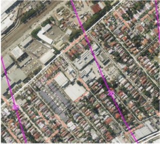
Below shows site in red outline with existing buildings. ANEF 25-30 corridor is shown in dotted black line. Blue line shows potential boundary for any land use zoning map to accommodate the ANEF position and to exclude residential uses.
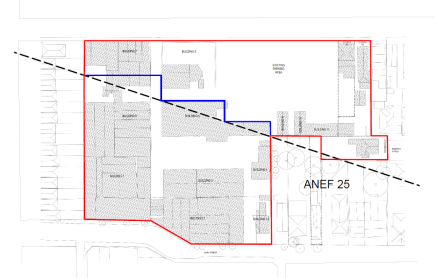
|
Question 7 |
|
|
|
Is there any likelihood that critical habitat or threatened species, populations or ecological communities, or their habitats, will be adversely affected as a result of the proposal? |
Part 5.10 of the Planning Proposal explains that this does not apply to the site. |
There has not been any critical habitat or threatened species, populations or ecological communities, or their habitats, identified on this site. |
|
Question 8 |
Planning Proposal Response |
Council officer Response |
|
Are there any other likely environmental effects as a result of the planning proposal and how are they proposed to be managed? |
Part 5.10.2 of the Planning Proposal explains that a Contamination report and remediation will be required. |
As indicated in response to Question 5 and SEPP 55 above the site is required to be remediated and a Phase 1 assessment has been provided. |
|
Question 9 |
Planning Proposal Response |
Council officer Response |
|
Has the planning proposal adequately addressed any social and economic effects?
|
Part 5.10.3 of the Planning Proposal provides a response to this and explains there will be improved employment opportunities and increased housing stock, and that retention of businesses will ensure positive economic effects. |
As indicated in the above response to the above Questions, it is fundamental there should be an LEP clause which provides certainty that sufficient employment floor space with functional access will be provided. This is outstanding. |
|
Question 10 |
Planning Proposal Response |
Council officer Response |
|
Is there adequate public infrastructure for the planning proposal?
|
Part 5.11.1 of the Planning Proposal provides a response to this and states that “the site is located in an established urban area and has access to a range of existing facilities and services, and it is anticipated that the public infrastructure will adequately service the area”. |
The Proposal has not demonstrated that there is adequate public infrastructure to cater for the more intensive use of the site, including in terms of how future development operations will interface with local road constraints, and the capacity of Mary Street and Edith Street. The RMS has also identified this issue.
There should be further investigation of the adequacy of Edith Street to cater for the functional servicing needs of the development, and whether there should be land dedication to achieve a better public domain and also provide the necessary technical street design. |
|
Question 11 |
Planning Proposal Response |
Council officer Response |
|
What are the views of state and Commonwealth public authorities consulted in accordance with the Gateway determination? |
Part 5.11.2 of the Planning Proposal provides a response to this and states that State and Commonwealth authorities will have the opportunity to provide comment on the Planning Proposal as part of its formal exhibition period. |
Refer to Part 3.2 of this report which provides a response to submissions from public authorities, including RMS concerns.
|
Part 4 Mapping
This requires that the maps accurately reflect the proposed land use zoning, Max Floor Space Ratio, and Max Building Height so that it is clear which parts of the site are affected.
|
Mapping |
|
|
|
|
Appendix B – D of the Planning Proposal provides the following indicative Proposed Maps
- Land Use Zoning - Maximum Floor Space Ratio - Maximum Building Height Complete A3 sized map tiles have not been provided. |
Refer to Part 4.2 of this report which assesses the proposed Maximum Floor Space Ratio and Maximum Building Height, and recommends reductions to achieve a compatible built form with surrounding development and have corresponding Maximum FSR.
This will require amended Mapping. This stage can be used to address issues brought up by the Sydney Eastern City Planning Panel regarding the maximum Building Height map and having a dedicated LEP clause to account for the different height areas within the site. |
4.2 Assessment of Proposed Land Use Zoning and Development Standards
01 Amendment to MLEP 2013 to rezone the site from IN2 Light Industrial and R2 Low Density Residential to B4 Mixed Use
The application seeks to apply a B4 Mixed Use zone to the site, replacing the existing IN2 Light Industrial and R2 Low Density Residential as shown in Figure 4. The B4 Mixed Use zone will permit a wider range of permissible uses throughout the site, including commercial, residential, retail and community uses.
Figure 4 - Existing and Proposed Land Use Zoning. Site is within red outline.
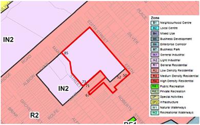
Existing Land Use Zoning Map within red outline. Most of the site is zoned IN2 Light Industrial to reflect the past industrial uses. Part of the site is zoned R2 Low Density Residential and contains houses.
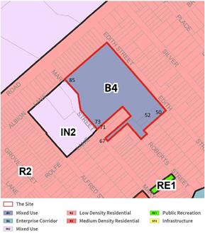
Proposed Land Use Zoning - B4 Mixed Use within red outline
Officer comment:
Rezoning of 67 Mary Street to B4 Mixed Use is not supported, as this would result in an isolated site with the house on either side zoned R2 Low Density Residential.
Rezoning of the rest of the site has a number of considerations explained below. These include that on 23 August 2018 the site became affected by the ANEF 25-30 contours and impacts from aircraft noise and in accordance with the Ministerial Directions (as explained in Part 3 of this report above), residential uses should not be permissible in such places.
Given this situation, there are two ways to proceed with the Planning Proposal as follows:
(i) B4 – Mixed Use is supported providing there is an explicit clause in the MLEP 2011 that retains adequate levels of employment generating floorspace. As explained elsewhere in this report, and for the reasons given by the Sydney Eastern City Planning Panel, it is essential to have a site specific clause to ensure that no more than 50 percent of the permitted Maximum FSR can be used as residential floorspace as exhibited, so that the remaining FSR can be used for employment generating land uses. The Planning Proposal supports this concept in its part 5.2.5- the intent of the LEP clause. A suggested LEP clause is indicated in Part 4.1 above, in response to Question 2.2 of the Planning Proposal preparation guidelines.
Standalone residential flat buildings can be permissible in the B4 Zone, as shown in the design concept. These buildings are proposed on the south part of the site including along Edith Street. The intent of a suggested LEP Schedule 1 clause is indicated in in Part 4.1 above, in response to Question 2.2 of the Planning Proposal preparation guidelines.
A site specific clause can be applied to prohibit residential uses in the part of the sites affected by the ANEF 25-30 corridor.
Alternatively, due to a significantly large part of the site being affected by the ANEF 25-30 contours (see Figure 3 above), the Planning Proposal could be progressed as follows:
(ii) The part of the site affected by the 25-30 ANEF corridor could remain IN2- Light Industrial. The rest of the site could be zoned R4-High Density Residential for the standalone residential flat buildings (not permissible in a R3 zone) and also employment generating uses such and shop top housing.
Noting that the DPE will ultimately determine how to progress the Planning Proposal, it is recommended that option (ii) be the preferred option. This is because it would retain a significant amount of existing buildings and their successful businesses to provide for employment and local services. Also an Industrial zoning is normally the appropriate zoning where there is a “very high impact” from aircraft noise.
02 Amendment to Maximum Height of Buildings (MBH) Map
The application seeks to apply a range of height limits (3 metres, 9.5 metres, 17 metres, 20 metres, 23 metres and 29 metres) as shown in Figure 5.
Figure 5- Existing and Proposed Maximum Height of Buildings Map.
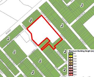
Existing Maximum Height of Buildings Map. Site is within red outline. The majority of the site currently has no maximum height due to its predominant industrial zoning.
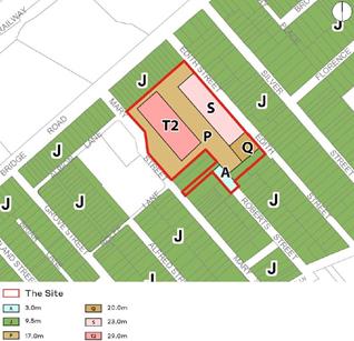
Proposed maximum FSR Map. A range of height limits (3 metres, 9.5 metres, 17 metres, 20 metres, 23 metres and 29 metres) are sought with the higher buildings towards the centre of the site, as indicated in the diagram above.
Officer comment:
No visual impact study has been provided to justify the proposed building heights, including by showing the parts that will be visible from adjacent and nearby affected areas and providing credible rationale for why this would be acceptable.
There are a number of parts of the site that should have reduced heights to be compatible with surrounding and nearby low rise residential neighbourhoods as follows:
(i) Edith Street
The proposed Maximum Building Height along Edith Street of S- 23m would be up to 6 to 7 storeys and this is excessive due to its close vicinity and visual impact on nearby residential areas between Edith Street and Silver Street. Existing buildings in Edith Street oultined in black in Figure 7 below are already visible from Silver Street - as viewed between houses (refer to photo in Viewpoint 2 below). A proposed 6 storey building in Edith Street would have an overbearing visual impact on those areas and change their character. It would also affect privacy to these house’s back gardens. There were many community objections (social consideration) to this impact as indicated in Part 3.1 of this report. It is therefore recommended there be a maximum height of 17 m (achieves 4 to part 5 storeys) along Edith Street as shown in red outline in Figure 7 below.
A lower height is also recommended for the remainder of the central part of the site as shown in Figure 8 below to lessen visual impact on low rise houses between Edith Street and Silver Street and so reduce impacts on the character of the surrounding residential areas.
Figure 7- East elevation - extract of Development Application.
Shows proposed height plane in blue line,
and recommended height plane in red line. 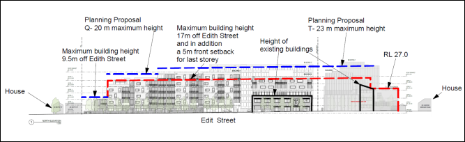
Figure 8 - Section across site - extract of Development Application.
Shows proposed height plane in blue line, and recommended height plane in red line.
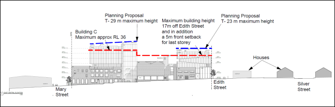
(ii) Northern and central part of site adjacent to houses in Unwins Bridge Road
The proposed Maximum Height of T2- 29m (up to 7 commercial storeys, or 9 residential storeys) would be very close to the rear of houses at Unwins Bridge Road (refer to photo in Viewpoint 1 below). The resulting overbearing visual impact and loss of privacy to the back gardens of houses is excessive. Ideally any new infill building should be no higher than the existing 15m high industrial building at the rear of the houses, to avoid any additional visual and privacy impacts. However a maximum height can be gradually increased providing there are significant setbacks from the existing 15m high building at the northern boundary as indicated in Figure 10 below.
If a B4 land use zoning is applied to the site (which will permit either residential or commercial buildings) it is recommended heights should be reduced as indicated in red outline in Figure 10 below.
Figure 9 - North Elevation - extract of Development Application.
This shows the existing houses off Unwins
Bridge Road in the foreground in red line, with the existing on site
building behind retained which is approx 15 m high. The proposed new commercial
building behind this would have a proposed maximum Height of T – 29m
. ![]()
![]()
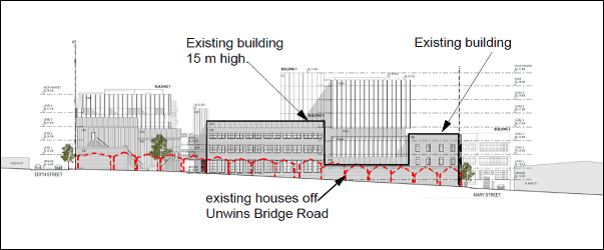
Figure 10- Mary Street elevation - extract of Development Application.
This shows the proposed height plane in blue line and the recommended height plane in red line
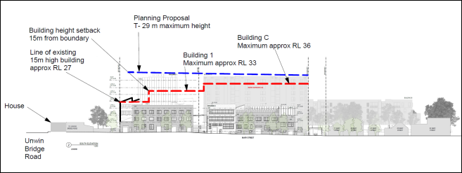
(iii) 67 Mary Street
The “isolated” land at 67 Mary Street is recommended to remain R2 Low Density Residential with no change to the corresponding building height.
Viewpoint 1 from Unwins Bridge Road looking toward site
Shows existing houses and existing 12- 15 metres high factory building to rear. A 29 metre building height is proposed.
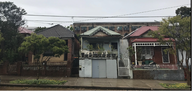
Viewpoint 2 from Silver Street looking toward site
Shows existing house in Silver Street and in distance the existing building in Edith Street which is 8 metres high. A 23 metres height is proposed for Edith Street.
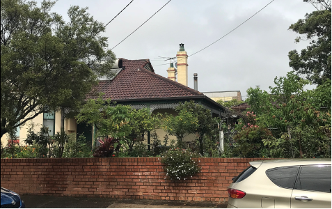
03 Amendment to Maximum Floor Space Ratio (FSR) Map
The application seeks to apply a 2.2:1 Maximum FSR development standard throughout the site as indicated in Figure 11 below.
Figure 11 – Existing and Proposed FSR Map
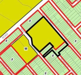
Existing Maximum Floor Space Ratio Map. Industrial zoned part of site has a maximum FSR of 0.95 : 1.
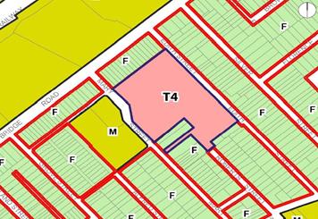
Proposed Maximum FSR Map. This proposes a maximum FSR of T4 - 2.2:1.
Officer comment:
If a B4 land use zoning is applied to the site, in the first instance, the proposed maximum FSR should be reduced to reflect the recommended Maximum Heights recommended above in the report. This would result in a “ballpark” of a maximum FSR of 1.8:1 for the site. However this will require further reduction to take into account reduced residential floorspace for areas affected by aircraft movements for the ANEF 25-30 corridor. This would require further detailed design analysis.
The land at 67 Mary Street is recommended to remain R2 Low Density Residential with no change to the existing Maximum Floor Space Ratio of 0.6:1.
An alternate IN2 – Light Industrial Use and part R4 – High Density Residential use, would require different Maximum FSR development standards to those exhibited.
5.0 Site Specific Indicative Development Control Plan (IDCP)
The proposed IDCP in Attachment 4 was produced by the proponent. It has not been formally exhibited as required in the procedures of the EPA Act 1979 for the making of a DCP. It therefore has no status other than being “indicative”. It is based on the site layout and built form indicated in the proponent’s Design Concept in Attachment 9, and has a site layout diagram (Figure 12) reflecting this and showing how buildings and open space should be arranged. It also proposes a “village/market” square between buildings on the northerly central part of the site.
Figure 12 – Extract of Map in IDCP
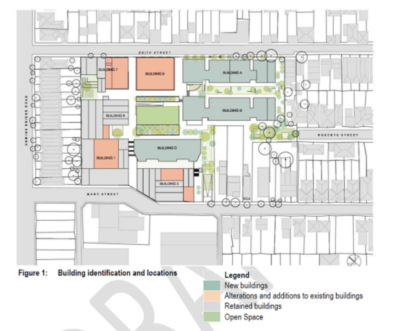
However there are several technical issues that need resolution, also to achieve acceptable building scale impacts on nearby residential areas, and to provide for the desirable type and quality of streetscape in Edith Street. The IDCP does not provide adequate guidelines for the matters identified below as also indicated by officer comments in Part 5 below of this report:
Road infrastructure
1 Edith Street reservation (adjacent southern portion of the site) should have sufficient width to accommodate two vehicular way movements, on street parking and wide footpaths.
Edith Street
2 Edith Street should have verge areas (footpaths) that are wide enough for substantial tree planting and pedestrian movements to achieve the desirable character of the tree lined environment of nearby residential streets and improve its spatial and environmental qualities.
3 Front gardens should be provided within the site along Edith Street (southern portion of the site) to enhance the street, with front building setbacks and deep soil areas to establish significant amounts of vegetation.
Site servicing needs and businesses use certainty
4 Adequate waste collection areas should be provided catering for all users of the site, and collection areas should have the necessary vehicular manoeuvring spaces. Otherwise Edith Street and Mary Street are at risk of being used to compensate for inadequate waste collection area. (Refer to Waste Collection comments in Part 5 of this report). Creating a risk that around 180 resident bins might be left on public streets or footpaths for waste collection is unacceptable.
5 Businesses on the site must be able to operate adequately, including having an adequate number of loading dock areas, and providing effective connecting service corridors to business areas for transfer of large goods. This is critical for ensuring that the LEP objective of having at least 50 percent of the Maximum FSR provided for employment uses is implemented.
Traffic movements through the site
6 There should be a clear and easy method of travel through the site that facilitates public and visitor use of basement for parking and loading areas.
7 Basement exit driveways to Mary Street should be designed to prevent conflict with pedestrians at Mary Street by having adequate vehicular sight lines, and consideration be given to separating service vehicles from exiting cars.
Building separation for privacy
8 An adequate building separation distance from the adjacent house at 71 Mary Street must be provided by creating a 3 m wide landscape buffer between the house and driveway ramp (being used for exit for 180 apartments and all businesses and their patrons).
9 Adequate building separation distances should be provided between proposed new buildings A (off Edith Street) and B to comply with the Apartment Design Guide (referenced by SEPP 65).
Compatible Building Scale
10 An appropriate building scale (height) for new buildings along Edith Street should be identified to ensure visual impacts to adjacent and nearby low rise residential properties between Edith Street and Silver Street are minimised.
11 Identifying an appropriate buildings scale (height) for new commercial buildings adjacent nearby houses in Unwins Bridge Road so that the amenity of houses is not further compromised.
Higher amounts of tree planting
12 Areas for substantial amounts of deep soil planting to accommodate tree planting and achieve higher levels of “urban forest canopy” in accordance with Marrickville Urban Forest Strategy 2011 should be identified.
Communal Open Space for residents
13 After accounting for the matters above and the necessary resulting revised site layout, provision is then made for a minimum 25 percent communal open space for the residential development component as required by the Apartment Design Guide.
ANEF 25-30 contour and aircraft noise
14 Due to the recent affectation of the ANEF 25-30 contour to a major part of the site which prohibit residential uses it is necessary to acknowledge this is in a DCP. It is also necessary to have controls for any residential uses in close vicinity which will be affected by noise from the adjacent flight paths.
Resolution of the above issues will affect the acceptable Maximum Height of Building and Maximum Floor Space Ratio as explained above in Part 4.2 of this report.
Noting that the content of any Development Control Plan is a matter for Council to determine, under the EP&A Act Council is required to responsibly produce its own site specific DCP addressing the relevant issues.
5.0 OTHER STAFF COMMENTS
5.1 Development Engineering
These are contained in Attachment 7.
It was noted that that the Design Concept proposes that residential traffic entry is off Edith Street and exit is onto Mary Street. Non residential vehicles would be able to use both Edith and Mary Street for entry, but only have an exit onto Mary Street.
It was noted due to future development in the area and the impact of WestConnex there is likely to be an increase in traffic volumes in local streets and roads, including Mary Street. This will result in longer vehicle waiting times and more queuing in Mary Street which will impact on traffic flow movements in and out of the site.
There is a need in any site specific DCP to include the following provisions:
- overland stormwater flow through the site to account for flooding in Edith Street,
- guidelines for how Edith Street should operate,
- guidelines for how parking is accessed off Edith Street and Mary Street, and how vehicles would travel through the site. There should be a clear and easy method of travel through the site that facilitates use by the public and visitors of basement for parking and loading areas.
Other comments were provided related to matters which are addressed at Development Application stage.
5.2 Urban Ecology
Noted that the Site Investigation Report has been submitted to meet the Phase 1 report requirements of the Land Contamination Guidelines of SEPP 55, and that further analysis and reports will be provided at Development Application stage. Other comments pertained to matters that would be addressed at Development Application stage where an actual building design proposal is assessed.
5.3 Urban Forest Officer
Noted that the Design Concept and proposed DCP does not identify adequate amounts of tree planting, and recommended that future controls for the site provide for:
- An Urban Forest canopy (trees) target of 25 percent set for the site, in accordance with the Marrickville Urban Forest Strategy 2011
- An appropriate diversity of tree species and size
- Adequate space, soil volume, and pervious ground is provided to support the trees to be planted
- Appropriate maintenance, particularly irrigation, is detailed in the design
- Adequate verge (footpath) width and distances between driveways are provided
- Trees are setback from property boundaries so that potential development on neighbouring properties.
5.4 Waste/Resource Recovery Officer
Advised that the Design Concept Plan does not adequately cater for waste collections within the site by Council vehicles, or turning paths for garbage trucks.
Also advised that future site layout and building design must also demonstrate it has made allowance for waste collection by Council vehicles which are parked in positions which have easy access from a public road, and from temporary standing locations for bins which do not compromise the amenity of streets and surrounds. This is because future occupants will always be charged Council rates for residential waste collection as required under the Local Government Act. Should residents not agree to pay fees in addition to Council rates for commercial waste collection to occur by commercial companies, or via any other special arrangements with Council, it is not acceptable as default to be “forced” to have around 180 bins placed in local streets and footpaths.
5.5 Architectural Excellence Panel
The Panel reviewed the Design Concept in Attachment 8. This is an illustrative document and not an actual Planning Proposal. They made various comments on this concept which have been taken into consideration in this report. These included:
· that the Building 1 height of 29 m opposite houses in Unwins Bridge Road and height of buildings in Edith Street were of concern.
· there should be a deep soil front garden area along Edith Street (south side).
5.6 Transport Planner
Noted that the proposal has potential to result in a higher proportional increase in traffic movements than anticipated in the submitted traffic study with greater potential for parking overflowing into adjacent streets. Also recommended that basement exit driveways to Mary Street be designed in a way which prevents conflict with pedestrians at Mary Street by having adequate vehicular sight lines and that consideration should be given to separating service vehicles from exiting cars. Future Development Applications should ensure that the site is permeable and the public have access to any “village square” proposed for the business areas on the site as portrayed in the Design Concept.
It was also noted there is likely to be an intensification of land uses in key sites within the vicinity of the proposal, and the impacts of WestConnex will likely lead to greater traffic volumes in local roads.
FINANCIAL IMPLICATIONS
There are potential future costs to Council if the Planning Proposal in its current form is supported by the DPE and the issues identified in this report are not addressed and future development results, with regard to the following:
- Improvements to Edith Street if there are problems with traffic flow issues, and street redesign and reconstruction is required.
- Construction work in Mary Street to provide adequate footpaths.
- Further traffic studies and road/street changes to address impacts to existing traffic flows, including added congestion and impacts on local streets leading to possible of road works to address this.
- Further resident parking schemes to address loss of on street parking.
CONCLUSION
Council is the Planning Proposal Authority but does not have delegation for ultimately determining whether to make the Plan, or in what form the proposed amendments to the Marrickville LEP 2013 should be made. This decision ultimately rests with the Minister of Planning who is advised by the Department of Planning and Environment (DPE).
Council’s role for this stage of the process is to carry out Community Consultation and respond to submissions and to assess the Planning Proposal including the proposed new Land Use Zoning, Maximum Building Heights and Maximum Floor Space Ratio. Council then makes recommendations to the DPE on how the Planning Proposal should progress or not.
Council carried out Community Consultation and a large number of submissions were received objecting to the proposal outlined in Part 3.1 of the report. These included concerns regarding: excessive building heights and loss of amenity, overdevelopment, land contamination, and Edith Street and Mary Street having a poor capacity to accommodate the needs of future development and there being a consequent “overspill” into local streets. These concerns are agreed with.
Council’s consideration of the Planning Proposal was later deferred to enable the proponents to respond to Roads and Maritime Services requirements for more information on the relationship of the site with future WestConnex ventilation stacks 600 m away. The RMS advised Council on 15 August 2018 it no longer objected to the Planning Proposal on this basis. The RMS still has concerns about local road and street capacity and their ability to cater for future development needs and how they would interface with road conditions. This needs to be realistically addressed in a Council site specific Development Control Plan and remains outstanding.
As indicated in this report, the Proposal has been assessed in detail in accordance with the State Government Planning Proposal Guidelines, and it is considered that the current development standards cannot be supported. As outlined in Part 4.2 of the report, the Planning Proposal should only be supported if there are there amendments to the proposed Maximum Building Heights to minimise amenity and visual impacts on houses in Unwins Bridge Road and nearby houses between Edith Street and Silver Street. This would result in a lower corresponding Maximum Floor Space Ratio.
With regard to the Land Use zoning, the recent extension of ANEF 25-30 corridor (aircraft corridor impacts) has affected a significant part of the site and in accordance with the Ministerial direction those parts must not have residential uses. If the proposal is to be progressed the Marrickville LEP 2011 it must have provisions that prohibit residential uses in the affected areas as indicated in Part 4.2 of this report.
For the proposed B4 Mixed Use zoning (as exhibited), the Planning Proposal should only be progressed if there is an explicit site specific clause in the Marrickville LEP 2013 which ensures that existing employment levels on the site are maintained, by limiting Residential development to 50 percent of the Maximum Floor Space. This was also a prerequisite of the Sydney Eastern City Planning Panel who supported the Planning Proposal on the basis of existing employment levels retained and increased. It will also be necessary for Council to produce its own site specific Development Control Plan to provide certainty that future development will adequately cater for fundamental operations of a B4 Mixed use zone and supports the LEP clause provision for ensuring employment uses are maintained. This includes meeting the servicing needs of businesses to enable them able to operate. It will also be necessary to have a LEP clause which explicitly excludes residential uses for the areas affected by the ANEF 25-30 aircraft noise contour.
Alternatively the part of the site affected by the ANEF 25-30 corridor could retain the current IN2 Light Industrial Use zoning, with the remaining part of the site zoned R4- High Density Residential. This would be the preferred land use zoning for the purpose of maintaining the existing businesses on site and providing for employment, it would also accommodate the affectation of the ANEF 25-30 contour.
A Voluntary Planning Agreement should be negotiated that reflects Council objectives for affordable housing and affordable artist spaces, in addition to potential road and public domain improvements in Edith and Mary Street.
Given the above, whilst it is agreed that the site is capable of having alternate LEP provisions to update and maximise its potential for both employment uses and additional residential uses, Council should advise DPE that it does not support the Planning Proposal in its current form, and that it recommends significant amendments as outlined in this report. Given the procedures for progressing the Planning Proposal, Council should seek a response from the DPE on how it intends to deal with this situation so that Council can respond and produce the required site specific Development Control Plan.
|
1.⇩ |
Sydney Eastern City Planning Panel |
|
2.⇩ |
Gateway Determination and Letter |
|
3.⇩ |
Planning Proposal |
|
4.⇩ |
Development Control Plan |
|
5.⇩ |
State Agency comments |
|
6.⇩ |
Traffic and Parking Assessment Report |
|
7.⇩ |
Council Engineer Comments |
|
8.⇩ |
Council AEP comments |
|
9.⇩ |
Design Concept Report |
|
10.⇩ |
Remedial Action Plan |
|
11.⇩ |
Heritage Assessment Report |
|
Council Meeting 30 October 2018 |
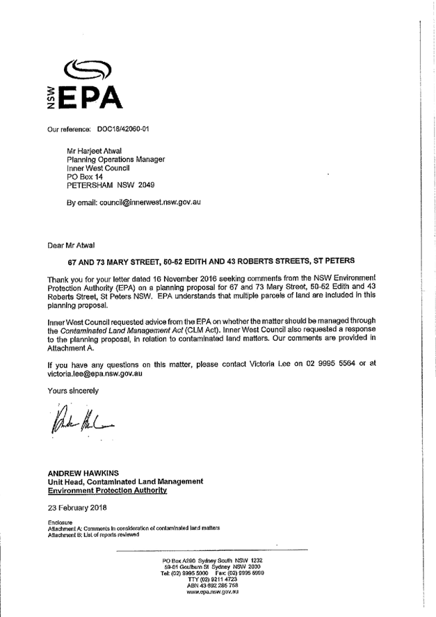
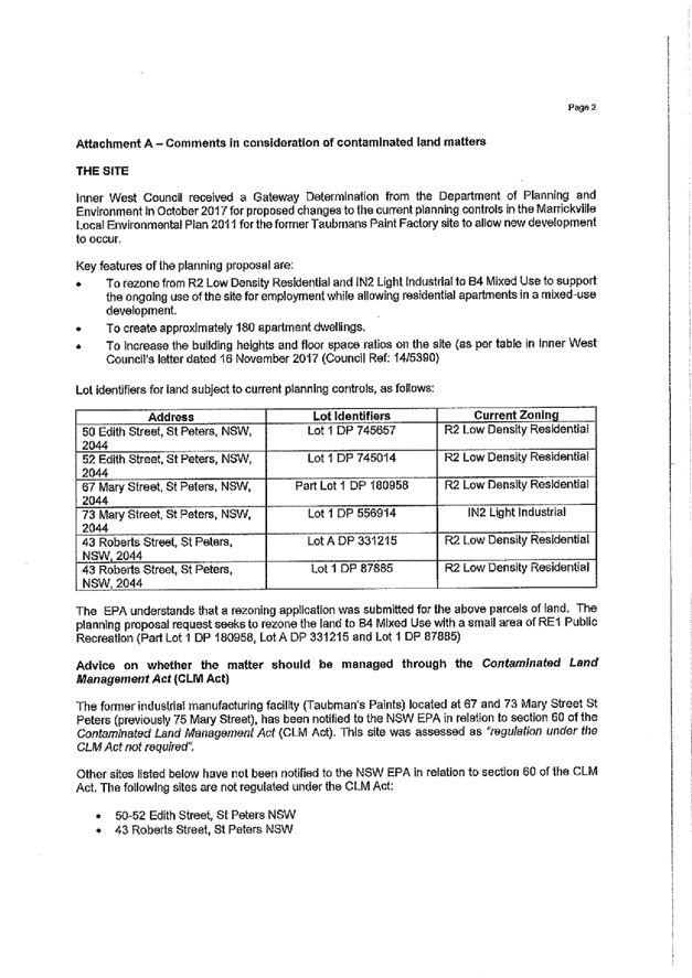

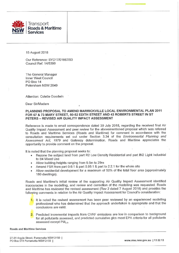
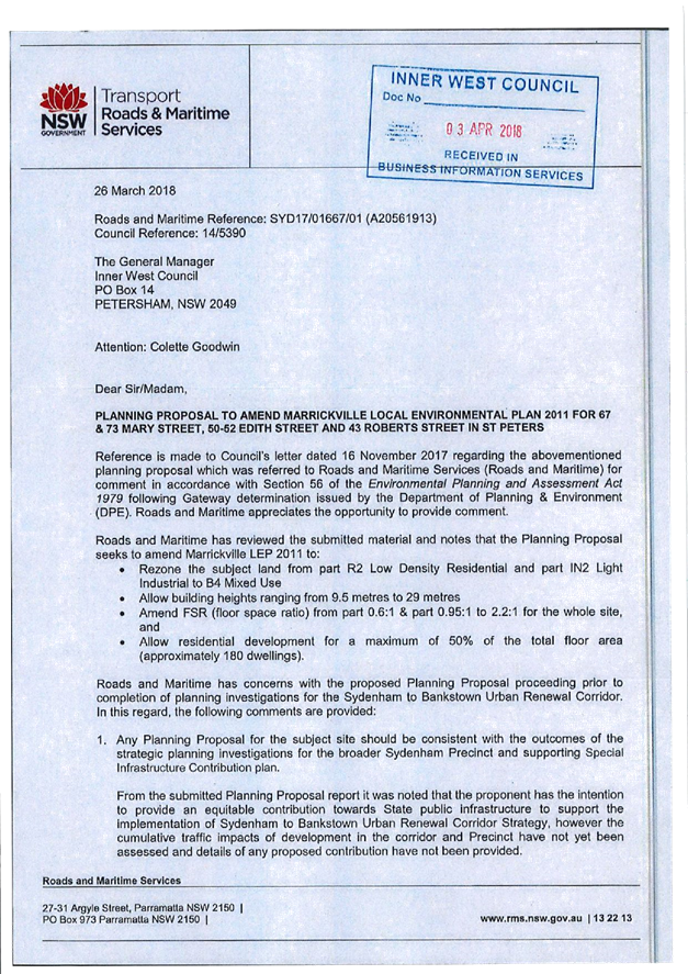
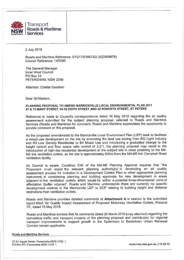

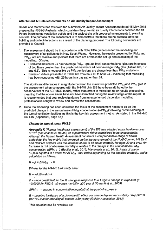


Traffic and Parking Impact Assessment Report
www.innerwest.nsw.gov.au/precinct-75-planning-proposal


|
|
Council Meeting 30 October 2018 |
Heritage Asessment and Statement of Heritage Impact
|
|
Council Meeting 30 October 2018 |
Subject: Affordable Housing for Victoria Road Precinct
Prepared By: Jon Atkins - Affordable Housing Policy Leader
Authorised By: David Birds - Group Manager Strategic Planning
|
SUMMARY Council resolved on 11 September 2018 to seek “timely external expert advice on how to get the financial feasibility analysis that would support the most effective application of Council’s affordable housing policy to the residential component of the Victoria Rd Precinct”. It was requested that this advice should canvas whether it can be funded from Section 94 monies or the LEP Project budget and requested that a report be brought back to the first meeting in October 2018.
In response to the Council resolution, the consultant who has previously advised Council on its Affordable Housing Policy was approached to develop a proposal to provide advice on the preparation of financial feasibility analysis to support the development of an Affordable Housing Contribution Scheme for the Victoria Road Precinct. An initial proposal has been obtained addressing assistance to Council with the preparation of a Planning Proposal to support a Local Environment Plan (LEP) amendment for a contribution scheme under State Environmental Planning Policy No. 70 – Affordable Housing (Revised Schemes) (SEPP 70).
However it is unlikely that an LEP amendment applying an affordable housing contribution scheme under SEPP 70 is currently capable of being made until late 2019 or later. It appears likely that Development Applications (DAs) for the residential components at Victoria Road may well have been submitted and determined by that time. Consequently affordable housing will need to be negotiated under Voluntary Planning Agreements (VPAs) associated with those DAs. However the negotiation of those VPAs will also need to be supported by financial feasibility analysis.
It is therefore proposed to develop a scope of works for the appointment of suitable consultant to support Council in the consideration of a generic model approach to affordable housing contribution schemes for precincts that are to be considered for rezoning before the new Council-wide LEP is gazetted, and to support Council in its negotiations on VPAs. Importantly this work will also support the development of the approach to be taken to SEPP 70 schemes in the new Council-wide LEP. It has been determined that funding is available to support the appointment of a consultant to carry out this work under the Community Services and Culture budget and from Section 7.11 Plan monies. |
|
RECOMMENDATION
THAT Council develop a scope of works and appoint a suitable consultant to provide financial feasibility analysis to support the consideration of a generic model approach to affordable housing contribution schemes for precincts that are to be considered for rezoning before the new Council-wide LEP is gazetted, to support Council in its negotiations on VPAs and to support the development of the approach to be taken to SEPP 70 schemes in the new Council-wide LEP. |
BACKGROUND
Affordable Housing Policy
At its meeting on 28 March 2017 (C0317 Item 3), Council resolved to adopt the Affordable Housing Policy and the Position Paper: Best Practice in Value Capture.
Research supporting the Affordable Housing Policy (AHP) showed that the Inner West Council LGA had experienced some of the most rapid real increases in housing prices (rental and purchase) over the past decade, with accelerating trends in recent years. Even the lowest priced strata dwellings are no longer affordable to very low and low income households, and are generally affordable only to the upper end of the moderate income band.
The AHP’s economic modelling also showed that very little new housing constructed in the future will be affordable to very low or low income households, or to moderate income families, without strong intervention through the planning system to capture a reasonable share of land value uplift to fund affordable rental housing in perpetuity.
The economic analysis indicated that there will be significant land value uplift associated with rezoning across the LGA, particularly in larger brownfield and redevelopment sites. Such value can be captured through Voluntary Planning Agreements (VPAs) negotiated prior to rezoning or through affordable housing contribution schemes under State Environment Planning Policy No. 70 – Affordable Housing (Revised Schemes) (SEPP 70) to provide for mandatory contributions.
State Environment Planning Policy No. 70 – Affordable Housing (Revised Schemes) (SEPP 70)
Council lodged a formal application with the Minister of Planning for inclusion in SEPP 70 on 28 April 2017. In April 2018, following an exhibition period, the Minister approved an amendment to SEPP 70 to include Inner West, Randwick, Northern Beaches, Ryde and Canada Bay councils.
In doing so, the Department of Planning and Environment (DPE) in its Explanation of Intended Effect relating to the SEPP amendment acknowledged that Council’s Affordable Housing Policy had provided a:
… comprehensive analysis of housing conditions within the local government area” and had identified a need for more affordable rental housing. It noted Council’s research showing “gentrification of the inner west had been coupled with a reduction in dwellings available to very low and low income households” and that this “had led to an increase in housing stress among these households, paying a disproportionate amount of their weekly income on rent and thus at risk of having insufficient income to pay for other necessities such as healthy food, transport and health care. (p. 7)
In order to implement an affordable housing contribution scheme under SEPP 70, Council is required to lodge a draft scheme with DPE that identifies areas or precincts to which mandatory affordable housing levies would apply. This can only be introduced through the normal LEP amendment process which includes the securing of a Gateway determination, public exhibition and subsequent consideration and gazettal by the Minister. DPE has indicated the schemes would need to demonstrate that the proposed affordable housing contribution schemes will not impact adversely on the general supply of housing in the specified areas through a financial feasibility analysis.
Without a SEPP 70 affordable housing contribution scheme in place, Council is only able to achieve affordable housing in precincts such as Victoria Road via Voluntary Planning Agreements (VPAs).
Affordable Housing for Victoria Road Precinct
Previous reports to Council have referred to the Victoria Road precinct planning proposal which encompasses approximately half the area of Precinct 47 as defined under Marrickville Development Control Plan 2011 (MDCP 2011). This subject land, comprising nearly 18 hectares, forms part of the Sydenham/Marrickville industrial lands which were formerly zoned IN1 General Industrial. A planning proposal gazetted in December 2017 rezoned these industrial lands to a mix of R3 Medium Density Residential, R4 High Density Residential, B4 Mixed Use and B5 Business Development. These changes to planning controls permit approximately 1,100 residential dwellings to be constructed in the precinct. Refer to Image 1 below.
|
Image 1: Zonings under the Victoria Road Planning Proposal |
|
|
|
|
The potential application of Council’s Affordable Housing Policy to the Victoria Road precinct was addressed in the Council report Victoria Road Precinct Planning Proposal (C0617, Item 5) on 27 June 2017. This report referred to the proponent’s planning proposal which sought changes to planning controls to permit approximately 1,100 dwellings in the precinct and included an offer of 5% affordable housing in the residential zones. The report noted that the proponent had sought to “up zone the subject land to allow residential development up to 14 storeys in height” but noted, however, that “in view of the scale of the up-zoning, the proponent’s proposed 5% affordable housing rate (with the actual rate being less when calculated under the proposed new definition of “accountable gross floor area”) is considered inadequate and therefore not supported.”
The former Council Administrator’s conditional support for the planning proposal given on 27 June 2017 included a number of requirements including “affordable housing being provided in accordance with the requirements of the Inner West Council’s Affordable Housing Policy”.
In the ‘Finalisation Report’ on the Marrickville Local Environment Plan 2011 Amendment No. 14, prepared by the DPE dated 30 November 2017, it was stated that:
The draft LEP does not include provisions for affordable housing as Council is not part of State Environment Planning Policy No. 70 – Affordable Housing (Revised Schemes) (SEPP 70). Council has requested to be included in SRPP 70 as part of a separate process, which would allow affordable housing contributions to be levied.
The Department supports the provision of affordable in the precinct and until Council’s request to be included in SEPP 70 is processed, the provision of affordable housing in the residential component of the precinct can be negotiated via VPAs in line with Council’s Affordable Housing Policy for the precinct. (p. 7)
On 1 December 2017, the draft amendment to Marrickville Local Environment Plan 2011 (MLEP 2011) was gazetted without any affordable housing requirement. Since that time, as noted earlier, Council has been included in SEPP 70 and therefore can now apply for affordable housing contribution schemes under the SEPP.
DISCUSSION
Options for Securing Affordable Housing in the Victoria Road Precinct
Council’s inclusion in SEPP 70 now opens up the possibility for an affordable housing contribution scheme to be developed for this precinct. This is in keeping with the AHP for such industrial lands subject to re-zoning and is consistent with DPE’s support for the provision of affordable housing in the precinct. While the re-zoning of the Victoria Road Precinct has now taken place, from the substantial resultant increase in land value that was generated there appears to be scope for a significant affordable housing contribution to be made in association with the development of the precinct.
The proponent has previously proposed a 5% contribution and Council has previously resolved to seek affordable housing in accordance with the Affordable Housing Policy. The DPE has also indicated support for a contribution.
In response to the recent Council resolution, the consultant who has previously advised Council on its Affordable Housing Policy was approached to develop a proposal to provide advice on the preparation of financial feasibility analysis to support the development of an Affordable Housing Contribution Scheme for the Victoria Road Precinct. An initial proposal has been obtained addressing assistance to Council with the preparation of a Planning Proposal to support a Local Environment Plan (LEP) amendment for a contribution scheme under State Environmental Planning Policy No. 70 – Affordable Housing (Revised Schemes) (SEPP 70).
It will be important for Council to demonstrate that any affordable housing contribution scheme does not undermine the overall feasibility of the development of the precinct. This will be the case if affordable housing is obtained through a SEPP 70 scheme or under a VPA.
It is therefore proposed to develop a scope of works for the appointment of suitable consultant to support Council in the consideration of a generic model approach to affordable housing contribution schemes for precincts that are to be considered for rezoning before the new Council-wide LEP is gazetted, and to support Council in its negotiations on VPAs. Importantly this work will also support the development of the approach to be taken to SEPP 70 schemes in the new Council-wide LEP.
Planning Proposal Process and Potential Timeline
The Planning Proposal (PP) process related to SEPP 70 currently involves a high degree of uncertainty because the process is new. It is understood that DPE is currently preparing guidelines on how such proposals should be prepared and will be assessed. It is likely that DPE will take a cautious approach to this taking into account the potential for setting precedents and its concerns about potential impacts on project feasibilities. As a result an initial potential timeline has been identified for the implementation of an affordable housing contribution scheme for the Victoria Road precinct under SEPP 70 below. It should be noted that this is high level and there is a significant risk of delay in the various stages. It should also be noted that any scheme will need to take account of the amendment currently being prepared for the Section 7.11 Contributions Plan for the Victoria Road precinct.
|
Stage |
Earliest Estimated Completion |
|
Preparation of draft PP in association with consultant and DPE |
November 2018 to February 2019 |
|
Briefing to IWPP |
March 2019 |
|
Draft Report to Council |
April 2019 |
|
Submission of report for Gateway determination |
April/May 2019 |
|
Gateway determination received by Council |
June/July 2019 |
|
Public exhibition |
July/August 2019 |
|
Post public exhibition report to Council |
September 2019 |
|
Finalise LEP amendment for Parliamentary Counsel (PC) and DPE consideration |
October 2019 |
|
Gazettal of LEP amendment |
November/December 2019 |
The timeline above could be affected by:
· The likelihood that the Gateway determination by DPE and the drafting of an LEP amendment by Parliamentary Counsel may be slower than usual as a result of these processes being relatively new under the revised SEPP 70 legislation;
· The need for DPE to test Council’s feasibility modelling at the Gateway determination stage and again after the LEP amendment exhibition stage.
It is therefore currently unlikely that an LEP amendment applying an affordable housing contribution scheme under SEPP 70 is capable of being made until late 2019 at the earliest.
At the time of preparation of this report, no Development Application (DA) for any of the residential zones within the Victoria Road Precinct had been submitted to Council. However DAs are expected to be lodged by the proponent(s) in the coming months.
While the DA assessment process will be complex, it appears that residential DAs for the Victoria Road precinct submitted in late 2018 / early 2019 may well be determined before a SEPP 70 scheme can be put in place. As a result it is anticipated that Council will need to secure affordable housing contributions from VPAs associated with those DAs during this period. The negotiation of those VPAs will need to be supported by financial feasibility analysis.
It is therefore proposed that the scope of works to be developed for the appointment of suitable consultant to support Council in the consideration of a generic model approach to affordable housing contribution schemes for precincts that are to be considered for rezoning before the new Council-wide LEP is gazetted, will include work that will support Council in its negotiations on VPAs. As noted earlier in this report, the consultant’s work will importantly also support the development of the approach to be taken to SEPP 70 schemes in the new Council-wide LEP. The feasibility of implementing a SEPP 70 scheme for the Victoria Road precinct in time to address DAs for sites in the precinct will be kept under review during this work and updates will be provided to Councillors.
FINANCIAL IMPLICATIONS
It has been determined that funding is available to support the appointment of a consultant under the Community Services and Culture budget and from Section 7.11 Plan monies.
CONCLUSION
Research supporting Council’s Affordable Housing Policy shows that there is a growing number of local people in housing stress and a large unmet need for affordable housing. Research also reveals that housing stress among very low, low and moderate income households is likely to worsen as the Inner West continues to grow and gentrify.
It is currently unlikely that an LEP amendment applying an affordable housing contribution scheme under SEPP 70 is capable of being made until late 2019 at the earliest. It appears likely that DAs for the residential components at Victoria Road may well have been submitted and determined by that time. Consequently affordable housing will need to be negotiated under VPAs associated with those DAs. The negotiation of those VPAs will need to be supported by financial feasibility analysis.
It is therefore proposed to develop a scope of works for the appointment of suitable consultant to support Council in the consideration of a generic model approach to affordable housing contribution schemes for precincts that are to be considered for rezoning before the new Council-wide LEP is gazetted, and to support Council in its negotiations on VPAs. Importantly this work will also support the development of the approach to be taken to SEPP 70 schemes in the new Council-wide LEP.
|
|
Council Meeting 30 October 2018 |
Subject: WestConnex update report
Prepared By: Kendall Banfield - Manager WestConnex Unit
Authorised By: David Birds - Group Manager Strategic Planning
|
SUMMARY This addresses action items from the 4 October 2018 meeting of Council’s WestConnex Community Liaison Forum (WCLF) when WCLF community members requested that certain items be reported to a Council meeting. As a result the following items are discussed and a recommendation is provided for each one: (1) Council dissemination of information on WestConnex; (2) Haberfield-Ashfield footpath issues; (3) plans for use of the Haberfield-Ashfield Muirs sites; (4) plans for Ashfield residual lands; (5) use of a portion of Reg Coady Reserve at Haberfield; (6) keeping a Council register and map of properties known to be damaged by WestConnex; and (7) reimbursement of WestConnex advocacy group expenses.
|
|
RECOMMENDATION
THAT Council:
1. Includes in its next quarterly newsletter information on WestConnex impacts and areas of assistance offered by Council, with reference to the issues listed in the Council report. This information is to be supported by complementary information on Council’s website and within the existing WestConnex Weekly Update Reports. Actions to be investigated and implemented for increasing the readership of the Weekly Update Reports;
2. Writes to the NSW Premier and relevant Ministers seeking: (a) relocation or removal of RMS signs and associated infrastructure in Haberfield-Ashfield that are obstructing footpaths - specifically Waratah Street, Dalhousie Street and Parramatta Road; and (b) further design and construction work be undertaken to widen the footway/path, pointing out that the newly-constructed footway/path on the Ashfield side of Parramatta Road between Orpington & Bland Streets is unduly narrow;
3. Writes to the NSW Premier and relevant Ministers seeking a dialogue with the WestConnex Stage 3A (mainline tunnel) contractor to inform the community of details of what facilities and activities are planned for the Ashfield-Haberfield Muirs sites;
4. Writes to the Premier and relevant Ministers seeking an urgent meeting between the relevant Minister(s) and senior Council staff over the M4 East Residual Lands Management Plan, with specific reference to residual lands in Ashfield. Council to argue that this plan be finalised at the earliest opportunity in consultation with Council, the community and other relevant stakeholders in a way that results in maximum benefit to the Ashfield community;
5. Writes to the Premier and relevant Ministers expressing concern about proposed use of part of Reg Coady Reserve at Haberfield as a truck turning area (G-Loop) and associated service area for WestConnex Stage 3A. This concern is consistent with Council’s general position of opposing use of parks or other areas of publicly-accessible open space by WestConnex, regardless of ownership. It should also be noted that the Inner West has an historic shortfall of open space;
6. Establishes a register and map of properties that have been reported to have suffered damage from WestConnex construction. Council to inform residents of this register and encourage them to inform Council of WestConnex-related property damage. The register to be kept up-to-date and be available to the public via Council’s website. Advice from Council’s legal and risk management staff on legal or other risks to be sought before proceeding with this action; and
7. Reimburses Rozelle Against WestConnex (RAW) $890 (including GST) for flyer printing for the 14 April 2018 anti-WestConnex rally in King George Park and $113.85 (including GST) for materials needed to erect 150 of Council’s anti-WestConnex corflute signs on poles in the Rozelle area (total RAW expenses = $1,003.85). Reimbursement is subject to provision to Council of invoices, receipts or other proof of expenses.
|
BACKGROUND
Introduction
This report addresses action items from the 4 October 2018 meeting of Council’s WestConnex Community Liaison Forum (WCLF), where WCLF community members requested that some of the items from this meeting be reported to a Council meeting. The items are discussed below with a recommendation for each one, and the recommendations are also collated above.
Item 1: Dissemination of Council’s WestConnex information
This action item is: “Council to investigate the production of a dedicated WestConnex community newsletter (or alternatively information within the rates newsletter) highlighting WestConnex impacts and advising residents of areas of assistance offered by Council.”
WCLF members had suggested the newsletter include (but not be restricted to) information on the following:
· issues related to Stage 3 truck routes, including information that all trucks will have GPS tracking in real-time, as required by the project’s conditions of approval;
· RMS street sign footings and associated infrastructure blocking footpaths in Haberfield-Ashfield, why the infrastructure is there and what Council is doing about it;
· use of part of Reg Coady Reserve for Stage 3;
· the likelihood there will be a change in the alignment of the Stage 3A tunnel (once confirmed); and
· early utilities works for Stage 3B (Rozelle Interchange and Iron Cove Link), to be undertaken in King George Park at Rozelle and in streets between the park and Victoria Road.
The option of producing a stand-alone flyer would cost in the order of $20,000 if distribution is to all ratepayers in the Inner West Council area. Printing of a double-sided A3 folded colour flyer would cost around $5,000, with distribution by letterbox drop around $15,000. Costs would be reduced proportionally (by around half) if distribution was limited to WestConnex-affected areas only – bringing the total cost to around $10,000.
Council does not currently have a budget for the production and distribution of such a flyer but as an alternative information could be supplied with the existing quarterly rates notice in summary form and the cost of this could be covered by existing budgets.
It is noted that after consideration of Notice of Motion: Tree DCP Mailout at the 11 September 2018 meeting, Council resolved to “consider at the time of the quarterly budget review an allocation of funds for the strategic planning group for the purpose of notification about infrastructure projects, rezoning proposals and public meetings.” If this funding is approved at the review, it could potentially be utilised for a future newsletter or other communication on WestConnex.
In the meantime it is proposed to utilise distribution of updates in associated with the quarterly rates notices. This information would be supported by complementary information provided on Council’s website and in the existing WestConnex Weekly Update Reports. Potential actions will also be investigated by Council’s WestConnex Community Organiser working with the various WestConnex advocacy groups on means of increasing the readership of the Weekly Update Reports.
Recommendation: That Council includes in its next quarterly newsletter information on WestConnex impacts and areas of assistance offered by Council, with reference to the issues listed in the Council report. This information to be supported by complementary information on Council’s website and within the existing WestConnex Weekly Update Reports. Actions to be investigated and implemented for increasing the readership of the Weekly Update Reports.
Item 2: Haberfield-Ashfield footpath issues
The action item is: “Council staff to include in the WestConnex report to Council consideration of: (a) the need for all RMS infrastructure in Haberfield and Ashfield that is obstructing the passage of pedestrians along footpaths to be relocated or removed - specifically Waratah Street, Dalhousie Street and Parramatta Road; and (b) the need to point out to RMS that the newly-constructed footway on the Ashfield side of Parramatta Road between Orpington & Bland Streets is too narrow, and further design and construction work be undertaken to widen the footway.”
Earlier in 2018, local residents and Council staff were advised that M4 East variable message and fixed signage would be erected on Waratah and Dalhousie Streets and Parramatta Road. Council staff and many community members objected to this infrastructure on the basis of potential for footway clutter and visual impact within heritage-listed residential areas.
Project contractors have a legal right under the NSW Roads Act to erect such signage within the road reserve on behalf of RMS. When initially notified, Council staff had emphasised the need to locate sign footings well away from footpaths as close as possible to the kerb within the ‘verge’. Council staff stated that under no circumstances should footings or other obstacles block pedestrian movement along footpaths.
In recent weeks, Council staff and local residents have been shocked and disappointed to see that several sign footings and electrical cabinets have been erected on footpaths, causing major visual and pedestrian access issues. As would be expected, feelings on this issue have been heightened by the fact that the Haberfield-Ashfield community has already endured years of construction impacts from WestConnex.
Council staff, WCLF members, the Haberfield Association and members of the local community continue to express their strong opposition to these obstacles. For example, the Haberfield Association raised this matter at a recent hearing of the WestConnex Parliamentary Inquiry. All are dismayed that RMS could have allowed M4 East contractors to proceed in this way. RMS’s WestConnex Project Director has stated at WestConnex Community Reference Group (WCRG) meetings that RMS staff are investigating options for moving these obstacles.
The main offending obstacle is the electrical cabinet that has been placed longitudinally across the footpath on Waratah Street, completely blocking the passage of pedestrians. Council staff recently attended a meeting with the RMS WestConnex Project Director and M4 East Project Director to determine whether there were options to move this cabinet off the footpath and into the verge. The M4 East Project Director stated this was not possible due to services in the verge, and it was not possible to re-orient the cabinet due to the need for M4 East maintenance staff to gain access via doors on both sides. Council staff maintained that this was not an acceptable situation.
There are several of these obstacles on footpaths in other Haberfield-Ashfield streets, including sign footings and cabinets on footpaths (and in some cases in verges) in Dalhousie Street and along Parramatta Road. Whilst all of these obstacles raise visual impact and pedestrian access issues, none are as critical as the aforementioned Waratah Street cabinet.
The owner of Milano Furniture at 140 Parramatta Road at Ashfield has raised strong objections to the erection of a large variable message sign and associated electrical cabinet on the footway at the front of his furniture store. The owner has recently written to Council seeking an assessment of the sign’s location by Council’s Traffic Committee and ultimately support for relocation of the sign to an alternative location.
Council staff and local residents and local business operators continue to express opposition to the erection of signs on the footway adjacent to Ashfield Park, mainly on the basis of visual impact. Notwithstanding, signs are being erected along this section of footpath.
Erection of signs adjacent to Ashfield Park may not be consistent with M4 East Condition of Approval B26, which states that “The Proponent must not destroy, modify or otherwise physically affect the buildings or land known as Yasmar Estate or Ashfield Park. Where visual impacts or other impacts to the setting of these heritage items are expected, these are to be mitigated through measures outlined within the Urban Design and Landscape Plan as required by condition B45.”
At project meetings, Council staff have raised strong objections to all these signs and cabinets blocking footpaths across Haberfield-Ashfield and creating a visual impact around Ashfield Park. It is recommended in this report that this objection be formally conveyed by Council to the highest levels of the NSW Government by writing to the NSW Premier and relevant Ministers.
A further M4 East footpath issue is the view by Council staff, WCLF members and Haberfield-Ashfield residents that the newly-constructed footway (i.e. distance from kerb to property boundary) and footpath (i.e. paved pedestrian movement path) along Parramatta Road between is too narrow. Instead of replacing the previous 4m-wide footway ‘like-for-like’, the newly-constructed footway has a reduced width of 2.9m. When challenged on this issue, the M4 East project has argued that the narrowing of the footway is justified as it has a low volume of pedestrian traffic.
In general terms, there has not been adequate consultation with Council staff and local residents on the design of footways and other elements of residual lands on the Ashfield side of Parramatta Road. Throughout the M4 East residual lands consultation process, the focus has been on lands on the Haberfield side of Parramatta Road rather than in Ashfield.
Further, drawings associated with consultations have not been scaled and did not include dimensions, so it has not been possible for Council staff or community members to determine proposed footpath/footway widths. Council has at different times requested scaled/dimensioned drawings, but these have not been supplied. Council is aware that traffic lanes were widened on that part of Parramatta Road, which could be a further reason why reduced-width footways have resulted.
Photographs of selected footpath obstacles (supplied by a local resident) are at Attachment 1. The photographs also show the footpath along the Ashfield side of Parramatta Road under construction. Note that as these photographs were taken in September 2018, construction of this infrastructure will have advanced in most cases.
Recommendation: That Council writes to the NSW Premier and relevant Ministers seeking: (a) relocation or removal of RMS signs and associated infrastructure in Haberfield-Ashfield that are obstructing footpaths - specifically Waratah Street, Dalhousie Street and Parramatta Road; and (b) further design and construction work be undertaken to widen the footway/footpath, pointing out that the newly-constructed footpath/footway on the Ashfield side of Parramatta Road between Orpington & Bland Streets is unduly narrow.
Item 3: Plans for use of the Ashfield Muirs sites
The action item is: “Council staff to include in a report to Council a request for letters to be written to the Premier and relevant Ministers requesting the Stage 3A (mainline tunnel) contractor to inform the community of details of what facilities and activities are planned for the Ashfield-Haberfield Muirs sites.”
WCLF members were concerned that there has not (at this stage) been any dialogue between the Stage 3A contractor and the local community about details of use of the Haberfield-Ashfield construction sites. Particular concern was raised about the two Muirs sites, as local residents have observed what appears to be soil testing on these sites and there is concern that this is related to soil contamination from prior car maintenance activities. It was felt there was a need for the Stage 3A contractor to inform the community on this and other matters related to the Muirs sites.
Recommendation: That Council writes to the NSW Premier and relevant Ministers seeking a dialogue with the WestConnex Stage 3A (mainline tunnel) contractor to inform the community of details of what facilities and activities are planned for the Ashfield-Haberfield Muirs sites.
Item 4: Plans for Ashfield residual lands
The action item is: “Council staff to include in the report to Council a request for senior Council staff to meet with the Minister for Roads about the M4 East Residual Lands Management Plan, with specific reference to residual lands in Ashfield. Council staff to argue that this plan be finalised in a way that brings maximum benefit to the Ashfield community, in consultation with Council and the community.”
WCLF members have felt that M4 East consultations have focused on residual lands on the Haberfield side of Parramatta Road rather than Ashfield residual lands. Members are concerned that there has been little consultation over the M4 East Residual Lands Management Plan as it applies to Ashfield. WCLF members would like all Ashfield residual lands to be devoted to open space or other appropriate community use, and that finalisation of this plan involve consultation with Council, the local community and other relevant stakeholders.
Recommendation: That Council writes to the Premier and relevant Ministers seeking an urgent meeting between the relevant minister(s) and senior Council staff over the M4 East Residual Lands Management Plan, with specific reference to residual lands in Ashfield. Council to argue that this plan be finalised at the earliest opportunity in consultation with Council, the community and other relevant stakeholders in a way that results in maximum benefit to the Ashfield community.
Item 5: Use of a portion of Reg Coady Reserve
The action item is: “Council staff to include in the report to Council information on the extension of the lease of a portion of Reg Coady Reserve proposed as part of Stage 3A Modification 1.”
The recently exhibited Stage 3A Modification 1 proposes continuation of the G-loop truck turning area at Dobroyd Parade, Haberfield with an area added next to the G-loop for general construction activities. A map from Stage 3 Modification 1 at Attachment 2 shows the layout of the G-loop. Use of this additional area of Reg Coady Reserve would likely require a lease arrangement with Council. WCLF members expressed their concerns about continued use of Reg Coady Reserve for WestConnex construction activities. This is consistent with Council’s general position of opposing use of parks or other areas of publicly-accessible open space by WestConnex.
Recommendation: That Council writes to the Premier and relevant Ministers expressing concern about proposed use of part of Reg Coady Reserve at Haberfield as a truck turning area (G-Loop) and associated service area for WestConnex Stage 3A. This concern is consistent with Council’s general position of opposing use of parks or other areas of publicly-accessible open space by WestConnex, regardless of ownership. It should also be noted that the Inner West has an historic shortfall of open space.
Item 6: Council register of damaged properties
This action item is: “Council staff to include in the report to Council a request from WCLF community members that Council establishes a register and map of properties known to have suffered structural or other damage from WestConnex construction.”
WCLF members acknowledged that Council is only aware of some instances where property damage has resulted from WestConnex, but nonetheless thought it would be useful for Council to record and map properties known to have suffered damage. This would inform the general community of damage ‘hot spots’ related to WestConnex, which could be useful in the event of a claim. A budget for this action is not required, as the register could be compiled using existing staff resources.
However, before proceeding with this action, it is prudent to obtain and consider advice from Council’s legal and risk management staff to ensure that Council is not exposed to legal action or other risks arising from this item from the project, property owners or other parties. Accordingly, the recommendation for this item includes a provision for seeking such advice.
Recommendation: That Council establishes a register and map of properties that have been reported to have suffered damage from WestConnex construction. Council to inform residents of this register and encourage them to inform Council of WestConnex-related property damage. The register to be kept up-to-date and be available to the public via Council’s website. Advice from Council’s legal and risk management staff on legal or other risks to be sought before proceeding with this action.
Item 7: Advocacy group expenses
The action item is: “Council staff to include in the report to Council claims for reimbursement of advocacy group expenses.”
At the meeting a WCLF member, who is also a Rozelle Against WestConnex (RAW) member sought reimbursement of $890 (including GST) for expenses incurred in printing 20,000 A5 notices for RAW’s anti-WestConnex rally at King George Park on Saturday 14 April 2018. An invoice from the printer has been supplied. Another RAW member has asked for reimbursement of $113.85 (including GST) for materials needed to erect 150 of Council’s anti-WestConnex corflute signs on poles in the Rozelle area. Receipts for these materials have been supplied.
When this request was made at the WCLF meeting, Council staff advised that these requests would need to be approved at a Council meeting, as have all prior expenses requests related to WestConnex advocacy.
Recommendation: That Council reimburses Rozelle Against WestConnex (RAW) $890 (including GST) for flyer printing for the 14 April 2018 anti-WestConnex rally in King George Park and $113.85 (including GST) for materials needed to erect 150 of Council’s anti-WestConnex corflute signs on poles in the Rozelle area (total RAW expenses = $1,003.85). Reimbursement is subject to provision to Council of invoices, receipts or other proof of expenses.
FINANCIAL IMPLICATIONS
Item 7 in this report recommends reimbursement of a total of $1,003.85 (including GST) to WestConnex Advocacy group Rozelle Against WestConnex (RAW). A budget adjustment will be required to fund the proposed reimbursement.
OTHER STAFF COMMENTS
Relevant Council staff have been engaged in the preparation of this report.
PUBLIC CONSULTATION
Nil. Public consultation is not required.
|
1.⇩ |
Photographs taken in September 2018 showing WestConnex-related footpath obstructions in Haberfield and Ashfield, and footpath on Ashfield side of Parramatta Road under construction |
|
2.⇩ |
Map from Stage 3 Modification 1 showing Dobroyd Parade G-loop at Haberfield |
|
|
Council Meeting 30 October 2018 |
Subject: Western Harbour Tunnel Reference Design
Prepared By: Kendall Banfield - Manager WestConnex Unit
Authorised By: David Birds - Group Manager Strategic Planning
|
SUMMARY In late July 2018 Roads & Maritime Services (RMS) released for public comment reference designs for the Western Harbour Tunnel (WHT) and Beaches Link projects. These are separate motorway projects that join at the Warringah Freeway at North Sydney. As only the WHT would directly affect the Inner West Council area, the Beaches Link has not been considered here.
Attached to this report is a draft submission on the WHT reference design which raises the main issues for Council and the Inner West community. Also attached is the reference design document itself.
It is recommended in this report that Council makes a submission to Roads & Maritime Services (RMS) on the WHT reference design by the 9 November 2018 deadline based on the attached draft submission and including comments raised at the Council meeting. |
|
RECOMMENDATION
THAT Council makes a submission to Roads & Maritime Services (RMS) on the Western Harbour Tunnel reference design by the 9 November 2018 deadline, based on the draft submission at Attachment 1 and including comments raised at the Council meeting.
|
BACKGROUND
In late July 2018 RMS released for public comment reference designs for the Western Harbour Tunnel (WHT) and Beaches Link projects. These reference designs are only intended to provide preliminary concepts for these projects. Detailed designs would be within Environmental Impact Statements (EISs), which are planned to be released for public comment in the first half of 2019. The consultation process for these reference designs is non-statutory, i.e. they do not need to follow consultation processes defined by the Environmental Planning & Assessment Act.
Although WHT and Beaches Link are separate motorway projects, they would join at the Warringah Freeway at North Sydney. As only the WHT would directly affect the Inner West Council area, the Beaches Link is not discussed in this report.
The 45-page WHT reference design (at Attachment 2) is available on RMS’s WHT / Beaches Link web pages at:
https://www.rms.nsw.gov.au/projects/sydney-north/western-harbour-tunnel-beaches-link/index.html
The document confirms the features of the project that would result in impacts on the Inner West Council area. In general terms, these features were known previously from information released to the community by RMS and from discussions between Council and RMS staff at project meetings.
The main features of the WHT, as they apply to the Inner West Council area, are as follows:
· a mid-tunnel construction dive-site at former Balmain Leagues Club site on Victoria Road;
· a construction site within the Rozelle Rail Yards (RRY) site;
· a construction site at Yurulbin Park at Birchgrove and within the harbour near Yurulbin Point – note that this park is owned by the NSW Government, not Council; and
· use of part of the White Bay port area for spoil handling and construction/storage of the concrete tunnel sections to be laid on the harbour floor.
Council has previously written to the Minister for Roads to express its opposition to the WHT as part of its overall position of opposing inner-Sydney motorways and preferring public transport solutions to Sydney’s traffic problems.
Environmental impacts from construction of the WHT would include: potential for pollution of the harbour from dredging; noise and vibration impacts on residents near Yurulbin Park; noise, vibration and dust impacts on residents near the former Balmain Leagues Club site and Rozelle Rail Yards (RRY) construction site; and property damage risks, particularly where tunnels are at shallow depths. Further details of these impacts are described in the reference design and in the draft Council submission at Attachment 1.
Importantly, the reference design confirms that spoil trucks would not need to use Balmain-Birchgrove roads. All spoil would either be removed by barge from the harbour or by road from the former Balmain Leagues Club site along Victoria Road and the City West Link Road, or from the RRY site via the City West Link Road.
All construction trucks would use main roads, not residential streets - but concerns are raised about general traffic impacts from the large number of trucks that would be using main roads, particularly when added to truck traffic from other infrastructure activities, including a number of other industrial activities, at White Bay and Glebe Island.
It is expected that most workers would park within White Bay, and that worker parking around the former Balmain Leagues Club site and Yurulbin Park sites would not be permitted. Council seeks a guarantee that workers would have no option but to park in the car parks provided, not in residential streets where parking demand is already strong.
Use of Louisa Road and adjoining streets for light vehicle construction traffic and some workers’ vehicles accessing the Yurulbin Park construction site is expected to create a significant traffic impact on those narrow residential streets.
It is also expected that spoil truck stabling within the White Bay port area would reduce the risk that trucks would park on local streets or queue on main roads before entering construction sites. Council seeks a guarantee that this will be the case.
At project meetings Council staff have raised the need for RMS to consider former coal-mining tunnels in the Balmain-Birchgrove area when preparing their plans. Council notes from the information flyer on early Sydney Harbour tunnels at Attachment 3 that RMS is aware of the location of these tunnels.
These issues and others have been raised in the draft submission at Attachment 1.
At the time of writing Roads & Maritime Services (RMS) had advised on its website arrangements for the following forthcoming community information sessions on the WHT and Beaches Link:
· Manly Warringah Leagues Club, 563 Pittwater Rd, Brookvale on Thursday 11 October, 2–6pm and Saturday 13 October 2018, 10am–2pm;
· Balmain Town Hall (Meeting Room), 370 Darling St, Balmain on Thursday 18 October, 1–5pm and Saturday 20 October 2018, 10am–2pm; and
· Balgowlah RSL, 30-38 Ethel St, Seaforth on Thursday 25 October, 3–7pm.
RMS has advised that details of forthcoming sessions at Northbridge and Cammeray will be posted shortly, and comments on the reference design will be received until Friday 9 November 2018. A final version of the Council submission attached will be lodged by the 9 November deadline.
As mentioned above, this is a preliminary non-statutory consultation that is not bound by the Environmental Planning & Assessment Act. The next statutory consultation would be the public exhibition of an EIS, planned for the first half of 2019.
On the RMS website for these projects is an ‘online tool’ that allows comments to be posted on a map according to six categories: environment; traffic and road safety; property and access; public transport; parking; and ‘other’. It is apparent that many of the WHT comments posted to date raise concerns that are similar to those raised in the draft Council submission.
FINANCIAL IMPLICATIONS
Nil.
OTHER STAFF COMMENTS
Comments from relevant Council staff have been included.
PUBLIC CONSULTATION
This is a NSW Government project and RMS has been undertaking community information sessions and has made the reference design and other information on the WHT available on its website.
|
1.⇩ |
IWC Submission to RMS on Western Harbour Tunnel Reference Design |
|
2.⇩ |
Western Harbour Tunnel reference design, RMS July 2018 |
|
3.⇩ |
RMS information flyer on early Sydney Harbour tunnels |
|
|
Council Meeting 30 October 2018 |
SUBMISSION FROM INNER WEST COUNCIL TO
ROADS & MARITIME SERVICES
ON THE REFERENCE DESIGN FOR THE PROPOSED
WESTERN HARBOUR TUNNEL MOTORWAY
DRAFT - OCTOBER 2018
Council appreciates the opportunity to comment on the reference design for the proposed Western Harbour Tunnel (WHT) motorway. As only limited detail has been provided in the reference design, Council’s submission is brief. As far as Council is aware, an Environmental Impact Statement (EIS) would be released for public comment some time in the first half of 2019, and it is expected that extensive details on the WHT will be included in the EIS.
Inner West Council continues to oppose inner-Sydney motorways, preferring alternative transport options that include public transport, active transport, modest/targeted road network improvements, transit-oriented development and travel demand-management. Council is concerned about a number of strategic issues that are created by inner-Sydney motorways, including reduced economic productivity, reduced liveability, induced traffic, declining air quality, mode-shifting from public transport and the equity impact of tolls.
In October 2017, the then newly-elected Inner West Council resolved that “Inner West Council formally adopts a position of continued opposition in the strongest terms to the WestConnex project, both approved and future stages including Stage 3, consistent with the opposition of the former councils of Ashfield, Leichhardt and Marrickville.”
In December 2017 Council had resolved to “Write to the Minister for Roads expressing its opposition to the Western Harbour Tunnel and Beaches Link project as part of its overall position of opposing inner-Sydney motorways and preference for public transport options.”
Notwithstanding this opposition, Council continues to work with the NSW Government, Sydney Motorway Corporation (SMC), project contractors and the community to ensure that impacts are minimised and benefits are gained wherever possible. In doing so, Council has raised many issues about local impacts from WestConnex - environmental, health, traffic, transport, construction and economic impacts, as well as lack of adherence to good planning and management practice. Council is concerned that these impacts will be extended in duration and spatial extent by the WHT, should it proceed.
Council has been particularly concerned about the health impacts from the construction and operation of WestConnex. For construction, identification of these issues is based on the lived experience of Haberfield-Ashfield and St Peters residents affected by Stages 1 and 2 from late 2015 to date. Ill-health has resulted from sleep deprivation caused by night works and from construction dust. For operation, the main issue is the impact on air quality from the unfiltered ventilation facilities and increased surface traffic. Council is keen to ensure that these issues are not extended to other parts of the Inner West Council area by the WHT.
Council notes that the WHT and Beaches Link are two separate motorway projects that would join at the Warringah Freeway at North Sydney, and that both projects are being progressed simultaneously. As only the WHT project will directly affect the Inner West Council area, the Northern Beaches Link has not been considered in this submission.
A draft version of this submission was considered by Council at its 30 October 2018 meeting and comments made at the meeting have been integrated into the submission. Should any additional comments be forthcoming from Council after the final version has been submitted by the 9 November 2018 due date, these will be forwarded to RMS as a late addendum.
Council’s comments on the reference design
Construction activities in the harbour at Yurulbin Point
It is noted that these activities are described on Page 38 of the reference design. Council is concerned about the impacts on marine life of dredging the harbour floor for the immersed tube, and the risk that this activity (along with construction of the cofferdam) will lead to contaminated sediments polluting the harbour. All construction activities will impose significant noise, vibration and visual pollution impacts on nearby residents for several years, particularly those at the end of Louisa Road and in Numa Street, Birchgrove.
Further concerns are the shallow depth of land tunnels at Yurulbin Point, with the consequent potential for cracking of buildings, and the inherent construction risks involved in joining the road header (land) tunnel to the immersed tube (under-sea) tunnel.
Council is also keen to ensure that the temporary relocation of the Birchgrove Ferry Wharf does not have a negative impact on ferry users and local residents, and that this wharf is fully accessible.
Council notes that RMS is aware of tunnels from former coal mines in the vicinity of the WHT route. Council seeks reassurance that these tunnels do not pose a risk in the construction of the WHT.
Construction within the park at Yurulbin Point
It is noted that this site is described on Page 39 of the reference design. Council acknowledges that Yurulbin Park is owned by the NSW Government (not Council) but continues to express opposition to any piece of open space that is removed (permanently or temporarily) for motorway construction. Yurulbin Park is no exception.
Although the tunnelling site within the harbour next to the park would be within an acoustic shed, Council is still concerned about noise, dust and vibration impacts on residents given their close proximity. These impacts will come from a range of activities within and around the park, including noise from machinery and barge movements.
Council is relieved to note that no spoil trucks would use Balmain-Birchgrove roads, as all spoil will either be removed by barge from the harbour construction sites or by road from the former Balmain Leagues Club site and RRY site. Council is also relieved that spoil truck movements to/from these sites would be on main roads – i.e. Victoria Road and City West Link Road. Notwithstanding, Council is concerned that use of Louisa Road and adjoining roads for light vehicle movements to/from Yurulbin Point would create a significant traffic impact on these narrow residential streets.
Council is also keen to ensure that there is no possibility that workers would be able to park anywhere near the Yurulbin Point construction sites, as parking demand is already strong on surrounding residential streets.
Construction site at former Balmain Leagues Club site
It is noted that this site is described on Page 40 of the reference design. Earlier in 2018 when use of the former Balmain Leagues Club (‘Tigers’) site for spoil removal was announced, Council formally expressed its opposition to use of this site. Council is concerned it would result in significant construction impacts and would unduly delay the imminent redevelopment of this site for uses that include the Tigers Leagues Club.
Although spoil trucks would use main roads to access this site (entering from and exiting to Victoria Road) and truck loading operations would occur within an acoustic shed, there would still be noise, vibration, dust, road safety and congestion impacts from the significant number of truck movements and 24/7 operations.
Residents at the rear of the site on Moodie, Waterloo and Darling Streets are within close proximity, so would be vulnerable to impacts - as would residents and children attending Rozelle Primary School on the opposite side of Victoria Road and businesses adjacent and opposite the site on Victoria Road.
Impacts from Tigers site will be in addition to impacts from the Victoria Road construction site (part of the Iron Cove Link component of WestConnex Stage 3B). Residents and businesses on or near Victoria Road from the Tigers site through to the Iron Cove Bridge would endure noise, vibration, dust and traffic impacts from both projects. Council is also concerned that traffic congestion caused by construction trucks along this part of Victoria Road will negatively affect the multiple bus services in operation.
Construction site at White Bay & Glebe Island
It is noted that this site is described on Page 41 of the reference design, where part of the White Bay / Glebe Island port area would be used for barge logistics, handling of tunnel spoil and dredged material, and construction/storage of the concrete tunnel (or ‘immersed tube’) sections to be laid on the harbour floor. Although the reference design states there will be “rigorous and comprehensive environmental procedures for sediment management”, Council is still concerned about the environmental and safety risks involved in handling contaminated material from the harbour floor.
Council is concerned about the cumulative impacts from all construction-related activities proposed to be carried out at White Bay and Glebe Island, as well as impacts from the redevelopment of the White Bay Power Station site, should that development proceed simultaneously. These impacts will be added to existing impacts from the White Bay passenger cruise terminal.
Proposed construction-related activities include parking/stabling for WestConnex, multi-user facility and concrete batching plants. Council seeks reassurance that the NSW Government will undertake an assessment of cumulative impacts rather than relying on separate assessments of each of these activities.
Council’s main concerns about cumulative impacts relates to noise impacts on surrounding residents from 24/7 activities – particularly those residents in southern parts of Balmain and in parts of Pyrmont fronting Jones Bay opposite the site (within the City of Sydney Council).
A further concern is congestion and road safety impacts from the significant number of large trucks that will service these activities via James Craig Road and City West Link Road. These truck movements will exacerbate existing congestion at major intersections in the area, including the intersection at The Crescent and City West Link Road. Even if the phasing of lights at these intersections were to be altered in an attempt to improve traffic flows, congestion would still be significant due to the sheer number of trucks involved.
Council is pleased that the WestConnex Stage 3 approval ruled out use of Robert Street, and Council continues to argue that trucks servicing the other proposed construction uses at White Bay not be allowed to that street, and that they be restricted to James Craig Road. Robert Street is already heavily congested, and due to the number of small businesses fronting that road, it is not suitable for large trucks.
Following is Council’s estimate of daily truck movements to/from White Bay via James Craig Road:
· Multi-user facility - approx. 1,200 truck movements/day;
· Concrete batching works – approx. 2,000 truck movement/day;
· WestConnex Stage 3 - approx. 280 truck movements/day;
· WHT - approx. 130 truck movements/day (includes movements to/from White Bay stabling area to former Balmain Leagues Club site);
· Sydney Metro (rail) – approx. 460 truck movements/day; and
· TOTAL truck movements – more than 4,000 truck movements/day.
This adds further weight to Council’s argument that the NSW Government needs to undertake an assessment of cumulative impacts, not just rely on individual assessments of uses proposed for White Bay and Glebe Island.
Council expects that parking will be provided at White Bay / Glebe Island for all WHT workers, and expects there would be procedures in place to ensure that workers have no option than to use the parking provided. It is imperative that workers are not able park on streets near WHT construction sites at the RRY site, Victoria Road and Yurulbin Point, as all surrounding streets are already subject to heavy parking demand.
Council also expects that all WHT truck movements to/from construction sites and the stabling area at White Bay would be carefully co-ordinated using GIS tracking and communication technology. It is imperative that ad-hoc stabling on streets and queuing of trucks entering sites is avoided.
Though Council is relieved that all construction trucks would use main roads (not residential streets), concerns are still raised about congestion and road safety impacts (discussed above) and ambient noise affecting residential areas in Rozelle, Balmain, Lilyfield and suburbs along the main trucking routes to the west. It is expected that ambient noise would be an issue given the sheer number of trucks from multiple activities and movements occurring 24/7.
Construction site at the Rozelle Rail Yards (RRY) site
It is noted that this site is described on Page 42 of the WHT reference design, where key activities would be fit-out of WHT ramps and ventilation facilities. Given the site would not be used for spoil removal, it is expected that most construction activities would be carried out during standard daytime construction hours.
As there are many residents living within close proximity to this site and these residents will also endure years of construction impacts from WestConnex Stage 3, it is imperative that noise and other impacts from this site are minimised across the board and restricted to daytime hours.
Council is also concerned that use of this site for WHT will delay completion of the RRY recreation area.
Other issues
The image on Page 27 of the reference design shows a road connection beneath Victoria Road (for the New M4 ramps) at the same location a walk/cycle connection was shown in the WestConnex Stage 3 EIS. Council is concerned that this vital walk/cycle connection may be removed to accommodate these ramps. Consistent with the view expressed in Council’s WestConnex Stage 3 EIS submission, the existing (former freight rail) passage beneath Victoria Road should be used as a walk/cycle connection and a future light rail connection to White Bay.
The image on Page 27 also shows a minimum-width walk/cycle bridge across City West Link Road to the RRY recreation area. Council is concerned that this minimum-width bridge will replace the wide, landscaped walk/cycle ‘land bridge’ proposed in the WestConnex Stage 3 EIS.
In its WestConnex Stage 3 EIS submission (and at every opportunity since), Council has expressed strong opposition to the removal of Buruwan Park, which RMS has informed Council is necessary to create road access from the Crescent to the WHT portal. Council acknowledges that this park is owned by the NSW Government and new areas of open space will be created elsewhere, such as at the RRY recreation area. Notwithstanding, Council remains opposed to removal of all areas of publicly-accessible open space, regardless of ownership – particularly as the Inner West has a shortfall of open space.
At the operational stage, Council is concerned that the WHT (in conjunction with other urban motorways) will increase traffic across Sydney through the ‘induced traffic’ effect. Council is particularly concerned that the WHT will significantly increase traffic along Johnston Street and The Crescent at Annandale – the main feeder roads to the WHT portal at the Rozelle Interchange. After completion of the WHT, these roads would service the main traffic ‘desire line’ between the Inner West and suburbs north of the harbour.
Although classified as State Roads, Johnston Street and The Crescent are lined with residential, school and local shopping uses, making them unsuitable for increased traffic. Council would prefer that traffic on these roads is reduced, and that some of the vehicle movement space is converted to bicycle lanes.
Consistent with Council’s position on WestConnex and other motorways, Council has strong concerns about unfiltered emissions from ventilation facilities. Council notes that one of the three stacks within the RRY site will serve the WHT. The description of “stronger measures on tunnel emissions” on Page 20 of the reference design is noted, but Council continues to argue that, as emissions have a negative health impact at any level, all ventilation facilities should be filtered. Council is also concerned about their visual impact.
|
|
Council Meeting 30 October 2018 |
Subject: City West Cycle Link - Progress Report
Prepared By: Ken Welsh - Transport Planner and Jarrad Sheather - Strategic Planner Strategy & Policy
Authorised By: David Birds - Group Manager Strategic Planning
|
SUMMARY This report has been prepared to provide Council with a summary of progress with Roads and Maritime Services (RMS) and other stakeholders regarding the potential for RMS to fund and deliver all or part of the City West Cycle Link, as part of M4-M5 Link Motorway project.
|
|
RECOMMENDATION
THAT Council:
1. Write to the City of Sydney Council requesting it supports the preparation of a joint letter to the RMS WestConnex Delivery Unit seeking their funding and delivery of the City West Cycle Link as a component of the M4-M5 Link Project. 2. Write to the Minister for Roads and Minister for Transport, highlighting the unique opportunity, presented by construction of the Rozelle Railyards Linear Park, to permit the creation of the City West Cycle Link and requesting their support in pursuing its synchronised construction with the park and Council’s active transport network and its funding and delivery by RMS.
|
BACKGROUND
At its meeting on 24 July 2018 Council resolved as follows (C0718 Item 23):
THAT Council:
1. Note its support for the City West Cycle Link concept;
2. Notes that there may be an opportunity for the project to be delivered by the WestConnex project; and
3. Seek a meeting with the RMS Project Director WestConnex and the City of Sydney to discuss the opportunity to deliver the City West Cycle Link, with the outcome to be reported back to Council.
This resolution was subsequent to a series of resolutions supporting the concept of the City West Cycle Link, dating back to 19 April 2011. Those resolutions were in response to project work by Council Officers commencing in January 2011.
In response to the Council resolution, a meeting was hosted by Inner West Council Officers on 30 August 2018 to discuss the opportunity for RMS to deliver the City West Cycle Link. Attendees at the meeting included relevant Inner West Council and City of Sydney Council staff, RMS staff and representatives of the Inner West Bike Coalition.
At the meeting it was determined that the best and most productive manner to seek RMS delivery of the cycle link was for Inner West and City of Sydney Councils to write a joint letter to RMS requesting that the cycle link be delivered by RMS as part of the M4-M5 Link Project.
Historically
The former Leichhardt Council and the City of Sydney Council initially proposed the City West Cycle Link in January 2011. It was proposed that the NSW State Government design and construct the cycle link within the former freight rail corridor while extending the Inner West Light Rail Line to Dulwich Hill.
Inclusion of the cycle link in the Inner West Light Rail project was rejected by the NSW Government at the time, citing cost and potential delays to delivery of the light rail project. Timing construction in unison with the light rail project was considered crucial to delivery of the cycle way, as the proposed construction methodology would otherwise require temporary shutdown of the light rail line.
The project was supported by numerous Councils and cycling advocacy groups including; Leichhardt Council, Ashfield Council, Marrickville Council, City of Sydney Council, EcoTransit Sydney, BIKESydney,Bicycle NSW and local bicycle user groups. Support from these agencies and Councils was shown in letters to the Minister for Transport at the time.
Overview
The proposed new City West Cycle Link would run from the northern end of the GreenWay/Bay Run to Pyrmont via either the Anzac Bridge or a reinstated Glebe Island Bridge.
The route alignment would generally be within the Light Rail Corridor and Rozelle Railyards. Figure 1 below depicts the general route of the cycle way.
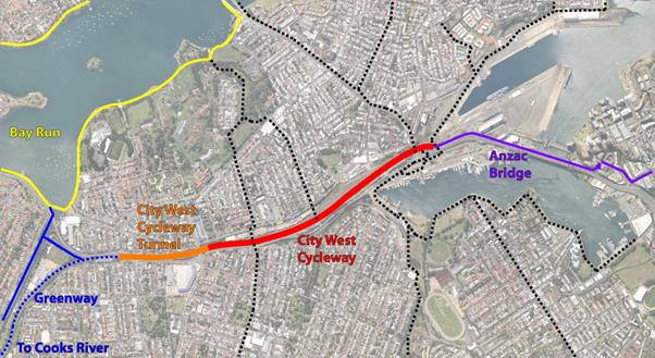
Figure 1: Aerial map of the proposed cycle link (depicted in red and orange) demonstrating it’s generally preferred alignment and connections to existing cycle infrastructure
The new link would be approximately 2.5km in length and would provide an off-street cycle path connecting regional cycle routes of the Bay Run/Greenway to the west and ANZAC Bridge cycleway to the east. It would generally be contained within the existing light rail corridor; however it would require the construction of a 3.5m deep cutting into the northern face of the light rail tunnel. Figure 2 below is a cross-section of the rail cutting, showing the existing light rail tracks adjacent to the proposed 3.5m deep cutting in the side wall of the corridor.
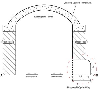
Figure 2: Cross section of the required cutting to accommodate the cycle way. The cross section is taken near Norton St where City West Link Road passes over the rail corridor.
The cycle link forms a crucial missing link between eastern and western regional cycling infrastructure. Currently to cycle from the GreenWay/Bay Run to the ANZAC Bridge, cyclists must use on-street shoulder lanes along Lilyfield Road. Whilst these shoulder lanes are marked on the road, there are multiple steep gradients along the route. These gradients are shown and compared to the proposed cycle way in the elevation profile in Figure 3 below.
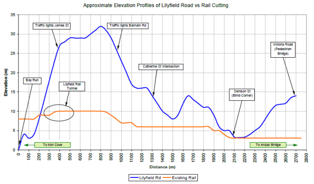
Figure 3: Approximate elevation profile of the Lilyfield Road cycle route (blue) and the proposed City West Link (orange).
As shown in Figure 3 above, the gradient of Lilyfield Road is steep and is not conducive to typical everyday cycling abilities. The proposed route is relatively flat with a gentle slope downwards towards the ANZAC bridge.
Additionally, the on-street nature of Lilyfield Road discourages less confident and less experienced cyclists who fear being hit by opening car doors and integrating with traffic on the road. City West Cycle Link would be completely off-road and would eliminate these risks.
It should be noted that, over the past year Council (with funding from RMS) has been developing potential designs for a separated cycleway along Lilyfield Road and that elements of the City West Cycle Link has the potential to complement, or perhaps replace, part of this route.
WestConnex M4-M5 Link Proposal
In accordance with the Environmental Impact Statement (EIS) for the M4-M5 Link, a cycleway passing through the Rozelle Rail Yards is proposed to be constructed. Conceptually, this cycleway links to the ANZAC Bridge Cycleway at the east and extends along the north edge of the Rozelle Rail Yards, making a connection to Lilyfield Road where it intersects with Lamb Street to the west.
An extension to the M4-M5 Link proposed for the Rozelle Rail Yards Cycleway is also identified in the project’s Active Transport Strategy. It extends from the western end of the Rail Yards, along the light rail corridor and onto the Bay Run and GreenWay at the west. It is identified in the summary of routes under the strategy as a separated cycleway to be delivered by other authorities including Inner West Council, RMS and Transport for NSW. An excerpt of the Rozelle Rail Yards future link identified in the Active Transport Strategy is included below in Figure 4.
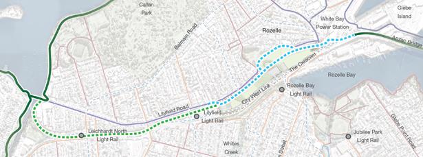
Figure 4: Map showing the route of the Rozelle Rail Yards Cycleway (blue dotted line) proposed as part of the WestConnex M4-M5 Link project as well as the remainder of the link along the light rail corridor (green dotted line) that is indicated to be delivered by other authorities including Inner West Council, RMS and Transport for NSW.
The M4-M5 Link was approved in April 2018, subject to many conditions, including condition E60 which requires the preparation and approval of a Pedestrian and Cycle Implementation Strategy that is consistent with the Active Transport Strategy contained in the EIS.
As this Active Transport Strategy includes part of the route intended for the City West Cycle Link and that Council will be a stakeholder in formulating the Pedestrian and Cycle Implementation Plan to satisfy condition E60, this portion of the cycle link is likely to be delivered in unison with the Rozelle Interchange component of the M4-M5 Link. Currently this is scheduled to open to the public in 2023, however the impact of the potential Western Harbor Tunnel on this timeline is currently unknown.
The request, proposed by this report and addressed in the meeting of 30 August 2018, to be made to RMS would require modifying the Active Transport Strategy as it is expressed in the Pedestrian and Cycle Implementation Plan. Modifications to this Strategy would include amending the delivery of the entire cycle way (both the blue and green dotted lines in Figure 4 by RMS as part of the M4-M5 Link.
Additionally, Council would request that the proposed Rozelle Rail Yards Cycleway has meaningful connections to the existing Lilyfield Road route where it intersects with Catherine Street and to a potential City West Cycle Link adjacent to the Inner West Light Rail Line. Further, it would be requested that the cycle link, through the rail yards, be delivered as early as possible i.e. not being delayed to accommodate Western Harbour Tunnel construction activity.
FINANCIAL IMPLICATIONS
It is proposed to request that the proposal is funded and delivered by RMS. This would eliminate any direct construction costs for Council.
Council obtained preliminary cost estimates during the initial proposal of the project in 2011. This estimate came to approximately five million dollars and was considered to provide a very rudimentary concept without detailed consideration of the complexity of all potential geotechnical issues. As the project is no longer going to be delivered alongside the light rail extension, it is expected to cost more than this, as much of the construction will have to be done at night to avoid day time obstruction of the light rail, which will likely need to be non-operational during construction hours. Additionally, construction of the cycle link would be more complex due to the need to safe guard light rail infrastructure and to coordinate with M4-M5 Link construction activities.
However there is the opportunity for some efficiency to be made by delivering at least part of the project alongside the M4-M5 Link Project through the Rozelle Rail Yards. If RMS integrates the cycle link within the park’s design, this will make delivery of that part of the project much more cost effective.
Further investigation will need to be done in order to determine the new final cost estimate of the project. A preliminary feasibility study could also be developed if RMS refuses the request to provide the entire cycle link to permit a more detailed understanding of the cost of implementing the whole route.
OTHER STAFF COMMENTS
Other units of Council including the GreenWay and Transport Engineers were consulted on during the preparation of this report and their comments integrated into this report.
PUBLIC CONSULTATION
Nil.
CONCLUSION
The City West Cycle Link will provide a well graded, off-street regional cycle way connecting three regional routes, the Bay Run, Greenway and ANZAC Bridge.
Although not supported by Council, Stage 3 of the WestConnex Project has now been approved by the State Government and provides a unique opportunity to deliver the cycle link (in part or in full) at a time when the area is being significantly transformed.
Council Officers have held a meeting with various stakeholders of the project and are now reporting back to Council. It is recommended that Council Officers work with the City of Sydney Council to request the RMS WestConnex Delivery Unit arranged for the funding and construction of the City West Cycle Link as part of the M4-M5 Link project.
|
|
Council Meeting 30 October 2018 |
Subject: Annandale Conservation Area Extension - Public Exhibition
Prepared By: Steve Roseland - Senior Strategic Planner
Authorised By: David Birds - Group Manager Strategic Planning
|
SUMMARY The former Leichhardt Council resolved to review the boundary of the Annandale Heritage Conservation Area. That review was completed in January 2017 and demonstrated that there is justification for extending the boundary of the Conservation Area. A Planning Proposal was forwarded to the Department of Planning and the Minister issued a Gateway Determination supporting the proposal proceeding to public exhibition.
The public exhibition has been concluded in accordance with the Gateway Determination requirements and responses are the subject of this report. It is recommended that the planning proposal to extend the Annandale Heritage Conservation Area proceed and that the Office of Environment and Heritage be requested to include the Mural on The Crescent on the State Heritage Register. |
|
RECOMMENDATION
THAT Council:
1. Support the amendment to Leichhardt Local Environmental Plan (LLEP) 2013 extending Annandale Conservation Area (C1) excluding all Sydney Regional Environmental Plan (SREP 26) lands;
2. Liaise with the NSW Parliamentary Counsel’s Office and NSW Department of Planning and Environment to draft and finalise the LLEP amendment;
3. Delegate the making of the LLEP to the Group Manager Strategic Planning;
4. Following completion of (3) above, request the Department of Planning and Environment notify the Plan; and
5. Support the inclusion of the Mural, The Crescent, Annandale on the State Heritage Register and forward relevant documentation to the Office of Environment and Heritage requesting the listing. |
BACKGROUND
At the September 2015 Ordinary Meeting the former Leichhardt Council resolved (C458/15) the following:
1. That a review of the 2004 Godden McKay Logan Heritage Review: Stage 2 be undertaken by Council’s Strategic Planning team to identify steps required to implement an alteration to the boundary of the Annandale Heritage Conservation Area;
2. A report be brought back to the March 2016 Policy meeting to provide Council with an update in relation to the review; and
3. That the report also be tabled at the Heritage Committee for discussion.
The matter was raised as Council was made aware of a complying development certificate being issued by a private certifier to demolish all existing structures at 307 Nelson Street, Annandale. The concern discussed was that the property and adjoining properties on the eastern side of Nelson Street can be demolished under the State Environmental Planning Policy (SEPP) Exempt & Complying Codes because they sit just outside the Annandale Heritage Conservation Area (C1) listed and mapped in Leichhardt Local Environmental Plan 2013.
Annandale Heritage Conservation Area currently covers the majority of the suburb (see Map 1) with some properties along the western and eastern boundaries within close proximity of Whites Creek and Johnston Creek being excluded.
Map 1 – Annandale Conservation Area (C1)
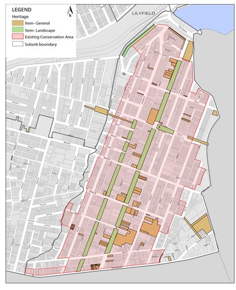
Analysis and recommendations of Leichhardt Heritage Review: Stage 2 (Jan 2004)
In 2003 heritage consultants Godden Mackay Logan were commissioned by Council to complete stage two of Council’s Heritage Review.
The outcome of the study was as follows:
· Review of the existing conservation area boundaries;
· Drafting of ‘Statement of Significance’ and ‘Key Values’ for each Area;
· Identification of thresholds/benchmarks for the subsequent assessment of contributory buildings/values by Council; and
· Review of the Local Environmental Plan (LEP) provisions relating to heritage and the structure/framework of the DCP.
The study emphasised that the approach of Council’s Residential Development Control Plan (DCP) at the time was towards providing advice about new development and recommended that the guidelines focus on ensuring that the existing fabric within conservation areas should be retained as much as possible with minimal change. This included a recommendation that additional protections for small attached and semi-attached houses be incorporated into the DCP.
The study also noted a number of ongoing heritage management concerns including inappropriate alterations and additions, the demolition of contributory items within conservation areas and the general demolition of structures within these areas detrimentally affecting the significance of the Area.
With regard to Annandale the study recommended that the existing Annandale Conservation Area boundaries be increased slightly to include almost the whole suburb from Whites Creek to Johnston Creek. The study highlighted that the historical suburb of Annandale was laid out and formed as a single entity and therefore needed to be managed as a whole. It is noted that the land bounded by Parramatta Road, Mallet Street, Booth Street and Johnston Creek whilst now part of the suburb of Annandale was originally part of Camperdown and not formed at the same time, hence it is excluded from this review.
The study recommendations were endorsed by Council and incorporated into a draft LEP amendment to extend a number of existing conservation areas. This draft amendment was publicly exhibited and forwarded to the NSW Department of Planning in 2006/07.
In the interim the NSW Government and Department had prepared the Standard Instrument LEP program requiring all NSW Councils to redraft their LEPs using the common format and content required by the standard LEP template. The Department required the proposed amendment to be put on hold until the former Leichhardt Council could prove that what would become Leichhardt LEP 2013 could meet all obligations and requirements with regard to residential dwelling targets and jobs provision required by the Inner West Subregional Plan.
Progressing extension of Annandale Conservation Area
Preliminary work indicated that development approved and undertaken in the areas immediately outside the Conservation Area is mostly consistent with that which has been constructed and approved within the Annandale Conservation Area during the same period (2003-present) resulting in a consistent built form with identified heritage significance.
A full re-assessment was undertaken to determine whether the development approved or constructed is likely to have compromised the suitability of those areas for inclusion within Annandale Conservation Area.
Part of this re-assessment was completed by Council’s heritage consultants carrying out the heritage assessment of the Parramatta Road corridor as part of its Strategic Sites and Corridors work. This study was presented to the March 2016 Policy meeting and endorsed (C96/16P) by Council. The area covered by this study includes the southern and eastern parts of the original proposed extension to the Annandale Conservation so the heritage value of all the properties in these localities have been updated. This includes the properties along:
· the southern side of Albion Street;
· the eastern side of Susan Street; and
· the eastern side of Taylor Street.
There were approximately 200 properties outside the Annandale Conservation Area within the suburb yet to be assessed. Using the same methodology NBRS + Partners consultants implemented to complete the Parramatta Road / Norton Street Heritage Study Council’s Strategic Planning team completed the assessment of all properties within the suburb of Annandale lying outside the Conservation Area (see Map 2) to determine whether the Area should be extended and if so to what extent.
Map 2 – Study Areas reviewed outside existing Annandale Conservation Area
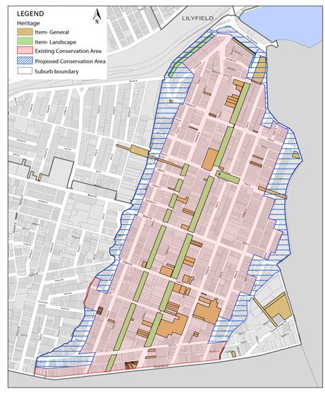
Heritage assessment of all properties within the suburb of Annandale lying outside the existing Conservation Area
Consistent with the NBRS study a heritage assessment was undertaken using methodology and guidelines drafted by the Heritage Office of NSW set out in Assessing Heritage Significance (2001), Conservation Areas (1996) and Planning and Heritage (1996).
The assessment included a site survey undertaken during August, September and October 2016 of the frontages of all properties in the study area. Data sheets were prepared listing each property, the predominant architectural style, notes on the character, design features and history of the structure/site and photos documenting the property on the date visited.
The data sheet included a ranking to define the degree to which individual buildings contribute to the character of the area (see following table). The data sheets were included in the report to Council on 28 February 2017 and may be viewed here - https://innerwest.infocouncil.biz/Open/2017/02/C_28022017_AGN_AT.PDF
|
Ranking |
Definition |
|
Heritage Item (local listing) - HI (local) |
A building of state or local heritage significance that also contributes substantially to the stated character of the area in the terms given in the definition of the Conservation Area. |
|
Building which contributes to the Area (heritage & aesthetic significance) - HA |
A building which contributes to the character of the area but significance has been reduced by loss of original architectural detail and materials and/or unsympathetic additions. |
|
Neutral - N |
A building where the impact on the heritage character of the area is neutral. |
|
Detracting - D |
A building which has an adverse impact upon the character of the area because of its scale, design, assertiveness, materials or the like, or because its original qualities have been militated or removed. |
To conduct the study the study area was split into two parts:
· Annandale Conservation Area Extension investigation – West (properties within close proximity of White Creek) includes 194 data sheets
· Annandale Conservation Area Extension investigation – East (properties within close proximity of Johnston Creek) includes 129 data sheets
Each data sheet included an assessment specific to that individual site. The assessment used the methodology to make recommendations to inform the building’s ranking as follows:
· Retain and where possible reinstate the significant façade and character
· Potential for sympathetic alterations and additions at the rear of the property
· Any proposed development to respect the character of the area
· Potential development site
The heritage assessment resulted in the following:
|
Annandale Conservation Area Extension investigation – West
|
|
|
Ranking |
Tally |
|
Heritage Item (local listing) - HI (local) |
2 |
|
Building which contributes to the Area (heritage & aesthetic significance) - HA |
166 |
|
Neutral - N |
17 |
|
Detracting - D |
2 |
|
Other (includes parks & N/A) |
7 |
|
Annandale Conservation Area Extension investigation – East
|
|
|
Ranking |
Tally |
|
Heritage Item (local listing) - HI (local) |
3 |
|
Building which contributes to the Area (heritage & aesthetic significance) - HA |
85 |
|
Neutral - N |
36 |
|
Detracting - D |
2 |
|
Other (includes parks & N/A) |
3 |
The study found that the vast majority of buildings in the suburb of Annandale not located within the existing conservation area either contribute to, or do not detract from, the collective heritage significance of the suburb. These buildings/structures should be protected from potential demolition.
FINANCIAL IMPLICATIONS
This report relates to a policy change and does not raise any financial obligation for Council.
PUBLIC CONSULTATION
In accordance with Gateway Determination requirements the proposed amendment was placed on public exhibition for 28 days from Tuesday 26 June 2018 until Tuesday 24 July 2018.
· Approximately 2,000 notification letters were sent to all owners and occupiers of properties proposed for inclusion in the expanded Annandale Conservation Area;
· A notice appeared in the Inner West Courier;
· The proposed amendment, planning proposal (see Attachment 1) and supporting documentation were made available for viewing on the Inner West Council’s ‘Have Your Say’ online community engagement hub for the entire exhibition period; and
· Hard copies of the relevant documents made available at Council’s Wetherill Street Administration Centre.
Public Exhibition – Submissions received / Issues raised
During the exhibition period Council’s ‘Have Your Say’ site received 190 visits, 146 of which downloaded linked documents.
By the end of the exhibition period this resulted in forty (40) submissions / responses to Council.
Support for the Planning Proposal
Of the submissions received twenty-one (21) submissions (52.5% of total) support the planning proposal. This includes:
· Nineteen (19) submissions (47.5%) which explain their support or request further clarification
· Two (2) submissions (5%) express support without providing any explanatory comments
Object to the Planning Proposal
Of the submissions received seventeen (17) submissions (42.5% of total) object to the planning proposal.
Neither support nor oppose Planning Proposal
Two (2) submissions (5% of total) neither support nor oppose planning proposal.
One submission raised an issue for Council to be made aware of, the need for infrastructure improvements in the identified area including roads, parking and pedestrian paths, especially near Whites Creek along the border of Annandale and Leichhardt.
Whites Creek is identified as a recreational cycle route in the former Leichhardt’s Bike Plan. At this stage the section adjacent to John Street has not been formally constructed and is considered a “missing link”. It is envisaged that, funding permitting, it will ultimately be developed as a shared path with a width of between 3.5 and 5.0m.
Issues raised by submissions
Submissions, both in support and objecting to the planning proposal, have raised a wide range of matters and issues they would like to see addressed (see Tables 1 and 2).
Many of these issues are common to a large number of submissions, and many of the submissions raise multiple issues.
The three most common issues raised by respondents supporting the planning proposal (Table 1) are:
· Preservation of heritage significance, history, built form and urban fabric of Annandale including prohibition on demolition of contributory buildings (19 submissions);
· Consistency of planning controls and built form across Annandale suburb (4 submissions); and
· Prevent inappropriate development (4 submissions)
The three most common issues raised by respondents objecting to the planning proposal (Table 2) are:
· Restrict development potential and devalue property (7 submissions);
· There are individual sites throughout Annandale which should not be included within the Conservation Area (6 submissions); and
· Streetscapes have already been altered with few original features retained (2 submissions each)
|
TABLE 1 |
|
|
Issues raised by the respondents supporting the planning proposal |
By number of respondents |
|
Preservation of heritage significance, history, built form and urban fabric of Annandale including prohibition on demolition of contributory buildings
|
19 |
|
Consistency of planning controls and built form across Annandale suburb
|
4 |
|
Prevent inappropriate development
|
4 |
|
Change is overdue as number of houses have already been demolished
|
3 |
|
Should not stifle development that maintains character and heritage of the neighbourhood
|
3 |
|
Detracting buildings should be identified to allow for improvement when developed
|
2 |
|
Support protection and retention of front facades, new extensions and development should be allowed to rear of properties
|
1 |
|
Foster Annandale’s local community
|
1 |
|
Support heritage protection of The Mural (The Crescent)
|
1 |
|
Efforts should be made not only to protect built form and heritage of Annandale but to enhance it
|
1 |
|
Support but further clarification needed on what alterations can be made to properties
|
1 |
|
TABLE 2 |
|
|
Issues raised by the respondents objecting to the planning proposal |
By number of respondents |
|
Restrict development potential and devalue property
|
7 |
|
There are individual sites throughout Annandale which should not be included within the Conservation Area
|
6 |
|
Streetscapes have already been altered with few original features retained
|
2 |
|
Complying Development option not possible
|
2 |
|
Existing Conservation Area is large enough
|
1 |
|
Objects as Council is installing a fitness area in Spindler Park which is inconsistent with preservation of heritage significance
|
1 |
|
Object due to existing flood control restrictions which already limit development
|
1 |
Responses to issues raised by community consultation
The following tables are a summary of the key issues raised through the public exhibition, including Council responses.
Support for the proposed LEP amendment
|
ISSUE – Preservation of heritage significance, history, built form and urban fabric of Annandale including prohibition on demolition of contributory buildings
|
|
Number of respondents commented on issue - 19 |
|
RESPONSE |
|
The assessments undertaken by Godden Mackay Logan (GML), NBRS consultants and Council officers over a number of years continue to recommend that the best way to preserve buildings and structures which contribute to the urban fabric and streetscapes of heritage significance in Annandale is to extend the conservation area to cover the entire suburb. This will enable consistency, provide certainty for existing and future property owners and ensure that neighbouring dwellings cannot be demolished without Council approval making sure that alterations, additions and new structures preserve and complement the identified heritage characteristics of the area.
|
|
ISSUE – Consistency of planning controls and built form across Annandale suburb
|
|
Number of respondents commented on issue - 4 |
|
RESPONSE |
|
The GML study recommends that the existing Annandale Conservation Area boundaries be increased slightly to include the whole suburb from Whites Creek to Johnston Creek. The study highlighted that the suburb of Annandale was largely laid out and formed as a single entity and therefore needed to be managed as a whole. The very similar built form in the parts of Annandale not included within the Conservation Area are not afforded the same protection regarding inappropriate alterations, additions and demolition as properties within the heritage conservation area. Extending the area to cover the whole suburb will provide consistency for all current, prospective and future Annandale property owners.
|
|
ISSUE – Prevent inappropriate development
|
|
Number of respondents commented on the issue - 4 |
|
RESPONSE |
|
A number of ongoing heritage management concerns have been identified if hundreds of properties in the suburb of Annandale are left outside the existing conservation area due to application of State Environmental Planning Policy (SEPP) Exempt & Complying Codes. These include inappropriate alterations and additions, the demolition of structures which could contribute to the conservation area and the general demolition of structures within these areas detrimentally affecting the existing conservation Area.
The proposal will not aim to prohibit development but encourage development that is sympathetic to, and complements, existing built form and streetscapes, with emphasis on front facades.
|
|
ISSUE – Change is overdue as number of houses have already been demolished
|
|
Number of respondents commented on the issue - 3 |
|
RESPONSE |
|
The matter of extending the conservation area was originally raised when Council was made aware of a complying development certificate being issued by a private certifier to demolish all existing structures at 307 Nelson Street, Annandale. The concern was that the property and adjoining properties on the eastern side of Nelson Street could be demolished under the SEPP Exempt & Complying Codes because they sit just outside the Annandale Heritage Conservation Area.
Studies have determined that the best way to preserve buildings and structures which contribute to the urban fabric and streetscapes of heritage significance in Annandale is to extend the conservation area to cover the entire suburb. The current proposal aims to provide consistency and clarity for all residents of Annandale, both present and future.
|
|
ISSUE – Should not stifle development that maintains character and heritage of the neighbourhood
|
|
Number of respondents commented on the issue - 3 |
|
RESPONSE |
|
The proposal will not aim to prohibit development but encourage development that is sympathetic to, and complements, existing built form and streetscapes, with emphasis on front facades.
Studies and investigation by NBRS consultants and Council staff have identified buildings which contribute to the heritage significance of the area, those which are neutral and those which detract from the urban fabric and streetscapes of heritage significance in Annandale. These data sheets can be used to inform more detailed strategic planning of the area and be referred to by Assessments officers when determining development applications to ensure development which maintains the character and heritage of the suburb is facilitated and supported by Council.
|
|
ISSUE – Detracting buildings should be identified to allow for improvement when developed
|
|
Number of respondents commented on the issue - 2 |
|
RESPONSE |
|
Studies and investigation by NBRS consultants and Council staff have identified buildings which contribute to the heritage significance of the area, those which are neutral and those which detract from the urban fabric and streetscapes of heritage significance in Annandale.
These data sheets can be used to inform more detailed strategic planning of the area and be referred to by Assessments officers when determining development applications.
|
|
ISSUE – Support protection and retention of front facades, new extensions and development should be allowed to rear of properties
|
|
Number of respondents commented on the issue - 1 |
|
RESPONSE |
|
The proposal will not aim to prohibit development but encourage development that is sympathetic to, and complements, existing built form and streetscapes with emphasis on front facades which contribute to those streetscapes of identified heritage significance.
The study by NBRS consultants and Council staff have identified buildings which contribute to the heritage significance of the area, those which are neutral and those which detract from the urban fabric and streetscapes of heritage significance in Annandale. These data sheets can be used to inform more detailed strategic planning of the area and be referred to by Assessments officers when determining development applications to ensure development which maintains character and heritage of the suburb is facilitated and supported by Council, which will often be to the rear of existing properties.
|
|
ISSUE - Foster Annandale’s local community
|
|
Number of respondents commented on the issue - 1 |
|
RESPONSE |
|
The GML study recommends that the existing Annandale Conservation Area boundaries be increased slightly to include the whole suburb from Whites Creek to Johnston Creek. The study highlighted that the suburb of Annandale was largely laid out and formed as a single entity and therefore needed to be managed as a whole. Extending the area to cover the whole suburb will provide consistency for all current, prospective and future Annandale property owners and protect urban fabric of heritage significance which contributes to the character of the suburb’s neighbourhoods encouraging a sense of place.
|
|
ISSUE – Support heritage protection of The Mural (The Crescent)
|
|
Number of respondents commented on the issue - 1 |
|
RESPONSE |
|
The Mural, located on the Crescent in Annandale, was originally painted in 1980 and due to deterioration repainted in 2004/05. The background to the Mural was the community activism spurred by key events such as opposition to the Vietnam War and the sacking of the Whitlam government, but also social movements around personal liberation including sexuality, gender, racism and ethnicity, and the self-expression of alternative lifestyles and cultural activities.
Council’s concern regarding the need to conserve the history embodied in the Mural triggered a heritage assessment of the Mural and review of the record on its making. The assessment of the Mural was undertaken in May 2005. This work was done in conjunction with a broader review of heritage across former Leichhardt Municipality. This recommended that the Mural become a Heritage Item of State significance, which was endorsed by Council. The Mural was included in the ‘Potential Items Schedule’ for future consideration.
In 2013 the previous assessment of the Mural’s heritage status was reviewed and Council recommended that the Mural be added to Leichhardt LEP 2013 Schedule 5 as soon as possible.
Heritage protection of the Mural on the Crescent in Annandale is supported. Its location on land in Sydney Regional Environmental Plan 26 – City West (SREP 26) means that it should be forwarded to the Office of Environment and Heritage requesting its review and inclusion on the State Heritage Register.
|
|
ISSUE – Efforts should be made not only to protect built form and heritage of Annandale but to enhance it
|
|
Number of respondents commented on the issue - 1 |
|
RESPONSE |
|
Studies and investigation by NBRS consultants and Council staff have identified buildings which contribute to the heritage significance of the area, those which are neutral and those which detract from the urban fabric and streetscapes of heritage significance in Annandale. These data sheets can be used to inform more detailed strategic planning of the area and be referred to by Assessments officers when determining development applications to ensure development which maintains the character and heritage of the suburb is facilitated and supported by Council.
|
|
ISSUE - Support but further clarification needed on what alterations can be made to properties
|
|
Number of respondents commented on the issue - 1 |
|
RESPONSE |
|
The proposal will not aim to prohibit development but encourage development that is sympathetic to, and complements, existing built form and streetscapes, with emphasis on front facades.
Development is required to be consistent with the Desired Future Character objectives and controls within the Leichhardt DCP Distinctive Neighbourhoods and any Sub Area within the locality, in addition to the requirements within other sections of the DCP.
Studies and investigation by NBRS consultants and Council staff have identified buildings which contribute to the heritage significance of the area, those which are neutral and those which detract from the urban fabric and streetscapes of heritage significance in Annandale. These data sheets can be used to inform more detailed strategic planning of the area and be referred to by Assessments officers when determining development applications to ensure development which maintains the character and heritage of the suburb is facilitated and supported by Council.
|
Opposed to the proposed LEP amendment
|
ISSUE – Restrict development potential and devalue property
|
|
Number of respondents commented on the issue - 7 |
|
RESPONSE |
|
Studies have determined that the best way to preserve buildings and structures which contribute to the urban fabric and streetscapes of heritage significance in Annandale is to extend the conservation area to cover the entire suburb.
The proposal will not aim to prohibit development but encourage development that is sympathetic to, and complements, existing built form and streetscapes with emphasis on front facades which contribute to those streetscapes of identified heritage significance.
|
|
ISSUE – There are individual sites throughout Annandale which should not be included within the Conservation Area
|
|
Number of respondents commented on the issue - 6 |
|
RESPONSE |
|
Various studies prepared by and for Council have determined that to ensure clarity and consistency for all Annandale residents the suburb should be managed as a whole single entity regarding heritage conservation.
Studies have identified buildings which contribute to the heritage significance of the area, those which are neutral and those which detract from the urban fabric and streetscapes of heritage significance in Annandale. These data sheets can be used to inform more detailed strategic planning of the area and be referred to by Assessments officers when determining development applications to ensure development which maintains the character and heritage of the suburb is facilitated and supported by Council.
If there are individual sites which are neutral or detract from the significance of the area and its streetscapes the aim will be to facilitate and approve development which positively adds to and complements existing built form.
|
|
ISSUE – Streetscapes have already been altered with few original features retained
|
|
Number of respondents commented on the issue - 2 |
|
RESPONSE |
|
The GML and NBRS studies have identified contributory heritage significance in the fringe areas of Annandale not currently located within the conservation area and determined that the best way to preserve buildings and structures which contribute to the urban fabric and streetscapes of heritage significance in Annandale is to extend the conservation area to cover the entire suburb.
Studies and investigation by NBRS consultants and Council staff have identified buildings which contribute to the heritage significance of the area, those which are neutral and those which detract from the urban fabric and streetscapes of heritage significance in Annandale. These data sheets can be used to inform more detailed strategic planning of the area and be referred to by Assessments officers when determining development applications to ensure development which maintains the character and heritage of the suburb is facilitated and supported by Council.
|
|
ISSUE - Complying Development option not possible
|
|
Number of respondents commented on the issue - 2 |
|
RESPONSE |
|
A number of ongoing heritage management concerns have been identified if hundreds of properties in the suburb of Annandale are left outside the existing conservation area due to application of State Environmental Planning Policy (SEPP) Exempt & Complying Codes. These include inappropriate alterations and additions, the demolition of structures which could contribute to the conservation area and the general demolition of structures within these areas detrimentally affecting the existing conservation Area.
The proposal will not aim to prohibit development but encourage development that is sympathetic to, and complements, existing built form and streetscapes, with emphasis on front facades.
|
|
ISSUE – Existing Conservation Area is large enough
|
|
Number of respondents commented on the issue - 1 |
|
RESPONSE |
|
Various studies prepared by and for Council have determined that to ensure clarity and consistency for all Annandale residents the suburb should be managed as a whole single entity regarding heritage conservation.
The GML and NBRS studies have identified contributory heritage significance in the fringe areas of Annandale not currently located within the conservation area and determined that the best way to preserve buildings and structures which contribute to the urban fabric and streetscapes of heritage significance in Annandale is to extend the conservation area to cover the entire suburb.
|
|
ISSUE – Objects as Council is installing a fitness area in Spindler Park which is inconsistent with preservation of heritage significance
|
|
Number of respondents commented on the issue - 1 |
|
RESPONSE |
|
The development of a fitness station at Spindler Park aims to provide benefits for the wider community while respecting residential amenity needs and the existing park usage.
The matter was placed on public exhibition and reported back to the Council meeting held on 14 August 2018. Council resolved for the installation not to proceed and that other locations be investigated.
|
|
ISSUE - Object due to existing flood control restrictions which already limit development
|
|
Number of respondents commented on the issue - 1 |
|
RESPONSE |
|
Council’s flood planning policies and controls are in place to minimise the risk to life and property and minimise impacts on land identified as flood affected. Inclusion within an extended conservation area or staying outside it will see no change in the flood planning policies applicable to a property or properties already designated as flood affected.
Whether a property or properties is identified as flood affected is not taken into consideration when determining whether it is a building/s / structure which contributes to the heritage significance of the local streetscape.
|
Consultation with public authorities
The Gateway Determination issued by the Department of Planning and Environment requires consultation with the following listed public authorities / organisations under section 56(2)(d) of the Environmental Planning and Assessment Act and relevant Section 117 Directions.
Office of Environment and Heritage (OEH)
The OEH response notes that the objective of the planning proposal is to preserve the characteristics which reflect the heritage significance of the conservation area and ensure buildings/structures which contribute to the landform and history of the suburb are provided statutory protection.
The Heritage Division has no objection to the planned extension of the Annandale Conservation Area.
Transport for NSW
The Land Use Planning and Development team have reviewed the relevant documents and have no comment to provide at this stage.
Roads and Maritime Authority (RMS)
The RMS response notes that the aim of this proposal is to ensure that those properties on the fringes of Annandale with identified heritage value which contribute to the character of the Conservation Area are preserved through inclusion within the existing Conservation Area.
RMS raises no objection to the planning proposal provided the following three issues are addressed.
|
ISSUE – All amendments to environmental planning instruments must align with the objectives and priorities of the Greater Sydney Region Plan and supporting District Plans
|
|
RESPONSE |
|
The aim, objectives and proposed extension of the Annandale Conservation Area do not conflict with objectives of the Greater Sydney Region Plan and Eastern City District Plan including the defined need to safeguard for future infrastructure projects.
|
|
ISSUE – All land within Sydney Regional Environmental Plan (SREP 26) must be excluded from the planning proposal and amendment to Leichhardt Local Environmental Plan (LEP) 2013
|
|
RESPONSE |
|
The boundaries of the proposed extension to the Annandale Conservation Area were drafted to reflect the suburb boundary of Annandale (excluding the industrial areas adjoining Camperdown). In doing so two small slivers of land (see map below) located within SREP 26 (excluded from Leichhardt LEP 2013) have been included within the area in error. These pieces of land are located immediately north of Bayview Crescent and west of Railway Parade.
As the planning proposal is an amendment to Leichardt LEP 2013 and these parcels of land are not covered by the LEP they shall be removed from the final mapping to be forwarded to the Department of Planning and the Minister for approval.
|
|
ISSUE – The proposed Conservation Area is within a broad area currently under investigation in relation to the proposed WestConnex Project (M4-M5) and the proposed Western Harbour Tunnel and Beaches Link (WHTBL) Motorway
|
|
RESPONSE |
|
RMS have indicated that indicative routes have been proposed for both infrastructure projects and include parts of the proposed Annandale Conservation Area. Regarding WestConnex the design will be finalised following feedback on the environmental impact statement (EIS) and any properties impacted by the final road design will be directly advised by RMS. Community engagement is underway relating to the WHTBL Motorway as the design is refined, which will lead to completion and exhibition of EIS. Once RMS has more certainty on the properties impacted by the final road design it will directly advise the owners of those properties.
Neither of these infrastructure projects alter the aim and objectives of the planning proposal nor do they conflict with the analysis and assessment undertaken by Council consultants and staff.
|
CONCLUSION
To preserve the characteristics which reflect the Statement of Significance of the existing Annandale Conservation Area (C1) and ensure that buildings/structures which contribute to the landform and history of Annandale cannot be demolished under the Exempt & Complying Codes SEPP it is recommended, after consideration of the submissions received, that the conservation area be extended to include properties identified in Map 2.
The proposed extension of the Annandale Conservation Area will provide greater certainty for existing and future property owners and residents of the suburb regarding the built form to be preserved and clarify the types of alterations and additions that will be encouraged to ensure consistency in the decision-making process ensuring development which maintains the character and heritage of the suburb is facilitated and supported by Council.
As noted in ‘Responses to issues raised by community consultation’ the Mural, located on The Crescent in Annandale, has undergone a number of heritage assessments, the first undertaken in 2005 which recommended that the Mural become a Heritage Item of State significance, endorsed by former Leichhardt Municipality. In 2013 The Mural’s heritage status was reviewed and Council recommended that the Mural be heritage listed as soon as possible. Heritage protection of the Mural on The Crescent in Annandale is supported. The location on land in Sydney Regional Environmental Plan 26 – City West (SREP 26) means that it should be forwarded to the Office of Environment and Heritage requesting its listing on the State Heritage Register.
|
1.⇩ |
Planning Proposal (publicly exhibited) |
|
2.⇩ |
LEP mapping (HER 005) |
|
3.⇩ |
LEP mapping (HER 008) |
|
4.⇩ |
LEP mapping (HER 009) |
|
|
Council Meeting 30 October 2018 |
Subject: Local Traffic Committee Meeting held on 2 October 2018
File Ref:
Prepared By: John Stephens - Traffic and Transport Services Manager
Authorised By: Wal Petschler - Group Manager Footpaths, Roads, Traffic and Stormwater
|
SUMMARY The minutes of the Local Traffic Committee Meeting held on 2 October 2018 are presented for Council consideration. |
|
RECOMMENDATION
THAT the Minutes of the Local Traffic Committee Meeting held on 2 October 2018 be received and the recommendations be adopted.
|
ITEMS BY WARD
|
Ward |
Item |
Page Number |
|
Leichhardt |
LTC1018 Item 1 Wells Street, Annandale - Christmas Street Party (Road Occupancy) (Leichhardt Ward/ Balmain Electorate/ Leichhardt LAC) |
Page 2 |
|
Leichhardt |
LTC1018 Item 4 James Street, Leichhardt - Christmas Street Party (Road Occupancy) (Leichhardt Ward/ Balmain Electorate/ Leichhardt LAC) |
Page 7 |
|
Leichhardt |
LTC1018 Item 6 Wharf Road, Lilyfield - Temporary Road Closure for Balmain Fun Run 2018 (Leichhardt Ward / Balmain Electorate / Leichhardt LAC) |
Page 10 |
|
Leichhardt |
LTC1018 Item 20 Carlisle Street, Leichhardt - Road Occupancy (Leichhardt Ward/Balmain Electorate/Leichhardt LAC) |
Page 26 |
|
Leichhardt |
LTC1018 Item 21 2018 Spring Cycle Event (Leichhardt and Balmain Ward/ Balmain and Summer Hill Electorate/ Leichhardt and Ashfield LAC) |
Page 29 |
|
Ashfield |
LTC1018 Item 2 Heighway Avenue, Ashfield-Annual Road Occupancy (Christmas Street Party) on Saturday 8 December 2018. (Ashfield Ward/Stathfield Electorate/Ashfield LAC) |
Page 4 |
|
Ashfield |
LTC1018 Item 3 Anthony Street, Croydon-Annual Road Occupancy (Christmas Street Party) on Saturday 22 December 2018. |
Page 6 |
|
Balmain |
LTC1018 Item 5 Manning Street at Darling Street, Rozelle - Pedestrian and Traffic Improvements LATM (Balmain Ward/ Balmain Electorate/ Leichhardt LAC) |
Page 9 |
|
Balmain |
LTC1018 Item 10 Temporary road closure to carry out sewer works - North Street, Balmain (Balmain Ward/ Balmain Electorate/ Leichhardt LAC) |
Page 17 |
|
Balmain |
LTC1018 Item 16 Darling Street, Balmain - Modification of Taxi Zone Operational Hours (Balmain Ward/ Balmain Electorate/ Leichhardt LAC) |
Page 24 |
|
Balmain |
LTC1018 Item 17 Wharf Road, Birchgrove - 'No Parking' restrictions (Balmain Ward/ Balmain Electorate/ Leichhardt LAC) |
Page 24 |
|
Balmain |
LTC1018 Item 21 2018 Spring Cycle Event (Leichhardt and Balmain Ward/ Balmain and Summer Hill Electorate/ Leichhardt and Ashfield LAC) |
Page 29 |
|
Stanmore |
LTC1018 Item 7 Pidcock Street, Camperdown - Proposed footpath reconstruction and formalisation of existing angled parking – Design Plan 6203 (STANMORE WARD /NEWTOWN ELECTORATE/ INNER WEST LAC) |
Page 13 |
|
Stanmore |
LTC1018 Item 12 Cowper Street, Marrickivlle - proposed 10m 'No Stopping' (Stanmore Ward/ Newtown Electorate/ Inner West LAC) |
Page 20 |
|
Stanmore |
LTC1018 Item 14 Marian Street at Cross Lane, Enmore - Proposed 10m 'No Stopping' (Stanmore Ward/ Newtown Electorate/ Inner West LAC) |
Page 22 |
|
Stanmore |
LTC1018 Item 15 Petersham Area M5 extension of Permit Parking (Stanmore Ward/Newtown Electorate/Inner West LAC) |
Page 22 |
|
Stanmore |
LTC1018 Item 22 Australia Street, Eliza Street, Lennox Street & Mary Street, Newtown – Temporary Full Road Closures For Newtown Festival On Sunday 11 November 2018 (Stanmore Ward/Newtown Electorate/Newtown LAC) |
Page 30 |
|
Marrickville |
LTC1018 Item 8 Local Bicycle Route 3 (LR3) - Detailed Design Plans (Marrickville Ward/Summer Hill Electorate/Inner West LAC) |
Page 13 |
|
Marrickville |
LTC1018 Item 9 Temporary Road Closure to carryout sewer works on Applebee Street, St Peters (Marrickville Ward/ Heffron Electorate/ Newtown LAC) |
Page 14 |
|
Marrickville |
LTC1018 Item 11 Fitzroy Street, Marrickville - Proposed Permit Parking (Marrickville Ward/Summer Hill Electorate/Inner West LAC) |
Page 20 |
|
Marrickville
|
LTC1018 Item 13 Victoria Road, Marrickville - Proposed 1P restrictions (Marrickville Ward/Summer Hill Electorate/Inner West LAC) |
Page 21 |
|
Marrickville |
LTC1018 Item 19 Church Street, St Peters - Proposed 'No Parking' restrictions (Marrickville Ward/Heffron Electorate/Inner west LAC) |
Page 25 |
|
All Wards
|
LTC1018 Item 18 Minor Traffic Facilities (All Wards/ All Electorates/ All LACs) |
Page 25 |
|
All Wards |
LTC1018 Item 23 Future LTC meeting dates |
Page 32 |
|
All Wards |
LTC1018 Item 24 Construction trucks on unapproved routes |
Page 32 |
|
All Wards |
LTC1018 Item 25 Thank you to Clr Julie Passas |
Page 32 |
BACKGROUND
Meeting of the Inner West Council Local Traffic Committee was held on 2 October 2018 at Petersham. The minutes of the October meeting are shown at ATTACHMENT 1.
FINANCIAL IMPLICATIONS
Projects proposed for implementation in 2017/18 are funded within existing budget allocations.
PUBLIC CONSULTATION
Specific projects have undergone public consultation as indicated in the respective reports to
the Traffic Committee. Members of the public are able to attend the meeting to address the Committee on specific items.
|
1.⇩ |
Minutes of Local Traffic Committee Meeting 2 October 2018 |
|
|
Council Meeting 30 October 2018 |
Minutes of Local Traffic Committee Meeting
Held at Petersham Service Centre on 2 October 2018
Meeting commenced at 9.59am
ACKNOWLEDGEMENT OF COUNTRY BY CHAIRPERSON
I acknowledge the Gadigal and Wangal people of the Eora nation on whose country we are meeting today, and their elders past and present.
COMMITTEE REPRESENTATIVES PRESENT
|
Victor Macri |
Chair, Deputy Mayor – Marrickville Ward |
|
Bill Holliday |
Representative for Jamie Parker MP, Member for Balmain |
|
Chris Woods |
Representative for Ron Hoenig MP, Member for Heffron |
|
Sarina Foulstone |
Representative for Jo Haylen MP, Member for Summer Hill |
|
Cathy Peters |
Representative for Jenny Leong MP, Member for Newtown |
|
Charles Buttrose |
NSW Police – Leichhardt Police Area Command |
|
Paul Vlachos |
NSW Police – Inner West Police Area Command |
|
Ryan Horne |
Roads and Maritime Services |
|
|
|
|
OFFICERS AND OTHER IN ATTENDANCE |
|
|
|
|
|
Anthony Kenny |
NSW Police – Inner West Police Area Command |
|
Asith Nagodavithane |
Transit Systems – Inner West Bus Services |
|
Colin Jones |
Inner West Bicycle Coalition |
|
Marghanita da Cruz |
Councillor – Leichhardt Ward |
|
Wal Petschler |
IWC’s Group Manager, Roads, Traffic and Stormwater |
|
John Stephens |
IWC’s Traffic and Transport Services Manager |
|
Manod Wickramasinghe |
IWC’s Coordinator Traffic and Parking Services (North) |
|
George Tsaprounis |
IWC’s Coordinator Traffic and Parking Services (South) |
|
Jenny Adams |
IWC’s Engineer – Traffic and Parking Services |
|
Sunny Jo |
IWC’s Traffic and Parking Planner |
|
Mary Bailey |
IWC’s Parking Planner |
|
Joe Di Cesare |
IWC’s Coordinator, Design Services |
|
Predrag Gudelj |
IWC’s Project Manager |
|
Jonathan Weng |
IWC’s Graduate Engineer, Design Services |
|
Christina Ip |
IWC’s Business Administration Officer |
|
|
|
|
VISITORS |
|
|
|
|
|
Nil. |
|
|
|
|
|
APOLOGIES: |
|
|
|
|
|
John Micallef |
NSW Police – Burwood Police Area Command |
|
|
|
DISCLOSURES OF INTERESTS:
Ms Sarina Foulstone declared a non-pecuniary interest in Item 8 as she is a member of BIKESydney’s management committee.
CONFIRMATION OF MINUTES
|
The minutes of the Local Traffic Committee Meeting held on Tuesday, 4 September 2018 were confirmed. |
MATTERS ARISING FROM COUNCIL’S RESOLUTION OF MINUTES
The Local Traffic Committee recommendations of its meeting held on 4 September 2018 were adopted at Council’s meeting held on 25 September 2018, with the following change to LTC0918 Item 21:
· Delete point 1a in Item 21 - Eliza Street, Newtown – Temporary Road Closure For The Newtown Good Food Fair 2018 – Sunday 14 October 2018 (Stanmore Ward/Newtown Electorate/Inner West LAC) so as to waive the fee for the road closure.
|
LTC1018 Item 1 Wells Street, Annandale - Christmas Street Party (Road Occupancy) (Leichhardt Ward/ Balmain Electorate/ Leichhardt LAC) |
|
SUMMARY Council has received an application for approval of an annual Christmas street party in Wells Street between Booth Street and Collins Street, Annandale to be held on Sunday, 25 November 2018 between 4:00pm and 7:00pm.
Officer’s Recommendation
THAT:
1. The temporary road closure of Wells Street between Booth Street and Collins Street, Annandale on Sunday, 25 November 2018 between 4:00pm and 7:00pm be supported; 2. All residents and businesses in and around the affected area will be notified in advance (28 days prior to the event) of the temporary road closure; 3. A minimum four (4) metre unencumbered passage be available for emergency vehicles through the closed section of Wells Street, Annandale; 4. The occupation of the road carriageway must not occur until the road has been physically closed; 5. The barbeque activities be undertaken on the footpath, subject to no fire restrictions; 6. The applicant notifies all affected businesses, residents and other occupants of the temporary road closure. Any concern raised by business proprietors, residents and other occupants must be resolved or accommodated. The notification shall involve at the minimum an information letterbox drop distributed one week prior to the commencement of the event. The proposed information, distribution area and period must be submitted to Council’s Traffic section for approval two weeks before the event; 7. The supported Traffic Control Plan (TCP) be implemented at the applicant’s expense; 8. Fire and Rescue NSW (Glebe) be notified of the intended closure by the applicant; 9. The applicant to provide and erect barricades and signs, in accordance with the current Australian Standard AS1742.3: Traffic Control Devices for Works on Roads. As a minimum the following must be erected at both ends of the road closure area: a. Barrier Boards b. Road Closed (T2-4) signs c. Detour (T5-1) signs;
10. The applicant be advised that Council provides barricades and ‘Road Closed’ signs free or at minimum cost. The applicant is required to arrange delivery by Council at cost, or arrange pickup from and return to Council’s Depot at no cost. Any non-standard signs may be provided at cost; 11. The areas to be used for the activities must be maintained in a clean and tidy condition to the satisfaction of Council’s Group Manager Roads & Stormwater, or else the applicant will be required to reimburse Council for any extraordinary cleaning costs; 12. The conduct of any activities or use of any equipment required in conjunction with the road occupancy and temporary road closure not results in any ‘offensive noise’ as defined by the Protection of the Environment Operations Act 1997; 13. A copy of the Council approval be available on site for inspection by relevant authorities; 14. Council reserves the right to cancel the approval at any time; 15. The applicant complies with any reasonable directive from Council Officers and NSW Police; and 16. The applicant be advised of the Committee’s recommendation.
DISCUSSION
The Committee members agreed with the Officer’s recommendation.
COMMITTEE RECOMMENDATION
THAT:
1. The temporary road closure of Wells Street between Booth Street and Collins Street, Annandale on Sunday, 25 November 2018 between 4:00pm and 7:00pm be supported; 2. All residents and businesses in and around the affected area will be notified in advance (28 days prior to the event) of the temporary road closure; 3. A minimum four (4) metre unencumbered passage be available for emergency vehicles through the closed section of Wells Street, Annandale; 4. The occupation of the road carriageway must not occur until the road has been physically closed; 5. The barbeque activities be undertaken on the footpath, subject to no fire restrictions; 6. The applicant notifies all affected businesses, residents and other occupants of the temporary road closure. Any concern raised by business proprietors, residents and other occupants must be resolved or accommodated. The notification shall involve at the minimum an information letterbox drop distributed one week prior to the commencement of the event. The proposed information, distribution area and period must be submitted to Council’s Traffic section for approval two weeks before the event; 7. The supported Traffic Control Plan (TCP) be implemented at the applicant’s expense; 8. Fire and Rescue NSW (Glebe) be notified of the intended closure by the applicant; 9. The applicant to provide and erect barricades and signs, in accordance with the current Australian Standard AS1742.3: Traffic Control Devices for Works on Roads. As a minimum the following must be erected at both ends of the road closure area: a. Barrier Boards b. Road Closed (T2-4) signs c. Detour (T5-1) signs;
10. The applicant be advised that Council provides barricades and ‘Road Closed’ signs free or at minimum cost. The applicant is required to arrange delivery by Council at cost, or arrange pickup from and return to Council’s Depot at no cost. Any non-standard signs may be provided at cost; 11. The areas to be used for the activities must be maintained in a clean and tidy condition to the satisfaction of Council’s Group Manager Roads & Stormwater, or else the applicant will be required to reimburse Council for any extraordinary cleaning costs; 12. The conduct of any activities or use of any equipment required in conjunction with the road occupancy and temporary road closure not results in any ‘offensive noise’ as defined by the Protection of the Environment Operations Act 1997; 13. A copy of the Council approval be available on site for inspection by relevant authorities; 14. Council reserves the right to cancel the approval at any time; 15. The applicant complies with any reasonable directive from Council Officers and NSW Police; and 16. The applicant be advised of the Committee’s recommendation.
For motion: Unanimous
|
|
LTC1018 Item 2 Heighway Avenue, Ashfield-Annual Road Occupancy (Christmas Street Party) on Saturday 8 December 2018. (Ashfield Ward/Stathfield Electorate/Ashfield LAC) |
|
SUMMARY Council seeks the support of the committee for a temporary full road closure of Heighway Avenue Ashfield, between Walter Street and Frederick Street, to conduct an annual Christmas Street party on Saturday, 8 December 2018 as recommended below.
Officer’s Recommendation
THAT:
Support be provided for the temporary full road closure of Heighway Avenue, Ashfield, between Walter Street and Frederick Street, to conduct an annual Christmas Street Party on the Saturday 8 December 2018, from 5.00pm – 9.00pm, subject to the following conditions:
1. The organiser is responsible to erect the signs and barricades in accordance of the Traffic Control Plan (TCP) attached, and arrange the management of the closure with RMS accredited traffic controllers;
2. Council Rangers be requested to oversee the event to assure that the traffic control arrangements are correctly in place;
3. The event would only entail the placement of tables and chairs upon the public footway or street, and that it be covered under Council (Casual Hire) insurance; 4. A clear passage of at least 4.0m must be provided for emergency vehicle access as required by Police;
5. The organiser is to arrange waste bins for litter control and make the area neat and tidy prior to the re-opening of the road;
6. The organiser is to arrange the dismantling of the temporary signs and barricades, and place the material in a designated area for Council to pick up after the completion of the event;
7. The organiser be responsible for notifying the residents in the area at least one week prior to the event; and
8. Council will arrange notification of the temporary full road closure of Heighway Avenue in the local newspaper, for a period of at least 28 days prior to the event.
DISCUSSION
Council Officers advised that Burwood/Campsie Police Area Command emailed their support for the recommendation.
The Committee members agreed with the Officer’s recommendation.
COMMITTEE RECOMMENDATION
THAT:
Support be provided for the temporary full road closure of Heighway Avenue, Ashfield, between Walter Street and Frederick Street, to conduct an annual Christmas Street Party on the Saturday 8 December 2018, from 5.00pm – 9.00pm, subject to the following conditions:
1. The organiser is responsible to erect the signs and barricades in accordance of the Traffic Control Plan (TCP) attached, and arrange the management of the closure with RMS accredited traffic controllers;
2. Council Rangers be requested to oversee the event to assure that the traffic control arrangements are correctly in place;
3. The event would only entail the placement of tables and chairs upon the public footway or street, and that it be covered under Council (Casual Hire) insurance; 4. A clear passage of at least 4.0m must be provided for emergency vehicle access as required by Police;
5. The organiser is to arrange waste bins for litter control and make the area neat and tidy prior to the re-opening of the road;
6. The organiser is to arrange the dismantling of the temporary signs and barricades, and place the material in a designated area for Council to pick up after the completion of the event;
7. The organiser be responsible for notifying the residents in the area at least one week prior to the event; and
8. Council will arrange notification of the temporary full road closure of Heighway Avenue in the local newspaper, for a period of at least 28 days prior to the event.
For motion: Unanimous
|
|
LTC1018 Item 3 Anthony Street, Croydon-Annual Road Occupancy (Christmas Street Party) on Saturday 22 December 2018. |
|
SUMMARY Council seeks the support of the Committee for a temporary full road closure of Anthony Street, Croydon, between Croydon Road and Etonville Parade, in order to conduct an annual Christmas Street party on Saturday, 22 December 2018 as recommended below.
Officer’s Recommendation
THAT:
Support be provided for the temporary full road closure of Anthony Street, Croydon, between Croydon Road and Etonville Parade, to conduct an annual Christmas Street Party on the Saturday 22 December 2018 from 4.00pm - 9.00pm, subject to the following conditions:
1. The organiser is responsible to erect the signs and barricades in accordance of the Traffic Control Plan (TCP) attached, and arrange the management of the closure with RMS accredited traffic controllers;
2. Council Rangers be requested to oversee the event to assure that the traffic control arrangements are correctly in place;
3. The event would only entail the placement of tables and chairs upon the public footway or street, and that it be covered under Council (Casual Hire) insurance;
4. A clear passage of at least 4.0m must be provided for emergency vehicle access as required by Police;
5. The organiser is to arrange waste bins for litter control and make the area neat and tidy prior to the re-opening of the road;
6. The organiser is to arrange the dismantling of the temporary signs and barricades, and place the material in a designated area for Council to pick up after the completion of the event;
7. The organiser is responsible for notifying the residents in the area at least one week prior to the event; and
8. Council will arrange notification of the temporary full road closure of Anthony Street in the local newspaper, for a period of at least 28 days prior to the event.
DISCUSSION
The Committee members agreed with the Officer’s recommendation.
COMMITTEE RECOMMENDATION
THAT:
Support be provided for the temporary full road closure of Anthony Street, Croydon, between Croydon Road and Etonville Parade, to conduct an annual Christmas Street Party on the Saturday 22 December 2018 from 4.00pm - 9.00pm, subject to the following conditions:
1. The organiser is responsible to erect the signs and barricades in accordance of the Traffic Control Plan (TCP) attached, and arrange the management of the closure with RMS accredited traffic controllers;
2. Council Rangers be requested to oversee the event to assure that the traffic control arrangements are correctly in place;
3. The event would only entail the placement of tables and chairs upon the public footway or street, and that it be covered under Council (Casual Hire) insurance;
4. A clear passage of at least 4.0m must be provided for emergency vehicle access as required by Police;
5. The organiser is to arrange waste bins for litter control and make the area neat and tidy prior to the re-opening of the road;
6. The organiser is to arrange the dismantling of the temporary signs and barricades, and place the material in a designated area for Council to pick up after the completion of the event;
7. The organiser is responsible for notifying the residents in the area at least one week prior to the event; and
8. Council will arrange notification of the temporary full road closure of Anthony Street in the local newspaper, for a period of at least 28 days prior to the event.
For motion: Unanimous
|
|
LTC1018 Item 4 James Street, Leichhardt - Christmas Street Party (Road Occupancy) (Leichhardt Ward/ Balmain Electorate/ Leichhardt LAC) |
|
SUMMARY Council has received an application for approval of a Christmas Street Party in James Street between William Street and Allen Street, Leichhardt to be held on Saturday, 15 December 2018 between 2:00pm and 7:00pm.
Officer’s Recommendation
THAT:
1. The temporary road closure of James Street between William Street and Allen Street, Leichhardt on Saturday, 15 December 2018 between 2:00pm and 7:00pm be supported; 2. A minimum four (4) metre unencumbered passage be available for emergency vehicles through the closed section of James Street, Leichhardt; 3. The occupation of the road carriageway must not occur until the road has been physically closed; 4. The applicant notifies all affected businesses, residents and other occupants of the temporary road closure. Any concern raised by business proprietors, residents and other occupants must be resolved or accommodated. The notification shall involve at the minimum an information letterbox drop distributed one week prior to the commencement of the event. The proposed information, distribution area and period must be submitted to Council’s Traffic section for approval two weeks before the event; 5. The supported Traffic Control Plan (TCP) be implemented at the applicant’s expense; 6. NSW Fire and Rescue (Leichhardt) be notified of the intended closure by the applicant; 7. The applicant to provide and erect barricades and signs, in accordance with the current Australian Standard AS1742.3: Traffic Control Devices for Works on Roads. As a minimum the following must be erected at both ends of the road closure area: a. Barrier Boards. b. Road Closed (T2-4) signs. c. Detour (T5-1) signs. 8. The applicant be advised that Council provides barricades and ‘Road Closed’ signs free or at minimum cost. The applicant is required to arrange delivery by Council at cost, or arrange pickup from and return to Council’s Depot at no cost. Any non-standard signs may be provided at cost; 9. The areas to be used for the activities must be maintained in a clean and tidy condition to the satisfaction of Council’s Group Manager Roads & Stormwater, or else the applicant will be required to reimburse Council for any extraordinary cleaning costs; 10. The conduct of any activities or use of any equipment required in conjunction with the road occupancy and temporary road closure not results in any ‘offensive noise’ as defined by the Protection of the Environment Operations Act 1997; 11. A copy of the Council approval be available on site for inspection by relevant authorities; 12. Council reserves the right to cancel the approval at any time; 13. The applicant complies with any reasonable directive from Council Officers and NSW Police; 14. The applicant be advised of the Committee’s recommendation.
DISCUSSION
The Committee members agreed with the Officer’s recommendation.
COMMITTEE RECOMMENDATION
THAT:
1. The temporary road closure of James Street between William Street and Allen Street, Leichhardt on Saturday, 15 December 2018 between 2:00pm and 7:00pm be supported; 2. A minimum four (4) metre unencumbered passage be available for emergency vehicles through the closed section of James Street, Leichhardt; 3. The occupation of the road carriageway must not occur until the road has been physically closed; 4. The applicant notifies all affected businesses, residents and other occupants of the temporary road closure. Any concern raised by business proprietors, residents and other occupants must be resolved or accommodated. The notification shall involve at the minimum an information letterbox drop distributed one week prior to the commencement of the event. The proposed information, distribution area and period must be submitted to Council’s Traffic section for approval two weeks before the event; 5. The supported Traffic Control Plan (TCP) be implemented at the applicant’s expense; 6. NSW Fire and Rescue (Leichhardt) be notified of the intended closure by the applicant; 7. The applicant to provide and erect barricades and signs, in accordance with the current Australian Standard AS1742.3: Traffic Control Devices for Works on Roads. As a minimum the following must be erected at both ends of the road closure area: a. Barrier Boards. b. Road Closed (T2-4) signs. c. Detour (T5-1) signs. 8. The applicant be advised that Council provides barricades and ‘Road Closed’ signs free or at minimum cost. The applicant is required to arrange delivery by Council at cost, or arrange pickup from and return to Council’s Depot at no cost. Any non-standard signs may be provided at cost; 9. The areas to be used for the activities must be maintained in a clean and tidy condition to the satisfaction of Council’s Group Manager Roads & Stormwater, or else the applicant will be required to reimburse Council for any extraordinary cleaning costs; 10. The conduct of any activities or use of any equipment required in conjunction with the road occupancy and temporary road closure not results in any ‘offensive noise’ as defined by the Protection of the Environment Operations Act 1997; 11. A copy of the Council approval be available on site for inspection by relevant authorities; 12. Council reserves the right to cancel the approval at any time; 13. The applicant complies with any reasonable directive from Council Officers and NSW Police; 14. The applicant be advised of the Committee’s recommendation.
For motion: Unanimous
|
|
LTC1018 Item 5 Manning Street at Darling Street, Rozelle - Pedestrian and Traffic Improvements LATM (Balmain Ward/ Balmain Electorate/ Leichhardt LAC) |
|
SUMMARY Detailed design plans have been finalised for the proposed pedestrian and traffic improvements in Manning Street, Rozelle as part of the Pedestrian Access and Mobility Plan (PAMP) adopted by the former Leichhardt Council in February 2014.
The proposed works includes kerb extension with garden beds, pedestrian ramps with associated signposting and line marking on Manning Street at Darling Street, Rozelle.
Officer’s Recommendation
THAT the detailed design plan for the kerb extension with associated garden beds, pedestrian ramps, associated signposting and line marking in Manning Street, Rozelle (as per the attached plan No. 10029) be approved.
DISCUSSION
The Member for Balmain requested for the one-way Shared Zone be made two-way for cyclists to allow cyclists access to Manning Street properties from Darling Street. Council Officers advised that ‘Bicycles Excepted’ signage .. be added underneath the One-Way signage.
Councillor da Cruz asked whether the existing Shared Zone could be extended to the intersection of Darling Street. The RMS representative advised that there may have been a reason for the Shared Zone terminating early; however, the representative did not anticipate issues with relocating the ‘End Shared Zone’ signage to the intersection.
The representative for the Inner West Bicycle Coalition requested for bicycle symbols to be marked on Manning Street. Council Officers advised that bicycle symbols are not typically installed in Shared Zones as speeds are already limited through the zone.
Councillor da Cruz asked whether there is a ‘No Right Turn’ at Darling Street into Manning Street. Council Officers stated that a ‘No Right Turn’ can be investigated at this location.
The Committee members agreed to amend the recommendation to relocate the Shared Zone signage to Darling Street, add ‘Bicycles Excepted’ signage on the one-way signage and investigate the need for a ‘No Right Turn’ sign in Darling Street.
COMMITTEE RECOMMENDATION
THAT:
1. The detailed design plan for the kerb extension with associated garden beds, pedestrian ramps, associated signposting and line marking in Manning Street, Rozelle (as per the attached plan No. 10029) be approved; 2. ‘Bicycles Excepted’ sign be added under the existing One-Way sign in Darling Street at Manning Street. 3. The ‘End Shared Zone’ signage be relocated to the intersection of Darling Street, Rozelle; and 4. A ‘No Right Turn’ sign in Darling Street approaching Manning Street be investigated.
For motion: Unanimous
|
|
LTC1018 Item 6 Wharf Road, Lilyfield - Temporary Road Closure for Balmain Fun Run 2018 (Leichhardt Ward / Balmain Electorate / Leichhardt LAC) |
|
SUMMARY Council has received an application for approval of a temporary road closure in Wharf Road, Lilyfield north of Balmain Road on Sunday, 18 November 2018 between 6:30am and 10:30am.
The road closure has been requested to facilitate the Balmain Fun Run through Callan Park.
Officer’s Recommendation
THAT:
1. The temporary road closure of Wharf Road, Lilyfield north of Balmain Road be supported, subject to the following conditions: a. That an unencumbered passage minimum 4.0m wide be available for emergency vehicles through the closed section of Wharf Road, Lilyfield. b. The occupation of the road carriageway must not occur until the road has been physically closed. c. That the organiser be advised to arrange accredited traffic controllers to manage the road closure. d. That the applicant notifies all affected businesses, residents and other occupants of the temporary road closure prior to the event. Any concerns or requirements in relation to the road closure raised by business proprietors, residents and other occupants must be resolved or accommodated. The notification shall involve at the minimum an information letterbox drop distributed one week prior to the commencement of the event. The proposed information, distribution area and period must be submitted to Council’s Traffic section for approval two weeks before the event. e. That the supported Traffic Control Plan (TCP) be implemented at the applicant’s expense. f. That Fire and Rescue NSW (Leichhardt) be notified of the intended closure by the applicant. g. That the applicant provide and erect barricades and signs, in accordance with the current Australian Standard AS1742.3: Traffic Control Devices for Works on Roads. As a minimum the following must be erected at both ends of the road closure area: I. Barrier Boards. II. ‘Road Closed’ (T2-4) signs. III. ‘Detour’ (T5-1) signs. h. All traffic controllers must hold RMS certification. i. That the areas to be used for the activities must be maintained in a clean and tidy condition to the satisfaction of Council’s Group Manager Roads & Stormwater, or else the applicant will be required to reimburse Council for any extraordinary cleaning costs. j. That the conduct of any activities or use of any equipment required in conjunction with the road occupancy and temporary road closure not results in any ‘offensive noise’ as defined by the Protection of the Environment Operations Act 1997. k. Copies of approvals from Council, NSW Police, RMS and the approved Traffic Management Plan must be available on the site for inspection by NSW Police, WorkCover Inspectors, RMS Inspectors, or Council Officers. l. Council and RMS must be indemnified against all claims for damage or injury that may result from either the activities or from the occupation of part of the public way during the road closures. The applicant must produce evidence of public risk insurance cover (under which the Council and RMS are indemnified) with a minimum policy value of at least $20,000,000. m. That Council reserves the right to cancel the approval at any time. n. That the applicant complies with any reasonable directive from Council Officers and NSW Police; and
2. The applicant be advised of the Committee’s recommendation.
DISCUSSION
The Committee members agreed with the Officer’s recommendation.
COMMITTEE RECOMMENDATION
THAT:
1. The temporary road closure of Wharf Road, Lilyfield north of Balmain Road be supported, subject to the following conditions: a. That an unencumbered passage minimum 4.0m wide be available for emergency vehicles through the closed section of Wharf Road, Lilyfield. b. The occupation of the road carriageway must not occur until the road has been physically closed. c. That the organiser be advised to arrange accredited traffic controllers to manage the road closure. d. That the applicant notifies all affected businesses, residents and other occupants of the temporary road closure prior to the event. Any concerns or requirements in relation to the road closure raised by business proprietors, residents and other occupants must be resolved or accommodated. The notification shall involve at the minimum an information letterbox drop distributed one week prior to the commencement of the event. The proposed information, distribution area and period must be submitted to Council’s Traffic section for approval two weeks before the event. e. That the supported Traffic Control Plan (TCP) be implemented at the applicant’s expense. f. That Fire and Rescue NSW (Leichhardt) be notified of the intended closure by the applicant. g. That the applicant provide and erect barricades and signs, in accordance with the current Australian Standard AS1742.3: Traffic Control Devices for Works on Roads. As a minimum the following must be erected at both ends of the road closure area: I. Barrier Boards. II. ‘Road Closed’ (T2-4) signs. III. ‘Detour’ (T5-1) signs. h. All traffic controllers must hold RMS certification. i. That the areas to be used for the activities must be maintained in a clean and tidy condition to the satisfaction of Council’s Group Manager Roads & Stormwater, or else the applicant will be required to reimburse Council for any extraordinary cleaning costs. j. That the conduct of any activities or use of any equipment required in conjunction with the road occupancy and temporary road closure not results in any ‘offensive noise’ as defined by the Protection of the Environment Operations Act 1997. k. Copies of approvals from Council, NSW Police, RMS and the approved Traffic Management Plan must be available on the site for inspection by NSW Police, WorkCover Inspectors, RMS Inspectors, or Council Officers. l. Council and RMS must be indemnified against all claims for damage or injury that may result from either the activities or from the occupation of part of the public way during the road closures. The applicant must produce evidence of public risk insurance cover (under which the Council and RMS are indemnified) with a minimum policy value of at least $20,000,000. m. That Council reserves the right to cancel the approval at any time. n. That the applicant complies with any reasonable directive from Council Officers and NSW Police; and
2. The applicant be advised of the Committee’s recommendation.
For motion: Unanimous
|
|
LTC1018 Item 7 Pidcock Street, CAMPERDOWN - Proposed footpath reconstruction and formalisation of existing angled parking – Design Plan 6203 (STANMORE WARD /NEWTOWN ELECTORATE/ INNER WEST LAC) |
|
SUMMARY A detailed design plan has now been finalised for the proposed footpath reconstruction and formalisation of the existing angled parking improvements in Pidcock Street, Camperdown along its entire length as part of Council’s identified asset improvements program.
Consultation was undertaken with owners and occupiers of properties in Pidcock Street regarding the proposal. A summary of the consultation results are presented in this report for consideration. It is recommended that the proposed detailed design plan be approved.
Officer’s Recommendation
That the detailed design plan (Design Plan No.6203) for the proposed footpath reconstruction and formalisation of the existing angled parking improvements in Pidcock Street, Camperdown along its entire length be APPROVED.
DISCUSSION
Councillor da Cruz requested that during construction, the sandstone gutter be reconstructed rather than replaced with concrete as proposed. Council Officers advised that while the sandstone kerbing will be reinstated the street is very flat and concrete gutters have been proposed to allow water to flow freely and prevent ponding. Council Officers also advised that the sandstone will be salvaged and reused as appropriate.
The Committee members agreed with the Officer’s recommendation.
COMMITTEE RECOMMENDATION
That the detailed design plan (Design Plan No.6203) for the proposed footpath reconstruction and formalisation of the existing angled parking improvements in Pidcock Street, Camperdown along its entire length be APPROVED.
For motion: Unanimous
|
|
LTC1018 Item 8 Local Bicycle Route 3 (LR3) - Detailed Design Plans (Marrickville Ward/Summer Hill Electorate/Inner West LAC) |
|
SUMMARY In November 2016, Council approved final concept plan for proposed improvement to Local Route 3 (LR3) bicycle route, identified in Council’s Bicycle Plan. LR3 is located along Livingstone Road, from Randall Street to Marrickville Park. The aim of the proposal is to make LR3 bicycle route safer, convenient and more enjoyable for people of all ages and ability to ride.
The draft design plans are based on the approved concept plan and are presented in this report for the Local Traffic Committee’s consideration. The proposed improvements will complete missing links in Council’s bicycle network and enhance bicycle access to public transport, local shops and other destinations.
It is recommended that the detail design for LR03 to enhance bicycle connectivity to public transport, local shops and other destination be APPROVED, and subsequently, Council submits Traffic Signal Design plans for Marrickville Road intersection to RMS for consideration and approval.
Officer’s Recommendation
THAT:
1. The detailed design plan (Design Plan No 6176) for Local Bicycle Route 3 be APPROVED; and
2. Council submits design plans to the Roads and Maritime Services (RMS) for bicycle upgrades to the signalised intersection of Marrickville Road and Livingstone Road for their consideration and approval.
DISCUSSION
The representative for Transit Systems requested that Council ensure changes to bus shelters are compliant under the Disability Discrimination Act (DDA). The representative stated that the Adshel bus shelter close to Marrickville Road may limit the space for a person with a disability or pram to access the bus stop.
The representative for the Member for Balmain outlined his objections to the proposed carriageway configuration for a 2m bidirectional cycle lane due to safety concerns.
The RMS representative requested that the 2.7m eastbound lane on Livingstone Road, be widened by setting back the proposed new kerb lines at the mixed traffic zones.
The Committee members agreed with the Officer’s recommendation with an additional recommendation to investigate widening the eastbound travel lane on Livingstone Road.
COMMITTEE RECOMMENDATION
THAT:
1. The detailed design plan (Design Plan No 6176) for Local Bicycle Route 3 be APPROVED; 2. Council investigate increasing the 2.7m eastbound travel lane on Livingstone Road adjacent to the threshold treatments at Marrickville Avenue and Hollands Avenue; and 3. Council submits design plans to the Roads and Maritime Services (RMS) for bicycle upgrades to the signalised intersection of Marrickville Road and Livingstone Road for their consideration and approval.
For motion: Unanimous
|
|
LTC1018 Item 9 Temporary Road Closure to carryout sewer works on Applebee Street, St Peters (Marrickville Ward/ Heffron Electorate/ Newtown LAC) |
|
SUMMARY An application has been received from GJ Building and Contracting for the temporary full road closure of Applebee Street (between Lackey Street and Hutchinson Street), St Peters periodically between 6:00pm to 11:00pm from Hutchinson Street to Short Street and/or 7:00am to 5:00pm from Short Street to Lackey Street from 29/10/2018 till 16/11/2018, with a further 4 weeks contingency thereafter, in order to carryout sewer works on Applebee Street, St Peters. It is recommended that the proposed temporary road closure be approved, subject to the conditions outlined in this report.
Officer’s Recommendation
THAT the proposed temporary full road closure of Applebee Street (between Lackey Street and Hutchinson Street) St Peters periodically between 6:00pm to 11:00pm from Hutchinson Street to Short Street and/or 7:00am to 5:00pm from Short Street to Lackey Street from 29/10/2018 till 16/11/2018, with a further 4 weeks contingency thereafter, in order to carryout sewer works on Applebee Street, St Peters, subject to the following conditions:
a. A fee of $1,578.50 for the temporary full road closure is payable by the applicant in accordance with Council’s Fees and Charges; b. The temporary full road closure be advertised in the local newspaper starting on 25 September 2018 providing 28 days’ notice for submissions, in accordance with the Roads Act; c. A Traffic Management Plan (TMP) be submitted by the applicant to the Roads and Maritime Services for consideration and approval; d. A Traffic Control Plan (TCP) which has been prepared by a certified Traffic Controller, is to be submitted to Council for review with a copy of the Traffic Controllers certification number attached to the plan, not less than 5 days prior to implementation of closure; e. A Road Occupancy License be obtained by the applicant from the Roads and Maritime Services’ Transport Management Centre; f. Notice of the proposed closure be forwarded by the applicant to the NSW Police, the NSW Fire Brigades and the NSW Ambulance Services; g. Notification signs advising of the proposed road closures and new traffic arrangements to be strategically installed and maintained by the applicant at each end of the street at least 7 days prior to the closure; h. All affected residents and businesses shall be notified in writing, by the applicant, of the proposed temporary road closure at least 7 days in advance of the closure with the applicant making reasonable provision for residents; i. Vehicular and pedestrian access for residents and businesses to their off-street car parking spaces be maintained where possible whilst site works are in progress; j. Adequate vehicular traffic control shall be provided for the protection and convenience of pedestrians and motorists including appropriate signage and flagging. Workers shall be specially designated for this role, as necessary to comply with this condition. This is to be carried out in accordance with the Australian Standard AS 1742.3 - Traffic Control Devices for works on roads; k. The holder of this approval shall indemnify the Council against all claims, damages and costs incurred by, or charges made against, the Council in respect to death or injury to any person or damage in any way arising out of this approval. In this regard, a public liability insurance policy for an amount not less than $20,000,000 for any one occurrence is to be obtained and is to note the Council as an interested party. The holder of this approval shall inform its insurer of the terms of this condition and submit a copy of the insurance policy to the Council prior to commencement of the work the subject of this approval; l. The operator of any unit exercising this approval shall have this approval with them and produce it if required along with any other relevant authority approvals granted in the connection with the work; m. Mobile cranes, cherry packers or concrete boom pumps shall not stand within the public way for extended periods when not in operation under this approval; n. The operation of the mobile crane shall not give rise to an "offensive noise" as defined in the Protection of Environment Operations Act, 1997. Furthermore, vibrations and/or emission of gases that are created during its operations and which are a nuisance, or dangerous to public health are not permitted; o. All work is to be carried out in accordance with Work Cover requirements; and p. The costs to repair damages, as a result of these works, to Council's footway and roadway areas will be borne by the applicant.
DISCUSSION
The representative for the Member for Heffron outlined concerns of:
The impact of the work on a local community and requested that every effort be made to minimise the disruption and requested that Council respond quickly to complaints and ensure that all guidelines are followed in the implementation of the work.
The Committee members agreed with the Officer’s recommendation.
COMMITTEE RECOMMENDATION
THAT the proposed temporary full road closure of Applebee Street (between Lackey Street and Hutchinson Street) St Peters periodically between 6:00pm to 11:00pm from Hutchinson Street to Short Street and/or 7:00am to 5:00pm from Short Street to Lackey Street from 29/10/2018 till 16/11/2018, with a further 4 weeks contingency thereafter, in order to carryout sewer works on Applebee Street, St Peters, be supported subject to the following conditions:
a. A fee of $1,578.50 for the temporary full road closure is payable by the applicant in accordance with Council’s Fees and Charges; b. The temporary full road closure be advertised in the local newspaper starting on 25 September 2018 providing 28 days’ notice for submissions, in accordance with the Roads Act; c. A Traffic Management Plan (TMP) be submitted by the applicant to the Roads and Maritime Services for consideration and approval; d. A Traffic Control Plan (TCP) which has been prepared by a certified Traffic Controller, is to be submitted to Council for review with a copy of the Traffic Controllers certification number attached to the plan, not less than 5 days prior to implementation of closure; e. A Road Occupancy License be obtained by the applicant from the Roads and Maritime Services’ Transport Management Centre; f. Notice of the proposed closure be forwarded by the applicant to the NSW Police, the NSW Fire Brigades and the NSW Ambulance Services; g. Notification signs advising of the proposed road closures and new traffic arrangements to be strategically installed and maintained by the applicant at each end of the street at least 7 days prior to the closure; h. All affected residents and businesses shall be notified in writing, by the applicant, of the proposed temporary road closure at least 7 days in advance of the closure with the applicant making reasonable provision for residents; i. Vehicular and pedestrian access for residents and businesses to their off-street car parking spaces be maintained where possible whilst site works are in progress; j. Adequate vehicular traffic control shall be provided for the protection and convenience of pedestrians and motorists including appropriate signage and flagging. Workers shall be specially designated for this role, as necessary to comply with this condition. This is to be carried out in accordance with the Australian Standard AS 1742.3 - Traffic Control Devices for works on roads; k. The holder of this approval shall indemnify the Council against all claims, damages and costs incurred by, or charges made against, the Council in respect to death or injury to any person or damage in any way arising out of this approval. In this regard, a public liability insurance policy for an amount not less than $20,000,000 for any one occurrence is to be obtained and is to note the Council as an interested party. The holder of this approval shall inform its insurer of the terms of this condition and submit a copy of the insurance policy to the Council prior to commencement of the work the subject of this approval; l. The operator of any unit exercising this approval shall have this approval with them and produce it if required along with any other relevant authority approvals granted in the connection with the work; m. Mobile cranes, cherry packers or concrete boom pumps shall not stand within the public way for extended periods when not in operation under this approval; n. The operation of the mobile crane shall not give rise to an "offensive noise" as defined in the Protection of Environment Operations Act, 1997. Furthermore, vibrations and/or emission of gases that are created during its operations and which are a nuisance, or dangerous to public health are not permitted; o. All work is to be carried out in accordance with Work Cover requirements; and p. The costs to repair damages, as a result of these works, to Council's footway and roadway areas will be borne by the applicant.
For motion: Unanimous
|
|
LTC1018 Item 10 Temporary road closure to carry out sewer works - North Street, Balmain (Balmain Ward/ Balmain Electorate/ Leichhardt LAC) |
|
SUMMARY An application has been received from Ozzy States Pty Ltd for the temporary full road closure of North Street (between Cardwell Street and Darling Street), Balmain between 7am and 5pm, Thursday, 25 October to Saturday, 24 November 2018 (approx. 4 weeks total, including 2 weeks of contingency) in order to carryout sewer works on North Street, Balmain. It is recommended that the proposed temporary road closure be approved, subject to the conditions outlined in this report.
Officer’s Recommendation
THAT the proposed temporary full road closure of North Street (between Cardwell Street and Darling Street), Balmain between 7am and 5pm, Thursday, 25 October to Saturday, 24 November 2018 (approx. 4 weeks total, including 2 weeks of contingency) be approved, in order to carryout sewer works on North Street, Balmain, subject to the following conditions:
a. A Traffic Management Plan (TMP) be submitted by the applicant to the Roads and Maritime Services for consideration and approval; b. A Traffic Control Plan (TCP) which has been prepared by a certified Traffic Controller, is to be submitted to Council for review with a copy of the Traffic Controllers certification number attached to the plan, not less than 5 days prior to implementation of closure; c. A Road Occupancy License be obtained by the applicant from the Transport Management Centre; d. Notice of the proposed closure be forwarded by the applicant to the NSW Police, Fire and Rescue NSW and the NSW Ambulance Services; e. Notification signs advising of the proposed road closures and new traffic arrangements to be strategically installed and maintained by the applicant at each end of the street at least 7 days prior to the closure; f. All affected residents and businesses shall be notified in writing, by the applicant, of the proposed temporary road closure at least 28 days in advance of the closure with the applicant making reasonable provision for residents; g. Vehicular and pedestrian access for residents and businesses to their off-street car parking spaces be maintained where possible whilst site works are in progress; h. Adequate vehicular traffic control shall be provided for the protection and convenience of pedestrians and motorists including appropriate signage and flagging. Workers shall be specially designated for this role, as necessary to comply with this condition. This is to be carried out in accordance with the Australian Standard AS 1742.3 - Traffic Control Devices for works on roads; i. The holder of this approval shall indemnify the Council against all claims, damages and costs incurred by, or charges made against, the Council in respect to death or injury to any person or damage in any way arising out of this approval. In this regard, a public liability insurance policy for an amount not less than $20,000,000 for any one occurrence is to be obtained and is to note the Council as an interested party. The holder of this approval shall inform its insurer of the terms of this condition and submit a copy of the insurance policy to the Council prior to commencement of the work the subject of this approval; j. The operator of any unit exercising this approval shall have this approval with them and produce it if required along with any other relevant authority approvals granted in the connection with the work; k. Mobile cranes, cherry pickers or concrete boom pumps shall not stand within the public way for extended periods when not in operation under this approval; l. The operation of the mobile crane shall not give rise to an "offensive noise" as defined in the Protection of Environment Operations Act, 1997. Furthermore, vibrations and/or emission of gases that are created during its operations and which are a nuisance, or dangerous to public health are not permitted; m. All work is to be carried out in accordance with Work Cover requirements; and n. The costs to repair damages, as a result of these works, to Council's footway and roadway areas will be borne by the applicant.
DISCUSSION
The Committee members agreed with the Officer’s recommendation.
COMMITTEE RECOMMENDATION
THAT the proposed temporary full road closure of North Street (between Cardwell Street and Darling Street), Balmain between 7am and 5pm, Thursday, 25 October to Saturday, 24 November 2018 (approx. 4 weeks total, including 2 weeks of contingency) be approved, in order to carryout sewer works on North Street, Balmain, subject to the following conditions:
a. A Traffic Management Plan (TMP) be submitted by the applicant to the Roads and Maritime Services for consideration and approval; b. A Traffic Control Plan (TCP) which has been prepared by a certified Traffic Controller, is to be submitted to Council for review with a copy of the Traffic Controllers certification number attached to the plan, not less than 5 days prior to implementation of closure; c. A Road Occupancy License be obtained by the applicant from the Transport Management Centre; d. Notice of the proposed closure be forwarded by the applicant to the NSW Police, Fire and Rescue NSW and the NSW Ambulance Services; e. Notification signs advising of the proposed road closures and new traffic arrangements to be strategically installed and maintained by the applicant at each end of the street at least 7 days prior to the closure; f. All affected residents and businesses shall be notified in writing, by the applicant, of the proposed temporary road closure at least 28 days in advance of the closure with the applicant making reasonable provision for residents; g. Vehicular and pedestrian access for residents and businesses to their off-street car parking spaces be maintained where possible whilst site works are in progress; h. Adequate vehicular traffic control shall be provided for the protection and convenience of pedestrians and motorists including appropriate signage and flagging. Workers shall be specially designated for this role, as necessary to comply with this condition. This is to be carried out in accordance with the Australian Standard AS 1742.3 - Traffic Control Devices for works on roads; i. The holder of this approval shall indemnify the Council against all claims, damages and costs incurred by, or charges made against, the Council in respect to death or injury to any person or damage in any way arising out of this approval. In this regard, a public liability insurance policy for an amount not less than $20,000,000 for any one occurrence is to be obtained and is to note the Council as an interested party. The holder of this approval shall inform its insurer of the terms of this condition and submit a copy of the insurance policy to the Council prior to commencement of the work the subject of this approval; j. The operator of any unit exercising this approval shall have this approval with them and produce it if required along with any other relevant authority approvals granted in the connection with the work; k. Mobile cranes, cherry pickers or concrete boom pumps shall not stand within the public way for extended periods when not in operation under this approval; l. The operation of the mobile crane shall not give rise to an "offensive noise" as defined in the Protection of Environment Operations Act, 1997. Furthermore, vibrations and/or emission of gases that are created during its operations and which are a nuisance, or dangerous to public health are not permitted; m. All work is to be carried out in accordance with Work Cover requirements; and n. The costs to repair damages, as a result of these works, to Council's footway and roadway areas will be borne by the applicant.
For motion: Unanimous
|
|
LTC1018 Item 11 Fitzroy Street, Marrickville - Proposed Permit Parking (Marrickville Ward/Summer Hill Electorate/Inner West LAC) |
|
SUMMARY Fitzroy Street between Edinburgh Road and Smith Street contains a section of residential dwellings that are surrounded by a busy light industrial business area. Council has received recent representations from residents in Fitzroy Street, Marrickville regarding difficulty finding parking due to parking by businesses in the area, reducing parking opportunities for residents. There have also been historical issues reported regarding friction between the parking demands for residents and businesses in the area. Council is proposing to implement permit parking in the section of Fitzroy Street where there are residential dwellings.
Officer’s Recommendation
THAT:
1. ‘2P Permit Holders Excepted 8:30am-6:30pm Monday to Friday Area M19’’ in Fitzroy Street (western side) between Smith Street and Edinburgh Road, Marrickville; and
2. Statutory 10m ‘No Stopping’ in Fitzroy Street (western side) at Smith Street, Marrickville; be approved.
DISCUSSION
The Committee members agreed with the Officer’s recommendation.
COMMITTEE RECOMMENDATION
THAT:
1. ‘2P Permit Holders Excepted 8:30am-6:30pm Monday to Friday Area M19’’ in Fitzroy Street (western side) between Smith Street and Edinburgh Road, Marrickville; and
2. Statutory 10m ‘No Stopping’ in Fitzroy Street (western side) at Smith Street, Marrickville; be approved.
For motion: Unanimous
|
|
LTC1018 Item 12 Cowper Street, Marrickivlle - proposed 10m 'No Stopping' (Stanmore Ward/ Newtown Electorate/ Inner West LAC) |
|
SUMMARY Following community representation, Council is proposing to implement ‘No Stopping’ in Cowper Street to improve vehicle and pedestrian safety and access at the intersection. Due to the placement of a service pit, the kerb ramp is offset from the intersection and reportedly vehicles park too close to the intersection obstructing pedestrian access via the kerb ramp as well as creating access and safety issues for vehicles turning left and right from Enmore Road into Cowper Street. Following consultation with affected residents, there have been no objections received to the proposal.
Officer’s Recommendation
That the installation of 10m ‘No Stopping’ restrictions in Cowper Street (northern side) at Enmore Road, Marrickville be approved.
DISCUSSION
The Committee members agreed with the Officer’s recommendation.
COMMITTEE RECOMMENDATION
That the installation of 10m ‘No Stopping’ restrictions in Cowper Street (northern side) at Enmore Road, Marrickville be approved.
For motion: Unanimous
|
|
LTC1018 Item 13 Victoria Road, Marrickville - Proposed 1P restrictions (Marrickville Ward/Summer Hill Electorate/Inner West LAC) |
|
SUMMARY Following representations from small business owners in Victoria Road, Marrickville; Council is proposing to implement a 13m section of “1P 9am to 3:30pm Monday to Friday’. The restrictions are proposed for the section of roadway directly outside the Marrickville Liquor Centre and in close proximity to a number of other small businesses in this section of Victoria Road. Small business owners have supported the proposal as a means to create parking turnover.
Officer’s Recommendation
That conversion of a 12m section of ‘No Parking 3:30pm-7pm Monday to Friday’ to ‘1P 9am-3:30pm Monday to Friday’ outside property Nos.284A-286 Victoria Road, Marrickville be approved.
DISCUSSION
The Committee members agreed with the Officer’s recommendation.
COMMITTEE RECOMMENDATION
That conversion of a 12m section of ‘No Parking 3:30pm-7pm Monday to Friday’ to ‘1P 9am-3:30pm Monday to Friday’ outside property Nos.284A-286 Victoria Road, Marrickville be approved.
For motion: Unanimous
|
|
LTC1018 Item 14 Marian Street at Cross Lane, Enmore - Proposed 10m 'No Stopping' (Stanmore Ward/ Newtown Electorate/ Inner West LAC) |
|
SUMMARY Council has received concerns which have been expressed by residents regarding access and safety issues at the intersection of Marian Street and Cross Lane, Enmore. Residents were seeking parking for parking restrictions to be implemented to improve safety and access at the intersection. Therefore, it is proposed to implement ‘No Stopping’ in Marian Street (western side) north and south of the intersection with Cross Lane.
The results from the community consultation process indicated that residents are concerned about the perceived loss of parking, however the implementation of the proposal is in keeping with the Australia Road Rules and will improve safety and access including for service and emergency vehicles.
Officer’s Recommendation
THAT the installation of the below points be approved:
1. 10m ‘No Stopping’ restrictions in Marian Street (western side), north of Cross Lane; and 2. 10m ‘No Stopping’ restrictions in Marian Street (western side), south of Cross Lane be approved.
DISCUSSION
The Committee members agreed with the Officer’s recommendation.
COMMITTEE RECOMMENDATION
THAT the installation of:
1. 10m ‘No Stopping’ restrictions in Marian Street (western side), north of Cross Lane; and 2. 10m ‘No Stopping’ restrictions in Marian Street (western side), south of Cross Lane be approved.
For motion: Unanimous
|
|
LTC1018 Item 15 Petersham Area M5 extension of Permit Parking (Stanmore Ward/Newtown Electorate/Inner West LAC) |
|
SUMMARY Following representation to Council a proposal for an extension of the existing M5 permit parking area was circulated to residents for comment. Given the feedback from residents a revised proposal has been developed. The revised proposal addresses concerns raised by residents and offers a balanced approach to providing permit parking and unrestricted parking in the area. To allow the committee additional time to review the proposal, the report has been deferred from the 4 September meeting of the Local Traffic Committee to be considered at the 2 October meeting.
Officer’s Recommendation
THAT:
1. ‘2P Permit Holders Excepted 8:30am-10pm Monday to Friday Area M5’ be installed on Brighton Street (southern side) between property no. 93 and West Street;
2. ‘2P Permit Holders Excepted 8:30am-10pm Monday to Friday Area M5’ be installed on Brighton Street (southern side) between Palace Street and Station Street;
3. ‘2P Permit Holders Excepted 8:30am-10pm Monday to Friday Area M5’ be installed on Brighton Street (northern side) between property no. 92 and Station Street;
4. ‘2P Permit Holders Excepted 8:30am-10pm Monday to Friday Area M5’ be installed on Wentworth Street (western side) between Brighton Street and the cul de sac;
5. ‘2P Permit Holders Excepted 8:30am-10pm Monday to Friday Area M5’ be installed on West Street (western side) between Brighton Street and the cul de sac; and
6. Implement Statutory No Stopping in conjunction with resident parking where required.
DISCUSSION
The Committee members agreed with the Officer’s recommendation.
COMMITTEE RECOMMENDATION
THAT:
1. ‘2P Permit Holders Excepted 8:30am-10pm Monday to Friday Area M5’ signage be installed on Brighton Street (southern side) between property no. 93 and West Street;
2. ‘2P Permit Holders Excepted 8:30am-10pm Monday to Friday Area M5’ signage be installed on Brighton Street (southern side) between Palace Street and Station Street;
3. ‘2P Permit Holders Excepted 8:30am-10pm Monday to Friday Area M5’ signage be installed on Brighton Street (northern side) between property no. 92 and Station Street;
4. ‘2P Permit Holders Excepted 8:30am-10pm Monday to Friday Area M5’ signage be installed on Wentworth Street (western side) between Brighton Street and the cul de sac;
5. ‘2P Permit Holders Excepted 8:30am-10pm Monday to Friday Area M5’ signage be installed on West Street (western side) between Brighton Street and the cul de sac; and
6. Implement Statutory ‘No Stopping’ signage in conjunction with resident parking where required.
For motion: Unanimous
|
|
LTC1018 Item 16 Darling Street, Balmain - Modification of Taxi Zone Operational Hours (Balmain Ward/ Balmain Electorate/ Leichhardt LAC) |
|
SUMMARY Council has received a request to change the existing operational hours of the ‘Taxi Zone’ in front of No. 366B Darling Street (Post Office / Court House), Balmain to increase the unrestricted parking between 7pm and 10pm.
Officer’s Recommendation
THAT the existing ‘1/2P ticket, 8am-7pm’ and ‘Taxi Zone, At Other Times’ parking restrictions on the southern side of Darling Street outside No.366B Darling Street, Balmain be modified to ‘1/2P ticket, 8am-7pm and Taxi Zone, 10pm-8am’ parking restrictions.
DISCUSSION
The Committee members agreed with the Officer’s recommendation.
COMMITTEE RECOMMENDATION
THAT the existing ‘1/2P ticket, 8am-7pm’ and ‘Taxi Zone, At Other Times’ parking restrictions on the southern side of Darling Street outside No.366B Darling Street, Balmain be modified to ‘1/2P ticket, 8am-7pm and Taxi Zone, 10pm-8am’ parking restrictions.
For motion: Unanimous
|
|
LTC1018 Item 17 Wharf Road, Birchgrove - 'No Parking' restrictions (Balmain Ward/ Balmain Electorate/ Leichhardt LAC) |
|
SUMMARY Concerns have been raised regarding vehicles parking on the footpath and obstructing pedestrian access to No. 40 Wharf Road, Birchgrove.
Officer’s Recommendation
THAT a 5.2m ‘No Parking’ zone be installed on the southern side of Wharf Road, Birchgrove extending east of the driveway of No.40 Wharf Road, Birchgrove.
DISCUSSION
Council Officers advised that a submission was received after the consultation period ended. The submission was from a resident who expressed support for the proposal.
The Committee members agreed with the Officer’s recommendation.
COMMITTEE RECOMMENDATION
THAT a 5.2m ‘No Parking’ zone be installed on the southern side of Wharf Road, Birchgrove extending east of the driveway of No.40 Wharf Road, Birchgrove.
For motion: Unanimous
|
|
LTC1018 Item 18 Minor Traffic Facilities (All Wards/ All Electorates/ All LACs) |
|
SUMMARY This report considers minor traffic facility applications received by Inner West Council, including ‘Disabled Parking’ and ‘Work Zone’ requests.
Officer’s Recommendation
THAT:
1. A 6m ‘Disabled Parking’ zone be installed in front of No.84 Edith Street, Leichhardt; and 2. A 12m ‘Works Zone 7.00am – 6.00pm Mon-Fri and 7.00am – 1.00pm Sat’ be installed in front of No.21 and No.19 Hartley Street, Rozelle.
DISCUSSION
The Committee members agreed with the Officer’s recommendation.
COMMITTEE RECOMMENDATION
THAT:
1. A 6m ‘Disabled Parking’ zone be installed in front of No.84 Edith Street, Leichhardt and Council officers confirm with the resident if a pram ramp is required. 2. A 12m ‘Works Zone 7.00am – 6.00pm Mon-Fri and 7.00am – 1.00pm Sat’ be installed in front of No.21 and No.19 Hartley Street, Rozelle.
For motion: Unanimous
|
|
LTC1018 Item 19 Church Street, St Peters - Proposed 'No Parking' restrictions (Marrickville Ward/Heffron Electorate/Inner west LAC) |
|
SUMMARY Council received representations from residents in Church Street, St Peters indicating that parking on both sides of the street in some sections is obstructing the safe passage of vehicles including service vehicles and potentially emergency vehicles. Council is proposing to restrict parking in order to improve access and allow for service and emergency vehicles to pass safely along the road. The proposal will result in the loss of one permit parking space on the southern side of Church Street. The signposting of ‘No Parking’ on the northern side is largely to reinforce “No Parking’ as there is a practice of people parking across their own driveways obstructing the flow of traffic in the street.
Officer’s Recommendation
THAT:
1. Implementation of ‘No Parking’ restrictions from property No.81 to property No.91D Church Street, St Peters (northern side); and 2. Conversion of one existing parking space from ‘‘2P Permit Holders Excepted 8:30am-6:30pm Mon-Fri’ restrictions to ‘No Parking’ outside property No.112 Church Street, St Peters be approved.
DISCUSSION
The representative for the Member for Heffron requested that:
The extension of 2P Residential Parking Scheme to northern end of Church Street be investigated.
The Committee members agreed with the Officer’s recommendation and the inclusion of a recommendation to investigate the extension of the 2P Residential Parking Scheme to the northern end of Church Street.
COMMITTEE RECOMMENDATION
THAT:
1. Implementation of ‘No Parking’ restrictions from property No.81 to property No.91D Church Street, St Peters (northern side); 2. Conversion of one existing parking space from ‘2P Permit Holders Excepted 8:30am-6:30pm Mon-Fri’ restrictions to ‘No Parking’ outside property No.112 Church Street, St Peters be approved; and 3. An investigation into the extension of the 2P Residential Parking Scheme to the northern end of Church Street, St Peters be undertaken at the same time.
For motion: Unanimous
|
|
LTC1018 Item 20 Carlisle Street, Leichhardt - Road Occupancy (Leichhardt Ward/Balmain Electorate/Leichhardt LAC) |
|
SUMMARY Council has received an application from the licensee of the Royal Hotel in Leichhardt for approval of a temporary full road closure in Carlisle Street between Norton Street and the Unnamed Laneway adjacent to No. 2 Carlisle Street to be held on Saturday, 17 and Sunday, 18 November 2018 between the hours of 12pm-8pm and 12pm-6pm respectively.
The road closure has been requested to facilitate the Royal Hotel Inner West Beer festival.
Officer’s Recommendation
THAT:
The temporary road closure of Carlisle Street, Leichhardt between Norton Street and the Unnamed Laneway adjacent to No.2 Carlisle Street to be held on Saturday, 17 and Sunday, 18 November 2018 between the hours of 12pm-8pm and 12pm-6pm respectively be supported, subject to the following conditions:
a. That an unencumbered passaged minimum of 4.0m wide be available for emergency vehicles through the closed section of Carlisle Street, Leichhardt; b. The occupation of the road carriageway must not occur until the road has been physically closed; c. That the organiser be advised to arrange accredited traffic controllers to manage the road closure; d. That the applicant notifies all affected businesses, residents and other occupants of the temporary road closure prior to the event. Any concerns or requirements in relation to the road closure raised by business proprietors, residents and other occupants must be resolved or accommodated. The notification shall involve at the minimum an information letterbox drop distributed one week prior to the commencement of the event. The proposed information, distribution area and period must be submitted to Council’s Traffic section for approval two weeks before the event; e. That the supported Traffic Control Plan (TCP) be implemented at the applicant’s expense; f. That Fire and Rescue NSW (Leichhardt) be notified of the intended closure by the applicant; g. That the applicant provide and erect barricades and signs, in accordance with the current Australian Standard AS 1742.3: Traffic Control Devices for Works on Roads. As a minimum the following must be erected at both ends of the road closure area: (a) Barrier Boards; (b) ‘Road Closed’ (T2-4) signs; and (c) ‘Detour’ (T5-1) signs; h. All traffic controllers must hold RMS certification; i. That the areas to be used for the activities must be maintained in a clean and tidy condition to the satisfaction of Council’s Group Manager Roads & Stormwater, or else the applicant will be required to reimburse Council for any extraordinary cleaning costs; j. That the conduct of any activities or use of any equipment required in conjunction with the road occupancy and temporary road closure does not result in any ‘offensive noise’ as defined by the Protection of the Environment Operations Act 1997; k. Copies of approvals from Council, NSW Police, RMS and the approved Traffic Management Plan must be available on the site for inspection by NSW Police, WorkCover Inspectors, RMS Inspectors, or Council Officers; l. Council and RMS must be indemnified against all claims for damage or injury that may result from either the activities or from the occupation of part of the public way during the road closures. The applicant must produce evidence of public risk insurance cover (under which the Council and RMS are indemnified) with a minimum policy value of at least $20,000,000; m. That Council reserves the right to cancel the approval at any time; n. That the applicant complies with any reasonable directive from Council Officers and NSW Police; and o. That the applicant be advised of the Committee’s recommendation.
DISCUSSION
The Committee members agreed with the Officer’s recommendation.
COMMITTEE RECOMMENDATION
THAT:
The temporary road closure of Carlisle Street, Leichhardt between Norton Street and the Unnamed Laneway adjacent to No.2 Carlisle Street to be held on Saturday, 17 and Sunday, 18 November 2018 between the hours of 12pm-8pm and 12pm-6pm respectively be supported, subject to the following conditions:
a. That an unencumbered passaged minimum of 4.0m wide be available for emergency vehicles through the closed section of Carlisle Street, Leichhardt; b. The occupation of the road carriageway must not occur until the road has been physically closed; c. That the organiser be advised to arrange accredited traffic controllers to manage the road closure; d. That the applicant notifies all affected businesses, residents and other occupants of the temporary road closure prior to the event. Any concerns or requirements in relation to the road closure raised by business proprietors, residents and other occupants must be resolved or accommodated. The notification shall involve at the minimum an information letterbox drop distributed one week prior to the commencement of the event. The proposed information, distribution area and period must be submitted to Council’s Traffic section for approval two weeks before the event; e. That the supported Traffic Control Plan (TCP) be implemented at the applicant’s expense; f. That Fire and Rescue NSW (Leichhardt) be notified of the intended closure by the applicant; g. That the applicant provide and erect barricades and signs, in accordance with the current Australian Standard AS 1742.3: Traffic Control Devices for Works on Roads. As a minimum the following must be erected at both ends of the road closure area: (a) Barrier Boards; (b) ‘Road Closed’ (T2-4) signs; and (c) ‘Detour’ (T5-1) signs; h. All traffic controllers must hold RMS certification; i. That the areas to be used for the activities must be maintained in a clean and tidy condition to the satisfaction of Council’s Group Manager Roads & Stormwater, or else the applicant will be required to reimburse Council for any extraordinary cleaning costs; j. That the conduct of any activities or use of any equipment required in conjunction with the road occupancy and temporary road closure does not result in any ‘offensive noise’ as defined by the Protection of the Environment Operations Act 1997; k. Copies of approvals from Council, NSW Police, RMS and the approved Traffic Management Plan must be available on the site for inspection by NSW Police, WorkCover Inspectors, RMS Inspectors, or Council Officers; l. Council and RMS must be indemnified against all claims for damage or injury that may result from either the activities or from the occupation of part of the public way during the road closures. The applicant must produce evidence of public risk insurance cover (under which the Council and RMS are indemnified) with a minimum policy value of at least $20,000,000; m. That Council reserves the right to cancel the approval at any time; n. That the applicant complies with any reasonable directive from Council Officers and NSW Police; and o. That the applicant be advised of the Committee’s recommendation.
For motion: Unanimous
|
|
LTC1018 Item 21 2018 Spring Cycle Event (Leichhardt and Balmain Ward/ Balmain and Summer Hill Electorate/ Leichhardt and Ashfield LAC) |
|
SUMMARY The Spring Cycle supported by Transport for NSW, is Sydney’s largest recreational mass community bike riding event and provides a unique opportunity to travel through Sydney by bike, capturing the city’s iconic attractions, landscape and views. Every year, around 10,000 people join the Spring Cycle for a celebration of cycling that starts in North Sydney and continues across the Sydney Harbour Bridge main deck through Glebe, Annandale, Leichhardt and Haberfield and onto the festival-style atmosphere at the finish at Sydney Olympic Park, Homebush.
The Spring Cycle is organised by Bicycle NSW with the support of the NSW Government, Transport for NSW, Transport Management Centre, Roads & Maritime Services, NSW Police, New South Wales Ambulance Service, St John First Aid, City of Sydney, Sydney Olympic Park, Local Councils and more than 500 trained Bicycle NSW volunteers.
Bicycle NSW has requested approval from the Local Traffic Committee and Council to conduct the 2018 Bicycle NSW Spring Cycle Event (its 35th year) on Sunday, 14 October 2018.
It is recommended that the 2018 Bicycle NSW Spring Cycle event to be held on Sunday, 14 October 2018 be supported.
Officer’s Recommendation
THAT: 1. The 2018 Bicycle NSW Spring Cycle event to be held on Sunday, 14 October 2018 be supported, subject to:
(a) The Traffic Management Plan and Traffic Control Plans being approved by the Transport Management Centre; (b) The event organiser producing a current Public Liability Insurance Policy with Inner West Council being included as an Interested Party;
2. The organiser of the event be requested to advise the affected properties in Canal Road, Leichhardt regarding the event details to discourage traffic movements through the narrow section of Canal Road during the critical period of the event; and
3. The representative of Bicycle New South Wales be advised of the Committee’s recommendation.
DISCUSSION
The Committee members agreed with the Officer’s recommendation.
COMMITTEE RECOMMENDATION
THAT: 1. The 2018 Bicycle NSW Spring Cycle event to be held on Sunday, 14 October 2018 be supported, subject to:
(a) The Traffic Management Plan and Traffic Control Plans being approved by the Transport Management Centre; (b) The event organiser producing a current Public Liability Insurance Policy with Inner West Council being included as an Interested Party;
2. The organiser of the event be requested to advise the affected properties in Canal Road, Leichhardt regarding the event details to discourage traffic movements through the narrow section of Canal Road during the critical period of the event; and
3. The representative of Bicycle New South Wales be advised of the Committee’s recommendation.
For motion: Unanimous
|
|
LTC1018 Item 22 Australia Street, Eliza Street, Lennox Street & Mary Street, Newtown – Temporary Full Road Closures For Newtown Festival On Sunday 11 November 2018 (Stanmore Ward/Newtown Electorate/Newtown LAC) |
|
SUMMARY A Section 96 (2) application had been received from the Newtown Neighbourhood Centre in relation to modifying conditions in holding the annual 'Newtown Festival' for the remaining 2 years assented, Sunday 12 November 2017 and Sunday 11 November 2018. The applicant has requested the temporary full road closures, between the hours of 5.00am to 8.00pm, of Australia Street (between Lennox Street and Alton Lane), Eliza Street, Lennox Street (between Australia Street and the exit of Lennox Street car park) and Mary Street, Newtown.
It is recommended that Council support to the temporary road closures for the last of the assented years on Sunday 11 November 2018 between the hours of 5.00am to 8.00pm; apply to the RMS for consent to close the subject roads, subject to the event being advertised, a Traffic Management Plan be submitted to the RMS for approval and advice of the proposed event being forwarded to the appropriate authorities, including the Transport Management Centre.
Comments of the Local Traffic Committee will be referred to Council’s Development Assessment Section for consideration in determining the Section 96 Application.
Officer’s Recommendation
THAT: 1. The proposed temporary full road closures of Australia Street (between Lennox Street and Alton Lane), Eliza Street, Lennox Street (between Australia Street and the exit driveway of Lennox Street car park) and Mary Street, Newtown on Sunday 11 November 2018, between 5.00am to 8.00pm, for the holding of the 39th annual 'Newtown Festival' (Class 2 event under the RMS Special Events Guide), be APPROVED subject to the applicant complying with the following conditions: a) The temporary road closure be advertised in the local newspaper providing 28 days’ notice for submissions; b) A Traffic Management Plan be submitted to the Roads and Maritime Services for consideration and approval; and a Road Occupancy License application be submitted to the Transport Management Centre; c) Notice of the proposed event be forwarded to the N.S.W. Police, State Transit Authority, Newtown Local Area Commander, the NSW Fire Brigades and the NSW Ambulance Services; d) Advance notifications signs for the event be strategically installed at least two (2) weeks prior to the event; e) "No Stopping - Special Event" signs be affixed over all existing timed parking restriction signs within the sections of streets to be closed on the afternoon of the day prior to the event; f) A 4-metre wide emergency vehicle access must be maintained through the closed road areas during the course of the event; g) The applicant is to consult with all affected residents and/or businesses in the area in writing and to conduct a letter box drop of surrounding properties at least two weeks prior to event; h) Adequate vehicular traffic control shall be provided for the protection and convenience of pedestrians and motorists including appropriate signage and flagging. Workers shall be specially designated for this role (and carry appropriate certificates), as necessary to comply with this condition. This is to be carried out in accordance with the Australian Standard AS 1742.3 - Traffic Control Devices for works on roads; 2. The Festival Director, Newtown Neighbourhood Centre be advised in terms of this report and that all costs for advertising the event and implementation of the road closures are to be borne by the applicant; and 3. The applicant be advised that an annual application needs to be submitted to Council for the temporary road closures associated with the festival.
DISCUSSION
The Committee members agreed with the Officer’s recommendation.
COMMITTEE RECOMMENDATION
THAT: 1. The proposed temporary full road closures of Australia Street (between Lennox Street and Alton Lane), Eliza Street, Lennox Street (between Australia Street and the exit driveway of Lennox Street car park) and Mary Street, Newtown on Sunday 11 November 2018, between 5.00am to 8.00pm, for the holding of the 39th annual 'Newtown Festival' (Class 2 event under the RMS Special Events Guide), be APPROVED subject to the applicant complying with the following conditions: a) The temporary road closure be advertised in the local newspaper providing 28 days’ notice for submissions; b) A Traffic Management Plan be submitted to the Roads and Maritime Services for consideration and approval; and a Road Occupancy License application be submitted to the Transport Management Centre; c) Notice of the proposed event be forwarded to the N.S.W. Police, State Transit Authority, Newtown Local Area Commander, the NSW Fire Brigades and the NSW Ambulance Services; d) Advance notifications signs for the event be strategically installed at least two (2) weeks prior to the event; e) "No Stopping - Special Event" signs be affixed over all existing timed parking restriction signs within the sections of streets to be closed on the afternoon of the day prior to the event; f) A 4-metre wide emergency vehicle access must be maintained through the closed road areas during the course of the event; g) The applicant is to consult with all affected residents and/or businesses in the area in writing and to conduct a letter box drop of surrounding properties at least two weeks prior to event; h) Adequate vehicular traffic control shall be provided for the protection and convenience of pedestrians and motorists including appropriate signage and flagging. Workers shall be specially designated for this role (and carry appropriate certificates), as necessary to comply with this condition. This is to be carried out in accordance with the Australian Standard AS 1742.3 - Traffic Control Devices for works on roads; 2. The Festival Director, Newtown Neighbourhood Centre be advised in terms of this report and that all costs for advertising the event and implementation of the road closures are to be borne by the applicant; and 3. The applicant be advised that an annual application needs to be submitted to Council for the temporary road closures associated with the festival.
For motion: Unanimous
|
General Business
|
LTC1018 Item 23 Future LTC meeting dates
|
|
Councillor Macri requested the Committee consider moving LTC meetings from Tuesday mornings to Monday mornings due to Council meetings occurring on Tuesday evenings.
Committee members agreed that a schedule of Monday meeting dates for the next 12 months be developed, taking into consideration any public holidays occurring on a Monday.
|
|
LTC1018 Item 24 Construction trucks on unapproved routes
|
|
The representative for the Member for Newtown raised the issue of truck, dog and trailer construction vehicles for WestConnex and Sydney Metro projects not using DA approved routes to access sites and asked Council to address this issue.
The Leichhardt Police representative advised that in other local government areas, Council Rangers photograph construction trucks travelling unapproved routes and fine the construction company for breach of the DA.
Council’s Regulatory Services Section will be asked to consider increase monitoring of truck movements in the Inner West, noting that a lot of construction vehicles are not using designated truck routes.
|
|
LTC1018 Item 25 Thank you to Clr Julie Passas
|
|
The Committee members thanked Clr Julie Passas for her time as Chair of the LTC and agreed for a letter of appreciation be drafted to thank her for her work with the LTC in the last year.
|
Meeting closed at 10.55am.
|
Council Meeting 30 October 2018 |
Subject: Compliance and Enforcement Policy and Protocol
Prepared By: Simon Grierson - Environmental Health & Building Regulation Section
Authorised By: Harjeet Atwal - Group Manager Development Assessment and Regulatory Services
|
SUMMARY A draft Compliance and Enforcement Policy and Protocol have been developed. The purpose of these documents are to guide Council officers responsible for unlawful activity compliance and enforcement in a manner that is accountable and transparent, consistent, proportional and timely and to assist the community in understanding its role and the role of Council in relation to unlawful activity compliance and enforcement.
This report is seeking Council’s endorsement of the draft Compliance and Enforcement Policy to be placed on public exhibition for 28 days, with the results presented to Council along with a final Policy for adoption.
|
|
RECOMMENDATION
THAT:
1. The draft Compliance and Enforcement Policy be placed on public exhibition for a period of 28 days;
2. The results of the public exhibition are presented to Council along with a final Compliance and Enforcement Policy for adoption; and
3. The Compliance and Enforcement Protocol be received and noted.
|
BACKGROUND
Council is responsible for unlawful activity compliance and enforcement under various legislations with delegated/authorised officers responsible for the investigation of such matters.
The NSW Ombudsman’s office encourages as best practice councils to have an adopted policy which covers this area and for that policy and associated protocol to be publically available.
The intent of this policy is to establish:
§ Council's compliance and enforcement principles;
§ how reports alleging unlawful activity will be dealt with by Council;
§ how Council’s limited resources will be deployed in addressing allegations of unlawful activity;
§ how confidentiality of people who report allegations of unlawful activity will be managed;
§ what Council expects from people who report allegations of unlawful activity;
§ what parties can expect from Council staff;
§ how Council deals with complaints about Council's enforcement action; and
§ how Council deals with anonymous reports.
The policy also provides advice and guidance on the role of Councillors in compliance and enforcement.
The policy and protocol are to be read together and provides a guide to officers responsible for unlawful activity compliance and enforcement to ensure that investigations are undertaken in a manner that is lawful, accountable and transparent, consistent, proportional and timely.
The protocol addresses the resource limitations in Council’s compliance and enforcement activities and how such resources are to be utilised.
The protocol also outlines for the community matters to be considered at the various stages of the compliance and enforcement process from the receipt and investigation of reports alleging unlawful activity, through to what, if any, enforcement option Council will choose and whether to commence criminal or civil proceedings.
In certain circumstances Council will have shared compliance and enforcement responsibilities with other regulatory authorities. The protocol sets out a cooperative approach to such matters. Advice and guidance is also provided on the role of Council in building and construction compliance matters where there is a private certifier.
Adoption of this Policy will necessitate the rescission of the former Leichhardt and Ashfield Council policies on enforcement:
· Ashfield Council Enforcement Policy:
https://www.innerwest.nsw.gov.au/ArticleDocuments/1444/Enforcement%20policy%20-%20Ashfield.docx.aspx
· Leichhardt Council Compliance and Enforcement Policy:
Marrickville Council did not have an adopted Policy on Compliance and Enforcement, rather an internal working protocol only. Hence no rescission is required.
FINANCIAL IMPLICATIONS
There are no financial implications arising from the Policy.
OTHER STAFF COMMENTS
Feedback from the following stakeholders have been received, reviewed and incorporated where appropriate in the draft Compliance and Enforcement Policy and Protocol: Council’s Trees, Parks and Sportsfields Group, Council’s Footpaths, Roads, Traffic and Stormwater Group, Council’s Environment and Sustainability Group, Council’s Integration, Customer Service and Business Excellence Group, Council’s Legal, Development Assessment and Regulatory Services Group and the NSW Internal Ombudsman.
PUBLIC CONSULTATION
It is recommended that the draft Policy be placed on public exhibition for 28 days.
CONCLUSION
The purpose of draft Compliance and Enforcement Policy and Protocol are to guide Council officers responsible for unlawful activity compliance and enforcement in a manner that is accountable and transparent, consistent, proportional and timely and to assist the community in understanding its role and the role of Council in relation to unlawful activity compliance and enforcement.
This report is seeking Council’s endorsement of the draft Compliance and Enforcement Policy to be placed on public exhibition for 28 days, with the results presented to Council along with a final Policy for adoption.
|
1.⇩ |
Draft Compliance and Enforcement Policy |
|
2.⇩ |
Draft Compliance and Enforcement Protocol |
|
Council Meeting 30 October 2018 |
Subject: Asbestos Policy Update
Prepared By: Simon Grierson - Environmental Health & Building Regulation Section
Authorised By: Harjeet Atwal - Group Manager Development Assessment and Regulatory Services
|
SUMMARY The purpose of this report is to provide an update to Council on the preparation of the draft Asbestos Policy as resolved by Council with a Notice of Motion on 14 August 2018 Council meeting. |
|
RECOMMENDATION
THAT this report be received and noted.
|
BACKGROUND
Council resolved at the 14 August 2018 Council Meeting with a Notice of Motion that a report on how Council can adopt the office of Local Government Model Asbestos Policy for NSW and Council’s Compliance and Enforcement Policy be reported to Council by 30 October 2018.
POLICY UPDATE
In accordance with the Council resolution Council Officers are currently in the process of preparing a draft Asbestos Policy in accordance with NSW Local Government Model Asbestos Policy and carrying out internal notification in relation to the policy. It is anticipated that the finalised draft Policy would be before Council for consideration at the 27 November 2018 Council meeting. The following diagram outlines the steps and timeframe required to develop, adopt and implement an Asbestos Policy:
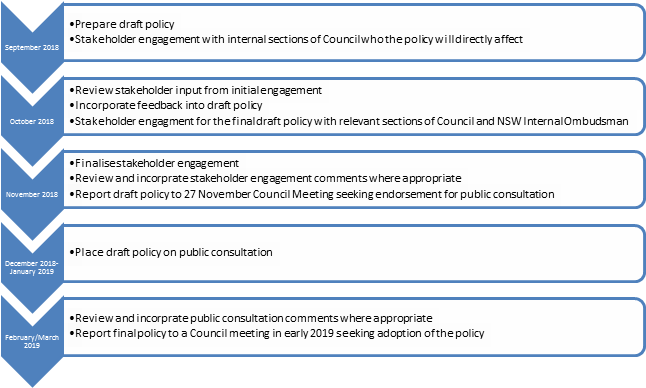
Please be advised that a draft Compliance and Enforcement Policy has been reported to this meeting under a separate Item number. Should a concern regarding asbestos arise within the Compliance area of responsibility the draft Compliance and Enforcement Policy and Protocol will provide the principles and investigation framework to officers managing the issue whilst the proposed Asbestos Policy will provide the specific asbestos technical knowledge.
FINANCIAL IMPLICATIONS
Nil
OTHER STAFF COMMENTS
Not applicable
PUBLIC CONSULTATION
CONCLUSION
The purpose of this report is to provide an update to Council on the preparation of the draft Asbestos Policy as resolved by Council at its meeting of the 14 August 2018.
Council Officers are currently in the process of preparing a draft Asbestos Policy in accordance with NSW Local Government Model Asbestos Policy. Anticipated report to Council on 27 November for consideration of a draft Asbestos Policy.
|
|
Council Meeting 30 October 2018 |
Subject: Adoption of Asset Management Policy
Prepared By: Tony Giunta - Infrastructure Planning (Transport and Stormwater) Manager
Authorised By: Wal Petschler - Group Manager Footpaths, Roads, Traffic and Stormwater
|
SUMMARY This report seeks Council’s adoption of the Asset Management Policy (AM Policy) which is an essential element of the Resourcing Strategy required under the Integrated Planning and Reporting Guidelines. The Asset Management Policy sets the broad framework for undertaking Asset Management in a structured and coordinated way. It outlines why and how asset management will be undertaken, provides a clear direction for asset management and defines key principles that underpin asset management for the Council. |
|
RECOMMENDATION
That Council adopt the Asset Management Policy.
|
BACKGROUND
At the Council meeting held on 26th June 2018, Council adopted its Resourcing Strategy which included asset management plans for its stormwater, transport, properties, parks and sportsfield asset portfolios.
While it is not a legislative requirement, Council also approved the public exhibition of the Draft Asset Management Policy and this report provides the feedback following the public exhibition of the policy.
PUBLIC EXHIBITION OUTCOMES
The response to the publicly exhibited Draft Asset Management Policy resulted in 4 submissions, during the exhibition period from 6 July 2018 to 8 August 2018.
Promotion
The Draft Asset Management Policy was promoted throughout the exhibition period, via the following:
· Dedicated project page on Council's Your Say Inner West website
· Featured Project in the Council Column in the Inner West Courier on Tuesday 17 July 2018
· Council’s fortnightly e-newsletter emailed on 20 July 2018
· Your Say Inner West monthly e-newsletter July 2018 edition
· Facebook post on 7 July
· Twitter post on 8 July
Submissions
The visitor information details from Council's Your Say web page are shown in the following table.
|
6 July 2018 to 8 August 2018 |
|
|
Total visits made to the web page |
108 |
|
Aware visitors (visited at least one page) |
87 |
|
Informed visitors (visited and clicked within the page) |
34 |
|
Visitors who contributed a submission |
4 |
|
Document Downloads |
33 |
Summary of Submissions
Predominately none of the comments or responses in the submissions deal with matters in the AM Policy, but rather relate to specific concerns about individual assets. These have been responded to individually. The most detailed submission was a critique of Council's financial reports and the discussion topics do not relate to the AM Policy document.
A summary of the submissions and response/outcome is provided in the following table.
|
Source |
Question Do you support the Draft Asset Management Policy? |
Submission Comments |
Response/outcome |
|
No. 1 Your Say Inner West Submission
|
Yes |
It addresses main issues Sustainability--enviro/social/economic/governance. It's integrated with strategic plan Dev. with community input. Decisions evidence based--assume utilizing experts in a particular field eg Heritage Will be continually ssessed/re-assessed by community / experts/ council staff. Will be risk assessed against enviro/econ. Etc. Accountability at all times to ALL stakeholders.
|
Noted. |
|
No. 2 Your Say Inner West submission
|
Yes- with changes as per the submission comments |
Needs specific clause/s regarding maintenance and safety. For example, safety issues regarding the absence of a protective fence between the playing field and playground at Mackey Park. There's been no action. |
Maintenance and safety (risk) is addressed in the policy. Refer to clause 6.1 and 6.8
Parks Group have provided the following response:
The Cooks River Parklands Plan of Management adopted by Council in 2016 identified reconfiguration of the cricket wicket as a measure to reduce the likelihood of cricket balls entering the playground. Funding has been allocated in 2021/2022 to undertake this work or other suitable measures identified through a detailed design and engagement process at that time.
|
|
No. 3 Your Say Inner West submission
|
Yes- with changes as per the submission comments |
Dawn Fraser baths is an Australian iconic asset of this council. The pool has been left in a state of disrepair. Heritage listed needs to be repaired urgently. The inner west is so lucky to have this beautiful pool that people from all over the world come to swim in.
|
Comments in the submission did not relate directly to the AM Policy.
Properties Group have provided the following response:
The design for the Dawn Fraser Baths renewal project is underway for a $6.7M raising and refurbishment of the southern pavilion. Council has committed to undertake the project that is due to commence mid-2019.
|
|
No. 4 Your Say Inner West submission with a separate email also being submitted
|
No |
A detailed list of comments was submitted which critiqued Council's financial reports, and the discussion topics did not relate to matters in the AM Policy document.
|
Comments in the submission did not relate to the AM Policy.
A combined response to the comments in the separate email was provided by Council’s Finance Team and Assets Team.
|
Revisions made to Asset Management Policy
The draft Policy was reviewed by the Asset Management Steering Committee and Council’s Leadership Team and it was determined that the policy be amended to include examples to demonstrate the whole of life liability (cost) that will come with the acquisition of new assets.
The updated Asset Management Policy with these additions is provided in Attachment 1, with the examples included in Section 8 of the policy.
FINANCIAL IMPLICATIONS
Nil
PUBLIC CONSULTATION
Public exhibition of draft document undertaken as outlined in the body of the report.
CONCLUSION
This report outlines the feedback received from the public exhibition and the revisions made to the Draft Asset Management Policy which is now ready for adoption by Council.
The Asset Management Policy was prepared with reference to its three preceding council policies, and the Integrated Planning and Reporting Manual. The draft Policy was reviewed and amended by the Asset Management Steering Committee and Council’s Leadership Team and they have both recommended the policy for endorsement.
|
1.⇩ |
Asset Management Policy |
|
Council Meeting 30 October 2018 |
Subject: INVESTMENT REPORT AS AT 30 SEPTEMBER 2018
Prepared By: Brendhan Barry - Manager Financial Services
Authorised By: Pav Kuzmanovski - Group Manager Finance
|
SUMMARY In accordance with the requirements of clause 212 of the Local Government (General) Regulation 2005, Council is provided with a listing of all investments made pursuant to section 625 of the Local Government Act 1993 and reported for period ending 30 September 2018.
|
|
RECOMMENDATION
1. THAT the report be received and noted. |
BACKGROUND
Clause 212 of the Local Government (General) Regulation 2005 requires that a report be presented to Council each month listing all investments with a certification from the Responsible Accounting Officer. Attached to this report are further reports from Council’s Investment Advisors, Prudential Investment Services.
FINANCIAL IMPLICATIONS
The Investment Holdings report (Attachment 1) for the period ending 30 September 2018 reflects Council’s holding in various investment categories these are listed in the table below. Council’s portfolio size sits at $206.4m, of which 81% was rated A rated or above. All Socially Responsible Investments (SRI’s) are investments that comply with the Non Fossil Fuel standards.
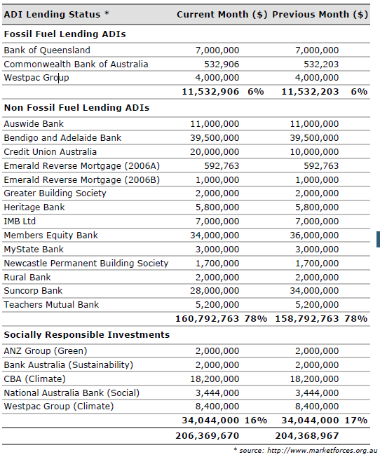
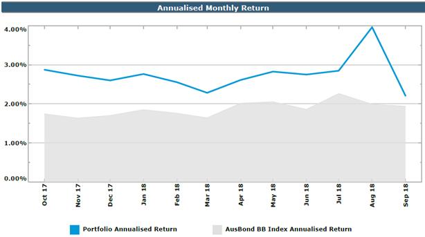
Council’s annualised return of continues to exceed the bank bill index benchmark. The period ending 30 September 2018, the portfolio for Inner West Council had a One-Month Portfolio Investment Return of 2.21%, above the UBSWA Bank Bill Index Benchmark (1.94%).
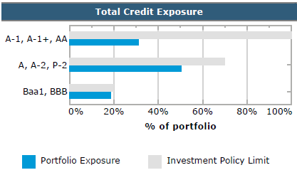
Council has a well-diversified portfolio with 81% of the portfolio spread among the top three credit rating categories (A long term / A2 short term and higher).
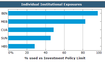
Council has a well-diversified portfolio invested among a range of term deposits and floating rate notes from highly rated Australian ADIs. The graph above shows Council’s individual institution exposure compared with the investment policy limits.
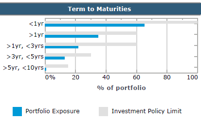
The graph above demonstrates the term to maturity for Council’s investments compared to Council’s approved investment policy limits.
Environmental and Socially Responsible Commitments
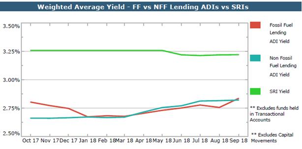
The graph above illustrates the gap between yields received from Socially Responsible Investments (SRI), Fossil Fuel (FF) and Non Fossil Fuel (NFF) Investments. All Socially Responsible Investments are also Non Fossil Fuel Investments.
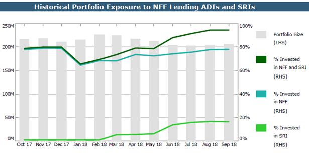
Council’s holdings in NFF / SRI’s was $194.8m with the relative total portfolio percentage of 94%.
Council’s holdings in NFF investments were $160.8m with the relative total portfolio percentage of 78%.
Council’s holdings in SRI’s were $34.0m, with the relative total portfolio percentage of 16%.
The attachments to this report summarise all investments held by Council and interest returns for periods ending 30 September 2018.
The Current Market value is required to be accounted for. The Current Market Value is a likely outcome if Council were to consider recalling the investment prior to its due date.
In May 2018, it was resolved that the Mayor make representations to TCorp regarding the establishment of ministerial compliant, Non Fossil Fuel financial instruments that will allow Council funds to be invested. Attachment 3 is TCorp’s response to the Mayoral representations. Council officers have been engaging with TCorp in relation to the Inner West Council investment portfolio with further information to be provided once finalised.
All investments made for the month of September 2018 have been made in accordance with the Local Government Act, Local Government Regulations and the Inner West Council Investment Policy.
|
1.⇩ |
IWC Sep18 |
|
2.⇩ |
IWC Economic and Investment Portfolio Commentary Sep 18 |
|
3.⇩ |
TCorp Response |
|
Council Meeting 30 October 2018 |
Subject: Former-Council Legacy Policies Rescission
Council at its meeting on 9 October 2018 deferred this item to the meeting to be held on 30 October 2018.
Prepared By: Charmian King - Policy and Risk Services Manager
Authorised By: Adam Vine - Executive Manager, Enterprise Risk
|
SUMMARY A number of legacy Council Policies have been reviewed and identified for rescission by Council as they have either been superseded by a new Inner West policy, or the relevant Policy Owner is recommending that the content is no longer relevant. A hardcopy of the Former Council legacy policies have been distributed to Councillors separately.
|
|
RECOMMENDATION
THAT the following legacy policies rescinded as they are deemed obsolete:
a) Audio Recording of Council Meetings Policy;
b) Council Committee Structure and Terms of Reference;
c) Councillor Expenses and Facilities Policy;
d) Provision of Information to Councillors Policy;
e) Councillor Policy For Payment Of Expenses & Provision Of Facilities;
f) Meetings Between Councillors & Members Of Parliament and/or Government Departments;
g) Precinct Committee System Policy;
h) Precinct Committee System Policy;
i) Social Media Policy;
j) Media Relations Policy;
k) Community Engagement Policy; and
l) Social Media Strategy.
|
BACKGROUND
Work continues to review the legacy Council Policies that were novated to Inner West Council at the time of proclamation. A key component of this work involves the relevant Group Manager (as Policy Owner) determining whether a legacy Policy is considered relevant, or has been superseded by a new Inner West policy.
This report provides a one-off identification of twelve former-Council (legacy) Policies that are recommended by the relevant Policy Owner for rescission by Council. For ease of consideration by Council, these proposed rescission policies have been collated into this single Council Report.
FINANCIAL IMPLICATIONS
Nil
OTHER STAFF COMMENTS
The relevant Group Managers, as Policy Owners, have provided the commentary and recommendations in this report related to their Policy, as attached.
PUBLIC CONSULTATION
As the reasons for Policy rescission relate to administrative drivers, public consultation is not considered necessary.
|
1.⇩ |
Council Policy Listing - Rescission Recommended |
A hardcopy of the Former Council Legacy Policies have been distributed to Councillors separately.
|
|
Council Meeting 30 October 2018 |
|
# |
Policy Name |
Date Adopted |
Legacy-Council Owner |
Recommendation |
Reason |
Recommended By |
|
1 |
Audio Recording of Council Meetings Policy |
1/10/2013 |
Former Ashfield |
To be rescinded |
Obsolete |
Group Manager Integration, Customer Service, Business Excellence and Civic Governance |
|
2 |
Council Committee Structure and Terms of Reference |
30/11/1998 |
Former Ashfield |
To be rescinded |
Obsolete |
Group Manager Integration, Customer Service, Business Excellence and Civic Governance |
|
3 |
Councillor Expenses and Facilities Policy |
27/10/2015 |
Former Ashfield |
To be rescinded |
Obsolete |
Group Manager Integration, Customer Service, Business Excellence and Civic Governance |
|
4 |
Provision of Information to Councillors Policy |
1/11/2011 |
Former Ashfield |
To be rescinded |
Obsolete |
Group Manager Integration, Customer Service, Business Excellence and Civic Governance |
|
5 |
Councillor Policy For Payment Of Expenses & Provision Of Facilities |
25/11/2008
|
Former Leichhardt |
To be rescinded |
Obsolete |
Group Manager Integration, Customer Service, Business Excellence and Civic Governance |
|
6 |
Meetings Between Councillors & Members Of Parliament and/or Government Departments |
28/09/2010
|
Former Leichhardt
|
To be rescinded |
Obsolete |
Group Manager Integration, Customer Service, Business Excellence and Civic Governance |
|
7 |
Precinct Committee System Policy |
22/02/2011
|
Former Leichhardt |
To be rescinded |
Obsolete |
Group Manager Integration, Customer Service, Business Excellence and Civic Governance |
|
8 |
Precinct Committee System Policy |
1/12/2015
|
Former Marrickville |
To be rescinded |
Obsolete |
Group Manager Integration, Customer Service, Business Excellence and Civic Governance |
|
9 |
Social Media Policy |
1/02/2016
|
Former Ashfield |
To be rescinded |
New IWC Policy adopted 13/3/18 |
Group Manager Communications, Engagement and Events |
|
10 |
Media Relations Policy |
30/10/2015
|
Former Ashfield |
To be rescinded |
New IWC Policy adopted 13/3/18 |
Group Manager Communications, Engagement and Events |
|
11 |
Community Engagement Policy |
6/11/2013
|
Former Leichhardt |
To be rescinded |
New IWC Framework adopted |
Group Manager Communications, Engagement and Events |
|
12 |
Social Media Strategy |
22/05/2012
|
Former Leichhardt
|
To be rescinded |
New IWC Policy adopted 13/3/18 |
Group Manager Communications, Engagement and Events |
|
Council Meeting 30 October 2018 |
Subject: Adoption of Public Access to Information held by Council Policy
Prepared By: Rad Miladinovic - Business Information Services Manager
Authorised By: Harin Perera - Group Manager Information Communications Technology
|
SUMMARY The revised Public Access to Information held by Council Policy was placed on public exhibition for the period 5 September to 3 October 2018, as resolved by Council on 21 August 2018. This report provides an overview of the feedback received from the exhibition period and seeks that Council resolves to adopt the revised Policy.
|
|
RECOMMENDATION
THAT Council adopts the revised Public Access to Information held by Council Policy (Attachment 1). |
BACKGROUND
At its meeting of 21 August 2018, Council resolved as follows:
THAT:
1. Council receives and notes the revised Inner West Council Agency Information Guide (Attachment 1) and place the revised Public Access to Information held by Council Policy (Attachment 2) on public exhibition for 4 weeks;
2. quarterly reports be provided on the requests for information and whether the information could have been made publically available and not required a request; and
3. Council include a link to the Charter for Public Participation – a guide to assist agencies and promote citizen engagement, alongside the draft policy when it is publicly exhibited.
PUBLIC CONSULTATION
The Draft Public Access to Information held by Council Policy was promoted through Council's ‘Your Say’ web page. Public participation occurred as follows:
# of aware participants: 56 people visited the exhibition page but did nothing further on the page
# of informed participants: 20 people downloaded one of the documents published on the page (either the policy or the guide)
# of engaged participants: 5 people completed the survey
The documents that were published as part of the exhibition were accessed as follows:
Draft Access to Information held by Council Policy 11 visitors
Agency Information Guide 3 visitors
Report to Council Meeting held on 21 August 2018 3 visitors
Following is a summary of the feedback received during the exhibition period:
Four respondents are in support of the Policy. Two respondents provided the following feedback:
· “Publishing information to the website is not specific enough. Databases held by the council, and which are in a format which can be easily searched via a web form or API access should be made available upon registration, and to registered residents. Further any access of council held information should be logged and audited annually, and information which has been provided for a fee should be considered for fee-less access. Finally, funds collected for information access should be used specifically to enhance and improve the access of council information into the future both in terms of access but also classification and categorisation.”
Council’s response / outcome: once implemented, the OneCouncil solution will provide customers with direct access to track the progress of their customer requests and to view information and the progress and status of Development Applications.
Council received approximately $4,000 in fees for public access to information requests during the 2017/18 financial year. These funds were used to provide electronic access to customers via digitisation of physical records.
· “Our Local Governments Councils seem to hold all the truth when it comes to Parking Metre Charges our local councils revenues, that affect the community and the community do not get a real answer from councils when question are ask, we the community have no refused to trust our councils, we believe council are not like 20years, the council are money angry and they don't really play a good roll in considering the community voice, they seem to make decision to meet their own interest, therefore we the community a now petitioning for all local Councils, we spoke to so many people in all walk of life in community, when ask them about the parking fees and charges, the first they say where is this money going and who is controlling and why is not use in each community by local councils, the even notice councils have approve so many small business developers a large to proceed to develop more high rise in community. they also want answer councils refuse to answer, we want to change the law and implements a right for our community to be given a voice to play a part in councils decision, it seem the councils are not willing to share more information to all community. we have a concern to councils charge levy which is not applied to the amendments of the legislation for breaching the metre reading for charging individual on rates which is build in the parking metre machines we have witness many time, we also wrote to council to allow us to meet up for discussion based on this subject they refused, so where are the real councils, why we are not given a freedom of right to speak out.
We the community need to know what are the councils doing with all these Revenues of Funds and what else they are restrict us to see, we ask under the freedom of information law”
Council’s response / outcome: Council wrote to the respondent advising that high level financial information about income and expenses is available in Council’s Annual Report and accompanying financial statements that are published on Council’s website. The respondent was also invited to contact Council to further discuss any aspect of the Policy.
Further consideration will be given to releasing additional financial information when Council develops a proactive release program.
One respondent does not support the draft Policy. The following feedback was provided:
· “council should always pro-actively publish all information that is not confidential in an organised and timely manner - this would uphold council's repeated claims to being transparent - i am saying 'no' because i see from past 'surveys' that when people say 'yes' with comments addressing their concerns that the feedback is almost always ignored or summarily 'discounted' by staff - staff then report that the item has majority support which if you read the feedback is not always the case - this type of survey is a form of 'push polling' that is discouraging the community from participating”
Council’s response / outcome: The responded was invited to contact Council to discuss any specific aspect of the draft Policy. The responded was also advised that the feedback provided will be shared with Council’s Engagement team.
Revisions made to the Draft Public Access to Information held by Council Policy:
The draft Policy has been updated to reflect that all income received from access to information requests (including application and copying fees) will be specifically used to improve access to Council held information (refer to highlighted update on page 3 of the Policy).
CONCLUSION
The Public Access to Information held by Council Policy will next be reviewed during June 2019 at the same time the Inner West Council Agency Information Guide is next reviewed.
|
1.⇩ |
Draft Public Access to Information held by Council Policy (updated after public participation) |
|
Council Meeting 30 October 2018 |
Subject: Status of Legal Proceedings
Prepared By: Joe Strati - General Counsel
Authorised By: Rik Hart - Interim General Manager
|
SUMMARY This report provides Council with a summary of legal proceedings in which Council is involved. |
|
THAT the Report be received and noted. |
BACKGROUND
This report provides Council with a summary of legal proceedings in which Council is involved.
It does not include the following types of legal proceedings:
1. Proceedings that are managed by Council’s insurers;
2. Local Court proceedings involving an appeal against a parking fine; and
3. Proceedings for the recovery of debts where those proceedings are being run by council’s external debt collection agency.
The report is current as at 3 October 2018. It does not capture changes that have occurred between that date and the date the report is considered by Council. As the report contains no information of a confidential nature that falls within section 10A(2) of the Local Government Act 1993, it is published as an open report. Should, however, Council wish to seek legal advice on any matter addressed in the report, it would be appropriate for Council to enter into closed session for such advice to be provided and so that any legal professional privilege that may attach to such advice is not waived.
FINANCIAL IMPLICATIONS
Nil.
OTHER STAFF COMMENTS
Nil.
PUBLIC CONSULTATION
Nil.
|
1.⇩ |
Summary of Legal Matters - as at 3 October 2018 |
|
Council Meeting 30 October 2018 |
Subject: LAND AND ENVIRONMENT COURT PROCEEDINGS - COUNCIL ats ERIC FINDLAY - ORDER TO REMOVE PONY
Prepared By: Joe Strati - General Counsel
Authorised By: Rik Hart - Interim General Manager
|
SUMMARY This report provides Council with an update on the progress of the subject proceedings and provides information to assist Council in determining whether to continue prosecuting the matter as per its current course. |
|
RECOMMENDATION
THAT:
1. Subject to the Chairperson, in accordance with section 10A(4) of the Local Government Act 1993, allowing members of the public to make representations as to whether this part of the meeting should be closed, Council moves into closed session as CONFIDENTIAL ATTACHMENT 1 contains advice concerning litigation which section 10A(2)(g) of the Act allows to be received and discussed in closed session.
2. Council adopt one of the options in paragraph 22 of Confidential Attachment 1.
|
BACKGROUND
On 25 September 2018, the Council resolved, in part, to receive a confidential report regarding the “pony” matter.
This matter has a long history that appears to date back to at least 2003. At that time, the former Ashfield Council resolved that Council would not take any action with respect to the keeping of a pony at premises in Summer Hill (“Premises”) provided certain conditions around cleanliness were met.
On 19 July 2016, the Land and Environment Court issued an order requiring the pony to be removed from the Premises by 21 October 2016 (“Order”). The Order was not complied with and that remains the case.
On 13 November 2017, class 4 proceedings were commenced in the Land and Environment Court seeking further Court orders to enforce the requirements of the Order.
On 11 October 2018, a Court mandated mediation took place. The matter is yet to be resolved.
CONFIDENTIAL ATTACHMENT 1 provides further information and advice regarding the above to assist Council in determining whether the current course of the proceedings ought change.
FINANCIAL IMPLICATIONS
Financial issues are addressed in Confidential Attachment 1.
OTHER STAFF COMMENTS
Not applicable.
PUBLIC CONSULTATION
Not applicable.
|
1.⇩ |
Confidential Attachment 1 - Legal Advice |
|
|
Council Meeting 30 October 2018 |
Subject: Notice of Motion: Councillor Professional Development
From: Councillor Julie Passas
|
Motion:
THAT Councillors be required to prepare a report on any professional development undertaken including seminars, training and conferences, this excludes attendance at the Annual Local Government Conference. |
|
|
Council Meeting 30 October 2018 |
Subject: Notice of Motion: Pocket Park upgrade
From: Councillor Julie Passas
|
Motion:
THAT Council upgrade the fencing, gate and playground equipment at the pocket park located at Elizabeth Street, Ashfield between Alt Street and Frederick Street, Ashfield. |
Background
A pocket park is located on Elizabeth Street Ashfield between Alt Street and Frederick Street Ashfield. The area has a high density with many unit complexes and town houses and there is no other open space available in the area. The pocket park has been poorly maintained with a gate that doesn’t close and wired fencing. The park requires a gate that closes, new fencing, upgraded playground equipment, a water tap, a bubbler, lighting and signage to be erected on the new fence that states ‘no dogs are allowed to entered the pocket park’. Therefore I ask that be park be upgraded by Council.
Officer’s Comments:
Comment from Group Manager Trees, Parks and Sports Fields:
The playground was installed in 2004 and is due for renewal between 2024 and 2029. The park includes a small bubbler.
A Playground Strategy is to be prepared to guide playground renewal priorities and establish contemporary design principals for all Inner West Council playgrounds. Capital works to implement the strategy are currently funded from 2022-2023. It is recommended that a well-designed upgrade of the playground be undertaken as part of this program, including a community engagement process. Upgrade of the park is expected to cost in the order of $80,000.
The playground is regularly inspected and repairs completed as required including recently completed softfall repairs. Further maintenance will be completed from the existing minor asset maintenance budget to install a missing gate, repair one hole in the fence and to install a ‘no dogs’ sign.
The fence is otherwise in fair condition. The majority of the fence is located on private property boundaries. Council will need to liaise with the property owners, who are responsible for boundary fences adjoining public land, when undertaking fencing work in the future.
|
|
Council Meeting 30 October 2018 |
Subject: Notice of Motion: Report on the use of Round Up in council parks, sporting fields and playgrounds and near waterways
From: Councillor Rochelle Porteous
|
THAT: 1. A report be brought to the next available council meeting outlining when and where and how frequently the Inner West Council is using Round Up and what processes are in place to protect council staff using Round Up and local residents and their pets using our parks, gardens and sporting fields where Round Up has been sprayed. That the report also includes what other safer products council can use to substitute Round Up; and
2. The Inner West Council joins with the Cancer Council of Australia in calling for an independent review of Round Up to be instigated as soon as possible. |
Background
Australia’s peak cancer body, the Cancer Council of Australia has this week called for an independent review of Round Up. Australia's regulator, the Australian Pesticides and Veterinary Medicines Authority (APVMA), has not formally reviewed glyphosate since 1995.
The Inner West Council uses Round Up in its parks, gardens, playgrounds and on sporting fields. Glyphosate, the key component of Round Up is effective in killing weeds but it is persistent in soils, plants and waterways. In soil, glyphosate remains for between 2 and 197 days and when it leaches into the waterways it persists for up to 91 days. It can also often be detected in plants for up to a year after the plant has been sprayed.
There is a growing body of evidence of the danger it poses to human health in terms of its toxicity and the impact it has on the nervous system as well as in terms of the fact that WHO (World Health Organisation) has now upgraded its classification of glyphosate to being a probable carcinogenic. State Cover, key insurers for NSW local government, note in their fact sheet “It is recommended that councils take a cautious approach and investigate their use of glyphosate and other hazardous chemicals used for weed control”.
Officer’s Comments:
Comment from Group Manager Trees, Parks and Sports Fields:
Glyphosate is used by Council to control weeds. An internal working group has recently been established to review the current use of glyphosate by Council. This working group is also investigating possible alternative products.
A report addressing the Notice of Motion will take a number of staff approximately 70 hours to complete at a cost of approximately $4,900. Council may also need to engage external expert consultants to provide advice at a cost of up to $25,000. Any use of alternative products is likely to require substantial changes in the current processes and methodologies utilised by the operational staff in the control of weeds. This may have implications on service levels and it may have substantial budget implications. The working group is still investigating this matter and therefore a report will be available in early 2019.
|
|
Council Meeting 30 October 2018 |
Subject: Notice of Motion: Prevention of Carparking on Tempe Reserve Recreation Areas
From: Deputy Mayor, Councillor Victor Macri
|
Motion:
THAT Council investigates and implements appropriate measures to prevent unauthorised vehicular access to the off-road areas of Tempe Reserve including fields and picnic areas.
|
Background
It has been observed that visitors to Tempe Reserve are often parking vehicles away from designated parking areas and roadways adjacent to picnic areas and on grassed areas. Not only does this present a potential hazard to reserve users but will damage the reserve surface.
Officer’s Comments:
Comment from Group Manager Trees, Parks and Sports Fields:
The primary unauthorised vehicle access locations have been identified at the amenities building driveway near the pedestrian crossing and at the road bend adjoining the village green. The recommended works to control access are:
- Install drop down bollard at the amenities building driveway with garden bed and bin stand either side of the driveway. Estimated cost including bollard, bin stand, garden edging, planting and mulching is $2,000.
- Install road side garden bed adjoining the village green, extending the existing garden. Estimated cost including edging, advanced tree and garden planting and mulching is $2,500.
The estimated total cost is $4,500. These works can be undertaken within existing parks assets and operational budgets.
It is recommended the above works be undertaken and the site monitored. A further potential for vehicle access exists between trees in the existing row of Norfolk Island Pines that runs between the above locations. If required, additional bollards can be installed between the trees at an estimated cost of $2,000.
|
|
Council Meeting 30 October 2018 |
Subject: Notice of Motion: Summer Hill Public School Spring Fair
From: Councillors Mark Drury and Lucille McKenna OAM
|
Motion:
THAT:
1. Council provide the Summer Hill Parents and Citizens a grant of $500;
2. Council work with the School and P & C to develop a plan to further reduce the amount of waste the event produces at the 2019 fete; and
3. This money come from an appropriate waste budget.
|
Background
Every year Summer Hill Public School Parents and Citizens have an annual fundraiser, Summer Hill PS Spring Fair. This year the fair is on Saturday 4 November. This fair is extremely important in helping the school raise funds for much needed resources for the students in a public school.
They have always ordered extra bins from the IWC (and the former Ashfield Council) to assist with responsible waste collection. In the past there has been no charge for this collection, but this year Council has quoted just around $500 for this service. This has not been budgeted for because the school was unaware of the changes to Council’s fees and charges.
Officer’s Comments:
Comment from Group Manager Environment and Sustainability:
Council can provide the waste service for the Summer Hill Spring Fair at a cost of $500.00.
There is no current program or resources available to support schools individually with their waste management. The Urban Sustainability team are fully occupied working on the Climate and Renewables program and their business as usual work. Support is already given to schools through the Inner West Sustainable Schools Network which meets on a quarterly basis and can connect schools with tools and resources to assist them.
Support for all schools to implement better waste management would cost in the order of $50,000 for a part time officer and resources. Council is unable to provide this service to schools as part of the domestic waste service as there is no budget to cover non-domestic waste collection and processing. It is illegal to fund schools waste from the Domestic Waste Charge. All schools have budgets to manage their waste and should be using them to fund waste management throughout the year and at events. It should be part of the school and event planning to fund essential elements such as waste.
|
|
Council Meeting 30 October 2018 |
Subject: Notice of Motion: Ashfield Pool - Ashfield District Historical Society
From: Councillors Mark Drury and Lucille McKenna OAM
|
Motion:
THAT the Ashfield District Historical Society be requested to produce a history of Ashfield Pool and that the 2019-2020 Council budget allocate $10,000 for this purpose. |
Background
The Ashfield pool has been one of the most important council places for many residents for over half a century. People have learnt to swim, won race, played games, done laps, mucked a round, kept cool, sat in the sun and fallen in love there. There are a range of great photos, reminiscences and official documents that would make a great local history.
The Ashfield District Historical Society has over the years done some great local histories of important clubs and facilities in our community and produced handsome volumes that collect and record. As we wait for our new pool to be built it might be a great time to ask the ADHS to produce a volume in time for the opening of the new pool. That as part of the project $2,500 be used to digitise the Ashfield collection so that it can be accessible on-line.
Officer’s Comments:
Comment from Group Manager Library and History Services:
A historic booklet / volume relating to the Ashfield pool prepared by the Ashfield District Heritage Society would be a welcome addition to Council’s community history collection.
Council’s Archives and Community History Collections currently contain a varied range of items relating to the Ashfield pool and its development. This includes original plans, sketches, photographs, opening footage and correspondence. This collection is currently stored in the Records Department at the Ashfield Service Centre and the original items can not be loaned off-site; however, they can be accessed via appointment at Petersham Archives or at the Ashfield Library via Council’s Community History team.
It would be expected that the $2,500 allocation towards digitisation would be managed by the Community History team and a specialist historic scanning company would be responsible for digitizing the collection. Following this, the digital records would be catalogued and would be entered into the library management system and made available on-line.
In addition, as the Ashfield District Historical Society would be researching the pool in-depth, it is recommended that they also identify key items of significance or themes that may be appropriate for any historical signage or interpretation or exhibition that may occur in the newly renovated facility. The Community History team would work alongside the group to provide guidance.
Resource Implications:
The annual breakdown of the Community History budget (excluding staff) is as follows:
|
Category
|
Allocated for |
Amount |
|
Conservation |
Conservation, preservation of historical collection ie this year the professional removal of mould from some historical Council minute books |
$3,073 |
|
Exhibitions, programs and display |
Heritage Festival, History Week, Architectural talks, and all history talks / walks throughout the year. |
$10,240 |
|
Collection |
Digitisation and purchasing of items of historic relevance and funding of oral histories |
$12,252
|
|
History Grant program
|
Funding of history grants for community to deliver a project that contributes to the community history collection |
$25,000 |
|
Total |
|
$50,565.00 |
Based on the above budget, Community History do not have any money to allocate to this project as the service currently operates on a very lean budget. It is requested that funding be allocated from savings for this project. If the project could not be funded from savings it would be suggested that the money be funded by:
· $5,000: reducing the History Grant program from $25k to $20k (see note below)
· $1,000: reduction in non-fiction collection budget
· $1,000: reduction in fiction collection budget
· $1,000: reduction in databases budget
· $$2,000: salary savings budget
This project is the type of project that would normally be funded through the History Grant Program. With regards to staff resources, the estimated breakdown of hours is as follows:
|
Action |
Staff member |
Number of hours |
|
Arranging for digitization of materials and liaison with external provider
|
Archivist |
5 |
|
Cataloguing of digitized material
|
Cataloguer / Library officer |
50 |
|
Supervision / access to material (if not digitized), photocopying, assistance with finding materials etc
|
Library officer / archivist |
Unknown |
|
Liaison with ADHS re content, themes etc
|
Library and History Coordinator |
2 |
|
Total |
|
57 hours |
The above tasks would be allocated to staff as part of standard service delivery.
|
|
Council Meeting 30 October 2018 |
Subject: Notice of Motion: Reducing Waste
From: Councillor Marghanita Da Cruz
|
Motion:
THAT a report be brought back on introducing tiered waste charges across the Inner West LGA including associated promotion to ratepayers and tenants about council and community services to divert resources and minimise waste going to landfill.
|
Background
“Council levies a Domestic Waste Management Charge
under Section 496 of the Local Government Act 1993, noting that Section 504 of
the Local Government Act requires that Domestic Waste charges be set so as to
be self-funding, with neither profit nor subsidy being provided to or
from general income." Domestic waste management charges and Income, Inner
West Council Operational Plan and Budget FY2018/19
"A community that is working towards less waste is one that avoids the
generation of waste and where any discarded materials are designed as a
resource for other processes, no materials are discharged to land, air or
water." Less waste, Inner West Council, https://www.innerwest.nsw.gov.au/live/waste-and-recycling/less-waste
Tiered waste charges encourage and reward residents for reducing the waste they
send to landfill. Residential Dwellings in the former Leichhardt LGA can choose
to have smaller rubbish bins and pay less.
There is no incentive or reward for Owners of Residential Dwellings in the
former Ashfield and Marrickville LGAs to reduce their waste and opt for smaller
garbage bins.
There is quite a significant disparity in Domestic Waste Charges between the
former LGAs.
--------------------------------------------------------------------------------------
2018/9 Domestic Waste Charge in the former Leichhardt LGA
----------------------------------------------------------------------------------------
Single residential dwellings
120 litre garbage bin: $526.00 p.a.
80 litre garbage bin: $454.00 p.a.
55 litre garbage bin: $428.00 p.a.
2 × 55 litre garbage bins: $526.00 p.a.
Units
240 litre garbage bin between 2 units: $526 per unit
240 litre garbage bin between 3 units: $454.00 per unit
240 litre garbage bin between 4 units: $428.00 per unit
------------------------------------------------------------------------------------------
2018/9 Domestic Waste Charge in the former Ashfield LGA
----------------------------------------------------------------------------------------
Single residential dwellings
120 litre garbage bin: $387.00 p.a.
240 litre garbage bin: $774.00 p.a.
Units: 240 litre garbage bin between 2 units $387.00 per unit
-----------------------------------------------------------------------------------------
2018/9 Domestic Waste Charge in the former Marrickville LGA
----------------------------------------------------------------------------------------
Single residential dwellings: 140 litre garbage bin: $578.50 p.a.
Units: 240 litre garbage bin between 2 units: $578.50 per unit
Officer’s Comments:
Comment from Group Manager Environment and Sustainability:
This work will be covered in the development of the Zero Waste Strategy and Transition Plan which is the subject of a report going to the 30 October Council meeting.
There is no additional time needed to report back on the domestic waste charge and investigating incentives will form part of the project, reporting back to Council will be in mid – late 2019.
|
|
Council Meeting 30 October 2018 |
Subject: Cooks River Parklands Upgrade Tender Report
Prepared By: Tim Brown - Coordinator Parks Project Delivery
Authorised By: Cathy Edwards-Davis - Group Manager Trees, Parks and Sports Fields
|
SUMMARY The Cooks River Parklands Upgrade Tender Number T21/18 applies to the development of the existing parklands on the north side of Cooks River, Marrickville, in accordance with the Cooks River Plan of Management and Masterplan 2016. Specifically, the areas are within Steel Park Playground, Steel Park North, Richardson’s Lookout, Warren Park, Cooks River Foreshore and Kendrick Park. A report by the Tender Review Panel on the results of the assessment of received tenders, which recommends the engagement of a tenderer to undertake the upgrade work, can be found in CONFIDENTIAL ATTACHMENT 1.
The work is scheduled to commence in November 2018.
|
|
RECOMMENDATION
THAT:
1. Council moves into closed session to deal with this matter as the information contained in CONFIDENTIAL ATTACHMENTS 1 of this report are classified as confidential under the provisions of Section 10A (2) d (i) and (ii) of the Local Government Act 1993 for the following reasons:
a. d (i) commercial information of a confidential nature that would, if disclosed prejudice the commercial position of the person who supplied it; b. d (ii) commercial information of a confidential nature that would, if disclosed confer a commercial advantage on a competitor of the council;
And in accordance with Sections 10A (4) of the Local Government Act 1993, that the Chairperson allow members of the public to make representations as to whether this part of the meeting should be closed.
|
BACKGROUND
Tenders were recently invited for the upgrade of the Cooks River Parklands. The works aim to implement priority actions of the Cooks River Plan of Management and Masterplan 2016 and include:
· New inclusive playground equipment and soft play areas
· New footpaths and extensive new footpath lighting
· Stormwater management systems including bio-retention ponds
· New furniture and fixtures
· Garden planting and tree planting.
The tender period commenced on Wednesday 14 August 2018 with a closing date of Friday 21 September 2018.
FINANCIAL IMPLICATIONS
Funding for the works is provided in the 2018-2019 Parks Capital Works Budget. Details of funding for the project are included in CONFIDENTIAL ATTACHMENT 1.
OTHER STAFF COMMENTS
At the closing of tenders three submissions were received. Tender submissions were examined and evaluated in accordance with the criteria set out below:
1. Tender Price;
2. Past experience and past performance;
3. Project Plan;
4. Accurate and complete return of all Tender Schedules.
PUBLIC CONSULTATION
Extensive community engagement was undertaken in the development of the Cooks River Plan of Management and Master Plan, adopted in August 2016. Works identified within the upgrade are in accordance with the recommendations in the Plan of Management and Master Plan.
Community engagement for the design of the Steel Park inclusive playground was undertaken in late 2017 with the assistance of the Touched By Olivia Foundation. The engagement also advised of the broader masterplan works between Steel Park and Kendrick Park and included a community newsletter, community engagement sessions and YourSay Inner West survey. Additional specific engagement has been undertaken with sports users and park neighbours affected by the works. A further newsletter is planned to be distributed in November to notify the commencement of the construction works program.
CONCLUSION
The Tender Review Panel has undertaken an assessment and made recommendations for Tender 22/15 as set out in CONFIDENTIAL ATTACHMENT 1. It is recommended that Council adopt the recommendations of the Panel.
|
Cooks River Parklands Upgrade Tender Report T-21-18 - Confidential |