|
AGENDA R |

Council Meeting
TUESDAY 25 JULY 2017
6:30pm
|
|
Council Meeting 25 July 2017 |
The following provides a summary of the items to be considered at the meeting.
Administrator's Minutes
ITEM PAGE #
C0717 Item 1 Administrator's Condolence Motion: The Late Mr Rae Jones former Mayor Ashfield 14
C0717 Item 2 Administrator's Condolence Motion: The Late Mr Peter Bonsall-Boone (Bon) 15
C0717 Item 3 Administrator's Condolence Motion: The Late Edward (Ted) Floyd 17
Staff Reports
ITEM PAGE #
C0717 Item 4 Implementation Advisory Group Meeting held on 6 July 2017 18
C0717 Item 5 WestConnex Update Report: Draft submission on M4-M5 Link Concept Design, Local Area Traffic Improvement Strategy & Extension of Funding for Community Organiser Position 24
C0717 Item 6 Evaluation and proposed outcomes of trial off leash areas at Johnson Park, Morton Park and Petersham Park. 30
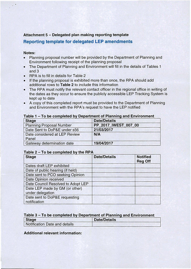
C0717 Item 7 120c Old Canterbury Road Summer Hill - Planning Proposal 66
C0717 Item 8 Planning Proposal: 58-76 Stanmore Road, 2-20 Tupper Street and 3-9 Alma Avenue, Stanmore 168
C0717 Item 9 Overview: Planning Proposal for Uniting Care Site at 15-17 Marion Street, Leichhardt 264
C0717 Item 10 Planning Proposal and Draft Development Control Plan - 168 Norton Street Leichhardt: Community Consultation Outcomes 475
C0717 Item 11 2-6 Cavill Avenue Ashfield - Planning Proposal 576
C0717 Item 12 Planning Proposal No. DA201600376 at 466-480 New Canterbury Road and 26-38 Hercules Street, Dulwich Hill 746
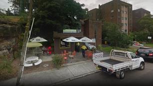
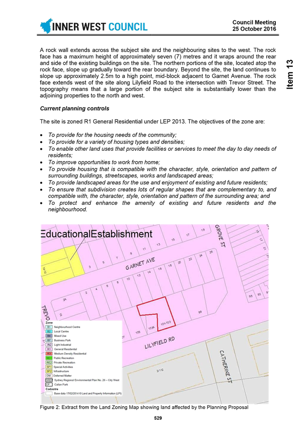
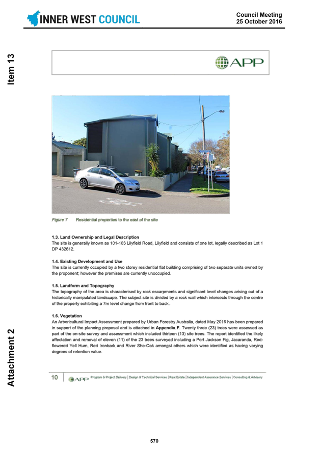
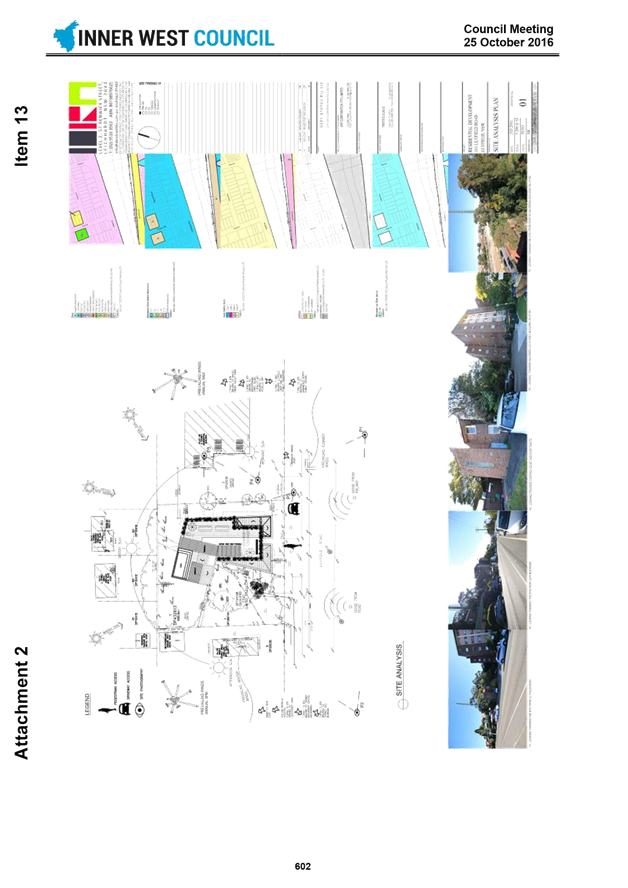
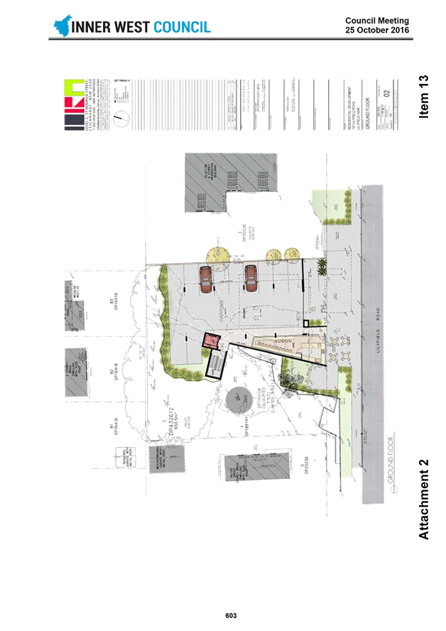
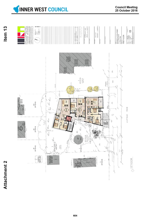
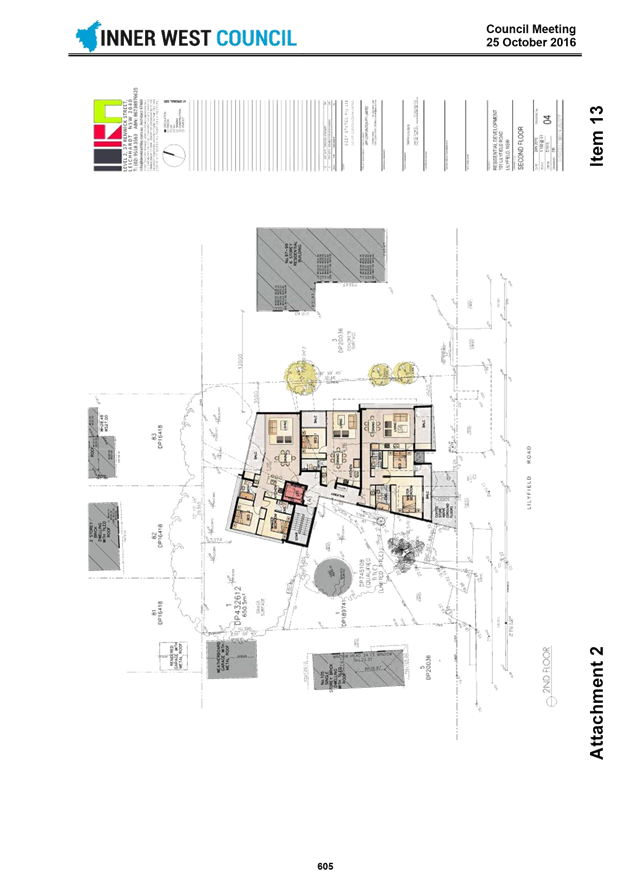
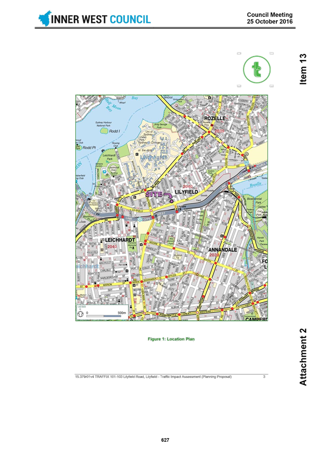
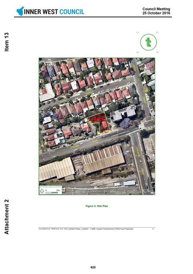
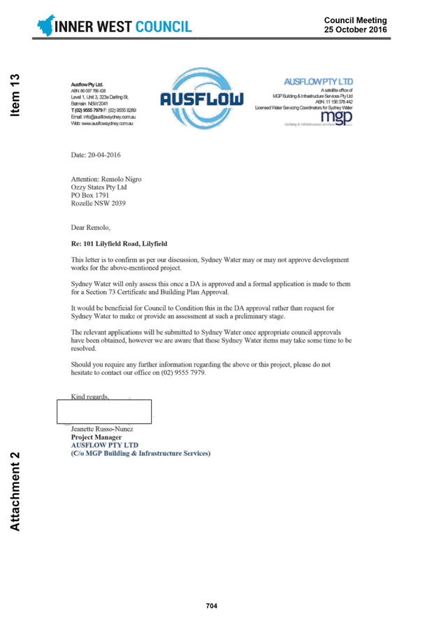
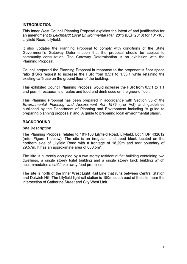
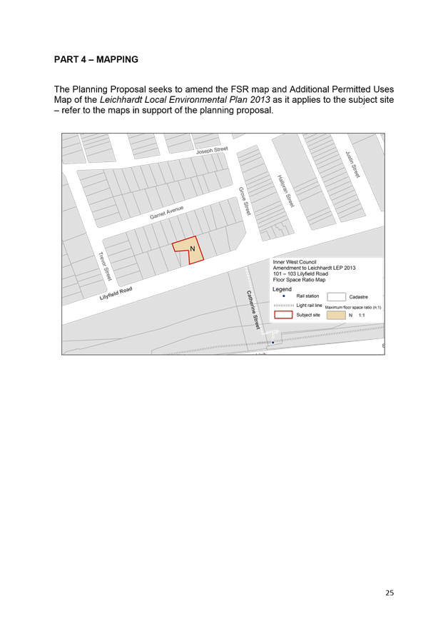
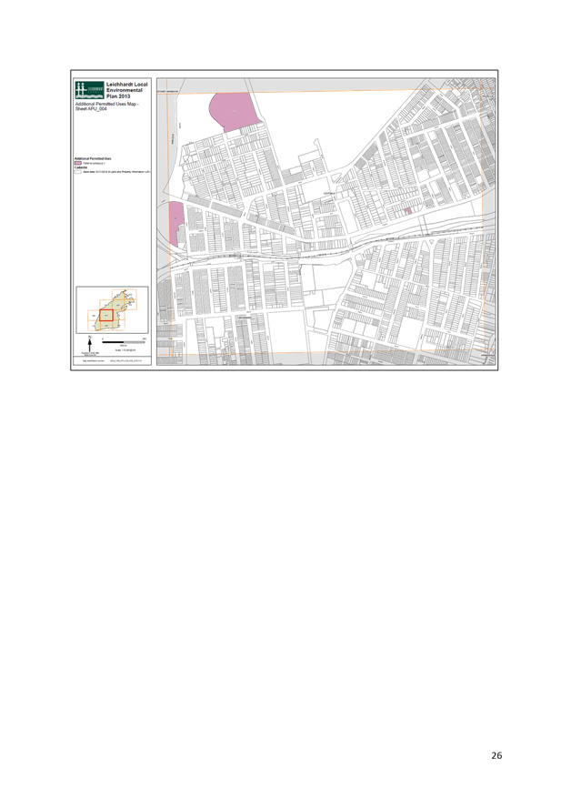
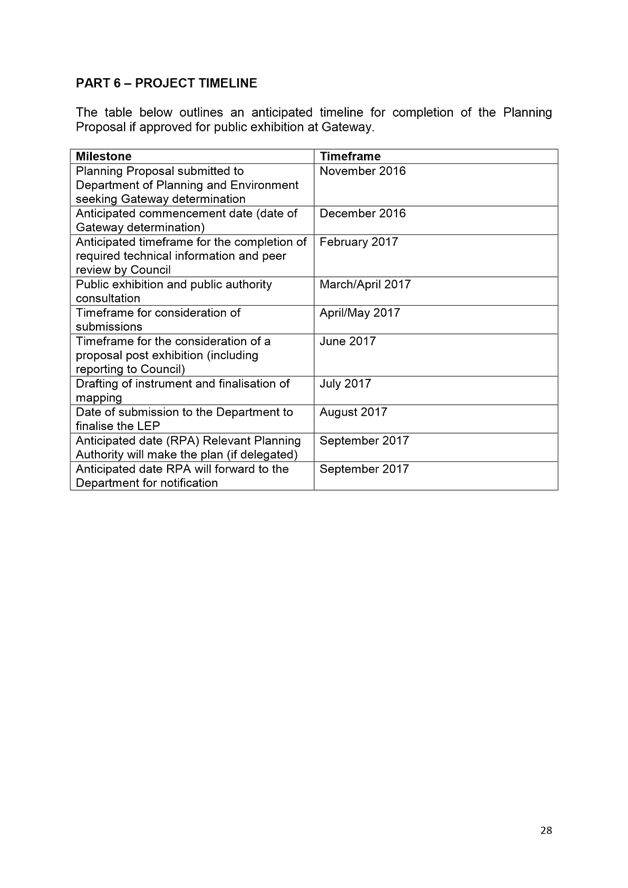
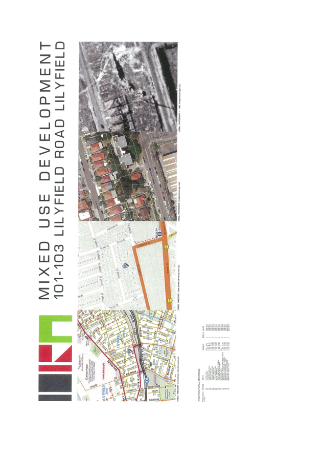
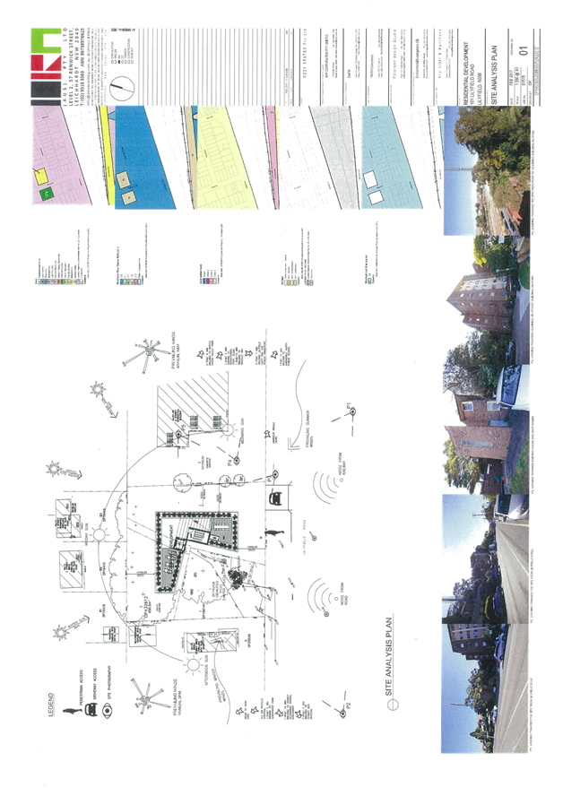
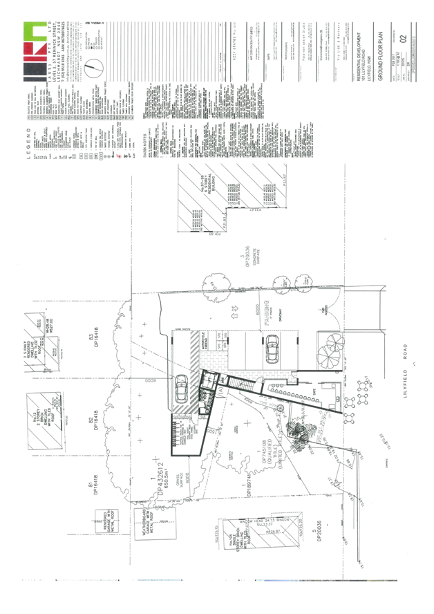
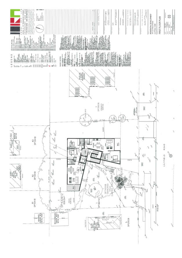
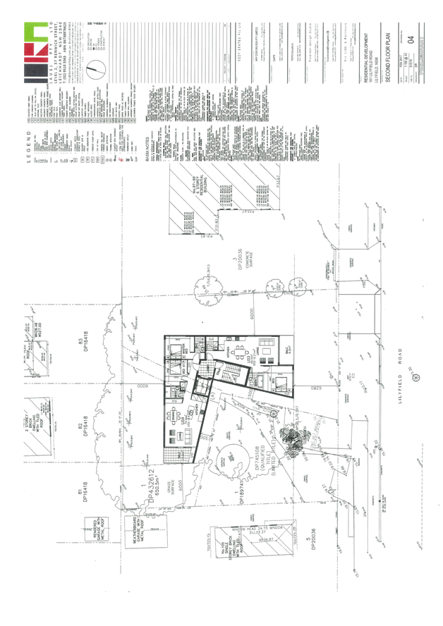
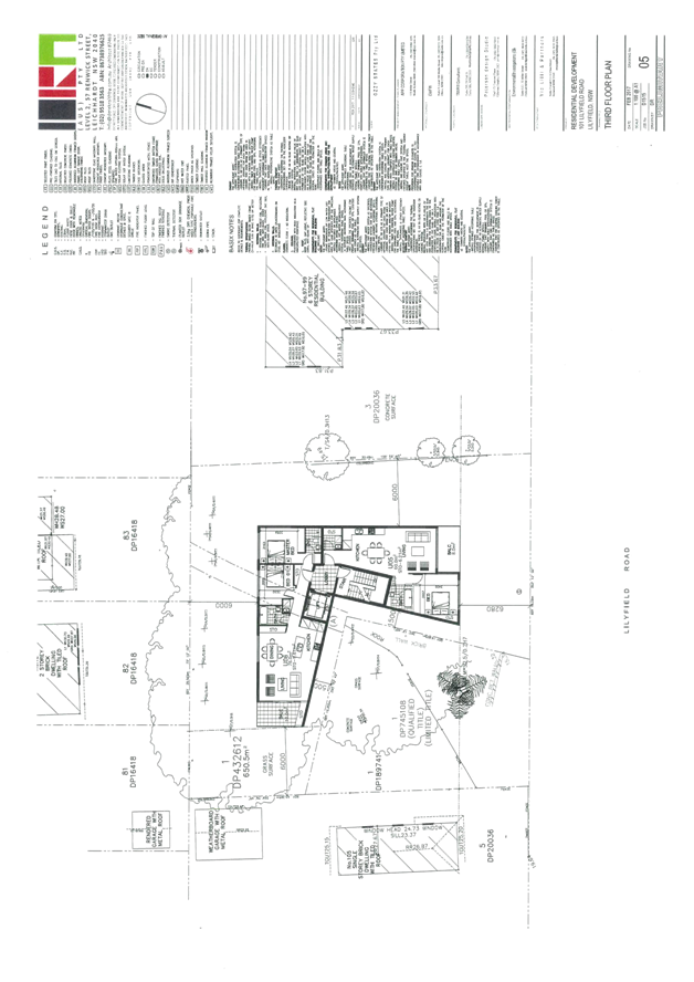
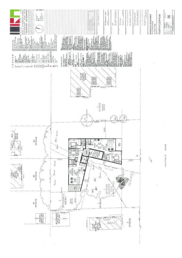
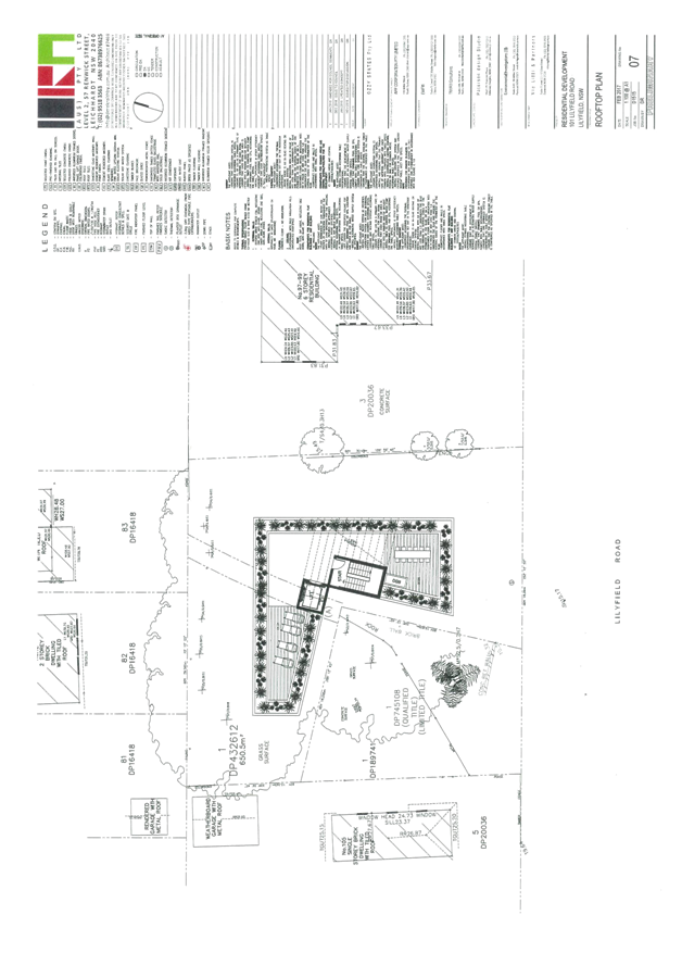
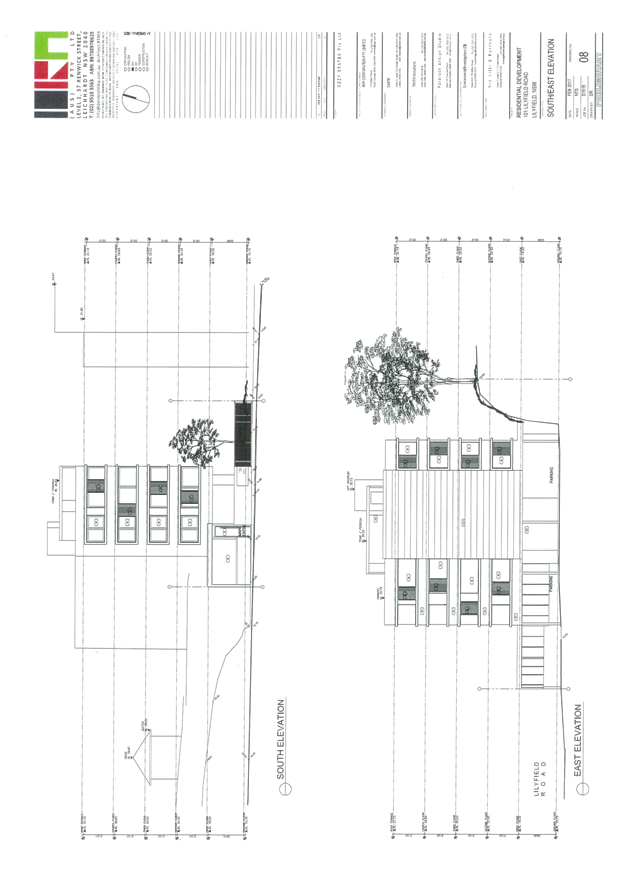
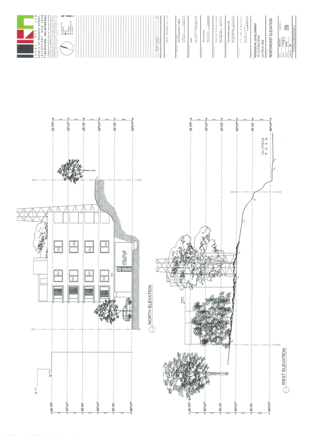
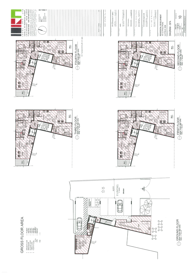
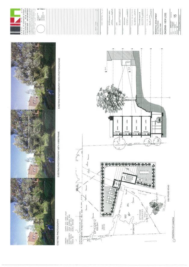
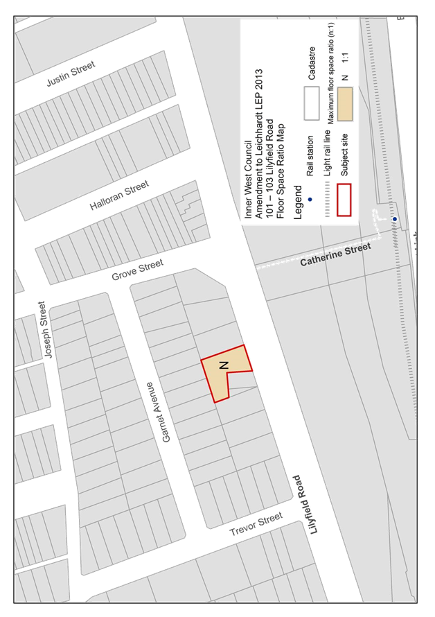
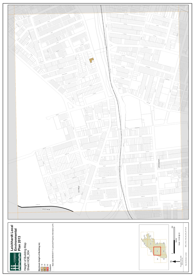
C0717 Item 13 101-103 Lilyfield Road Planning Proposal Report 800
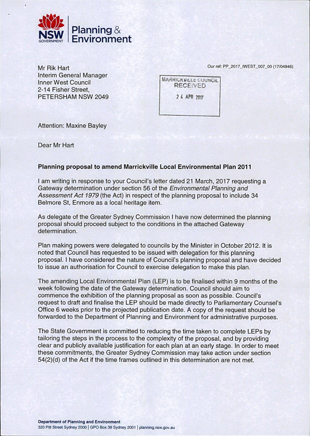
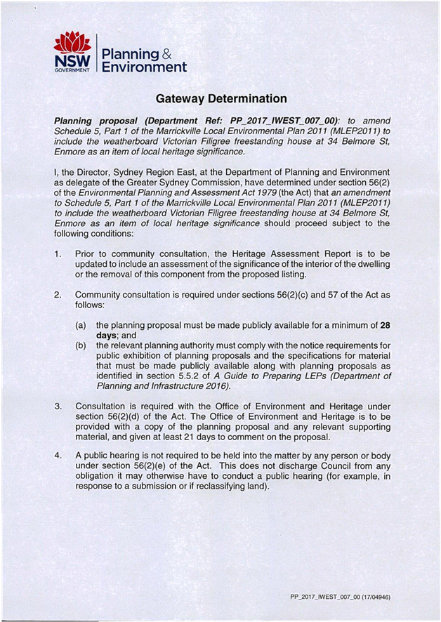
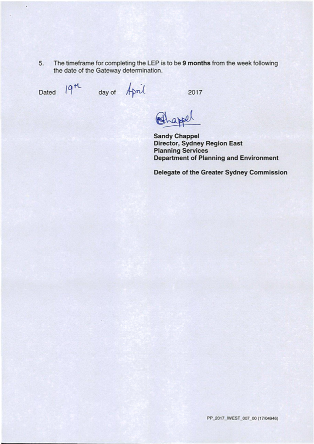
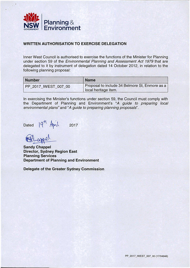
C0717 Item 14 Post Exhibition Report Draft Marrickville Local Environmental Plan 2011 (Amendment No. 13) - 34 Belmore Street, Enmore 1060
C0717 Item 15 Amendments to Inner West DCP 2016 1072
C0717 Item 16 Marrickville Development Control Plan 2011 - Amendment to Part 2.22 Flood Management 1094
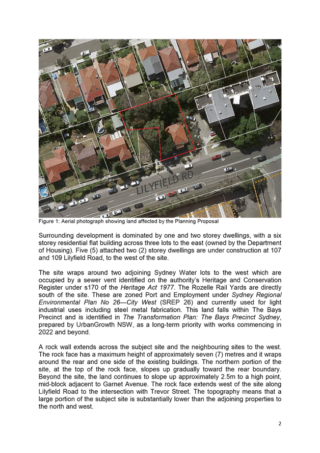
C0717 Item 17 Local Traffic Committee Meeting held on 6 July 2017 1100
C0717 Item 18 Draft Councillor Expenses and Facilities Policy - Public Exhibition Period to 25 July 2017 1128
C0717 Item 19 Flood Management Advisory Committee Meeting held on 22 June 2017 1131
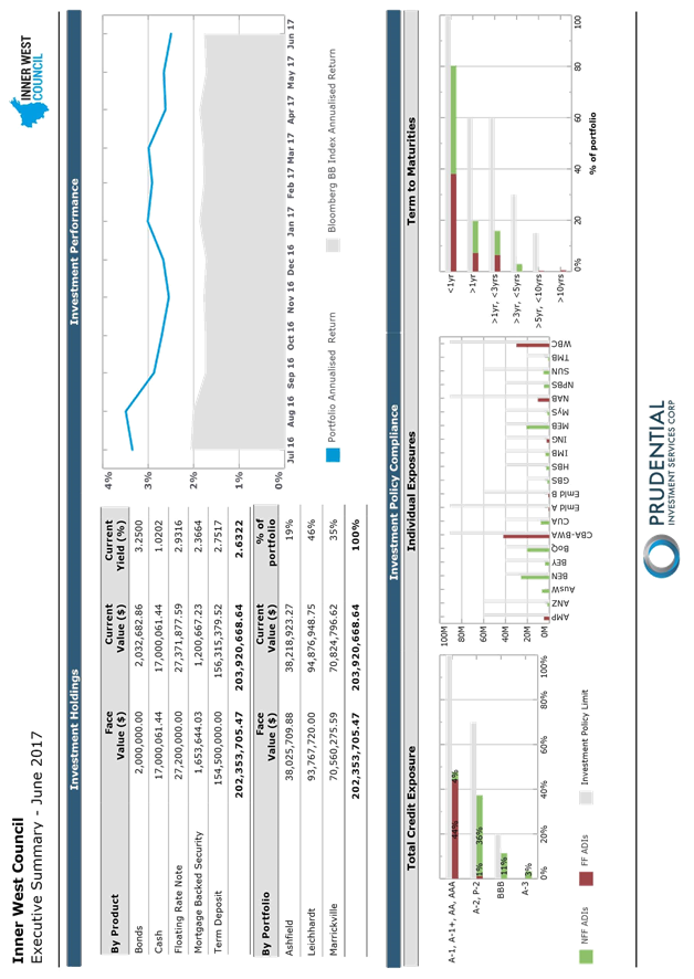
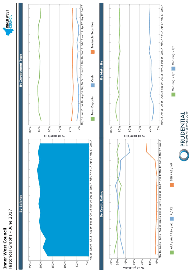
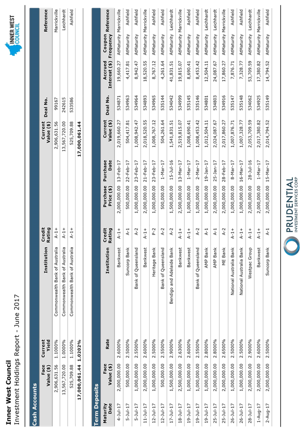
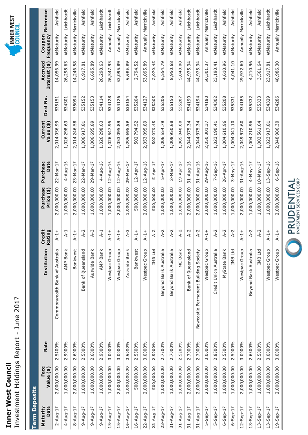
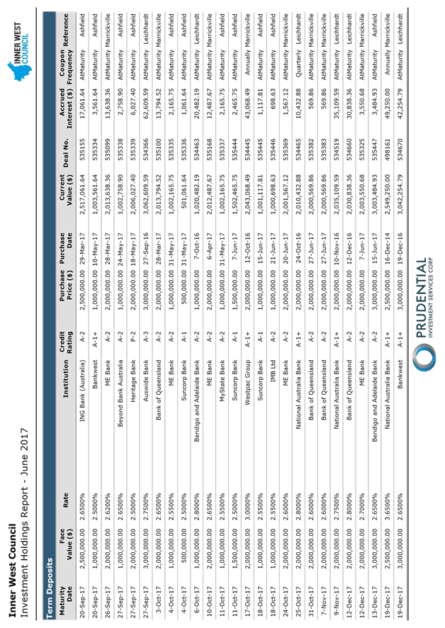
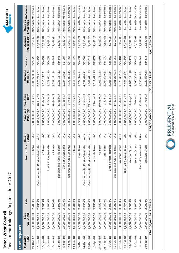
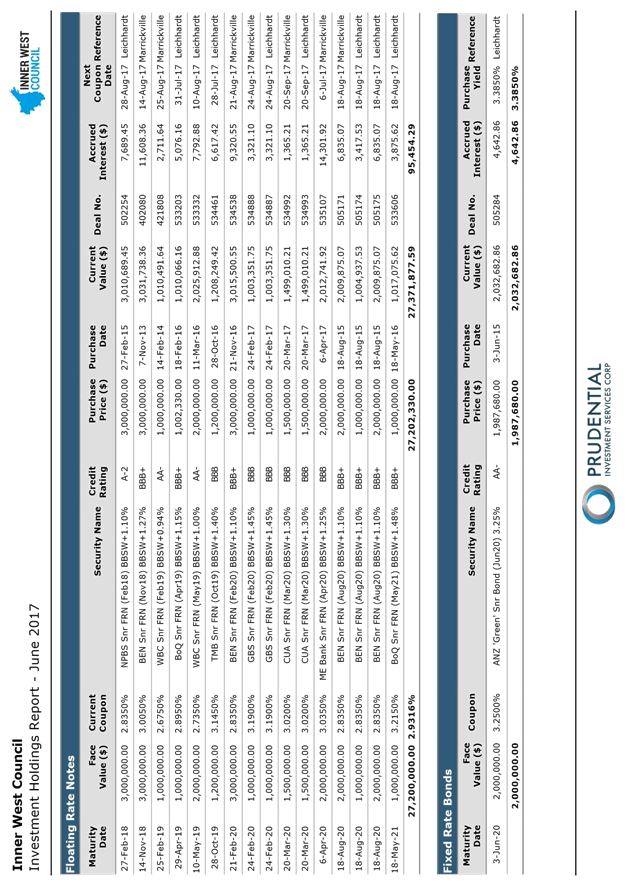
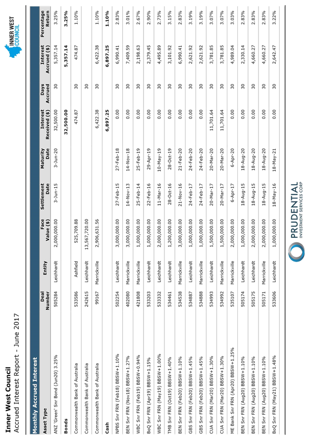
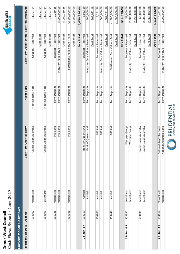
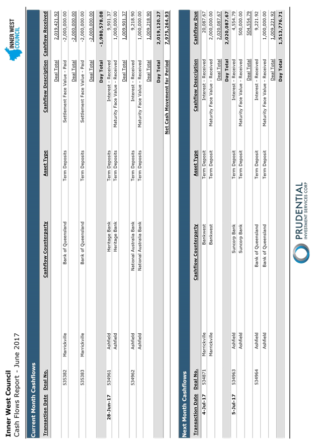
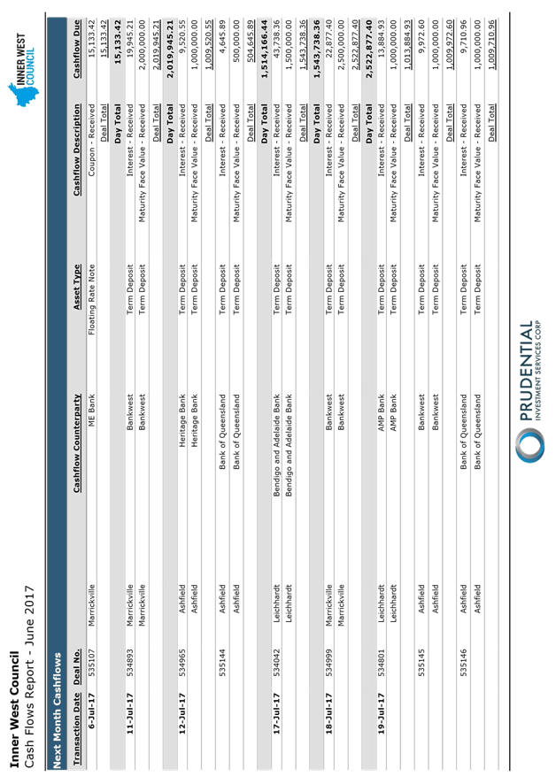
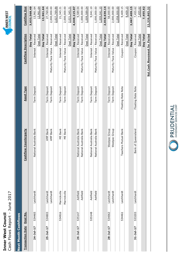
C0717 Item 20 Inner West Council Investments as at 30 June 2017 1146
|
|
Council Meeting 25 July 2017 |
|
INDEX |
1 Acknowledgement of Country
2 Notice of Live Streaming of Council Meeting
3 Disclosures
of Interest (Section 451 of the Local Government Act
and Council’s Code of Conduct)
4 Confirmation of Minutes Page
Minutes of 27 June 2017 Council Meeting 4
5 Administrator’s Minutes
6 Staff Reports
3 Administrator's Minutes
4 Staff Reports
|
|
Council Meeting 25 July 2017 |
Minutes of Council Meeting held on Tuesday 27 June 2017
Meeting commenced at 6.31pm
|
Present: |
|
|
Richard Pearson |
Administrator |
|
Rik Hart |
Interim General Manager |
|
Michael Tzimoulas |
Deputy General Manager Chief Financial and Administration Officer |
|
John Warburton |
Deputy General Manager Community and Engagement |
|
Cathy Edwards-Davis |
Group Manager Trees, Parks & Sports Fields |
|
Pav Kuzmanovski |
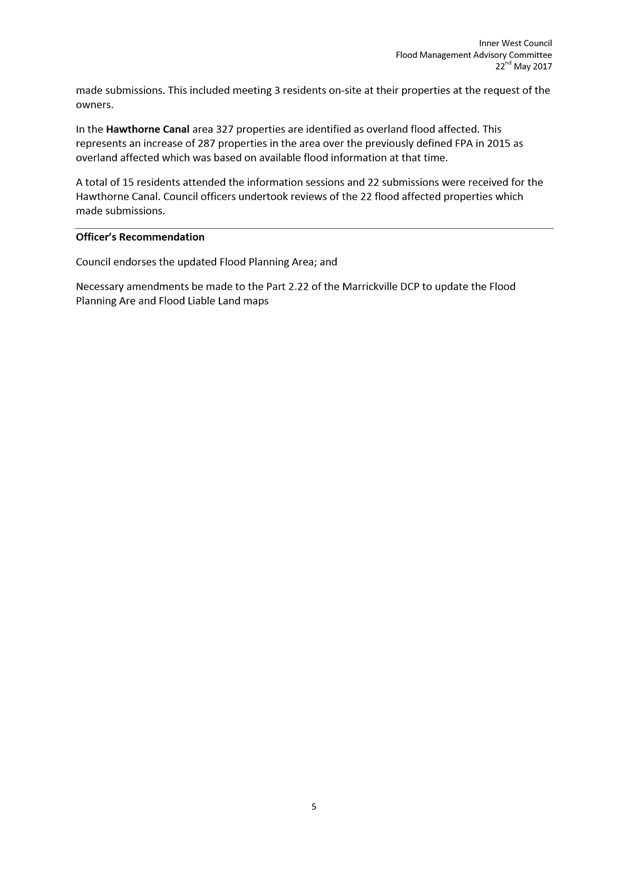
Group Manager Finance |
|
Simon Manoski |
Group Manager Strategic Planning |
|
Brooke Martin |
Group Manager Properties, Major Building Projects & Facilities |
|
Wal Petschler |
Group Manager Footpaths, Roads, Traffic & Stormwater |
|
Elizabeth Richardson |
Group Manager Development Assessment & Regulatory Services |
|
Tanya Whitmarsh |
Group Manager Governance |
|
Rad Miladinovic |
Coordinator Governance and Administration (Minute Taker) |
Public Speakers: see last page of these minutes.
1. Acknowledgement of Country by Chairperson
“I acknowledge the Gadigal and Wangal people of the Eora nation on whose country we are meeting today, and their elders past and present.”
2. Notice of Live Streaming of Council Meeting
The Administrator advised that the Council meeting was being streamed live on Council's website and members of the public must ensure their speech to the Council is respectful and use appropriate language.
DISCLOSURES OF INTERESTS: The Administrator declared a less than significant, non-pecuniary disclosure of interest in Item 7 (Changes to Planning Rules for Outdoor Advertising (Review of SEPP 64)) as he carried out consulting for the RMS two years ago on a matter related to the issue of outdoor advertising.
CONFIRMATION OF MINUTES
|
The Administrator determined that the Minutes of the Council Meeting held on Tuesday, 23 May 2017 be confirmed. |
|
C0617 Item 1 Minutes of the Implementation Advisory Group (IAG) Meeting held 8 June 2017 and Minutes of the Local Representation Advisory Committee (LRAC) Meeting held 13 June 2017 |
|
The Administrator determined that:
1. the Minutes of the IAG Meeting held on 08 June 2017 be noted; and 2. the Minutes of the LRAC Meeting held on 13 June 2017 be noted.
|
|
C0617 Item 2 WestConnex Update Report: Stage 3 Assessment; Local Area Traffic Improvement Strategy; and support for Community Advocacy |
|
The Administrator determined that: Council: 1. receives and notes this report; 2. makes a financial and in-kind contribution to a total value of $750 toward curating costs to the organisers of the DisConnex: Reframing Resistance art exhibition; 3. makes a financial and in-kind contribution to a total value of $300 to Newtown Residents Against WestConnex (NRAW) for a WestConnex protest event at Camperdown Park; and 4. calls on the EPA to carry out air quality monitoring around all proposed WestConnex ventilation facility sites (pre- and post- operation) with the results to be made publicly available to the community online and in real time, in a similar manner to the EPA’s White Bay cruise ship terminal air quality monitoring.
|
|
C0617 Item 3 Ashfield Aquatic Centre Refurbishment - Project Update and Community Engagement Outcomes |
|
The Administrator determined that: 1. Council endorses the Concept Plan Option 3 (Diagram 6) with the following amendments as detailed in the ‘Community Preferred Concept Design’ (Diagram 7): × inclusion of a combined splash-pad and shallow water pool suitable for young children; × inclusion of a 25 metre grandstand on the western side of the 50 metre pool; × inclusion of shade sails over the combined splash-pad and shallow water pool, grassed areas on the western side of the 50 metre pool and grassed area on the south-eastern corner of the site; × extension of the Bastable Street carpark, including demolition of the Bastable Street Hall and playground, single entry via Elizabeth Street and single exit onto Bastable Street; 2. all residents and stakeholders who made submissions during the community engagement be notified of Council’s decision; and 3. the project proceeds to detailed design based on ‘Community Preferred Concept Design’ (Diagram 7).
|
|
C0617 Item 4 Operational Plan and Budget 2017/18 |
|
The Administrator determined that Council: 1. adopts the Operational Plan and Budget 2017/18 subject to the minor amendments detailed in this report; 2. makes and levy the Rates for 2017/18 as contained in accordance with section 405 of the Local Government Act 1993; 3. adopts the rate of 7.5% as the interest rate to apply on outstanding rates, in accordance with section 566(3) of the Local Government Act 1993; and 4. adopts the Schedule of Fees and Charges, annexed to the Operational Plan 2017/18 noting the changes to Fees and Charges made since on public exhibition. |
|
C0617 Item 5 Victoria Road Precinct Planning Proposal |
|
The Administrator determined that: Council forwards the Victoria Road Planning Proposal to the Minister for Planning indicating its support for the Proposal subject to: 1. resolution of matters the subject of an unresolved objection from the Roads and Maritime Service; 2. there is to be no change to the existing IN1 – General Industrial zoning on the south eastern side of Victoria Road. This land forms part of the core Sydenham / Marrickville Industrial Area and should be preserved in line with the recommendations of the Marrickville Employment Lands Study and subsequent Review. Council will further consider its position subject to review of the Sydenham to Bankstown Urban Renewal Corridor Strategy; 3. with the exception of the properties on the north western side of Farr Street to be zoned R3 – Medium Density Residential, no properties in the precinct are to be zoned residential; the Danias Timbers Site / Timber Yards Sub-precinct to be zoned B4 – Mixed Use (along Victoria Road and Sydenham Road) and B7 – Business Park (for the remainder of the sub-precinct) with an appropriate mix of employment and residential uses to be provided via site specific provision. The remainder of the precinct north-west of Victoria Road and north of Chalder Street to be zoned B5 – Business Development; 4. any intersection upgrade works necessitated by the planning proposal cannot require the acquisition of parts of Wicks Park or properties outside the area covered by the planning proposal; 5. the planning proposal must adequately deal with infrastructure planning, funding and delivery (including any required property acquisitions) in consultation with Council; 6. the planning proposal must reflect the urban design and built form recommendations provided by Rod Simpson and Council’s Architectural Excellence Panel; 7. affordable housing being provided in accordance with the requirements of the Inner West Council Affordable Housing Policy; 8. the planning proposal cannot result in the loss of any existing areas of public open space and adequate new additional areas of public open space must be provided to service the new resident and worker population (e.g. an expansion and embellishment of Wicks Park); 9. the planning proposal must provide suitable mechanisms to deliver the new laneways and road connections required to service the rezoning and stated vision for the Victoria Road corridor; and 10. the planning proposal must adequately deal with identified potential heritage.
|
|
C0617 Item 6 Parramatta Road Urban Transformation Strategy - Council's Action Plan |
|
The Administrator determined that: 1. Council resolves to receive and note the report; 2. works identified to implement the PRUTS have been estimated at $1.2 million; and 3. Council supports an application to State Government to seek funds to complete work identified in this report.
|
|
C0617 Item 7 Changes to Planning Rules for Outdoor Advertising (Review of SEPP 64) |
|
The Administrator determined that: 1. Council receives and notes this report including the draft submission at (Attachment 1); 2. the submission be sent to the Department of Planning and Environment.
|
|
C0617 Item 8 Planning Proposal: 55-63 Smith Street Summer Hill |
|
The Administrator determined that:
1. Council notes the report and response to submissions; 2. Council authorises the General Manager to finalise the Planning Proposal as outlined in this report; 3. the Planning Proposal be referred pursuant to Section 59 of the Environmental Planning and Assessment Act 1979 (the Act) to the NSW Parliamentary Counsel Office to seek an Opinion that the Plan may be made; 4. upon receipt of a Parliamentary Counsel Opinion, Council requests the Department of Planning and Environment to make the Plan; and 5. site specific Draft Development Control Plan contained in Attachment 5 be incorporated into the exhibition of future amendments to the “Inner West Comprehensive Development Control Plan 2016 Ashbury, Ashfield, Croydon, Croydon Park, Haberfield, Hurlstone Park and Summer Hill”.
|
C0617 Item 9 Haberfield Heritage Conservation Area - Project for Listing on State Heritage Register |
|
The Administrator determined that:
Council:
1. receives and notes this report; 2. supports the project to list the Haberfield Conservation Area on the NSW State Heritage Register; 3. agrees to Council officers to work with the Heritage Office and commence preparatory work required for the Nomination of the Haberfield Conservation Area; and 4. notes that a further report be brought to Council once a pathway for listing has been agreed and entered into.
|
|
C0617 Item 10 Post Exhibition Report - Draft Marrickville Local Environmental Plan 2011 (Amendment No. 12) - 180 Princes Highway, St Peters |
|
The Administrator determined that: 1. the report be received and noted; and 2. Council forwards the draft amendment to MLEP 2011 to the Department of Planning & Environment seeking final approval and gazettal.
|
|
C0617 Item 11 3-7 & 13-17 Regent Street, 287-309
Trafalgar Street and |
|
The Administrator determined that:
1. Council supports the planning proposal subject to: (i) The resident car parking on site to be capped at the rate contained in Part 2.10 of Marrickville Development Control Plan (MDCP) 2011; (ii) The proponent must engage an arborist to investigate the opportunities to retain the significant trees located on the corner of Regent Street and Fisher Street (Site 3) and adjust the building envelopes as may be required; (iii) an affordable housing contribution being made using Council’s Affordable Housing Policy and 15% target as a guide; 2. Council officers consider the Voluntary Planning Agreement (VPA) Offer in accordance with Council’s interim VPA Policy; 3. forward the planning proposal to the Minister for Planning for a Gateway determination in accordance with Section 56 of the Environmental Planning & Assessment Act 1979; 4. request that Council be delegated plan making functions in relation to the planning proposal; and 5. resolves to develop site specific planning controls to apply to the future development at 3-7 Regent Street (Site 1); 13-17 Regent Street (Site 2); and 287-309 Trafalgar Street & 16-20 Fisher Street (Site 3), Petersham for inclusion in Part 9.6 (Precinct 6) of MDCP 2011 and that these be publicly exhibited concurrently with the planning proposal. |
|
C0617 Item 12 Local Traffic Committee Meeting held on 1 June 2017 |
|
The Administrator determined that the Minutes of the Local Traffic Committee Meeting held on 1 June 2017 be received and the recommendations be adopted.
|
|
C0617 Item 13 Flood Management Advisory Committee meeting
held |
|
The Administrator determined that the minutes of the Inner West Council Flood Management Advisory Committee held on 16 May 2017 be received and the recommendations be adopted. |
|
C0617 Item 14 Mandatory Reporting of Fire Safety Reports Referred to Council from Fire and Rescue NSW |
|
The Administrator determined that:
Council:
1. notes the correspondence provided by Fire and Rescue NSW for development on land at Sydney College of the Arts “- Callen Park Balmain Road Lilyfield; Balmain Lodge - 415 Darling St Balmain ; Balmain Backpackers – 673 to 677 Darling Street Rozelle, “The Fig”68 -82 Palmer St Balmain and Ashfield Mall – 260A Liverpool Road Ashfield (Attachments 1 - 5);
2. endorses the Councils Officers use of statutory powers (and discretion as appropriate) under s121B of the Environmental Planning and Assessment Act 1979 to require upgrades to buildings to the satisfaction of Council's Fire Safety Officer in order to:
· improve the provisions for fire safety at the premises; · improve the provision of fire safety awareness; · improve the adequacy of the premises to prevent fire; · improve the adequate of the premises to suppress fire or prevent the spread of fire, · Improve the safety of persons in the event of fire; and
3. notes that Council is proceeding with a priority audit of all high rise residential buildings (greater than 3 storeys) and other high-risk premises in the LGA with external cladding to identify any buildings with non-compliant cladding and recommended actions to rectify if any are found.
|
|
C0617 Item 15 Naming of New Lane Between Grove and Alfred Streets and Perpendicular to Albion and Rolfe Lanes, St Peters |
|
The Administrator determined that:
Council:
1. selects “Dangura Lane” as the preferred option for naming the new lane running between Grove and Alfred Streets, and perpendicular to Albion and Rolfe Lanes for the purpose of public exhibition;
2. publicly exhibits its preferred name for a period of not less than 28 days; and
3. receives a further report on the outcome of the public exhibition period prior to determining the name.
|
|
C0617 Item 16 Review of the Trial Extension of the 2016/17 Swimming Season at Fanny Durack Aquatic Centre |
|
The Administrator determined that: 1. Council notes the outcomes from the trial extension of the 2016/17 swimming season at Fanny Durack Aquatic Centre; 2. Council continues to operate the Fanny Durack Aquatic Centre from October to March each year; 3. Council writes to the head petitioner informing them of the outcome of the trial and thanking them for their initiative; and 4. Council writes to Belgravia Leisure expressing appreciation for their cooperation in undertaking the operation of Fanny Durack Aquatic Centre during April 2017.
|
|
C0617 Item 17 Draft Community Engagement Framework - Results of Public Exhibition |
|
The Administrator determined that: 1. Council receives and notes the results of the Draft Community Engagement Framework public exhibition; 2. Council adopts the final Community Engagement Policy and Framework; and 3. Council endorses a comprehensive review of the Framework to take place within one year of adoption with Councillor, community and staff input.
|
|
C0617 Item 18 Draft Mobile Food Vending Policy |
|
The Administrator determined that: 1. Council adopts the draft Mobile Food Vending Policy as attached at (ATTACHMENT 1) of this report and that the policy be placed on public exhibition (including targeted stakeholder consultation) for a minimum of 28 days; and 2. a further report be prepared for Council’s consideration following the exhibition of the draft Mobile Food Vending Policy.
|
|
C0617 Item 19 Internal Ombudsman |
|
The Administrator determined that: 1. Council approves in principle the establishment of an Internal Ombudsman service for the Inner West Council; 2. the General Manager be authorised to establish the Internal Ombudsman service which is either a shared service with other partner Councils or as a role dedicated only to the Inner West Council; 3. the General Manager be authorised to sign agreements necessary to both appoint an Internal Ombudsman and commit to the commercial terms of a shared arrangement with partner Councils; and 4. the estimated costs of the Internal Ombudsman service be provided for in the 2017/2018 Budget.
|
|
C0617 Item 20 Councillor Remuneration - 2017/18 Annual Fees for Councillors and the Mayor |
|
The Administrator determined that:: 1. the report be received and noted; and 2. Council fixes the 2017/18 annual fee to be paid to Councillors under section 248 of the Local Government Act 1993 at the maximum annual rate of $24,550; and 3. Council fixes the 2917/18 annual fee to be paid to the Mayor under section 249 of the Local Government Act 1993 at the maximum annual rate of $65,230.
|
|
C0617 Item 21 Draft Councillor Expenses and Facilities Policy |
|
The Administrator determined that:
1. in accordance with section 253(1) of the Local Government Act 1993, the DRAFT Councillor Expenses and Facilities Policy (ATTACHMENT 1) be placed on public exhibition for a period of 28 days from 28 June to 25 July 2017; 2. in the event that submissions are received in response to the public notice inviting submissions from members of the public, staff submit a further report to the next Council Meeting presenting the feedback received in the submissions and making a recommendation for Council’s consideration; 3. in the event that no submissions are received in response to the public notice, Council adopts the attached Councillor Expenses and Facilities Policy; and 4. Council staff advertise the Draft Policy widely to increase awareness of the proposal to adopt the policy and to encourage members of the public to provide feedback for Council’s consideration before a policy is adopted, in accordance with section 253(2) of the Local Government Act 1993.
|
|
C0617 Item 22 Inner West Council Investments as at 31 May 2017 |
|
The Administrator determined that the report be received and noted.
|
Meeting closed at 9.25pm.
Public Speakers:
|
Item # |
Speaker |
Suburb |
|
|
|
|
|
|
|
|
|
Item 1: |
Chris Elenor |
Haberfield |
|
|
John Stamolis, Leichhardt LRAC |
Balmain |
|
|
Adrian Schilling |
No WestConnex |
|
|
Julie Passas, Ashfield LRAC |
Ashfield |
|
|
John Lozano |
Haberfield |
|
|
|
|
|
|
|
|
|
Item 2: |
Cynthia Moore Julie Passas, Ashfield LRAC Lucille McKenna, Ashfield LRAC Victor Macri, Marrickville LRAC John Stamolis, Leichhardt LRAC Chris Eleanor John Lozano Richard Dudley-Smith |
Haberfield Ashfield Summer Hill Belmore Balmain Haberfield Haberfield Annandale |
|
|
|
|
|
|
|
|
|
Item 3: |
Mark Drury, Ashfield LRAC |
Croydon |
|
|
Julie Passas, Ashfield LRAC
|
Ashfield |
|
|
|
|
|
Item 4: |
Mark Drury, Ashfield LRAC Anna York Paul Avery Julie Passas, Ashfield LRAC Darcy Byrne, Leichhardt LRAC John Stamolis, Leichhardt LRAC |
Croydon Newtown Balmain Ashfield Leichhardt Balmain |
|
|
|
|
|
|
|
|
|
Item 5: |
Jon Farry Sean Macken Anthony Markakis Dan Jacobson Todd Wagstaff David Tierney David Rodriguez George Bouteris James Gilronan Mark Drury, Ashfield LRAC Victor Macri, Marrickville LRAC Rosana Tyler, Marrickville LRAC Morris Hanna, Marrickville LRAC |
Marrickville
Marrickville
Marrickville Marrickville Marrickville
Croydon Belmore Tempe Maroubra |
|
|
|
|
|
|
|
|
|
Item 9: |
Lucille McKenna, Ashfield LRAC |
Summer Hill |
|
|
|
|
|
|
|
|
|
Item 11: |
Mark Drury, Ashfield LRAC |
Croydon |
|
|
|
|
|
|
|
|
|
Item 18: |
Mark Drury, Ashfield LRAC |
Croydon |
|
|
James Gilronan |
|
|
|
|
|
|
|
|
|
|
Item 19: |
Mark Drury, Ashfield LRAC |
Croydon |
|
|
|
|
|
|
|
|
|
Item 22: |
Frank Breen, Leichhardt LRAC |
Birchgrove |
|
|
|
|
|
|
Council Meeting 25 July 2017 |
Subject: Administrator's Condolence Motion: The Late Mr Rae Jones former Mayor Ashfield
File Ref: 17/4718/74982.17
From Richard Pearson, Administrator
|
Motion:
THAT Council: 1. Express its condolences to the family of Mr Rae Jones, his wife Helen, children Karey, Alyse and Bevan and grandchildren Caleb, Caspian and Sascha; and 2. In consultation with the Jones family, investigate options to remember Rae. This could include a bench or seat in a local park, a tree or other suitable memorial.
|
BACKGROUND
It is with sadness that Council notes the recent passing of former Mayor of Ashfield Mr Rae Jones. Rae Desmond Jones was also a poet, novelist, and teacher. He was Mayor of Ashfield from 2004 to 2006.
Rae Jones was born in Broken Hill, but became much associated with Sydney’s inner west. In the radical days of Glebe in the late 1960s and ‘70s, he was writing poetry, attending NSW Poets Union events, and by his own admission “smoking something illegal”.
He started the “legendary” publication Your Friendly Fascist, a journal which he ran with his friend John Edwards, when he was 29 in 1970. It wound up in 1984.
The Fascist, as one could tell from its title, was not a normal literary journal. If your work appeared in it, for example, it was not always clear if it had been selected on “literary merits” or if it was so bad the editors couldn’t resist it.
About Your Friendly Fascist, Rae wrote that his and John’s inspiration was:
“take bad poetry and make it an assault on the bland and the comfortable.”
Rae was a major Australian poet. To forge a career both as a poet AND as a politician is a wonderfully unusual combination.
Of that, he said: "Poetry and politics are mutually contradictory, and [I find] consolation from each in the arms of the other."
He was a popular Mayor of Ashfield who held together a broad coalition of Labor, Greens and independents.
Our thoughts go out to his family: wife Helen, children Karey, Alyse and Bevan, and grandchildren Caleb, Caspian and Sascha.
|
|
Council Meeting 25 July 2017 |
Subject: Administrator's Condolence Motion: The Late Mr Peter Bonsall-Boone (Bon)
File Ref: 17/4718/80634.17
From Richard Pearson, Administrator
|
THAT Council:-
1. Acknowledges Mr Peter Bonsall-Boone’s (Bon’s) many years of community service; and 2. In consultation with Bon’s partner, investigate options to remember Bon. |
BACKGROUND
It is with sadness that Council notes the recent passing of Peter Bonsall-Boone (known as ‘Bon’), a tireless community volunteer and an important figure in the history of LGBTI rights in Sydney.
Bon was a true pioneer activist and fighter for equality who was there with his partner Peter at the very first Mardi Gras in 1978. (Bon was charged with a criminal offence after the police crackdown.)
They were proud and active members of the “78-ers” group.
Long-term residents of Balmain, Bon and Peter, were also:
· Foundation members of Campaign Against Moral Persecution (CAMP), which changed the history of homosexuality in Australia, eventually leading to homosexual law reform, anti-discrimination legislation and even the current push for marriage equality. All these advances began with CAMP.
· Founders of Phone-a-Friend, the first gay and lesbian counselling service in Australia.
· Active supporters of the Gay Rights Lobby.
· Active members of Sydney's Pride History Group.
· The first gay couple in Australia to kiss on TV, when they featured on ABC TV’s Chequerboard in 1972.
Bon was also:
· Principal co-ordinator and trainer with Community Support Network (CSN) which was set up in response to the AIDS crisis. CSN was eventually folded into the AIDS Council of NSW (ACON).
· A much-beloved reader on Radio for the Print Handicapped (2RPH) for over 30 years.
· An active Christian and organist of some skill, playing and acting as choir master at various churches from 1953.
Bon, who passed away on Friday 19 May, was sad he and his partner of 50 years were never able to wed. Not long before he died he said, “It looks like we missed the boat”.
|
|
Council Meeting 25 July 2017 |
Subject: Administrator's Condolence Motion: The Late Edward (Ted) Floyd
File Ref: 17/4718/80820.17
From Richard Pearson, Administrator
|
Motion:
THAT Council:-
1. Acknowledges the significant contributions made by Ted Floyd; and 2. In consultation with the Mr Floyd’s family, investigate options to remember Ted. This could include a bench or seat in a local park, a tree or other suitable memorial. |
BACKGROUND
It is with sadness that Council notes the recent passing of environmentalist and researcher Ted Floyd, who created the original concept for Whites Creek Wetland in Annandale in the mid-1990s.
Mr Floyd died in May. He was walking near his house on Gordon Street Rozelle, when a car backed out of a driveway and hit him.
He had lived in Rozelle for more than 40 years and worked as a scientist with the Department of Agriculture.
Upon his retirement, he focused his energy into helping the local area.
He worked with Leichhardt Council on solar energy and conservation projects and, ironically and sadly, was also a pedestrian safety activist.
He was also an active member of Friends of the Earth.
|
|
Council Meeting 25 July 2017 |
Subject: Implementation Advisory Group Meeting held on 6 July 2017
File Ref: 17/4718/81134.17
Prepared By: Maria Coles - Mayoral Secretary
Authorised By: Tanya Whitmarsh - Group Manager Governance
|
SUMMARY To present the Minutes of the IAG Meeting held on 6 July 2017 and the LRAC meeting held on 11 July 2017.
|
|
RECOMMENDATION
THAT:
1. The Minutes of the IAG meeting held on 6 July 2017 be noted. 2. The Minutes of the LRAC Meeting held on 11 July 2017 be noted.
|
BACKGROUND
The Implementation Advisory Group meeting was held on 6 July 2017. The minutes of the meeting are shown at ATTACHMENT 1.
The Local Representation Advisory Committee Meeting was held on 11 July 2017. The minutes of the meeting are show in ATTACHMENT 2.
FINANCIAL IMPLICATIONS
Nil.
PUBLIC CONSULTATION
Nil.
|
1.⇩ |
Minutes of IAG Meeting held on 6 July 2017 |
|
2.⇩ |
Minutes of LRAC Meeting held on 11 July 2017 |
|
Council Meeting 25 July 2017 |
Subject: WestConnex Update Report: Draft submission on M4-M5 Link Concept Design, Local Area Traffic Improvement Strategy & Extension of Funding for Community Organiser Position
File Ref: 16/6107/81638.17
Prepared By: Kendall Banfield - Manager WestConnex Unit
Authorised By: Simon Manoski - Group Manager Strategic Planning
|
SUMMARY This report considers three WestConnex items – the first is development of a draft Council submission on the M4-M5 Link Concept Design, the second is progress of Council’s Local Area Traffic Improvement Strategy and the third is a proposed one-month extension of funding for the WestConnex Community Organiser position. Regarding the first item, Council has developed a draft submission, assisted by planning/engineering consultants Beca, which is summarised in this report. Key issues within the submission are Council’s strategic position on WestConnex Stage 3 and local impacts such as mid-tunnel construction dive-sites and air quality impacts from ventilation facilities. A final version of the submission will be lodged on or before the 4 August 2017 close date. Regarding the second item, Council’s consultants are currently undertaking traffic modelling with a view to identifying local streets that may be affected by WestConnex-related traffic impacts. Regarding the third item, this report recommends that the current round of 12-month funding for the Community Organiser position be extended by four weeks. This is to ensure there is no gap between the end of the current round of 12-month funding and the first meeting of the newly-elected Council on 26 September 2017.
|
|
RECOMMENDATION
THAT Council:
1. receives and notes this report;
2. makes a submission on the M4-M5 Link Concept Design; and
3. extends the current 12-month round of funding for the WestConnex Community Organiser position by four weeks.
|
BACKGROUND
Item 1: Assessment of Stage 3 (M4-M5 Link) Concept Design
Progress on Council’s assessment of the Concept Design for WestConnex Stage 3 (M4-M5 Link) has been reported to prior meetings of the Local Representation Advisory Committee (LRAC) and Council. The last report on this item was to the July 2017 LRAC meeting, supported by a presentation by staff from Council and Council’s consultant Beca. The submission is being prepared by Council staff, but informed by expert analysis from Beca. Issues raised by LRAC members at the July meeting have been noted for inclusion in the submission, as have issues raised by specialist Council staff and members of the community. Beca has developed a draft submission, which is summarised below. A final submission will be lodged with Sydney Motorway Corporation (SMC) on or before the 4 August 2017 close date.
Although Council’s brief for the Concept Design assessment includes the following eight elements, the submission will focus on Elements 1, 2 and 8 – not only because of the relative importance of these three elements, but because the limited amount of detail in the Concept Design does not allow for a full assessment of the other five elements.
There elements are:
1. strategic issues;
2. traffic and transport (construction and operation);
3. visual impact and urban design;
4. social, economic, heritage and property (construction and operation);
5. air quality (construction and operation);
6. contamination, flooding & water management;
7. noise and vibration (construction and operation); and
8. consultation process.
Key documents and other information sources guiding Beca’s assessment are:
· WestConnex M4-M5 Link State Significant Infrastructure Application Report (SSIAR) – January 2016;
· the Department of Planning & Environment (DP&E) Secretary's Environmental Assessment Requirements (SEARs) for the preparation of an Environmental Impact Statement (EIS) for the M4-M5 Link;
· feedback from Inner West Council staff members and submissions by the community on the M4-M5 Link Concept Design;
· WestConnex M4–M5 Link Concept Design Plan – May 2017; and
· City of Sydney – The WestConnex Challenge, Public Summary Report – June 2017 draft, and WestConnex - Alternative Proposal – 5 June 2017.
As has been previously reported, the Stage 3 Concept Design has not only raised ‘content’ issues for Council, but also ‘process’ issues, such as lack of detail in the Concept Design document (refer to Point 8 above). As a result, Council’s submission by necessity includes questions and requests for further information. Council has already written to the Minister for WestConnex and SMC’s Chief Executive Officer (CEO) to raise process issues.
It is expected the Stage 3 EIS will be placed on public exhibition for two to three months at the end of August or early September 2017, and it is hoped the EIS will provide information of sufficient detail to enable Council to undertake a more comprehensive assessment. When the EIS is released, Council will engage a consultant to assist with preparation of its submission on that document.
Council is currently developing a flyer for distribution to residents which highlights the main issues raised by the Stage 3 Concept Design and encourages residents to make a submission. Council also plans to hold a public meeting as part of the Stage 3 EIS exhibition to hear residents’ concerns and further formulate Council’s position.
In the draft submission, Council’s position on Stage 3 is expressed at three levels. The ‘first tier response’ is that Council continues to oppose WestConnex, preferring public transport and other demand-management (traffic reduction) solutions to Sydney’s traffic problems. The ‘second tier response’ is that whilst Council reluctantly accepts that Stages 1 and 2 are approved and under construction, Stage 3 should be redesigned to reduce traffic impacts, reduce costs and improve transport outcomes across the board. Council’s ‘third tier response’ is that should the project proceed generally according to Concept Plan, a number of modifications and conditions are required to protect the Inner West community from what may otherwise be unacceptable construction and operational impacts.
The first and second tier responses described above form the basis of Council’s strategic position on Stage 3. This important element of Council’s submission on the Concept Design will be refined further before the submission is finalised and lodged. In developing this strategic position, Beca has acknowledged that the City of Sydney and Inner West Council are united in their opposition to WestConnex. Beca has also considered the City’s WestConnex - Alternative Proposal, publicly available on the City’s website. Notwithstanding, there are important differences between the strategic positions of the two councils – an appropriate situation given the two councils’ unique communities and environmental characteristics.
In the draft submission, the second tier of Council’s strategic position - i.e. Council’s ‘alternative proposal’ - is described as follows:
· construct the main Stage 3 tunnel between Haberfield and the realigned M5 to the south-east – Council is concerned that without this tunnel link, residents around the Haberfield and St Peters interchange sites will suffer unacceptable operational traffic impacts;
· consider downgrading the St Peters Interchange and realigning the main Stage 3 tunnel to provide a more direct underground connection to Sydney Airport and Port Botany - if an alternative workable site closer to the Airport and Port can be found;
· connecting the main Stage 3 tunnel to Victoria Road and Western Harbour Tunnel (if built) - but not to City West Link / Anzac Bridge or to Johnstone Street / The Crescent, converting the Rozelle interchange to a junction below the surface - whilst this will reduce local vehicular access to WestConnex, it will substantially reduce local traffic impacts and construction costs;
· connect the main Stage 3 tunnel to Victoria Road via the Iron Cove Link tunnel, with amenity, active transport and public transport improvements implemented on the surface along that section of Victoria Road;
· minimise traffic impacts on local roads through processes such as Council’s Local Area Traffic Improvement Strategy (LATIS), funded by the NSW Government;
· capitalise on opportunities for amenity and public transport improvements on all roads where traffic has been reduced, e.g. light rail or guided electric transit along Parramatta Road and Victoria Road;
· extend dedicated bus lanes across the Anzac Bridge – made possible by ensuring WestConnex does not add extra traffic to the Anzac Bridge; and
· convert the Rozelle Rail Yards (RRY) site to parkland designed in conjunction with Council and the community, to assist with offsetting currently low levels of open space in the Rozelle area.
In the submission, the third tier of Council’s position is as follows. These are the more detailed, local issues that would be raised if the project was to proceed generally in accordance with the Concept Design:
· concerns about the full range of construction impacts – including traffic, parking, noise and dust – around all Stage 3 construction sites;
· particular concerns about noise, dust and traffic impacts from the mid-tunnel construction dive sites proposed for Darley Road, Leichhardt and Bridge Road / Parramatta, Annandale;
· opposition to the Darley Road and Bridge Road dive sites, with a preference for no dive sites, or a potentially lower-impact dive site option at the western end of the Rozelle Rail Yards (RRY) site;
· concerns about noise, safety and amenity impacts from truck stabling on streets, and consequently a requirement that off-street stabling areas be provided;
· concerns about continued use of existing Stage 1 works compounds at Haberfield for Stage 3, resulting in an extension of construction impacts – a particularly important issue as Haberfield residents have already endured significant impacts from the construction of Stage 1;
· impacts from property acquisitions on residents and businesses along a section of Victoria Road at Rozelle – required for construction of the Stage 3 traffic portal onto Victoria Road;
· lack of commitment to traffic capacity reductions and public transport improvements wherever traffic is reduced by WestConnex – in particular, along Victoria Road and Parramatta Road;
· concerns about increased construction and operational traffic in the area around the proposed Rozelle Interchange, with consequences for residential amenity, pedestrian and cyclist safety and parking demand;
· particular concerns about the Rozelle Interchange feeding additional traffic onto the already congested Anzac Bridge and onto Johnstone Street and The Crescent at Annandale – these latter two streets being within densely developed residential areas;
· for the RRY site, lack of consideration of retention of rail heritage features in situ and staging of site clearing to minimise biodiversity impacts;
· air quality and visual amenity concerns from unfiltered ventilation facilities proposed for the RRY site and Victoria Road near Terry Street – the latter facility raises particular concerns due to its proximity to densely developed residential areas;
· a greater number of north-south walk/cycle connections needed across City West Link and the RRY site to link the Rozelle, Lilyfield and Annandale communities and to ensure the RRY site recreation area is readily accessible to the community;
· concerns that construction of WestConnex Stage 3 and the Western Harbour Tunnel (if built) may hamper implementation of Western Metro (rail) and sever future light rail links, such as the White Bay / Balmain link; and
· a range of less-critical (but nonetheless important) local issues, some raised by community groups and members of the community, e.g. impact of Iron Cove Link designs on local traffic access to King George Park at Rozelle.
Although most of the above issues have been raised by the community groups and individuals, Council has noted there has been particular concern in the community about air quality impacts from ventilation facilities proposed within the RRY site and on Victoria Road adjacent to Terry Street. As is mentioned above, the latter site raises particular concerns due to its close proximity to densely developed residential areas.
This situation is exacerbated by the fact that residential areas on the eastern side of Victoria Road are elevated, with some dwellings potentially above the level of the ventilation facility outlet. Rozelle Primary School is also within reasonably close proximity to this outlet, and Council has noted that this school’s Parents & Citizens’ Association has raised concerns about air quality impacts on children. Although raising the height of these facilities increases dispersal of emissions over a wider area, this increases their visual impact.
Council is of the view that unfiltered emissions are not acceptable, even if compliant with regional air quality standards. Council is aware that filtration is costly and has not been applied to other motorway tunnels in Sydney. Notwithstanding, Council will continue to argue that filtration be applied to all WestConnex ventilation facilities, with the added financial costs signaling the true environmental costs of this project.
It is planned that a summary of the final submission (as lodged) will be made publicly available on Council’s website.
Item 2: Local Area Traffic Improvement Strategy (LATIS)
Progress on development of this strategy has been reported to Council and LRAC meetings in June 2017, and further progress reports will be presented to Council later in 2017. As was reported previously, Veitch Lister Consulting (VLC) has been engaged by Council to undertake the required traffic modelling with assistance from Roads & Maritime Services (RMS). Beca has been engaged to use the modelling to shortlist local roads to be treated with Local Area Traffic Management (LATM) schemes and develop LATM designs.
Consistent with Council’s brief, VLC is modelling the following traffic scenarios:
· base case 2011;
· base case 2021;
· project case 2021 – WestConnex Stages 1 & 2;
· project case 2031 – WestConnex Stages 1 & 2; and
· project case 2031 – WestConnex Stages 1, 2 & 3.
Also consistent with Council’s brief, key outputs from the modeling will be volume capacity ratios for local roads, levels of service, average travel speeds and delay estimates.
VLC has now scoped the road network to be modelled, and its Zenith model has been refined by coding all relevant local streets within the Council area. VLC has received almost all of the modelling data it requires from RMS and Council, and model validation will be undertaken shortly. In parallel with the validation work, VLC is considering how demographic forecasts and possible future transport infrastructure projects can be factored in to the traffic modelling.
Beca is currently reviewing relevant transport/planning documents and is working with VLC to ensure consistency between VLC’s traffic modelling work and LATIS development. Council will shortly provide further relevant information to Beca for review – including local crash data, road hierarchy details and relevant GIS information. Beca will also shortly review Council’s existing LATM scheme infrastructure for consideration in the design of future LATM infrastructure related to this project.
A summary of further traffic modelling milestones is as follows:
· model validation – to be completed by the end of July 2017;
· base case – to be completed mid-August 2017;
· future scenarios – to be completed in early September 2017; and
· analysis and reporting – to be completed by the end of September 2017.
A summary of further LATIS LATM scheme milestones is as follows:
· identifying scope of works and background review – to be completed by the end of July 2017;
· site audits and review of existing LATM schemes – to be completed mid-August 2017;
· modelling review – to be completed early September 2017;
· future modelling review – to be completed by the end of September 2017;
· community consultation – to commence in early October 2017;
· draft LATIS – to be completed by the end of October 2017; and
· final LATIS – to be completed by the end of November 2017.
Item 3: Extension of funding of Community Organiser position
A request by No WestConnex Public Transport (NoW PT) to extend the current 12-month round of funding of the WestConnex Community Organiser position by a further 12 months was considered by Council at its 23 May 2017 meeting. Council resolved to write to the City of Sydney seeking a contribution of half of the funding (i.e. $50,000) but did not resolve to extend the funding. It was intended that the 12-month extension of funding be a matter for consideration by the newly-elected Council at its first meeting on 26 September 2017.
As there may be a gap between the end of the current round of 12-month funding and the first meeting of the newly-elected Council, it is recommended in this report that the current funding be extended by four weeks to ensure this gap is covered. Note that the City of Sydney has recently accepted Inner West Council’s request for a 50% contribution to the next 12-months of funding of this position. Note also that this item was reported to the 11 July 2017 LRAC meeting, and LRAC has recommended to Council that the extension be granted.
FINANCIAL IMPLICATIONS
The first two items discussed above do not have financial implications – they relate to Council projects that already have funding for consultants. The third item - the proposed four-week extension of the Community Organiser position - would cost Council approximately $8,000. Though this has not been allocated in Council’s 2017/18 draft budget, it can be funded by existing budgets. This may be offset by a 50% contribution from the City of Sydney.
OTHER STAFF COMMENTS
Comments from relevant Council staff have been incorporated in the draft submission for the Stage 3 concept design.
PUBLIC CONSULTATION
As mentioned above, Council is currently developing a flyer for distribution to residents which highlights the main issues raised by the Stage 3 Concept Design and encourages residents to make a submission. Council also plans to hold a public meeting as part of the Stage 3 EIS exhibition to hear residents’ concerns and further formulate Council’s position. Through other information outlets, Council has been encouraging community members to make a submission on the Concept Design and to forward to Council their submissions - draft or final.
|
|
Council Meeting 25 July 2017 |
Subject: Evaluation and proposed outcomes of trial off leash areas at Johnson Park, Morton Park and Petersham Park.
File Ref: 16/6044/70330.17
Prepared By: Peter Montague - Coordinator Recreation, Planning and Programs
Authorised By: John Warburton - Deputy General Manager Community and Engagement
|
SUMMARY This report details the outcomes from the recent evaluation process undertaken to assess the current trial of three dog off leash areas at Johnson Park, Dulwich Hill; Morton Park, Lewisham; and Petersham Park, Petersham. The report also discusses the suspension of impacted off leash areas during Council run community events. |
|
RECOMMENDATION
THAT:
1. The report be received and noted; 2. The trial dog off leash areas at Johnson Park, Dulwich Hill; Morton Park, Lewisham; and Petersham Park, Petersham be made permanent; 3. The time restrictions at Johnson and Petersham Parks are aligned consistently allowing off leash use from 6am to 9am and 5pm to 8pm during daylight saving and 4pm to 7pm during non-daylight saving; 4. That appropriate works including signage and relevant infrastructure are undertaken in the 2017/18 program of upgrades to dog off leash areas;
5. The design considerations outlined in this report are considered in upcoming capital works programs and in the development of the upcoming Plan of Management and Master Plan for Dulwich Hill Parklands;
6. All residents who have provided feedback during the trial and evaluation process are notified of Council’s decision; and
7. Council allows the suspension of dog off leash areas for the purposes of holding Council run community events wherever applicable in the Council area.
|
BACKGROUND
A total of 32,000 dogs are identified in the Inner West Council Local Government Area and it is anticipated that this number will increase over time.
Council’s Recreation Policy and Strategy (2013) states that:
“Council actively promotes responsible pet ownership, recognises the value of pet ownership in contributing to community well-being, and acknowledges that providing public spaces to exercise pets is essential. Council’s approach to equitable access to parks for people with pets is based on:
· safe and shared use of Council’s parks and open space;
· the development of facilities to meet the needs of residents and their pets; and
· ongoing management of pet access in parks and open space.”
The aim of Council’s Biodiversity Strategy 2011-21 is to:
‘Protect and enhance Marrickville’s biodiversity values and the ecosystem services they provide’
The Biodiversity Strategy sets out six strategic focus areas that have specific, associated strategies to achieve the aim. The following focus areas are relevant to parks in the Greenway Priority Biodiversity Area:
1. Priority Biodiversity Areas – preserve and enhance the biodiversity value of Priority Biodiversity Areas.
3. Threats – eliminate or mitigate key present and future threats to Marrickville’s biodiversity.
Further Council’s Biodiversity Action Plan (2011-15) and Draft Biodiversity Action Plan (2016-21) lists the following action for the Greenway Priority Biodiversity Area:
Investigate and implement options to exclude or manage dog access in parks within the Bandicoot protection Area and incorporate into Council policy relating to dog access in parks.
In recent years Council has conducted off leash trials at a number of parks resulting in the development of seven new permanent off leash areas and amendments to permitted off leash hours at two existing areas.
A number of further trials have been implemented as follows:
Johnson Park and Morton Park - at the Council meeting of 5 July 2016 it was resolved that:
§ Council implements a trial off leash area at Johnson Park, Dulwich Hill subject to the following time restrictions:
- 6am to 9am, 6pm to 8pm during daylight saving, and 5pm to 7pm during non-daylight saving time;
§ Council implements a trial off leash area at Morton Park, Lewisham.
Petersham Park – following a trial and evaluation process, Council resolved on 5 July 2016 to establish a permanent off leash in an area adjacent to Wentworth and Brighton Streets. Following a petition from local residents a Notice of Motion was presented on 19 April 2016 and Council resolved to implement an additional trial off leash area at Petersham Park allowing dogs around the oval off leash between the hours of 6am and 9am, and 5pm and 8pm during day-light saving, and 4pm and 6pm during non-daylight saving time.
The objectives of all the trials were to:
§ inform Council’s decision making on the future of dog off leash areas (DOLAs) by investigating and measuring community attitudes;
§ identify issues arising from the trial for Council to investigate / address;
§ record compliance issues for future policy making purposes;
§ educate park users on ways to share the spaces; and
§ encourage the community to create their own solutions to park sharing issues.
The trials commenced in October 2016 and the trial conditions will remain in place pending a longer term decision.
Community Engagement
The community was encouraged to provide feedback throughout the trial and an evaluation process was conducted at the trials’ conclusion. Specifically, the community engagement undertaken comprised:
§ letterbox drop to residents adjacent to the three locations informing them of the trials;
§ Council Column notice;
§ media releases;
§ information on Council’s website;
§ development and installation of DOLA signage in relevant parks;
§ designated email addresses for each park were set up for feedback during the duration of the trials; and
§ the installation of additional bins and bags.
Evaluation of the trial included:
§ an evaluation survey on Your Say Inner West;
§ letterbox drop to residents adjacent to the three trial locations informing them of the evaluation process;
§ feedback from the designated email addresses set up for the duration of the trials; and
§ promoting awareness of the evaluation through Council Column and media release.
Survey – Respondents were initially asked if they visited the park to exercise their dog to identify dog owners from other park users. They were then they were asked for their level of support for making the trial arrangements permanent as follows:
§ supportive;
§ somewhat supportive;
§ neutral;
§ somewhat opposed; or
§ opposed.
The opportunity was also given to add further comment / feedback on the trial.
Overall level of response
A total of 288 communications were received during the trial and evaluation period - 261 people participated in the evaluation process through late April and May 2017, 17 emails were received through the email addresses set up for the three parks and 21 communications through Merit (Council’s customer response management system).
Monitoring
Council Rangers conducted a total of 93 patrols across the three off leash areas during the trial period.
Johnson Park
The Dulwich Hill suburb has 1774 identified dogs. Open space in the locality is limited and consequently the available open space has to work hard to deliver multiple outcomes for the community. Johnson Park is located in the bandicoot protection area under Council’s DCP which aims to protect the endangered long-nosed bandicoot population of inner western Sydney as listed under NSW Threatened Species Conservation Act 1995. Dogs, cats and foxes are a recognised threat to bandicoots. The north-east corner of the park has recently been established as one of six biodiversity sites along the rail corridor to offset habitat that was lost during construction of the inner west extension of the Sydney Light Rail. It was one of many conditions of consent for Transport for NSW to carry out the project. The popular Council program for young families, the ‘Magic Yellow Bus’ also operates on a weekly basis at the park.
Online Survey - a total of 119 people provided feedback in response to the online evaluation survey for Johnson Park. The following tables summarise this feedback from dog owners (72% of respondents) and non-dog owners (28% of respondents).
|
Johnson Park Dog Users |
||
|
Feedback |
Total |
% |
|
supportive |
83 |
97 |
|
somewhat supportive |
2 |
2 |
|
neutral |
0 |
0 |
|
somewhat opposed |
1 |
1 |
|
opposed |
0 |
0 |
|
Total |
86 |
|
|
Johnson Park Non-Dog Users |
||
|
Feedback |
Total |
% |
|
supportive |
10 |
30 |
|
somewhat supportive |
2 |
6 |
|
neutral |
2 |
6 |
|
somewhat opposed |
5 |
15 |
|
opposed |
14 |
42 |
|
Total |
33 |
|
Email - the designated email address received seven (7) emails throughout the trial, six of which were supportive and one unsupportive of the trial.
Merit – Nil merits were received during the trial period.
The most consistently raised issues by dog and non-dog owners included:
§ off leash dogs outside the designated areas;
§ dogs adjacent to the playground;
§ need for more owner education, monitoring and enforcement;
§ need for fencing; and
§ dog waste.
All responses from the evaluation and email throughout the trial at Johnson Park are included at Attachments 1, 2 and 3.
Morton Park
The Lewisham suburb has 562 identified dogs.
Online Survey - A total of 50 people provided feedback in response to the online evaluation survey for Morton Park. The following tables summarise this feedback from dog owners (68% of respondents) and non-dog owners (32% of respondents).
|
Morton Park Dog Users |
||
|
Feedback |
Total |
% |
|
supportive |
34 |
100 |
|
somewhat supportive |
0 |
0 |
|
neutral |
0 |
0 |
|
somewhat opposed |
0 |
0 |
|
opposed |
0 |
0 |
|
Total |
34 |
|
|
Morton Park Non-Dog Users |
||
|
Feedback |
Total |
% |
|
supportive |
8 |
30 |
|
somewhat supportive |
2 |
6 |
|
neutral |
1 |
6 |
|
somewhat opposed |
3 |
15 |
|
opposed |
2 |
42 |
|
Total |
16 |
|
Email - The designated email address received three (3) emails throughout the trial, two of which were supportive and one unsupportive of the trial.
Merit - 3 communications were received during the trial period. All reports were from the same person, 2 in November and 1 in December 2016, regarding specific dogs approaching the children’s playground area. Patrols at that time were re-focused around the time the incidents were occurring. No further reports were received for the remainder of the trial period.
The most consistently raised issues included:
§ off leash dogs outside the designated area; and
§ need for more owner education, monitoring and enforcement.
A specific concern is the current location of a bubbler in the centre of the park which results in playground users and dogs being attracted to the same location.
All responses from the evaluation and email throughout the trial at Morton Park are included at Attachments 4, 5 and 6.
Petersham Park
The Petersham suburb has 1354 identified dogs. Petersham Park is located in the bandicoot protection area under Council’s DCP which aims to protect the endangered long-nosed bandicoot population of inner western Sydney as listed under NSW Threatened Species Conservation Act 1995. Dogs, cats and foxes are a recognised threat to bandicoots. The popular Council program for young families, the ‘Magic Yellow Bus’ also operates on a weekly basis at the park.
Online Survey - A total of 102 people provided feedback in response to the online evaluation survey for Petersham Park. The following tables summarise this feedback from dog owners (70% of respondents) and non-dog owners (30% of respondents).
|
Petersham Park Dog Users |
||
|
Feedback |
Total |
% |
|
supportive |
67 |
94 |
|
somewhat supportive |
0 |
0 |
|
neutral |
0 |
0 |
|
somewhat opposed |
1 |
2 |
|
opposed |
3 |
4 |
|
Total |
71 |
|
|
Petersham Park Non-Dog Users |
||
|
Feedback |
Total |
% |
|
supportive |
6 |
19 |
|
somewhat supportive |
1 |
3 |
|
neutral |
0 |
0 |
|
somewhat opposed |
5 |
16 |
|
opposed |
19 |
61 |
|
Total |
31 |
|
Email - The designated email address received seven (7) emails throughout the trial, three of which were supportive and four unsupportive of the trial.
Merit - 19 communications were received from 8 different people during the trial period:
§ a total of 6 communications were received from 15 and 16 November 2016 relating to personality clashes between a group of persons legitimately using the off-leash area correctly, but did not get on with each other. Rangers observed the behaviours of the dogs, which was not problematic, but did make some suggestions to one of the owners who did not appear to have strong interpersonal skills; and
§ 8 communications were received from March to April 2017 are from the same person. This person indicated they were against the trial, believed we should be patrolling 24 hours a day and has recently take to reporting dogs not on leash as “dogs roaming” to illicit an immediate Ranger response. When Rangers attend the dog is either gone or with its owner.
The most consistently raised issues included:
§ off leash dogs outside the designated areas;
§ dogs adjacent to the playground;
§ need for more owner education and monitoring; and
§ dog waste.
All responses from the evaluation and email throughout the trial at Petersham Park are included at Attachments 7, 8 and 9.
CONCLUSION
Johnson Park
There was overwhelming support among dog owners to make the trial arrangements permanent. While the majority expressed some level of opposition, there was also a reasonable level of support from non-dog owners to make the trial arrangements permanent.
The trial has demonstrated the evident need for an off leash dog area in the locality. Without a designated off leash area, it is foreseeable that unauthorised off leash use will proliferate in all available open space in Dulwich Hill. To provide effective management of conflicting uses and potential impact on the endangered bandicoot population, it is proposed that the time restricted trial off leash area at Johnson Park is made permanent and that the upcoming Master Plan for the park includes design approaches to reduce the likelihood of off leash dogs entering children’s playground, bbq facilities and newly planted biodiversity offset site. The need is also noted for an increased on-site Ranger presence to educate users and where necessary enforce the regulations.
Morton Park
While there was a comparatively lower level of feedback throughout the trial and response to the evaluation at Morton Park, the trial was unanimously supported by dog owners and the majority of non-dog owners. A permanent DOLA at this location will also provide an alternative off leash facility for open space poor Dulwich Hill residents.
It is considered best practice to provide an alternative bubbler for dogs to avoid the potential for conflicting uses with playground users and that this is considered in upcoming programs of works for DOLAs.
Petersham Park
There was a substantial level of support among dog owners to make the trial arrangements permanent. More than three quarters of non-dog owners expressed a level of opposition with the remainder indicating a level of support to make the trial arrangements permanent.
Petersham Park is a very busy multifunctional facility and while the trial has demonstrated a majority level of support for an additional time restricted DOLA, the evaluation also highlights community safety concerns with off leash dogs outside the designated areas and times allowed (notably adjacent to the playground). To provide effective management of conflicting uses, it is proposed that the time restricted trial off leash area is made permanent and this is accompanied by an increased on-site Ranger presence to educate users and where necessary enforce the regulations as well as design options in keeping with the heritage nature of the park are explored to better delineate where dogs are only allowed on leash and reduce the likelihood of dogs entering the playground area.
Events and DOLAs.
Liaison with the Communications Engagement and Events and Development Assessment and Regulatory Services teams has highlighted an opportunity to address conflicting uses between Council run community events and DOLAs. An annual “Movies in the Park” event is held at Johnson Park during the first quarter of the year, International Women’s Day is held in Pioneer Park, Leichhardt each March and an Australia Day event has been held at Enmore Park for a number of years. To avoid potential Work Health and Safety issues it is proposed that Council resolves to suspend off leash areas for the duration (including set up and take down) of any Council organised community event at any affected park and that the community is provided with prior notice of this through on site notices and Council’s website.
PUBLIC CONSULTATION
The community was encouraged to provide feedback throughout the trial and an evaluation process was conducted at the trials’ conclusion. Specifically, the community engagement undertaken comprised:
§ letterbox drop to residents adjacent to the three locations informing them of the trials;
§ Council Column notice;
§ media releases;
§ information on Council’s website;
§ development and installation of DOLA signage in relevant parks;
§ designated email addresses for each park were set up for feedback during the duration of the trials; and
§ the installation of additional bins and bags.
Evaluation of the trial included:
§ an evaluation survey on Your Say Inner West;
§ letterbox drop to residents adjacent to the three trial locations informing them of the evaluation process;
§ feedback from the designated email addresses set up for the duration of the trials; and
§ promoting awareness of the evaluation through Council Column and media release.
FINANCIAL IMPLICATIONS
There is an allocation of $60,000 in the 2017/18 Trees Parks and Sportsfields budget to provide for signage and relevant infrastructure for the implementation and upgrade of dog off leash areas.
Council parks maintenance staff currently service major parks (litter collection, garden maintenance) 2-3 times per week with smaller parks being serviced weekly and fortnightly. Staff do not currently inspect all areas of the park due to time constraints and focus on high use areas such as playgrounds and picnic areas. Resource implications of the increased number of off leash areas are being investigated and the findings will be included in the report to Council following the upcoming evaluation of the trial DOLA on the sportsground at HJ Mahoney Reserve during August 2017.
OTHER STAFF COMMENTS
There has been regular internal engagement throughout the off leash trials project involving Children and Family Services, Communications, Engagement and Events, Development Assessment and Regulatory Services, Environment and Sustainability and Tree Parks and Sportsfields.
Comments from Senior Community Ranger.
In regards to the reported need for “an increased on-site Ranger presence” at both Johnson and Petersham - Rangers preferred method during previous trials has been to vary times of patrol in an attempt to capture a broader cross-section of park users. However, particularly at Petersham, we have recently re-configured our Patrol roster to focus on the times of alleged non-compliance. It is proposed that this recent adjustment, coupled with the current proposed re-structure to create a dedicated Companion Animal Team under Regulatory Services this year, will strengthen the ability to provide a more frequent and consistent service at Petersham and other problematic parks.
Park users advise that the “Pets in Parks” Totem Panels are not easy to understand when it comes to timed restrictions. Rangers agree that in their current format, they are unreasonable to enforce. Rangers require much more simplistic black-on-white signage to be installed, either next to these totems (or preferably attached to bottom of them) where time restrictions apply.
|
1.⇩ |
Dog owners Johnson feedback schedule - report version |
|
2.⇩ |
Non-dog owners Johnson feedback schedule - report version |
|
3.⇩ |
Feedback received by email throughout the trial DOLA at Johnson Park Jun17 |
|
4.⇩ |
Dog owners Morton feedback schedule - report version |
|
5.⇩ |
Non-dog owners Morton feedback schedule - report version |
|
6.⇩ |
Feedback received by email throughout the trial DOLA at Morton Park Jun17 |
|
7.⇩ |
Dog owners Petersham feedback schedule - report version |
|
8.⇩ |
Non-dog owners Petersham feedback schedule - report version |
|
9.⇩ |
Feedback received by email throughout the trial DOLA at Petesham Park Jun17 |
|
Council Meeting 25 July 2017 |
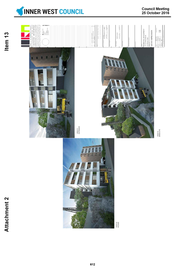
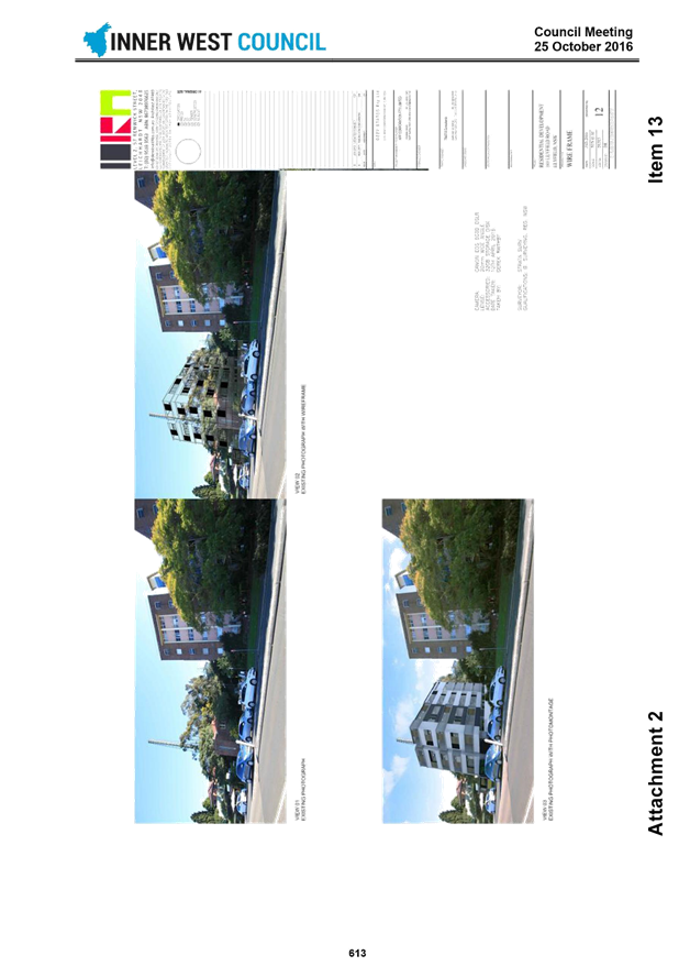
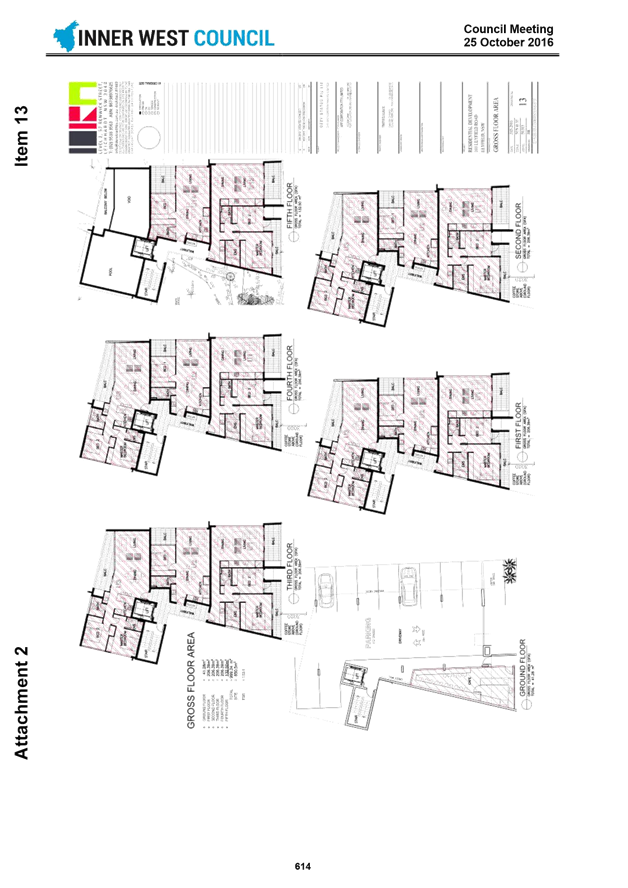
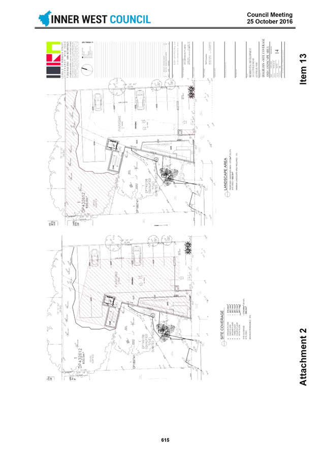
Subject: 120c Old Canterbury Road Summer Hill - Planning Proposal
File Ref: 17/4718/80217.17
Prepared By: Con Colot - Senior Strategic Planner & Projects
Authorised By: Simon Manoski - Group Manager Strategic Planning
|
SUMMARY Council has received a Planning Proposal for 120 C Old Canterbury Road Summer Hill, which seeks a change of Land Use Zoning for part of the site, increase in Maximum Building Height and increase in Maximum Floor Space Ratio in the Ashfield LEP 2013. It has been put on preliminary “upfront” public exhibition in accordance with Council’s policy - for the former Ashfield LGA area, and a large number of public submissions have been received and commented on in this report.
This report recommends that Council support the Planning Proposal subject to amendments being first made by the applicant as identified in the report, including amendments to reduce the Maximum Height of Buildings proposed to six storeys relative to Old Canterbury Road and reduce the Maximum Floor Space Ratio proposed to reflect this. After this has been carried out to the satisfaction of Council, the Proposal can be forwarded to the Department of Planning and Environment for Gateway Assessment, and for Council’s delegate being the General Manager to be given delegation (“The Authorisation”) to process the application. LRAC considered this report at its Meeting on 11 July and supported the staff recommendations as well as making some additional recommendations. |
|
THAT:
1. The Planning Proposal be amended to Council’s satisfaction addressing the recommendations outlined in this report, including a Maximum Height of Building equating to 6 storeys relative to Old Canterbury Road and a reduced Maximum Floor Space Ratio;
2. Council authorises the Interim General Manager to be Council’s delegate and use “the Authority” for the processing of the Planning Proposal as outlined in this report;
3. On satisfactory completion of Resolution 1 and 2, the Planning Proposal be referred pursuant to Section 56 of the Environmental Planning and Assessment Act 1979 (the Act) seeking a Gateway Determination and for Council to be the Relevant Planning Authority, and requesting the studies identified in the report be produced;
4. Council develop a site specific Draft Development Control Plan as outlined in this report and exhibit it concurrently with the Planning Proposal; and
5. Upon receipt of the Gateway Determination the Planning Proposal and Draft DCP be put on public exhibition pursuant to the Environmental Planning and Assessment Act 1979 (the Act). |
1.0 INTRODUCTION
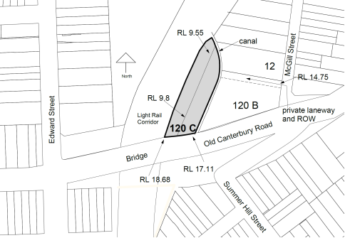
A Planning Proposal (as amended 22 June 2017) has been submitted seeking a change of Land Use Zoning for part of the site, increase in Maximum Building Height and increase in Maximum Floor Space Ratio in the Ashfield LEP 2013 summarised below in Table 1, for the land shown in Figure 1 below,.
Table 1- Summary proposed changes to Ashfield LEP 2013.
|
Control |
Existing |
Proposed |
|
Land Zoning: |
East side - B4 - Mixed Use |
No Change |
|
|
West side – SP2 Infrastructure |
B4 -Mixed Use |
|
Max. Floor Space Ratio |
East side -1.0:1 |
2.75:1 |
|
|
West Side – no FSR |
2.75:1 |
|
Max. Height of Buildings |
East side –20 m. Ground level varies at approx. RL 9.55 to RL 10. |
Maximum Height - RL 41.1.
This is 7 storeys relative to Old Canterbury Road, and 10 storeys relative to the lower part of the site adjacent the railway corridor. |
|
|
West side No MBH |
Maximum Height - RL 41.1 |
Figure 1- location of site shown in grey.
LRAC considered this report at its Meeting on 11 July 2017 and recommended:-
|
L0717 Item 2 120c Old Canterbury Road Summer Hill - Planning Proposal |
|
Recommendation: Cassidy / Stamolis THAT: 1. the Planning Proposal be amended to Council’s satisfaction addressing the recommendations outlined in this report, including a Maximum Height of Building equating to 6 storeys relative to Old Canterbury Road and a reduced Maximum Floor Space Ratio; 2. Council authorises the General Manager to be Council’s delegate and use “the Authority” for the processing of the Planning Proposal as outlined in this report; 3. on satisfactory completion of Resolution 1 and 2, the Planning Proposal be referred pursuant to Section 56 of the Environmental Planning and Assessment Act 1979 (the Act) seeking a Gateway Determination and for Council to be the Relevant Planning Authority, and requesting the studies identified in the report be produced; 4. a site specific Draft Development Control Plan be produced as outlined in this report and incorporated into any exhibition of the Planning Proposal; and 5. upon receipt of the Gateway Determination the Planning Proposal be put on public exhibition pursuant to the Environmental Planning and Assessment Act 1979 (the Act). CARRIED |
|
Amendment: Drury / Lofts THAT the LRAC: 1. asks the Administrator to: a) note that this proposal has no affordable housing and insist that the Department apply the IWC 15% policy; b) note that the LEP is less than 5 years old and the LRAC cannot see how this proposal meets the strategic merit test; c) highlight that the proposal is inconsistent with flood prone land d) note that there needs to be an area wide traffic study and LRAC thinks it is reasonable for this planning proposal to address this
|
|
CARRIED |
Officer Comment
As the Planning Proposal was submitted to Council prior to the introduction of the Inner West Council Affordable Housing Policy, the Policy only applies to the proposal as a guide and is not enforceable retrospectively. Notwithstanding, affordable housing remains an important element of urban renewal projects within the Inner West area. On this basis, any offer from the proponent for affordable housing will be considered in accordance with Council’s VPA Policy and in consideration with any other infrastructure required as public benefit.
On strategic planning grounds, the Planning Proposal forms part of a broader renewal area that is in proximity to services and facilities at Summer Hill and transport Infrastructure at Lewisham West. The Planning proposal has also been considered in detail by a range of technical staff from across Council including flooding and traffic specialists which have identified that the quantum and scale of development that would be made permissible by the Planning Proposal could be accommodated subject to design conditions.
Council officers will recommend that a detailed traffic analysis be prepared to ensure the planning proposal will not unreasonably impact on the surrounding road network. This analysis will be made available for public comment during the exhibition period.
2.0 SITE CONTEXT
The site has a unique context and characteristics which influence the extent of development that can be accommodated.
There are two allotments comprising 120C Old Canterbury Road. The eastern allotment is vacant and has past approvals for a light Industrial use and building set above columns so that the understorey can be void and accommodate flooding. The western allotment was acquired from the State Government, and was previously part of the “Railways Corridor”.
Most of the site topography is at approximately at RL 9.55 to RL 10 (varies), with a steep embankment at the southern end up to Old Canterbury Road at approximately at RL 17.11 – RL 18.68 (varies). The site’s only means of vehicular access is from a private laneway through the adjacent site at 120 B Old Canterbury Road, with access from a bridge over the canal at approx. RL 11.6.
The site is flood prone, with the freeboard floor level minimum being approx. RL 12.8. Based on past development approvals and Council’s engineers advice no building is permitted below that level apart from supporting columns. Adjacent is a Sydney Water stormwater canal, which receives stormwater from the surrounding locality.
Adjacent at 120 B Old Canterbury Road there is 5 storey apartment buildings above a ground level storey containing a childcare centre, which is in close vicinity to the site (see Figure 3 below). At 12 McGill Street there is under construction a 7 storey apartment buildings in close vicinity to the northern part of the site. This affects separation distances for any new building and winter solar access to those apartments.
Adjacent the site to the west, there is the Railways corridor containing the light rail and residual land, where the GreenWay concept is intended to be applied.
Sites to the east along Old Canterbury Road have a building scale of 5- 6 storeys, approximating the maximum scale set in the Marrickville McGill Street DCP. There are R2 -Low Density zones within close vicinity to the south (also being within the Lewisham Estate Heritage Conservation Area), and nearby to the west in Summer Hill. Tall apartment buildings have been approved on the former Flour Mill Site (entire site is at approx. FSR 1.5:1), the closest tall buildings are approx. 45 metres to the south of Old Canterbury Road.
Figure 3 – View of site as seen from Old Canterbury Road, 120 B Old Canterbury Road is on the right had side.
![]()
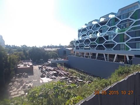
3.0 PRELIMINARY NOTIFICATION
The Planning Proposal was notified between 31 January and 6 March 2017. This process is in place in order for Council (former Ashfield LGA policy) to obtain community feedback, so that relevant issues may able be addressed “upfront” in the process. There were 568 visitations to Council’s “Have Your Say” website.
152 submissions were received. This included 5 letters of support, 75 individual submissions objecting to the proposal, and 72 submissions using a proforma letter objecting to the proposal.
Table 2 – Objections to Proposal – Issues raised
|
Concerns |
Officer Response |
|
Traffic and Vehicular Access |
|
|
Adverse increase in traffic, and traffic gridlock.
The private right of way laneway will be heavily congested due to its use by apartments at 120 B Old Canterbury Road and future (under construction) apartments at 12 McGill Street.
|
Refer to Council’s Traffic Engineers comments in Part 8.1 of this report. A future site specific study and car parking level layout will be required to ensure the site layout has adequate capacity for vehicular entry and exit, on site queuing needed to address the use of the shared laneway at 120 B Old Canterbury Road which provides access for adjacent apartment buildings, and to ensure disruption is minimized to traffic flow in McGill Street.
|
|
Improvements are required to the McGill Street and Old Canterbury Road intersection to enable right turn movements onto Old Canterbury Road.
|
There have been many buildings constructed, or under construction in the McGill Street precinct which will impact on this intersection at Old Canterbury Road, and on traffic flow. Any change to road conditions at this intersection will require an area wide study. It is not reasonable to be expecting this particular Planning Proposal to address this.
|
|
Proposal must provide adequate parking, there being a loss of onstreet parking due to low levels of parking provision in the McGill Street apartment blocks. |
Car parking provision will be assessed with any future Development applications and will be required to comply with the applicable controls.
|
|
Impact on apartments 120 B Old Canterbury Road |
|
|
Proposal will impact resident’s view who reside at 120 B Old Canterbury Road, including their winter solar access.
New buildings at the Flour Mills are blocking sunlight access in winter in afternoon, and the proposal will do the same.
|
120 B Old Canterbury Road has 5 levels of apartments, including apartments along its north west side which presently look over the site at 120 C Old Canterbury Road and received afternoon winter sun after midday(see Figure 3 above).
The applicants states that the Proposal has been amended to show building envelopes which will provide 2 hours winter solar access to apartments at 120 B Old Canterbury Road, and also achieve minimum building separation distance stipulated in the Apartment Design Guide. This will be carefully assessed during any future formal exhibition. Part 9 of this report recommends a site specific DCP be produced to address solar access.
|
|
Devalue property values at 120 B Old Canterbury Road |
The valuation of adjacent apartments is not within the control of Council, is affected by a variety of market conditions, and does not form part of the strategic merit test. |
|
Impact of development on Child Care Centre at 120 B Old Canterbury Road |
|
|
Will be impacted, including solar access, and overlooking |
The Child Care Centre is located at ground level, approx. at the same level as Old Canterbury Road (see Figure 3).
The latest Design Concept building envelopes submitted 22 June 2017 provide for 1 hour winter solar access. The Design Concept building envelope plans also propose that part of northern part of the site be left as “open space”, and this will provide a degree of outlook from the Childcare Centre north west toward the “GreenWay”. It is also possible to have a deep soil areas along the eastern boundary of the site for tall tree planting for privacy screening.
The above can be placed in a future site specific DCP and further refined through the detailed design phase and considered via the development application process. |
|
Building Height and Scale |
|
|
Will start a precedent where 4 storeys can be added over the established building scale
Contradicts Marrickville DCP 2011 with regard to maintaining “desired future character”, “Health and Wellbeing”, “Heritage”.
Building height should be two storeys lower than 9 storeys relative to Old Canterbury Road proposed in the February exhibition.
Objects to height, should be same as 120 B Old Canterbury Road
The proposal will not achieve a human scale adjacent the Greenway.
New buildings will block views of the old historic Mills buildings and other views
The resultant building will be able to be seen above existing tree vegetation along the east side of Old Canterbury Road, and this will be an “eyesore”. |
Refer to Part 6.2 of the report which assesses the proposed Maximum Building Height. |
|
Impact on GreenWay |
|
|
The land should be made part of the Greenway.
There is no proposal for new or enhanced links to the Greenway. |
The GreenWay area is adjacent the site, and presently consists of the Railway Corridor containing the light rail track, residual land either side, and is currently owned by Sydney Trains. Council does not have any strategy for acquiring private property for the purpose of enlarging a future GreenWay area.
The applicants 22 June 17 design concept scheme shows that a pedestrian link is spatially possible from the laneway at 120 B Old Canterbury Road and continuing onto the site alongside the canal. This will be a matter for future negotiation with Council and the creation of easements enabling public access. It would also be included in a site specific DCP. |
|
Open Space |
|
|
There should be more “green space”
Impact on people’s health, eg there are no green spaces that allows children to kick a ball and no provision on cycle ways” in the area.
Trees within 120 C Old Canterbury Road, along the boundary with the Railways corridor, should be retained. |
Council’s GreenWay project will include provision of additional public open space and also public pedestrian and bike paths, including along the adjacent railway corridor. |
|
Unsuitable location |
|
|
Poor Liveability location |
The Proposal has unique constraints, explained in this report, which will affect future building design. Nevertheless the Design Concept (Attachment 2) shows that any future building will have apartments with the benefit of a north western outlook over a future “GreenWay”, and good solar access. The site is also close to public transport |
|
Adjacent light rail trains will have an impact on the amenity of future residents |
Refer to Part 3 of the report which advises that Sydney Trains have raised no objection to the Proposal. The DA process will assess internal amenity impacts and define measures to mitigate and manage impacts. |
|
Lewisham is affected by plane noise, and lies between the ANEF 20 and 25 contours. |
The building that would result from the Planning Proposal is well below nearby buildings that are up to 10 storeys and higher. Any future development application will assess the specific building design and how plane noise is addressed. |
|
Proposal is contrary to the stated objectives of the Ashfield LEP 2013 |
With respect to the proposed land use, this is not considered to be the case. Refer to Part 6 of this report that discusses the proposed amendments to the Ashfield LEP 2103. |
|
Affordable Housing |
|
|
There is no Affordable Housing provision in the proposal |
Refer to Part 7 of this report which discusses Council’s Affordable Housing Policy, and how this can be addressed. |
|
Impact on Lewisham Estate Heritage Conservation Zone |
|
|
Adverse Visual Impact |
Refer to Part 6.2 of the report which discusses the Proposed Maximum Building Height. |
|
Impact on nearby residential buildings in R2 zones |
|
|
Residents of the new buildings will be able to look into the backyards and front rooms of houses. |
Refer to Part 6.2 of the report which discusses the Proposed Maximum Building Height. This part of the process is considering the strategic and site specific merits of the proposal. If the site is rezoned, this matter would be assessed via a future Development Application and be subject to further community consultation. |
|
Inadequate Infrastructure |
|
|
Infrastructure, including schools, is not able to accommodate the Proposal.
Light Rail is already at capacity at peak period times and cannot cope with more apartments.
Light Rail is already at capacity at peak period times and cannot cope with more apartments.
There is one bus service, 413, which is overcrowded at peak periods and stuck in the gridlocked traffic.
There should not be more apartments
Impact on sewerage and water drainage
|
The Council has no advice from the Department of Planning and Environment or relevant State Government departments that there is no capacity in local schools, and that public transport is beyond capacity. Nevertheless, at post Gateway Determination stage, referrals will be made to the relevant Government departments.
There is adequate sewerage and water infrastructure. |
|
Inappropriate Land Zoning |
|
|
SP2 zoned land should not be rezoned to B4. |
This land was formerly part of the railway corridor and acquired from Sydney Trains, and is flood affected. The Land Use zoning is discussed in Part 6.1 of this report. |
|
Public Interest |
|
|
Approval would be detrimental to the local community. |
Refer to Part 4 and Part 5 of this report where the proposal is assessed against the Planning Proposal guidelines and draft Central District Plan and local Council Strategy, and proposed Development standards |
Table 3 - Submissions in support
There were 5 submissions.
|
Proposal will provide more housing and so should be supported. |
This is noted. |
Table 4 - Public Authority comments
|
Sydney Water |
|
|
Raised no objection at this stage.
They note the existing bridge at RL 11.6 is below the minimum freeboard level of RL 12.8 recommended by the applicant’s consultant. They request with any future development application that emergency pedestrian access be provided from the site onto Old Canterbury Road in the event of a flood.
|
Part 8 of this report provides comments from Council’s Engineers, and explains that it is Council’s responsibility to determine the suitability of the site to take development taking into consideration the “Flood Plain Development Manual 2005”. Part 5 of this report explains it is also a requirement of a Section 117 direction that this matter must be resolved, and requires further detailed studies to be produced by the applicant. This can also explain how emergency access to Old Canterbury Road can be provided on site.
Referral will again be made to Sydney Water post Gateway determination given the site is flood prone, and is adjacent a canal that collects local and regional storm water. |
|
Sydney Trains |
|
|
Raised no objection at this stage.
And advised any future Development Application can be assessed relative to the Department of Planning - “Development Near Rail corridors and Busy Roads”. |
Referral will again be made post Gateway determination, given the site is adjacent the Light Rail Corridor.
|
4.0 AMENDED PLANNING PROPOSAL
Council officers wrote to the applicant on 4 April 2017 advising of concerns with the Planning Proposal, including in relation to excessive building height, excessive FSR, and loss of afternoon winter solar access to apartments at 120 B Old Canterbury Road. In response the applicant deferred consideration of the Proposal to enable amendments to be made.
An amended Planning Proposal and ancillary Design Document was submitted to Council on 22 June 2017 (Attachment 1). Amendments include reducing the height of the southern part of buildings relative to Old Canterbury Road to 7 storeys (previously as exhibited 9 storeys), reducing the northern part of the site to 4 storeys relative to Old Canterbury Road level, reducing the maximum FSR to 2.75 (previously 3.0 :1). The Land Use Zoning and Development standards are assessed in Part 6 of this report.
5.0 COMPLIANCE WITH PLANNING PROPOSAL GUIDELINES AND DOCUMENT CONTENT
In order for Council to act as the Relevant Planning Authority and be in control of the processing of the Planning Proposal, it is the Council’s responsibility to ensure there is adequate content and “justification” in a Planning Proposal document as required in “ Planning Proposal – A Guide to preparing Planning Proposal Guidelines” 2016. The following provides an assessment of the adequacy of the content.
Table 5 - Planning Proposal Guidelines
Part 1 Objectives and intended outcomes and explanation of provisions
|
|
Guideline Requirements |
Officer comments |
|
2.1
|
Requires a concise statement setting out the objective or intended outcomes. |
The statement given in the Planning Proposal is satisfactory. |
Part 2- explanation of provisions
|
|
Guideline Requirements |
Officer Comments |
|
2.2 |
Requires an explanation of the land use zones and development standards sought to be amended. |
The proposal seeks to make amendments to the Land Uses, Maximum Floor Space Ratio, and Maximum Height of Buildings, and this is adequately explained in the Planning Proposal.
A Maximum Height of Building is expressed as RL of 41.1 is proposed, but it is not adequately explained how this can be implemented in an LEP Map, as the LEP map requires an actual linear building height measured from ground level to be stated. Refer to Part 6.2 below of the report which discusses this and recommends an alternative Maximum Height of Building.
|
Part 3 – Justification
|
|
Guideline Requirements |
Officer Comments |
|
2.3 |
Requires adequate justification documentation to be provided for the specific land use and development standards proposed to the LEP. |
Design concept documentation has been submitted which provides floor plans and building envelopes for the proposed maximum Building Height and Maximum FSR. These development standards are assessed and evaluated in detail Part 6 of this report.
|
2.3.1 Questions to consider when demonstrating the justification
|
|
Guideline requirements |
Officer Comments |
|
Section A – Need for Planning Proposal |
||
|
Q1 |
Is the planning proposal part of any strategic study or report? |
The proposal is not part of any strategic study or report.
The eastern allotment was formerly owned by the State Government (Sydney Trains), and later acquired by the present owners, and the easement over the property benefiting Transport for NSW was later released. The land was zoned SP2 Infrastructure in the Ashfield LEP 2013, reflecting the then Railways Corridor use. This no longer reflects the use of the land, and so this needs to be corrected.
It is also relevant that the site was considered as part of the reporting to the former Ashfield Council on the exhibition of the Draft Ashfield LEP 2012. At the time the site owners requested Council to reconsider the Land Use Zoning and Development Standards. Council resolved to receive a future Planning Proposal that would put forward suitable amendments for Council to consider. This is explained in the Planning Proposal.
|
|
Q2
|
Is the planning proposal the best means of achieving the objectives or intended outcomes, or is there a better way?
|
Yes, the objectives require amendments to the Land Use zonings and Development Standards of the Ashfield LEP 2013. Part 6 of the report below discusses and assesses these. |
|
Section B –relationship to strategic planning framework |
||
|
Q3 a |
Does the proposal have strategic merit? Is it:
|
|
|
|
Consistent with the relevant District Plan within the Greater Sydney region. |
The Proposal is consistent with A Plan for Growing Sydney (2014), and Towards Our Greater Sydney 2056, and the objective to increase housing supply.
The draft Central District Plan (dCDP) is also a consideration. One of the key objectives of the draft CDP is to provide for additional residential growth close to transport and services – which the proposal does. The dCDP provides an Inner West LGA housing target of 5,900 dwellings by 2021 which this proposal would contribute to.
The dDCP also requires the Relevant Planning Authority to include an Affordable Rental Housing Target as a form of inclusionary zoning and sets a target of 5% to 10% of new floor space at rezoning stage. The Planning Proposal does not address this, and this needs to be resolved “upfront”. Refer to Part 7 of this report which discusses this matter and Council’s Affordable Housing Policy.
|
|
|
Consistent with a relevant local council strategy that has been endorsed by the Department
|
The Ashfield Urban Planning Strategy 2010 was approved by the Department of Planning and Environment and the B4 land use proposed for the western allotment is consistent with that Strategy since it mirrors the adjacent eastern portion land zoning. |
|
|
There will be a presumption against a rezoning review request that seeks to amend LEP controls that are less than 5 years old, unless the proposal can clearly justify that it meets the Strategic Merit Test.
|
The Ashfield LEP was gazetted in December 2013, and is less than 5 years old. As stated above the Planning Proposal can be considered given that Council (former Ashfield Council) resolved in 2013 to receive a future Planning Proposal that would put forward suitable amendments to the Ashfield LEP 2013 for Council to consider. The Planning Proposal also seeks to address a change of circumstances, being that the SP2 Infrastructure use of the western portion of the site is now redundant, and a new land use is required to enable orderly development of the site.
|
|
Q3b |
Does the proposal have strategic merit with regard to the following : |
|
|
|
The natural environment
|
The site is subject to flooding, and this is acknowledged in the applicant’s engineer’s report (Attachment 3). Based on Council’s engineer’s advice and past Development Application approvals, this requires that the site ground level, which is at approx. RL 9.5 to RL 10.0, must not have any building apart from supporting columns, and that the floor level above that must be at a minimum freeboard level of RL 12.8.
Council’s engineers also advise in Part 8.2 of this report that there will be a detailed floodwater study required to confirm minimum floor levels, and avoid impacts on adjoining properties since adjacent development has driveway entries to basement carparks at approx. RL 11.6.
The Planning Proposal needs to have the relevant information and studies covering the above considerations, and this will be requested to be produced post any Gateway determination approval.
|
|
|
The existing uses, approved uses, and likely future uses of land in vicinity of the proposal.
|
The site has no significant building and is mostly unused at the present.
There will be an affectation to the existing apartments at 120 B Old Canterbury Road, and future apartments under construction at 12 McGill Street, in terms of ensuring they receive adequate levels of solar access, and there is adequate building separation. The amended Design concept demonstrates that it is possible to have building envelopes which will provide minimum winter solar access and adequate building separation.
The Planning Proposal information is adequate for the purpose of Gateway Determination, subject to further studies recommended in this report.
|
|
|
The services and infrastructure that are or will be available to meet the demand arising from the proposal and any proposed financial arrangement for infrastructure provision
|
There are existing water and sewerage service, and roadways for vehicular access. There are nearby primary and high schools, and public transport including bus and rail. The Planning Proposal information is adequate for the purpose of Gateway Determination |
|
Q4 |
Is the proposal consistent with a council’s local strategy or other local strategic plan? |
The proposal’s height of 7 storeys relative to Old Canterbury Road is not consistent with the McGill Street DCP which limits building height along Old Canterbury Road to 4 to 5 storeys This is discussed in more detail in Part 6.2 of this report. |
|
Q5 |
Is the planning proposal consistent with applicable State Environmental Planning Policy |
With regard to SEPP 65, a Design Concept has been submitted. The proposed building heights and resulting FSR are commented on in Part 6 below.
For SEPP no 55 –Remediation of Land, there will be a Phase 1 Site Assessment provided post Gateway Determination.
The Planning Proposal identifies the other applicable SEPPs, being SEPP (BASIX), SEPP (Complying Development), SEPP (State and Regional Development) 2011, Sydney REP Harbour Catchment, noting that these do not have an impact of consideration of the Planning Proposal.
|
|
Q6 |
Is the planning proposal consistent with applicable Ministerial Directions (s. 117 directions)? |
The Planning Proposal in its Annexure B , states that it is consistent with the following Section 117 directions, being :
“3- Housing, Infrastructure and Urban Development- Residential Zones” – and providing for future housing needs.
“3.4 Integrating Land Use and Transport “- the site close to transport and services
“6.0 Local Plan Making” – the LEP provisions will not compromise the efficient and appropriate assessment of development.
“7- Metropolitan Planning” - the proposal is consistent with the NSW Government’s – “A Plan for Growing Sydney” (2014) and its generalist directions, in particular “Principle 1 –Increasing housing choice around all centres through urban renewal in established areas,
However more information is required in the Planning Proposal elaborating on the above.
The Proposal is inconsistent with “4.3- Flood Prone Land”. There are various considerations including :
5) A Proposal must not rezone land that is zoned Special Use (in this case SP2- Infrastructure -western portion of site) and is flood prone, to a Residential or Business use.
(6) A Planning Proposal must not contain provisions that apply to the flood planning areas which permit development in flood way areas
A Planning Proposal may be inconsistent with the Direction only if the relevant planning authority can satisfy the Director General that :
- The planning proposal is in accordance with a floodplain risk management plan prepared in accordance with the principles and guidelines of the Flood Plain Manual, or - The provisions of the planning proposal that are inconsistent are of minor significance.
The Applicants design concept shows in section there will not be any building structure at ground level other than structural columns, as was the case with a previous development approval for an Industrial use. Any structure’s floor level is required to be at a minimum of RL 12.8- as recommended in the applicant’s Consultant Hydraulic Engineer’s report. However, as explained by Council’s engineers at Part 8.2 of this report there will be a detailed precinct flood study required to address this Section 117 direction, establish post development freeboard floor levels, ensure impacts on adjacent buildings are satisfactory, and ensure that there is no building at ground level storey and so no disruption to storm water flow.
The Planning Proposal is therefore required to have a detailed flood study provided post Gateway to addressing this Section 117 Direction- this would be at the applicant’s cost.
|
|
Q7 |
Is there any likelihood that critical habitat or threatened species, populations or ecological communities, or their habitats, will be adversely affected as a result of the proposal? |
No. |
|
Q8 |
Are there any other likely environmental effects as a result of the planning proposal and how are they proposed to be managed? |
There are no other substantial environmental effects that are known of. |
|
Q9 |
How has the planning proposal adequately addressed any social and economic effects? |
The site contains no significant buildings and appears mostly unused. Previous use included a stone masons – light industry, with low employment generation. The Planning Proposal document adequately covers this matter. |
|
Q10 |
Is there adequate public infrastructure for the planning proposal? |
The site has restricted vehicular access, with the main part of the site being approx. 7.5 - 8 metres below Old Canterbury Road and it not being clear whether there is opportunity for vehicular access onto Old Canterbury road- eg exit onto Old Canterbury Road.
The site relies on vehicular access of laneway on the property at 120 B Old Canterbury Road, where the site owner has a Right of Way. Evidence for this ROW will need to be submitted post Gateway determination. Council’s Traffic Engineer’ in Part 8.1 below explains the particular on site issues to enable proper use of the laneway which is shared with the existing apartment building at 120 B Old Canterbury Road and apartments under construction at 12 McGill Street. The required studies can be provided post Gateway Determination. |
|
Q11 |
What are the views of State and Commonwealth authorities consulted in accordance with the gateway determination? |
Public Authorities will be formally consulted post Gateway Determination and the Guidelines require that Proposal should suggest who they should be. This will be a matter for the Greater Sydney Commission.
|
|
2.4 Mapping |
||
|
|
|
The Planning Proposal has not provided the required Maps for Max FSR and Max Height of Buildings. These need to be provided with the Planning Proposal.
|
|
2.5 Community Consultation |
||
|
|
|
It is considered that the Proposal should be formally exhibited for a minimum of 28 days in accordance with the Inner West DCP 2016 (former Ashfield Council area). |
|
2.6 Project Timeline |
||
|
|
|
The Gateway Determination will determine the maximum timeline, and so it is premature to state actual milestones. The Planning Proposal provides the necessary timeline table. |
6.0 ASSESSMENT OF SPECIFIC AMENDMENTS BEING SOUGHT
TO ASHFIELD LEP 2013, FOR LAND USE, MAXIMUM HEIGHT, MAXIMUM FSR.
6.1 Amendment to Land Use zoning Map- Ashfield LEP 2013.
The present land zoning is as indicated in the Figure below with the property shown within the red boundary.
Figure 4 – Extract Zoning map. Property is within the red boundary, Purple is B4- Mixed Use, Yellow is SP2 -Infrastructure
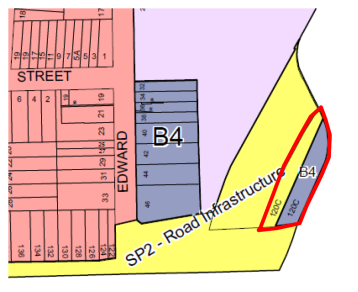
The applications seeks amendments to the Land Zoning maps as indicated in the Planning Proposal, and summarized in the Table below.
Table 6
|
Control |
Existing |
Proposed |
|
Land Use Zoning Map : |
East side B4 -Mixed Use |
B4 - Mixed Use |
|
|
West side SP2- Infrastructure |
No Change |
Officer Comment
The west side allotment zoning is now redundant and should be changed to match the adjacent B4 Mixed Use zoning.
6.2 Amendment to Maximum Building Height Map.
The present Maximum Building Height is as indicated in the Figure below with the property shown within the red boundary.
Figure 5 - Extract Height of Buildings Maps. Q denotes 20 m, N denotes 13m,
I denotes 8.5 metres
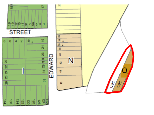
The applications seeks amendments to the Maximum Building Height maps as indicated in the Planning Proposal and summarized in the Table below.
Table 7
|
Control |
Existing |
Proposed |
|
Maximum Height of Building Map: |
East side allotment– 20 m measured from ground level which varies and is approx... RL 9,55 to RL 10 at the flat lower part , resulting in approx. RL 30 relative to the predominantly flat lower part (Old Canterbury Road is varies between RL 17.1 to RL 18.8)
|
Maximum Height be RL 41.1, which equated to 7 storeys relative to Old Canterbury Road, and 10 storeys relative to the lower part of the site adjacent the railway corridor, as depicted in the Design Concept (Attachment 2). |
|
|
West side
No MBH |
Maximum Height be RL 41.1 |
Officer Comment
It considered that the maximum building height to be placed in Height of Buildings Map should equate to six storeys relative to Old Canterbury Road. This building scale is in line with the same number of storeys established at 120 B Old Canterbury Road building, and in line with the objectives of the McGill Street Precinct DCP which requires a medium rise scale along the road. This is also the view of Council’s Architectural Excellence Panel (refer to Part 8.3 of this report). This is also the advice Council officers have been providing to the applicant at pre-lodgement stages and in correspondence in April 2017.
Six storeys above Old Canterbury Road equates to a maximum RL of 37.9 m measured to the top of the building’s roof. This will need to be translated into a linear height which can be placed in the Maximum Height of Buildings Map in the Ashfield LEP 2013. This would be 28 metres as measured from the lower flatter part of the site which ranges from RL 9.55 to RL 10.0. It will also be necessary to have a site specific clause that restricts the height of the sloping part of the southern part of the site (which goes from RL 10.0 up to approx. RL 17.11 to 18.68 at the roadway) in order to avoid having the southern last 20 metres with the equivalent of a 12 storey building. A future site specific DCP would ensure that the northern part of the site has lower building heights as currently portrayed in the Design Concept which enable afternoon winter solar access to 120 B Old Canterbury Road. The Planning Proposal should be amended to reflect the above, and provide the required LEP mapping.
6.3 Amendment to Maximum Floor Space Ratio.
The present maximum FSR is as indicated in the Figure below with the property shown within the red boundary.
Figure 6 – Extract Floor Space Ration map. N denotes 1.0:1, S denotes 1.5:1, H denotes, I denotes 0.7:1
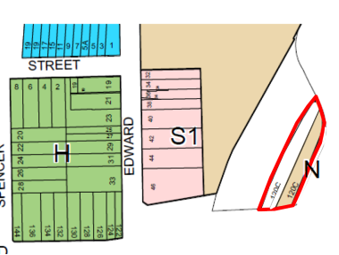
The application seeks amendments to the Maximum FSR maps as shown in the in the Table below.
Table 8
|
Control |
Existing |
Proposed |
|
FSR: |
East side -1.0:1 |
2.75 :1 |
|
|
West Side – no FSR |
2.75:1 |
Officer Comment
The Design Concept- Architectural Report (Attachment 2) has produced detailed floor layout drawings. These show 5,366 sqm of Gross Floor Area, and with a site area of 1956 sqm this equates to a Maximum FSR of 2.75:1. The maximum Floor Space Ratio needs to equate with the number of storeys containing Gross Floor Area that can be accommodated on site. The above proposed FSR is based on the building envelopes in the Design Concept which include 7 storeys adjacent Old Canterbury Road, and resulting gross floor area.
As explained in Part 6.2 above, it is considered that there should be a maximum of 6 storeys above Old Canterbury Road, and so the FSR resulting from the applicant’s proposed Level 7 is required to be discounted and the maximum Floor Space Ratio reduced. The Planning Proposal should be amended to reflect the above, and provide the required LEP mapping provided. This will also require amended Design Concept drawings to be produced by the applicant in order to show compliance with SEPP 65 and the Apartment Design Guide.
7. 0 Affordable Housing
It is relevant that the Draft Central District Plan requires the provision of affordable Housing, at a rate of 5-10 percent of any development. Council’s Affordable Housing Policy was adopted in March 2017, and this application was submitted in Dec 2017. To date the applicants have not agreed to the provision of affordable housing in accordance with Council’s Policy.
Part 1.8 of the Policy states:
“Timing – in consideration of reasonableness and equity, the value capture requirement should apply to land that is subject to a proposal for rezoning or variation to planning controls whether that application is received after the Policy is approved by Council. For applications that have been made or under consideration prior to the Policy’s approval, this Policy will provide guidance as to the quantum of affordable housing contribution that is considered appropriate”.
Part 2.5.2 Sharing Land value Uplift for Affordable Rental Housing, states:
Major Planning Agreements:
“The Council share of land value uplift will be taken as 15% of Gross Floor Area of the development for developments with a Gross Floor Area of 1.700 sqm or greater, or where development results in 20 or more dwellings”.
Pursuant to the Council Policy and the Draft Central District Plan, negotiations may be carried out with the applicant to provide a Voluntary Planning Agreement for the provision of affordable housing, and such a document could operate alongside the Planning Proposal. The final form of the VPA document can be provided post Gateway approval stage when Council becomes the Relevant Planning Authority, to Council’s satisfaction. Any offer from the proponent will be considered in accordance with Council’s VPA Policy.
8.0 OTHER STAFF COMMENTS
8.1 Traffic Engineer
Council’s Traffic Engineer has advised:
From a vehicular access and servicing consideration, the site has particular restrictions, as identified below.
The site has a shared vehicular right of way laneway on land at 120 B Old Canterbury Road accessed off McGill Street (side street), and there is a bridge constructed over the canal to link into the subject site. At the moment there is no vehicular access available off Old Canterbury Road which is approx. 7.5 metres above the site. There is shortfall of available on street parking in the McGill Street Precinct, and traffic congestion at peak hour on Old Canterbury Road. It is considered that for any future studies, and to confirm the suitability of the site to take development, that:
1. There needs to be car parking provided on the site at the minimum rate stipulated in the applicable controls.
2. There should be illustrative designs showing car parking layouts, vehicle movements showing the method of access from the bridge onto the site at RL 12.8, template vehicle movements and also showing that vehicles can move out in a forward direction, areas assigned for servicing such as deliveries and capacity for providing an area for potential on site waste collection by a garbage truck. Also, allowance for vehicle queuing on site due to use of the private right of way laneway, which is shared and will be heavily congested due to its use by apartments at 120 B Old Canterbury Road and future (under construction) apartments at 14 McGill Street.
3. Evidence provided that the right of way belonging to 120 B Old Canterbury Road, may be used for access, and will be able to take the weight and use of garbage trucks so as to not cause any structural damage.
4. Evidence that the site owner intends to give Council indemnity to enable Council garbage vehicles to access the site.
5. Plans showing McGill Street and the right of way laneway and access into the site at 120 C Old Canterbury Road, that show a garbage truck and emergency vehicles are able to access the site and exit in a forward direction.
The above can form part of a study submitted post Gateway determination stage, and would be at the applicant’s cost.
8.2 Stormwater Engineer
Council’ Stormwater Engineer has advised:
The property has been identified in Council’s 2014 Flood Study for the Hawthorne Canal catchment as being flood prone. In accordance with past development applications as a minimum any building must be elevated above the peak flood level.
In order for Council to be satisfied and remain consistent with the NSW Flood Prone Land Policy and the principles of the “Floodplain Development Manual 2005” a Flood Impact Report shall be required to be submitted. The objectives of the “Flood Impact report” will be to ensure the development does not adversely affect neighboring properties and to provide adequate free board against the peak storm event. In order to achieve this, the following is required:
- A review of the existing topography maps, flood inundation maps, flood hazard maps etc.
- The Implementation of Council controls & State Government policies to ensure adequate safety and design of the proposed development during a flood event.
- Engineering assessment and reporting of the development and its impact on the existing surrounding developments.
- A review of the impact of flooding on the proposed development and the surrounding properties & modifications to the design that might be required to minimise any adverse impact.
- Identify the flood risk management procedures necessary for the proposed development
- Quantify post development flood water levels
Figure 7 – Extract of Report in Attachment 3. Site is within red boundary. Blue shows extent of flooding.
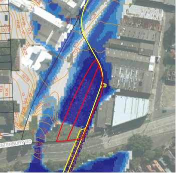
The required studies should be provided post Gateway determination stage, and these would be at the applicant’s cost.
8.3 Architectural Excellence Panel
The Panel visited the site on 6 June 2017 and met with the proponent and Council officers, and considered the design merit of the Planning Proposal.
The Panels comments (Attachment 4) are based on interim sketch design amendments submitted to Council on 29 May 2017 which sought feedback from the Panel. These comments included that any building should be consistent with the objectives of the McGill Street DCP, and should not be any higher than the building scale established by the 6 storey building at 120 B Old Canterbury Road. They also requested more detailed architectural documentation be provided in the future. This can be forthcoming post Gateway determination given that the purpose of the Planning Proposal is to determine Development standards, and these have been adequately assessed in this report in
Part 6.
The Planning Proposal design scheme was later amended on 22 June 2017 and reduced to 7 storeys relative to Old Canterbury Road (previously 9 storeys as exhibited), and shows a scheme where an easement can be provided on the north part of the site for public access from the private laneway right of way, along the canal, and linking to the Railway corridor- future Greenway.
9. 0 Draft Site Specific Development Control Plan
This planning report has explained the special constraints that affect future development on the site. Considerations include impacts on adjacent apartments, specially configured building envelopes with varying heights, floodway clearance, vehicular access to the site, interface with the Greenway, comments made by the Architectural Excellence Panel, and the various technical matters explained in this report.
A draft site specific DCP should therefore be produced to provide guidelines for future development. This is required to be in the format of the Inner West DCP 2016 (former Ashfield Council) and can be produced post Gateway determination stage.
FINANCIAL IMPLICATIONS
The Planning Proposal does not raise any financial implications for Council at this stage. As explained in the report, future flooding impacts will need to be identified in future studies produced by the applicant, to Council’s satisfaction, to ensure there are no impacts on adjacent properties, and no impact on Council’s liability.
CONCLUSION
The Planning Proposal is at a preliminary stage and requires additions and amendments to its content in order to meet Planning Proposal Guidelines, Council’s Affordable Housing Policy for the processing of the proposed amendments to the Ashfield LEP 2013.
Amendments to the proposed Land Use zoning are supported. It is agreed that the site should have an increased maximum FSR and increased Height of Building, however as proposed these are considered excessive, and need to be reduced as identified in the report so that any resulting building at Old Canterbury is a maximum of 6 storeys noting this will have an impact on the recommended maximum FSR. In addition various additional studies also will be required to be produced by the applicant. A site specific Development Control Plan will also be required to provide guidelines for future development. A Voluntary Planning Agreement for affordable housing should also be considered consistent with Council’s policy and for any public benefits that may be derived from the proposal.
It is recommended Council supports the Planning Proposal subject to it being amended as outlined in this report. Upon receipt of the amended Planning Proposal from the applicant, Council would then forward the documentation to the Department and request the Minister to issue the relevant “Gateway Determination” to allow the process of preparing an LEP to commence with progression to formal public exhibition, with Council being in control of this process.
It is also is recommended that Council seek permission from the “Gateway Panel” to use the Council “Authorisation” to process the Planning Proposal, and that Council authorise the General Manager to activate the delegation as part of the plan-making process. This will put Council in control of the Plan making process.
|
1.⇩ |
Planning Proposal |
|
2.⇩ |
Design Concept |
|
3.⇩ |
Engineers Flooding Report |
|
4.⇩ |
Architectural Excellence Panel Report |
|
Council Meeting 25 July 2017 |
Subject: Planning Proposal: 58-76 Stanmore Road, 2-20 Tupper Street and 3-9 Alma Avenue, Stanmore
File Ref: DA201600244/68241.16
Prepared By: Maxine Bayley - Strategic Planner and Peter Wotton - Strategic Planning Projects Coordinator
Authorised By: Simon Manoski - Group Manager Strategic Planning
|
SUMMARY Council received a planning proposal request for 58-76 Stanmore Road, 2-20 Tupper Street and 3-9 Alma Avenue, Stanmore on 24 May 2016. A number of amendments were made to the planning proposal in response to issues raised by Council officers during the assessment process.
It is considered that the proposal has strategic merit, however further design refinement is required. This report recommends that Council give in principle support for the planning proposal subject to the imposition of conditions on the Gateway Determination as detailed in this report with a revised urban design scheme required prior to exhibition, to ensure that the proposed development is appropriate and provides suitable amenity for all users of the site and adjoining areas. |
|
RECOMMENDATION
THAT Council:
1. Support the planning proposal request for 58-76 Stanmore Road, 2-20 Tupper Street and 3-9 Alma Avenue, Stanmore to rezone the land to facilitate the redevelopment of the site to include a new club premises, commercial floor space, a public plaza and residential accommodation with associated basement car parking subject to the following amendments: (a) The Land Zoning for Site C being amended to R3 Medium Density Residential; (b) Inclusion of MLEP 2011 Schedule 1 additional permitted use of a ‘residential flat building’ as part of a mixed use development; (c) Maximum height of building controls and number of storeys to be applied across the site as detailed in this report; (d) Floor space ratio controls to be developed for each site should the proposal obtain Gateway approval. 2. Request the applicant to update the planning proposal report and associated documentation to ensure consistency between all documents; 3. Forward the planning proposal to the Minister for Planning for a Gateway determination in accordance with Section 56 of the Environmental Planning & Assessment Act 1979; 4. Request that Council be delegated plan making functions in relation to the planning proposal; 5. Resolve to develop site specific planning controls to apply to the future development at 58-76 Stanmore Road, 2-20 Tupper Street and 3-9 Alma Avenue, Stanmore for inclusion in MDCP 2011 Part 9.9 (Newington Precinct 9) consistent with the advice contained within this report and that the site specific controls be publicly exhibited concurrently with the planning proposal; and 6. Consider the Voluntary Planning Agreement (VPA) offer in accordance with Council’s interim VPA Policy.
|
BACKGROUND
Design details In September 2015 Council received a request for pre-planning proposal advice regarding the subject site. Council officers reviewed the documentation and provided written advice on the proposal, including comments from Council’s AEP, in February 2016.
The planning proposal request was lodged with Council on 24 May 2016. A full copy of the proposal is included as ATTACHMENT 1.
Following an initial assessment process, Council forwarded a letter of issues to the applicant in December 2016. The applicant’s response was referred to Council’s Architectural Excellence Panel (AEP) for their further consideration in March 2017. A meeting was then held with the applicants in March 2017 to discuss the contents of the AEP’s advice and Council’s final position regarding the application.
A further meeting was held with the applicants on 8 June 2017 and a subsequent letter, dated 14 June 2017, was sent to the applicant identifying issues with certain components of the revised scheme. The letter also requested further documentation in relation to certain aspects of the proposal.
The applicant’s written response to the Council’s letter is included as ATTACHMENT 2.
DISCUSSION
The subject site is currently zoned RE2 Private Recreation (58-76 Stanmore Road, 3-9 Alma Avenue and 20 Tupper Street), SP2 Electricity Supply (electrical substation on land fronting Alma Avenue) and R2 Low Density Residential (2-14 Tupper Street) under MLEP 2011. The subject site has a combined site area of 9,206 square metres (including the substation lot). The Alma Avenue frontage of the development site (excluding the Alma Avenue frontage of the property 20 Tupper Street) is shown on the MLEP 2011 Land Reservation Acquisition Map for the purposes of local road widening.
Note: As part of the planning proposal, known as Marrickville Local Environmental Plan 2011 (Amendment No. 4), the former Marrickville Council resolved to place a Local Road (SP2) Reservation on the Alma Avenue frontage of the property 20 Tupper Street.
The subject site is bounded by Stanmore Road to the north, Tupper Street to the east and Alma Avenue to the west. The southern boundary of the subject site abuts a residential flat building on 22 Tupper Street. The site has a frontage of approximately 67 metres to Stanmore Road and 140 metres to both Alma Avenue and Tupper Street. The land slopes away from the northern portion of the site to the south and contains a fall of approximately 11 metres.
The subject site comprises twelve separate properties, all of which are owned by the applicant with the exception of the electrical substation which the applicant is in the process of acquiring. As the land on which the substation is sited is critical to the progression of the proposal in its current form, the planning proposal application has been assessed including that land. The extent of the subject site is shown at Figure 1.
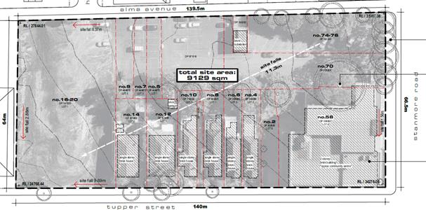
Figure 1: The Subject Site
The site currently contains the Cyprus Club which is a three part four storey building located on the north eastern corner of the site. The club currently contains bars, a restaurant and function rooms. The north western portion of the site contains an at grade car parking area and several established trees. The western portion of the site contains a continuation of the car parking area and a collection of mature trees. The southern part of the site contains a vacant lot which is grassed but otherwise devoid of any significant vegetation. The eastern portion of the site, facing Tupper Street, contains six freestanding residential dwelling houses which are all single storey (shown as numbers 4 to 14 in Figure 1). A small electrical substation exists in Alma Avenue which is proposed to be acquired by the proponents.
Vehicular access is currently provided to the at grade car parking area via Alma Avenue only.
The surrounding area is predominantly residential and contains a mix of built forms, ranging from single dwelling houses to four storey residential flat buildings. Stanmore Road contains a mix of residential typologies and an increasing number of commercial properties heading towards the main commercial strip of Enmore Road.
To the south, the site is directly adjoined by a three part four storey residential flat building that fronts Tupper Street with a minimal setback. Further to the south development fronting Tupper Street consists of a mixture of single dwelling houses and residential flat buildings. To the north, on the opposite side of Stanmore Road, the site is adjoined by two and three storey terrace houses contained within a Heritage Conservation Area. The properties 61-75 Stanmore Road on the northern side of the Stanmore Road directly opposite the site are listed as part of Heritage Item No. I242. To the east, the site is adjoined by a relatively large residential flat building on the corner of Tupper Street and Stanmore Road, with single storey dwelling houses to the south of this building. To the west, on the opposite side of Alma Avenue the site is adjoined by a small number of dwelling houses, one of which (6 Alma Avenue) is a listed Heritage Item (Item No. I29). Setbacks within the area vary significantly, particularly on the eastern side of Tupper Street, where residential flat buildings are setback further from the road than dwelling houses.
The streets within the precinct are narrow, with Alma Avenue operating as a one way street due to its limited width. Residential blocks tend to be long and run in an east-west direction. Connectivity from east to west is limited, restricting vehicular and pedestrian access. The subject site is within walking distance of the Enmore Road commercial area and is serviced by buses which operate along Stanmore and Enmore Roads. The site is approximately 800 metres from Stanmore railway station. The area suffers from an overall lack of open space areas. A small pocket park, known as Newington Road playground is located approximately 200 metres from the southern edge of the site. A larger open space area, known as Ryan Park, is located approximately 250 metres from the site along Stanmore Road. Enmore Park is approximately 800 metres from the site.
Proposed Development
Indicative concept design plans were submitted with the application, including an Urban Design Study. The concept plans propose:
- Demolition of all existing improvements on the site;
- Consolidation of all existing lots; and
- Division of land into three sites: Site A, Site B and Site C as shown in Figure 2.
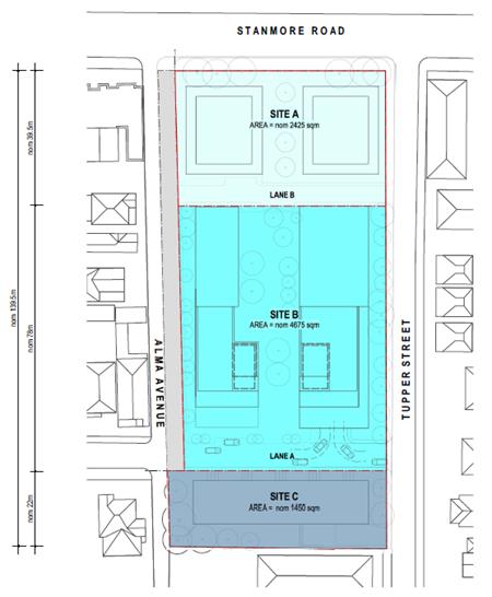
Figure 2: Proposed site layout
- Creation of two laneways between Site A and Site B (Lane B), and Site B and Site C (Lane A) as shown in Figure 3;
- Basement car parking for residential, commercial and club activities on Site A to be accessed via Lane B;
- Basement car parking for residential uses on Site B to be accessed via Lane A;
- Car parking for Site C to be accessed via Tupper Street; and
- Widening of Alma Avenue from Stanmore Road up to the northern alignment of Site C.
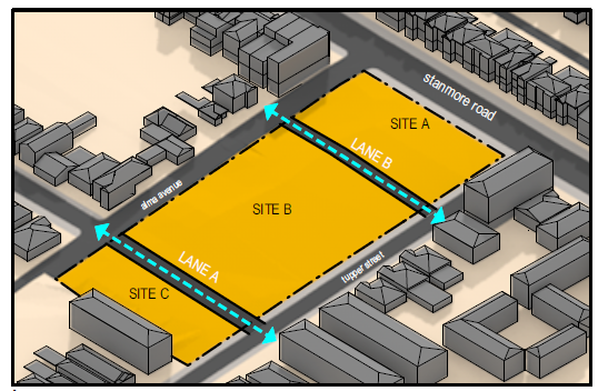
Figure 3: Proposed development including laneways and buildings
- Site A to contain a new club facility (Building B), commercial premises (Building A) and residential flat buildings (Buildings A and B) up to 5 storeys in height;
- Site B to contain two residential flat buildings up to 8 storeys in height; and
- Site C to contain attached dwellings up to 4 storeys in height as shown in Figure 4.
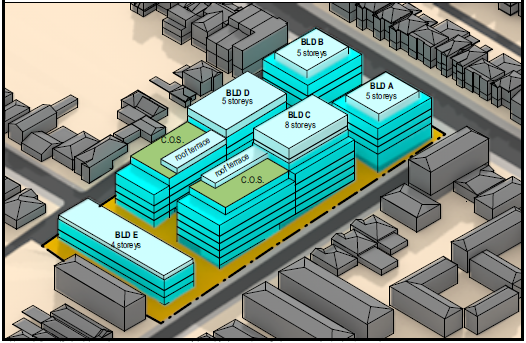
Figure 4: Proposed buildings locations and heights
A summary of the proposal for each site is included in Table 1 below:
|
PROPOSED |
Site A |
Site B |
Site C |
|
Land Use zone (proposed) |
B4 Mixed Use |
R1 General Residential |
R1 General Residential |
|
Uses |
Building A – club and residential Building B – commercial and residential |
Residential (residential flat buildings) |
Residential (terraces) |
|
Height of Building (maximum) |
21 metres |
28 metres |
14 metres |
|
Height in storeys (maximum) |
Building A – 5 storeys Building B – 5 storeys |
Building C –8 storeys Building D –5 storeys |
4 storeys |
|
Site Area |
2,425m² |
4,675m² |
1,450m² |
|
Gross Floor Area |
4,250m² |
9,350m² |
2,100m² |
|
Floor Space Ratio (excluding car parking) |
1.75:1 |
2.0:1 |
1.84:1 |
Table 1: Summary of proposal for each proposed site
The proposal includes the provision of a public plaza located between Buildings A and B on Site A which will also serve as an access point into Buildings A and B. Communal and private open space is to be provided between Buildings C and D on Site B. The revised scheme also shows common open space provided to the rooftop areas of Buildings C and D. This space is not proposed to be publicly accessible. Figure 5 shows the proposed open space areas within the site.
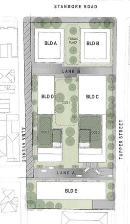
Figure 5: Proposed open space areas
The subject site is not a listed heritage item nor contained within a heritage conservation area. The site is located adjacent to a Heritage Conservation Area located on the northern side of Stanmore Road (Kingston South Heritage Conservation Area No. 17). It is also located adjacent to existing Heritage Items at 6 Alma Avenue (Item No. I29) and 61-75 Stanmore Road (Item No. I242).
Comment
Intensification of development on the site is supported as currently the site is underutilised. The division of the site into three seperate sites is also supported as it would create improved accessibility through the site and assist access for the wider area, and assist to break up the bulk of the development.
Land Use Zoning
The subject site is currently zoned RE2 Private Recreation (58-76 Stanmore Road, 3-9 Alma Avenue and 20 Tupper Street), SP2 Electricity Supply (electrical substation fronting Alma Avenue) and R2 Low Density Residential (2-14 Tupper Street) under MLEP 2011 as shown in Figure 6 below.
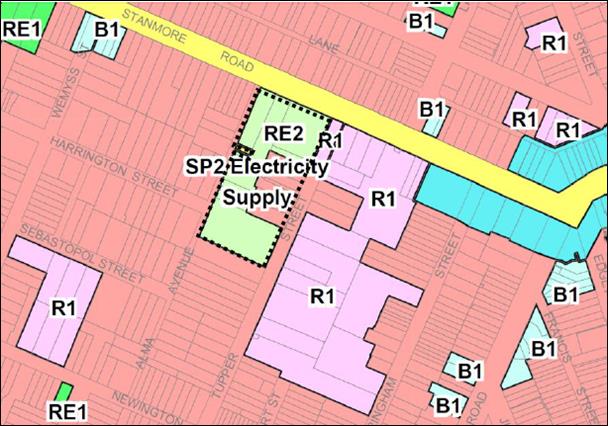
Figure 6: MLEP 2011 Current land zoning of subject site and environs
The planning proposal request seeks to rezone the land to B4 Mixed Use and R1 General Residential. Figure 7 shows the proposed zoning for the site sought in the planning proposal.

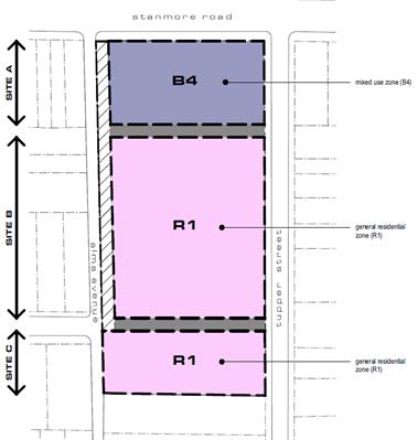
Figure 7: Proposed land use zoning for subject site
The MLEP 2011 objectives for the B4 Mixed Use and R1 General Residential zones are as follows:
B4 Mixed Use
- To provide a mixture of compatible land uses.
- To integrate suitable business, office, residential, retail and other development in accessible locations so as to maximise public transport patronage and encourage walking and cycling.
- To support the renewal of specific areas by providing for a broad range of services and employment uses in development which display good design.
- To promote commercial uses by limiting housing.
- To enable a purpose built dwelling house to be used in certain circumstances as a dwelling house.
- To constrain parking and restrict car use.
R1 General Residential
- To provide for the housing needs of the community.
- To provide for a variety of housing types and densities.
- To enable other land uses that provide facilities or services to meet the day to day needs of residents.
- To provide for retail premises in existing buildings designed and constructed for commercial purposes.
- To provide for office premises in existing buildings designed and constructed for commercial purposes or as part of the conversion of existing industrial or warehouse buildings.
Comment
Proposed B4 Mixed Use zoning for Site A
The B4 Mixed Use zone generally supports the uses proposed within the planning proposal. However, the B4 Mixed Use zone does not permit new residential accommodation in a form other than ‘shop top housing’ which is defined as:
shop top housing means one or more dwellings located above ground floor retail premises or business premises.
Building B on Site A proposes a residential flat building above a registered club. A registered club is defined as:
registered club means a club that holds a club licence under the Liquor Act 2007.
Whilst registered clubs are permitted with consent in the B4 Mixed Use zone, a ‘registered club’ is not a type of ‘retail premises’ or ‘business premises’ and, consequently, Building B would not fall under the definition of ‘shop top housing’ within MLEP 2011. Building B would be considered a ‘mixed use’ development incorporating a ‘registered club’ and a ‘residential flat building’. As ‘residential flat buildings’ are prohibited in the B4 Mixed Use zone, a Schedule 1 inclusion to permit a ‘residential flat building’ as part of a mixed use development would be required to apply to Site A to facilitate the proposed development on that land.
To ensure the proposed building typologies are permissible in the B4 Mixed Use zone, it is recommended that a Schedule 1 additional permitted use be added to MLEP 2011 as follows:
22 Use of certain land at 58-76 Stanmore Road, Stanmore
(1) This clause applies to land at 58-76 Stanmore Road, Stanmore, shown coloured blue and identified as “K” on the Key Sites Map.
(2) Development for the purpose of a residential flat building is permitted with consent, but only as part of a mixed use development.
Proposed R1 General Residential zoning for Sites B and C
The R1 General Residential zone aims to provide a variety of housing types and densities to service the needs of the community. Site B contains two residential flat buildings which are permissible within the R1 General Residential zone. This zone also permits other forms of residential accommodation including attached dwellings and multi dwelling housing. That zone is considered appropriate for the development proposed on that part of the site referred to as Site B.
The proposed built form for Site C is for terrace housing. It is considered that that built form would provide an acceptable interface between Site C and adjoining properties. It is recommended that the planning proposal be amended to zone Site C as R3 Medium Density Residential to reflect the proposed built form outcome for the site. The R3 Medium Density Residential zone permits attached dwellings and multi dwelling housing with consent, but does not permit residential flat buildings.
It is recommended that the planning proposal be amended to reflect a R3 Medium Density Residential zoning for Site C to limit the built form for that part of the site to terrace housing, which is considered a suitable response for that part of the site.
Height of Buildings
Currently, two height of building controls apply to the subject land under MLEP 2011. A Height of Building control of 9.5 metres applies to the residential dwellings facing Tupper Street known as 4-14 Tupper Street and a Height of Building control of 14 metres applies to the remainder of the site, with the exception of a strip of land fronting Alma Avenue). No Height of Building control applies to the land required for the future road widening of Alma Avenue.
The current and proposed Height of Building controls for the site are included at Figure 8.
KEY: J = 9.5m, N = 14m, N1= 16m, P1= 19m, Q1=21m, Q2=22m, T1A= 28m
Figure 8: Current Height of Building control for the site under MLEP 2011 and Height of Building controls proposed
The planning proposal request includes a range of building heights from 14 metres to 28 metres to accommodate buildings of up to 8 storeys on the north eastern part of Site B.
The site contains a considerable slope falling from the Stanmore Road frontage to the rear of the site. The proposed building height controls have been considered taking into consideration the topography of the site. Accordingly, this report looks at the proposed height of building controls as well as building heights in storeys.
Comment
This matter was assessed in detail by the Architectural Excellence Panel (AEP) and is discussed further in this report.
The central portion of Site B is proposed for a 28 metre Height of Building control (T1A). That height is considered excessive in the context of the site and would potentially allow an 8 storey building to be developed on that part of the site. Prior to public exhibition, this proposed height needs to reduced as per the recommendation of this report. This matter is addressed in detail later in the report.
The Height of Building control proposed for Site C is 14 metres. As detailed previously it is recommended that the zoning for Site C be amended from R1 General Residential as proposed to R3 Medium Density Residential. The proponent has previously been advised that the “proposed four storey built form” on Site C is not supported.
The 14 metre Height of Building (HOB) control proposed for Site C is inappropriate for a R3 Medium Density Residential zone which permits multi dwelling housing (vertical dwellings) as opposed to residential flat buildings (horizontal dwellings).
Such a height control is also considered an inappropriate transition to the residential zoned land to the south which has a 9.5 metre Height of Building control under MLEP 2011. The recommended maximum Height of Building control for Site C is 11 metres. Prior to public exhibition, this proposed height for Site C needs to reduced as per the recommendation of this report.
Floor Space Ratio
The current Floor Space Ratio controls for the site are included at Figure 9.
KEY: F = 0.6:1 (subject to clause 4.4 of MLEP 2011)
Figure 9: Current Floor Space Ratio control for the site under MLEP 2011
Note: As part of the planning proposal known as Marrickville Local Environmental Plan 2011 (Amendment No. 4) the former Marrickville Council resolved to delete the floor space ratio along the Alma Street frontage of the property 20 Tupper Street proposed to be reserved for Local Road (SP2) purposes.
The proposed floor space ratio for the site is 1.84:1, however the actual floor space ratio for Site A, Site B and Site C varies signficantly (see Table 1). The final resolution of floor space ratio on the site (Site A, Site B and Site C) will be dependent on the resolution of the maximum Height of Building controls to be applied across the site.
It is recommended that a separate FSR be set for each of the proposed sections (Site A, Site B and Site C) to ensure that the more sensitive interface areas remain low density development areas.
Architectural Excellence Panel
Pre planning proposal advice was provided to the applicant in December 2015 (see ATTACHMENT 3). The AEP considered the application and held an on-site meeting on 28 June 2016. The AEP report on the proposal makes a number of recommendations (see ATTACHMENT 4). An issues letter was sent to the applicant in December 2016. It included, amongst other things, issues raised by the AEP in their advice. Council received a response letter which was forwarded to the AEP for their further consideration in March 2017 (see ATTACHMENT 5). The response from the applicant did not involve major modifications to the proposal.
A further meeting was held in June 2017 when the applicant provided additional information responding in more detail to the AEP’s comments for the site (see ATTACHMENT 6). The information submitted at this meeting has considered the AEP’s comments but does not completely align with the advice from the AEP. Accordingly, this report recommends approval of the planning proposal subject to amendments to ensure it more closely aligns with the AEP’s advice.
The AEP’s March 2017 advice regarding the application and the additional information provided by the applicant is discussed below.
1. Site-specific Development Control Plan: The preparation of a site-specific DCP, revision of the urban design report and preparation of a vision statement post-Gateway is supported.
Comment
This report includes a recommendation for the development of site specific development controls to include matters raised in this report. Inconsistencies exist in the documentation attached to the planning proposal application. These need to be addressed and rectified prior to the public exhibition of the planning proposal.
2. Car Parking: Panel’s recommendations regarding minimisation of onsite car parking remain the same as provided in the report dated 8 July 2016. In addition, the Panel is of the view that the proposed car parking podium results in a poor streetscape and built form outcome and should be reconsidered. Any area of car parking space (podium) that sits more than 1.0m above existing Ground Level should be counted as GFA and as a floor level.
Comment
The quantum of car parking provided will be resolved at the development application stage. However, it is agreed that the current proposal’s inclusion of extensive underground parking impacts upon the overall design options for the site, particularly in relation to opportunities for deep soil planting and building response to the slope of the site. Accordingly, the site specific DCP controls will, amongst other matters, seek to limit parking to the amount required for the development under the provisions of Part 2.10 of MDCP 2011.
The proposed extrusion of the podium elements will vary across the site depending on the fall of the land. These have the potential to lead to poor built form outcomes, as noted by the AEP. The application should seek to not only minimise the occurrence of those podiums, but also seek to minimise their visual impacts on the development and the surrounding area. The applicant will also need to demonstrate that those podium structures do not impact upon pedestrian movement and accessibility through the site.
Accordingly, it is agreed that any podium element of the building sitting higher than 1.0 metre above existing ground level be counted as a floor level as it will impact upon the bulk and scale of the buildings. The applicant will need to demonstrate that the podiums will not have unreasonable visual or accessibility impacts. Those requirements will be included within the site specific DCP.
3. Setbacks:
a. Buildings A and B: side setback to Building A (corner with Alma Avenue) and Building B (corner with Tupper Street) to be 2.0m wide to provide some relief to the streets, greater separation from adjoining period buildings, potentially wider footpath, and to create opportunities for landscaping. Front setback to Stanmore Road boundary should be determined to ensure that the existing trees and roots are protected from excavation works. Although the appropriate setback (4.5m or greater) should be determined by Council’s tree officer, from a streetscape perspective, the Panel recommends the front setback to Buildings A and B to be consistent.
b. Building C: front setback to Tupper Street to be 5.0m to ensure some consistency with the existing streetscape character and allow the provision of a well-sized front yard to the Ground Level units, tree planting and landscaping.
c. Building D: front setback to Alma Avenue to be 3.0m to ensure consistency with the existing streetscape character of nearby streets, provide adequate separation and visual relief between new higher-density buildings and existing low-density buildings along Alma Avenue (particularly given that Alma Avenue will be 10.0m wide only) and allow the provision of a small front yard to the Ground Level units and landscaping.
d. Building E: the intent to provide a 3.0m wide front setback to Lane A is supported as this will allow north-facing courtyards/landscaped areas to the terraces and provide visual relief and separation between the buildings fronting the lane. Side setback to Tupper Street to be 5.0m.
Comment
The revised scheme presented to Council at the June 2017 meeting aligns with the AEP’s setback recommendations for the site.
The proposed lower setbacks are shown in Figure 10 below:
Figure 10: Proposed setbacks for lower levels
Those setbacks align with the AEP’s recommendations. However the setback of Building E from Alma Avenue is shown based on the current alignment of Alma Avenue. As discussed later in this report Council’s Development Engineer has indicated that Council will require the widening of Alma Avenue for the full length of the subject site. The setback of Building E from Alma Avenue should be a minimum of 3 metres from Alma Avenue (after widening).
Accordingly, it is recommended that the site specific DCP include the following setbacks:
|
Location |
Setbacks |
|
Site A |
Minimum front setback to Stanmore Road to ensure existing trees and roots are protected from excavation works to be determined by Council’s Investigation and Design Team Minimum setback of 2 metres from Alma Avenue (after widening) and Tupper Street |
|
Site B |
Minimum 5 metres to Tupper Street Minimum 3 metres to Alma Avenue (after widening) |
|
Site C |
Minimum 3 metres to Lane A Minimum 5 metre setback to Tupper Street Minimum 3 metres to Alma Avenue (after widening) |
4. Heights and FSR:
e. The Panel maintains its view that an 8 to 9-storey building on the subject site is over-scaled and does not fit with the existing context nor the desired future character for the area. It is recommended that building heights are as follows:
i. Buildings A and B: maximum of 4-storeys (14m).
ii. Building C: maximum of 5-storeys with a six-storey element set back a minimum of 3.0m from Tupper Street front boundary and 6.0m from Lane A side boundary.
iii. Building D: maximum of 4-storeys (14m).
iv. Building E: maximum of 3-storeys (11m).
Comment
A revised scheme for the planning proposal was submitted by the proponent during a meeting with officers in June 2017 and is included as ATTACHMENT 7 to this report. The comments below respond to the revised scheme and the advice provided by the AEP in relation to the proposal.
Buildings A and B: The revised scheme proposes a 5 storey built form for Buildings A and B, with the 5th storey recessed 3 metres on all sides. Although this is in excess of the 4 storey limit recommended by the AEP, it is considered suitable due to its Stanmore Road frontage. A control is to be included in the site specific planning controls for the site to minimise the visual impact of balconies or other structures on the building facades, particularly to the recessed 5th storey element.
Buildings C and D: The revised scheme proposed a maximum 8 storey built form for Building C and a maximum 5 storey built form for Building D. Both those proposed heights are in excess of the recommendation provided by the AEP. It is considered that the AEP recommendation for Building C (maximum of 5-storeys with a six-storey element set back a minimum of 3.0m from the Tupper Street front boundary and 6.0m from Lane A side boundary) is the appropriate response within the context of this building. The applicant has not provided justification for the additional height proposed for this part of the site. It is considered that an 8 storey built form would be out of keeping with the predominant character for the area which is a mix of dwelling houses and lower scale residential flat buildings.
Accordingly, the proposed 28m height of building control for this part of the site is not supported. This report recommends the planning proposal be amended to be consistent with the AEP’s advice in relation to Building C.
Building D shows a maximum 5 storey built form. The AEP’s advice was for this building to be a maximum of 4 storeys in height. However, as the applicant has agreed to the proposed setbacks for this building from Alma Avenue, it is considered a reasonable outcome for that part of the site. The widening of Alma Avenue in addition to the setback will provide sufficient relief for the building addressing Alma Avenue. In order to minimise the visual impact of the building, it is recommended that the upper levels be recessed 3 metres from its Alma Avenue elevation.
On balance, the proposed height of building control and built form for Building D is supported. Controls limiting the building to 5 storeys and requiring a 3 metre setback of upper floor levels will be included in the site specific development controls.
The revised scheme for Buildings C and D also show common open space and associate roof terraces on parts of the buildings. The applicant will need to ensure that any roof structure, including plant and lift overruns, are fully contained within the proposed height of building controls.
Building E: The revised scheme for Building E shows a 4 storey built form. This is more than the maximum recommended by the AEP. The proposed 4 storey built form for this part of the site is not supported. That part of the site is located adjacent to a 3 storey residential flat building (above ground level parking), which although orientated towards Tupper Street, contains a long, northerly orientated side wall, including balconies. A 4 storey built form on that part of the site has the potential to affect the amenity of the residential flat building on the property 22 Tupper Street. A 3 storey built form and 11 metre height of building control is considered more appropriate to provide a suitable interface between the subject site and adjoining areas. The recommended R3 Medium Density Residential zone will prohibit residential flat buildings on this part of the site, thereby providing more variety in building typology.
The proposed development controls for the building heights are as follows:
|
Building |
Building height in storeys |
|
|
Site A |
Building A |
Maximum 5 storeys with the top storey setback a minimum of 3 metres on all sides from the external wall of the floor below |
|
Building B |
Maximum 5 storeys with top storey setback a minimum 3 metres on all sides from the external wall of the floor below |
|
|
Site B |
Building C |
Maximum 6 storeys with the top storey set back a minimum of 3 metres from the Tupper Street external wall of the floor below and a minimum of 6 metres from the Lane A external wall of the floor below |
|
Building D |
Maximum 5 storeys with the top storey setback a minimum of 3 metres from the Alma Avenue external wall of the floor below |
|
|
Site C |
Building E |
Maximum 3 storeys |
The final building heights may be impacted by Sydney Airport and Civil Aviation Safety Authority in light of the proposal’s breach of the Obstacle Limitation Surface (OLS) to ensure the safe operations of Sydney Airport. The OLS places a maximum height of 51 metres above Australian Height Datum (AHD) for the site. Under the current proposal, the development breaches that limit. Should the planning proposal obtain Gateway approval consultation with Sydney Airport and the Commonwealth should be required.
f. The Panel does not view favourably the provision of a car parking podium and is of the view that the podium will create unreasonable bulk, height and amenity impacts to the streetscape. If a car parking podium is inevitable in some points, the podium should be no higher than 1.0m from the existing ground level.
Comment
As stated previously, a control will be included in the site specific DCP controls limiting the extent to which car parking podiums can extrude out of existing ground level before they are counted as a building floor. It may not be possible for the proponent to limit the podiums to a maximum of 1.0 metre in parts due to the need to provide enough height for vehicles to safely access the basement car parks. However, the applicant will be required to minimise where these extrusions occur and ensure their impacts are reasonable, managed and integrated into the overall site and building design.
g. In the Panel’s experience, a single height and FSR limit across the site could potentially create several problems for Council at DA stage. It is recommended that the LEP indicates separate height limits (in metres - measured from existing ground level) and FSR for Sites A, B and C. Site B is 60m wide and the Panel recommends the height limit to Site B be split in two portions that are 30m in width each. The portion fronting Alma Avenue to be 14m high (4-storeys maximum) and the one fronting Tupper Street to be 20m high (6-storeys maximum). Heights for Sites A and C to be 14m and 11m, respectively.
Comment
It is agreed that the controls should be nuanced across the site to reflect the desired built form outcomes. This approach is consistent with the original application which seeks different building height controls across the site. The division of the site into three distinct lots makes it easier to express different height of building controls.
The issue of building heights has been discussed previously in this report.
h. The proposal does not adequately demonstrate how GFA and FSR have been calculated. In drawing number PP403, it is unclear whether the lanes have been included in the calculations and if so, on which site (gross FSR, net FSR or net-net FSR?). Detailed GFA/FSR calculation plans should be provided. Amendments to FSR calculation will be required to address the recommendations for height and setbacks discussed above.
Comment
The amendments recommended in this report will result in amendments to the GFA and FSR calculation for the site. The planning proposal documentation will require amendment prior to the public exhibition process, including demonstrating how the proposed FSR has been calculated. The FSR for the site can be determined prior to a public exhibition process should the proposal receive a favourable Gateway determination.
i. There appears to be some inconsistencies between the height diagrams, 3Ds, architectural plans and FSR calculations.
Comment
The applicant will be required to update their documentation and ensure consistency between documents prior to any public exhibition process.
5. Lanes:
a. As stated by the Panel previously, street connectivity and pedestrian permeability through the provision of two east-west lanes (Lanes A and B) and the widening of Alma Avenue are the aspects of the proposal that have developed most since Pre-Planning Proposal and are considered good public benefits associated with the Planning Proposal. In order to give greater certainty to Council that the lanes and road widening will be implemented, it is recommended that, in addition to the inclusion of these elements in a site-specific DCP, a VPA agreement is entered between Council and the proponent.
Comment
The proposed site permeability and laneways to enhance connectivity are strongly supported. Council’s Development Engineer has reviewed the proposal and advised that:
· Lane A (7m wide) is supported as a two-way public road. It shall be an extension of Harrington Street with the two road pavements aligning (kerb to kerb);
· Lane B (5m wide) is supported as a one-way (Alma Avenue to Tupper Street) private road with a public right of way created over the road.
The revised scheme presented to Council in June 2017 is not proposing to widen Alma Avenue to full length of the site. Council’s Development Engineer has indicated that Council will require the widening of Alma Avenue for the full length of the subject site.
The site specific DCP will make reference to the laneways consistent with the advice of the AEP and Council’s Development Engineer. A VPA is to be negotiated separately to the assessment of this planning proposal as per Council’s Interim VPA policy.
6. Deep soil zones, tree planting and landscaping:
a. A clear strategy to establish a robust urban tree canopy and Ground Level deep soil zones for the site should be provided at Planning Proposal stage and should be included in the site-specific DCP. Most likely, opportunities for tree planting will occur on the streets (if footpaths are wide enough to accommodate them) or on front setbacks (provided that the basement car parking is designed accordingly). The Panel recommends that, if ‘deep soil planter boxes’ are provided, it should be part of a comprehensive landscape proposal.
Comment
This report recommends the proposed site specific development controls include requirements to maximise the provision of deep soil planting on site. This may require amendments to the extent of the proposed basement car parking, which would also assist in minimising basement extrusions.
Council’s Tree Management Officer has reviewed the landscape plans submitted with the application and noted that the proposal includes the retention and protection of some high retention value trees along the property’s Stanmore Road frontage. However, it is noted that there appears to be major encroachment by the proposed development into the tree protection zones (TPZ) that fringes into the structural root zones (SRZ) of those trees, due to excavation for basement level car parking. This clearly exceeds the minor 10% encroachment within the TPZ as suggested by the project’s arborist. Consequently, it has not been demonstrated that trees proposed for retention will remain viable beyond the completion of the development and/or demonstrated appropriate strategies to minimise impacts upon the trees.
Adequate and appropriate compensatory tree planting and landscaping will be required as part of the development of the site.
7. Design Competition: given the scale and importance of the project, it is recommended that an urban designer, an architect and a landscape architect are involved throughout the Planning Proposal process. Additionally, it is recommended that a condition of consent at Planning Proposal stage be included (should the PP is approved) requesting the engagement of an urban designer and two to three different architects at Pre-DA and DA stages.
Comment
This comment is noted.
8. Further urban design recommendations can be provided for the Site-specific DCP.
Additional DCP controls
In addition to other controls which have been discussed in this report or otherwise apply to the land, the following matters are recommended to be included within the proposed site specific DCP controls:
Access and permeability
The current proposal provides accessibility improvements through the site via the inclusion of two new laneways and a public plaza linked to Stanmore Road. The DCP controls will reinforce the importance of those connections and the need for any proposal on the site to provide publicly accessible links to improve permeability through the site to the benefit of the wider community.
Built form typology
The subject site contains a significant fall from north to south. It is essential that the built form reflects this aspect of the site. The DCP controls will include provisions to ensure the proposed buildings reflect the natural slope of the land by stepping down the slope.
The DCP controls will include the following provisions relating to building design:
- Ensure that new buildings are of exceptional design quality.
- Ensure that new residential development provides good amenity for residents and does not adversely impact on existing surrounding development.
- Variations in parapet walls and/or roof form are required to create a varied skyline.
- The architectural expression and articulation of buildings are to emulate the fine grained built form of the surrounding area.
Public Plaza
The DCP controls will contain the following requirements for the plaza space:
- The plaza design to be configured to provide intimacy of the human scale amenity inclusions including seating, large canopy shade tree plantings and the addition of softscape planting.
- Public through site links between Lane B and Stanmore Road via the plaza are to be provided.
- Planting within the plaza must finish flush with pavement surface.
- If planting is on slab, trees will require 1.0m soil depth, 75mm minimum mulch plus drainage material.
- Planting on slab will require irrigation from a non-potable supply.
- Pavement materials must be a high quality stone.
Landscaping, Open Space and Biodiversity
More detailed landscaping and open space plans will be required as part of any development application for the site. Site specific controls will seek to maximise the coverage of landscaping, particularly deep soil plantings, across the site. This may involve a reduction in the amount of basement car parking proposed for the site. It will also include controls for canopy tree planting along street frontages.
Lot Subdivision
- At the end of the design and approval process there should be a re-subdivision of the site into smaller lots (Sites A, B and C).
- Basement car parking should be designed in accordance with the proposed lot subdivision.
- The site should not result in a single community or strata title scheme.
Traffic and Access
Council’s Development Engineer has reviewed the traffic and parking impact assessment that was provided with the planning proposal request.
Contamination
A site investigation report was previously prepared as part of a previous application to Council and was prepared in 2003. The report concluded that the site was suitable for the proposed development of medium to high rise residential dwellings. However, the report did not cover the full extent of the current planning proposal. Specifically, it excluded the residential dwellings on Tupper Street and the substation fronting Alma Avenue. The applicant was requested to update the report to include all properties subject to the planning proposal. The applicant provided the following response:
(i) the properties fronting Tupper Street are already in a residential zone and have a long history of residential use (and therefore unlikely to contain contaminated soils);
(ii) the substation may require more detailed investigation. However, it is the intention to remove the substation and restore the site and we anticipate that contamination investigations and restoration will be part of the requirements in future negotiations with Ausgrid.
The applicant requested that Council agree to the updated assessment being undertaken at the post-Gateway stage due to the costs involved. Council’s Environmental Officer considered the applicant’s request and concluded that the updated detailed site investigation could be deferred given the site’s current and past uses.
Consequently, the matter of contamination will be subject of further investigation should the proposal receive a favourable Gateway determination. It will also be further investigated at the development application stage.
The DCP will contain a requirement that the site be remediated to an acceptable standard to accommodate residential development.
Waste Management
The DCP will note that detailed waste management plans will need to be submitted as part of any development application for the site. The plans will need to include separate bin storage areas for residential and commercial uses, bulky waste/clean up room and waste collection points.
Australian Noise Exposure Forecast (ANEF)
A small portion of the south western part of the site, approximately 328 square metres in area, falls within ANEF 25-30 as shown in Figure 11 below in red hatching.
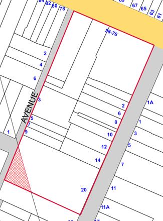
Figure 11: Extent of subject site affected by ANEF 25-30 shown in red hatching
Section 117 Direction 3.5 Development Near Licensed Aerodromes includes the following restriction:
(5) A planning proposal must not rezone land:
(a) for residential purposes, nor increase residential densities in areas where the ANEF, as from time to time advised by that Department of the Commonwealth, exceeds 25, or
(b) for schools, hospitals, churches and theatres where the ANEF exceeds 20, or
(c) for hotels, motels, offices or public buildings where the ANEF exceeds 30.
This Direction is relevant for the planning proposal as part of the site is affected by ANEF contour 25-30. The area of the site affected by ANEF 25-30 is approximately 3.5% of the entire site area. This is considered to be a relatively small portion of the site and, therefore, the inconsistency is considered to be of a minor nature. The applicant will be required to noise attenuate buildings as per Clause 6.6 of the MLEP 2011.
Obstacle Limitation Surface
As noted previously, the subject site is mapped under the Obstacle Limitation Surface (OLS) to ensure the safe operations of Sydney Airport. The OLS places a maximum height of 51 metres above Australian Height Datum (AHD) for the site. Under the current proposal, the development breaches that limit by 4 metres. Clause 6.6 of the MLEP 2011 requires a consent authority to consult with the relevant Commonwealth body before granting development consent for a proposal which breaches the OLS.
The applicant has commenced a Controlled Activity Application due to the proposed breach. Further information will be required to be prepared should the proposal proceed through the Gateway process.
Consistency of Proposed LEP Amendment with Strategic Planning Policies
The following discussion provides an assessment of the proposal against the State Government’s and Council’s strategic planning directions for the former Marrickville LGA.
Draft Central District Plan (2017)
The draft Central District Plan (released in November 2016) contains the following actions: Liveability Priority 1: Deliver Central District’s five year housing targets; and Action L3: Councils to increase housing capacity across the District. The subject site is currently underdeveloped and well located to provide additional housing capacity for the Central District.
The draft plan also contains Liveability Priority 2: Deliver housing diversity. It is essential that, should the planning proposal progress, the resultant development provides a range of residential typologies and also variety in building sizes.
Marrickville Urban Strategy (2007)
The Marrickville Urban Strategy (MUS) was adopted by Council in 2007. It establishes a vision and co-ordinated directions addressing a range of planning, community, and environmental issues, to guide short, medium and long term strategic planning policies for the Marrickville LGA. The MUS was developed in response to employment and housing targets established through the dSSS and its overriding strategy, Sydney Metropolitan Strategy City of Cities, A Plan for Sydney’s Future (December 2005).
The MUS adopted six urban renewal approaches to inform policy options for future residential development within the LGA. These are:
1. Focus on residential density in and around centres;
2. Focus on commercial zoned land in centres;
3. Rezone select industrial sites;
4. Develop new centres;
5. Rezone select special use sites; and
6. Increase density in infill areas.
It is considered that the subject site is consistent with Approach 6 – increase density in infill areas. The MUS states that this approach is suitable where locations are within good access to public transport and open space. The subject site can be identified as an infill area as it is currently underdeveloped and can accommodate additional development. It is also well located, being within close proximity to an existing centre, public transport and open space.
Marrickville Community Strategic Plan 2023
Marrickville Council’s Community Strategic Plan 2023 was adopted by Council in June 2013. The plan sets the desired future direction and priorities for Council over a 10 year period.
The Community Strategic Plan 2023 includes the following action:
3.9 Marrickville’s built environment demonstrates good urban design and the conservation of heritage, as well as social and environmental sustainability
- 3.9.1 Provide effective planning controls to ensure that the built environment reflects community expectations and changing needs, conserves heritage and is socially and environmentally sustainable
FINANCIAL IMPLICATIONS
The Planning Proposal does not result in any cost implications for Council.
The proponent has provided a letter of offer to Council “confirming a commitment to enter into a voluntary planning agreement linked to the potential uplift as well as the public benefits proposed to be delivered directly by the master planned scheme”. The proponent advised that “should the application receive a positive Gateway determination the applicant intends to progress the draft VPA with Council that may be subject to public exhibition concurrently with the draft Planning Proposal.”
Should the proposal receive a positive Gateway Determination, the offer submitted by the applicant will be considered in accordance with Council’s Interim VPA Policy.
A copy of the proponent’s letter is included as ATTACHMENT 8.
OTHER STAFF COMMENTS
Internal referrals were undertaken with the following departments: Architectural Excellence Panel, Development Assessment (Development Engineer), Culture and Recreation, Sustainability and Resource Management, Development Assessment (Trees), Biodiversity. Comments received are discussed in the body of this report.
PUBLIC CONSULTATION
Public consultation will occur as part of the public exhibition of the planning proposal, in accordance with the requirements of the Environmental Planning and Assessment Act 1979.
CONCLUSION
This report considers a planning proposal for land at 58-76 Stanmore Road, 2-20 Tupper Street and 3-9 Alma Avenue, Stanmore to enable its redevelopment into a precinct to include a registered club, commercial spaces and residential accommodation.
On balance, the application is considered to demonstrate strategic merit and in principle support is recommended. However, as detailed within this report, some design modifications are recommended to ensure that the scale and density of the development proposed is reasonable within the context of the area.
It is recommended that Council resolve to seek amendments to the planning proposal outlined in this report to enable it to agree to forward the application to the Department of Planning & Environment for their consideration as part of the Gateway process.
|
1.⇩ |
Planning Report: 58-76 Stanmore Road, 2-20 Tupper Street and 1-9 Alma Avenue, Stanmore |
|
2.⇩ |
Applicant's response to matters raised in Council's letter |
|
3.⇩ |
Pre Planning Proposal advice for 58-76 Stanmore Road, 2-20 Tupper Street and 3-9 Alma Avenue, Stanmore |
|
4.⇩ |
Architectural Excellence Panel Report: June 2016 |
|
5.⇩ |
Architectural Excellence Panel Report: March 2017 |
|
6.⇩ |
Additional information letter from applicant |
|
7.⇩ |
Revised Planning Proposal Scheme: 58-76 Stanmore Road, 2-20 Tupper Street and 3-9 Alma Avenue, Stanmore |
|
8.⇩ |
Letter of offer - Cyprus Club VPA |
|
Council Meeting 25 July 2017 |
Subject: Overview: Planning Proposal for Uniting Care Site at 15-17 Marion Street, Leichhardt
File Ref: 17/6032/77192.17
Prepared By: Gill Dawson - Manager Environment and Urban Planning
Authorised By: Simon Manoski - Group Manager Strategic Planning
|
SUMMARY A planning proposal for the Uniting Care site at 15-17 Marion Street, Leichhardt has been received by Council requesting an amendment to Leichhardt Local Environmental Plan (LEP) 2013. The Proposal aims to redevelop an existing aged care facility. |
|
RECOMMENDATION
THAT Council:-
1. Receive and note this report and attachments; 2. Resolve to support the revised Planning Proposal as outlined in this Report. 3. Resolve to forward the revised Planning Proposal to the Minister for Planning and Environment for a Gateway Determination in accordance with Section 56 of the Environmental Planning and Assessment Act 1979; 4. Delegate the preparation of a revised draft Development Control Plan (DCP) that will reflect the revised Planning Proposal to the General Manager; 5. Upon receipt of the Gateway Determination, the Planning Proposal should be put on public exhibition to meet the requirements of the Environmental Planning and Assessment Act 1979. The revised draft DCP should be exhibited concurrently and public authorities be consulted in accordance with the Gateway Determination; and 6. That a post exhibition report be prepared for Council consideration. |
DISCUSSION
In February 2013 representatives of Uniting Care Ageing (Uniting) met with representatives of Council to discuss general housing issues across the former Leichhardt Municipality and the potential planning options for a number of their Leichhardt (suburb) properties, including Annesley House at 15-17 Marion Street (see image below).
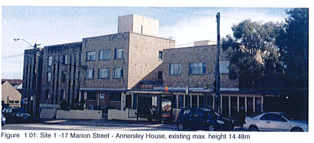
Following this meeting Uniting Care wrote to Council requesting the establishment of a formal process for discussing the future use and planning of two sites, Annesley House and Harold Hawkins Court (18 Norton Street, Leichhardt).
At the April 2013 Council meeting it was resolved (C126/13) to:
“… commence negotiations with Uniting Care Ageing to establish a planning agreement applying to properties at 15-17 Marion St (Annesley House) and 168 Norton St (Harold Hawkins House) to assist the provision of affordable and supported housing at those locations for people of all ages, key workers and people with disabilities. Council’s support for the social benefit enabled through the dedication of these valuable land holdings, and in light of the clearly stated philanthropic intent of Uniting Care Ageing to make a bold intervention assisting the capacity of Leichhardt’s residents to `age in place’, that Council explore opportunities made available to projects on both sites through the granting of density bonuses”.
In August 2013 a report was presented to the Housing Advisory Committee (see HC42/13 and C448/13) outlining progress in relation to the Uniting Care properties.
The report noted that Council staff had begun the process of preparing for the negotiations for establishing an agreement with Uniting Care by identifying the key outcomes Council would like to achieve in relation to the two sites, namely:
· Facilitating the redevelopment of both sites
· Ensuring that redevelopment is financially viable
· Achieving a significant housing outcome in terms of the provision of one or more of the following on each of the sites:
- Modern Aged Housing
- Affordable Housing for Key Workers
- Supported Housing
· Activating the ground level Norton Street frontage
· Providing on-site parking suited to the likely future demand created by tenants
· Ensuring that urban design considerations inform the ultimate building envelope and development footprint and confirm an upper limit in terms of floor area
· Involving the local community and other key stakeholders throughout the process
The report also examined potential formats for an agreement including a Memorandum of Understanding (MOU) and/or Voluntary Planning Agreement (VPA).
In January 2014 Uniting Care Ageing contacted Council and advised that they had reviewed Council resolutions and suggested that Council and Uniting Care should consult the local community as soon as possible. In response local residents were notified in accordance with the provisions of the Notifications DCP and invited to attend a community briefing to obtain information from Council Staff and Uniting Care.
The Community Forum was held in Leichhardt Town Hall on Wednesday 12th March 2014. Members of the Seniors Council’s and Housing Advisory Committee were also invited and a notice was placed on Council’s web site. 62 people attended the forum, the outcome of which confirmed unanimous support for Council working with Uniting Care and the local Uniting Church Congregation to address the housing Issues confronting the local community.
At the May 2014 Council meeting a report and noted (C152/14) was considered documenting the outcomes of the March Community Forum, including:
· All materials presented at the community forum
· Comments and concerns from local residents
· A program for taking the project forward, including confirmation of guiding principles and the development of plans for the future development of three Uniting Care properties in Leichhardt
Two further Community Forums were held in July 2014. Council Staff and consultants Allen Jack + Cottier (AJ+C) presented:
· A history of the sites
· Preliminary Site Analysis
· Site Constraints
· Site Opportunities
· Draft Guiding Principles
Final draft Building Envelopes and development controls were prepared by AJ+C (see Attachment 1) for each of the sites, developed in response to both the Guiding Principles and the discussion/feedback provided during the course of the final Community Forum.
Final outcomes of the Community Forums were reported to Council in September 2014.
In December 2014 Council resolved (C455/14) to authorize the Mayor and General Manager to execute a draft Memorandum of Understanding (MOU), which would include a summary of indicative development controls and anticipated community benefits. All documentation including draft building envelopes (see below) and controls was to be publicly exhibited and attendees of previous community forums notified.
Figures 1, 2 and 3 - Allen Jack + Cottier (AJ+C) Building Envelopes
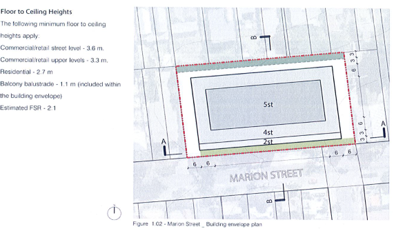
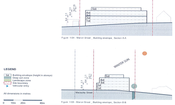
Memorandum of Understanding
On 5 March 2015 Leichhardt Municipal Council and the Uniting Church in Australia Property Trust NSW signed a Memorandum of Understanding (MOU) (see Attachment 2) with respect to three Uniting Aged Care properties in the suburb of Leichhardt.
This MOU includes key principles and objectives, proposed built form controls and anticipated community benefits drawn up in consultation with local residents and endorsed by Council.
Figure 4 – Existing and indicative planning controls, height, land use and community benefits for 15-17 Marion Street, Leichhardt (March 2015)
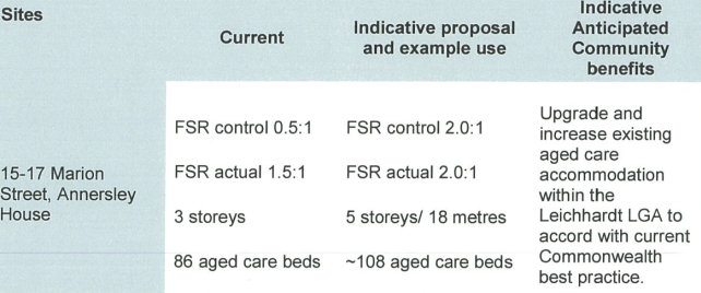
At the MOU stage both parties acknowledged that detailed assessment of site specific opportunities and constraints was lacking and that future planning proposals would determine built form development controls that integrated with the local context and minimized detrimental impacts.
Pre-Planning Proposal
In December 2016 a pre-planning proposal application was lodged with Council for 15-17 Marion Street, Leichhardt, Annersley House.
The initial proposal sought the following controls:
· FSR – 2.5:1
· Height – Maximum height of RL 57.5 (5 storeys)
· Use: Residential Aged Care Facility (90-95 beds) and Independent Living Units (ILUs, total 20 units)
Based on the information in the pre-planning proposal Council raised the following matters the proponent should address prior to lodgment of the Proposal:
· Need for a Social Impact Study (including Net Community Benefit Test covering aged care) - Council and the local community, through extensive public consultation and subsequent drafting of the MOU, agreed that upgrading and increasing the existing aged care accommodation is a desirable community benefit. The MOU includes an indicative 108 aged care beds, an increase of 22 beds (25%+) on the existing provision. The current pre-planning proposal envisages aged bed provision of potentially 90 aged care beds (an increase of 4.6%, over the existing 86 beds) with an additional 20 independent living units (ILUs). It is important to demonstrate and detail the proposed changes to the community benefit, the addition of the ILUs to the development proposal and the required bulk and scale of the building required to facilitate the ILUs compared with aged care beds.
· FSR increase – The pre-planning proposal states that for Uniting Church’s model for seniors housing to be economically feasible a further increase to 2.5:1 (25% increase on the 2:1 MOU agreed control) is necessary. Further justification for this proposed significant increase is required, addressing the ‘model’ and collective economic feasibility in the context of the Uniting Church portfolio of sites in and around Marion / Norton / Wetherill Streets, particularly those covered by the MOU. This further detail should take into consideration any outcomes of the Social Impact Study regarding the make-up of the proposed development i.e. replacement and new aged cared beds versus number of ILUs.
· Building height – Inclusion of a maximum building height RL that establishes a planning control the equivalent of 5 storeys / 18 metres is agreed.
· Building setbacks to Marion Street and adjoining properties – The proposed adjustment to the setback from Marion Street to the 3 storey component of the future built form is inconsistent with the site specific controls set by AJ+C in their report endorsed by Council. The reduced articulation and increased bulk of the building as it presents to Marion Street would have a negative visual impact in general and in this location within the heritage conservation area adjacent to heritage items in particular. The urban design report suggestion that the change of the building to a predominantly 3 storey frontage character to screen more of the 4 storey elements is not recognised as a positive change to the proposed design. Further design work on the west-facing elements of the proposed building is also recommended to ensure that the future built form setback / articulation to the 3 or 4 storey components minimise detrimental amenity impacts upon adjoining properties.
· Communal Open Space and Deep Soil Planting – Communal Open Space to be incorporated in accordance with established guidelines and ideally designed to be integrated with required deep soil planting.
· Compliance with Apartment Design Guide – The Department of Planning has required compliance with ADG controls as a condition of more recent Gateway Determinations and Council will likely request it in this case. The planning proposal should demonstrate compliance with the relevant ADG controls including:
o solar and daylight access
o visual privacy
o deep soil zones
o setbacks
o cross ventilation
o private open space / landscaping
Planning Proposal
In April 2017 the Planning Proposal (see Attachment 3) was lodged with Council for 15-17 Marion Street, Leichhardt, Annersley House.
The Proposal requests an amendment to Leichhardt Local Environmental Plan (LEP) 2013 seeking the following planning controls:
· FSR – 2.4:1
· Height – Maximum height of RL 57.5 (5 storeys)
· Use: Residential Aged Care Facility (90-95 beds) and Independent Living Units (ILUs, total 20 units)
Floor Space Ratio (FSR)
The proposed FSR for the new building is 2.4:1. Still substantially above the indicative FSR of 2:1 under the MOU, the applicant yield analysis states that a feasible and functional seniors living development within the building envelope set by Council’s consultants AJ+C cannot be supported and therefore the increase is necessary.
The Proposal reiterates that the development will replace an old building past its prime with new best practice accommodation for senior members of the community.
The Proposal outlines that the model the development is based upon focuses on allowing seniors to age in place with a high degree of independence (ILUs) as well as allowing for higher levels of care once required (aged care beds). This approach leads to higher floor space requirements and therefore a higher FSR control to facilitate the development.
Use (aged care beds and independent living units (ILUs))
The Social Impact Statement (see Attachment 4) states that in Leichhardt the population of individuals aged 70 years or over currently numbers 4,544. The 70+ years population is expected to grow by approximately 190 people annually for the next 10 years reaching 6,450 people over the age of 70 by the year 2027.
Uniting Care’s internal supply and demand assessment has calculated the following:
|
Residential Aged Care (beds) |
|
NOW Oversupply by 140 beds |
|
2027 Undersupply by 190 beds |
|
Independent Living Units (ILUs) |
|
NOW Undersupply by 121 ILUs |
|
2026 Undersupply by 123-395 ILUs |
The Planning Proposal change from the MOU indicative proposal which showed an increase from 86 aged care beds to 108 aged care beds, to a development mix of 90-95 aged care beds and 20 independent living units is justified by this demand and the Uniting Model of Care providing for ageing in place determines the reduction of aged care bed provision.
Urban Design Report / Draft DCP / Architectural plans
The proponent’s urban design report and diagrams, proposed draft Development Control Plan and architectural plans (see Attachments 5, 6 and 7 respectively) suggest that a higher than MOU floor space ratio (2:1 increased to 2.4:1) and reduced setback (for level 3 facing Marion Street) is required to facilitate the built form and desired mix of aged care beds and independent living units.
The indicative draft plans and proposed development controls (Figures 5, 6 and 7, see below) propose to respond to the desired future scale and character of the streetscape while maintaining amenity for surrounding properties.
Figures 5, 6 and 7 – Planning Proposal building envelope controls for the site
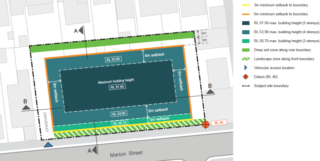
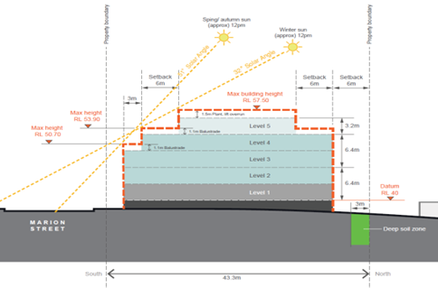
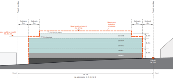
Heritage Impact Statement
The Heritage Impact Statement (HIS, see Attachment 8) acknowledges that the site:
· Is not a heritage item
· Is located within the Whaleyborough Heritage Conservation Area listed in Schedule 5 of Leichhardt Local Environmental Plan (LEP) 2013
· Is in close proximity to the Excelsior Subdivision Heritage Conservation Area
· Is located within close proximity of six heritage items located within the Norton / Marion Street Leichhardt Civic Precinct
The assessment concludes that the proposed planning controls and building envelopes will have no adverse impact on the significance of the heritage items or the heritage conservation areas.
Traffic
The Traffic report (see Attachment 9) has assessed the traffic implications of the proposed development and found the following:
· The proposed development is easily accessible by public transport
· The parking provision will be adequate and appropriate
· Vehicular access and movements can be provided in accordance with relevant Australian standards
· The existing road network will be able to cater for traffic generated by the proposed development
· That the traffic generated by the proposed development will not be noticeable on the surrounding road network
Arborist report
The Arborist report (see Attachment 10) provides an analysis of the impact of the existing development proposal on existing trees and guidance for the removal of some and protective measures for others.
The proposed development will require the removal of seven high category trees and recommends that in order to compensate for loss of amenity consideration should be given to replacement planting within the site.
Voluntary Planning Agreement (VPA)
As of the deadline for reports to be tabled on the July 2017 Council Meeting Agenda no VPA has been provided to Council by the applicant.
Given that there is a proposed change in composition of the development (proposed aged care beds replaced with independent living units) and a proposed uplift in floor space ratio the potential for lodging a VPA offer has been discussed with the applicant, possibly addressing Council’s affordable housing policy.
STAFF COMMENTS
Heritage
Existing status
The site is in the Whaleyborough Heritage Conservation Area and close to the Excelsior Subdivision Heritage Conservation Area (see Figure 8).
This is a conservation area and generally the enforcement of the Area and maintenance of the relevant heritage values and significance will mean little change can be expected other than modest additions and discrete alterations.
It is acknowledged that buildings which do not contribute to the heritage significance of the Area may be replaced with sympathetically designed infill.
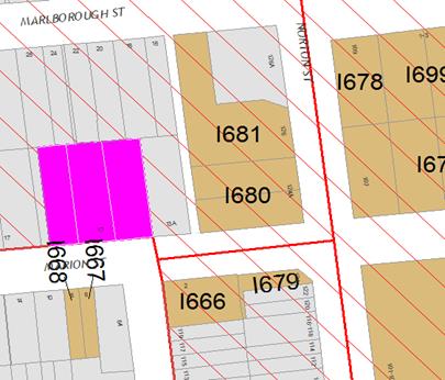
Figure 8 - An excerpt from Inner West Council’s Latitude Maps showing the location of the eastern portion of the subject site (purple highlight) in relation to the nearest heritage items (tan shading). The heritage conservation area is depicted by the red parallel lines.
The site is also located within close proximity of a number of heritage items located within the Norton / Marion Street Leichhardt Civic Precinct. Measures must be taken to ensure that there are no negative impacts upon the adjacent items and if proposed building elements, bulk, scale and design have detrimental impacts these must be mitigated.
The subject property is located within the Leichhardt Development Control Plan West Leichhardt Distinctive Neighbourhood and any amendment to the DCP must not conflict with relevant objectives and standards.
The Heritage Impact Statement (HIS) prepared by City Plan Heritage
In the absence of any information to the contrary, the HIS claim that no significant historic fabric pertaining to the former, historic, partial use of the site, as a corset factory, remains on the site, is accepted. In the event of lodgment of a future development application for the subject site should Council officers determine that historic fabric is present measures to protect this may be implemented as conditions of consent.
The conclusions regarding the acceptability of the development proposal, from a heritage perspective, are not supported:
“The proposed new building envelope is deemed acceptable from a heritage perspective. This will allow for a larger scale development, however, the proposed setbacks will allow for an appropriate distance from the street and surrounding buildings so that any future development has an appropriate curtilage around it. The gradual increase in the setbacks as the building increases in height also ensures any future development is reduced in bulk, providing articulation.”
In this regard, it is considered that additional analyses could be undertaken to ensure the new building on the site integrates into its historic built context including the surrounding heritage conservation areas and adjacent and nearby locally listed heritage items.
Nonetheless, the final recommendations of the HIS are supported, as reproduced below:
· “An archival recording should be conducted to record the Annesley House should demolition be proposed in the future;
· “Any new development should include heritage interpretation that explores the history of the site as a former corset factory (as reported) and as an aged care facility since the 1960s; and
· A separate Heritage Impact Statement will be required for any future proposed development of the site.”
Urban Design Report (Heritage)
The Urban Design Report (UDR) provides informative 3D images and important design principles, which, if properly applied to this site, should ensure that the development proposal sits comfortably within it’s generally, lower scale historic built setting.
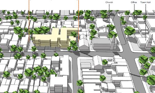
Figure 9 - Existing Development 3D Image.
The 3D image above shows how the existing development, despite its scale, minimises its visual intrusion into the surrounding heritage conservation area by modulating its bulk and scale, both horizontally and vertically. Although not shown in this image the use of brick as the main walling material has also ensured that the building is generally recessive in the streetscape despite its atypical bulk.
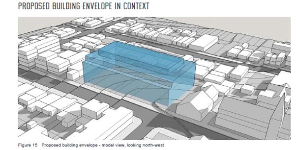
Figure 10 - Proposed Development 3D Image
In contrast with the existing development 3D Image, the proposed building envelope would not achieve the same level of integration because the mass of the proposed building is not sufficiently modulated, either vertically and horizontally. On this matter, it can be seen in the existing development 3D Image, how the widths of each horizontal component of the existing building roughly corresponds to the general width of the historic built forms located opposite in Marion Street, which also form part of the Excelsior Estate Conservation Area. Furthermore the slope of the site (down towards the west) provides opportunity to modulate the distinctively large proposed structure by stepping different components of the building down the slope, so that the two ends of the structure, and rear of the building better integrate with the lower scale buildings to the east, west, and north. This approach would be consistent with the urban design principles submitted by the applicant and with the relevant Leichhardt Development Control Plan Desired Future Character design principles as follows:
C3. Preserve and enhance the predominant scale and character of dwellings in this precinct, consisting of mostly single storey Victorian and Federation-style dwellings, with more dense development in appropriate areas.
C6. Allow for contemporary development, which is complementary to the existing streetscape.
C7. Preserve the consistency of the subdivision pattern in this area.
C8. Maintain existing views by stepping dwellings down contours along east/west streets.”
Similarly Figure 11 (see below, pg. 20, Urban Design Principles) shows a desirable vertical integration between the subject site and adjacent low scale adjoining premises which will not be satisfied by the proposed building envelope.
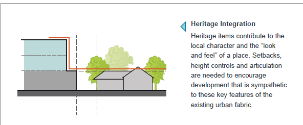
Figure 11 – Planning Proposal Urban Design Principle
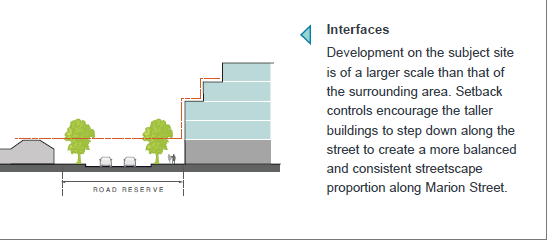
Figure 12 – Planning Proposal Urban Design Principle
Any future DCP controls addressing urban design should ensure that:
· the building is broken up into component parts that better respond to the predominant widths/forms of surrounding buildings; and
· the slope of the site and the scale of adjoining buildings on the edges and to the rear are taken into consideration when developing appropriate setbacks.
Draft Development Control Plan (Heritage)
The ‘Building height’, ‘Building setbacks, separation and articulation’, and ‘Building materials and finishes’ sections do not adequately respond to or address the heritage conservation area setting of the property, or incorporate desirable heritage sensitive design principles (see Urban Design (Heritage) comments). The ‘Building height’ section of the draft DCP needs to be modified to show how the building should step down the slope to the west and how the eastern and western edges of the building should be lowered to better respond to the lower scale historic buildings on the eastern and western side property boundaries. Desirably, the rear section of the building, fronting the rear boundary, should also better respond to lower scale contributory buildings to the north.
The ‘Building setbacks, separation and articulation’ section of the draft DCP needs to acknowledge the historical built context of the site and clearly show how this is to be satisfactorily responded to in the future development of the property by breaking up the building into component parts which correspond to the width of historic buildings on the opposite side of Marion Street. The ‘Building materials and finishes’ section needs to set specific parameters for materials that ensure satisfactory integration with the historic built context. The use of distinctively modern off-form concrete, glass, steel, aluminium and other metallic materials such as walling is discouraged. The long established built character of this locality demands the use of predominantly brick walls, vertical timber or metal balustrades to balconies, vertically proportioned light to mid toned timber window and door frames and a solid to glazing ratio similar to historic properties in the locality.
Based upon the assessment of Council officers the draft DCP lodged with the Proposal cannot be supported in its current form and it is recommended that it be amended to ensure that the proposed building/buildings on the subject site better integrate with the surrounding heritage conservation areas and locally listed heritage items.
Assessments
Building Articulation
· The proposed DCP controls will not achieve sufficient articulation. The block plan is very horizontal and without DCP instruction may present a façade/wall to Marion Street (and to the rear) that negatively impacts upon the existing streetscape. Requiring balconies does not guarantee the level of articulation required to reinforce the local character. Some articulation of the building footprint itself would achieve better integration with surrounding structures as required for heritage reasons.
· Additional setbacks to the upper levels are required, especially to the west and north. The proposed addition of large independent living units on levels 4 and 5 with large outdoor terraces will significantly increase the loss of amenity to surrounding residential dwellings.
· The building envelope, urban design principles and relevant draft DCP diagrams should be revised otherwise the building will present a bulk and scale that does not integrate with the surrounding built form and streetscape. This will detract from the dominance of the church/school/town hall node as pedestrians or vehicles approach the site via Norton Street or east to west along Marion Street.
· The Concept Sketch (see Attachment 11) artist representation overstates the visual role of the church/town hall node as viewed from west to east along Marion Street, the visual impact of how the building presents to the south is likely to be far greater, and greater still if the setback to the third level is reduced.
Landscape
The following requirements have been drawn up following review of the arborist report and are to be incorporated into the future draft development control plan.
· Reasonable sized trees (6m) in the front setback of 3m to Marion Street with gardens.
· Larger scale street trees to Marion Street to match the existing heights of street trees.
· Some larger scale trees on the northern boundary to soften the building.
· These should be included in a detailed landscape plan.
· Arborist advice required to retain and protect the existing trees.
· Small scale trees and gardens to the eastern boundary of the site.
Infrastructure / Engineers
Any site specific DCP should be consistent with the parking, traffic, stormwater and waste collection sections of the current Leichhardt Development Control Plan.
CONCLUSION
The proponent has proposed a larger building with a higher FSR than the built form established with Leichhardt Council through community forums, development principles devised by Council’s urban designers AJ+C and in the Uniting Care / Council Memorandum of Understanding (MOU). Consequently the Planning Proposal should be amended to reflect the FSR of 2:1 stated in the MOU prior to its submission to the Gateway. The draft DCP also needs to be amended to take account of the prospective revised Planning Proposal prior to the exhibition of both.
|
1.⇩ |
Site Specific Controls for 3 sites |
|
2.⇩ |
Memorandum of Understanding (MOU, March 2015) |
|
3.⇩ |
Planning Proposal |
|
4.⇩ |
Social Impact Statement |
|
5.⇩ |
Urban Design Report |
|
6.⇩ |
Draft DCP |
|
7.⇩ |
Architectural Plans |
|
8.⇩ |
Heritage Impact Statement |
|
9.⇩ |
Traffic Report |
|
10.⇩ |
Arborist Report |
|
11.⇩ |
Concept Sketch Plan |
|
Council Meeting 25 July 2017 |
Subject: Planning Proposal and Draft Development Control Plan - 168 Norton Street Leichhardt: Community Consultation Outcomes
File Ref: 17/6032/77205.17
Prepared By: Gill Dawson - Manager Environment and Urban Planning
Authorised By: Simon Manoski - Group Manager Strategic Planning
|
SUMMARY The purpose of this report is to advise Council of the outcomes of community consultation undertaken for a Planning Proposal at 168 Norton Street, Leichhardt and associated draft Development Control Plan 2013 (DCP) amendment. This report also seeks endorsement from Council to proceed to finalising the amendment to Leichhardt Local Environmental Plan 2013 (LEP) and amendment of the DCP. |
|
RECOMMENDATION THAT Council:
1. Amend the Leichhardt Local Environmental Plan 2013 at 168 Norton Street as detailed in the exhibited Planning Proposal; 2. Liaise with the Parliamentary Counsel's Office and the Department of Planning and Environment to draft and finalise the LEP amendment; 3. Delegate the making of the LEP amendment to the General Manager; 4. Following the completion of (3) above, request the Department of Planning and Environment to notify the Plan; and 5. Delegate the adoption of the revised draft Development Control Plan for 168 Norton Street as detailed in this report to the General Manager. |
DISCUSSION
At its meeting of 28 February 2017, Council resolved (C0217 Item 3) the following in relation to the subject Planning Proposal:
1. The attached Planning Proposal be forwarded to the Minister for Planning for a Gateway determination in accordance with Section 56 of the Environmental Planning & Assessment Act 1979;
2. The Department of Planning and Environment be requested to delegate the plan making functions, in relation to the subject Planning Proposal, to Council;
3. Following receipt of a Gateway determination, and compliance with any conditions and following the required changes being made by the Proponent, the Planning Proposal and supporting documentation be placed on public exhibition for a minimum of 28 days and public authorities be consulted on the Planning Proposal in accordance with the Gateway determination; and
4. A report be presented to Council at the completion of the public exhibition period detailing submissions received and the outcome of consultation with public authorities.
The report considered by Council on 28 February 2017 is included as Attachment 1.
The Planning Proposal seeks to amend LEP 2013 to enable the redevelopment of the former Harold Hawkins Court boarding house at 168 Norton Street, Leichhardt for a seniors housing, mixed use development with affordable residential units, an active street frontage and minimal adverse impacts.
The proposed outcome will be achieved by including a new local provision in the LEP 2013 that:
1. confirms the objective of the proposed amendment as enabling a seniors housing, mixed use development with minimal adverse impacts.
2. includes requirements for:
o A maximum floor space ratio of 3:1
o A maximum building height of RL 50.40 and 5 storeys;
o 15% of the dwellings that comply with the State Environmental Planning Policy (Housing for Seniors of People with a Disability) 2004 definition of affordable housing.
The proposed outcome will also be achieved by amending the LEP 2013 Key Sites Map for Harold Hawkins Court at 168 Norton Street, Leichhardt in accordance with the proposed Key Sites Map as attached to the Planning Proposal (Attachment 2).

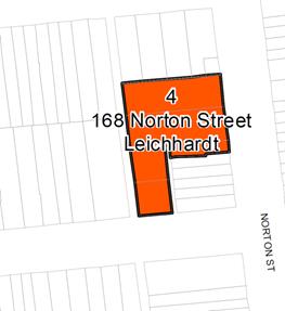
Image - 1 Proposed Key Sites Map under Leichhardt LEP 2013
Council received a Gateway Determination from the NSW Department of Planning and Environment on 21 April 2017. The Gateway Determination required community consultation with residents and relevant public authorities. The Gateway conditions also required the Planning Proposal to be updated to simplify the intent, amend the proposed sub-clause, amend the key sites map and include a maximum building height of RL 59.4 and number of storeys as suggested in the proponent's Planning Proposal, prior to public exhibition.
While the Planning Proposal was being amended by Council Officers in accordance with the Gateway conditions, it was noted that the survey plan provided by the proponent referred to incorrect Reduced Levels (RLs). As a consequence, the proponent was requested to revise the survey plan and planning proposal package to reflect the correct RLs and the Department was requested to alter the Gateway condition 1(c) which required the Planning Proposal to include the proponent's proposed original maximum building height of RL 59.4.
An altered Gateway Determination from the Department was received on 9 May 2017 which replaced the original condition 1(c) with the amendment of the planning proposal including a maximum building height of RL 50.40. The Planning Proposal was updated prior to public exhibition in accordance with the altered Gateway conditions.
FINANCIAL IMPLICATIONS
There are no financial implications for Council. The proponent has made an offer to enter into Voluntary Planning Agreement (VPA) with Council to provide 15% of affordable housing units in perpetuity under the SEPP 2004 and active uses along Norton Street. This offer is currently being considered in accordance with the Council's Interim Voluntary Planning Agreement Policy. The VPA will need to be publicly exhibited in accordance with the policy prior to finalising the LEP amendment.
OTHER STAFF COMMENTS
Nil
PUBLIC CONSULTATION
In accordance with the Council's resolution (C0217 Item 13) and Gateway Determination conditions, the Planning Proposal, DCP amendment and supporting documentation were exhibited for 29 days from Wednesday 24 May 2017 to Wednesday 21 June 2017. During this period, the material was made available on Council's Your Say website and in the Leichhardt Customer Service Centre and Leichhardt Library.
The public exhibition was notified by way of an advertisement in the Inner West Courier on Tuesday 23 May 2017 and letters were sent to approximately 400 owners and occupiers in the vicinity of the subject site.
Letters including the copies of the Planning Proposal and supporting documentation were also sent to four public authorities as required by the Gateway Determination conditions.
Submission Overview
During the exhibition period, Council's Your Say Inner West website received the following response:
· No. of visitors who viewed the page - 95;
· No. of visitors who clicked the page to read more and download documents - 64; and
· No. of visitors who engaged and made an online submission - 24
The public exhibition process generated 36 submissions in all with the following mix of opinion on the proposal:
· 10 (28%) submissions supported the Planning Proposal;
· 18 (50%) submissions supported the Planning Proposal with objections to the exhibited design;
· 8 (22%) submissions objected to the Planning Proposal;
· The proponent made a submission requesting consideration of the proponent's DCP over Council's DCP;
· Submissions were also received from Office of Environment and Heritage and NSW Family and Community Services.
Public Authority Submissions
Two (2) submissions were received from public authorities, one from the Office of Environment and Heritage and the other from NSW Family and Community Services. Both submissions raised no objections to the planning proposal and one submission identified matters to be considered at the development application stage.
Local resident / Inner West Your Say submissions
Submissions that support the redevelopment of the site in principle and those that object to it have raised concerns about the design of the exhibited proposed development concept. These primarily relate to DCP matters such as scale, height and setbacks of the proposed development, visual privacy for the existing neighbours, parking and traffic.
Submissions opposing the planning proposal raised concerns in relation to the following key issues:
Table - 1 Summary of issues raised and frequency of mention
|
|
Issues raised by the respondents |
By number of residents |
|
1. |
Traffic, Transport and Parking |
21 |
|
2. |
Excessive building height and density |
17 |
|
3. |
Location of waste collection area |
10 |
|
4. |
Visual Privacy |
13 |
|
5. |
Road and Pedestrian safety |
11 |
|
6. |
Setbacks |
9 |
|
7. |
Overshadowing |
10 |
|
8. |
Preferred form of development, density and FSR |
7 |
|
9. |
Noise |
4 |
|
10. |
Heritage |
4 |
|
11. |
Support for private development instead of the seniors housing |
2 |
|
12. |
Landscape |
2 |
|
13. |
Infrastructure |
2 |
|
14. |
Business on Norton Street |
2 |
|
15. |
Vandalism and Graffiti |
1 |
|
16. |
Stormwater management |
1 |
The following section provides details of the key issues raised in submissions by the residents and officer responses to these:
|
ISSUE - Excessive building height and Density |
|
Submissions expressed concern about: · Building heights; · Density; · Overdevelopment; · Overlooking; · Overshadowing of neighbouring residential and commercial properties; · Development contrary to the character, form and scale of the surrounding low rise residential area; and · Setting a dangerous precedent for the neighbourhood. |
|
RESPONSE |
|
The planning proposal recommends an increase in the FSR and height of the existing building in recognition of the need to provide seniors housing in the area given its proximity to the public transport and services. The increased FSR and height is only for a senior's housing development with a minimum of 15% of the dwellings to be affordable places. This will ensure that a high quality mixed use and senior's housing development which makes a genuine contribution to community benefit and the urban form is delivered on the site. The implications of the increased height and FSR would be mitigated through a well-designed built form with appropriate setbacks and building articulation. In response to the submissions received, post-exhibition amendments have been made to the DCP to increase the setbacks to ensure that the redevelopment of the site has minimal adverse impacts on the neighbouring properties. The detailed design of a development for the site, along with the assessment of a future development application, will provide further opportunity for the impacts on the neighbouring properties to be addressed. |
|
ISSUE - Traffic and Transport |
|
Many submissions raised concerns about increased traffic generation and parking problems, especially in respect of the vehicular access to the development along the narrow rear laneway. The laneway is 3.5m metre wide which is not wide enough to safely accommodate additional traffic and pedestrian movements. The maneuvering of service, garbage and delivery vehicles on the laneway is of particular concern because it could create vehicular conflicts.
The proposed number of car parking spaces (42 car spaces) would generate vehicular movements along the rear laneway and on adjacent streets. The proposed plans and the draft DCP indicate that the access for garbage collection would be via the rear laneway, but the lane is too narrow to accommodate heavy vehicles. This issue is also discussed in another section below.
Seniors housing could affect existing on-street parking along Norton Street and Carlisle Street because of relatively high levels of visitors. Pressure on local on-street parking is already an issue and needs to be addressed. |
|
RESPONSE |
|
The proponent's Traffic study uses 44 independent living units and ground floor retail/commercial uses of around 600 sqm as its benchmark and states that this would generate 20 to 30 vehicles per hour two-way during weekday peak period. Whilst this is considered as low traffic generation in terms of its impact on the surrounding network, the proposed location of the vehicular access would have more significant impacts for the neighbours. Concern was raised by Council's traffic consultant regarding the interaction between the vehicles accessing the vehicular access points of the proposal and the driveway access to the existing properties on the western side of the laneway. It was also noted that due to the narrow width of the laneway, there is no provision for two vehicles to pass one another in the laneway and given the additional traffic generated by the proposal, the conflicts between vehicles would increase. The vehicular conflicts would also pose risks to pedestrian safety on the laneway as there is a lack of pedestrian facilities to walk along the narrow carriageway. Council's Traffic and Transport assessment also identified that there are restricted pedestrian-vehicular and vehicular-vehicular sight lines at the Macauley Street/ laneway intersection which further increases the risk of vehicular and pedestrian accidents. Whilst noting that the site specific Draft DCP 10.7.1 C1 Control states that ‘Vehicle access and egress points will be provided from laneway located on the western boundary of the site’, the use of Carlisle Street for vehicular access as opposed to the proposed vehicular access from the laneway is considered more appropriate. Carlisle Street provides a wide road carriageway which would adequately provide for safe vehicular access. |
|
ISSUE - Location of Waste Collection Area |
|
Concerns were expressed regarding the proposed waste management and storage areas on the western site boundary. This location could result in unpleasant odours for the townhouses on the rear laneway and for the private open spaces of the dwellings to the north at Macauley Avenue. Garbage truck maneuvers would be extremely difficult in the rear lane and the noise created by heavy vehicles would also be problematic for the neighbours.
|
|
RESPONSE |
|
Council's Traffic and Transport Assessment noted that the proponent does not provide any provision for on-site garbage truck access or delivery vehicles to service the business uses on Norton Street which would potentially block the laneway during garbage collection and other loading and delivery activities. Additionally, there are concerns regarding the amenity impacts on the neighbouring properties in relation to the proposed location of the waste collection and storage area considering the narrowness of the laneway. In response to the submissions and to ensure that there are minimal impacts on the surrounding properties, post exhibition DCP amendments have been made to relocate the waste collection area from the western boundary to the southern boundary of the site on Carlisle Street. |
|
ISSUE - Setbacks |
|
The proposed setbacks on the western and the northern boundaries are insufficient and would result in unacceptable privacy impacts for the townhouses on the laneway and the private open spaces of Macauley Street properties. The proposed balconies on the first few levels of the western façade of the development would have direct lines of sight into the bedrooms, living areas and the private open spaces of the town houses as the separation would be barely five metres due to the narrowness of the laneway. Residential use of the balconies would also generate unwanted noise for the living areas of the existing surrounding development. Additionally, solar access to the townhouses would be compromised due to the bulk of the development and its proximity to the laneway. |
|
RESPONSE |
|
The proponent's original urban design concept was consistent with the AJ+C controls endorsed by the former Leichhardt Council at community forums and in the related Memorandum of Understanding (MOU). The draft controls resulting from the community forums and drafted by AJ+C are concept level and were not subject to detailed assessment. Council's detailed analysis of the proposed original built form raised concerns regarding the potential amenity impacts on the adjoining properties. Of particular concern were the setbacks from the western boundary and the northern boundary, which would have overlooking and privacy impacts on the adjoining townhouses and the rear of the properties on Macauley Street. It was noted that the proponent's original design did not analyse the amenity impacts on the properties on the rear laneway as no setbacks were provided to the western boundary. Prior to public exhibition, the building envelope controls were revised to provide 1.5m setback to the western boundary. The first and second levels on the rear laneway were envisaged to be 4.5m apart from the habitable room of the adjoining dwellings. However, this separation distance is considered insufficient. In response to the submissions received and to reduce the impact on the existing townhouses, it is proposed that a minimum of three metres setback would be provided from the western boundary. This will ensure that the built form is appropriately setback from the adjoining buildings to achieve a desirable urban form and higher levels of amenity and privacy for the building occupants and surrounding neighbours. This will also be consistent with the building separation guidelines in the Apartment Design Guide which recommend a minimum separation distance of 6m for buildings of up to four storeys. This would further alleviate the visual overlooking impacts and overshadowing impacts on the surrounding properties. The additional setback would also provide opportunities for landscaping along the laneway which will further support the residential amenity and help to provide communal open space areas. The proponent's original urban design study indicated a 6m setback to the northern boundary for third, fourth and fifth storey. It is proposed that this setback to the upper levels would be included as a control in the post-exhibition DCP amendment subject to achieving minimal overlooking impacts on the properties on Macauley Street. |
|
ISSUE - Visual Privacy |
|
(See above) This issue is closely tied to the height of the buildings and the proposed setbacks to the western and northern site boundaries. The submissions highlight the direct overlooking of existing properties that could arise from windows and balconies in the new development. |
|
RESPONSE |
|
In response to the submissions received and to address concerns raised by Council officers, the proposed setbacks have been revised as discussed in the above section. These have been included in the post exhibition DCP amendments. It is believed that the revised setbacks and other measures such as selection of appropriate screening plant species for setbacks, unit layout/orientation, size and opening of windows, balcony designs will need to be put in place through the development consent to address neighbour's visual privacy concerns. |
|
ISSUE - Overshadowing |
|
Submissions from owners/occupants of several properties to the west and south of the site in the rear laneway, Carlisle and Norton Street were concerned about potential overshadowing due to increased bulk. One submission indicated that the overshadowing on their property along Norton Street would reduce business at their restaurant, which currently benefits from the sunlight in the outside eating area. Another submission from a local resident raised a concern regarding potential overshadowing of the balcony and the ground level of the Royal Hotel due to the additional height of the proposed development which could impact the amenity of the patrons. |
|
RESPONSE |
|
The proponent's original urban design study provided shadow diagrams which analysed the impacts of the proposed bulk on the surrounding properties. It is considered that the revised setbacks as discussed above are sympathetic to the neighbours and would help in reducing overshadowing impacts on the adjoining properties. Whilst there may be some additional overshadowing on No. 156 Norton Street (The Royal Hotel) and on the properties on the eastern side of Norton Street between 1pm to 3pm, the impact is considered minimal as the properties will continue to receive sunlight between 9am and 1pm. It is envisaged that the design in the post exhibition site specific DCP amendment will address the relevant solar access, overshadowing and visual privacy concerns and have an acceptable overshadowing outcome. |
|
ISSUE - Road and Pedestrian safety |
|
Many submissions were concerned that the safety of child, adult and senior pedestrians would be adversely affected by the increase in traffic, especially of service vehicles that would be generated by the proposed redevelopment along the rear laneway. One submission suggested that there is a high level of pedestrian and vehicular traffic accidents at the Norton and Carlisle Street intersection which will be exacerbated by an increase in population on the subject site. |
|
RESPONSE |
|
Council's traffic assessment noted that the proposal would increase the number of pedestrians using nearby streets and raised issues with pedestrian links and safety. These issues included the narrow width of the laneway, lack of pedestrian facilities and vehicular-pedestrian conflicts along the laneway. To address these issues, the vehicular access location has been relocated to Carlisle Street instead of the proposed access through rear laneway. This would significantly reduce the number of conflicts and improve the pedestrian safety along the laneway. It is also noted that the 3m setback to the western boundary which will incorporate deep soil plantings will help traffic calming through friction management and mitigate the concerns regarding the pedestrian and road safety along the laneway. |
|
ISSUE - Noise |
|
Submissions raised concerns regarding the increased noise arising from more traffic in the area, especially from service vehicles on the western boundary of the site. There is also concern regarding the resident noise from balconies and windows on the west side of the redevelopment. |
|
RESPONSE |
|
This issue is closely tied to the proposed setbacks. It is considered that the additional setbacks to the western boundary would reduce noise impacts from the residential development and the relocation of vehicular access points to Carlisle Street would help mitigate concerns regarding traffic noise. These concerns have been adequately addressed through the post-exhibition DCP amendments. |
|
ISSUE - Heritage |
|
The site is located within a heritage conservation area. Concerns were raised regarding the proposed built form and scale which would be out of scale with the general character of the area, especially the adjoining low density residential area. One submission has specific concerns regarding the over imposing built form which would impact the adjacent heritage property located at the 156 Norton Street - The Royal Hotel. |
|
RESPONSE |
|
The site specific DCP amendment provides building envelope controls which will guide the future redevelopment of the site. The existing building on the site, which was a former movie theatre/ boarding house, has been a long standing anomaly in terms of scale, setbacks and heights. The redevelopment of the site provides an opportunity to create a desired built form which integrates with the local character of the area. Adequate setbacks have been proposed to encourage the tall building to step down towards adjacent streets and laneways to create a more balanced and consistent streetscape. The proposed setbacks to the upper levels on Carlisle Street will help mitigate any impacts on the adjacent heritage property at the Royal Hotel. |
|
ISSUE - Preferred form of development, density and Floor Space Ratio (FSR) |
|
A number of submissions were concerned that the proposed FSR of 3:1 and height of 5 storeys is inappropriate for the surrounding residential area, which would in turn result in adverse amenity impacts for the surrounding area. 16 submissions expressed support for seniors housing and redevelopment of the disused site. More particularly, 7 submissions expressed a view that if the site was to be redeveloped, it should be within the current planning controls which is FSR 1.5:1 or a maximum FSR of 2:1. |
|
RESPONSE |
|
The planning proposal seeks to increase FSR of the site from 1.5:1 to 3:1 and introduce a maximum building height of 5 storeys. The Planning Proposal is the result of previous community consultation and urban design studies undertaken by the former Leichhardt Council. The Planning Proposal was supported by the urban design study undertaken by Council's engaged consultants, Allen Jack + Cottier, in 2015 and the proponent's study in 2016 which identifies that the site can support a development of greater FSR and height than the current planning controls allow without significant impact on the surrounding properties. The building envelope controls have been revised in response to the submissions and Council officers' concerns to achieve a higher quality urban design outcome for streetscape character; and minimal impacts on the surrounding properties. The Planning Proposal and site specific DCP amendment will ensure acceptable floor space ratio and design outcomes. |
|
ISSUE - Landscape |
|
Two submissions raised concern that the indicated design outcome is a breach of the landscape area control as it does not provide adequate landscape area. |
|
RESPONSE |
|
The proponent's original urban design study did not provide sufficient landscaping. Prior to public exhibition, the draft landscape/ deep soil planting controls were revised to include a requirement for a minimum of 10% of the site area to be landscaped. The setbacks on the western and southern boundary will include deep soil planting to meet the minimum landscape area requirements. This is also consistent with the requirements of the Apartment Design Guide (ADG). The Planning Proposal and site specific DCP amendment are considered acceptable in this instance. |
|
ISSUE - Infrastructure |
|
Concern was expressed regarding the inadequacy of the local area to support overdevelopment of the site. Two submissions particularly mentioned that there is insufficient infrastructure in the local area to support the dramatic increase of population associated with the three developments of Uniting within a few blocks from each other. |
|
RESPONSE |
|
The proponent's Planning Proposal indicates a yield of 40 independent living units for seniors on the subject site if the FSR of 3:1 was to be approved. This increase in population is considered minor considering the location of the subject site and its proximity to public transport and other services. Additionally, the redevelopment of the site as a mixed use development with seniors housing is considered as a genuine community benefit for the local area as the active uses along Norton Street would rejuvenate the businesses and the seniors housing component would help the older population to age in place. In addition until its closure, the boarding house would have accommodated a similar number of residents. Inner West Council continues to pursue actions to improve public transport in the area, including continued advocacy for improved public transport and continued work with Transport for NSW to improve capacity and reliability of public transport services. |
|
ISSUE - Business on Norton Street |
|
Two submissions expressed a view that specific conditions should be included to ensure the right types of businesses are set up to rejuvenate the character of Norton Street. |
|
RESPONSE |
|
The Planning Proposal retains the existing land use B2 Local Centre. Leichhardt Local Environmental Plan 2013 prescribes the objectives of the zone to provide a range of retail, business, entertainment and community uses that serve the needs of people who live in, work in and visit the local area. It is envisaged that the active uses along Norton Street would be provided in accordance with the Leichhardt LEP 2013. |
|
ISSUE - Vandalism and Graffiti |
|
One submission expressed a view that the proposed development should consider features to minimise opportunities for vandalism and illegal graffiti. |
|
RESPONSE |
|
It is noted that the proposed redevelopment of the site would benefit the public domain in respect of passive surveillance, street activity and street aesthetics which would in turn reduce the opportunities for vandalism and illegal graffiti. |
|
ISSUE - Stormwater management issues |
|
One submission expressed a view that the proposal does not address stormwater and flooding issues adequately. |
|
RESPONSE |
|
The subject site is not identified as a flood lot in the Leichhardt DCP 2013. Thus, the redevelopment of the site should not raise flooding issues. The detailed design of redevelopment of the site, along with the assessment of future development application, will address stormwater management. |
|
ISSUE - Support for private development instead of the seniors housing |
|
Two submissions expressed support for the redevelopment of the site subject to the whole/ part of development being made available for market housing in order to meet the future demand of housing supply in Sydney. |
|
RESPONSE |
|
The redevelopment of the site has been supported by Council to facilitate a self-contained seniors housing and mixed use development with 15% of the dwellings to be affordable places. The Planning Proposal will allow redevelopment of the site to provide additional housing opportunities in close proximity to services and public transport. The Planning Proposal responds to the changing demographic trends in that there is a need for seniors housing as well as for affordable housing given the housing affordability concerns across the Inner west area. |
|
Proponent's Submission |
|
A submission was received from the applicant on behalf of Uniting in support of the Planning Proposal. The submission specifically raises concerns regarding the Council's proposed building envelope controls as included in the exhibited draft DCP amendment for 168 Norton Street and its implications on the built form. The Council's proposed setbacks of 1.5m to the rear laneway and the “dunny lane” are of particular concern. The proponent's review of the Council's draft DCP controls has demonstrated that whilst the alternate controls will generally accommodate a similar quantity of Ground Floor Area (GFA), the resultant shape of the building form results in a less efficient floorplate making it difficult to practically accommodate accessible unit layouts. This may result in a detrimental impact on the total number of Independent Living Units (ILUs), the size and mix of ILUs, and as a consequence, the feasibility and affordability of the final product. The proponent is of the view that the proposed DCP lodged with the original Planning Proposal provides a more suitable solution to the built form on the site that can be designed to improve the public domain amenity of adjoining residents across the rear laneway and minimise potential impacts on adjoining properties. |
|
RESPONSE |
|
Whilst Council acknowledges that the proponent's original urban design study and draft DCP controls were generally in accordance with the AJ+C controls endorsed by the former Leichhardt Council at community forums and in the related MOU; it was noted that the draft controls were at a concept level and not subject to detailed assessment as acknowledged in the Clause 5 of the MOU. Council's detailed analysis of the proponent's draft DCP controls raised concerns regarding the adverse amenity impacts on the residents in the adjoining properties and within the proposed development itself. Consequently, the proponent's draft DCP controls were revised prior to public exhibition to introduce 1.5m setback to the rear laneway and the dunny lane. Both the rear laneway and the dunny lane are very narrow and are used to provide different services. The dunny laneway is in a dilapidated condition as it is used as a garbage collection zone to service the rear of the commercial premises at 158-166 Norton Street. The proponent's preliminary architectural design proposed a built form with no setbacks to the dunny lane. The design indicated ILUs which overlooked into the dunny lane and relied on the lane for cross-ventilation. Additionally, the design did not adequately respond to any future development of the properties along the Norton Street. This demonstrated the need to introduce the minimum setback of 1.5m to the dunny lane.
The Proponent's design also did not provide any setbacks to the rear laneway and solely relied on building articulations and fenestrations to mitigate the impacts on the adjoining townhouses. The narrow width (3.5m) of the laneway and the proximity of the proposed balconies to the adjoining properties on the western boundary raised potential concerns regarding visual and acoustic privacy impacts on the surrounding properties. Council officers' concerns regarding insufficient setbacks to the western and northern boundary and visual privacy impacts were confirmed through the public exhibition feedback when the issue regarding the adverse amenity impacts (setbacks, visual privacy and overshadowing) on the adjoining properties was mentioned 22 times.
Increased setbacks are required to the rear laneway to ensure that the redevelopment of the site has reduced impacts on the adjoining properties. In this regard, additional setbacks have been introduced to the rear laneway as a post exhibition amendment to address the submissions and Council officers' concerns. This setback will also ensure that the proposed development complies with the minimum building separation controls of the ADG. The increased setback of three metres from the western boundary is consistent with the objectives of the Planning Proposal which facilitates the redevelopment of the site as mixed use seniors housing with minimal adverse impacts to the surrounding properties It may be noted that the setbacks included in the draft DCP are only guidelines for the proposed redevelopment of the site. In accordance with Control C1 Clause 10.6.2 reduced setbacks can be provided to the development if demonstrated that the privacy and amenity of the residents on the site and of the neighbouring properties can be maintained with reduced setbacks. These impacts will be considered in more detail at the Development Application Stage. |
Internal Staff Comments
During the public exhibition period, the Planning Proposal and draft DCP Amendment were referred to Council Assessment officers, Traffic and Transport officers and Engineers. Concerns were raised regarding the insufficient building setbacks, location of vehicular access points and waste collection areas.
Assessment officers recommended that the setbacks to the rear laneway should be increased to 3m to mitigate overlooking, acoustic and overshadowing impacts on the adjoining properties. They also recommended an amendment to the setbacks section of the draft DCP to specify the setbacks from the northern site boundary subject to minimal impacts on the rear of the Macauley Street properties.
They also recommended that the minimum setback to the fifth storey to Norton Street be increased to 12m so that the additional setback is not visible from the public domain. Whilst it is acknowledged that the 12m setback would help hide the increased bulk and mitigate adverse impacts on heritage conservation area, it may not be feasible in this circumstance as that would greatly reduce the potential GFA of the site which has previously been agreed in the Planning Proposal and the Council's MOU. It was also agreed that the impacts on the streetscape can be assessed in more detail at the DA stage and higher setbacks can be provided at that stage if necessary.
Council's Traffic and Transport Officers recommended relocating the vehicular access points and garbage collection area to the southern boundary of the site on Carlisle Street. These have been included as post exhibition amendments to the DCP as discussed in the section below.
Post Exhibition Amendments
A review of the Planning Proposal and draft DCP amendment was undertaken with regard to public exhibition submissions and further internal consideration by the Council. The review has resulted in a number of post exhibition changes to the draft DCP amendment. No changes have been made to the exhibited Planning Proposal.
Draft DCP Amendments
In response to the concerns raised by respondents and internal consideration of issues by Council officers', the following draft DCP amendments have been made:
· Amendment to Clause 10.6.2 Building setbacks, separation and articulation
Following the consideration of the issues raised, additional setbacks are proposed on the western boundary to ensure that there are minimal adverse impacts on neighbouring properties. It is recommended that:
o Development on the rear laneway is setback by a minimum of 3m from the western site boundary.
It is recommended that the following controls be added to specify the building envelope controls on the Northern Site boundary:
Northern Site boundary
o The upper levels of the building are to be setback by a minimum of 6m from the northern site boundary.
o Despite the above subclause, development on the northern boundary must ensure that there are minimal overlooking impacts on the private open space of the adjoining residential properties.
· Amendment to Clause 10.7.1 Vehicular Access
Following the consideration of the issues raised, it is recommended that the controls be amended to the following:
o Vehicular access and egress points will be provided from Carlisle Street located on the southern boundary of the site.
o Vehicular access and pedestrian entries will be designed sympathetic to the surrounding development and integrated with the Carlisle Street frontage landscaped and the overall design.
· Amendment to Clause 10.8.1 Waste and Recycling Materials Storage and Disposal
Following the consideration of the issues raised, it is recommended that the controls be amended to the following:
o Waste management and storage areas are to be located, designed and constructed to ensure integration into the streetscape of the southern boundary on Carlisle Street.
o All waste management facilities must comply with the Resource Recovery and Waste Management provisions contained in D2.5 of this Plan.
· Additional Minor amendments to the draft DCP
Some minor editorial changes have been made to the wording of the draft DCP. These changes are inconsequential as they do not alter the intent of the exhibited draft DCP.
The changes to the draft DCP amendment are shown in Attachment 3.
It is envisaged that supporting diagrams will be added to the draft DCP to illustrate the building envelope controls as stated in the text. This will enable Council officers, residents and the applicant to clearly understand the DCP controls.
CONCLUSION
The Planning Proposal and draft DCP Amendment for 168 Norton Street, Leichhardt have been publicly exhibited in accordance with the Gateway conditions, Environmental Planning and Assessment Act and Council's Community Engagement Framework.
This report has assessed the submissions and recommends that the Planning Proposal as exhibited should be supported by Council. It is also recommended that the draft DCP, with amendments as discussed in this report, be endorsed by Council subject to minor changes where illustrative diagrams to reflect the text will be added before adoption.
It is recommended that Council officers liaise with the Parliamentary Counsel's Office and the Department of Planning and Environment in relation to the drafting of the LEP amendment. It is also recommended that Council delegate the making of the LEP amendment and the adoption procedure for the DCP to the General Manager.
|
1.⇩ |
Council Report and Minutes February 2017 |
|
2.⇩ |
Planning Proposal |
|
3.⇩ |
Gateway Determination |
|
4.⇩ |
Draft DCP (with changes) for adoption |
|
5.⇩ |
Draft Exhibited DCP |
|
Council Meeting 25 July 2017 |
Subject: 2-6 Cavill Avenue Ashfield - Planning Proposal
File Ref: 17/4718/80212.17
Prepared By: Con Colot - Senior Strategic Planner & Projects
Authorised By: Simon Manoski - Group Manager Strategic Planning
|
SUMMARY This site on the west side of the Ashfield Town Centre, presently contains two five storey office buildings, and comprises several allotments with different land use zones.
The proposal seeks to increase Maximum Floor Space Ratio from 2.0:1 to 3.0:1 to bring this in line with similar sites in other parts of the Ashfield Town Centre. It also seeks to apply a 7 metre height (2 storey) bonus to the site, the same as that applying to other comparable sites in the Ashfield Town Centre- this would be in addition to the existing 23 metre Maximum Building Height in the Ashfield LEP 2013.
Also sought are changes to land zonings to small sites fronting “The Avenue”, and amendments to specific clauses in the Ashfield LEP 2013 discussed in detail in this report.
The Proposal has been put on preliminary “upfront” public exhibition in accordance with Council’s policy - for the former Ashfield LGA, prior to a report being considered by Council.
This report recommends that Council support the Planning Proposal and seek Gateway determination to become the Relevant Planning Authority, and that a site specific Development Control Plan be produced to address the unique circumstances of this large site in the Ashfield Town Centre. |
|
RECOMMENDATION THAT Council:
1. Support the Planning Proposal subject to amendments outlined in the report;
2. Forward the Planning Proposal to the Minister of Planning for a Gateway Determination in accordance with Section 56 of the Environmental Planning and Assessment Act, and seek that Council use its delegated plan making functions to be the Relevant Planning Authority for the processing of the Planning Proposal;
3. Authorise the Interim General Manager to be Council’s delegate and “the Authorisation” to be the Relevant Planning Authority for the processing of the Planning Proposal; and
4. Develop a site specific Draft Development Control Plan as outlined in the report once the Gateway approval is received and exhibit the Draft DCP concurrently with the Planning Proposal.
|
1.0 Introduction
The Planning Proposal seeks to make various amendments to the Ashfield LEP 2013, including to Development Standards for Maximum Building Height and Maximum Floor Space Ratio, which are described in more detail in the Report in Part 5. The applicant is concerned that there is a declining long term market for consolidated commercial tenants in Ashfield and is therefore seeking to redevelop the site. The proposal is seeking consent to amend the height and density of the proposal. Residential flat development is currently permissible with consent within the B4 Mixed Use Zone.
LRAC considered this report at its Meeting on 11 July 2017 and recommended:-
|
L0717 Item 3 2-6 Cavill Avenue Ashfield - Planning Proposal |
|
Recommendation: Drury / Mansour THAT: 1. support the Planning Proposal subject to amendments outlined in the report; 2. forward the Planning Proposal to the Minister of Planning for a Gateway Determination in accordance with Section 56 of the Environmental Planning and Assessment Act, and seek that Council use its delegated plan making functions to be the Relevant Planning Authority for the processing of the Planning Proposal; 3. authorise the General Manager to be Council’s delegate and “the Authorisation” to be the Relevant Planning Authority for the processing of the Planning Proposal; and 4. a site specific Draft Development Control Plan as outlined in the report be produced post-Gateway and exhibited concurrently with the Planning Proposal. 5. notes that there is a presumption against rezoning where the LEP is less than 5 years old unless it meets the strategic merit test; 6. express concern that this proposal will result in a significant reduction in employment in the Ashfield CBD.
|
|
CARRIED |
Officers Comment
The Planning Proposal is seeking a change in height and density reflecting that which is available to adjoining sites within the remainder of the commercial/retail core area of Ashfield. The proponent is not seeking any change to the zoning or permissible uses for the site.
It is noted that the proposal may result in a reduction in employment in the Ashfield commercial core area however under the current Ashfield LEP, residential flat development is permissible on the site.
2.0 CONTEXT AND CURRENT USE OF SITE
The site currently contains two 5 storey office buildings built in the 1980s, with a large sized roof top plant room making the building approximately 24 metres high relative to Cavill Avenue (equivalent of 7 residential storeys). Most of the site is zoned B4 – Mixed Use (approx. 7,960 sqm) except for two small properties off The Avenue zone R2- Low Density Residential. The site contains tall trees (equivalent of 4 storeys) along Cavill Avenue which make a strong contribution to the quality of the area and are protected by Council’s Tree Preservation Policy. Adjacent on the east side, is a residential street - The Avenue- zoned R2 Low Density Residential which is a mixture of 2 and 3 storey residential flat buildings and two houses. Adjacent to the north is a “slim” four storey residential flat building with ground level parking, and then the railway line. To the east is the Ashfield Town Centre, predominantly zoned B4 Mixed Use, with buildings permitted along Liverpool Road up to 8 storeys high, except for a front podium maximum 12 metre height and 12 metre depth (“street wall height”). To the south properties include B4 zoned land on Liverpool Road including a three storey Commercial building, and the Miller Street Conservation Area containing houses.
Nearby to the west along Liverpool Road land is zoned B4- Mixed Use with up to 6 storey buildings permissible, with a recently constructed 6 storey building at 371 Liverpool Road.
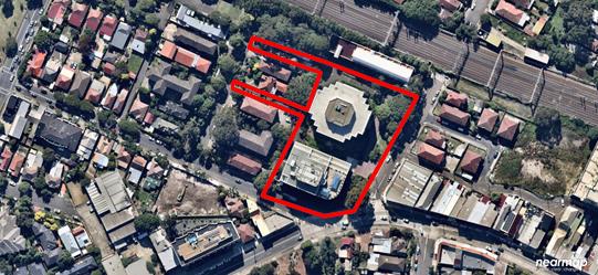 |
3.0 PRELIMINARY NOTIFICATION AND PUBLIC SUBMISSIONS
The Planning Proposal was notified between 31 January and 28 February 2017. This process is in place in order for Council to obtain community feedback, so that relevant issues may able be addressed “upfront” in the process. There were 24 visitations to Council’s “Have Your Say” website with 22 people having read the Planning Proposal. Three submissions were received:
Table 1
|
|
Issues raised |
Officer Response |
|
Submission 1 |
|
|
|
Does not support the Planning Proposal |
Land use zoning for properties in The Avenue should remain R2, and the current maximum FSR of 0.7:1 and Maximum Building Height should remain at 8.5 m. |
The commercial property contains two smaller allotments in the “The Avenue” which are currently used for vehicular access. This zoning issue is discussed below in Part 5 of the report and it is agreed that properties in The Avenue should have their Land Use zoning, Maximum FSR and Maximum Building Height remain as currently contained in the Ashfield LEP, since this characterizes the spatial environment of this area. Also, the R2 land use zoning already allows access to The Avenue from the main property off Cavill Avenue. |
|
Submission 2 |
|
|
|
Does not support Proposal |
Ashfield is becoming overdeveloped, and increasing dwellings will adversely “increase traffic and business”. |
The additional FSR of 1:1 will generate approx. 90 dwellings (at 90 sqm), within a total of approx. 265 dwellings (90 sqm) at a total FSR of 3:1. Pursuant to Councils Ashfield Urban Planning Strategy 2010, the town centre is intended to accommodate 1,100 dwellings, and this site will contribute to this. Council’s Traffic Engineer has raised no objection to the Proposal. The site has adequate existing vehicular access off Cavill Avenue and The Avenue. |
|
Submission 3
|
Submission from Sydney Trains. All future developments will need to be in accordance with “Development Near Rail Corridors and Busy Roads- Interim Guidelines”. |
The Planning Proposal if progressed to formal exhibition will be referred to Sydney Trains for comment. Any future Development Application with be consider the document. |
4.0 COMPLIANCE WITH PLANNING PROPOSAL GUIDELINES AND DOCUMENT CONTENT
In order for Council to support the Planning Proposal, Council needs to be satisfied that there is adequate content and “justification” in a Planning Proposal document as required in “A Guide to preparing Planning Proposal Guidelines- 2016”. The following provides an assessment of the adequacy of the content.
Part 1 Objectives and intended outcomes and explanation of provisions
|
|
Guideline Requirements |
Officer comments |
|
2.1
|
Requires a concise statement setting out the objective or intended outcomes. |
The statement given in the Planning Proposal is satisfactory. |
Part 2- explanation of provisions
|
|
Guideline Requirements |
Officer Comments |
|
2.2 |
Requires an explanation of the land use zones and development standards sought to be amended. |
The proposal seeks to
- increase Maximum Floor Space Ratio from 2.0:1 to 3.0 :1 on the B4 zoned site, and increase Max FSR from 0.7:1 to 3:1 on the R2 Low Density Residential land zonings
- apply a 7 metre height bonus, above the existing 23 metre Maximum Building Height applying to the site zoned B4 -Mixed Use.
- make changes to R2 Low Density Residential land zonings on two small sites fronting “The Avenue”.
The Planning Proposal adequately identifies these matters, refer to Part 5 of the report below for an assessment of the above. |
Part 3 – Justification
|
|
Guideline Requirements |
Officer Comments |
|
2.3 |
Requires adequate justification documentation to be provided for the specific land use and development standards proposed to the LEP. |
Design concept documentation has been submitted which provides floor plans and building envelopes for the proposed maximum Building Height and Maximum FSR. These depict a scenario where there are new residential flat buildings on the site. These development standards are assessed in Part 5 of this report. . |
2.3.1 Questions to consider when demonstrating the justification
|
|
Guideline requirements |
Officer Comments |
|
Section A – Need for Planning Proposal |
||
|
Q1 |
Is the planning proposal part of any strategic study or report? |
The Proposal is site specific, and not part of any Strategic Study such as a local precinct study.
However it is relevant that the site was considered as part of the reporting on the Draft Ashfield LEP 2012 exhibition in February 2013 to the former Ashfield Council, where an objection was lodged to the proposed Heritage listing of the site and Council agreed that the Heritage listing was not relevant and was removed. However the Maximum Building Height and Maximum FSR in the Draft LEP reflected at the time, the retention of the buildings and is lower than other B4 Mixed Use zonings elsewhere in the Ashfield Town Centre.
It is also relevant that the Ashfield Urban Strategy 2010 nominates the Ashfield Town Centre as a key contributor to housing supply, and that the land use zoning already permits standalone residential flat buildings, and that this proposal has the potential to contribute to housing supply.
|
|
Q2
|
Is the planning proposal the best means of achieving the objectives or intended outcomes, or is there a better way?
|
The objectives/intended outcomes require amendments to the Land Use zonings and Development Standards and particular clauses of the Ashfield LEP 2013. Part 5 of the report assesses these. |
|
Section B –relationship to strategic planning framework |
||
|
Q3 a |
Does the proposal have strategic merit? Is it:
|
|
|
|
Consistent with the relevant District Plan within the Greater Sydney region. |
With regard to the Draft Central District Plan (dCDP), the Planning Proposal adequately addresses the following :
The dDCP identifies the Ashfield Town Center as a “local centre”. One of the key objectives for a local centre is to provide for additional residential growth close to transport and services – which the Ashfield Town Centre provides.
Another key objective is to consider the need to reinforce the suitability of a “local centre” for retail and commercial use. A Strategic Economic Assessment report (Attachment 2) is included with the Planning Proposal and explains that potential conversion of the site to a predominantly residential use will not have any local adverse economic impacts on the existing town centre, and that it is expected in the dCDP that major commercial use will relocate to District Centres (e.g. Burwood) and CBD locations, and that it is State Government policy to relocate major departments further west such as at Parramatta. This has been reviewed by Council’s Economic Development Manager and found to be satisfactory –refer to Part 6.0 of this report.
According to the “Strategic Economic Assessment” there is no certainty that the two existing 5 storey office buildings, which contain a single consolidated tenant will continue to have that tenant. This is due to government policy for relocating such tenants to other strategic locations to the west of Ashfield such as Parramatta. There should therefore be development standards that make the continued use or redevelopment of the site viable, so that the existing buildings are not left vacant long term or derelict, providing there is a satisfactory “fit” with the town centre and surrounds.
Notwithstanding, the Ashfield LEP 2013 currently permits in the B4 zones in the Ashfield Town Centre standalone residential flat buildings, mixed use development, and stand-alone commercial development and the Ashfield LEP is consistent with the Draft Central District Plan. The Planning Proposal will not change this.
|
|
|
Consistent with a relevant local council strategy that has been endorsed by the Department
|
The Ashfield Urban Planning Strategy 2010 was approved by the Department of Planning and the land uses are consistent with that Strategy, and also reflect the current commercial use. |
|
|
There will be a presumption against a rezoning review request that seeks to amend LEP controls that are less than 5 years old, unless the proposal can clearly justify that it meets the Strategic Merit Test.
|
The Ashfield LEP was gazetted in Dec 2013, and is less than 5 years old. Noting that the Proposal is at the preliminary stage, subject to future exhibition and detailed assessment, it is considered that the Proposal adequately meets the Strategic Merit test providing the matters identified in this report in Part 5 (which assesses the Development Standards) are addressed, including applying a site specific DCP to ensure that future development will be compatible with surrounding development and the character of the town centre. |
|
Q3b |
Does the proposal have strategic merit with regard to the following : |
|
|
|
The natural environment
|
There are several large trees along the Cavill Avenue front gardens and within the site which are protected via the Ashfield LEP 2013 and the Tree Protection Policy in the Inner West DCP 2016. This would be able to be highlighted in a future draft DCP- as discussed in Part 5.0 below. |
|
|
The existing uses, approved uses, and likely future uses of land in vicinity of the proposal.
|
This Proposal will permit a continuation of existing land uses and the existing office buildings, see Part 5 below for an assessment. There will be an affectation to existing land /property use at The Avenue in terms of the impacts of additional building height and this is illustrated in the explanatory Design Concept submitted with the Planning Proposal, and is assessed in Part 5 below. The Planning Proposal information is adequate for the purpose of Gateway Determination. |
|
|
The services and infrastructure that are or will be available to meet the demand arising from the proposal and any proposed financial arrangement for infrastructure provision
|
The proposal is in a town centre, there are existing water and sewerage service, and roadways for vehicular access. There are nearby primary and high schools, and public transport including bus and rail. The Planning Proposal information is adequate for the purpose of Gateway Determination |
|
Q4 |
Is the proposal consistent with a council’s local strategy or other local strategic plan? |
The proposal is consistent with the Ashfield Urban Planning Strategy 2010, with the land uses being consistent with that Strategy, and also reflecting the current commercial use, except for the small parcels of land off The Avenue (see Part 5 below).
Council’s Affordable Housing Policy adopted in March 2017 and is a relevant consideration. Part 2.5.2 – “Major Planning Agreements” of the Policy requires a 15 percent contribution on any uplift. Based on the additional 1.0 :1 FSR, at 15 percent, this equates to approximately 1200 sqm of floor space (on the current B4 zone site), the equivalent of 18 apartments (being a mix of one and two be apartments), or the equivalent of 13 x 90 sq metre apartments.
The current Ashfield LEP 2013, in Clause 4.3A (3), requires 25 percent of floor space generated by a 7 metre (2 level bonus) to be provided as “affordable rental housing”, and this equates to approximately 18 apartments (mix of one and two bed apartments) using the Design Concept drawings. This also equates to 10 x 90 sqm apartments using the 25 percent additional floor space of approx. 1760 (out of 7050) sqm. The Planning Proposal agrees to have this Clause 4.3A(3), provision applied to the site and this meets the objectives of the Affordable Housing Policy.
|
|
Q5 |
Is the planning proposal consistent with applicable State Environmental Planning Policy |
The B4 zoning permits several land uses, including standalone residential flat buildings, mixed use developments, commercial developments, and the proposed development standards will be able to accommodate these.
With regard to SEPP 65 a Design Concept has been submitted, which puts forward a predominantly residential development, and this has been reviewed by Council’s Architectural Excellence Panel (Attachment 4). Refer to Part 5 of this report which explains the need to have a site specific Development Control Plan to address the unique location and beneficial characteristics of the site, to achieve a positive built form and open space outcome for the site, with this being reinforced by Council’s Architectural Excellence Panel comments. The applicant’s Design Concept should also be amended to reflect the Panel’s comments and to demonstrate at future assessment stage that the Floor Space Ratio standards, for standalone residential flat buildings, are suitable for the site. This will also require amendments to parts of the Planning Proposal that make reference to the current Design Concept.
For SEPP no 55 –Remediation of Land, there will be a Phase 1 Site Assessment provided post Gateway Determination.
The Planning Proposal identifies the other applicable SEPPs, being SEPP (BASIX), SEPP (Complying Development), SEPP (State and Regional Development) 2011, Sydney REP Harbor Catchment, noting that these do not have an impact of consideration of the Planning Proposal.
|
|
Q6 |
Is the planning proposal consistent with applicable Ministerial Directions (s. 117 directions)? |
The Planning Proposal at its Part 7.2.4 –Table 4, shows that it is consistent with the relevant Section 117 directions, being :
“3- Housing, Infrastructure and Urban Development- Residential Zones” – and providing for future housing needs.
“3.4 Integrating Land Use and Transport “- the site close to transport and services
“6.0 Local Plan Making” – the LEP provisions will not compromise the efficient and appropriate assessment of development.
“7- Metropolitan Planning” - the proposal is consistent with the NSW Government’s – “A Plan for Growing Sydney” (2014) and its generalist directions, in particular “Principle 1 –Increasing housing choice around all centres through urban renewal in established areas, |
|
Q7 |
Is there any likelihood that critical habitat or threatened species, populations or ecological communities, or their habitats, will be adversely affected as a result of the proposal? |
Large significant trees on the site are protected by Councils Tree Protection Order. A future draft DCP will highlight this. |
|
Q8 |
Are there any other likely environmental effects as a result of the planning proposal and how are they proposed to be managed? |
There are no other substantial environmental effects that are known of and the Planning Proposal document adequately covers this matter. |
|
Q9 |
How has the planning proposal adequately addressed any social and economic effects? |
The Planning Proposal adequately discusses this matter at its part 7.4, and in the Strategic Economic Assessment report (Attachment 2). Refer to Part 6 of this report, Council’s Economic Development Manger agrees the Planning Proposal will not result in an adverse local economic impact, and that there are adequate regional employment areas within close vicinity and transport access of the Ashfield Town Centre.
Under the Ashfield LEP 2103, the existing commercial building can presently seek approval for a residential use, such as has occurred at 164 Liverpool Road with conversion of a 6 storey office building. There is no inherent change in economic effects affecting the Ashfield LEP content which permits both standalone residential use and commercial use. |
|
Q10 |
Is there adequate public infrastructure for the planning proposal? |
Yes. |
|
Q11 |
What are the views of State and Commonwealth authorities consulted in accordance with the gateway determination? |
The Public Authorities will be consulted post Gateway Determination and the Guidelines require that Proposal should recommend who they should be. This will be a matter for the Greater Sydney Commission, given the land is adjacent a regional road (Liverpool Road) and there will additional traffic generation, and that the site is nearby the railway line, public authorities should be: Sydney Trains, Roads and Maritime Services.
|
|
2.4 Mapping |
||
|
|
|
Adequate maps have been provided but require amendment to conform to this reports recommendations for retaining Land Use Zones and development standards in The Avenue. |
|
2.5 Community Consultation |
||
|
|
|
It is considered that the Proposal should be formally exhibited for a minimum of 28 days in accordance with the Inner West DCP 2016 (former Ashfield Council area). |
|
2.6 Project Timeline |
||
|
|
|
The Gateway Determination will determine the maximum timeframe, and so it is premature to state actual milestones. The Planning Proposal provides the necessary timeline table. |
5.0 ASSESSMENT OF SPECIFIC AMENDMENTS BEING SOUGHT TO ASHFIELD LEP 2013 , FOR LAND USE, HEIGHT BONUS, MAXIMUM FSR, AND SPECIFIC CLAUSES.
5.1 Amendment to Land Use zoning Map- Ashfield LEP 2013.
There are several allotments in the one ownership and these properties are described on the map in Figure 1 below within the red boundary.
Figure 1 – Extract Ashfield LEP 2013 – Land Use Map. Purple indicates B4 -Mixed Use zone, pink indicates R2 -Low Density Residential Zone
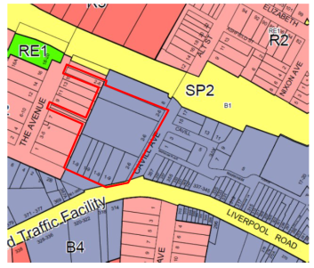
The application seeks that the properties within the red boundary in The Avenue be zoned B4 - Mixed Use to match the current use of the site and zoning off Cavill Avenue and Thomas Street.
Officer Comment.
It is considered that the properties off The Avenue should remain zoned R2- Low Density Residential to match the character of the street and present building typologies. “Roads” are permissible in an R2 Zoning and so these properties will be able to use this land for access to The Avenue if required.
5.2 Amendment to Maximum Building Height Map.
The current site’s maximum Building Height is described on the extract of the Map in Figure 2. Properties to the east within the blue boundary on the map have the benefit of a 7 metre height bonus pursuant to Clause 4.3A(3) of the Ashfield LEP 2013 (which requires 25 percent of the floor space within the height bonus to be provided as Affordable Housing). Presently, other sites in the town centre which have had development consent for residential flat buildings have had this enforced through Development Approval conditions of consent requiring this to be applied on the land title via a “restriction as to user”.
Figure 2 - Extract Ashfield LEP 2013 – Maximum Building Height Map. Code S signifies 23 metres, Code I signifies 8.5 metres, Code K signifies 10 metres. Blue boundary indicates where a 7 metre height bonus applies.
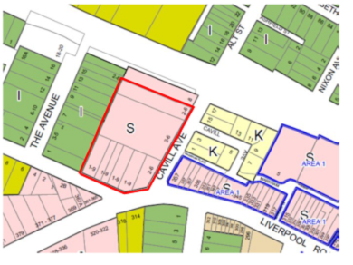
The application seeks to have all the properties within the red boundary contain a blue boundary (being properties fronting Cavill avenue and Thomas street) which gives a 7 metre height bonus pursuant to Clause 4.3A(3) of the Ashfield LEP 2013. This would generate approximately 18 affordable apartments (mix of one and two bedrooms). It would bring the total permissible building height to 30m, noting that existing buildings are
approximately 24m high.
The additional floor space that is generated with an extra 7 metres in height, where it is above the maximum FSR permitted in the LEP maps, is required to be addressed via Clause 4.6 – Variations of the Ashfield LEP, and “assessed on merits”. This would include such things as scale impacts to adjacent properties.
Officer Comment and need for a draft DCP.
The “Area 1” blue boundary was not applied to the site in the Ashfield LEP 2013, as during the Draft LEP 2012 phase the site was proposed as Heritage item, and so it was thought the site would not be redeveloped and so the 23m height was sufficient for the site (the existing building is approximately 24 m high). Council agreed to remove the heritage listing after considering objection to this listing arguing that the heritage listing was not warranted, that the building was a modern one and not meeting any of the Heritage Manual listing for criterion.
For the property fronting Cavill Avenue and Thomas Street (currently zoned B4 Mixed Use) it is considered that the 7 metre height bonus can be supported, providing that a site specific Development Control Plan is applied to the site, and to address building scale impacts to adjacent properties. This should require a transition/lowering of maximum height and scale to the west of the site in order to be sympathetic to the residential properties, provide guidelines for general site layout and retention of trees along Cavill Avenue as required in Councils Tree Preservation Policy, adequate distribution of open space on the site and contribution to the public domain, activation of ground floor areas, and address the matters brought up in the Architectural Excellence Panel (refer to Part 6 of the report). This draft DCP would provide guidance for assessment of the additional FSR (above the maximum 3:1 FSR), flowing from the 7 metre (2 storey) height bonus, which is required as part of a Clause 4.6 (Exceptions to development standards) to the Ashfield LEP 2013.
5.3 Amendment to Clause 4.3 (2A) in the Ashfield LEP that affects the use of the uppermost part of the building.
Clause 4.3 states as follows
4.3 Height of buildings
(1) The objectives of this clause are as follows:
(a) to achieve high quality built form for all buildings,
(b) to maintain satisfactory sky exposure and daylight to existing buildings, to the sides and rear of taller buildings and to public areas, including parks, streets and lanes,
(c) to provide a transition in built form and land use intensity between different areas having particular regard to the transition between heritage items and other buildings,
(d) to maintain satisfactory solar access to existing buildings and public areas.
(2) The height of a building on any land is not to exceed the maximum height shown for the land on the Height of Buildings Map.
(2A) If a building is located on land in Zone B4 Mixed Use, any part of the building that is within 3 metres of the height limit set by subclause (2) must not include any area that forms part of the gross floor area of the building and must not be reasonably capable of modification to include such an area.
The purpose of this clause is to account for various evident roof top building components, such as plant rooms, roof top communal open space including any pergola structures since this cannot be usually provided at ground level in a town centre, enclosed structures used to access a roof top containing stairs and landings, “green roofs” as promoted in the “Urban Green Cover Guidelines”- Office of Environment and Heritage. Otherwise the town centre would be restricted to flat inaccessible roof tops with poor to bland urban design outcomes and ‘absent” sustainable roof design. Sub Clause 2(A) also resulted from a previous Ashfield Council LEP working party resolution during formulation of the LEP.
The application states that it wishes to “adjust” Part (2A) of the above clause (in Italics), and proposes the following additional clause be added after (2A) as follows:
(a) Notwithstanding this provision, development consent may be granted for development at 2-6 Cavill Avenue , Ashfield in accordance with subclause 2, if Council has considered the relevant objectives.
Implicitly the proposal argues that the justification for the above is that the site is in a different context to those of the rest of the town centre, since it is a large site, that any new buildings will have very large roof areas, and so it is reasonable to allow within that roof top area some building (floor space). It argues that reliance can be made on the Built Height Objectives of the LEP.
Officer Comment
It is considered that the applicants request is acceptable on the proviso that there is a site specific DCP which will provide guidance on roof top area design and sustainability matters explained above.
5.4 Amendment to clause 4.3B of the Ashfield LEP –‘street wall height”.
Clause 4.3B states:
4.3B Ashfield town centre—maximum height for street frontages on certain land
(1) The objective of this clause is to apply a maximum height for primary street frontages on certain land in Ashfield town centre.
(2) This clause applies to land identified as “Area 1” on the Height of Buildings Map.
(3) Despite clauses 4.3 (2) and 4.3A (3), the maximum height of that part of a building that has an entrance or lobby on the ground floor facing Liverpool Road, Norton or Hercules Streets or Markham Place, Ashfield (a primary street frontage) is 12 metres for a distance of 12 metres from the primary street frontage away from the road.
The intention of this clause is to require a lower human scale along the principal roads in the Ashfield Town Centre which typically have 10-11 metre high terrace buildings, and Council would be aware of buildings that have been already constructed that illustrate this urban design scale principle.
The applicants wish to add the following clause after Sub Clause (3):
(a) Notwithstanding this provision, development consent may be granted for development at 2-6 Cavill Avenue, Ashfield in accordance with subclause (2), if Council is satisfied that this achieves an appropriate design outcome having regard to surrounding development.
Officer Comment
Existing buildings on the site are already prominent 5 storeys office buildings - 24 metres high (equivalent of 7 residential storeys) near the junction with Liverpool Road, placed within a landscape setting along the frontage of the site. Nearby constructed dwellings at Liverpool Road to the west are 6 storeys.
The proposed clause is considered acceptable providing a site specific DCP is provided (as explained in Part 5.2 above) which gives guidance on the built form and open space layout for the site along Liverpool Road, and responds to context of the site.
5.5 Amendment to Maximum FSR Map- increase the maximum FSR from 2:1 to 3:1.
Figure 3 Extract of Ashfield LEP 2013 FSR Map, T signifies 2.0:1. H Signifies 0.7:1, V signifies 3.0 :1.
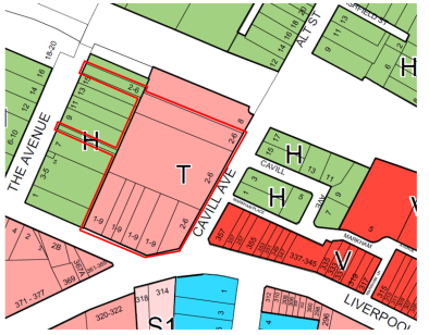
It is requested that the maximum FSR for properties within the red boundary be made 3.0:1.
Officer Comment
As explained above in the report, due to the previous proposed Heritage listing in the draft Ashfield LEP the maximum FSR for the main property off Cavill Avenue was kept lower at 2:1, and later the LEP Heritage listing was removed in the gazetted Ashfield LEP 2013.
The now proposed FSR of 3:1 for the properties off Cavill Ave and Thomas Street, currently shown in pink shade in Figure 3 will accord with the proposed maximum FSR elsewhere in the majority of the town centre (noting that the corresponding maximum Building Height of 23 metres).
It considered that the existing FSR of Code H- 0.75:1 for properties in The Avenue should remain to reflect the adjacent lower rise houses and flat buildings in that street, and this will reflect the maximum building height of 8.5 metres applied to the R2 Low Density Zone.
6.0 OTHER STAFF COMMENTS
Traffic Engineer
Council’s Traffic Engineer have not raised any objection to this stage of the Proposal.
Economic Development Manager
Agrees with the conclusions of the Strategic Economic Assessment Report (Attachment 2) and that should the proposed higher development standards in the Ashfield LEP facilitate use of the site for mostly standalone residential flat buildings, that this will not have an adverse local economic impact to existing retail areas and service providers in the town centre, and that there will be good transport access to regional employment areas within close vicinity of the Ashfield Town Centre which will compensate for loss of employment resulting from the commercial buildings being vacated.
Architectural Excellence Panel.
The panel have reviewed the “Design Report” (Attachment 3) submitted with the Planning Proposal and advised as follows:
It is the Panel’s view that the best overall strategy is to:
· determine and retain significant trees on the site, along with commensurate setbacks to enable this retention and augment landscaping
· provide a predominantly residential development, sited within a strong landscape setting;
· structure the site around the Cavill Street/Liverpool Road/Thomas Street frontages, with new publicly accessible connections through the site, set out on the alignment of property links to The Avenue and along the north-western boundary, to generally result in a perimeter layout, with a functional-shaped central open space (generally as proposed);
· rather than a uniform, 8-9 storey envelope around the site perimeter, which creates an unrelenting, enclosed and self-shadowing outcome , allow for additional height (with no overall additional density) generally configured as smaller-footprint (maximum 500sqm/floor) buildings on the south-eastern side of the site (provided that solar access impacts can be mitigated);
· transition to lower scale buildings to the north-western side of the site to allow good solar access into the centre of the site, to provide visual relief and to better relate to the adjoining medium density residential scale;
· present a “landmark” building to the Liverpool Road frontage and to terminate the vista behind the retained and embellished landscape corner, while providing a clear break between building envelopes to open to the central landscaped courtyard beyond and reduce the apparent density; and
· Provide some retail activation onto a well-landscaped street corner addressing the Cavill Street/Liverpool/Road Thomas Street corner frontage.
The above can be used to inform a site specific draft Development Control Plan for the site. The applicant’s Concept Design (Attachment 3) should also be amended to reflect the above, as this document is necessary pursuant to the Strategic Merit test of the Planning Proposal Guidelines to justify the proposed Development Standards.
FINANCIAL IMPLICATIONS
The Planning Proposal does not raise any financial implications for Council. The Planning proposal is intended to increase the level of flexibility in land uses at the site and is unlikely to require any upgrade works to Council infrastructure. Detailed assessment of new uses will be undertaken at the detail design stage associated with each new development application.
CONCLUSION
The Planning Proposal application is at pre-Gateway stage, and would be subject to future community consultation and detailed assessment should Council agree to be the Relevant Planning Authority and are granted delegation for this.
The Planning Proposal is considered acceptable for submission to the Department of Planning and Environment for Gateway Determination - subject to requiring amendments to its ancillary documents as identified in this report. The proposal is considered to have adequate Strategic merit, for the reasons stated in the report. This includes that it will provide development standards that equate with those found in the other parts of the Ashfield Town Centre, and be able to better respond to potential circumstance where the two existing five office buildings are vacated. The additional Floor Space Ratio and Building Height will also generate affordable housing with approximately 18 apartments being able to be provided, pursuant to Clause 4.3 A (3) of the Ashfield LEP 2013, which reflects Council’s Affordable Housing Policy,
Given the unique circumstances of a large site in the Ashfield Town Centre it is necessary to apply a site specific draft Development Control Plan to provide guidelines for future development on the site to ensure a positive impact for the Ashfield Town Centre. This will include the suitability of the 7 metre (2 storey) height bonus being sought for particular pats of the site and relationship to adjoining properties. The draft DCP should be included with a future exhibition of the Planning Proposal.
|
1.⇩ |
Planning Proposal and Letter |
|
2.⇩ |
Strategic Economic Assessment |
|
3.⇩ |
Concept Design Report |
|
4.⇩ |
Architectural Excellence Panel Comments |
|
Council Meeting 25 July 2017 |
Subject: Planning Proposal No. DA201600376 at 466-480 New Canterbury Road and 26-38 Hercules Street, Dulwich Hill
File Ref: DA201600376/09/72587.17
Prepared By: Peter Failes - Urban Design Planner
Authorised By: Elizabeth Richardson - Group Manager Development Assessment and Regulatory Services
|
SUMMARY On 27 July 2016, Council received a planning proposal, for a site known as 466-480 New Canterbury Road and 26-38 Hercules Street, Dulwich Hill. The planning proposal seeks to amend Marrickville Local Environmental Plan (MLEP) 2011 by: 1. Amending the zoning from IN2 Light Industrial to RE1 Public Recreation for the proposed public open space link along the western edge of the site and public open space pocket park on the south-eastern corner of the site, and to B5 Business Development for the remaining land; 2. Including a clause 22 in Schedule 1 Additional permitted uses of MLEP 2011 to permit residential flat buildings throughout the B5 Business Development zone, and neighbourhood shops limited to the north-western corner of the site; 3. Amending the MLEP 2011 height of building (HoB) map from no height identified to a mixture of 20 m, 23 m and 32.0 m, and retaining no HoB control for the area relating to the proposed open spaces and the church; and 4. Amending the MLEP 2011 floor space ratio (FSR) map from 0.95:1 FSR to a mixture of 2.4:1, 3.0:1 and 3.3:1 for the mixed use component, 1.2:1 for the church, and no FSR identified for the proposed public open space pocket park on the south-eastern corner of the site.
The planning proposal is supported by other documentation, including an urban design report that outlines the envelope and architectural concept, consisting of: · a perimeter block layout, with built form generally massed to the site edges and provision of a shared central communal open space courtyard; · Five storey mixed use development along New Canterbury Road, with retention of the four two-storey shop facades near Kintore Street corner and ground floor non-residential use (with retail limited to the north-western corner of the site); · Eight storey, part nine storey for a minor part fronting Hercules Street, ‘landmark’ mixed use building massed to the western side of the site adjacent to the light rail / GreenWay corridor, but setback 6-8 m, and setback a minimum of 7.5 m from the New Canterbury Road boundary; · Five storey residential flat building in the central part of Kintore Street side of the site; · Five storey, part six storey for a minor part fronting Hercules Street, residential flat building in the central part of Hercules Street fronting side of the site; · Retention and alteration of the Greek Orthodox Church of the Holy Unmercenaries, located at 28 Hercules Street; · Provision of public open spaces, consisting of a pocket park on the corner of Hercules and Kintore Street and a strip of land adjacent to the light rail corridor connecting between Hercules Street and New Canterbury Road; and · A three level basement car park accommodating 29 spaces, with entrance off the middle of the Kintore Street frontage and a three level basement car park accommodating 137 spaces, with entrance off the middle of the Hercules Street frontage.
The proponent has worked responsively with Council, through the pre planning proposal and planning proposal stages, including referral comments received from the Architectural Excellence Panel, which has resulted is a highly advanced envelope and architectural concept, based on a good understanding of the site and its context and providing a well-considered approach to connectivity, the public domain, heritage preservation and density. This gives a high level of confidence about the potential built outcome that will result from the planning proposal.
While the development intention of the planning proposal as outlined by the concept is supported, some alterations to the proposed planning controls is recommended, to ensure they match the proposed envelopes and lead to the desired land use and built outcomes.
The proponent has provided a voluntary planning agreement offer for public open space and affordable housing. This would be provided in addition to Section 94 contributions and other public domain works provided as part of the development. The value of the public benefits or otherwise of the offer will need to be the subject of further evaluation and negotiation with the proponent after any Gateway determination from the Department of Planning and Environment and prior to the final determination of the planning proposal.
The proposal is considered to have strategic merit as it involves increasing residential densities in a highly accessible location and is consistent with the direction of the revised draft Sydenham to Bankstown Urban Renewal Corridor Strategy. The proposed redevelopment has the potential to provide significant community benefit through public domain improvements, improved pedestrian linkages and affordable housing, associated with the terms of the final VPA to be negotiated with Council. Accordingly, it is recommended that Council resolve to forward the planning proposal in the manner recommended in this report to the Department of Planning and Environment for Gateway determination. |
|
RECOMMENDATION
THAT:
1. Council supports the development intention of the planning proposal as outlined by the concept design within the submitted Urban Design Report, dated 23 May 2017; 2. The planning proposal zoning be altered, with Marrickville Local Environmental Plan (MLEP) 2011 Zoning Maps being amended from IN2 Light Industrial zone to: (a) RE1 Public Recreation zone for the land on the western edge of the site adjacent to the Light Rail line, and the proposed pocket park on the south-eastern corner of the site (or RE2 Private Recreation for any of this land that Council does not agree to take ownership of); (b) B5 Business Development for Nos. 466-480 New Canterbury Road, (excluding the area proposed to be zoned RE1 Public Recreation) and the rear (approximately 9 m) parts of Nos. 26-28 Hercules Street, Dulwich Hill not proposed to be zoned RE1 Public Recreation or RE2 Private Recreation, being Lots 1, 2, 3 and 4 DP542147, Lot 1 DP540366, Lots 1, 2 and 3 DP236603 and rear (approximately 9 m) parts of Lot 4 DP540366 and Lot 14 Section 4 DP932, with an additional permitted use clause applying to such zoned land; (c) R4 High Density Residential for Nos. 34-38 Hercules Street, (excluding the area proposed to be zoned RE1 Public Recreation) and the rear of No. 474 New Canterbury Road fronting Hercules Street, Dulwich Hill, being Lots 5,6 and 7 DP236603 and Lot 2 DP540366; and (d) RE2 Private Recreation for No. 28 Hercules Street, (excluding the area proposed to be zoned B5 Business Development) and the part of No. 26 Hercules Street not proposed to be zoned RE1 Public Recreation or B5 Business Development, Dulwich Hill; 3. The planning proposal clause wording to be included in Schedule 1 Additional permitted uses be altered to read: Use of certain land at 466-480 New Canterbury Road and 26-38 Hercules Street, Dulwich Hill (1) This clause applies to land at 466–480 New Canterbury Road and 26–38 Hercules Street, Dulwich Hill, being Lots 1, 2, 3 and 4 DP542147; Lots 1, 2 and 4 DP540366; Lots 1, 2, 3, 5, 6 and 7 DP236603; and Lot 14 Section 4 DP932. (2) Development for the following purposes is permitted with consent: (a) residential flat buildings, as part of a mixed use development, on land zoned B5 Business Development but only if: (i) any dwelling located on the ground floor will not have frontage to New Canterbury Road; (b) neighbourhood shops on the land at 478-480 New Canterbury Road, Dulwich Hill, being Lots 1 and 2 DP236603 in Zone B5 Business Development; and (c) vehicular and pedestrian access, car parking and site facilities on the land at 34-38 Hercules Street and the rear of 474 New Canterbury Road, Dulwich Hill in Zone R4 High Density Residential to service the development on the land at 474-480 New Canterbury Road, Dulwich Hill in Zone B5 Business Development. 4. The planning proposal height of building (HoB) be altered, with MLEP 2011 HoB Maps being amended from no height identified to: (a) 17 metres for Nos. 466-472 New Canterbury Road, the front part of No. 474 New Canterbury Road, 476 New Canterbury Road, the front 7.5 metres of Nos. 478 and 480 New Canterbury Road and the rear (approximately 9 m) part of Nos. 26-28 Hercules Street, Dulwich Hill, being Lots 1, 2, 3 and 4 DP542147, Lot 1 DP540366, Lot 3 DP236603 the front 7.5m of Lots 1 and 2 DP236603, and the rear (approximately 9 m) part of Lot 4 DP540366 and Lot 14 Sec 4 DP932; (b) 20 metres for the rear part of No. 474 New Canterbury Road and No. 34 Hercules Street, Dulwich Hill, being Lot 2 DP540366 and Lot 7 DP236603; (c) 29 metres for the rear part behind the front 7.5 m of Nos. 478-480 New Canterbury Road, Dulwich Hill, being Lots 1 and 2 DP236603 (excluding the area proposed to be zoned RE1 Public Recreation, which is to have no height control indicated); (d) 32 metres for No. 36-38 Hercules Street, Dulwich Hill, being Lots 5 and 6 DP236603 (excluding the area proposed to be zoned RE1 Public Recreation, which is to have no height control indicated); and (e) 9.5 metres for the front (approximately 22 m) part of Nos. 26-28 Hercules Street not proposed to be zoned RE1 Public Recreation or B5 Business Development, Dulwich Hill, being the front (approximately 22 m) part of Lot 4 DP540366 and Lot 14 Sec 4 DP932 not proposed to be zoned RE1 Public Recreation or B5 Business Development. 5. The planning proposal floor space ratio (FSR) be altered, with MLEP 2011 FSR Maps being amended from 0.95:1 FSR to: (a) 3.0:1 for Nos. 466-472 New Canterbury Road and rear (approximately 9 m) part of Nos. 26-28 Hercules Street, Dulwich Hill, being Lots 1, 2, 3 and 4 DP542147, and rear (approximately 9 m) part of Lot 4 DP540366 and Lot 14 Sec 4 DP932; (b) 2.2:1 for Nos. 474-476 New Canterbury Road, and No. 34 Hercules Street (excluding the western (approximately 5.5m) part of No. 476 New Canterbury Road and the western (approximately 6.0-7.5m) part of No. 34 Hercules Street), Dulwich Hill, being Lots 1 and 2 DP540366 and Lots 3 and 7 DP236603 (excluding the western (approximately 5.5m) part of Lot 3 DP236603 and the western (approximately 6.0-7.5m) part of Lot 7 DP236603); (c) 3.3:1 for Nos. 478-480 New Canterbury Road, the western (approximately 5.5m) part of No. 476 New Canterbury Road, Nos. 36-38 Hercules Street, and the western (approximately 6.0-7.5m) part of No. 34 Hercules Street, Dulwich Hill, being Lots 1, 2, 5 and 6 DP236603, the western (approximately 5.5m) part of Lot 3 DP236603, and the western (approximately 6.0-7.5m) part of Lot 7 DP236603; (d) 0.6:1 for the front (approximately 22 m) part of Nos. 26-28 Hercules Street not proposed to be zoned RE1 Public Recreation or B5 Business Development, Dulwich Hill, being the front (approximately 22 m) part of Lot 4 DP540366 and Lot 14 Sec 4 DP932 not proposed to be zoned RE1 Public Recreation or B5 Business Development; and (e) No FSR indicated for the front (approximately 22 m) part of No. 26 Hercules Street, Dulwich Hill, being the front (approximately 22 m) part of Lot 14 Sec 4 DP932, relating to the land proposed to be zoned RE1 Public Recreation for a pocket park on the south-eastern corner of the site. 6. Council officers consider the Voluntary Planning Agreement (VPA) Offer in accordance with Council’s interim VPA Policy; 7. The planning proposal, as altered by recommendations 2-5, be forwarded to the Minister for Planning for a Gateway determination in accordance with Section 56 of the Environmental Planning & Assessment Act 1979; 8. Council requests that delegated plan making functions be granted in relation to the planning proposal; and 9. Site specific planning controls be developed to apply to the future development at 466-480 New Canterbury Road and 26-38 Hercules Street, Dulwich Hill, for inclusion in Part 9.18 (Precinct 18 – Dulwich Hill Station North) of MDCP 2011 and that these be publicly exhibited concurrently with the planning proposal. |
1. BACKGROUND
On 21 October 2015 Council received a Pre-Planning Proposal Advice application for a mixed use development, as well as provision of open space and the ongoing use of a church at 28 Hercules Street. The proposal was supported by an Urban Design Report that provided analysis of the site and surrounds and a concept design consisting of 5 storey residential envelopes on the majority of the site; an 8 storey ‘landmark’ building adjacent to the light rail corridor; retention and alteration of the church building; some ground floor retail fronting New Canterbury Road; and public open spaces, consisting of a pocket park on the corner of Hercules and Kintore Street and a link adjacent to the light rail corridor. An advice letter was sent to the proponent on 10 December 2015, including comments from the Architectural Excellence Panel (AEP), which generally supported the proposal, given the development was consistent with the draft Sydenham to Bankstown Urban Renewal Corridor Strategy and the scale was generally appropriate for the site. The advice recommended improvements to the envelope treatment and configuration of zoning and development standards to achieve the desired development outcome. It also supported the open spaces being offered (while noting the limitations of the small pocket park) and suggested other public domain and social infrastructure (affordable housing) needs in the locality that the development should contribute towards.
On 27 July 2016, Council received the subject planning proposal. An additional information letter was sent out on 29 August 2016 to address certain information missing and clarify aspects of the proposal, which the applicant has subsequently addressed.
Amendments to the Planning Proposal were submitted in June 2017, responding to issues raised. The proponent has now gained ownership of No. 26 Hercules Street (on which the public open space pocket park is proposed to be located), and has modified the planning proposal to include the front part of 26-28 Hercules Street to be in the Primary Site. This enables the implementation and dedication of the public open space pocket park to be delivered as part of a VPA tied to the development of the Primary Site, along with the church alterations and additions, which are required in order for the rear part of these properties to be excised and be added to the Secondary Site.
LRAC considered this report at its Meeting on 11 July 2017 and recommended:-
|
L0717 Item 4 Planning Proposal No. DA201600376 at 466 - 480 New Canterbury Road and 26 -38 Hercules Street Dulwich Hill |
|
Recommendation: Drury / Stott THAT the LRAC calls on the Administrator to defer the consideration of this proposal until the Minister makes a decision about the Sydenham to Bankstown Urban Renewal Corridor Strategy. |
|
CARRIED |
Officers Comment
The Sydenham to Bankstown Urban Renewal Corridor Strategy is currently on public exhibition until 3 September 2017. There is no mandated timeframe in which the Minister must make a decision on the Strategy. It is not expected that a decision will be made on the Strategy until late 2017 or early 2018.
Although Council may determine to hold the proposal in abeyance until such time that the Strategy is in place, the proponent will have the opportunity during this period to submit a pre-Gateway application to the Department of Planning and Environment and circumvent Council’s decision. The pre-Gateway application could revert to the proponent submitting the planning proposal as originally submitted to Council which is a less desirable proposal to that currently before Council.
This approach is not recommended as Council staff have worked proactively with the proponent to shape a planning proposal that will deliver an improved built form outcome, public open space, improve the condition of the Church on site and provide a quality urban domain and access to Dulwich Grove Light Rail Station.
2. THE SITES AND SURROUNDING DEVELOPMENT
The site that the planning proposal relates to consists of 466-480 New Canterbury Road and 26-38 Hercules Street, Dulwich Hill. The site is bounded by New Canterbury Road (a major, highly trafficked RMS classified road) to the north (with a 78.46 m long frontage); Kintore Street to the east (being 60.96 m in width), Hercules Street on the south (being 75.759 m in length); and the light rail / GreenWay corridor (with the light rail situated 6-9 m below the site level in a deep cutting) to the west (being approximately 61.17 m in total width - consisting of 13.565 m, 16.915 m and 30.685 m segments). The total site area is 4,743 sqm.
The site accommodates a number of buildings of various ages and styles which are used for light industrial and artisan purposes. On-site parking is available in an existing at grade parking area on the southern portion of the site from Hercules Street, which also provides some limited servicing. The buildings on the north-eastern corner of the site comprise traditional two storey shop top housing, while the south-eastern corner of the site accommodates a two storey church building and single storey brick and tile cottage.
The site is located approximately 8km south-west of the Sydney CBD; 1km north of Cooks River; 800m north of Dulwich Hill Railway Station; 300m south-west of Dulwich Hill Centre; 400m south-west Dulwich High School of Visual Arts and Design; opposite the Dulwich Hill Primary School (on the other side of Hercules Street); and directly adjacent to the entrance to the Dulwich Grove Light Rail Stop (at the north-western corner of the site). The site is situated 100m from bus stops on both sides of New Canterbury Road for multiple Sydney Buses routes (418, 428, 444, 445 and L28), with routes 425 and 426 located on nearby Marrickville Road. The site is also located adjacent to the regional RR08 Newtown to Canterbury cycling route (running along Hercules Street); regional RR01 Cooks River to Iron Cove GreenWay cycling/walking route running along the path to the west of the light rail corridor (at street level above the cutting); and near local LR18 Marrickville Station to West Dulwich Hill cycle route (running along nearby Beach Road).
The area around the site has a mix of zonings, including Residential R1 – General Residential; R2 – Low Density Residential; R3 Medium Density Residential; R4 – High Density; B1 – Neighbourhood Centre; B2 – Local Centre; and B4 – Mixed Use. This reflects the mix of uses, including light industrial, warehousing, retail/commercial mixed-use and medium density residential uses, with retail in the Dulwich Hill Centre and single dwelling housing further from the site, in the surrounding Dulwich Hill suburb.
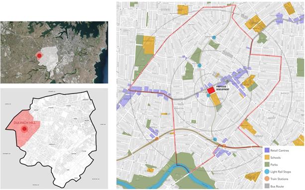
Image 1: Site location
The planning proposal relates to the properties shown in the table and map below, which comprises a Primary Site and a Secondary Site. Nos. 474 - 480 New Canterbury Road and 26 and 34-38 Hercules Street are currently owned by the proponent, and it is understood that an arrangement has been made with the Greek Orthodox Church of the Holy Unmercenaries at 28 Hercules Street, to undertake alterations and additions to the church building (to reduce the building length but widen it slightly) and undertake boundary adjustments to change the configuration of the church property. Except for the rear part of Nos. 26-28 Hercules Street these properties form the Primary Site. The remaining properties form the Secondary Site, which may be developed separately.
|
Address |
Lot/DP |
Area |
Interest |
|
474 New Canterbury Road, Dulwich Hill |
Lot 1&2 DP540366 |
1026.0 sqm |
Primary Site |
|
476 New Canterbury Road, Dulwich Hill |
Lot 3 DP236603 |
371.5 sqm |
Primary Site |
|
478 New Canterbury Road, Dulwich Hill |
Lot 2 DP236603 |
371.5 sqm |
Primary Site |
|
480 New Canterbury Road, Dulwich Hill |
Lot 1 DP236603 |
524.2 sqm |
Primary Site |
|
Front part of 26 Hercules Street Dulwich, Hill |
Front part of Lot 14 Sec 4 DP932 |
Approx. 216 (of 306.1) sqm |
Primary Site |
|
Front part of 28 Hercules Street Dulwich, Hill |
Front part of Lot 4 DP540366 |
Approx. 216.5 (of 306.6 sqm) |
Primary Site |
|
34 Hercules Street Dulwich, Hill |
Lot 7 DP236603 |
371.5 sqm |
Primary Site |
|
36 Hercules Street Dulwich, Hill |
Lot 6 DP236603 |
371.5 sqm |
Primary Site |
|
38 Hercules Street Dulwich, Hill |
Lot 5 DP236603 |
482.3 sqm |
Primary Site |
|
466 New Canterbury Road, Dulwich Hill |
Lot 1 DP542147 |
148.5 sqm |
Secondary Site |
|
468 New Canterbury Road, Dulwich Hill |
Lot 2 DP542147 |
148.5 sqm |
Secondary Site |
|
470 New Canterbury Road, Dulwich Hill |
Lot 3 DP542147 |
142.1 sqm |
Secondary Site |
|
472 New Canterbury Road, Dulwich Hill |
Lot 4 DP542147 |
170.7 sqm |
Secondary Site |
|
Rear part of 26 Hercules Street Dulwich, Hill |
Rear part of Lot 14 Sec 4 DP932 |
Approx. 90.1 sqm (of 306.1) sqm |
Secondary Site |
|
Rear part of 28 Hercules Street Dulwich, Hill |
Rear part of Lot 4 DP540366 |
Approx. 90.6 sqm (of 306.6) sqm |
Secondary Site |
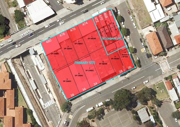
Image 2: Identification of subject site
3. EXISTING PLANNING CONTROLS
The site is currently zoned IN2 Light Industrial; has no Height of Building (HOB) development standard and has a 0.95:1 floor space ratio (FSR) development standard.
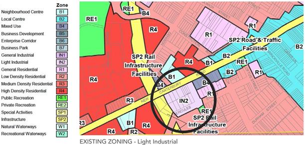
Image 3: Existing MLEP 2011 zoning
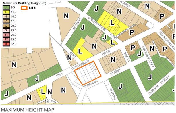
Image 4: Existing MLEP 2011 Height of Building
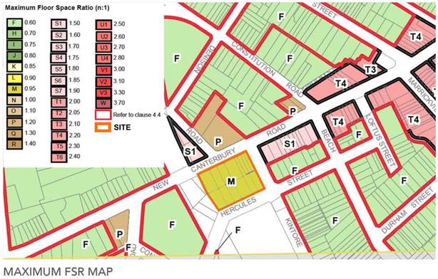
Image 5: Existing MLEP 2011 Floor Space Ratio
4. DETAILS OF THE PLANNING PROPOSAL
The planning proposal seeks to amend Marrickville Local Environmental Plan (MLEP) 2011 by:
1. Amending the zoning from IN2 Light Industrial to RE1 Public Recreation for the part of No. 480 New Canterbury Road (Lot 1 DP236603) and part of 38 Hercules Street (Lot 5 DP236603) relating to the proposed link along the western edge of the site, and the front part of No. 26 Hercules Street (Lot 14 Section 4 DP932) relating to the proposed pocket park on the south-eastern corner of the site;
2. Amending the zoning from IN2 to B5 for the remaining land;
3. Including a clause 22 in Schedule 1 Additional permitted uses as follows:
22. Use of certain land at 466 - 480 New Canterbury Road, Dulwich Hill
(1) This clause applies to land at 466–480 New Canterbury Road and 26 – 40 Hercules Street, Dulwich Hill, being Lot 1 DP236603; Lot 2 DP236603; Lot 3 DP236603; Lot 5 DP236603; Lot 6 DP236603; Lot 7 DP236603; Lot 1 DP540366; Lot 2 DP540366; Lot 1 DP542147; Lot 2 DP542147; Lot 3 DP542147; Lot 4 DP542147; Lot 4 DP540366; Lot 14 Section 4 DP932;
(2) Development for the purpose of a residential flat building is permitted with development consent, as part of a mixed use development, but only if:
(a) neighbourhood shops are only permitted within 45m of the New Canterbury Road entry of Dulwich Grove Light Rail Station, and
(b) any dwelling located on the ground floor will not have frontage to New Canterbury Road.
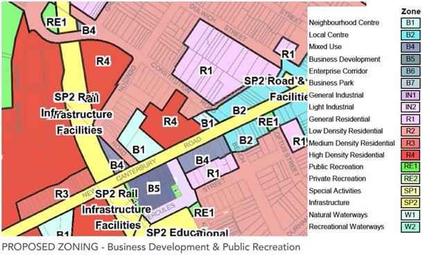
Image 6: Proposed amendment to MLEP 2011 zoning
4. Amending the MLEP 2011 height of building (HoB) map from no height identified to:
(a) 20 metres for Nos. 466-472 New Canterbury Road (Lots 1, 2, 3 and 4 DP542147), the front part of No. 474 New Canterbury Road (Lot 1 DP540366), 476 New Canterbury Road (Lot 3 DP236603) and rear part of Nos. 26-28 Hercules Street (Lot 14 Sec 4 DP932 and Lot 4 DP540366);
(b) 23 metres for the rear part of No. 474 New Canterbury Road (Lot 2 DP540366) and No. 34 Hercules Street (Lot 7 DP236603); and
(c) 32 metres for Nos. 478-480 New Canterbury Road (Lots 1 and 2 DP236603) and 36-38 Hercules Street (Lots 5 and 6 DP236603), excluding the land proposed to be zoned RE1 public recreation relating to the link along the western edge of the site;
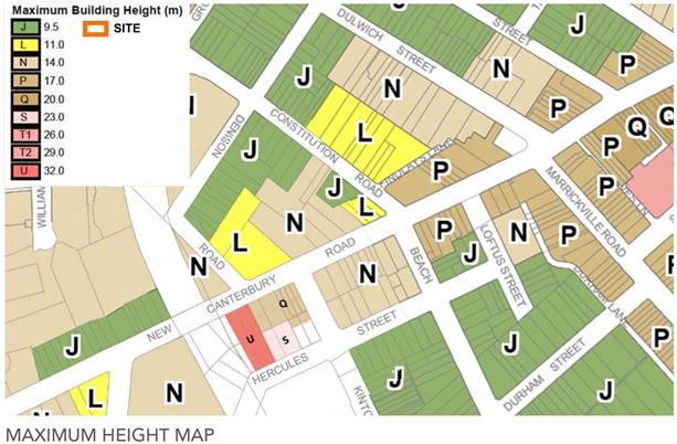
Image 7: Proposed amendment to MLEP 2011 Height of Building
5. Amending the MLEP 2011 floor space ratio (FSR) map from 0.95:1 FSR to:
(a) 3.0:1 for Nos. 466-472 New Canterbury Road (Lots 1, 2, 3 and 4 DP542147) and rear part of Nos. 26-28 Hercules Street (Lot 14 Sec 4 DP932 and Lot 4 DP540366);
(b) 2.2:1 for No. 474 New Canterbury Road (Lot 1 and 2 DP540366), 476 New Canterbury Road (Lot 3 DP236603) and No. 34 Hercules Street (Lot 7 DP236603);
(c) 3.3:1 for Nos. 478-480 New Canterbury Road (Lots 1 and 2 DP236603) and 36-38 Hercules Street (Lots 5 and 6 DP236603);
(d) 1.2:1 for the front part of No. 28 Hercules Street (Lot 4 DP540366); and
(e) No FSR indicated for the front part of No. 26 Hercules Street (Lot 14 Sec 4 DP932), relating to the land proposed to be zoned RE1 public recreation for a pocket park in the south-eastern corner of the site.
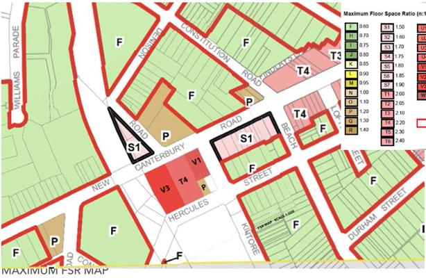
Image 8: Proposed amendment to MLEP 2011 Floor Space Ratio
The planning proposal is accompanied by the following supporting documentation:
· Urban Design Report
· Assessment of Traffic and Parking Implications
· Preliminary Site Investigation (investigating potential contamination)
· Waste Management Plan
· Heritage Assessment
· Overland Flow Flood Advice
The supporting Urban Design Report outlines the envelope and architectural concept, including calculations of FSR and HoB, which confirms that the proposed FSR and HoB in the planning proposal correlates with the desired massing for the site. The submitted envelope and architectural concept consists of:
· A perimeter block layout, with built form generally massed to the site edges and provision of a shared central communal open space courtyard, approximately 16 m wide x 34 m long in size.
· Five storey mixed use development along New Canterbury Road, with retention of the four two-storey shop facades near Kintore Street corner, ground floor non-residential use (with retail limited to the north-western corner of the site opposite the light rail stop entrance onto an integrated forecourt area and residential above, massed to the New Canterbury Road boundary and to Kintore Street near the corner (with a recess on level 2 where it is above the retained façade);
· Eight storey, part nine storey for a minor part fronting Hercules Street, ‘landmark’ mixed use and residential flat building massed to the western side of the site adjacent to the light rail / GreenWay corridor but setback 6-8 m, and setback a minimum of 7.5 m from the New Canterbury Road boundary (and five storey street wall massing);
· Five storey residential flat building in the central part of Kintore Street fronting side of the site, setback minimum 3 m form the Kintore Street boundary;
· Five storey, part six storey for a minor part fronting Hercules Street, residential flat building in the central part of Hercules Street fronting side of the site, setback minimum 3 m from the Hercules Street boundary;
· Retention and alteration of the Greek Orthodox Church of the Holy Unmercenaries, located at 28 Hercules Street, involving relocation of its apse from its rear to its eastern side, to connect to a new community space/garden
· Provision of public open spaces, consisting of a pocket park on the corner of Hercules and Kintore Street (approximately 9 m wide x 22m long and 210 sqm in area) and a strip of land adjacent to the light rail corridor connecting between Hercules Street and New Canterbury Road (approximately 6-8 m wide x 61 m long and 397 sqm in area) that will have a 2m wide shared walking/cycling path, trees and other landscaping (and potentially integrated landscape treatment on the top of the rail cutting on Transport for NSW (TfNSW) owned land and public domain treatment at the entrance of the Dulwich Grove light rail stop to create a larger integrated forecourt over TfNSW, Council and proponent owned land).
· A three level basement car park accommodating 29 spaces, with an entrance from the Kintore Street frontage, allowing separate development to occur for Nos. 466-472 New Canterbury Road (Lots 1, 2, 3 and 4 DP542147) and the rear part of Nos. 26-28 Hercules Street (Lot 14 Sec 4 DP932 and Lot 4 DP540366), if required.
· A three level basement car park accommodating 137 spaces, with an entrance from the Hercules Street frontage, to serve the remaining mixed use development.
5. Developer Contributions
The proponent has advised that they intend on entering into a Voluntary Planning Agreement (VPA) with Council, outlined as follows to comprise:
1. Public open space on the western side of subject site on the interface with the light rail corridor. This new space will:-
· effectively provide a through-site-link between the residential lands to the south and the entry to the Dulwich Grove Light Rail Station;
· provide improved pedestrian and bicycle access through the site; and
· form part of an important link within the broader pedestrian network that links Dulwich Hill and the light rail and bus network.
The developer offers to finance the embellishment works and dedicate the land to Inner West Council on the western side of subject site (as show on Annexure A) on the interface with the light rail corridor to the value of $2.41m (land $1.4m, embellishment $1m) for the benefit of the general public as an additional public benefit provided as part of the project.
2. Public open space provision on the south-eastern of subject site fronting Hercules and Kintore Streets. This new public open space will:-
· provide a pocket park for use by the broader residents of the Hercules/Kintore Street precinct;
· provide a visual curtilage to the Church of the Holy Unmercenaries; and
· form part of an important link within the broader open space network of Dulwich Hill.
The developer offers to finance the embellishment works and dedicate the land to Inner West Council on the south-eastern of subject site (as show on Annexure A) fronting Hercules and Kintore Streets to the value of $1.93m (land $1.3m, embellishment $0.63m) for the benefit of the general public as an additional public benefit provided as part of the project.
3. Public owned affordable housing provision in close proximity to the light rail station. This new public owned affordable housing will:-
· be completed to the same standard as the other housing units; and
· be dedicated to the Council as strata lots as part of the strata plan.
There is no requirement under the Marrickville Local Environmental Plan 2011 for the dedication of these affordable housing units. Notwithstanding this, the developer offers to construct, strata sub-divide and dedicate the units to Inner West Council on the subject site of 3% of the apartments (5 apartments under the proposed scheme) in the same mix as the DCP or cash equivalent for the benefit of the general public as an additional public benefit provided as part of the project.
The voluntary planning agreement would not exclude (wholly or in part) the application of section 94, 94A or 94EF. The benefits under the agreement are not to be taken into consideration in determining a development contribution under section 94.
Other public benefits identified by the proponent that the redevelopment will provide, are the
· retention (and expected restoration) of the facades of the four shops on the north-eastern corner of the site (corner New Canterbury Road and Kintore Street), and
· retention (with some alteration improvements) of the Greek Orthodox Church of the Holy Unmercenaries,
that the proponent has considered worthy of retention as identified in a supporting heritage study submitted with the planning proposal, while not being worthy of heritage listing.
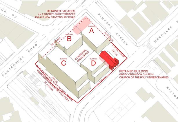
Image 9: Proposed public benefits (also refer to ground floor plan in attachments)
While Council is generally supportive of the provision of the ‘pocket park’ as green open space and the link providing public access, referral comments from the Public Domain Planning Unit within the Recreation and Aquatics Group considered the open spaces being offered do not offer great recreation benefit to the LGA and as such it would not be worth the expense for Council to take ownership of these facilities. However, Environmental Services and Planning Services find value in Council taking ownership for these spaces to be fully public open space (especially in relation to the Light Rail Station forecourt, link between Hercules Street and New Canterbury Road and landscaping on the edge of the GreenWay in accordance with GreenWay landscape guidelines, to enhance the GreenWay access, biodiversity and a habitat corridor, and ensure ongoing stewardship of this area can be achieved).
While the retention of the church and ‘heritage’ facades have only limited public benefit it will be a positive outcome to enable architectural, social and cultural continuity for the area. While there are no mechanisms to protect the church, it will benefit from the property now being in the Primary Site, requiring alterations and addition in order for the rear part of the property to be excised and be added to the Secondary Site. Additionally, the planning controls recommended will result in the site having limited development potential, which will assist in the long term retention of the church rather than it being redeveloped. In regards to the heritage facades, it is considered reasonable that the merits of the retention of the ‘heritage’ facades be considered as part of any future DA of the Secondary Site.
The proponent has been informed that other contributions could be delivered as part of the development (potentially of greater strategic value) such as improvements to Transport for NSW owned Dulwich Grove Light Rail Stop entrance (to assist creating an integrated forecourt); implementation of the GreenWay missing link near the site (shared walking/cycling route RR01); cycling route RR08 along Hercules Street; public domain improvements surrounding the site, such as street trees, verge extensions to allow larger street trees and streetscape improvement, undergrounding or aerial bundling of power lines; provision of green walls; and public art.
The value of the public benefits or otherwise of the offer will need to be the subject of further evaluation and negotiation with the proponent after any Gateway determination from the Department of Planning and Environment and prior to the final determination of the planning proposal. Any draft VPA supported will be placed on exhibition concurrently with any planning proposal receiving Gateway.
6. ASSESSMENT OF PROPOSED ENVELOPES AND ARCHITECTURAL CONCEPT
The proponent has worked responsively with Council, through the pre planning proposal and planning proposal stages, providing detailed analysis of the site and its context; multiple preliminary envelope massing studies; presentations of public domain and other public benefit; proof of concept architectural plans and perspective drawings; shadow diagrams and presentation of other visioning images. While the envelope and architectural concept has been generally supported by the AEP, recommendations were provided to refine the envelopes and architectural concept.
Key recommendations included pushing the mass to the New Canterbury Road boundary; providing increased setback of the upper 3 storey ‘landmark’ building component; providing step down of the 5th storey to the north of the central communal courtyard; providing horizontal and vertical breaks between main building parts; and providing commercial activation fully along New Canterbury Road (instead of residential with poor amenity), to improve the quality of the built form and the streetscape, as well as solar amenity to the central communal open space. The comments from the AEP were reflected in submitted amendments to the planning proposal and Urban Design Report.
The shadow diagrams submitted demonstrate that in mid-winter some of the apartments to the west will only be shadowed from 9.00am to approximately 10.30am. The orientation of these units is such that the units will receive solar access to northern-eastern windows and private open space for 2 hours from 10.30 to 12.30 and south-eastern windows currently will have very limited solar access, resulting in minimal loss of solar access to these windows. The envelope will not shadow any other residential properties. While schools have no solar access controls it is noted that the playground of the Dulwich Hill Primary School will only be significantly shadowed in mid-winter after 1.30pm, after lunch time use.
The collaboration with the proponent has resulted in a highly advanced envelope and architectural concept being submitted in support of the planning proposal, based on a good understanding of the site and its context and providing a well-considered approach to connectivity, the public domain, heritage preservation and density. From the submitted solar access analysis it is considered it is sufficient to support the planning proposal to proceed to gateway. This gives a high level of confidence about the potential built outcome that will result from the planning proposal.
7. STRATEGIC CONTEXT ASSESSMENT
(i) A Plan for Growing Sydney (2014)
A Plan for Growing Sydney was released in late 2014 and sets the direction for planning in Sydney over the next 20 years.
The proponent considers the planning proposal to be consistent with A Plan for Growing Sydney, outlining that the future of New Canterbury Road under the Sydney Metropolitan Plan and the Marrickville LEP is for the future development of this corridor as an intensive mixed use locality of residential, shops, restaurants and services.
A Plan for Growing Sydney contains a number of broad objectives relating to the supply of housing across the Sydney area. It notes that Sydney’s population growth will require an additional 664,000 dwellings by 2031. The document contains overarching principles on how to accommodate population growth and housing supply relevant to this planning proposal including:
- Principle 1: Increasing housing choice around all centres through urban renewal in established areas;
- Direction 2.1: Accelerate housing supply across Sydney; and
- Direction 1.9: Support priority economic sectors (requiring under Action 1.9.2 that new proposals to convert existing industrial zoned land to other uses being assessed under the Industrial Lands Strategic Assessment Checklist)
It is considered that the planning proposal is consistent with Principle 1 and Direction 2.1 as it will provide additional residential accommodation in close proximity to existing services and public transport.
In terms of Direction 1.9, the updated Marrickville Employment Lands Study (MELS) 2014, does not make a specific recommendation concerning appropriate planning controls for the subject site. However, Action 4.3 supports rezoning of select residential interface sites to B4 Mixed Use: Some industrial sites that are peripheral to the main industrial precincts, or are fragmented, but have good public transport accessibility and are not constrained may be appropriate for mixed use zoning. Rezoning to B4 Mixed Use should not compromise existing industrial activity and should not jeopardise the future role and function of industrial precincts and should not risk the ability of the LGA to meet demand employment targets.
The subject site is an isolated, fragmented, industrial zoned land holding, such that the proposed rezoning will not compromise existing industrial activity or jeopardise the future role and function of industrial precincts. The site also has excellent public transport accessibility and is not constrained such that it is suitable for mixed use zoning / residential zoning. In addition to this, the recommended B5 zoning on the New Canterbury Road side of the site will allow for the continuation of some employment uses fronting New Canterbury Road. The B5 zone has been nominated instead of B4 to ensure a greater mix of employment, such as business premises and office premises, with a Schedule 1 Additional permitted uses clause being added to allow retail premises only adjacent to the Dulwich Grove Light Rail Stop.
(ii) Towards Our Greater Sydney 2056
The Greater Sydney Commission has been tasked with reviewing A Plan for Growing Sydney as well as developing District Plans. As part of the review of A Plan for Growing Sydney, a new document entitled Towards Our Greater Sydney 2056, which is seen as the first part of the process of reviewing A Plan for Growing Sydney, has been developed and publicly exhibited. The need for this document has arisen out of a shift in the focus of strategic planning since the release of A Plan for Growing Sydney. The document seeks to redefine the community’s understanding of Greater Sydney as a metropolis of three cities, being Eastern City, Central City and Western City.
This document provides broad objectives in relation to the future operation of Greater Sydney, including A Productive Sydney, A Liveable Sydney and a Sustainable Sydney. It is considered that this planning proposal is consistent with the broad aims of this document as it seeks to provide additional residential accommodation near an existing centre with good access to services and public transport.
(iii) Draft Central District Plan
Subregional planning strategies (District Plans), to support the aims of A Plan for Growing Sydney, have been prepared and are currently in draft form following a public consultation period that finished on 31 March 2017.
The draft Plans aim to facilitate well-coordinated, integrated and effective planning for land use, transport and infrastructure across the Greater Sydney Region over the next 20 years.
The Inner West Council is located within the Central District and the following assessment considers the planning proposal, having regard to the relevant sections of the draft Central District Plan (dCDP):
4.3 Improving housing choice
The dCDP establishes a housing target for the Inner West Council to provide an additional 5,900 dwellings by 2021. The dCDP requires Council to undertake a number of actions in relation to housing supply, including the following:
- monitor and support the delivery of Inner West’s five-year housing target of 5,900 dwellings
- investigate local opportunities to address demand and diversity in and around local centres and infill areas with a particular focus on transport corridors and other areas with high accessibility.
The additional densities sought as part of this planning proposal will assist Council in meeting its dwelling target, whilst increasing housing diversity in close proximity to a local centre (Dulwich Hill Centre) and public transport (Dulwich Grove Light Rail Stop).
4.4.4 Deliver Affordable Housing
The dCDP requires the relevant planning authority to include an Affordable Rental Housing Target as a form of inclusionary zoning and sets a target of 5% to 10% of new floor space at rezoning stage.
The proponent has advised that they intend on entering into a Voluntary Planning Agreement (VPA) with Council, which at this stage comprises an offer to construct, strata sub-divide and dedicate to Inner West Council 3% of the apartments built on the subject site (5 apartments under the proposed scheme), in the same mix as the DCP or cash equivalent for the benefit of the general public.
In light of the requirements outlined in Council’s Affordable Housing Policy (and the dCDP), the proponent has advised that they are willing to negotiate with Council as to the public benefits to be provided as part of the final VPA.
The value of the public benefits or otherwise of this offer is still the subject of evaluation and negotiation with the proponent. The final terms of the offer can be finalised after any Gateway determination and prior to the final determination of the planning proposal.
4.6 Create Great Places
The dCDP encourages design led planning that produces good architecture and planning as elements of a people centred, sustainable, liveable environment. The dCDP requires growth to be managed to create healthy, well designed, safe and inclusive places that encourage economic and social activity, vibrancy and community spirit.
The proponent has provided architectural drawings as part of the planning proposal that demonstrate the built form vision of the planning proposal. The architectural plans have been reviewed by Council’s AEP who are generally supportive of the proposed schemes. As part of the planning proposal the proponent has identified significant public domain improvements which coupled with high quality architecture will create a well-designed, healthy, safe and inclusive space.
(iv) Marrickville Urban Strategy (2007)
The Marrickville Urban Strategy (MUS) was adopted by Council in 2007. It establishes a vision and co-ordinated directions addressing a range of planning, community, and environmental issues, to guide short, medium and long term strategic planning policies for the Marrickville LGA. The MUS was developed in response to employment and housing targets established through the draft South Subregional Strategy (dSSS) and its overriding strategy, Sydney Metropolitan Strategy City of Cities, A Plan for Sydney’s Future (December 2005).
The MUS supports the aim of locating additional residential development in and around existing centres with good access to public transport and services. The MUS adopted six urban renewal approaches to inform policy options for future residential development within the LGA. These are:
1. Focus on residential density in and around centres;
2. Focus on commercial zoned land in centres;
3. Rezone select industrial sites;
4. Develop new centres;
5. Rezone select special use sites; and
6. Increase density in infill areas.
The planning proposal is consistent with the criteria established in the MUS, particularly approaches 1, 3 and 6.
(v) Revised draft Sydenham to Bankstown Urban Renewal Corridor Strategy
The draft Sydenham to Bankstown Urban Renewal Corridor Strategy (draft Strategy) and precinct plans were released by the Department of Planning and Environment on October 2015. Under this draft Strategy and the Dulwich Hill Precinct plan, the subject site was identified for medium-high rise housing. In June 2017, a revised draft Sydenham to Bankstown Urban Renewal Corridor Strategy (revised draft Strategy) and precinct plans were released by the Department of Planning and Environment. Under the revised draft Strategy and Dulwich Hill Station Precinct plan, the subject site continues to be identified for medium-high rise housing. The medium-high density classification of development equates to a built typology of a maximum of eight storeys under 6.3 Built form typology.
The proposal is generally consistent with the strategic direction identified under the revised draft Strategy and Dulwich Hill Station Precinct plan. However, to respond to the context, the planning proposal is generally 5 storeys in height, with an 8 storey building located adjacent to the light rail corridor, becoming 9 storeys in a minor section due to the land dropping away to the south-western corner (which will ensure an active frontage). It is considered the generally lower height with minor 9 storey inconsistency as massed in the planning proposal will create a better urban design outcome. The other inconsistency is that the part of the site fronting New Canterbury Road is to be a B5 (combined with a Schedule 1 Additional permitted use to allow residential throughout and retail in the north-western corner), that will require this part of the site to be a mixed use development rather than purely residential as identified in the draft Strategy and Dulwich Hill Station Precinct plan. It is considered this is a more appropriate response to the site, retaining some employment (responding to A Plan for Growing Sydney (2014) and Section 117 directions) and providing commercial and some retail floor space to servicing the location, adjacent to the Dulwich Grove Light Rail Stop, and position between the Stop and the Dulwich Hill Centre.
(vi) Marrickville Community Strategic Plan 2023
Marrickville Council’s Community Strategic Plan (CSP) 2023 was adopted by Council in June 2013. The plan sets the desired future direction and priorities for Council over a 10 year period. The planning proposal is considered to be consistent with the following key result areas contained in the CSP:
· 1.5.4 Pursue planning controls that support existing and new supplies of affordable housing – The proponent has advised that they intend on entering into a Voluntary Planning Agreement (VPA) with Council as outlined above. However, in light of the requirements outlined in Council’s Affordable Housing Policy, the proponent has advised that they are willing to negotiate with Council as to the public benefits to be provided as part of the final VPA.
· 3.3.2 Promote accessibility of railway stations and bus stops – The subject site is located directly adjacent to the Dulwich Grove Light Rail Stop and 100m from bus stops on both sides of New Canterbury Road for multiple Sydney Buses routes (418, 428, 444, 445 and L28), with routes 425 and 426 located on nearby Marrickville Road. The planning proposal and VPA being negotiated includes a public open space link adjacent to the light rail / GreenWay corridor, providing a connection between Hercules Street and New Canterbury Road at the Light Rail Stop and potentially public domain improvements to the Light Rail Stop entry by providing an integrated forecourt (being negotiated with TfNSW and Inner West Council land owners). Also the uplift proposed as part of this planning proposal is considered reasonable given it will be transport oriented development, increasing the population that will have access to the light rail and bus infrastructure.
(vii) The Inner West Council Interim Statement of Vision and Priorities
Council’s recently adopted Interim Statement of Vision and Priorities will guide Council until a single Community Strategic Plan is developed for the Inner West. The Interim Statement, which was adopted at a Council meeting on 28 March 2017, contains eight high level priorities:
· Planning and development
· Transport
· Social vitality, creativity and quality of life
· Sustainability and the environment
· One Council
· Local industry and business
· Advocacy
· Local democracy
The planning proposal is considered to be consistent with these eight high level priorities.
(viii) State Environmental Planning Policies (SEPPs)
SEPPs are environmental planning instruments which address planning issues within the State. The following assessment considers the SEPPs that are relevant to the planning proposal:
State Environmental Planning Policy No. 55 – Remediation of Land (SEPP 55)
A preliminary site investigation (PSI) report prepared by STS GeoEnvironmental Pty Ltd was submitted as part of the planning proposal. The PSI report concluded that:
The results of the soil sampling program performed as part of this investigation show that the concentrations of chemical contaminants measured in the soils on the site are generally low and at levels that would not be expected to present an unacceptable risk to human-health or the environment for a mixed commercial and high-density residential land use setting. In addition, the results of the soil sampling program show that the site is not expected to be the source of unacceptable groundwater impacts.
Based on the results of this investigation and also that the site is proposed to be bulk excavated for a basement car parking facility as part of the proposed redevelopment, the site is likely to be made suitable for the proposed mixed commercial and high-density residential land use simply by developing the land in accordance with the current proposed plans. However, however given that a number of allotments which form part of the site were not able to be accessed during this investigation it is recommended that a thorough inspection of the site be undertaken by an environmental consultant at the time of redevelopment after the existing buildings and hardstand surfaces have been removed (when the underlying soils are exposed) in order to screen the site for potential soil impacts. In addition, given that the soil sampling performed as part of this investigation was preliminary in nature it is recommended that further limited soil sampling also be performed at the time of redevelopment to confirm that the concentrations of contaminants in the soils within the areas outside the footprint of the proposed bulk excavation are low and do not present an unacceptable risk to human-health or the environment for the proposed use of the land.
It is considered that sufficient information has been provided with this planning proposal to demonstrate that the proposal is consistent with the aims and objectives of the SEPP to enable the rezoning and density uplift to be supported. Further detailed investigation will be required with any future development application made for the site.
State Environmental Planning Policy No. 65 – Design Quality of Residential Apartment Development (SEPP 65)
SEPP 65 and the Apartment Design Guide apply to residential flat buildings, shop top housing and the residential component of mixed use developments where the building is greater than three storeys in height and contains four or more dwellings.
The planning proposal was considered by Council’s AEP who were generally supportive of the concept plan submitted that demonstrated that a good built and public domain outcome would result from the planning proposal and provided recommendations to improve the architectural treatment of any development application submitted for the site.
Accordingly the planning proposal is considered consistent with the requirements of SEPP 65.
(ix) Section 117 Directions
The following Section 117 Directions are relevant to this planning proposal:
Direction 1.1 Business and Industrial Zones
The relevant objective of Direction 1.1 is (1) (b) to protect employment land in business and industrial zones, and applies because (3) the planning proposal will affect land within an existing or proposed business or industrial zone. The relevant provisions are that the planning proposal (4) (a) must give effect to the objectives of this direction, (b) retain the areas and locations of existing business and industrial zones, and (d) not reduce the total potential floor space area for industrial uses in industrial zones.
However under (5) A planning proposal may be inconsistent with the terms of this direction only if the relevant planning authority can satisfy the Director-General of the Department of Planning (or an officer of the Department nominated by the Director-General) that the provisions of the planning proposal that are inconsistent are: (c) in accordance with the relevant Regional Strategy, Regional Plan or Sub-Regional Strategy prepared by the Department of Planning which gives consideration to the objective of this direction.
As discussed above, the proposal is consistent with the Draft Sydenham to Bankstown Urban Renewal Corridor Strategy, supporting medium-high density residential development on the subject site, satisfying this direction.
Direction 3.1 Residential Zones
The objectives of this Direction are to encourage a variety of housing types, make efficient use of infrastructure, and minimise the impact of residential development on the environmental and resource lands.
The Direction requires a planning proposal to encourage housing that will broaden the choice of building types and locations available in the housing market; make more efficient use of existing infrastructure and services; reduce the consumption of land on the urban fringe; and be of good design.
The planning proposal is assessed as being consistent with this direction as it provides increased densities near an existing centre with good access to public transport (transit oriented development) and would therefore reduce demand for land on the urban fringe.
Direction 3.4 Integrating Land Use and Transport
As highlighted above, the changes sought as part of this planning proposal seek to increase densities in a highly accessible location. Accordingly, the planning proposal supports the efficient and viable operation of public transport systems and is consistent with this direction.
Direction 3.5 Development Near Licensed Aerodromes
The objectives of this Direction are to ensure the safe and effective operation of aerodromes; ensure that aerodrome operations are not jeopardised by hazards or obstructions; and that residential development near aerodromes are safe for human occupation.
The planning proposal seeks to increase the FSR and HoB development standards applying to the site. The planning proposal is however considered to be consistent with the direction given:
· The site is located below the 20 ANEF contour on the ANEF 2033 Contours Map; and
· Sydney Airports Corporation Limited (SACL) and the Department of Transport and Regional Development will be consulted with should the planning proposal receive Gateway determination.
Direction 7.1 Implementation of A Plan for Growing Sydney
This Direction gives legal effect to A Plan for Growing Sydney. For the reasons outlined above, the planning proposal is considered to be consistent with both “A Plan for Growing Sydney” and the “draft Central District Plan”.
8. RECOMMENDED PLANNING CONTROLS
While the development intention of the planning proposal as outlined by the concept design within the submitted Urban Design Report, dated 23 May 2017, is supported, some alterations to the proposed planning controls is recommended, to ensure they match the proposed envelopes and lead to the desired land use and built outcomes. It is recommended that the Hercules Street side of the site be zoned R4 High Density Residential rather than B5, as there is no intention by the developer or strategic merit in having commercial uses fronting Hercules Street. Also it is considered best to apply a RE2 Private Recreation zone to the church land rather than B5 Business Development, as well as applying 9.5 m HoB and 0.6:1 FSR development standards (which are the default planning controls that have been applied to churches under MLEP 2011), to limit the redevelopment potential of the church, to support its ongoing protection. It is also recommended that 3 metres be removed from most of the HoB development standard, as the selected HoB is 4-4.5 metres above the proposed envelope to ‘generously’ accommodate lift overruns, which is not considered necessary and could lead to future claims for undesirable additional storeys. Any minor encroachment above the HoB could reasonably be accommodated by applying 4.6 Exceptions to development standards under MLEP 2011. Also the higher HoB relating to the 8 storey envelope is recommended to be setback 7.5 m to match the proposed envelope.
Accordingly, it is recommended the planning proposal be altered, to be in accordance with the following planning control amendments to Marrickville Local Environmental Plan (MLEP) 2011:
1. Rezone the land which is currently zoned IN2 Light Industrial to:
(a) RE1 Public Recreation zone for the land on the western edge of the site adjacent to the Light Rail line, and the proposed pocket park on the south-eastern corner of the site (or RE2 Private Recreation for any of this land that Council does not agree to take ownership of);
(b) B5 Business Development for Nos. 466-480 New Canterbury Road, (excluding the area proposed to be zoned RE1 Public Recreation) and the rear (approximately 9 m) parts of Nos. 26-28 Hercules Street, Dulwich Hill not proposed to be zoned RE1 Public Recreation or RE2 Private Recreation, being Lots 1, 2, 3 and 4 DP542147, Lot 1 DP540366, Lots 1, 2 and 3 DP236603 and rear (approximately 9 m) parts of Lot 4 DP540366 and Lot 14 Section 4 DP932, with an additional permitted use clause applying to such zoned land;
(c) R4 High Density Residential for Nos. 34-38 Hercules Street, (excluding the area proposed to be zoned RE1 Public Recreation) and the rear of No. 474 New Canterbury Road fronting Hercules Street, Dulwich Hill, being Lots 5,6 and 7 DP236603 and Lot 2 DP540366; and
(d) RE2 Private Recreation for No. 28 Hercules Street, (excluding the area proposed to be zoned B5 Business Development) and the part of No. 26 Hercules Street not proposed to be zoned RE1 Public Recreation or B5 Business Development, Dulwich Hill.
2. Including a clause in Schedule 1 Additional permitted uses as follows:
Use of certain land at 466-480 New Canterbury Road and 26-38 Hercules Street, Dulwich Hill
(1) This clause applies to land at 466–480 New Canterbury Road and 26–38 Hercules Street, Dulwich Hill, being Lots 1, 2, 3 and 4 DP542147; Lots 1, 2 and 4 DP540366; Lots 1, 2, 3, 5, 6 and 7 DP236603; and Lot 14 Section 4 DP932.
(2) Development for the following purposes is permitted with consent:
(a) residential flat buildings, as part of a mixed use development, on land zoned B5 Business Development but only if:
(i) any dwelling located on the ground floor will not have frontage to New Canterbury Road;
(b) neighbourhood shops on the land at 478-480 New Canterbury Road, Dulwich Hill, being Lots 1 and 2 DP236603 in Zone B5 Business Development; and
(c) vehicular and pedestrian access, car parking and site facilities on the land at 34-38 Hercules Street and the rear of 474 New Canterbury Road, Dulwich Hill in Zone R4 High Density Residential to service the development on the land at 474-480 New Canterbury Road, Dulwich Hill in Zone B5 Business Development.
3. Amending the height of building (HoB) map from no height identified to:
(a) 17 metres for Nos. 466-472 New Canterbury Road, the front part of No. 474 New Canterbury Road, 476 New Canterbury Road, the front 7.5 metres of Nos. 478 and 480 New Canterbury Road and the rear (approximately 9 m) part of Nos. 26-28 Hercules Street, Dulwich Hill, being Lots 1, 2, 3 and 4 DP542147, Lot 1 DP540366, Lot 3 DP236603 the front 7.5m of Lots 1 and 2 DP236603, and the rear (approximately 9 m) part of Lot 4 DP540366 and Lot 14 Sec 4 DP932;
(b) 20 metres for the rear part of No. 474 New Canterbury Road and No. 34 Hercules Street, Dulwich Hill, being Lot 2 DP540366 and Lot 7 DP236603;
(c) 29 metres for the rear part behind the front 7.5 m of Nos. 478-480 New Canterbury Road, Dulwich Hill, being Lots 1 and 2 DP236603 (excluding the area proposed to be zoned RE1 Public Recreation, which is to have no height control indicated);
(d) 32 metres for No. 36-38 Hercules Street, Dulwich Hill, being Lots 5 and 6 DP236603 (excluding the area proposed to be zoned RE1 Public Recreation, which is to have no height control indicated); and
(e) 9.5 metres for the front (approximately 22 m) part of Nos. 26-28 Hercules Street not proposed to be zoned RE1 Public Recreation or B5 Business Development, Dulwich Hill, being the front (approximately 22 m) part of Lot 4 DP540366 and Lot 14 Sec 4 DP932 not proposed to be zoned RE1 Public Recreation or B5 Business Development.
4. Amending the floor space ratio (FSR) map from 0.95:1 FSR to:
(a) 3.0:1 for Nos. 466-472 New Canterbury Road and rear (approximately 9 m) part of Nos. 26-28 Hercules Street, Dulwich Hill, being Lots 1, 2, 3 and 4 DP542147, and rear (approximately 9 m) part of Lot 4 DP540366 and Lot 14 Sec 4 DP932;
(b) 2.2:1 for Nos. 474-476 New Canterbury Road, and No. 34 Hercules Street (excluding the western (approximately 5.5m) part of No. 476 New Canterbury Road and the western (approximately 6.0-7.5m) part of No. 34 Hercules Street), Dulwich Hill, being Lots 1 and 2 DP540366 and Lots 3 and 7 DP236603 (excluding the western (approximately 5.5m) part of Lot 3 DP236603 and the western (approximately 6.0-7.5m) part of Lot 7 DP236603);
(c) 3.3:1 for Nos. 478-480 New Canterbury Road, the western (approximately 5.5m) part of No. 476 New Canterbury Road, Nos. 36-38 Hercules Street, and the western (approximately 6.0-7.5m) part of No. 34 Hercules Street, Dulwich Hill, being Lots 1, 2, 5 and 6 DP236603, the western (approximately 5.5m) part of Lot 3 DP236603, and the western (approximately 6.0-7.5m) part of Lot 7 DP236603;
(d) 0.6:1 for the front (approximately 22 m) part of Nos. 26-28 Hercules Street not proposed to be zoned RE1 Public Recreation or B5 Business Development, Dulwich Hill, being the front (approximately 22 m) part of Lot 4 DP540366 and Lot 14 Sec 4 DP932 not proposed to be zoned RE1 Public Recreation or B5 Business Development; and
(e) No FSR indicated for the front (approximately 22 m) part of No. 26 Hercules Street, Dulwich Hill, being the front (approximately 22 m) part of Lot 14 Sec 4 DP932, relating to the land proposed to be zoned RE1 Public Recreation for a pocket park on the south-eastern corner of the site.
9. FINANCIAL IMPLICATIONS
The Planning Proposal does not result in any cost implications for Council. The proponent has provided a voluntary planning agreement offer as outlined in this report for public open space and affordable housing. This would be provided in addition to Section 94 contributions and other public domain works provided as part of the development.
Notwithstanding the offer made by the proponent to date, this offer would need to be considered by Council in accordance with its VPA Policy.
10. OTHER STAFF COMMENTS
In assessing this planning proposal internal referrals were received from various sections of Council, including Planning Services (AEP, Heritage and GreenWay Place Manager), Development Engineer, Traffic Management Planning, Environmental Services; Community Development; Waste; Infrastructure Planning and Property; Culture and Recreation; and Traffic.
11. PUBLIC CONSULTATION
Nil to date. Public consultation will occur in accordance with any Gateway determination.
12. CONCLUSION
The planning proposal is considered acceptable for submission to the Department of Planning and Environment for Gateway determination.
The proposal is considered to have strategic merit as it involves increasing residential densities in a highly accessible location and is consistent with the direction of the revised draft Sydenham to Bankstown Urban Renewal Corridor Strategy. The proposed redevelopment has the potential to provide significant community benefit through public domain improvements, improved pedestrian linkages and affordable housing, associated with the terms of the final VPA to be negotiated with Council.
It is recommended that Council resolve to forward the planning proposal in the manner recommended in this report to the Department of Planning and Environment for Gateway determination.
|
1.⇩ |
Pages from Urban Design Report |
|
Council Meeting 25 July 2017 |
Subject: 101-103 Lilyfield Road Planning Proposal Report
File Ref: 17/4718/76886.17
Prepared By: Svetlana Kotevska - Executive Strategic Planner
Authorised By: Simon Manoski - Group Manager Strategic Planning
|
SUMMARY This Planning Proposal for 101 to 103 Lilyfield Road, Lilyfield seeks to amend Leichhardt Local Environmental Plan 2013 to increase the Floor Space Ratio (FSR) from 0.5:1 to 1:1 and permit ‘restaurants or cafes’ and ‘take away food and drink uses’ on the ground floor. The Planning Proposal has been publicly exhibited in accordance with the Gateway Determination. This report advises Council of the results of community consultation. A total of nine (9) submissions were received objecting to the Planning Proposal, three (3) submissions in support subject to a reduction in height, and a further submission by the Proponent seeking a greater FSR of 1.4:1 This report outlines the issues raised in the submissions and provides a response to these concerns. |
|
RECOMMENDATION THAT Council:
1. Receive and note this report; and
2. Request that an amendment to Leichhardt Local Environmental Plan 2013 be drafted by Parliamentary Counsel in support of this Planning Proposal that seeks an FSR of 1:1 and ‘restaurants or cafes’ and ‘takeaway food and drink uses’ up to 50sqm on the ground floor as additional permitted uses on the land.
3. Include a height of building control that states the maximum height of the development is 5 storeys or RL 35.73 to the top of the lift overruns. |
BACKGROUND
The proponent’s original Planning Proposal, was lodged with Council on 15 March 2016. The proposal sought to amend LEP 2013 to facilitate redevelopment of the site for a six storey mixed use development by:
· increasing the maximum floor space ratio for the site from 0.5:1 to 1.53:1; and
· introducing a maximum height of buildings of 22m.
Following consideration of the proposal against the NSW State Environmental Planning Policy No. 65 - Design Quality of Residential Apartment Development and the Apartment Design Guide (ADG) and in response to concerns raised by Council officers, the proponent prepared an amended Planning Proposal to:
· increase the maximum floor space ratio for the site to 1:1 (the concept designs reflect a 5 storey built form); and
· introduce “restaurant or cafes’ and ‘take away food and drink premises’ as additional permitted uses for the site.
The amended Planning Proposal was reported to the Ordinary Council meeting held on 25 October 2016, where the Administrator determined (C1016 Item 13) that:
1. The attached Planning Proposal be forwarded to the Minister for Planning for a Gateway determination in accordance with Section 56 of the Environmental Planning and Assessment Act 1979;
2. The Department of Planning and Environment be requested to delegate the plan making functions, in relation to the subject Planning Proposal, to Council;
3. Following receipt of a Gateway determination, and compliance with any conditions, the Planning Proposal and supporting documentation be placed on public exhibition for a minimum of 28 days and public authorities be consulted on the Planning Proposal in accordance with the Gateway determination; and
4. A report be presented to Council at the completion of the public exhibition period detailing submissions received and the outcome of consultation with public authorities.
Council received a Gateway Determination from the NSW Department of Planning and Environment on the 18 January, 2017. This required community consultation with residents and relevant authorities including Sydney Water, the adjacent land owner. The Gateway conditions also required that the Planning Proposal be updated to include concept schemes demonstrating compliance with SEPP 65, the ADG and address recent policies, being the Draft Central District Plan, prior to public exhibition.
FINANCIAL IMPLICATIONS
As this report relates to a policy change, it does not raise any financial obligation for Council. The Proponent has submitted an offer to enter into a Voluntary Planning Agreement with Council for the provision of affordable housing. This offer is currently being considered in accordance with Council’s Interim Voluntary Planning Agreement Policy. The offer also includes payment of up to $20,000 to cover Council’s legal costs for negotiating the agreement. The VPA will need to be publicly exhibited as required by the Regulations prior to finalising the LEP amendment.
OTHER STAFF COMMENTS
Nil
PUBLIC CONSULTATION
In accordance with Gateway Determination requirements, the Planning Proposal was placed on public exhibition (see Attachment 3) for 35 days from Tuesday 11 April 2017 until Tuesday 23 May 2017. This extended exhibition period took account of the school holiday period.
· Approximately 179 notification letters were sent to owners and occupiers in the immediate vicinity of the subject site, including the occupiers of the Department of Housing building next door;
· A notice appeared in the Inner West Courier on Tuesday 11 April 2017;
· Sydney Water who owns the adjoining site was consulted;
· The planning proposal and supporting documentation were made available for viewing on the Inner West Council’s ‘Your Say’ online community engagement hub;
· Hard copies of the relevant documents made available at Council’s Wetherill Street Administration Centre and Leichhardt and Balmain Libraries.
Public Exhibition – Submissions received / Issues raised
During the exhibition period, Council’s online site ‘Your Say Inner West’ received:
· 90 aware visitors - people who viewed the page
· 64 informed visitors - people who clicked to read more and download documents
· 8 engaged - people who made a submission online at Have Your Say
By the end of the exhibition period, this resulted in twelve (12) submissions to Council. In addition, the Proponent is seeking a higher FSR of 1.4:1 and lodged a submission during the public exhibition for Councils consideration and this is discussed separately below.
Of the twelve (12) public submissions received:
· nine (9) submissions (75%) object to the Planning Proposal
· Three (3) submissions (25%) support the planning proposal subject to a reduction in height to 2 to 3 storeys and reduced FSR
Issues raised by submissions
Submissions, objecting to the planning proposal, have raised a range of matters and issues they would like to see addressed (see Table 1).
Some of the issues are common to a number of the submissions.
The most common issues raised by respondents objecting to the planning proposal (Table 1) are:
· Excessive height of five storeys plus roof terrace;
· Loss of privacy;
· Density of 1:1 is excessive and an overdevelopment, sets a new precedent, results in a bulk and scale inconsistent with the existing dwellings / It is not a high density residential zone;
· Loss of views and outlook.
|
TABLE 1 |
|
|
Issues raised by objectors to the planning proposal |
By number of respondents |
|
Excessive height of five storeys plus roof terrace
|
8 |
|
Loss of privacy. Balconies, windows and a roof terrace overlook yards and dwellings
|
7 |
|
Density of 1:1 is excessive and an overdevelopment, sets a new precedent, results in a bulk and scale inconsistent with the existing dwellings. It is not a high density residential zone
|
5 |
|
Loss of views and outlook from properties atop the ridge blocked by the building height. The proposal is obtrusive
|
5 |
|
Overshadowing and loss of sunlight to neighbours dwellings and backyards
|
3 |
|
Acoustic privacy and noise concerns with future occupants using the roof terrace due to parties/entertainment at night and noise during construction
|
3 |
|
Increasingly scarce parking and traffic will get worse with the development and commercial premises
|
2
|
|
Landscape/existing rock outcrops/escarpment of the “Nanny Goat Hill” ridge will be visually and physically impacted by excavation. This is inconsistent with the natural unique character
|
2 |
|
Loss of trees, green space and disturbed microclimate. The trees true height/canopy are not accurately shown on the elevations. Trees protect privacy to yards and living areas
|
2 |
|
Existing rock escarpment/outcrop limits natural light, solar access and ventilation to units
|
2 |
|
Digging into the cliff face may cause future instability
|
1 |
|
Food and drink premises are incongruous with existing uses and has unacceptable impacts
|
1 |
|
Councils notification letter was obscure as it seemed like it only concerned the café
|
1 |
|
The new development at 107-109 Lilyfield Road has been developed using existing FSRs on a smaller block
|
1 |
|
The recently exhibited Draft FSR LEP Amendment No. 13 represents a comprehensive review that should be complied with
|
1 |
|
The development adversely impacts pockets of natural character and the environment. It takes away more than is on offer and isn’t the kind of development IWC should advocate
|
1 |
|
This is a poor Planning Proposal given the sites inherent constraints and directly impacts on neighbours
|
1 |
|
Trees and land upon which existing privacy screening is based are not currently maintained by the owner, reducing the trees life expectancy
|
1
|
|
Potential privacy concerns were raised by Council with my own DA resulting in its modification
|
1 |
|
Sydney Water infrastructure (sewerage) is present everywhere in and around this area that would be problematic and costly to move, restore or resolve in a new development
|
1 |
|
Loss of property values due to this proposed development |
1
|
|
Commercial premises located on the street frontage is not in keeping with the character of the neighbourhood
|
1 |
Responses to issues raised by community consultation
The following tables are a summary of the key issues raised through the public exhibition, including Council responses.
|
ISSUE – Excessive height of five storeys plus roof terrace |
|
Number of respondents commented on the issue – 8 |
|
RESPONSE |
|
The Planning Proposal density of 1:1 is reflected in a built form of five (5) storeys including ground floor café/parking and four residential storeys above plus a roof terrace. This is depicted in the concept urban design plans submitted in support of the proposal. This concept design shows that the lowest ground floor level is 15.73, the roof terrace finished floor level is RL 31.73 and the parapet is RL 32.73, 1m above. This equates to 17m, but excludes the lift overrun at an RL of 35.73, which is even higher than the parapet.
Concern was also raised that a conservative estimate of the building height means it will be 18m tall excluding the roof terrace/lifts, which is 5 times greater than the Nanny Goat Hill Distinctive Neighbourhood wall height of 3.6m.
Existing development surrounding the site includes a mix of one to two storey dwellings, townhouses currently under construction to the west and a 5/6 storey Public Housing development to the east.
Given the slope of the land and the prominent ridge line traversing the site towards the rear, the development can be built into the existing ridge and rock outcrops. This means that its height, as viewed from neighbouring properties, has been minimised along with amenity issues arising from a five storey development. It is noted that the adjoining rear dwellings No. 12 and No. 14 on Garnet Avenue are predominantly two storeys at the rear of the site in height and are located on top of the prominent ridge line. The concept designs show, given the slope of the land/ridge, that the height of the proposed building envelope at five storeys is not as visually imposing on these neighbouring properties as the development would visually present as a two to three storey building when viewed from Garnet Avenue. Similarly, the adjoining single storey dwelling to the west on Lilyfield Road is located on top of the ridge line, such that this concept design would appear as a three storey built form relative to this one storey dwelling. A reduced height of 2-3 storeys would not be feasible on this site given its constraints. The Proposed density/FSR of 1:1 as reflected in a five storey proposal limits overshadowing of adjoining properties and can be designed to mitigate privacy concerns with offset balconies to living areas and windows from neighbouring properties to reduce the privacy impacts. The roof terrace incorporates planter boxes along the perimeter edge to the whole terrace to aid screening and minimise any loss of visual and acoustic privacy.
Council sought a height of building control for this Planning Proposal as part of a Gateway Determination, as stated in the original report to Council dated 25 October 2016. This was not, however included in the Gateway Determination issued by the Department of Planning and Environment. The concept design plans in support of a Planning Proposal for a 1:1 FSR show a five storey built form plus a roof terrace with a lift overrun to a RL of 35.73. This is consistent with the neighbouring public housing development. It is recommended that Council seeks to include a height of building control that states the maximum height of the development is 5 storeys or RL 35.73 which is to the top of the lift overrun and will include the roof terrace.
There is also potential that the concept development may have to be redesigned to avoid Sydney Water infrastructure/easement, and reconfigured to a greater height on a smaller building footprint. To ensure the concept design for a FSR of 1:1 over 5 storeys is not greatly increased in height, a height of building control is essential as part of this Planning Proposal. This will minimise any potential adverse streetscape concerns relating to the future character of the area such that the future development is not higher than the adjoining Department of Housing development, and minimise overlooking of neighbours properties. It will also help to maintain the heritage significance of the Sydney Water sewer vent. Without a height of building control, the proposed concept design can be reconfigured with a subsequent DA to propose a higher building/ greater number of storeys. |
|
ISSUE - Loss of privacy. Balconies, windows and a roof terrace overlook yards and dwellings |
|
Number of respondents commented on the issue – 6 |
|
RESPONSE |
|
The Planning Proposal shows conceptual design for a 5 storey development comprising eight (8) units over four (4) residential storeys above a ground floor café and parking area. This is an additional six units on the site. Two units are located on each residential floor level, one facing the rear (north) and the other orientated towards Lilyfield Road to the south. Four dwellings face the rear boundary. Excavation would be required into the rock face and ridge to facilitate the concept development shown. Many of the surrounding single storey and two storey residential dwellings are located on top of the existing ridge. As such, the proposed concept development would have the appearance of three storey residential development when viewed from the rear yards of the Garnet Avenue properties, as compared to a five storey development. Of the four units on the north elevation, only 3 units would have an outlook to Garnet Avenue.
The proposed setbacks to the side and rear boundaries of 6m, in addition to the neighbouring dwellings setbacks provides for separation between dwellings to minimise the opportunities for overlooking. The dwellings to the rear at Nos. 10, 12 and 14 Garnet Avenue that adjoin the sites northern boundary are setback from this rear boundary between 7.8m to 9m. Combined with the concept proposals 6m setback, this separation is a minimum of 13.8m.
The top residential level on the fifth storey should be setback 9m from the rear northern boundary to provide greater building separation, as per the SEPP 65 Apartment Design Guide, building separation control 2F that requires the fifth storey of a building to have a 9m setback between habitable rooms on each site which is a total of 18m building separation. This is not achieved on this site as there is 13.8m building separation. Compliance in this regard can be demonstrated at a future DA stage with opportunities for a reduced front building setback. To further address privacy concerns, the design of the concept development has offset balconies to the north-west of the site, 6m side and rear boundary setbacks, and in addition, landscaping/trees can be used, including fast growing species to protect privacy.
The roof terrace incorporates planter boxes along the entire perimeter and edge of the terrace to facilitate screening and minimise any potential loss of visual and acoustic privacy. Privacy screening measures such as louvres to balconies along the north-west elevation, raised window sill heights to the dining room and bedroom 1 on each floor level to a 1.5m minimum sill height, along the north elevation, can be used to minimise privacy impacts and overlooking of rear neighbour’s properties. Should this Planning Proposal be supported, such privacy screening measures can be reflected in a future Development Application. |
|
ISSUE – Density FSR of 1:1 is excessive and an overdevelopment, sets a new precedent, results in a bulk and scale inconsistent with existing dwellings. It is not a high density residential zone |
|
Number of respondents commented on the issue - 5 |
|
RESPONSE |
|
The Planning Proposal density of 1:1 represents a 50% increase on the permissible FSR of 0.5:1 and a 40% increase based on the proposed 0.6:1 FSR recently exhibited and supported by Council as part of Draft LEP Amendment No. 13. The Proposal density of 1:1 is reflected in a concept design scheme of five storeys plus a roof terrace.
The concept design plans show that even with this significant increase in density, the built form is not unsympathetic to the existing surrounding development and with minor changes to increase the fifth storey rear setback, compliance can be achieved with the State Environmental Planning Policy No. 65 - Design Quality of Residential Apartment Development Apartment Design Guide (the Gateway Determination required the planning proposal to demonstrate compliance with the Apartment Design Guide).
The proposed density of 1:1 represents a significant change from existing dwellings that are one to two storeys, however it is considered to not be inconsistent with the desired future character given that the potential amenity impacts arising from such a development have largely been mitigated and it is consistent with the adjoining public housing development to the east that is five to six storeys in height. The concept design includes landscaping in the proposed front setback and a narrow building footprint and a façade that does not dominate the street.
A concern was also raised that the proposed development includes recently purchased crown land which was added to the lot only to increase the FSR and council should exclude this parcel from FSR calculations. There is no evidence to suggests that such a purchase has occurred and the existing buildings erected on the land have been present since the late 1970s based on aerial photography.
The increased density on the site results in an additional six dwellings on the site and a total of 8 dwellings located 150m from a light rail station. This can be supported from a strategic perspective and is consistent with relevant local and state strategies that support increased housing close to jobs and transport.
The area is not a high density residential zone. Council only has one general residential zone, however there is a mix of densities immediately adjoining the site, with both one and two storey dwellings and a five to six storey residential flat building that the Planning Proposal is consistent with in terms of building height. Residents pointed out that the public housing apartment block adjoining the site was built in the middle of last century and should be excluded from the assessment of the local area.
The proposal does not unreasonably overshadow neighbouring properties because it is located to the south and east of the single residential dwelling houses. These surrounding one and two storey dwellings are located on top of the ridge and therefore less likely to be impacted by this development as the height of the proposal when viewed from these properties is up to 3 storeys instead of the full five storeys. The development provides a setback to the east, west and northern boundary. The fifth storey setback is currently six (6) metre, a nine (9) metre setback can be conditioned at the Development Application stage to provide additional building separation along with adequate privacy screening measures to minimise potential overlooking.
The development provides adequate internal amenity to the proposed units. As such the Planning Proposal is not considered to be an overdevelopment of the site. All planning proposals and development applications are assessed on their merits as such this proposal does not set an undesirable precedent for the area. |
|
ISSUE – Loss of views and outlook from properties atop the ridge and the proposal is obtrusive |
|
Number of respondents commented on the issue - 4 |
|
RESPONSE |
|
A prominent ridge line/rock escarpment traverses the site and many surrounding residential dwellings are located on top of this ridge. There is the light rail and city west link to the south of the subject site. To the east of the site are significant and iconic views of the Sydney CBD and city skyline.
The concept design’s view analysis diagram shows that the rear properties along Garnet Avenues view and outlook to the south is towards the existing mature trees on the rear of the subject site, with distant district views of the Spire of the Hunter Baillie Memorial Presbyterian Church, Annandale between trees, as shown in the photograph. While this view may not be significant, a view of the church spire is likely to be maintained from a habitable room window, given the eastern boundary setbacks to the proposed development as shown in the concept design.
The Leichhardt DCP Clause 3.10
View Sharing controls do not apply to this Planning Proposal as it does not
impact on water views and views of significant landmarks (e.g. Sydney
Harbour, Sydney Harbour Bridge, ANZAC Bridge and the City skyline including
features such as Sydney Tower). Such views are more highly valued than
district views or views without significant landmarks. |
|
ISSUE - Overshadowing and loss of sunlight to neighbouring dwellings and backyards |
|
Number of respondents commented on the issue - 2 |
|
RESPONSE |
|
The concept designs submitted in support of this Planning Proposal show that the development does not unreasonably overshadow neighbouring properties. The site is located to the south of the dwellings facing Garnet Avenue and to the east of 105 Lilyfield Road. These one and two storey dwellings are located on top of the ridge and therefore less impacted by this development. The Solar access diagrams submitted with the concept design scheme show that the shadow cast by the development predominantly falls onto the street, Lilyfield Road. A shadow is cast over the dwelling at 105 Lilyfield Road at 9am but by midday there is no shadow cast on this property. This dwelling will receive adequate solar access from midday onwards in mid June (21 June). Further, their principal open space/yard area is not overshadowed (refer to Proponent’s shadow diagrams below). The shadow does not extend as far as the property at 107 Lilyfield Road which is not impacted by overshadowing.
In addition, Part C3.9 of Clause C17 in Leichhardt DCP 2013 requires that new developments must ensure that solar access is retained for three hours between 9am and 3pm to 50% of the total area of adjoining existing dwellings with north facing private open space during the winter solstice. The proposal complies with this requirement.
There is minimal overshadowing on the driveway of the adjoining public housing development to the east at 99 Lilyfield Road, Lilyfield. There is no shadow impact on the properties located to the rear on Garnet Avenue as they are located to the north and the subject site is located to the south of these properties as shown on the diagrams for the 21 June.
|
|
ISSUE - Increasingly scarce parking and traffic will get worse with the development and commercial premises |
|
Number of respondents commented on the issue - 2 |
|
RESPONSE |
|
The concept design provides seven (7) car spaces including a stacked space that caters for the parking generated on site. This complies with the minimum car parking rates required by Leichhardt Development Control Plan 2013 of 4 to 6 spaces for the residential component and 1 space per 80 sqm to café/restaurants or 1 space per 100 sqm for takeaway food and drink premises. The Proposal is unlikely to impact on parking on Lilyfield Road or neighbouring streets given that parking demand is accommodated on site and also the close proximity of public transport, including the light rail 150m away. The ground floor plan shows the open car parking spaces, and the dimensions would comply with relevant standards. |
|
ISSUE - Existing rock escarpment/outcrop limits natural light, solar access and ventilation to units |
|
Number of respondents commented on the issue - 2 |
|
RESPONSE |
|
Due to the rock escarpment, the slope of land with an RL of 23 atop the ridge in the rear yard and the residential first floor Finished Floor Level of 19.33 RL, the lowest residential units appear to be potentially overshadowed by the slope itself. The proponent’s solar access diagrams show that Unit 2 along the rear north elevation on the first floor will receive adequate sunlight, 3.5 hours where the minimum required under the Apartment Design Guide is 2 hours. The units can also be adequately cross ventilated with openings along three elevations to the north, west and east elevations. |
|
ISSUE - Landscape/existing rock outcrops/escarpment of the “Nanny Goat Hill” ridge will be visually and physically impacted by excavation. This is inconsistent with the natural unique character |
|
Number of respondents commented on the issue - 2 |
|
RESPONSE |
|
The landscape/existing rock outcrops/escarpment of the “Nanny Goat Hill” ridge will be impacted by the excavation required to facilitate this development. A submission also pointed out the Planning Proposal refers to the Draft Central District Plan Sustainability Priority #8 “Improve protection of ridgelines and scenic areas” and another submission is concerned that there will be a significant loss of landscaped area when compared to what is currently existing on the site, and the landscaped area is unlikely to survive construction and unlikely to comply with the Apartment Design Guide (ADG).
The proposed rear boundary setbacks of 6m will provide for deep soil planting and landscaping. The proposed rear landscaped area is 241.8sqm and complies with the ADG that requires 7% of the site area to be deep soil zone, and 37% is provided. In addition to the neighbouring dwellings setbacks, separation exists between dwellings to allow adequate tree planting.
There is an existing two storey building on the site and a building accommodating a café use currently located at the bottom of the existing rock face. The concept designs show a much larger building footprint on the site that would require excavation into the ridge and rock face. Towards the southern boundary and the front of the property along Lilyfield Road, the existing rock face is visible. This front section of the rock face to the south-west boundary is to be maintained by the proposed new development. The concept design incorporates 6m side and rear boundary setbacks which reduces the extent of excavation on site and maintains the rear sections of the existing rock face that are currently not visible from the street as the existing site buildings block views to it.
It is noted that the nearby townhouse development at 107-109 Lilyfield Road that is currently under construction shows significant excavation into the sandstone rocks/ridge to facilitate a basement car park and five dwellings. |
|
ISSUE - Loss of trees, green space and disturbed microclimate. The trees true height/canopy are not accurately shown on the elevations. Trees protect privacy to yards and living areas |
|
Number of respondents commented on the issue - 2 |
|
RESPONSE |
|
An Arboricultural Impact Assessment (AIA) report prepared by Urban Forestry Australia was submitted with the Planning Proposal that assessed the vigour and condition of 23 surveyed trees on the site and adjoining the site. The proponent’s AIA report recommends: · Removal of eleven (11) prescribed trees (greater than 6m height and having a trunk diameter of more than 200mm) · The basis for the removal is that these trees fall within or are too close to the proposed development footprint · Removal of three (3) non-prescribed trees/or weeds of local significance on the site · Six large mature trees in the north-east corner of the site are recommended to be removed regardless of a development proposal due to structural defects posing issues with risk, safety and site management. · Retention of two (2) trees on the site being Tree No. 13 a Silky Oak and Tree No. 14 Red Ironbark to the sites north-western corner. Although, tree 14 is also listed as a mature tree recommended for removal, so it is unclear whether this would be retained. · No trees on adjoining properties are proposed to be removed.
Many of the trees proposed to be removed are located along the rear northern boundary and are mature, with heights of between 12m and 20m (Trees 13, 14, 15, 16, 19,20 and 21). Since they are not located within the concept designs building footprint, their retention should be investigated at the Development Application stage subject to adequate Tree Protection zones being maintained.
Should the concept design propose a built form located further towards the front boundary, this may provide for additional tree retention on site and help maintain privacy. The proposed development will disturb the local micro climate however there is the potential for this to adapt and for new trees to be planted within the 6m rear setback to help reinstate the green space and microclimate benefits of having trees, urban canopy from tree cover and a variety of species. The Apartment Design Guide requires 1 medium tree per 50m² of deep soil zone such that a minimum of 4 medium trees would need to be provided.
The concept design elevation plans show some trees, however the concept design’s northern elevation drawing does not accurately reflect their existing heights as they are mature trees. It should be noted that there are other measures that can be implemented into the development to protect privacy including new tree planting and privacy screening devices such as offset windows and balconies or raised window sill heights above 1.5m.
|
|
ISSUE - Acoustic privacy and noise concerns with future occupants using the roof terrace with parties/entertainment at night and noise during construction |
|
Number of respondents commented on the issue - 3 |
|
RESPONSE |
|
The concept design shows a roof top terrace as the principal open space for the proposed development, with a BBQ area and a deck with seating. This may give rise to minor acoustic privacy impacts to neighbouring residents. The roof terrace incorporates planter boxes along the entire perimeter and edge of the terrace that will facilitate planting, and landscape screening. If densely planted with appropriate species, such planting may provide an additional buffer to mitigate against the loss of privacy. Also the proposal is setback 6m from the rear boundary. There is also another landscaped area provided to the rear of the property that can be utilised for residents for passive open space, subject to the design incorporating access thereto, this further mitigates the loss of acoustic privacy. In the event that late night parties occur and residents are unreasonably impacted, they are entitled to their normal recourse to report the matter to the police.
It is noted that there is an existing roof terrace to the sixth storey of the existing public housing development to the east of the site that appears to be used for clothes drying purposes refer to photo.
|
|
ISSUE - Digging into the cliff face may cause future instability |
|
Number of respondents commented on the issue - 1 |
|
RESPONSE |
|
Should this Planning Proposal be supported, this issue around structural stability of the existing rock cliff face that needs to be excavated, can be managed and addressed at a future development application stage. It is noted that the approved townhouse redevelopment at 107 to 109 Lilyfield Road, Lilyfield involved a geotechnical investigation report that was prepared by a suitably qualified engineering geologist. This will also be required by Council to determine structural stability with any future Development Application submitted to Council for the site. High quality construction methodology and techniques will be required to limit the potential for any damage to the neighbouring properties. |
|
ISSUE - Food and drink premises are incongruous with existing uses and has unacceptable impacts |
|
Number of respondents commented on the issue - 1 |
|
RESPONSE |
|
This Planning Proposal does not include ‘food and drink premises’ as an additional permitted use on the site because pubs and small bars are inappropriate in this location. As such Council required the applicant to amend their Planning Proposal to only include restaurant or café and take away food and drink premises as additional permitted uses. Further, Council proposes to limit these uses to a maximum floor space of 50sqm to minimise any potential amenity impacts. These uses, defined as follows, are appropriate:
restaurant or cafe means a building or place the principal purpose of which is the preparation and serving, on a retail basis, of food and drink to people for consumption on the premises, whether or not liquor, take away meals and drinks or entertainment are also provided.
take away food and drink premises means premises that are predominantly used for the preparation and retail sale of food or drink (or both) for immediate consumption away from the premises.
It is not considered that these additional permitted uses would be incongruous with the existing uses in the nearby vicinity, with an existing café already operating on site and with the proposed limits to the scale the impacts are likely to be similar. |
|
ISSUE - Councils notification letter was obscure as it seemed like it only concerned the café |
|
Number of respondents commented on the issue - 1 |
|
RESPONSE |
|
Councils’ notification letter clearly stated twice in the subject heading and within the body of the letter that the Planning Proposal also sought to increase the sites floor space ratio as well as allow for additional permitted uses. The relevant sections of Councils notification letter are extracted below: · “Have your say on a planning proposal to permit restaurants or cafés and takeaway food and drink premises, and increase the Floor Space Ratio” · increase the sites Floor Space Ratio (FSR) from 0.5:1 to 1:1. Floor Space Ratio is the ratio of a building’s overall floor area to the size of its site. · amend the FSR and additional permitted uses LEP 2013 maps accordingly Council’s advertisement in the Inner West Courier also stated that the Planning Proposal sought to increase the FSR. |
|
ISSUE - The new development at 107-109 Lilyfield Road has been developed using existing FSRs on a smaller block |
|
Number of respondents commented on the issue - 1 |
|
RESPONSE |
|
A development application for a nearby townhouse development was approved by Council officers. The FSR applicable was 0.5:1. Council officers approved an FSR of 0.69:1 as the proposal was assessed to have merit. The Planning Proposal under consideration seeks an increased FSR of 1:1 to facilitate eight residential units is considered to have planning merit without significant adverse impacts on neighbours amenity. |
|
ISSUE - The recently exhibited Draft FSR LEP Amendment No. 13 represents a comprehensive review that should be complied with |
|
Number of respondents commented on the issue - 1 |
|
RESPONSE |
|
Leichhardt Draft LEP Amendment No. 13 – Floor Space Ratio was recently exhibited and is a comprehensive review of floor space ratio across the former Leichhardt Local Government Area. This draft LEP proposed a FSR of 0.6:1 for the Lilyfield area on sites greater than 450sqm which includes the subject site. However, site specific Planning Proposals can be lodged seeking changes to Councils development standards, in this case the FSR which the Proponent is seeking to increase to 1:1. The original Planning Proposal as submitted by the Proponent sought an FSR of 1.53:1. However, the amenity impacts of this FSR at this scale was assessed by Council officers as unacceptable and Council staff advised the Proponent to reduce the FSR to a maximum of 1:1. At its meeting on the 25th October 2016 Council officers report stated that an FSR of 1:1 had potential merit on this site. As such, Council resolved to support this increased FSR of 1:1 for this site and to forward the Planning Proposal to the Department of Planning and Environment for a gateway determination. Council officers assessed the concept design schemes submitted in support of the 1:1 Planning Proposal against relevant policies, in particular SEPP 65 and the Apartment Design Guide, and determined that the proposal had merit and could achieve compliance. |
|
ISSUE - The development adversely impacts pockets of natural character and the environment. It takes away more than is on offer and isn’t the kind of development IWC should advocate |
|
Number of respondents commented on the issue - 1 |
|
RESPONSE |
|
The existing natural character on this site includes the trees present and existing landform/rock shelf. The environment will be impacted by a future development proposal, however, this is not considered to be significant. There is the potential for the local environment to adapt in response to this future development with new trees and plantings within the 6m rear setback, a rooftop terrace with landscaping and deep soil zone to help reinstate the green space, tree canopy and natural character. While excavation of the rock shelf is required to facilitate a redevelopment, a section to the rear will be retained as part of the rear setback. |
|
ISSUE - This is a poor Planning Proposal given the sites inherent constraints and directly impacts on neighbours |
|
Number of respondents commented on the issue - 1 |
|
RESPONSE |
|
The site is constrained due to the L-shaped lot configuration, however the Planning Proposal shows that conceptual designs for a 5 storey development comprising eight (8) units over four (4) residential storeys can work with the existing natural features without significant adverse impacts on surrounding residential amenity.
The majority of the surrounding single storey and two storey residential dwellings are located on top of the existing ridge. Also, the subject site is located to the south of the single residential dwellings along Garnet Avenue such that there is no overshadowing. To the west of the site is a single residential dwelling at 105 Lilyfield Road and this property’s rear boundary only is shared with the subject site, as it is partly separated by the Sydney Water land parcel. As such overshadowing of this property is minimal and limited to the morning.
The proposed side and rear boundary setbacks of 6m, in addition to the neighbouring dwellings setbacks, provides for adequate separation between dwellings, and minimises opportunities for overlooking. The 6m setback to the fifth residential storey can be increased to 9m to the rear boundary to comply with the ADG.
As such, the concept design minimises the impacts on surrounding neighbours in terms of amenity, privacy and solar access and it is not considered a poor Planning Proposal. |
|
ISSUE - Trees and land upon which existing privacy screening is based are not currently maintained by the owner, reducing the trees life expectancy |
|
Number of respondents commented on the issue - 1 |
|
RESPONSE |
|
This issue is not strictly relevant to this Planning Proposal as it relates to a current property maintenance concern that is pre-existing and needs to be taken up with the land owner. |
|
ISSUE - Potential privacy concerns were raised by Council with my own DA resulting in its modification |
|
Number of respondents commented on the issue - 1 |
|
RESPONSE |
|
This issue is not strictly relevant to this Planning Proposal as it relates to a previous development application for the erection of a dwelling house on a neighbouring property and Council raised privacy concerns that needed to be addressed. Any potential privacy concerns with this Planning Proposal can be addressed and dealt with as part of a future Development Application. |
|
ISSUE - Sydney Water infrastructure (sewerage) is present everywhere in and around this area that would be problematic and costly to move, restore or resolve in a new development |
|
Number of respondents commented on the issue - 1 |
|
RESPONSE |
|
There is a sewer easement over the subject site. The adjoining site to the west at 103A Lilyfield Road, Lilyfield is owned by Sydney Water and significant sewer infrastructure is present both above ground (heritage sewer vent) and underground (Bondi Sewer Main). The depth of this sewer main and easement is unknown. Council was required to consult with Sydney Water on the abovementioned Planning Proposal in accordance with the Department of Planning and Environment Gateway determination condition and section 56(2) of the Environmental Planning and Assessment Act, 1979. Council wrote to Sydney Water on the 11 April, 2017 to advise of the public exhibition of this Planning Proposal. Sydney Water in response advised of the following, extracted below:
“Thank you for notifying Sydney Water of the proposed development listed above. We have reviewed the proposal and can provide the following comments for your consideration. Due to the proximity of the proposed development to Sydney Water assets, we recommend that Council imposing the following conditions of consent: Building Plan Approval The approved plans must be submitted to the Sydney Water Tap in™ online service to determine whether the development will affect any Sydney Water sewer or water main, stormwater drains and/or easement, and if further requirements need to be met. Section 73 Certificate A Section 73 Compliance Certificate under the Sydney Water Act 1994 must be obtained from Sydney Water. It is recommended that applicants apply early for the certificate, as there may be water and sewer pipes to be built and this can take some time. This can also impact on other services and building, driveway or landscape design.”
Sydney Water’s response is relevant to a future Development Application. Council reiterated to Sydney Water that this was a Planning Proposal and no response was provided. The proponent has also sought advice from Sydney Water to no avail as they are concerned with detailed designs submitted after a Development Application has been approved by Council. The concept design proposed will involve a significant cut into the rock wall to facilitate the development where the Sydney Water easement appears to be located. This is due to the sites topography, a ridge line and rock wall. Should this Planning Proposal proceed and a future DA lodged, a Section 73 certificate and Sydney Water approval will be required where there are any potential modifications to their infrastructure.
The proponent had contacted Sydney Water with the intent to purchase their land as it adjoins the subject site and could have potentially enabled a larger redevelopment site. In an e-mail from Sydney Water to the Proponent dated 22 November, 2016 it states that “the land is operational and is not surplus to Sydney Waters operational requirements” and also that “due to the operational complexity of the site, Group Property cannot, at this stage, provide you with any confirmation regarding the likelihood of a change to the land of its current Non Surplus status”.
Therefore a height of building control is essential as part of this Planning Proposal to ensure that if a reconfiguration is required to to avoid Sydney Water infrastructure or redesign around, there is no increase in height above 5 storeys. This was always Council’s intent as stated in the original report to Council which sought this in the gateway conditions. |
|
ISSUE - Loss of property values due to this proposed development |
|
Number of respondents commented on the issue - 1 |
|
RESPONSE |
|
There is no evidence presented to suggest that this Planning Proposal will result in a loss of property values and this is not a relevant matter for consideration in this Planning Proposal. |
|
ISSUE - Commercial premises located on the street frontage is not in keeping with the character of the neighbourhood |
|
Number of respondents commented on the issue - 1 |
|
RESPONSE |
|
Based on the survey plan submitted, the existing single storey brick building housing the café on the site, is located on the property boundary, with the two storey flat building located approximately 2.7m from the front boundary with Lilyfield Road. The concept designs show a café component on the boundary and this will assist to activate the street frontage and is not inconsistent with the established streetscape character.
|
Support for the proposed LEP amendment
|
ISSUE – Support a reduced height to 2-3 storeys on a small site |
|
Number of respondents commented on the issue – 3 |
|
RESPONSE |
|
A reduced height of 2-3 storeys is unlikely to make redevelopment of the site feasible given the sites constraints. The Proposed density/FSR of 1:1, as reflected in a five storey proposal, limits overshadowing of adjoining properties and can be designed to mitigate privacy concerns with offset balconies to living areas and windows from neighbouring properties to reduce the privacy impacts. Also, given the slope and topography of the land, the proposal presents at the rear of the Garnet Avenue properties as only a three storey development. Also the proposal is consistent in height with the five to six storey residential flat building adjoining the site on Lilyfield Road. |
|
ISSUE – Support in principle to increased floor space and uses as a useful public amenity but only if the number of storeys is limited to 3 at a maximum with a similar height to the existing 2 storeys and existing FSR |
|
Number of respondents commented on the issue – 2 |
|
RESPONSE |
|
It is acknowledged that the proposed uses can be considered a useful public amenity as the existing café is well utilised by local workers and residents.
A reduced height of 2-3 storeys is unlikely to make redevelopment of the site feasible given the site constraints. The Proposed density/FSR of 1:1, as reflected in a five storey proposal, limits overshadowing of adjoining properties and can be designed to mitigate privacy concerns with offset balconies to living areas and windows from neighbouring properties to reduce the privacy impacts. Also, given the slope and topography of the land, the proposal presents at the rear of the Garnet Avenue properties as only a three storey development. Also the proposal is consistent in height with the five to six storey residential flat building adjoining the site on Lilyfield Road. |
Proponents Submission seeking an increased FSR of 1.4:1
During the public exhibition, the Proponent made a submission seeking an increased FSR of 1.4:1 as part of this Planning Proposal. Council officers assessed the concept design schemes for an FSR of 1.4:1. The assessment revealed that poor amenity outcomes would likely result, for both future residents of the development and the existing neighbours as a consequence of an increased density on the site, and additional non-compliances with the Apartment Design Guide (ADG). Compliance with the ADG with an FSR of 1:1 is only just achieved, with the exception of the required 9m setback to the fifth storey where compliance is not achieved. Following a meeting with the Proponent, Council officers outlined their serious concerns with the submission seeking a higher FSR of 1.4:1 and recommended that the Proponent withdraw their submission. However, the Proponent advised they would still like Council officers report on their submission.
This is the Proponent’s third request to amend the sites FSR and the following background is relevant:
1. Original Planning Proposal FSR sought an FSR of 1.53:1;
2. Amended Planning Proposal with an FSR of 1:1. This was supported/recommended for a gateway by Council;
3. Submission made during public exhibition seeking an FSR of 1.4:1. This is considered in detail below.
With any increase in density to an FSR of 1.4:1, residential amenity is compromised and on this basis cannot be supported. The main issues of concern with a proposed FSR of 1.4:1 are:
· visual and acoustic privacy impacts;
· insufficient side and rear boundary setbacks, including a zero lot line to the boundary with Sydney Water;
· poor residential amenity with the increased number of dwellings to 12;
· inadequate natural ventilation;
· poor solar access;
· increased density/bulk and scale not consistent with the character of the area.
Brief outline of Proponents submission seeking an FSR of 1.4:1;
· This is reflected in a five (5) storey development comprised of 4 residential storeys above a ground floor café.
· Side and rear setbacks decreased to west, east and southern boundary from 6m at the 1:1 FSR:
o East setback: 4.5m to non-habitable rooms and 6m to habitable rooms up to 4 storeys. While this complies with ADG 3F-1, there are limited habitable rooms with windows along the east elevation reducing opportunities for solar access and ventilation and therefore compromising residential amenity.
o The fifth storey should be setback 9m from all boundaries. This does not comply.
o West setback is 4.725m with a blank wall.
o Nil boundary setback to Sydney Waters boundaries to the south and west. Sydney Water correspondence in Appendix C, states “due to the operational complexity of the site, Group Property cannot, at this stage, provide you with any confirmation regarding the likelihood of a change to the land of its current Non Surplus status”.
Visual privacy concerns
· The additional density of 1.4:1 results in 8 northern facing units to the rear and increased overlooking of neighbouring properties. This compares with only four units facing neighboring dwellings on Garnet Avenue under the proposed 1:1 FSR. This increased density adversely impacts on visual privacy. Many submissions from Garnet Avenue residents were received objecting to the development including for reasons relating to visual privacy impacts. The density of 1.4:1 results in additional dwellings overlooking rear yards and cannot be justified or supported.
· The fifth storey should be setback 9m in compliance with the ADG to protect privacy.
· The private open space located on the rooftop with increased number of dwellings and residents exacerbates the adverse impacts on both visual and acoustic privacy.
Acoustic privacy concerns
· Given the proximity to noise sources such as the light rail, City West Link, noise attenuation would be required to balconies along Lilyfield Road such as enclosures which may limit solar access.
· The bedrooms of Units 2, 5, 8 and 11 are located next to the communal foyer lift entry where acoustic privacy is compromised. Non-habitable bathrooms could be relocated here to buffer noise and improve solar access to the bedrooms
Natural Ventilation concerns
· The lack of openings to the side elevations to enable reduced side boundary setbacks, compromises residential amenity to future occupants by reducing both solar access and natural cross ventilation. The FSR of 1:1 proposal has living rooms and balconies facing east and west that would receive solar access and ventilation.
· All 8 units in the exhibited 1:1 FSR proposal were dual aspect apartments facing both north/east and north/west and also south/east but at this greater density of FSR to 1.4:1 shows that four (4) units have lost their dual aspect which curtails cross ventilation due to blank facades without openings and poor dwelling layout/configuration.
· The development is proposed to be built to the boundary on a zero lot line to the Sydney Water allotment further limiting natural ventilation.
· The west and east elevations have no openings along their facades with the exception of a small walk in wardrobe window associated with four (4) units to the north-east. These units do not receive adequate ventilation via 1.55m² small window that does not appear openable.
· The exhibited FSR at 1:1 concept design showed the bedrooms with both north and east facing windows for solar access and ventilation that can be offset from the neighbouring property to the east or louvered for privacy.
· In accordance with the ADG, clause 4B.1.1 requires that the buildings orientation maximises capture and use of prevailing breezes for natural ventilation in habitable rooms – this is not achieved. The ADG requires that 66% of units are adequately ventilated, it is more likely that only 33% achieve this and this does not comply with ADG Objective 4B.3.
Solar access concerns
· Units 1 and 2 along the rear north elevation on the first floor are unlikely to receive adequate sunlight (min 2 hours) due to slope of land – 23 RL atop the ridge in the rear yard and the units on the First Floor FFL is RL of 19.33 and they appear overshadowed by the slope itself. Drawing 15 does not show whether these units get sunlight.
· The south facing units 3, 6 and 9 do not get adequate solar access. Unit 12 is higher on the 4th floor and while the plans state that it receives solar access it is unclear if this is the case as a shadow diagram in elevation was not provided.
· Southern units balconies were east facing in the exhibited concept design at an FSR of 1:1 but are now only south facing limiting solar access. ADG 4E-2 design guidance states private open spaces and balconies predominantly face north, east or west.
· The exhibited concept design at 1:1 FSR had a vastly different concept design/unit layout which was capable of achieving compliance with the ADG solar access provisions.
The blank east and western elevations to allow for reduced side and rear setbacks and nil boundary setbacks to accommodate additional density results in poor visual and acoustic privacy, poor natural cross ventilation and limited solar access. For the above reasons, the proposed density increase to FSR of 1.4:1 cannot be supported and results in unacceptable residential amenity. An FSR increase of 1.4:1 is not consistent with the character of the area. In summary no further increase in density above 1:1 is supported as the amenity impacts above this are to great and compliance with the Apartment Design Guide is already stretched at this FSR.
CONCLUSION
This Planning Proposal for 101 to 103 Lilyfield Road, Lilyfield seeks to amend Leichhardt Local Environmental Plan 2013 to increase the Floor Space Ratio (FSR) from 0.5:1 to 1:1 (as reflected in a five storey concept design scheme) and permit ‘restaurants or cafes’ and ‘take away food and drink uses’ on the ground floor. The Planning Proposal has been publicly exhibited in accordance with the Gateway Determination. This report has assessed the submissions and recommends that the Planning Proposal as exhibited be supported by Council. It is recommended that Council resolve to request that an amendment to Leichhardt Local Environmental Plan 2013 be drafted by Parliamentary Counsel which reflects the exhibited planning proposal, and includes a height of building control and complies with Gateway Determination conditions.
|
1.⇩ |
Attachment 1 - Council report Item 13 - Planning Proposal 101-103 Lilyfield Road Lilyfield |
|
2.⇩ |
Attachment 2 - Signed Gateway Determination |
|
3.⇩ |
Attachment 3a - ADG Compliance Table Design Verification Statement |
|
4.⇩ |
Attachment 3b - Additional Permitted Uses Map |
|
5.⇩ |
Attachment 3c - Draft_Planning_Proposal_lilyfield_101-103_Lilyfield_Road |
|
6.⇩ |
Attachment 3d - Design Concept Plan |
|
7.⇩ |
Attachment 3e - Map_amending_Leichhardt_LEP_2013__Floor_Space_Ratio |
|
8.⇩ |
Attachment 4 - Height of Building Map |
|
Council Meeting 25 July 2017 |
Subject: Post Exhibition Report Draft Marrickville Local Environmental Plan 2011 (Amendment No. 13) - 34 Belmore Street, Enmore
File Ref: 17/6173/69773.17
Prepared By: Peter Wotton - Strategic Planning Projects Coordinator
Authorised By: Simon Manoski - Group Manager Strategic Planning
|
SUMMARY This report concerns the public exhibition of a planning proposal to amend Marrickville Local Environmental Plan 2011 (MLEP 2011) to list the property 34 Belmore Street, Enmore as a heritage item. The planning proposal was publicly exhibited in accordance with the Gateway determination from 30 May 2017 to 27 June 2017. Six individual submissions, including a submission from one of the owners of the property, and one submission from the Office of Environment and Heritage were received in response to the exhibition of the planning proposal.
It is not considered that the submissions raise issues that warrant not proceeding with the planning proposal.
It is recommended that Council resolve to forward the draft amendment to MLEP 2011 to the Department of Planning & Environment seeking final approval and gazettal.
|
|
RECOMMENDATION
THAT:
1. the report be received and noted; and 2. Council forwards the draft amendment to MLEP 2011 to the Department of Planning & Environment seeking final approval and gazettal.
|
BACKGROUND
At its meeting on 5 April 2016 the former Marrickville Council considered a report which recommended that Council resolve to prepare a draft planning proposal to make a number of amendments to Marrickville Local Environmental Plan 2011. The proposed amendments were referred to as Draft Marrickville Local Environmental Plan 2011 (Amendment No. 4).
One of those amendments recommended related to the listing of the property 34 Belmore Street, Enmore as a heritage item.
An extract from the report considered by the former Marrickville Council in relation to the matter is reproduced below:
“34 Belmore Street, Enmore
At its meeting on 20 October 2015, Council resolved to place an Interim Heritage Order (IHO) on 34 Belmore Street, Enmore. An expert assessment of the heritage significance of subject premises established that the house met the NSW Office of Environment and Heritage’s criteria for local heritage significance. The expert’s report recommended that the property be listed as a local heritage item in Schedule 5 of Marrickville Local Environmental Plan (MLEP) 2011.
A report on the matter was considered by Council at its March 2016 Infrastructure and Planning Services Committee Meeting (Item 2 IP0316) when Council resolved (in part) to list 34 Belmore Street, Enmore, as a local heritage item in Schedule 5 of MLEP 2011 and to prepare a planning proposal for submission to the NSW Department of Planning & Environment to include 34 Belmore Street, Enmore, as a heritage item in Schedule 5 of the MLEP 2011.
MLEP 2011: Schedule 5 Environmental heritage
Part 1 Heritage Items
Recommendation L-Sch. 5-Part 1 (10):
That the property, 34 Belmore Street, Enmore be listed as a heritage item in Part 1 of Schedule 5 of MLEP 2011, after the listing of Heritage Item No. I29 – 6 Alma Avenue, as follows:
|
Enmore |
Weatherboard Victorian Filigree style freestanding house – Ashley Villa, including interiors |
34 Belmore Street |
Lot 4, DP 136 |
Local |
IXXX |
MLEP 2011: Heritage Maps
Recommendation L-HER_003 (02):
That the property 34 Belmore Street, Enmore be identified with distinctive colouring, with black edging with its heritage item reference number on Heritage Map (HER_003).”
The above recommendations were adopted by the former Marrickville Council in relation to the matter.
Due to delays with the larger amendments it was decided to excise the above matter from the planning proposal known as Marrickville Local Environmental Plan 2011 (Amendment No. 4) and progress the matter as part of a separate standalone planning proposal.
Gateway Determination
The planning proposal was forwarded to the Department of Planning and Environment on 21 March 2017 for gateway determination.
A Gateway determination for the proposal, giving conditional approval for the planning proposal to proceed to public exhibition, was issued by the Department on the 19 April 2017 (Department Ref: PP 2017 IWEST 007_00). A copy of the Gateway Determination is ATTACHMENT 1.
Public Exhibition
The planning proposal was publicly exhibited in accordance with the Gateway Determination from 30 May 2017 to 27 June 2017. As part of that community consultation letters were sent to the property owners of the subject property and property owners and occupiers of land in the vicinity of the subject property. A total of 16 letters were sent out advising of the public exhibition of the planning proposal.
As part of the Gateway determination Council was required to consult with the Office of Environment and Heritage, provide a copy of the planning proposal and supporting material to the Office of Environment and Heritage and give the Office at least 21 days to comment on the proposal.
A copy of the planning proposal and supporting documents together with and accompanying letter were forwarded to the Office of Environment and Heritage on 16 May 2017 in accordance with the Gateway determination. The accompanying letter stated (in part) that “Should your agency have any comments on the planning proposal it is required that they be received by Friday 16 June 2017.”
Six individual submissions, including a submission from one of the owners of the property, and one submission from the Office of Environment and Heritage were received in response to the exhibition of the planning proposal. Those submissions are discussed below.
DISCUSSION
Submissions
Individual submissions
Submission 1
Does not support the planning proposal. The submitter considers that “While 34 Belmore St, Enmore, is a lovely old-ish home, I do not support this proposal - unless the current owner is seeking heritage protection. It's adjacent to some of the ugliest blocks of flats in Sydney (I own one of those flats) and any kinds of restriction on it could see this house left as an island among these flats, with its owners hamstrung. I firmly believe owners should be able to do what they wish with their property, within current planning controls. Imposing heritage orders after someone has bought a property is unfair - and in this case, I think, unwarranted.”
Comment: The subject property is located in the residential area. All most all of the residential properties in the immediate area are zoned R2 Low Density Residential under Marrickville Local Environmental Plan 2011. The only exceptions are the properties 1-7 London Street, Enmore which are zoned R1 General Residential. Residential flat buildings are prohibited on land R2 Low Density Residential under Marrickville Local Environmental Plan 2011.
According to Council’s records the current owners of the property 34 Belmore Street, Enmore purchased the property on 3 June 2016. It should be noted that prior to the owners’ purchase of the property the former Marrickville Council on 23 October 2015, pursuant to Section 25(2) of the Heritage Act 1977, made an Interim Heritage Order in respect of all of the land known as 34 Belmore Street Enmore. The former Marrickville Council also resolved on 1 March 2016 to list 34 Belmore Street, Enmore, as a local heritage item in Schedule 5 of MLEP 2011 and to prepare a planning proposal for submission to the NSW Department of Planning & Environment to include 34 Belmore Street, Enmore, as a heritage item in Schedule 5 of the MLEP 2011.
The Interim Heritage Order placed on the property referred to earlier in this report, was placed on the property before the current owners of the property purchased the property.
Submission 2
Supports the planning proposal.
Submission 3
Supports the planning proposal.
Submission 4
Supports the planning proposal but “only if the proposal is supported by the current owners of the property, otherwise the proposal is not supported.”
Comment: As part of the community consultation the current owners of the subject property were sent a letter advising of the planning proposal and given an opportunity to lodge a submission concerning the proposal. The owners lodged a submission generally in support of the proposal. That submission (Submission 6) is discussed later in this report.
Submission 5
Supports the planning proposal. The submitter advises that “Having read the reports the house looks like a beautiful building and well worth preserving. Whilst I am generally in favour of increasing residential density the building is perfect how it is and should not be demolished or subdivided. As mentioned in the plan some sympathetic renovations at the rear can be done to improve the amenity of the house.”
Submission 6
Submission from one of the owners of the property generally in support with the proposal. The submission reads (in part) as follows:
“I am the owner of 34 Belmore St, we bought the property about a year ago. At the time we were glad that the property would not be demolished as we had heard about the plan to do so, we have no intention of demolishing this house. However it is a pity that there are no council funds to assist us with the required upkeep and also the extra level of planning approval which would be required should we want to do any renovations. It seems it would be fair that we should be compensated as we will have extra restrictions on what renovations etc we and future owners will be allowed to do and also I think the heritage order will affect the resale price of the property. I'm glad that our home will benefit the community but in a way it seems unfair that more properties in the street are not getting heritage listing as well so as to preserve the character of the whole street. It would hardly be of benefit to the community if all the houses on the street were demolished except ours. We did have plans to make an attic room upstairs in the main area of the house incorporating the existing roof with no external additions to the front except for a sky light on the front face of the roof as it is north facing, so I hope this can still somehow be achieved. It is also impossible to access the right hand side of the house (the one bordering the block of flats) to maintain the weather boards as the gap between the side of the house and the fence is so narrow, it would be great if the fence could be moved about 50cm to the right to allow access.”
Comment: Property owners of heritage properties are often concerned about the added cost of undertaking work to their properties, including the cost of applying for development consent. Council does not have a local heritage assistance fund to financially assist owners of heritage properties. Whether the heritage listing of a property will affect the resale price of that property is open to conjecture. However it is noted that the current owners of the property purchased the property after an Interim Heritage Order had been placed on the property.
Government Authorities/Agencies submissions
Submission from the Office of Environment and Heritage
The submission from the Office of Environment and Heritage reads (in part) as follows:
“Thank you for referring the abovementioned planning proposal to the Heritage Division, Office of Environment and Heritage for comment. The proposal is to include 34 Belmore Street, Enmore, as a local heritage item within Schedule 5 'Environmental heritage' of MLEP 2011. The item is to be known as Weatherboard Victorian Filigree style freestanding house — "Ashley Villa".
The site is not listed on the State Heritage Register, however, the site adjoins a locally listed heritage conservation area.
The planning proposal outlines that, in response to community concern for a development application proposing demolition of the house, an Interim Heritage Order (IHO) was made over the property by the former Marrickville Council on 20 October 2015. Subsequently, a heritage assessment was carried out by Paul Davies Pty Ltd dated January 2016 which concluded that the house and its setting met the NSW Office of Environment and Heritage's criteria for local heritage listing based on its rarity, intactness and representativeness as an extant freestanding Victorian Filigree timber house on its original lots within the 1876 Ashley estate subdivision.
The recommendation to list the property as outlined in the Heritage Assessment Report prepared by Paul Davies dated January 2016 is supported.
However, it is noted that the Department of Planning and Environment in its Gateway Determination of 19 April 2017 has stated in condition 1 that “prior to community consultation, the Heritage Assessment Report is to be updated to include an assessment of the significance of the interior of the dwelling or the removal of this component from the proposed listing.” It is understood that the Inner West Council has not carried out further assessment of the interiors and has instead deleted the words "and interiors" from the description of the proposed heritage item.
Given the Department of Planning's requirements along with the efforts taken by the Inner West Council to impose the IHO and propose the listing, it is suggested that the Inner West Council carry out further investigation of the building interior to determine levels of significance and intactness. The inclusion of “and interiors” in the description of the heritage item may provide additional statutory protection to assist in its conservation.”
Comment: The majority of the buildings currently listed as heritage items under Marrickville Local Environmental Plan 2011 include “interiors” as part of their respective listing. The words “including interiors” were added to the respective listings of those items as part of Marrickville Local Environmental Plan 2011 (Amendment No. 1) which was gazetted on 25 October 2013.
Under Clause (2) (a) of Section 119D Powers of investigation officers to enter premises of the Environmental Planning and Assessment Act, an investigation officer may only enter a part of premises uses for residential purposes with the consent of the occupier. The consent of the occupier to inspect the interiors of the subject dwelling house was not sought and the planning proposal was amended to remove the words “including interiors” from the proposed listing in the planning proposal, in accordance with the Department’s Gateway determination prior to community consultation taking place.
FINANCIAL IMPLICATIONS
Nil to proceed with the planning proposal as exhibited. If Council was to engage an external heritage consultant to undertake an investigation of the building interior to determine levels of significance and intactness it is estimated that such investigations would cost in the order of $2,000. However prior to any such engagement, Council would have to obtain the consent of the occupiers of the dwelling house to carry out an inspection of the building’s interiors.
PUBLIC CONSULTATION
The planning proposal was publicly exhibited, in accordance with the Gateway determination issued by the Department of Planning & Environment, between 30 May 2017 and 27 June 2017.
CONCLUSION
Six individual submissions, including a submission from one of the owners of the property, and a submission from the Office of Environment and Heritage were received in response to the public exhibition of the planning proposal.
As discussed previously the submissions did not raise any issues that would warrant not proceeding with the planning proposal. The suggested change to the planning proposal to include the listing of the interiors suggested by the Office of Environment and Heritage would require the owners’ agreement to an inspection of the building interiors being carried out by a suitable qualified person to determine levels of significance and intactness of the building’s interiors.
The issue of the listing of interiors of heritage items is a matter that will require further investigation as part of the development of a new local environmental plan for the Inner West LGA. As detailed previously the majority of the buildings currently listed as heritage items under Marrickville Local Environmental Plan 2011 include “interiors” as part of their respective listing. “Including interiors” also forms part of the listing of heritage items under Leichhardt Local Environmental Plan 2013. However the interiors of buildings are not included as part of the listing of heritage items under Ashfield Local Environmental Plan 2013.
In view of the circumstances it is considered that no changes should be made to the planning proposal as exhibited.
It is recommended that Council resolve to forward the draft amendments to MLEP 2011 to the Department of Planning & Environment seeking final approval and gazettal.
|
1.⇩ |
Gateway determination from the Department of Planning and Environment |
|
Council Meeting 25 July 2017 |
Subject: Amendments to Inner West DCP 2016
File Ref: 17/4718/73823.17
Prepared By: Con Colot - Senior Strategic Planner & Projects
Authorised By: Simon Manoski - Group Manager Strategic Planning
|
SUMMARY This report recommends amendments to the “Inner West DCP 2016 for Ashbury, Ashfield, Croydon, Croydon Park, Haberfield, Hurlstone Park and Summer Hill”. Amendments are required to insert a new DCP Part for the “Ashfield East” area in the Ashfield Town Centre that was rezoned by Ashfield LEP 2013 (Amendment No 3) in November 2016. Minor additions and corrections are required to particular parts of the DCP 2016. Council’s support is sought for the exhibition of these amendments in accordance with the requirements of the Environmental Planning and Assessment Act 1979 (the Act). |
|
RECOMMENDATION
THAT:
1 Council support the amendments to the “Comprehensive Inner West DCP 2016 Ashbury, Ashfield, Croydon, Croydon Park, Haberfield, Hurlstone Park and Summer Hill” as indicated in this report and found in Attachment 1 for public exhibition.
2 Council place the Draft amendments and supporting documents on public exhibition in accordance with the requirements of the Act and Environmental Planning and Assessment Regulation 2000 (the Regulation).
3 The Interim General Manager be authorised to make any minor amendments to the Draft DCP content as required for its exhibition that do not result in any significant policy changes.
4 A post exhibition report be submitted for Council’s consideration. |
DISCUSSION
The “Comprehensive Inner West DCP 2016 Ashbury Ashfield, Croydon, Croydon Park, Haberfield, Hurlstone Park and Summer Hill “ (Inner West DCP 2016) came into effect on 10 January 2017. It is necessary to make amendments to the Inner West DCP 2016, to insert a new Part for the “Ashfield East” area that was that was rezoned by Ashfield LEP 2013 (Amendment No 3) and for minor additions and corrections, as explained below.
MINOR AMENDMENTS TO INNER WEST DCP 2016
Section 1 Preliminary – Part B Notification and Advertising.
This part of the Inner West DCP 2016 makes several references to “Major Development Applications” and “Minor Development Applications”. The following definitions, which were previously contained in Ashfield DCP 2007, were omitted from the Inner West DCP 2016, and should be re-inserted in “Part B”.
Major Development Application: A major development application is defined as any of the following:
a) the erection of new multi-unit residential development (i.e. townhouses, residential flat buildings, dual-occupancies).
b) a home industry, hospital, place of public worship, public building, boarding house, child-care centre, professional consulting room, open space or educational establishment within a Residential R2 or R3 zone.
c) total demolition of a heritage listed item, or a building, work, relic, tree or place within a heritage conservation area.
d) partial demolition of a heritage listed item, or a building, work, relic or place within a heritage conservation area where such work involves the removal of more than 50% of the original fabric of the item, building, work relic or place or the removal of any portion of the original fabric (except where re-tuckpointing or pointing of the original masonry is involved) of the front façade of the item, building, work or relic.
e) total demolition of a non-heritage listed building other than outbuildings or where approval for a new replacement building has already been given.
f) the use of a building or land referred to in the LEP 2013 (ie where an application is made to carry out prohibited use on the basis that an incentive is needed for heritage conservation).
g) other development which, in the opinion of Council, may have a major impact on the surrounding amenity, heritage conservation or character, particularly major new commercial or public buildings.
h) subdivision not involving minor boundary adjustments (refer Clause 11(d)).
Minor Development Application: a development application which does not meet the criteria applicable to a ‘major’ application.
Chapter A – Adding reference to the Stormwater Management Policy
It is necessary to reference Stormwater Management Guidelines in a DCP. For example, the “Codes - State Environmental Planning Policy” for “Complying Development” and its part “3A.32 Drainage“ requires compliance with a Council DCP for stormwater disposal (which is in addition to allowing as complying development direct connection to street drainage systems using pipework, charge lines or onsite detention). This has been requested by the former Ashfield Council’s Stormwater Engineer and will be an interim measure until a new Inner West Stormwater Management Code can be prepared and implemented in 2018.
An amendment is proposed to be make reference in “Section 2- Chapter A – Miscellaneous” to the “Ashfield – Stormwater Management Policy” as currently found in the Interim Development Assessment Policy 2013. This has been a longstanding code/policy used by Council’s engineers for the former Ashfield Council area.
Chapter E 1 – Heritage Conservation Area
There is typographical error for the semi-detached house at 12 Oak Street, Ashfield (contained within the Federal Fyle Conservation Area) which is shown as having a Ranking of “1” in the Character Statements. As confirmed by Council’s Heritage adviser, the ranking for 12 Oak Street should be a “2” since this reflects a substantial side and rear addition, including an upper level storey, on the existing semi- detached building. The “2” ranking was also found in Ashfield DCP 2007 (now rescinded). The ranking in the proposed DCP amendment has been changed to “2”.
SECTION 2, CHAPTER A - PROPOSED NEW PART D - 2 ASHFIELD EAST
The “Ashfield East” area is shown on the map below within the red outline. Amendments to the Land Use Zoning, Maximum Building Height and Maximum Floor Space Ratio maps were gazetted on 11 November 2016 (Ashfield LEP 2013 Amendment No 3). It was not possible at that time to add content for “Ashfield East” into the Inner West DCP 2016 which was adopted on 6 December 2016 by Council, as these amendments had yet to be publicly exhibited.
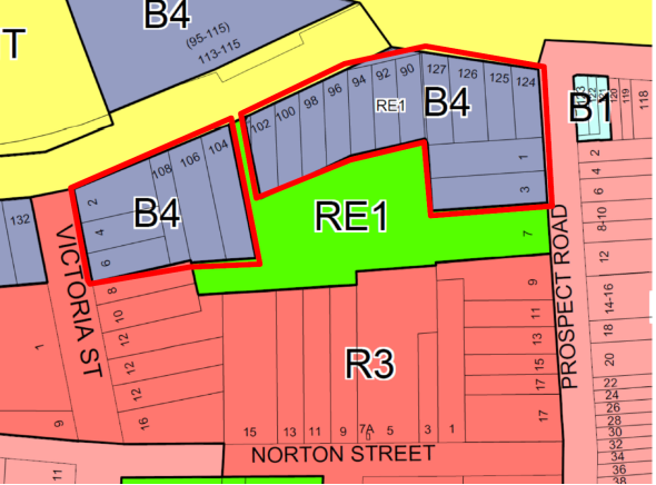
Figure 1 – Extract Ashfield LEP 2013 – Zoning Map. “Ashfield East” area is within the red boundary.
At the time of the exhibition of the draft “Ashfield East” LEP amendment (Planning Proposal), concurrently exhibited was a working draft version DCP for “Ashfield East”. Both the former Ashfield Council and the community supported its content. This has been used as the basis for the current proposed DCP Part D -2 Ashfield East. Draft Part D -2 is contained in Attachment 1, and it is necessary to have this in place to provide controls for the “Ashfield East” area. It has been laid out to follow the structure of Inner West DCP 2016, which is divided into columns for “Performance Criteria” and corresponding “Design Solutions”. It identifies various key or unique parameters, including:
- ensuring that the front presentation along Liverpool Road has deep soil planting areas for establishment of tall trees and responding to the Ashfield Council Public Domain Plan 2014
- there is a consistent building setback along Liverpool Road, with the front building setback accommodating space for large tree planting and their canopies, and having a “green” foreground setting
- apartment internal room layout design will be in a form that mitigates noise impacts from Liverpool road – for “healthy living”
- adequately sized communal open space areas are provided and which receive adequate winter solar access by having lowered buildings heights in key location
- provides maximum number of storeys which complies with the maximum height restrictions of the Ashfield LEP 2013
- incorporates the Road and Maritime Services requirements (submitted with the previous Planning Proposal) which limits the extent of vehicular access to the development sites from Liverpool Road
Draft Part D2-Ashfield East, contained in Attachment 1 should be placed on exhibition for inclusion into the Inner West DCP 2016.
FINANCIAL IMPLICATIONS
There are no financial implications.
OTHER STAFF COMMENTS
The former Ashfield Council’s Stormwater Engineer provided the following advice:
“Council has sort and obtained grant funding to undertake a “Floodplain Risk Management Study & Plan” for both the Hawthorne & Dobroyd Catchments, as part of the Consultants brief to undertake these works was to review the existing flood planning instruments including the review of Council’s “Stormwater Management Code. As a result of the amalgamations of the three former Inner West Council’s into the Inner West Council this particular part of the contract to review the “Stormwater Management Code” was delayed and rescheduled for the end of the contract (approximately May 2018), with the intent that this new Stormwater Management Code will then encompass the needs of all three of the old Council’s so that it can be used as one singular document throughout the new LGA” .
PUBLIC CONSULTATION
Pursuant to clause 18 of the Regulation 2000 the following must be carried out :
- The DCP placed on public exhibition for 28 days, together with a copy of the Ashfield Local Environmental Plan 2013
- An advertisement placed in the local newspaper
- Paper copies of DCP at Ashfield Customer Service plus supporting documents.
In addition to the above, Council’s Have Your Say Web page will include a dedicated links to the DCP amendment documents and an overview. After completion of the exhibition, a further report to Council outlining the outcome of the submissions period and response to submissions will be provided for Council’s consideration.
CONCLUSION
The proposed amendments should be made to the Inner West DCP 2016 as outlined in this report and be put on public exhibition to comply with procedures under the Regulation.
|
1.⇩ |
Draft Part D-2 Ashfield East Guidelines |
|
Council Meeting 25 July 2017 |
Subject: Marrickville Development Control Plan 2011 - Amendment to Part 2.22 Flood Management
File Ref: 17/6209/66347.17
Prepared By: Peter Wotton - Strategic Planning Projects Coordinator
Authorised By: Simon Manoski - Group Manager Strategic Planning
|
SUMMARY Council has recently completed two new flood studies, Johnstons Creek and Alexandra Canal, and has reviewed the existing flood study for the Hawthorne Canal as part of the ongoing Flood Risk Management Study.
At the June 2017 Council meeting Council considered a report (CO617 Item 13) on the Flood Management Advisory Committee meeting held on 16 May 2017 when Council resolved:
“That the minutes of the Inner West Council Flood Management Advisory Committee held on 16 May 2017 be received and the recommendations be adopted.”
Those minutes included the adoption of the Johnstons Creek and Alexandra Canal Flood Studies. The Hawthorne Canal Flood Study was previously adopted by Council at its February 2015 meeting. The revised Flood Planning maps were considered by the Flood Management Advisory Committee at its June 2017 meeting and the minutes of that meeting are to be reported to the July 2017 Council meeting.
This report proposes amendments to Part 2.22 Flood Management of Marrickville Development Control Plan 2011 (MDCP 2011) to update the Flood Planning Area Map and the Flood Liable Land Map to incorporate the additional flood affected properties that have been identified in the adopted Flood Studies. This report recommends that Council adopt the updated Flood Planning Area Map and the Flood Liable Land Map and resolve to publicly exhibit draft Marrickville Development Control Plan 2011 (Amendment No. 7) to amend Part 2.22 – Flood Management. |
|
RECOMMENDATION THAT Council:
1. Receive and note the report;
2. Adopt the updated Flood Planning Area Map in ATTACHMENT 1 and the updated Flood Liable Land Map in ATTACHMENT 2; and
3. Resolve to publicly exhibit draft Marrickville Development Control Plan 2011 (Amendment No. 7) to amend Part 2.22 – Flood Management to incorporate the updated Flood Planning Area Map in ATTACHMENT 1 and the updated Flood Liable Land Map in ATTACHMENT 2.
|
BACKGROUND
Part 2.22 Flood Management of MDCP 2011 contains provisions which complement Clause 6.3 Flood Planning of Marrickville Local Environmental Plan 2011.
The land to which the flood management controls apply is the land identified on the Flood Planning Area Map and the Flood Liable Land Map. Those Maps are contained in the Appendices to Part 2.22 of the DCP; Flood Planning Area Map (Appendix 1) and the Flood Liable Land Map (Appendix 2).
Part 2.22.2 Land affected of MDCP 2011 states (in part):
“The land identified on the DCP 2011 Flood Liable Land Map and on the DCP 2011 Flood Planning Area Map is based on information available to Council when the Plans were prepared. As new information becomes available, the DCP 2011 Flood Planning Area Map and the DCP 2011 Flood Liable Land Map may change.”
Council has recently completed two new flood studies, Johnstons Creek and Alexandra Canal, and has reviewed the existing flood study for the Hawthorne Canal. Council’s Coordinator Asset Planning, Marrickville has advised that as part of those three studies a number of additional properties have been identified as being within a flood planning area. Council’s Coordinator Asset Planning, Marrickville advised:
“As part of recent flood studies flood affected properties have been identified in-line with Council’s adopted policy.
Under Council’s policy, properties are deemed to be flood affect by overland flow if they are subject to major drainage and in the 100 year ARI event they are inundated by flood waters to a depth greater than 0.15m across more than 10% of the property area, or would be but for the existing building footprint(s).
Major Drainage (under the NSW Government’s Floodplain Development Manual April 2005) is defined as:
· The floodplains of original watercourses (which may now be piped, channelized or diverted), or areas where overland flows develop along alternative paths once system capacity is exceeded; and/or
· Water depths generally in excess of 0.3m. These conditions may result in danger to personal safety and property damage to both premises and vehicles; and/or
· Major overland flow paths through developed areas outside of defined drainage reserves which have the potential to affect a number of buildings along the flow path.
All flood affected property owners were notified that their property was proposed to be flood affected by letter. In addition, three information sessions were conducted to enable flood affected property owners to discuss the results of the flood study and specifically any impacts on their property.
Property owners were also given the opportunity to have their property reviewed by Council staff and/or consultants. Council officers reviewed all properties that made a submission including visiting each site.
In the Alexandra Canal area 80 properties are identified as overland flood affected. This represents an increase of 58 properties in the area over the previously defined Flood Planning Area (FPA) in 2015 as overland flood affected which was based on available flood information at that time.
No residents attended the information sessions and no submissions were received for the Alexandra Canal area.
In the Johnstons Creek area 431 properties are identified as overland flood affected. This represents an increase of 219 properties in the area over the previously defined FPA in 2015 which was based on available flood information at that time.
A total of 16 residents attended the information sessions and 30 submissions were received for the Johnstons Creek area. Council officers undertook reviews of the 30 flood affected properties which made submissions. This included meeting 3 residents on-site at their properties at the request of the owners.
In the Hawthorne Canal area 327 properties are identified as overland flood affected. This represents an increase of 287 properties in the area over the previously defined FPA in 2015 as overland affected which was based on available flood information at that time.
A total of 15 residents attended the information sessions and 22 submissions were received for the Hawthorne Canal. Council officers undertook reviews of the 22 flood affected properties which made submissions.”
Council’s Coordinator Asset Planning, Marrickville also advised that all flood affected property owners were notified that their property was proposed to be flood affected by letter and that a total of 5 information sessions were conducted concerning the flood studies.
The existing Flood Planning Area Map and the Flood Liable Land Map have been updated to incorporate the additional flood affected properties that have been identified in the adopted flood studies.
The updated Flood Planning Area Map is attached as ATTACHMENT 1.
The updated Flood Liable Land Map is attached as ATTACHMENT 2.
The inclusion of the updated maps does not necessitate any other changes to be made to the flood management provisions contained in Part 2.22 Flood Management of Marrickville Development Control Plan 2011. Following the adoption of the Johnstons Creek Flood Study, the Alexandra Canal Flood Study, and the reviewed the Hawthorne Canal Flood Study notations will be placed on Section 149 Certificates issued for those properties in “ITEM 7A Flood related development controls information” that the land is identified as flood affected according to the respective Flood Study.
FINANCIAL IMPLICATIONS
Nil
OTHER STAFF COMMENTS
Nil
PUBLIC CONSULTATION
Public consultation of the draft DCP amendment would be carried out in accordance with the requirements of the Environmental Planning and Assessment Act 1979.
CONCLUSION
It is recommended that Council adopt the updated Flood Planning Area Map in ATTACHMENT 1 and the updated Flood Liable Land Map in ATTACHMENT 2 and resolve to publicly exhibit draft Marrickville Development Control Plan 2011 (Amendment No. 7) to amend Part 2.22 – Flood Management to incorporate the updated Flood Planning Area Map and the updated Flood Liable Land Map.
|
1.⇩ |
Flood Planning Area Map |
|
2.⇩ |
Flood Liable Land Map |
|
Council Meeting 25 July 2017 |
Subject: Local Traffic Committee Meeting held on 6 July 2017
File Ref: 17/6022/80778.17
Prepared By: John Stephens - Traffic Manager
Authorised By: Wal Petschler - Group Manager Footpaths, Roads, Traffic and Stormwater
|
SUMMARY The minutes of the Local Traffic Committee Meeting held on 6 July 2017 are presented for Council consideration. |
|
RECOMMENDATION
THAT the Minutes of the Local Traffic Committee Meeting held on 6 July 2017 be received and the recommendations be adopted. |
BACKGROUND
A meeting of the Inner West Council Local Traffic Committee was held on 6 July 2017 at Ashfield. The minutes of the meeting are shown at ATTACHMENT 1.
FINANCIAL IMPLICATIONS
Projects proposed for implementation in 2017/18 are funded within existing budget allocations.
OTHER STAFF COMMENTS
Nil.
PUBLIC CONSULTATION
Members of the public attended the meeting to address the committee on specific items.
|
1.⇩ |
Minutes of Local Traffic Committee Meeting 6 July 2017 |
|
Council Meeting 25 July 2017 |
Subject: Draft Councillor Expenses and Facilities Policy - Public Exhibition Period to 25 July 2017
File Ref: 17/4014/81737.17
Prepared By: Rad Miladinovic - Manager Business Information Services
Authorised By: Tanya Whitmarsh - Group Manager Governance
|
SUMMARY At its meeting on 27 June 2017, Council resolved to place the Draft Councillor Expenses and Facilities Policy on public exhibition for a period of 28 days from 28 June to 25 July 2017.
|
|
RECOMMENDATION
THAT Council:
1. Notes the public exhibition period remains open until 5pm on 25 July 2017; and 2. Considers the feedback received from the public exhibition prior to providing a Councillor Expenses and Facilities Policy to Council for adoption.
|
BACKGROUND
The Councillor Expenses and Facilities Policy enables the reasonable and appropriate reimbursement of expenses and provision of facilities to Councillors to help them undertake their civic duties. It ensures accountability and transparency, and seeks to align Councillor expenses and facilities with community expectations. Councillors must not obtain private or political benefit from any expense or facility provided under this policy.
The policy has been prepared in accordance with the Local Government Act 1993 (the Act) and Local Government (General) Regulation 2005 (the Regulation), and complies with the Office of Local Government’s Guidelines for the payment of expenses and provision of facilities to Mayors and Councillors in NSW.
DISCUSSION
The Councillor Expenses and Facilities Policy has been prepared using the template policy provided by the NSW Department of Premier and Cabinet. The template has been reviewed and endorsed by the NSW Office of Local Government.
The Policy sets out the maximum amounts Council will pay for specific expenses and facilities. Expenses not explicitly addressed in this policy will not be paid or reimbursed. The main expenses and facilities are summarised in the table below. All monetary amounts are exclusive of GST.
|
Expense or facility |
Maximum amount |
Frequency |
|
General travel expenses |
$3,000 per Councillor |
Per year |
|
Interstate, overseas and long distance intrastate travel expenses |
$15,000 total for all Councillors |
Per year |
|
Accommodation and meals |
As per the NSW Crown Employees (Public Service Conditions of Employment) Reviewed Award 2009, adjusted annually |
Per meal/night |
|
Professional development |
$5,000 per Councillor |
Per year |
|
Conferences and seminars |
$15,000 total for all Councillors |
Per year |
|
ICT expenses |
$3,600 per Councillor $6,000 for the Mayor |
Per year |
|
Carer expenses |
$3,000 per Councillor |
Per year |
|
Home office expenses |
$600 per Councillor |
Per year |
|
Postage stamps |
Nil – to be posted by Council |
Per year |
|
Christmas or festive cards |
100 per Councillor 500 for the Mayor |
Per year |
|
Access to facilities in a Councillor common room [where applicable Clause 9.1] |
Provided to all Councillors |
Not relevant |
|
Council vehicle, toll tag and fuel card [where applicable Clause 10] |
Provided to the Mayor |
Not relevant |
|
Reserved parking space at Council office where Mayoral office is located |
Provided to the Mayor |
Not relevant |
|
Furnished office [where applicable Clause 10] |
Provided to the Mayor |
Not relevant |
|
Number of exclusive staff supporting Mayor and Councillors [where applicable Clause 10] |
Provided to the Mayor and councillors |
Not relevant |
FINANCIAL IMPLICATIONS
The 2017/18 Operating Budget supports the ongoing provision of services and facilities to councillors. The limits applied to specific items of expenditure will be monitored to enable control of expenditure to avoid exceeding budgetary limitations.
OTHER STAFF COMMENTS
N/a.
PUBLIC CONSULTATION
The Draft Councillor Expenses and
Facilities Policy was placed on public exhibition on
28 June for a period of 28 days with members of the public invited to make
submissions before the exhibition closing date of 25 July 2017.
At the time of writing this report, Council is in receipt of one submission. This submission, together with any other submission received prior to the public exhibition closing date, will be considered before the final policy is put to Council for adoption on 25 July 2017.
|
|
Council Meeting 25 July 2017 |
Subject: Flood Management Advisory Committee Meeting held on 22 June 2017
File Ref: 17/4718/80828.17
Prepared By: Wal Petschler - Group Manager Footpaths, Roads, Traffic and Stormwater
Authorised By: Peter Gainsford - Deputy General Manager Assets and Environment
|
SUMMARY The minutes of the Inner West Council Flood Management Advisory Committee meeting held on 22 June 2017 are presented for Council consideration. |
|
RECOMMENDATION
THAT the minutes of the Inner West Council Flood Management Advisory Committee held on 22 June 2017 be received and the recommendations be adopted. |
BACKGROUND
A meeting of the Inner West Council Flood Management Advisory Committee was held on 22 June 2017 at Council’s Leichhardt Town Hall. The minutes of the meeting are included as (Attachment 1). The business paper for the meeting is included as (Attachment 2).
The Committee recommended that Council endorse:
1. The draft Leichhardt Flood Risk Management Study and Plan for public exhibition.
Feedback from the Advisory Committee will be included in the draft Leichhardt Flood Risk Management Study and Plan for exhibition. The comments primarily related to the manner in which Sydney Water may contribute to structural flood modification options and acknowledgment of the Office of Environment and Heritage grant contribution towards funding of the draft Leichhardt Flood Risk Management Study and Plan.
Owners of those properties identified to be added to the flood control lot mapping were notified in writing of the proposal at the end of June 2017. The owners were invited to contact Council’s engineers to discuss any concerns they may have.
The draft Leichhardt Flood Risk Management Study and Plan can be viewed electronically on the Inner West Council website.
2. The updated Flood Planning Area for Johnstons Creek south of Parramatta Road, Alexandra Canal and Hawthorne Canal south of Parramatta Road and that necessary amendments be made to the Part 2.22 of the Marrickville DCP to update the Flood Planning Area and Flood Liable Land maps.
Maps of the updated Flood Planning Area for Johnstons Creek south of Parramatta Road, Alexandra Canal and Hawthorne Canal south of Parramatta Road are included as (ATTACHMENT 3).
FINANCIAL IMPLICATIONS
The Flood Risk Management Study and Plan includes recommendations for a number of structural management options, such as stormwater drainage upgrade, which will be implemented through the budgetary process, reliant on contributions from external sources including Sydney Water, Roads and Maritime Services, financial assistance from the Office of Environment and Heritage under their Floodplain Management Program and through developments undertaken within flood prone land.
OTHER STAFF COMMENTS
Nil
PUBLIC CONSULTATION
Public consultation of the draft Leichhardt Flood Risk Management Study and Plan and proposed amendments to the Flood Control Lot Mapping will be undertaken during the public exhibition period in August and September 2017. The draft Floodplain Risk Management Study and Plan documents will be updated based on the feedback received during the public exhibition period. The final Floodplain Risk Management Study and Plan documents will also contain a chapter outlining the community consultation activities and outcomes.
Public information sessions were held for the Johnstons Creek, Alexandria Canal and Hawthorne Canal proposals and public submissions were received and considered from the public exhibition period. Site meetings were held were requested by property owners.
|
1.⇩ |
Minutes of the IWC Flood Management Advisory Committee 22 June 2017 |
|
2.⇩ |
Attachment 2 Business Paper IWC FMAC meeting 22 June 2017 |
|
3.⇩ |
Attachment 3 Updated Flood Planning Areas: Figures 38, 43A and 43B |
|
Council Meeting 25 July 2017 |
Subject: Inner West Council Investments as at 30 June 2017
File Ref: 16/5386/79525.17
Prepared By: Brian Chen - Team Leader Financial Accounting
Authorised By: Pav Kuzmanovski - Group Manager Finance
|
SUMMARY In accordance with the requirements of clause 212 of the Local Government (General) Regulation 2005, Council is provided with a listing of all investments made pursuant to section 625 of the Local Government Act 1993 and reported for periods ending 30 June 2017.
|
|
RECOMMENDATION
THAT the report be received and noted.
|
BACKGROUND
Clause 212 of the Local Government (General) Regulation 2005 requires that a report be presented to Council each month listing all investments with a certification from the Responsible Accounting Officer. Attached to this report are further reports from Council’s Investment Advisors, Prudential Investment Services.
FINANCIAL IMPLICATIONS
The Investment Holdings report (Attachment 1) for the period ending 30 June 2017 reflects Council’s holding in various investment categories these are listed in the table below. Council’s portfolio size has decreased by approximately $8 million to $202m of which 85% was rated A rated or above.
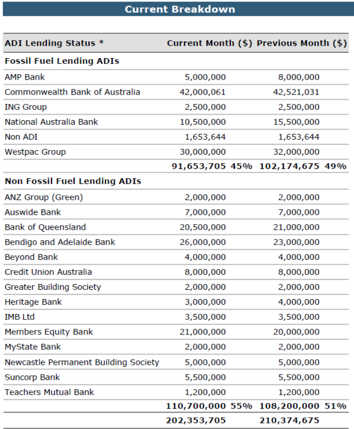
Environmental Commitments
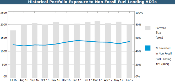
Council’s holdings in Non-Fossil investments increased to approximately $110.7m with a relative total portfolio percentage increase (55% in June 2017 as opposed to 51% in May 2017) in Non-Fossil investments. The percentage increase was driven by both an increase in investing in Non-Fossil fuel investments and a decrease in fossil fuel lending investments from $102.2m to $91.7m (due to maturities) while investments in non-fossil fuel lending ADIs increased from $108.2m to $110.7m. The attachments to this report summarise all investments held by Council and interest returns for periods ending 30 June 2017.
The period ending 30 June 2017, the portfolio for Inner West Council had a One-Month Portfolio Investment Return (2.50%) was above the UBSWA Bank Bill Index Benchmark (1.76%). Council has a well-diversified portfolio with 85% of the portfolio spread among the top three credit rating categories (A long term / A2 short term and higher).
The Current Market value is required to be accounted for by the accounting standards and are due to the nature of the investment, and are unlikely to impact on the eventual return of capital and interest to Council. The Current Market Value is a likely outcome if Council were to consider recalling the investment prior to its due date.
Certificate by Responsible Accounting Officer:
I, Pav Kuzmanovski, hereby certify in accordance with Clause 212 (1) (b) of the Local Government (General) Regulation 2005 that the investments listed in the attachments have been made in accordance with section 625 of the Local Government Act 1993 for the Inner West Council and in accordance with its adopted policy.
|
1.⇩ |
IWC Investment June 2017 |
|
2.⇩ |
IWC Monthly Interest June 2017 |
|
3.⇩ |
IWC Economic and Investment Portfolio Commentary June 2017 |

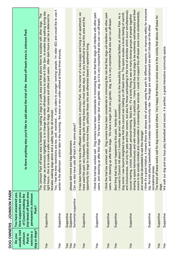
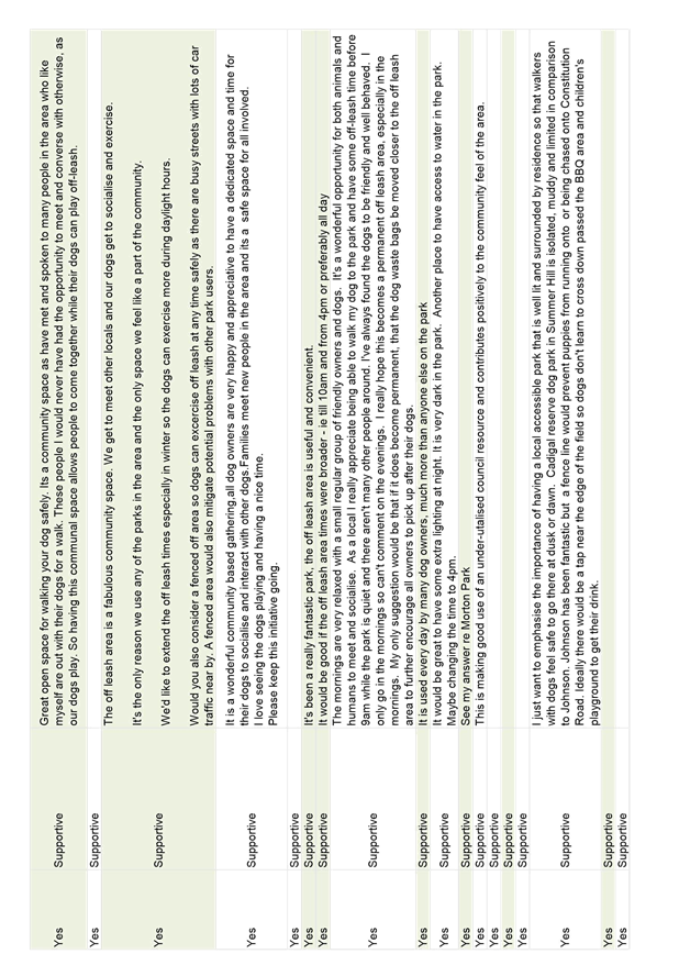
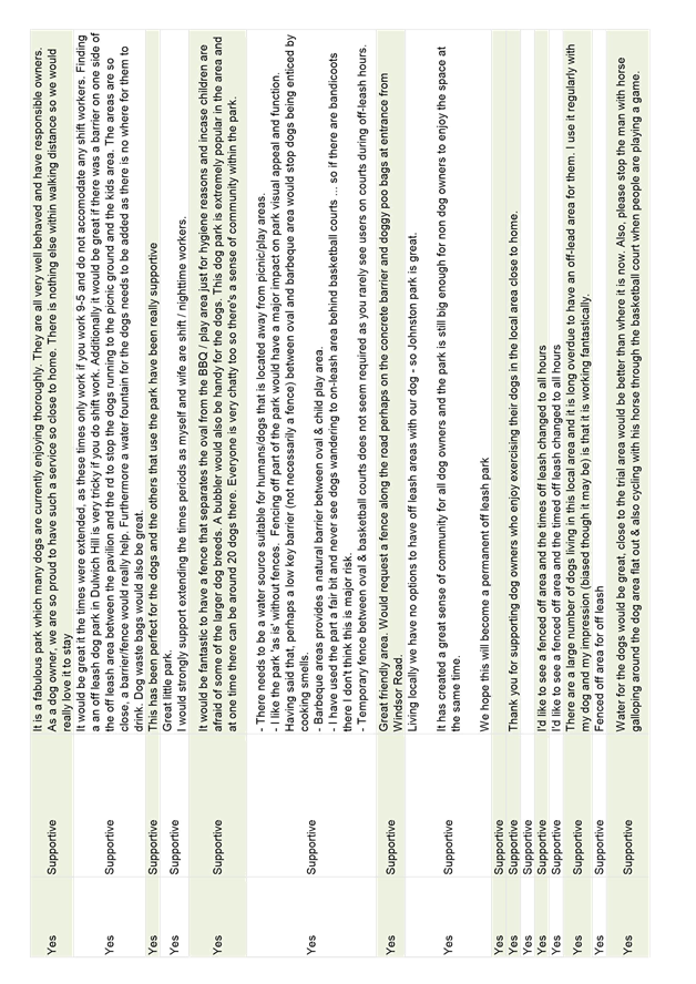
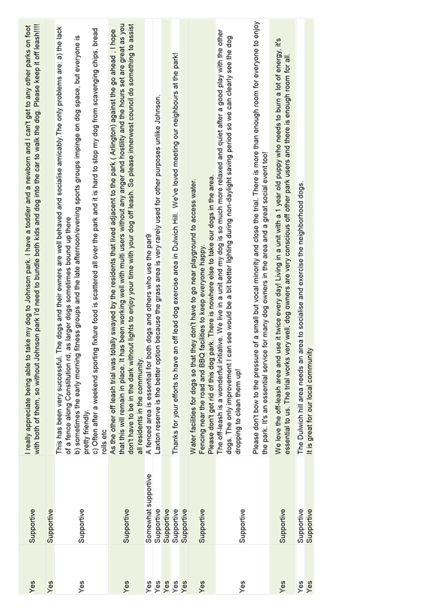
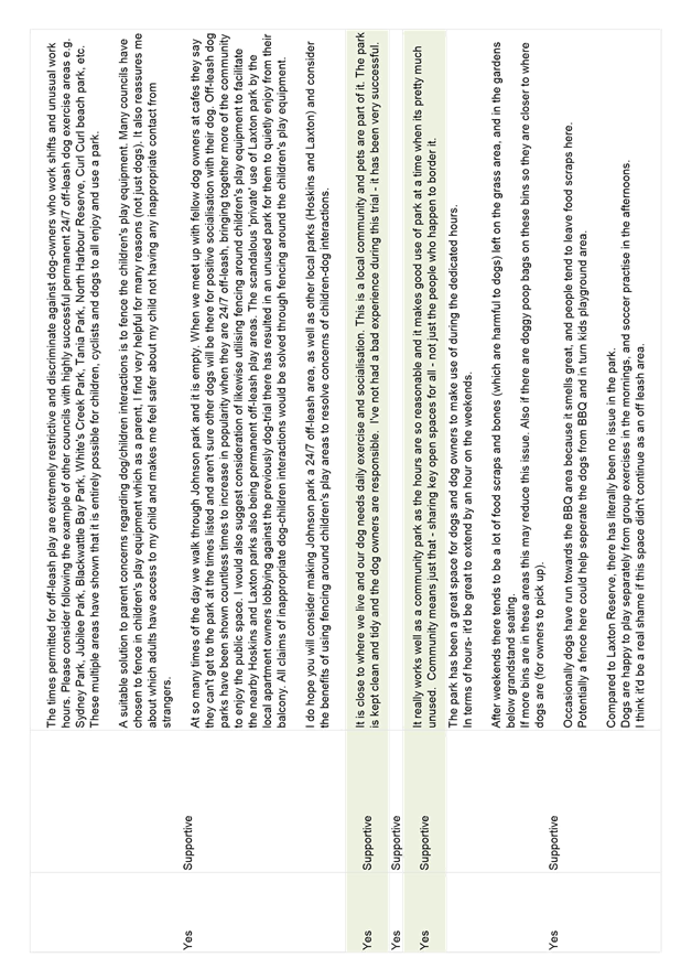
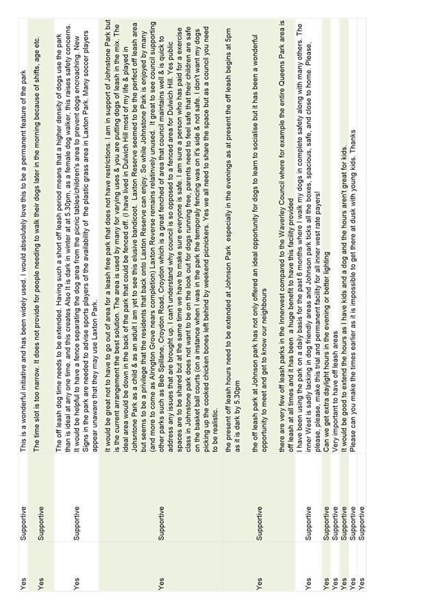
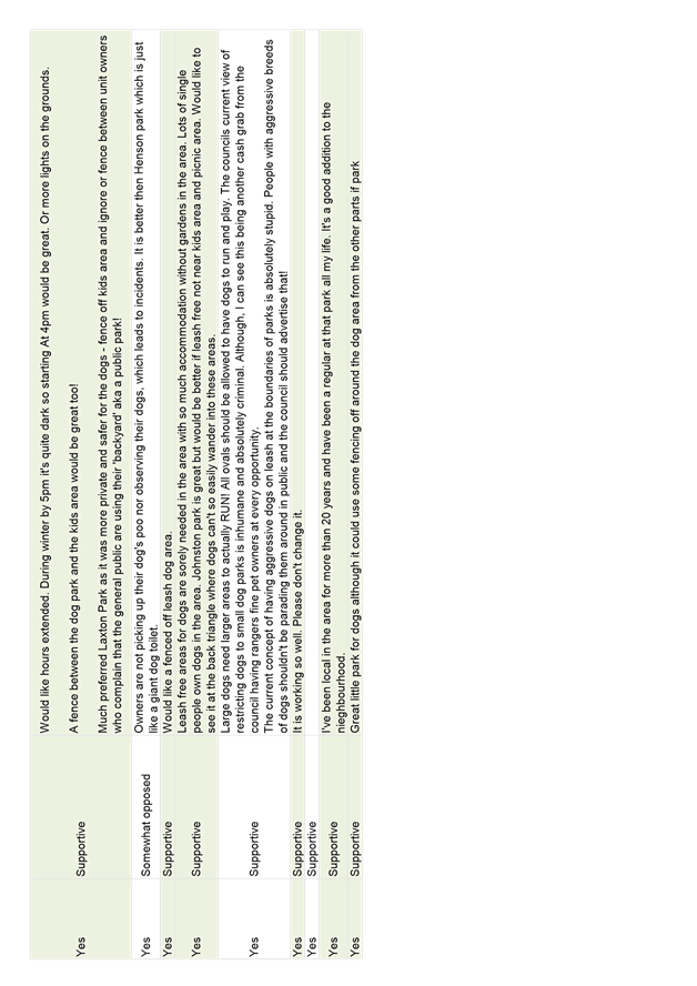
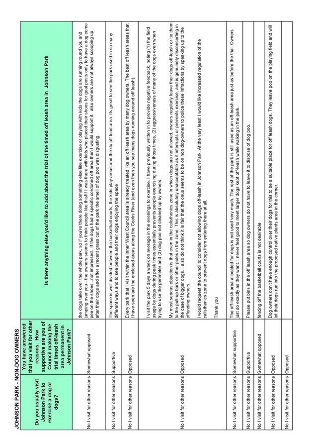
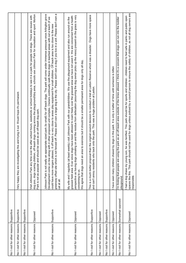
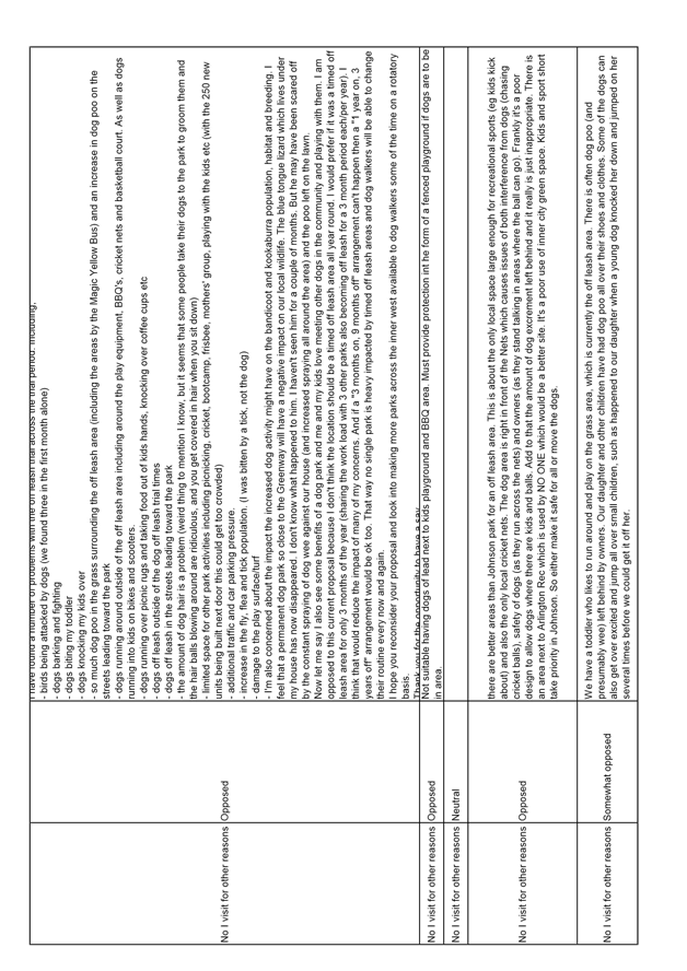
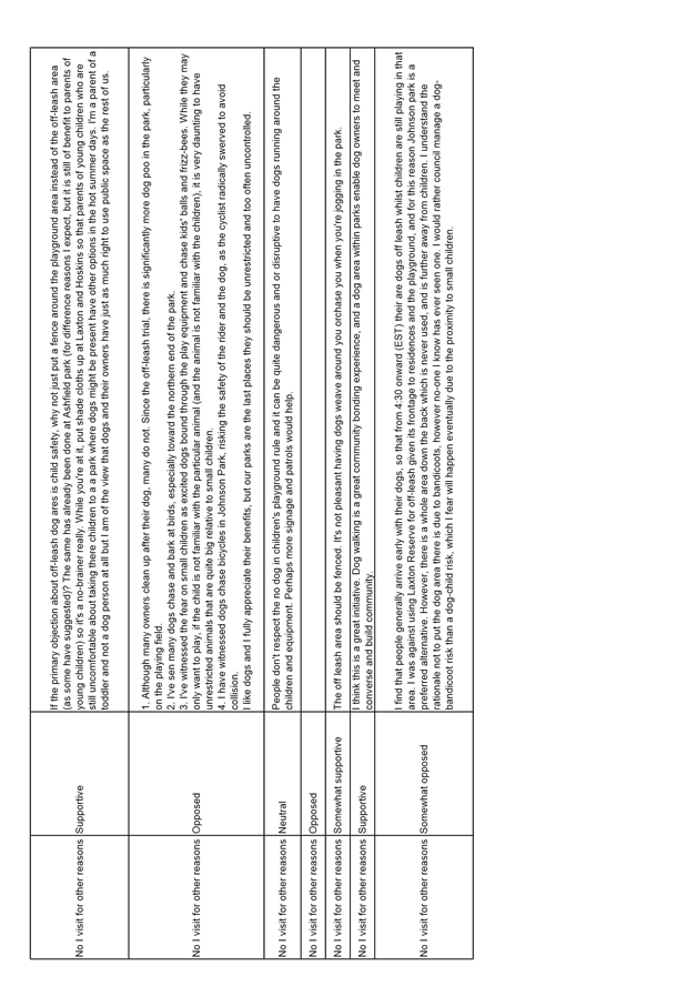
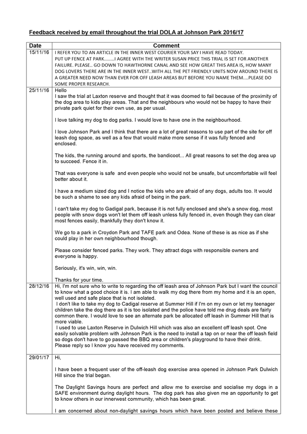
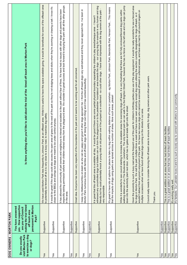
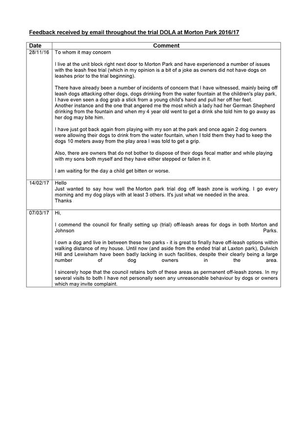
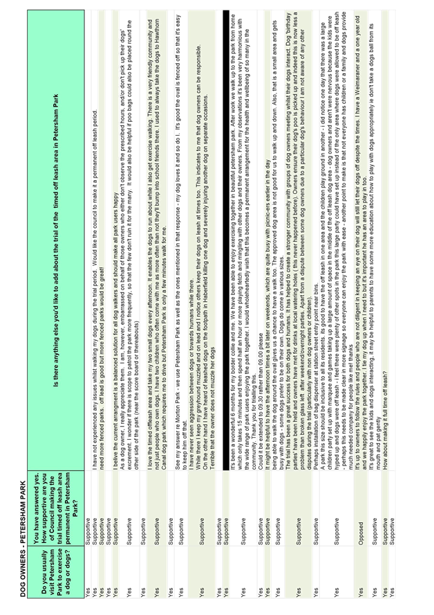
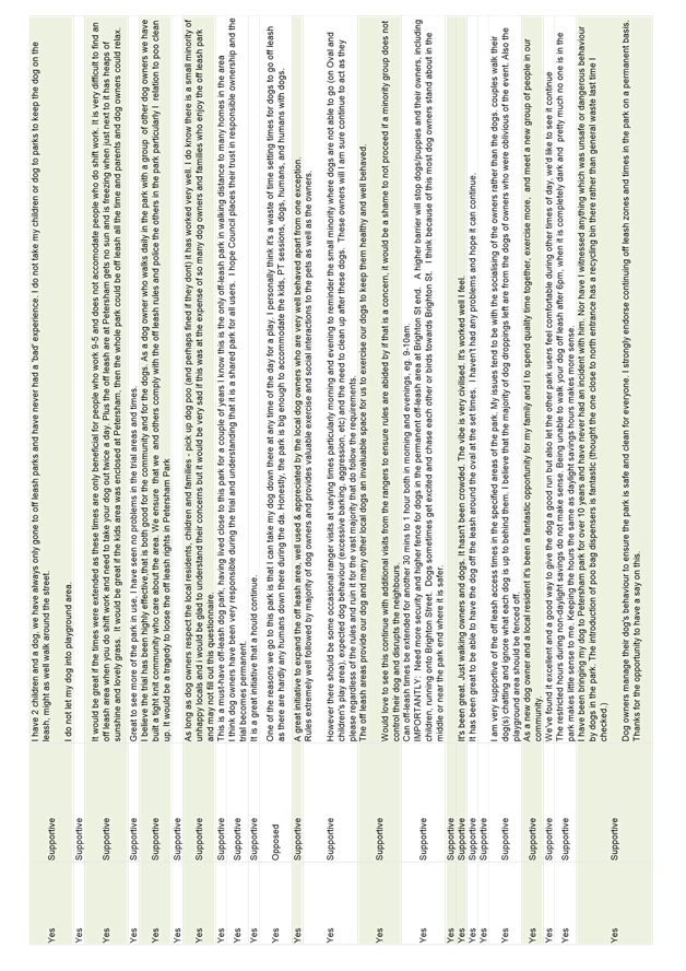
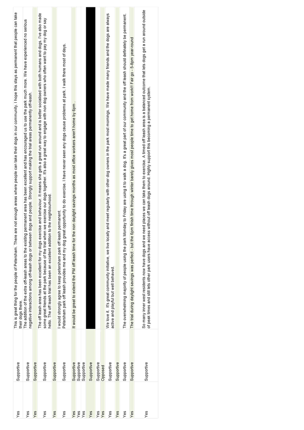
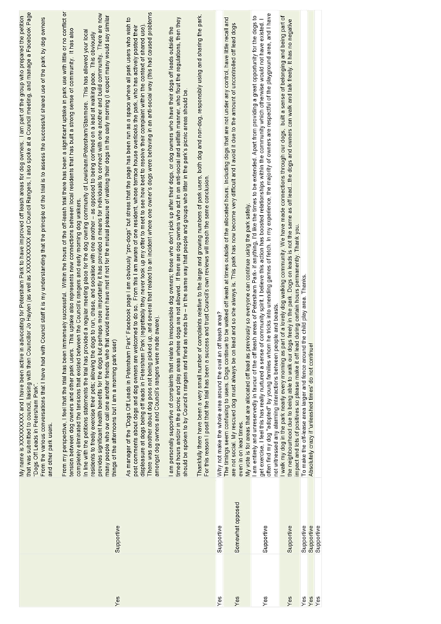
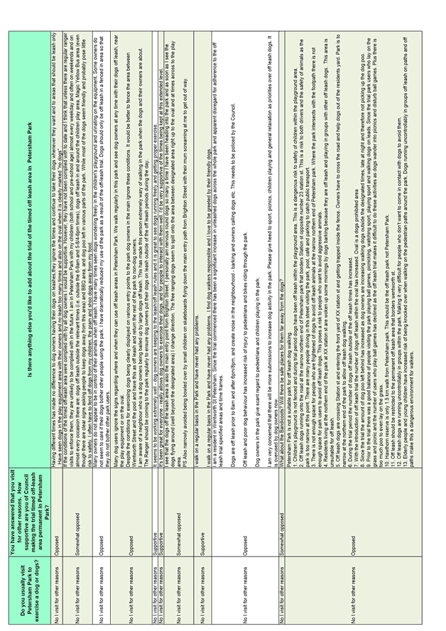
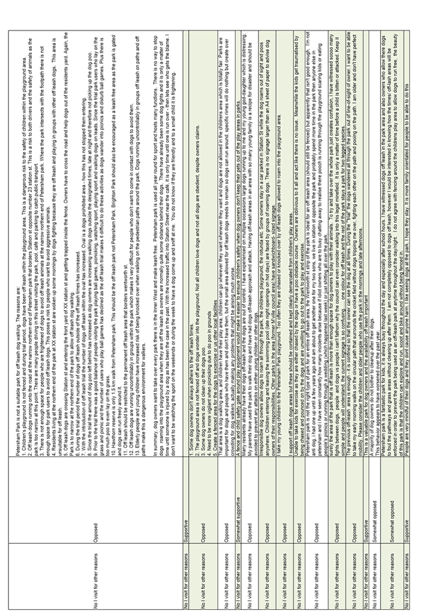
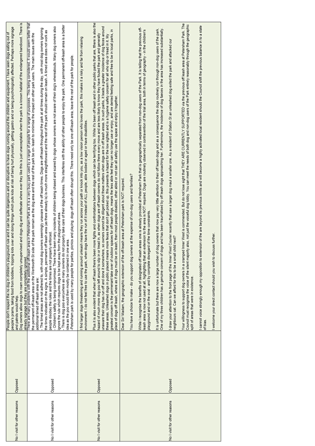
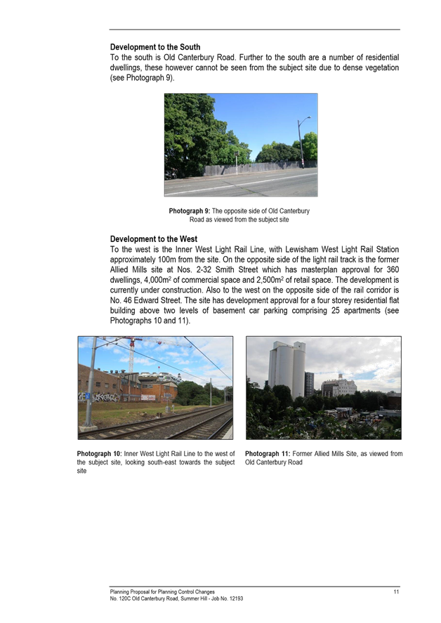
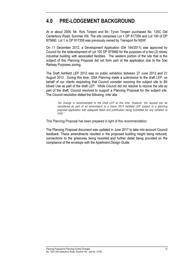
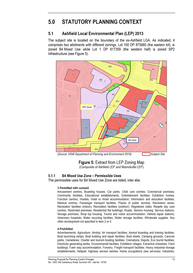
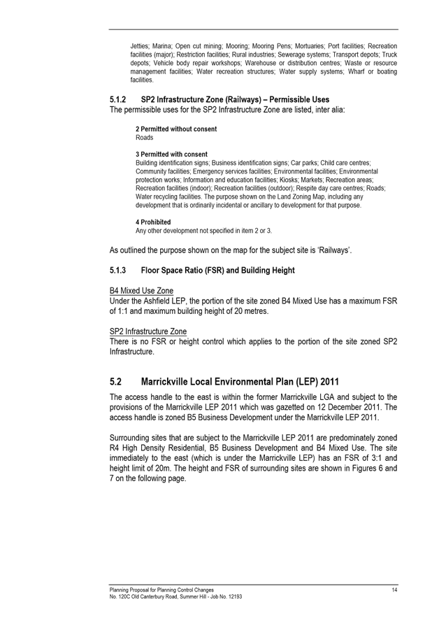
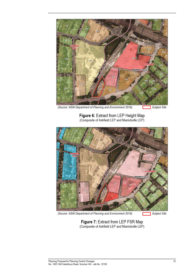
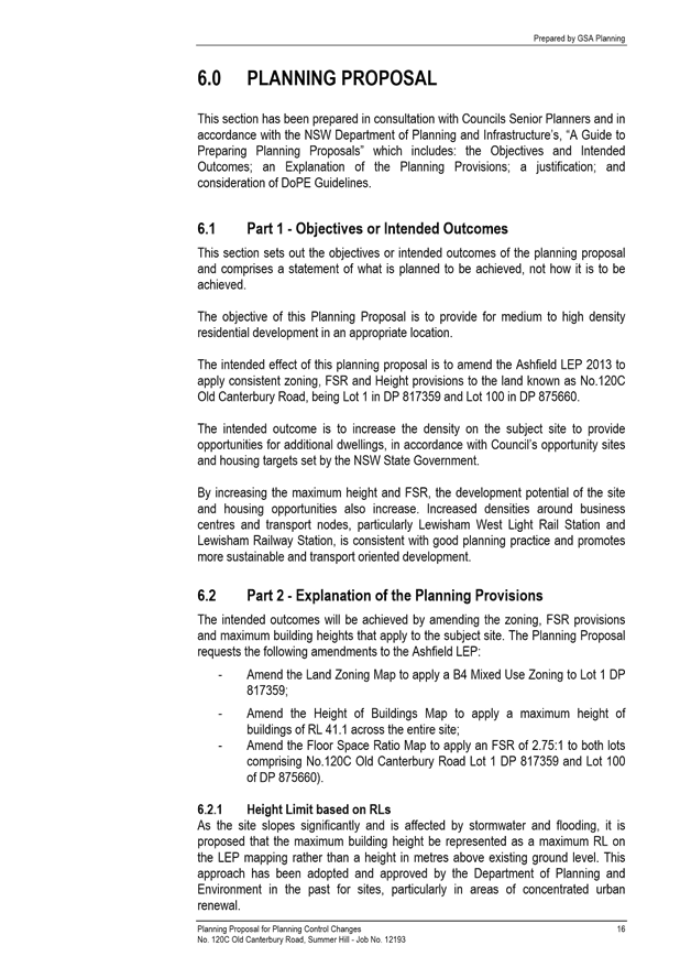
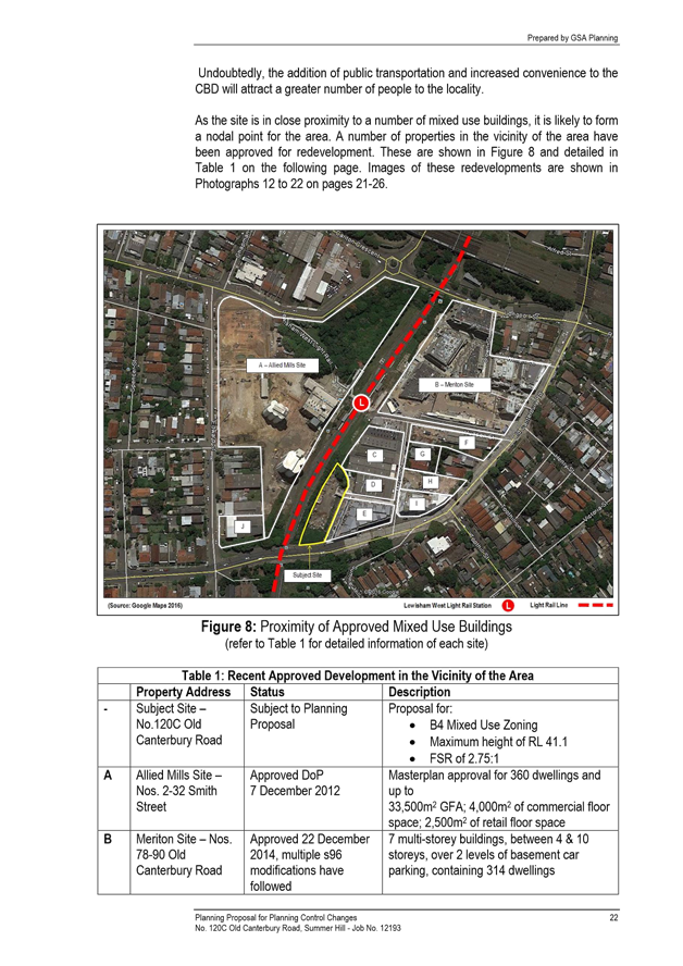
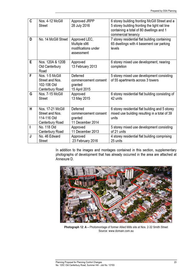
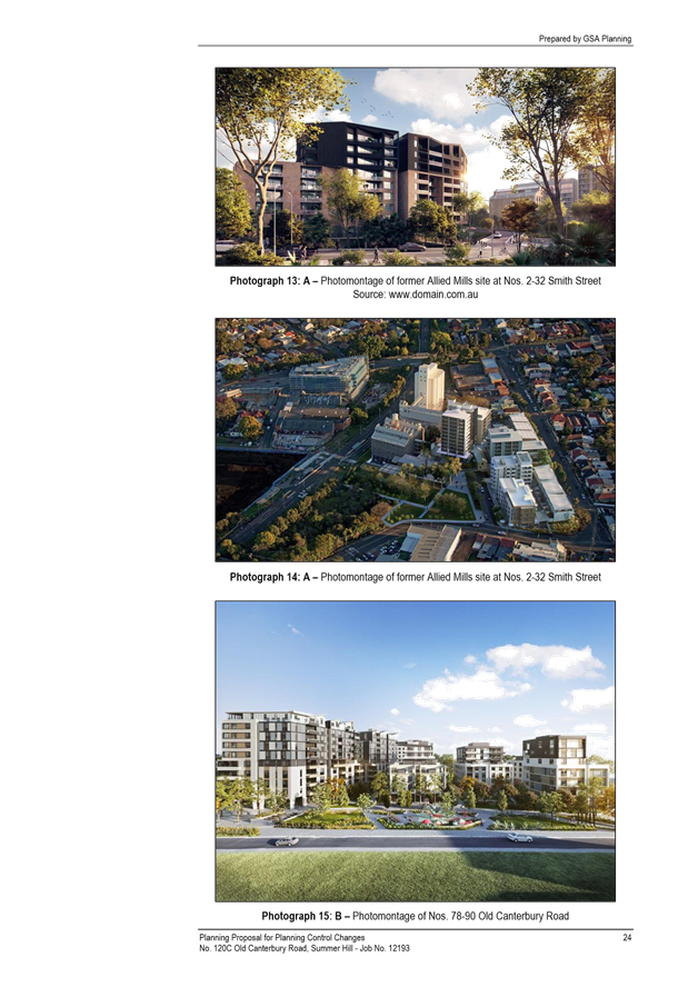
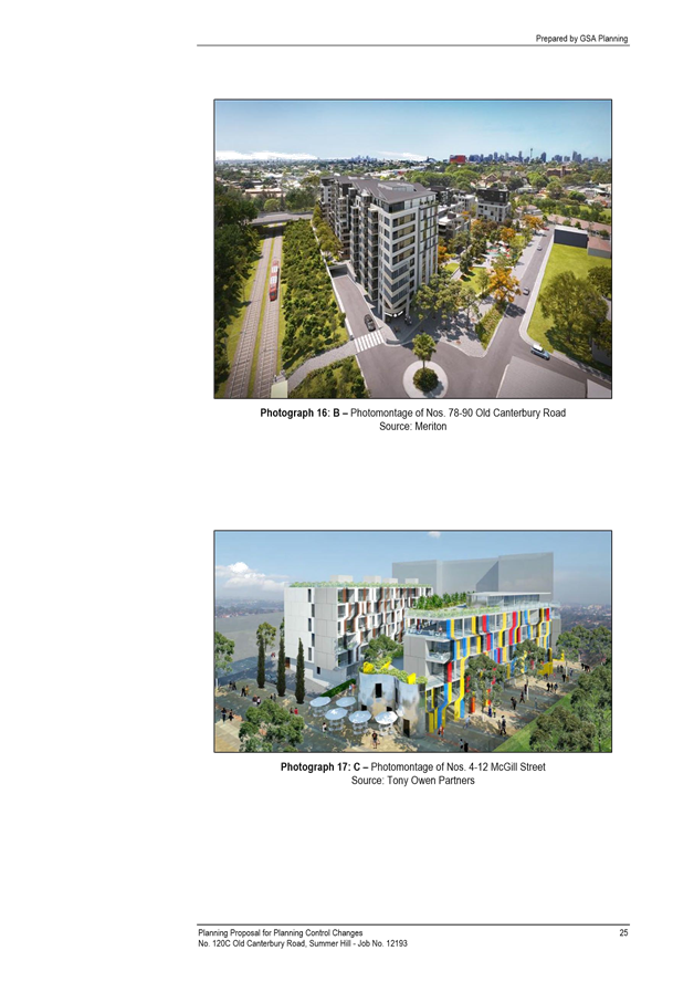
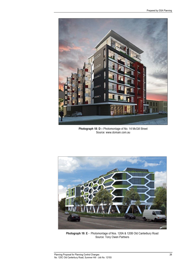
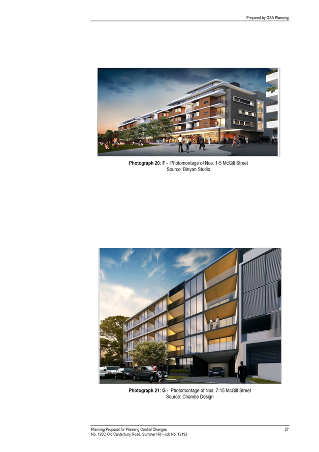

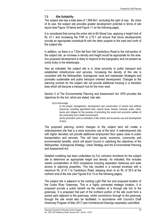
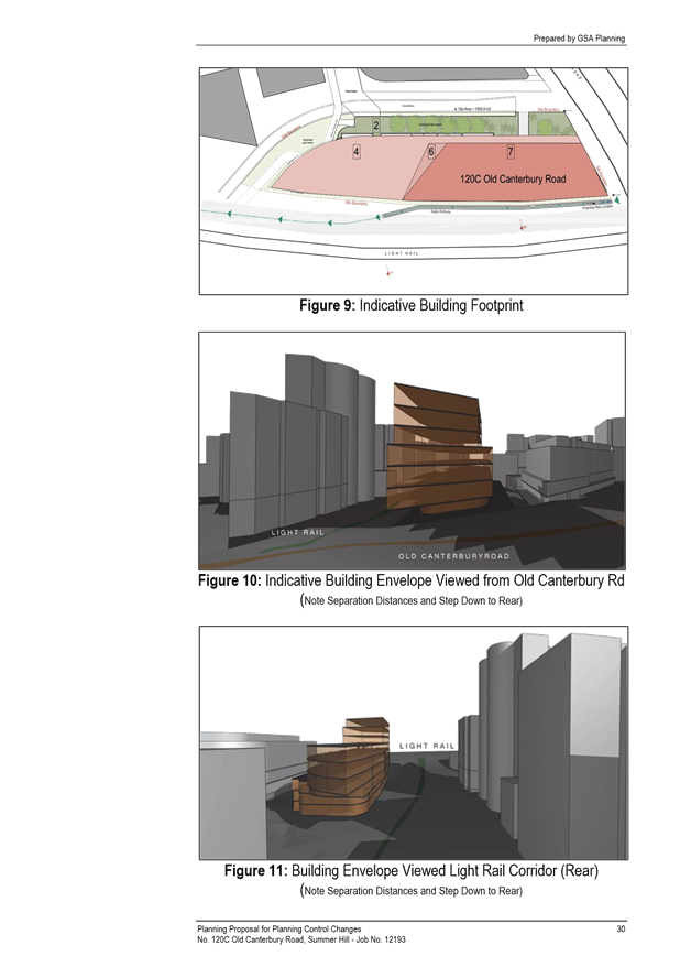
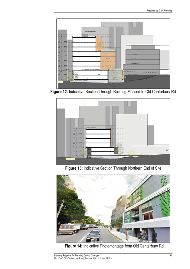
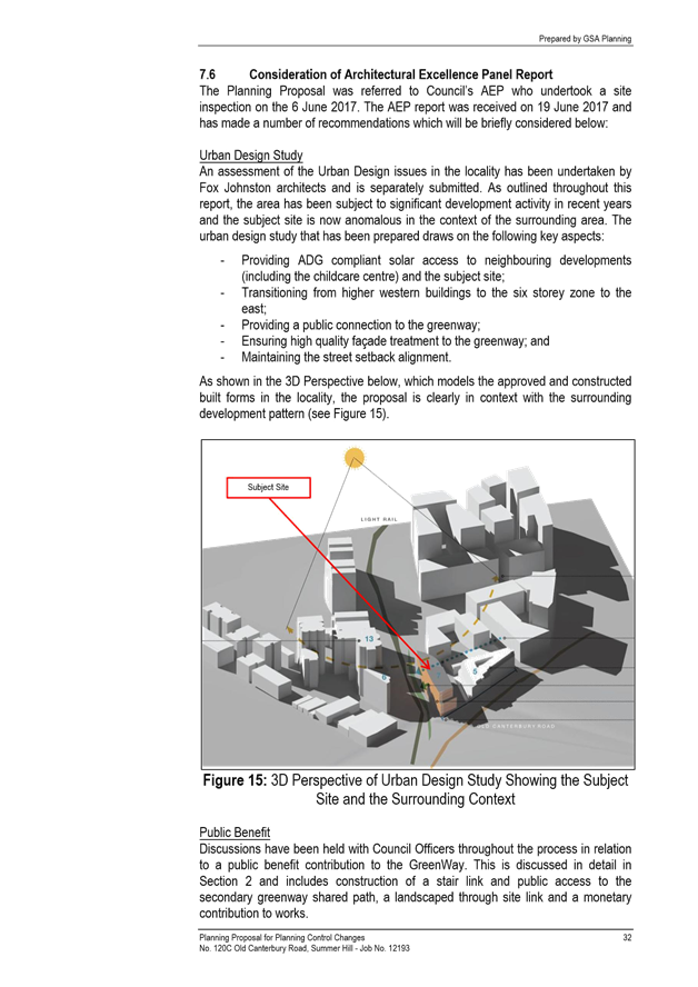


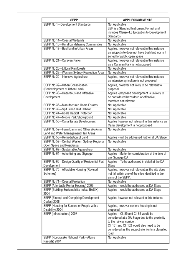
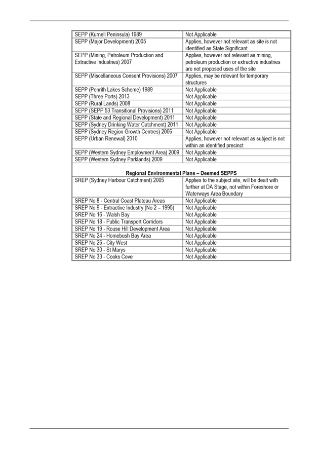
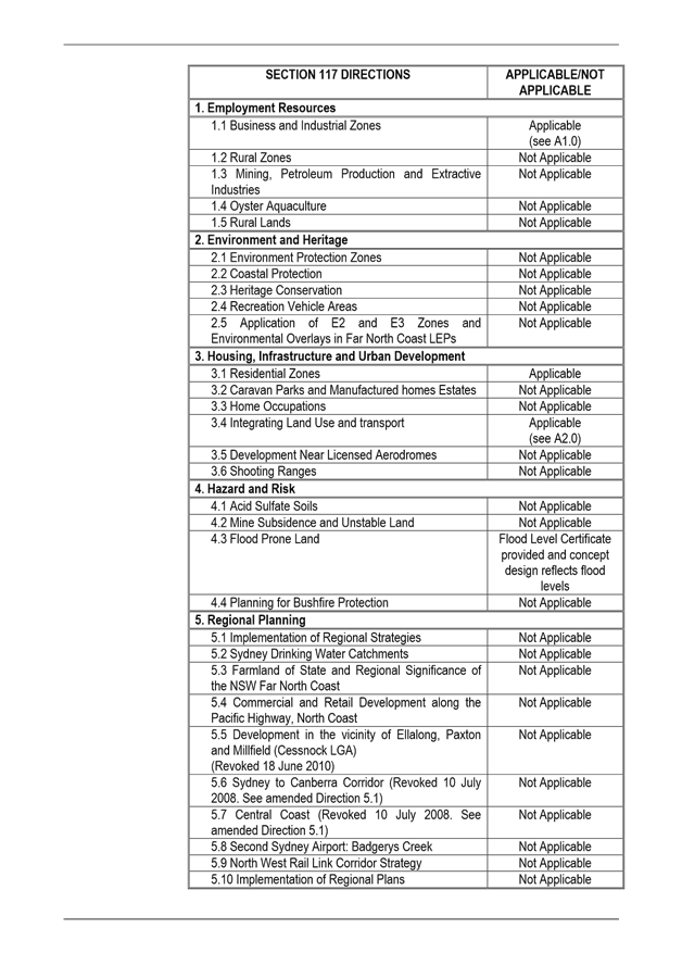

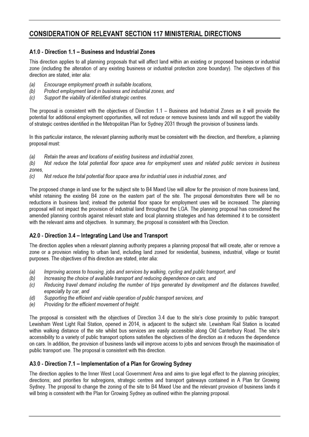


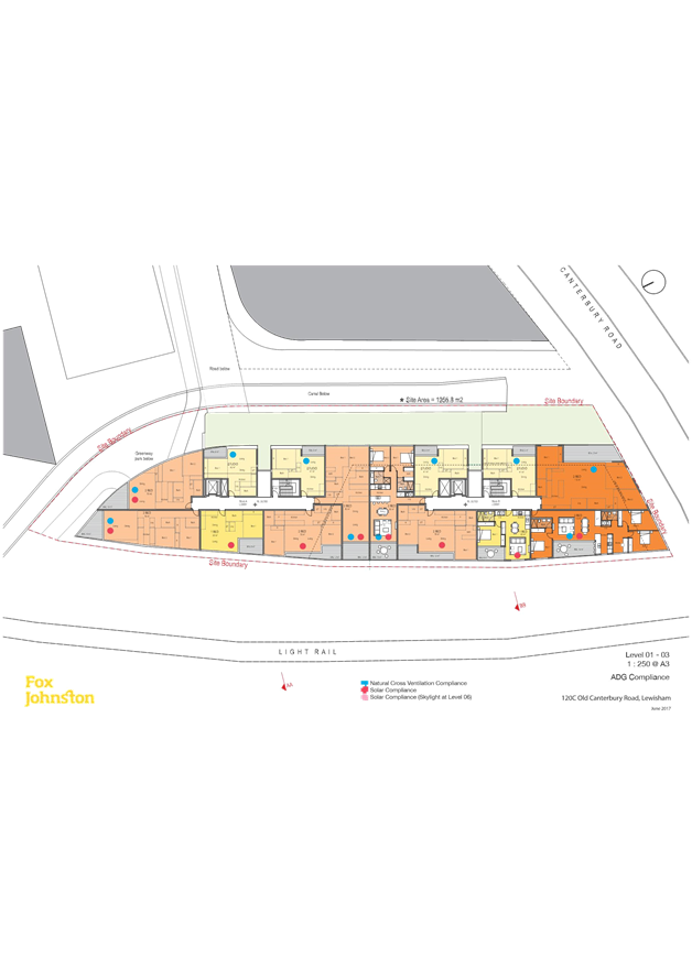
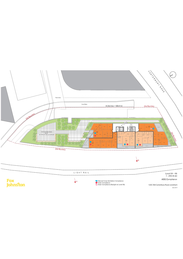
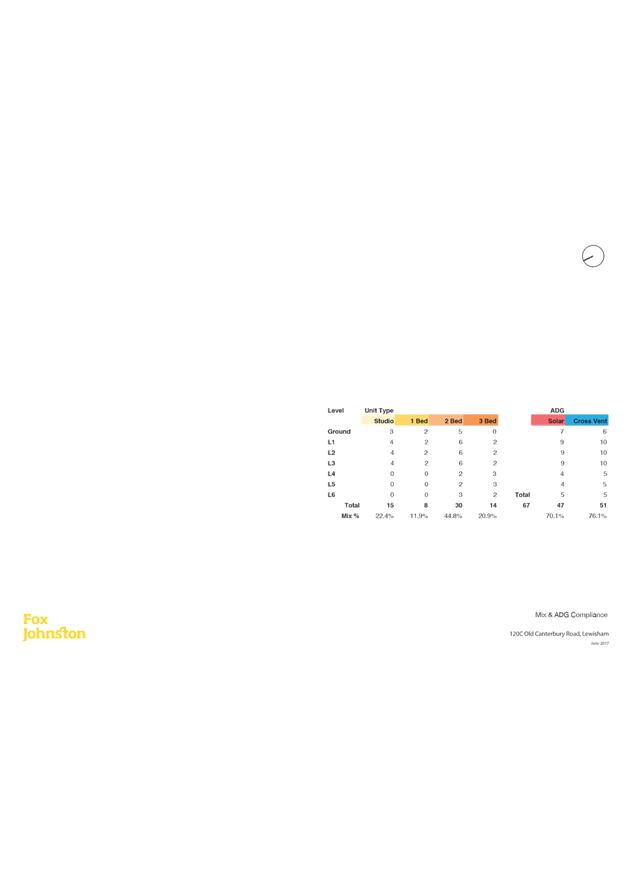
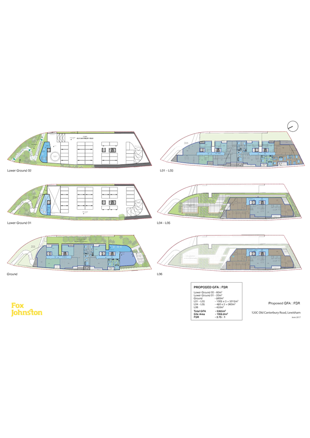
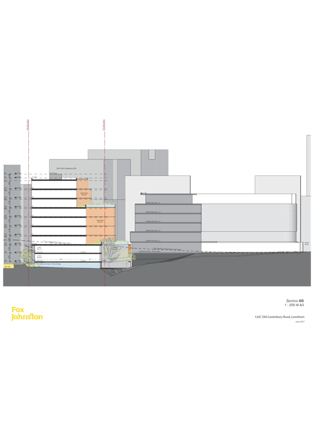
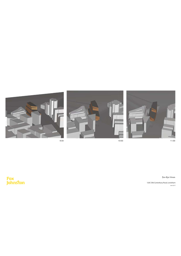
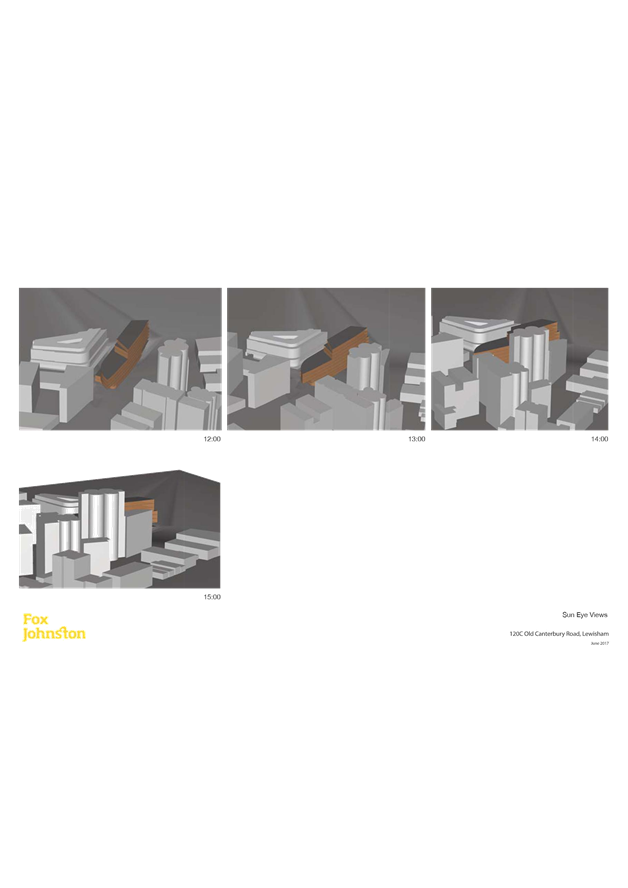
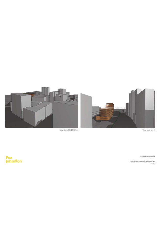
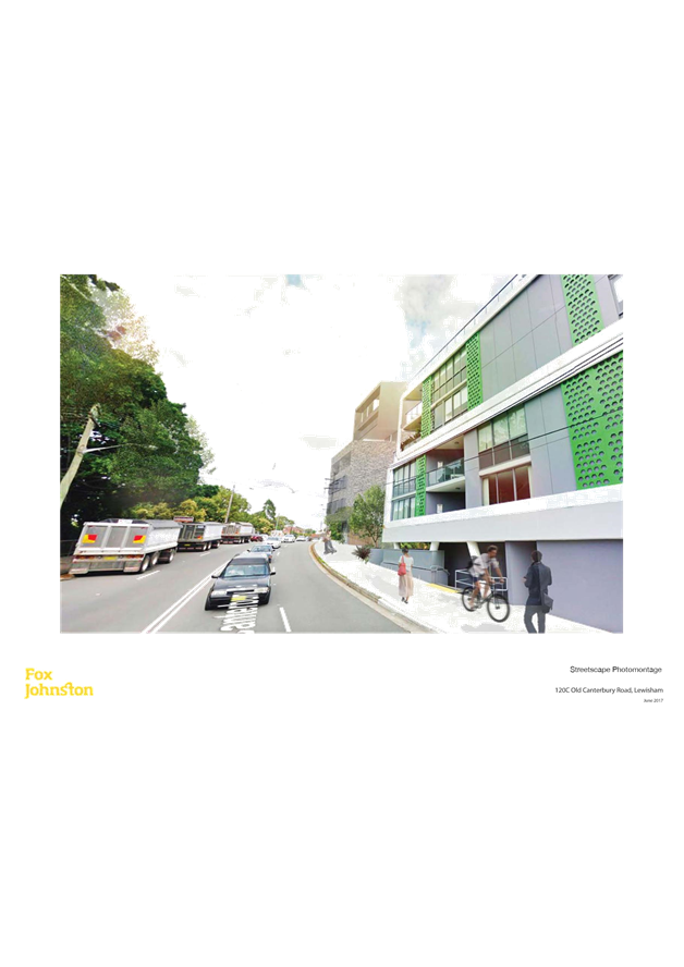

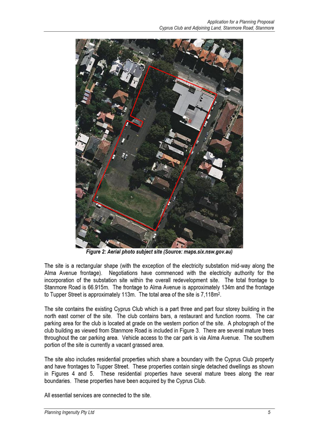
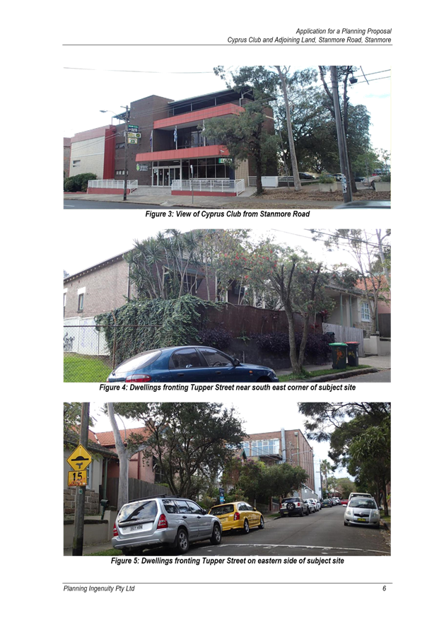
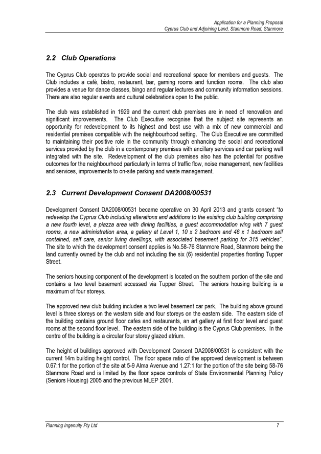
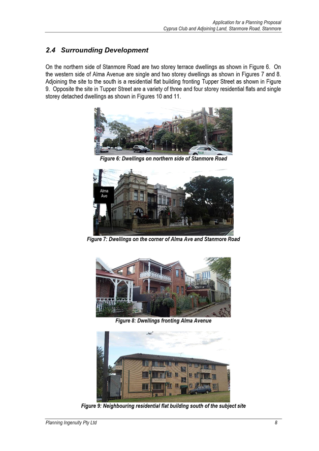
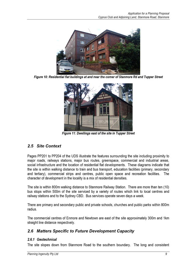
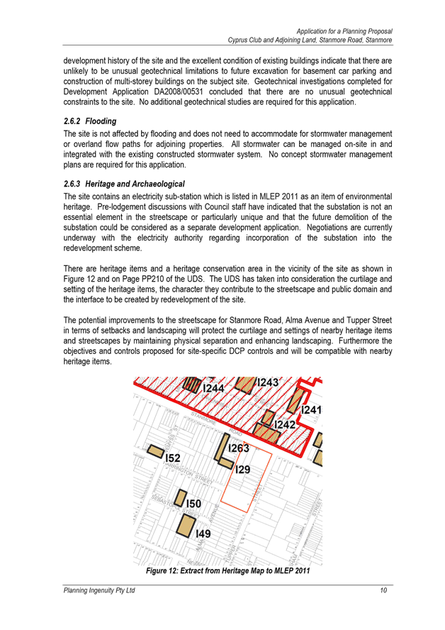
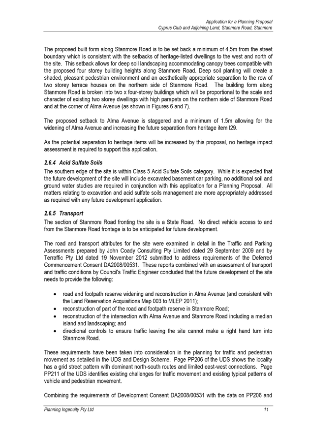
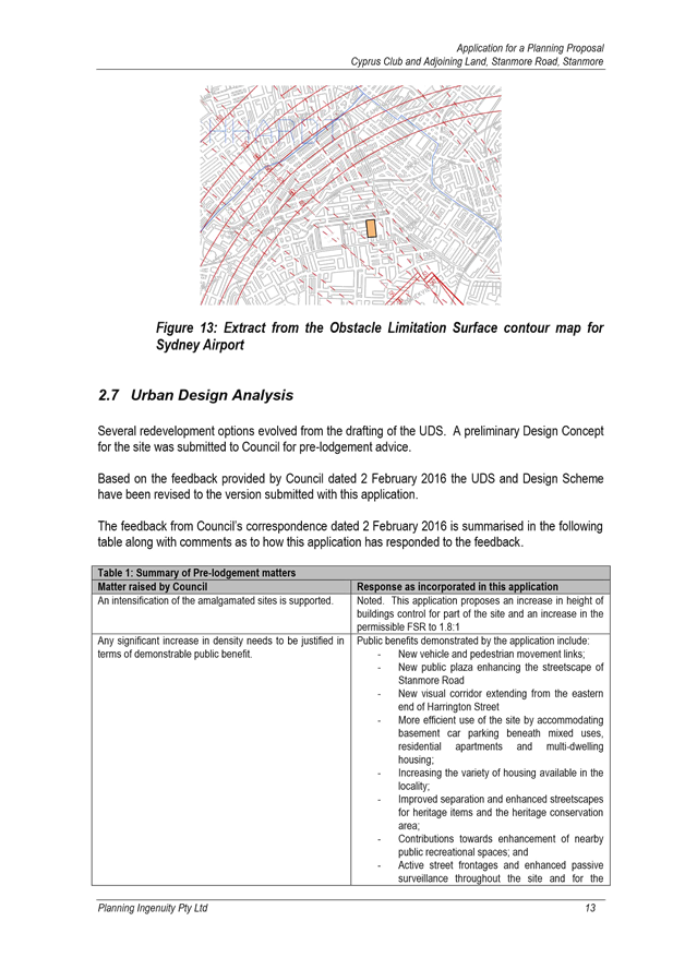

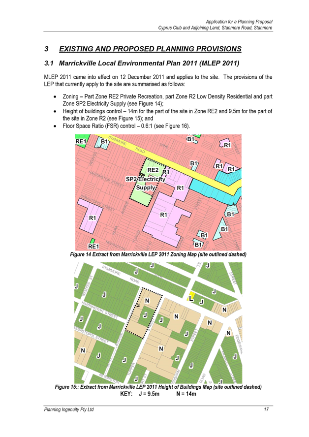
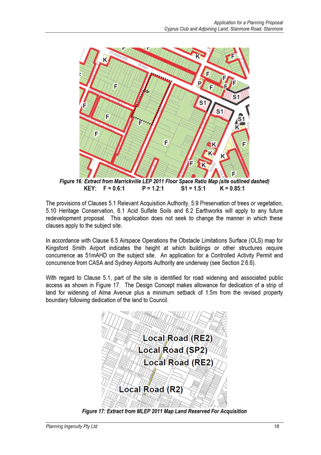
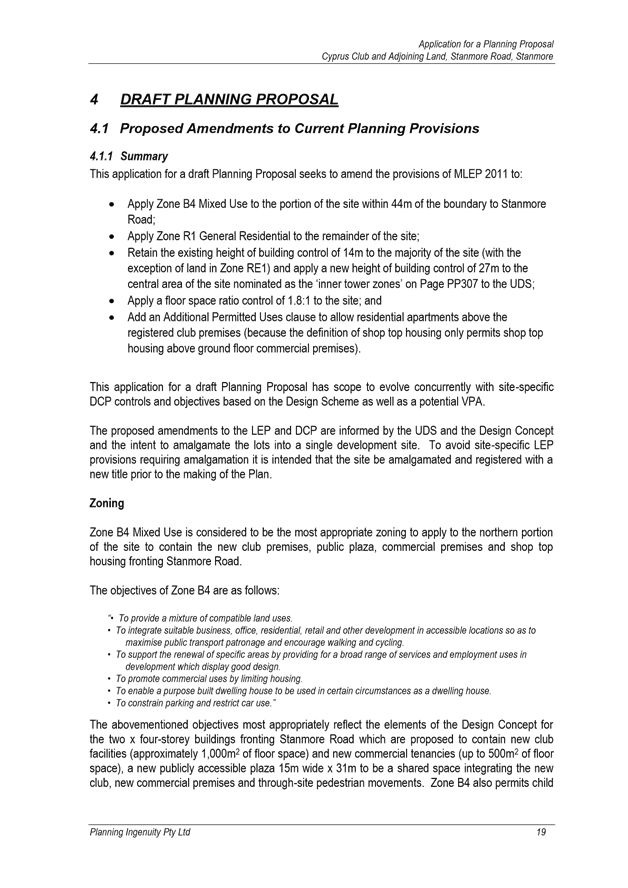
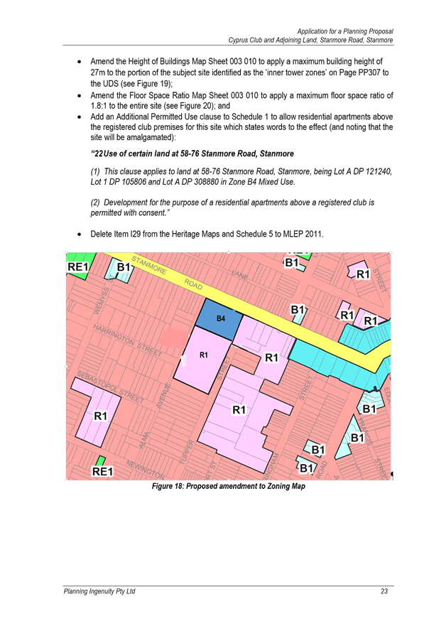
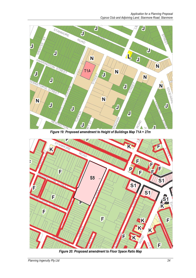
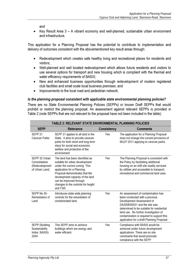
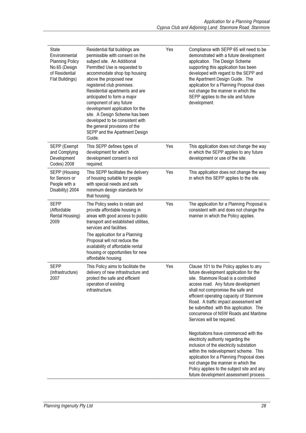
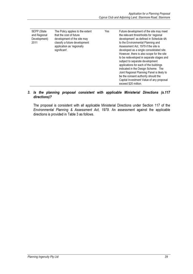
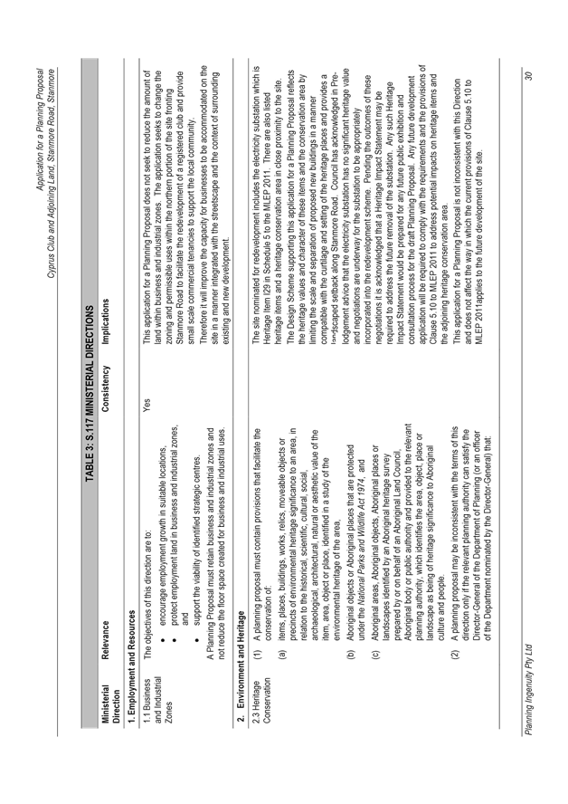
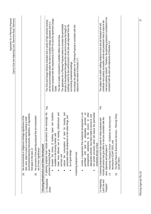
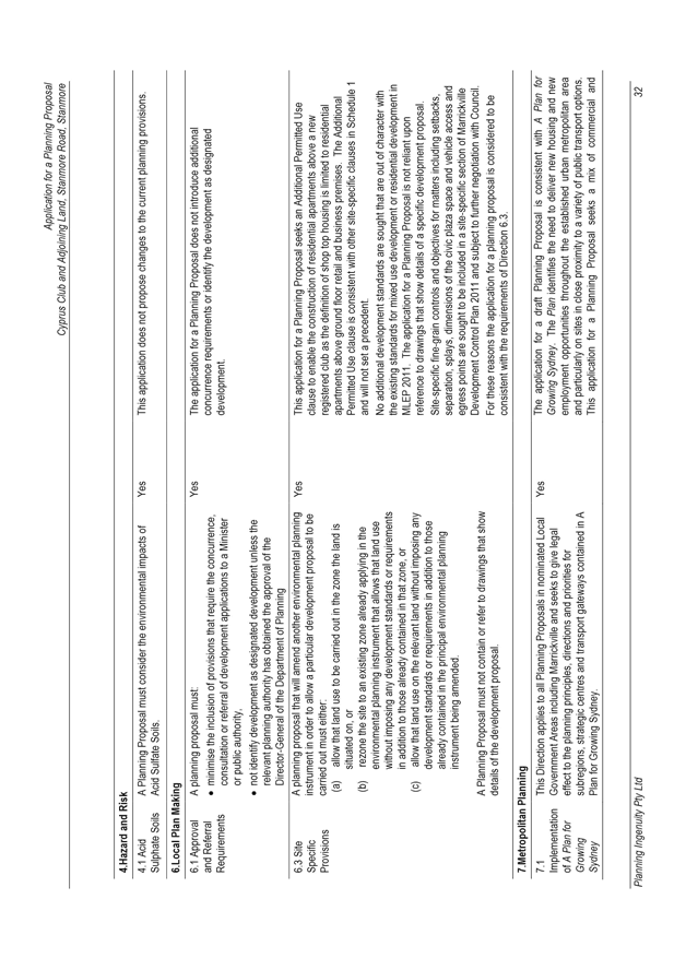
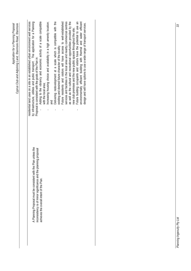
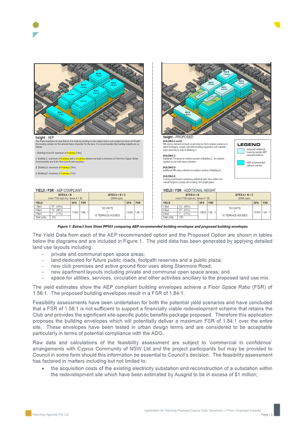

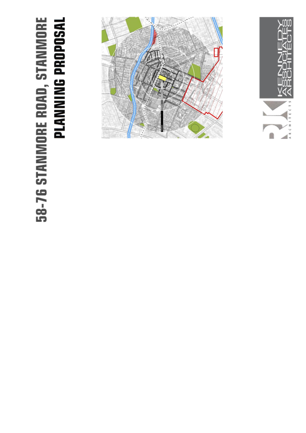
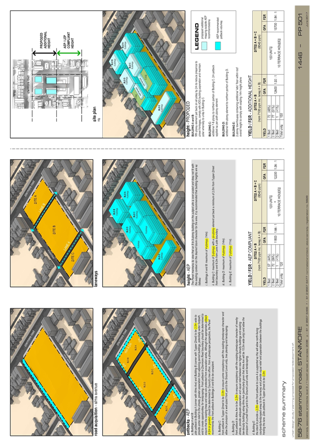
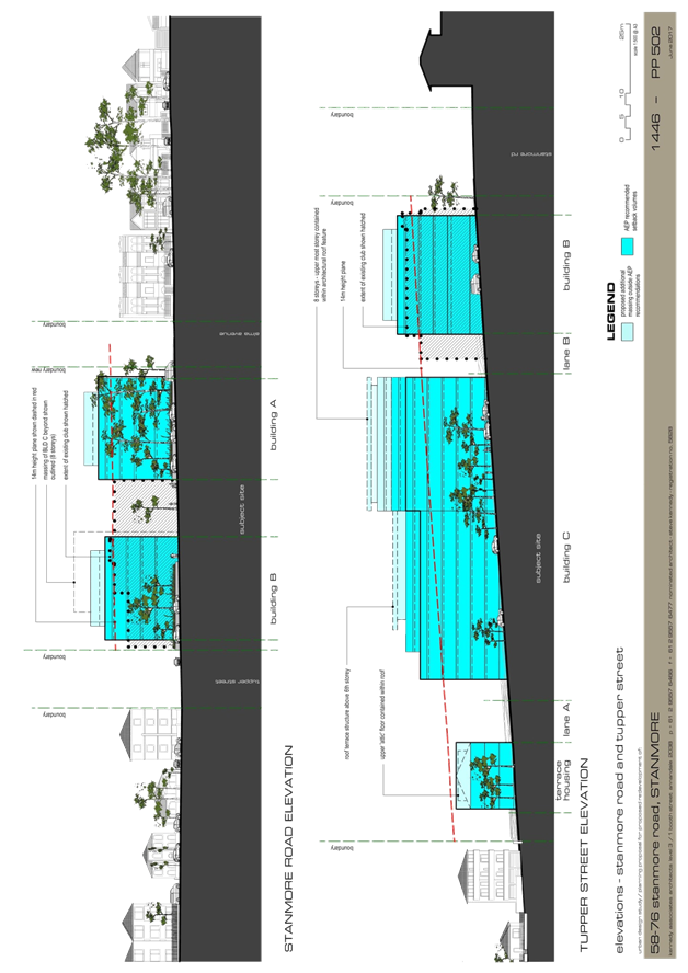
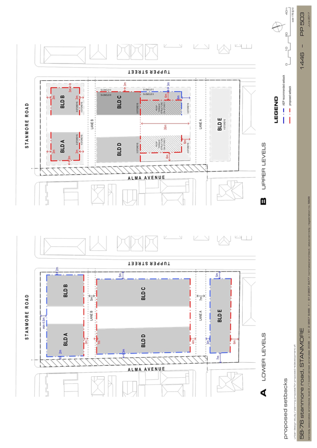
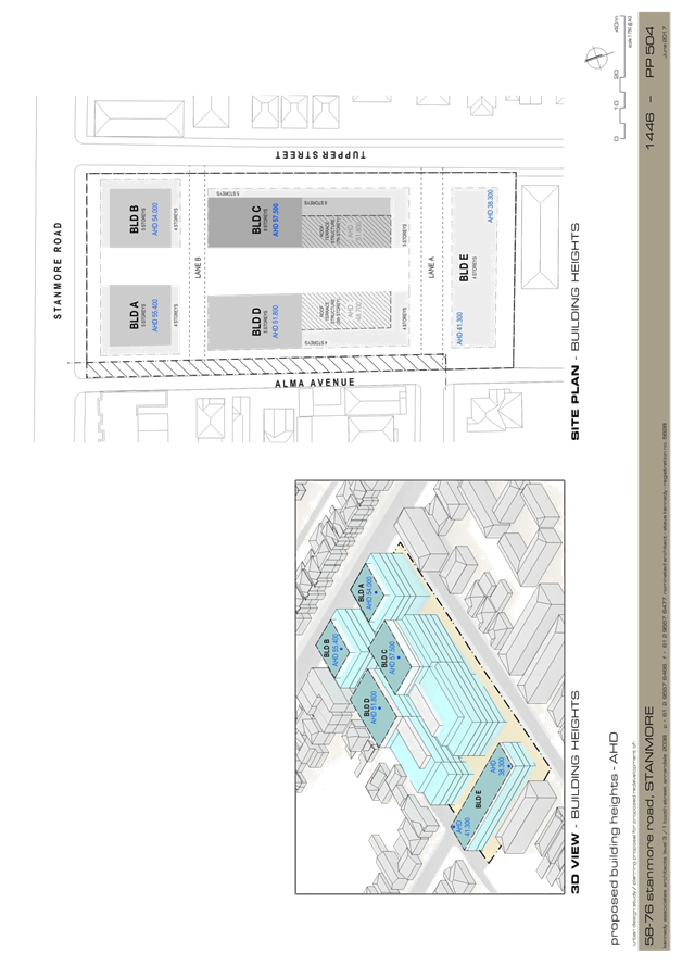
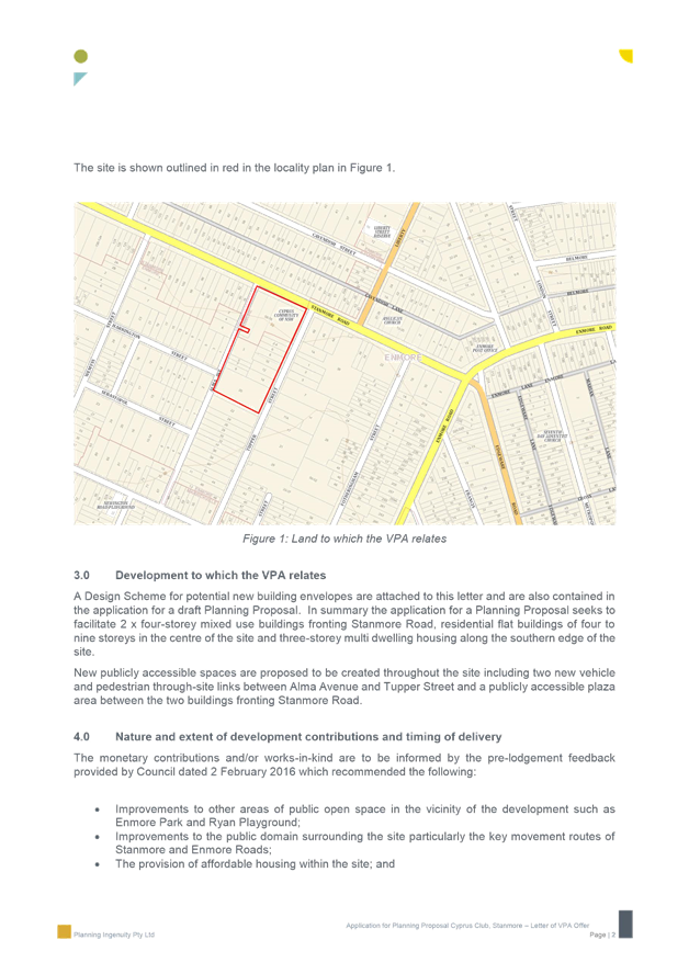
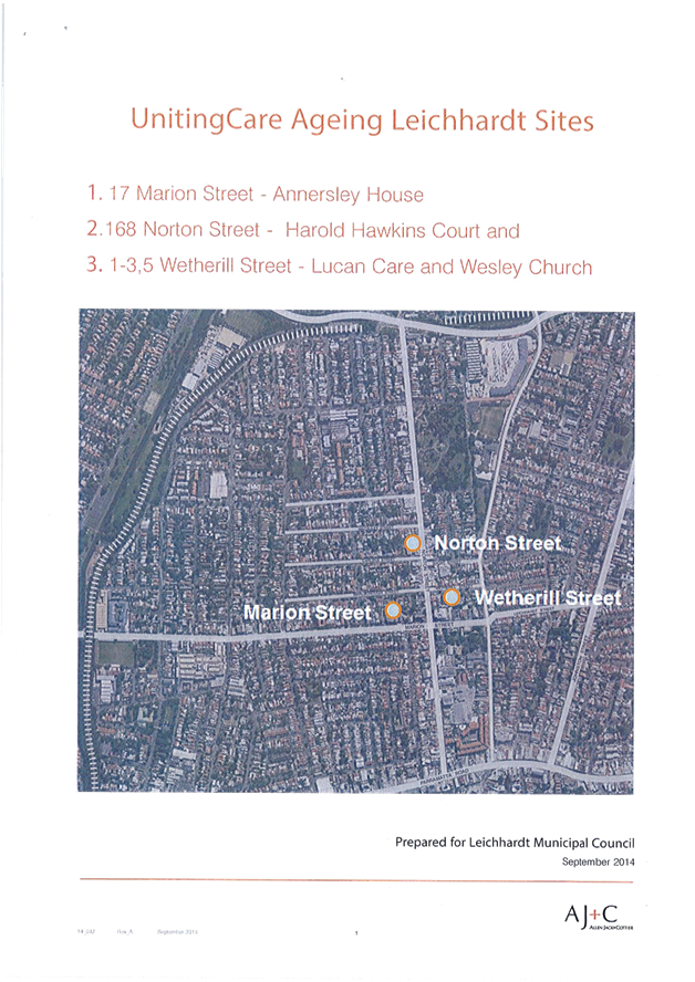
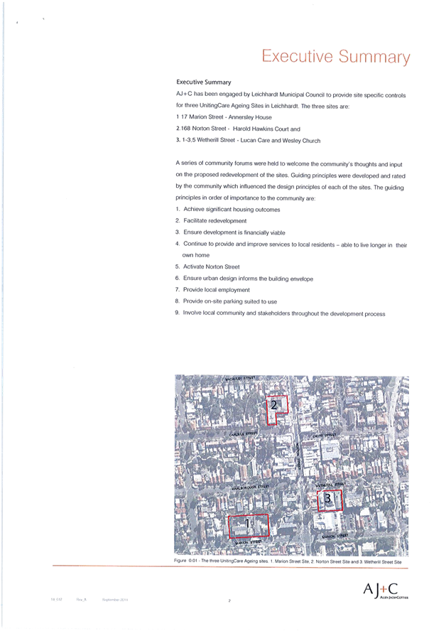
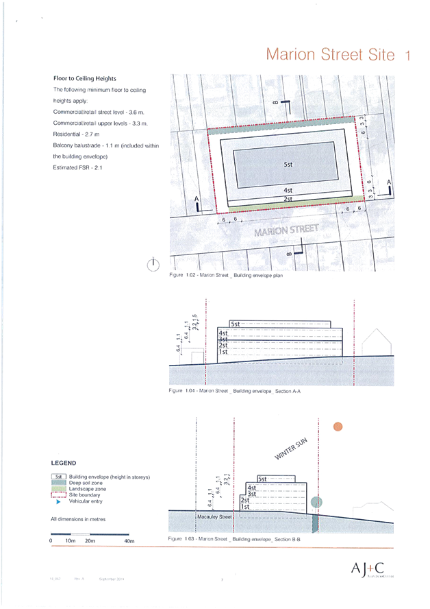
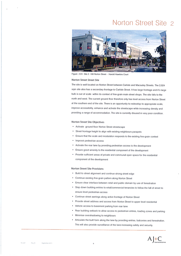
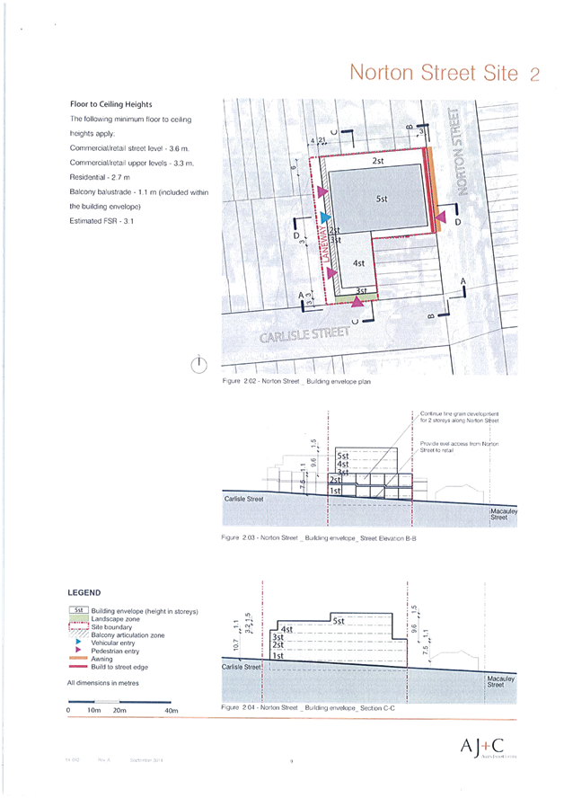
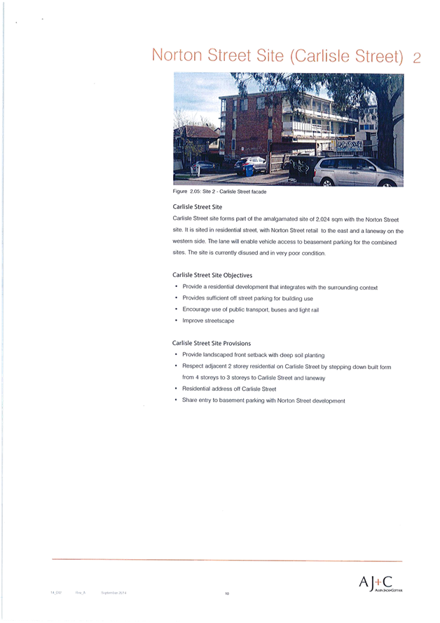
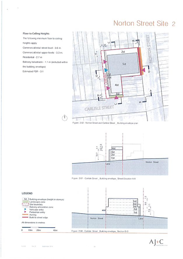
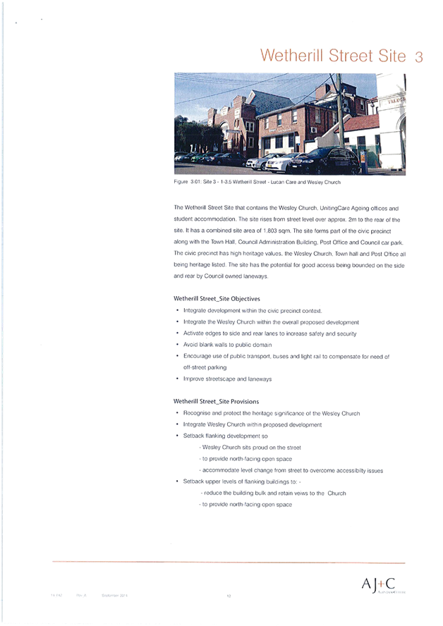
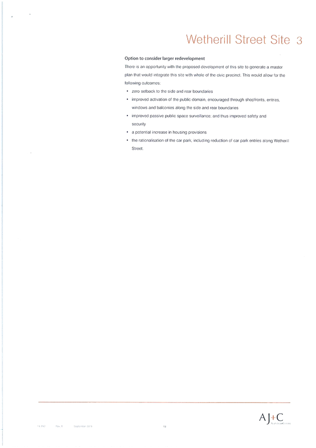
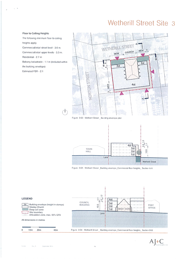
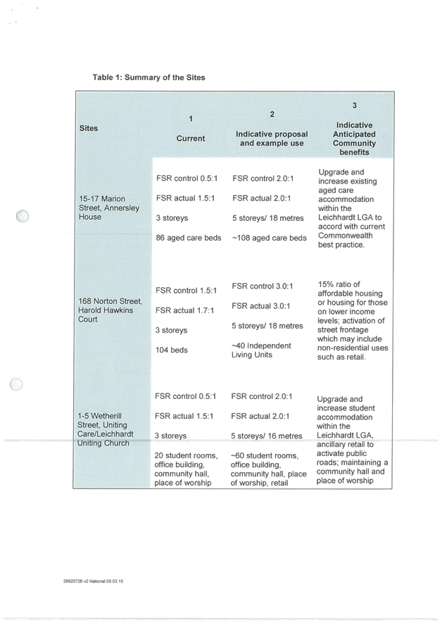

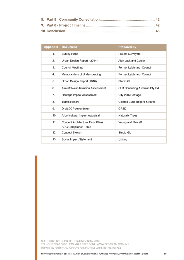
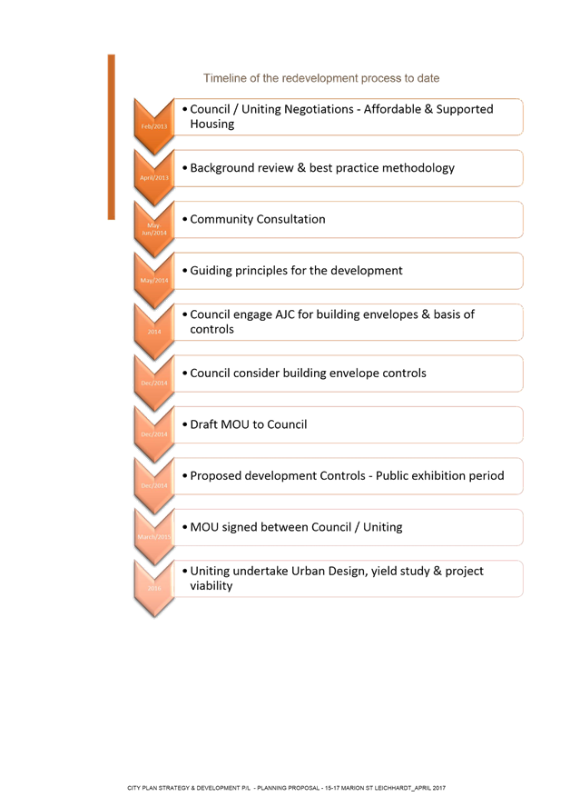
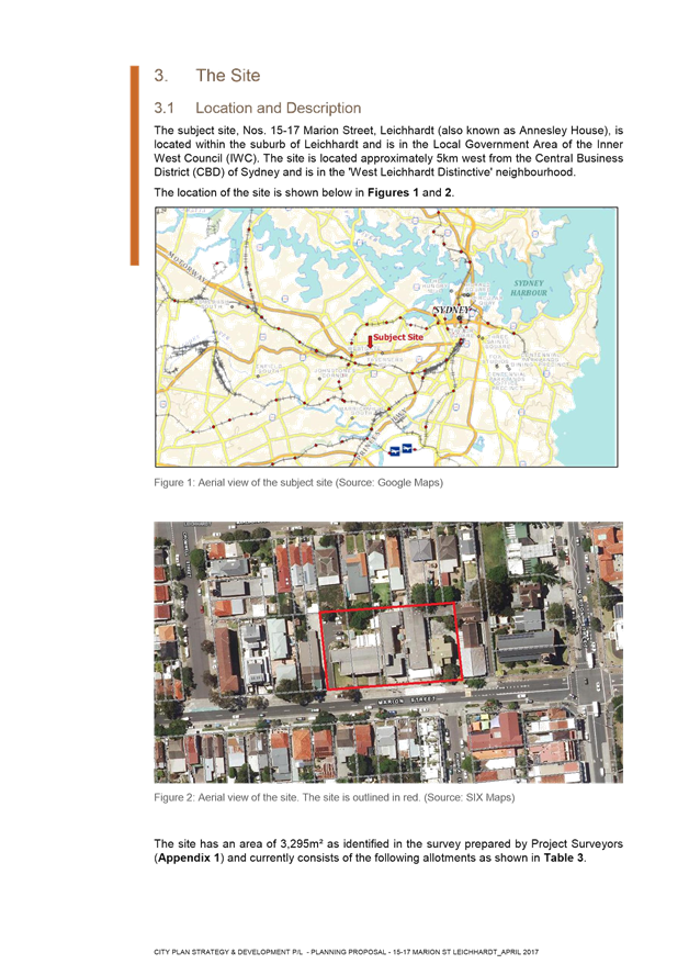
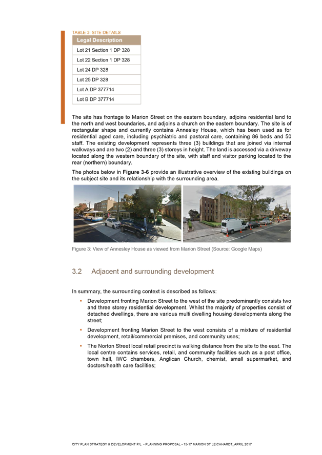
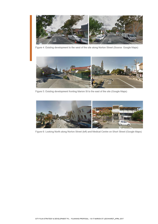
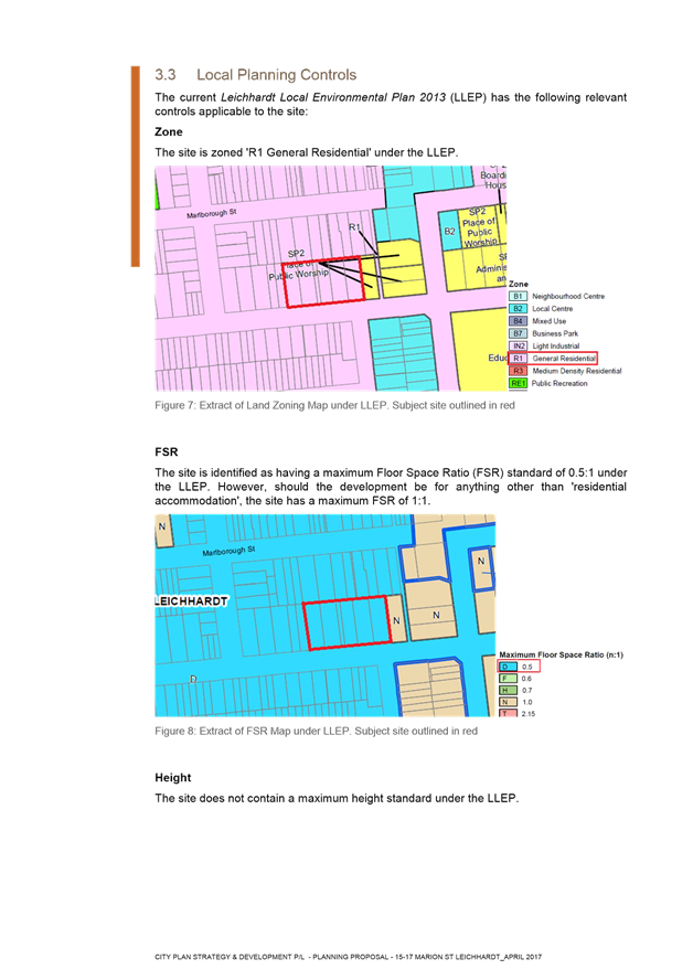
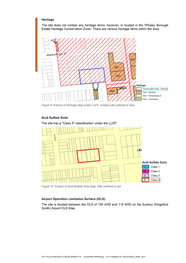
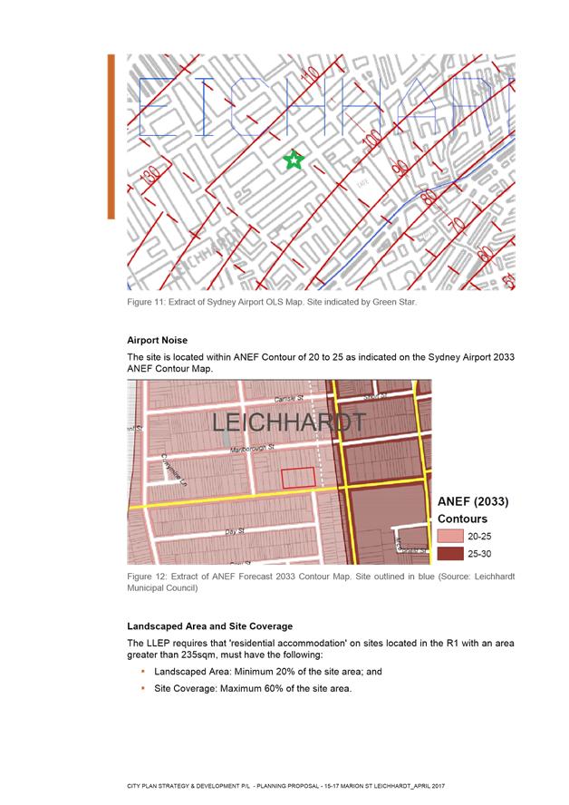

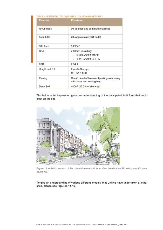
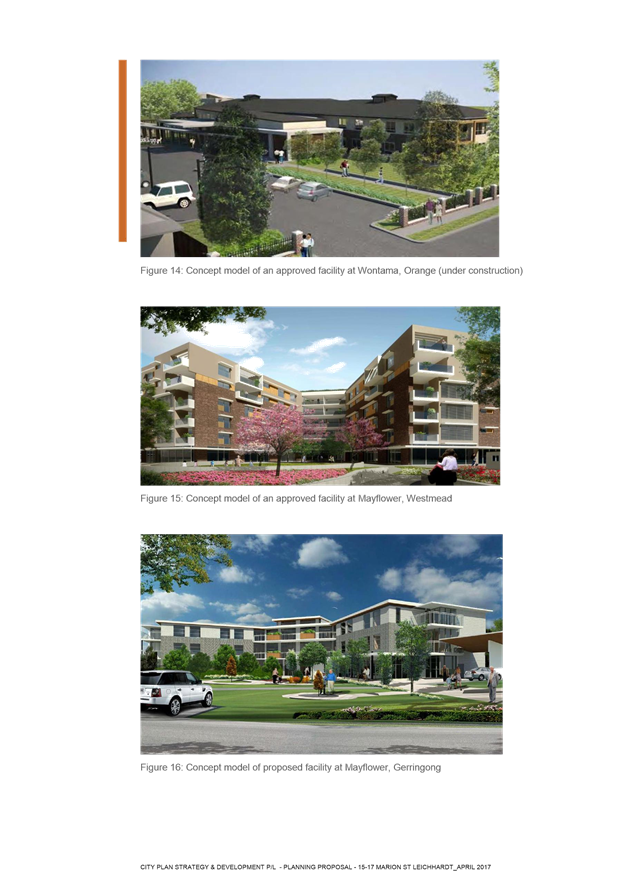
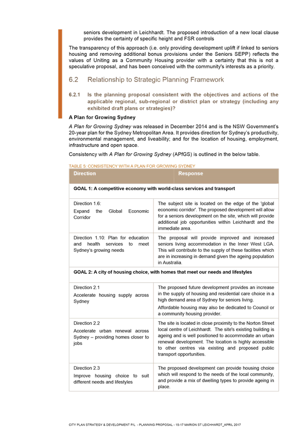
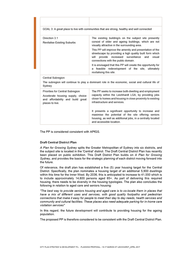
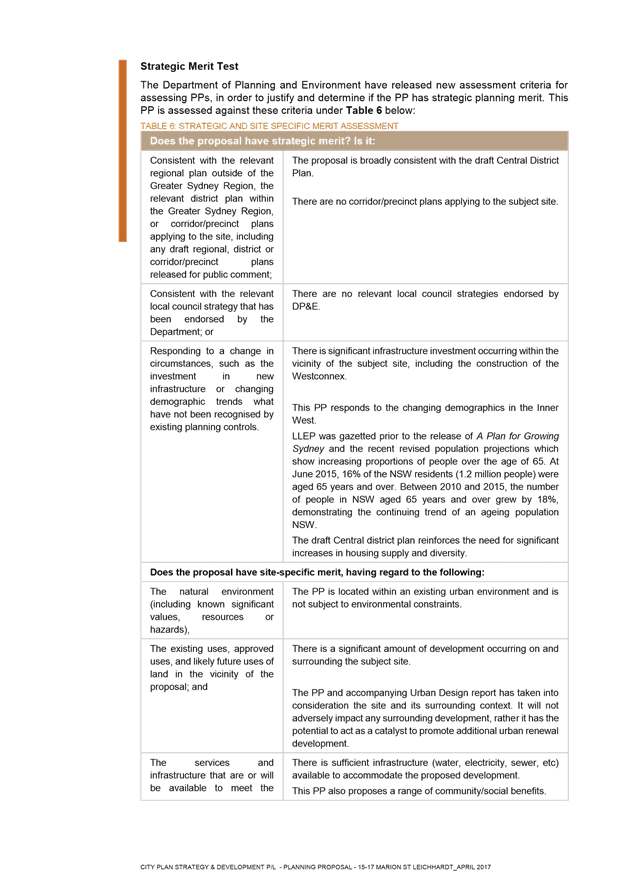
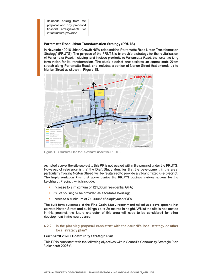
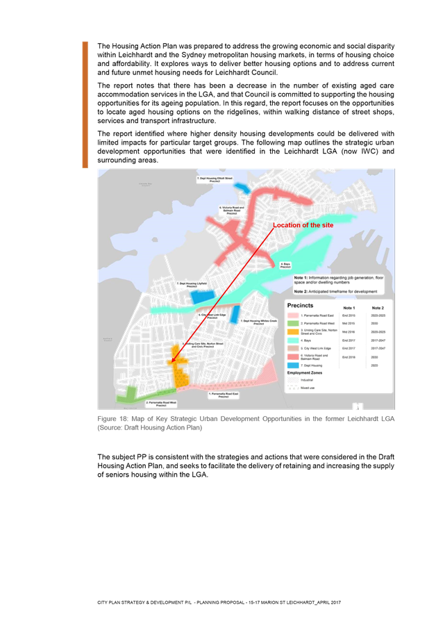
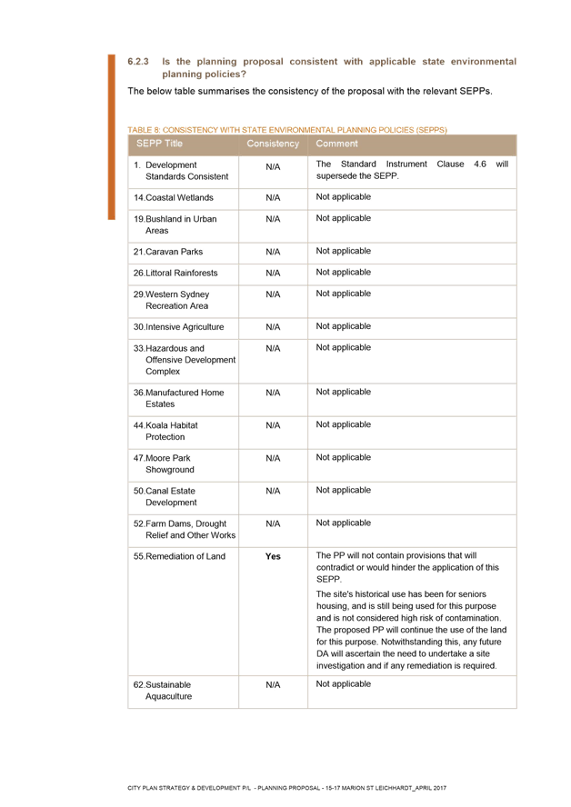
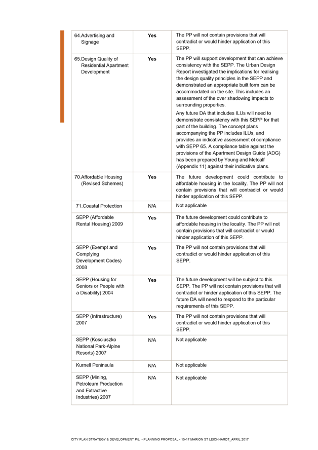
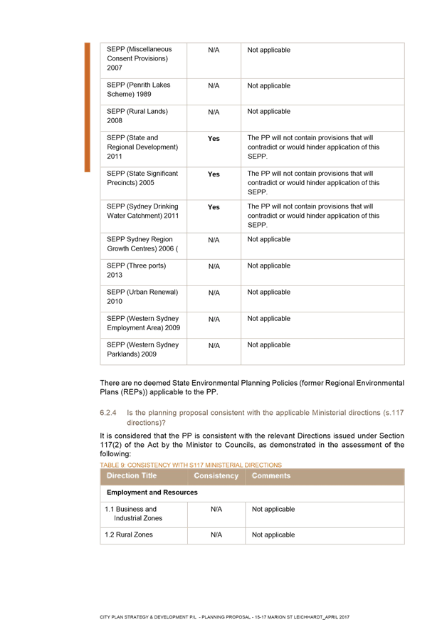
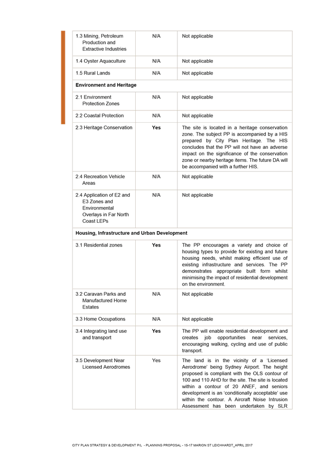
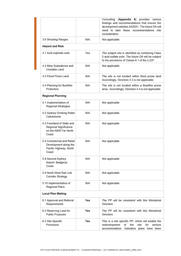
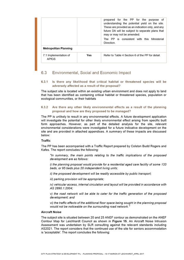
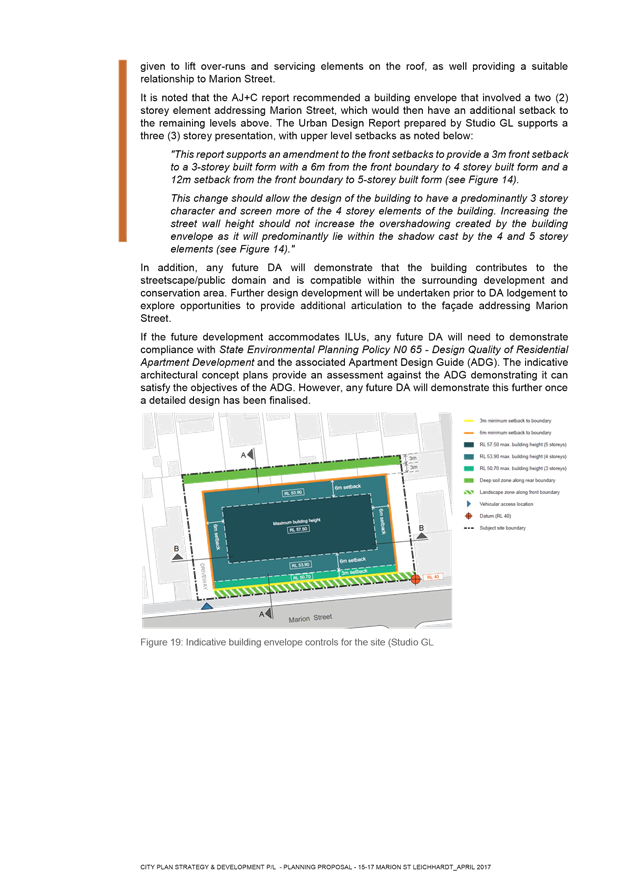
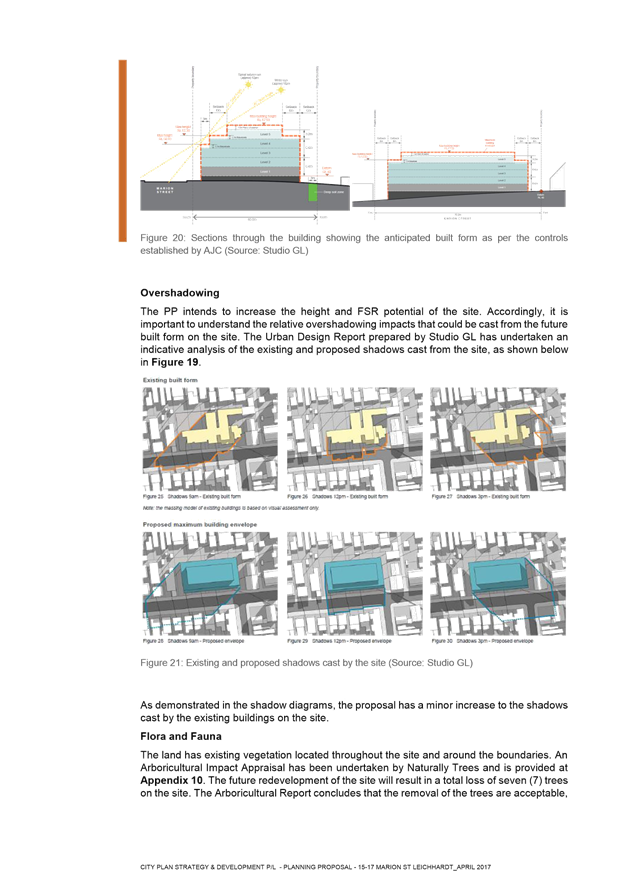

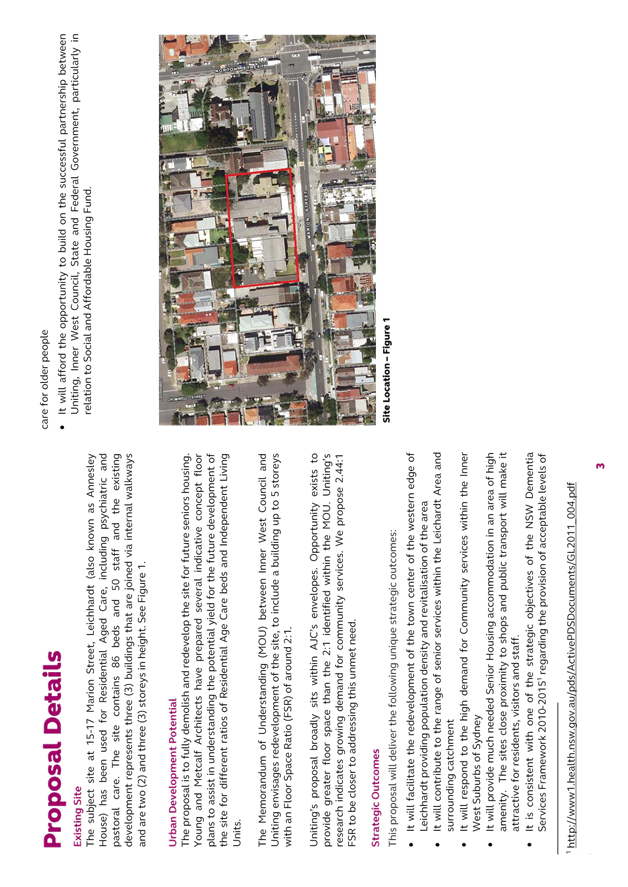
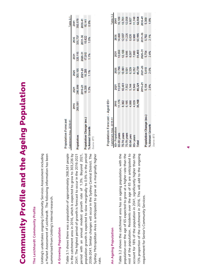
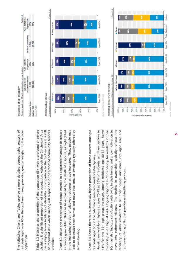
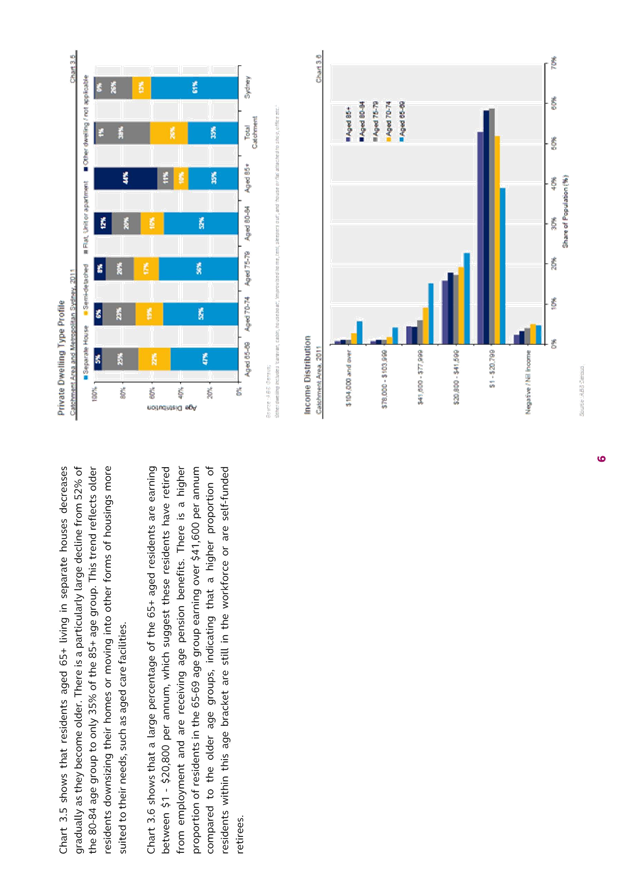
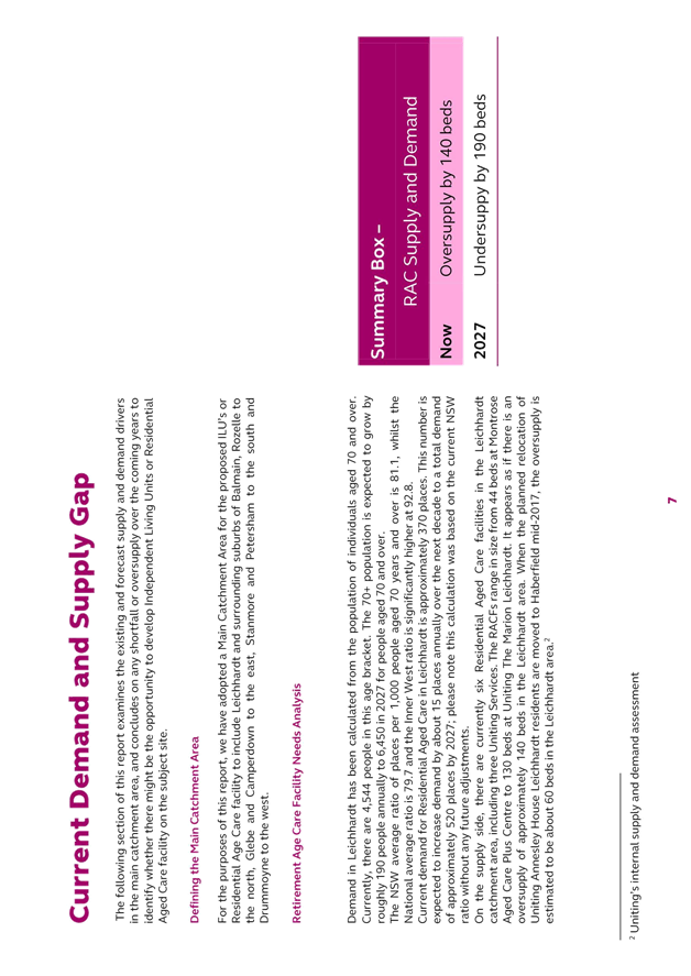
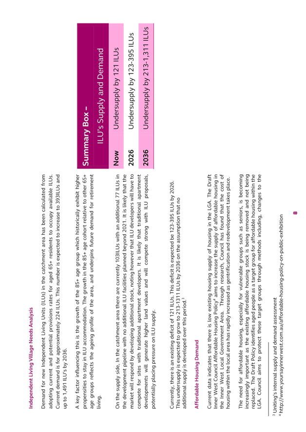
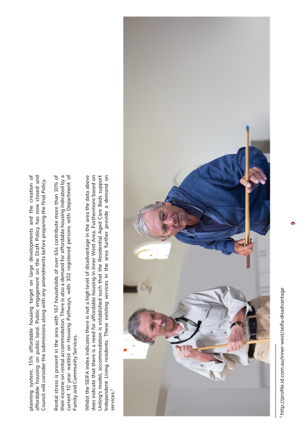
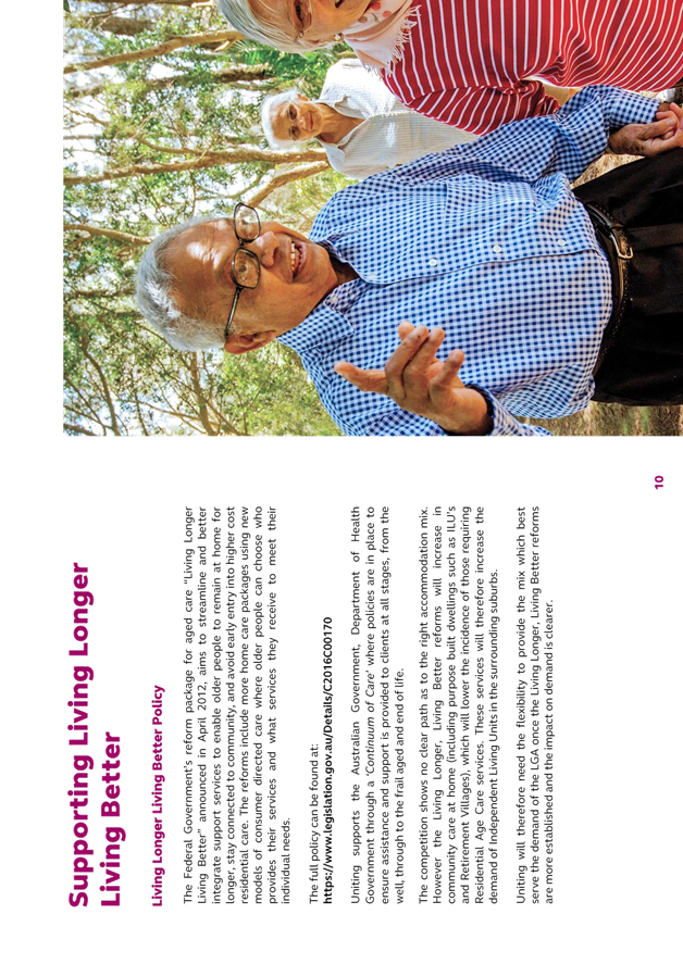
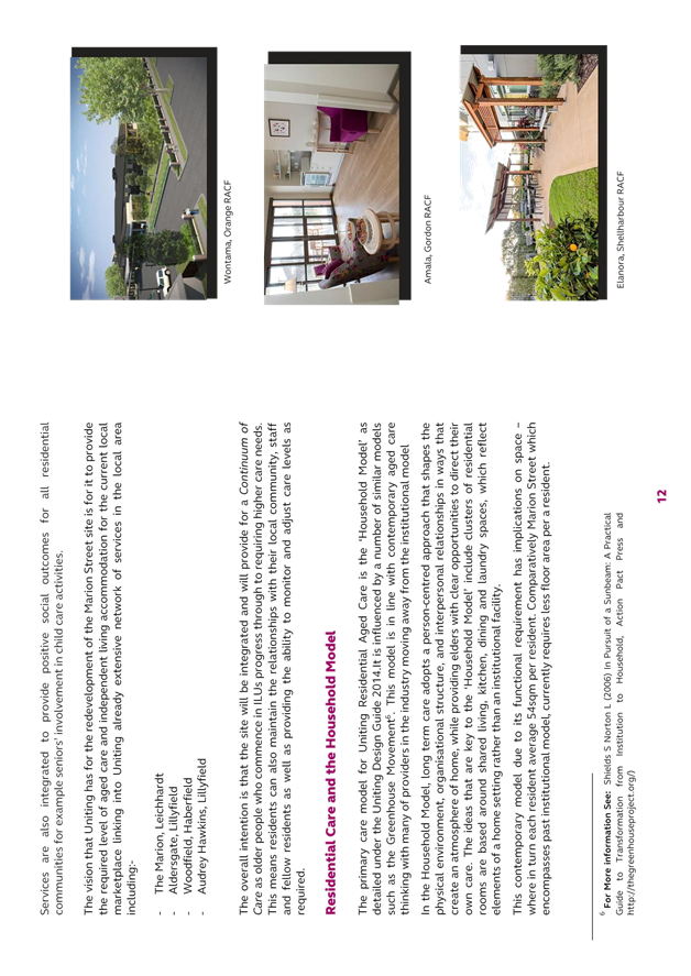
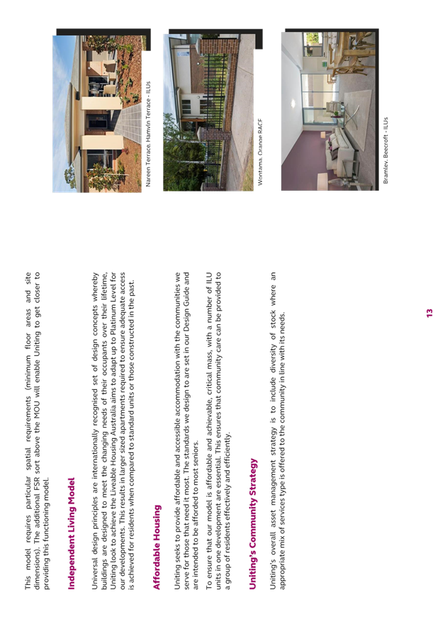


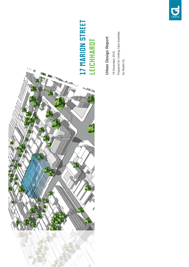

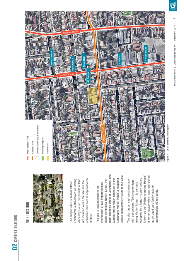
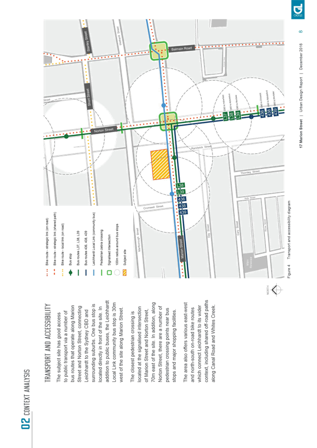
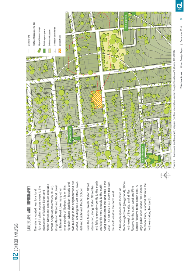
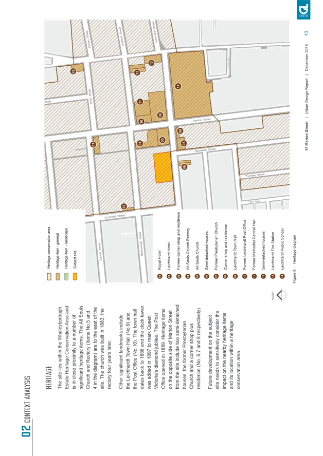
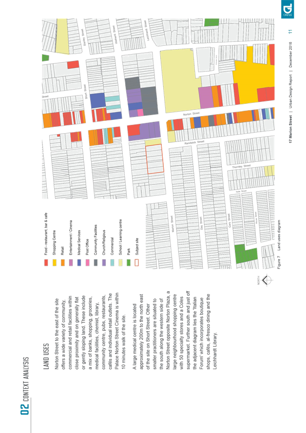
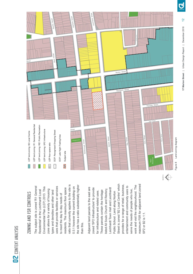
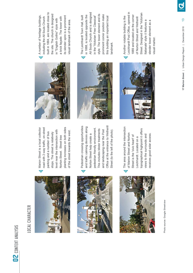
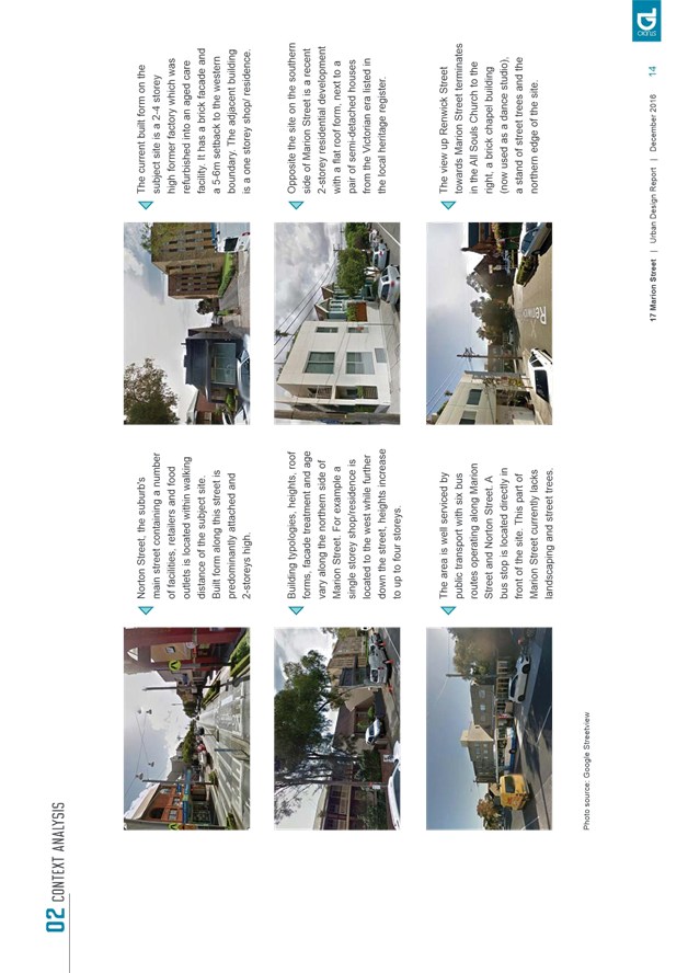
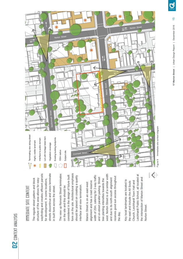
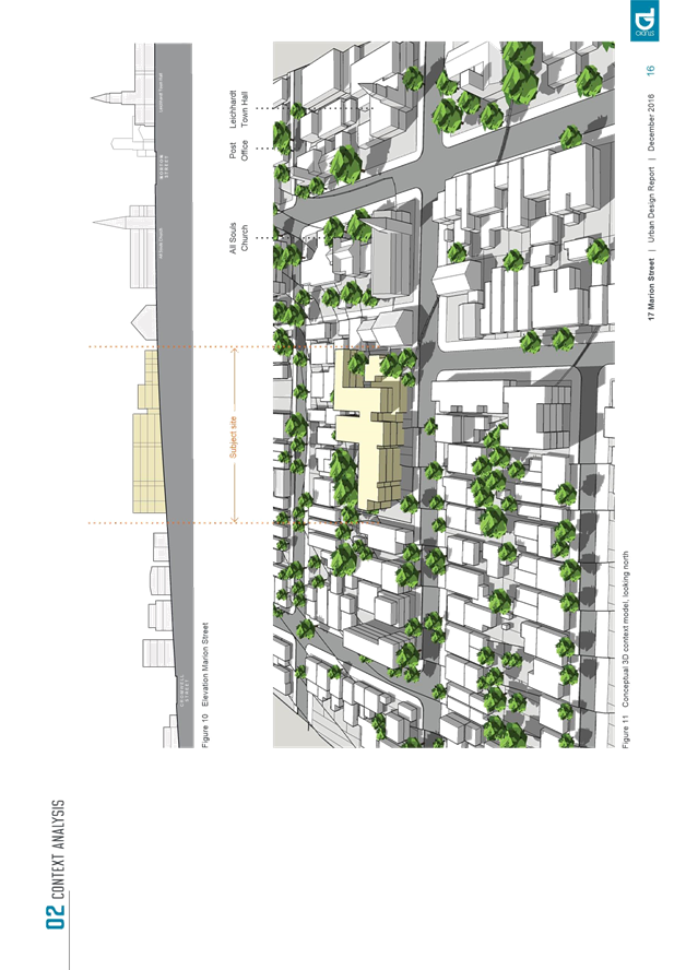
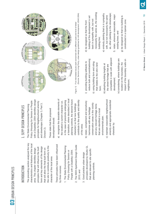
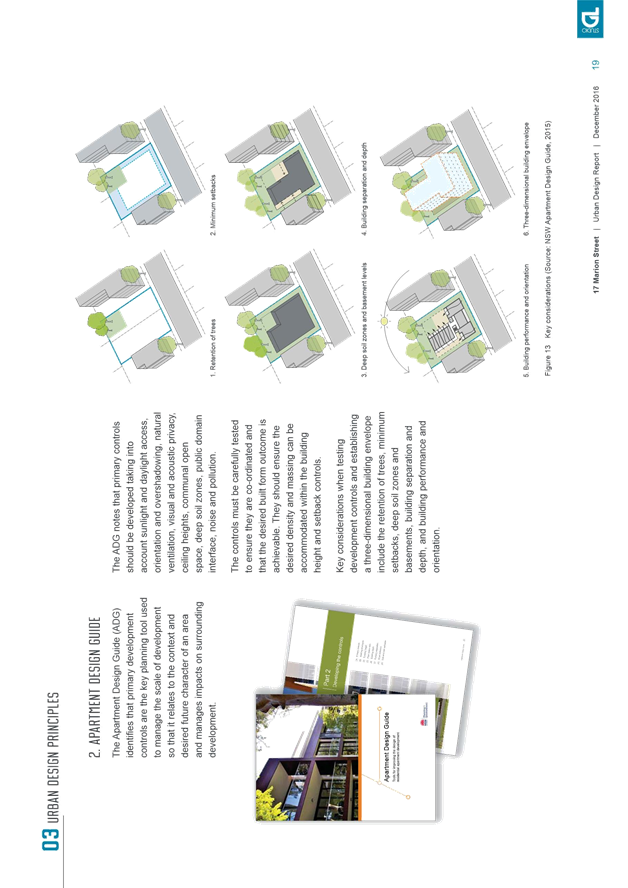
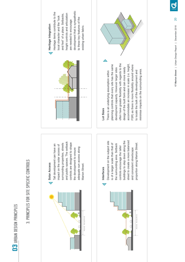
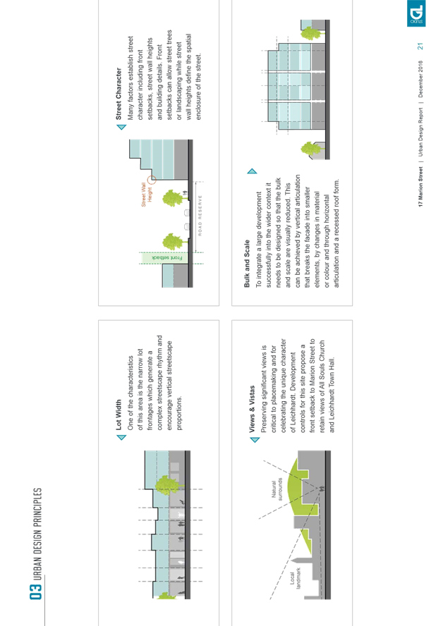
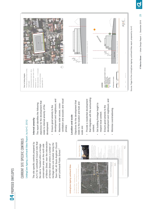
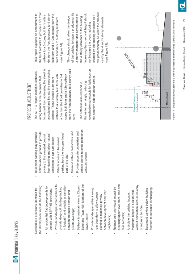
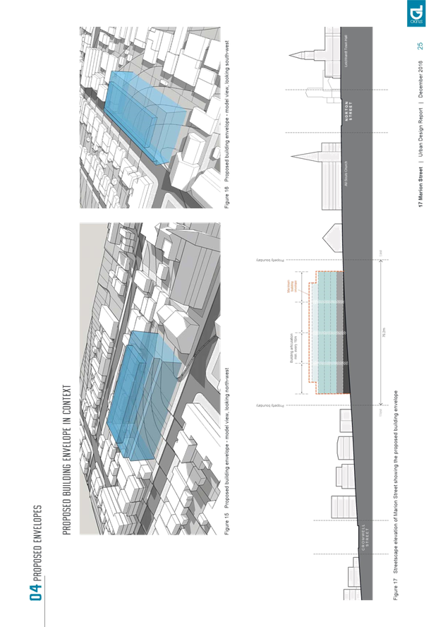
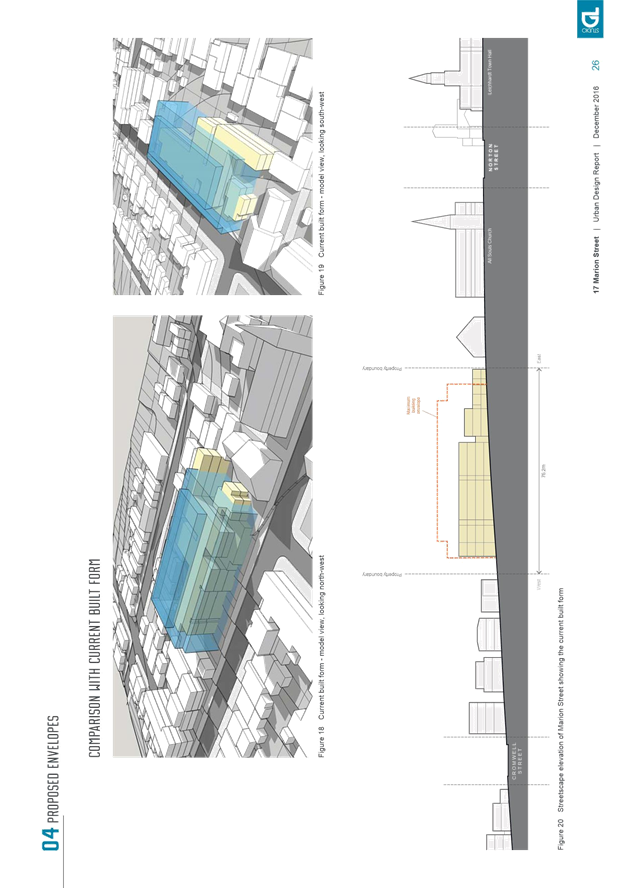
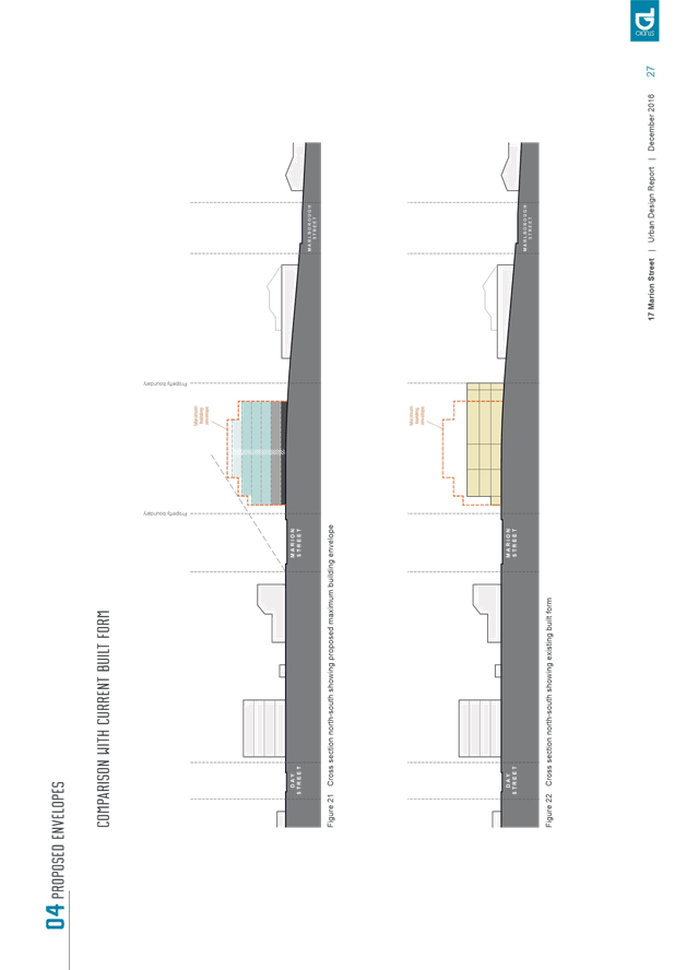
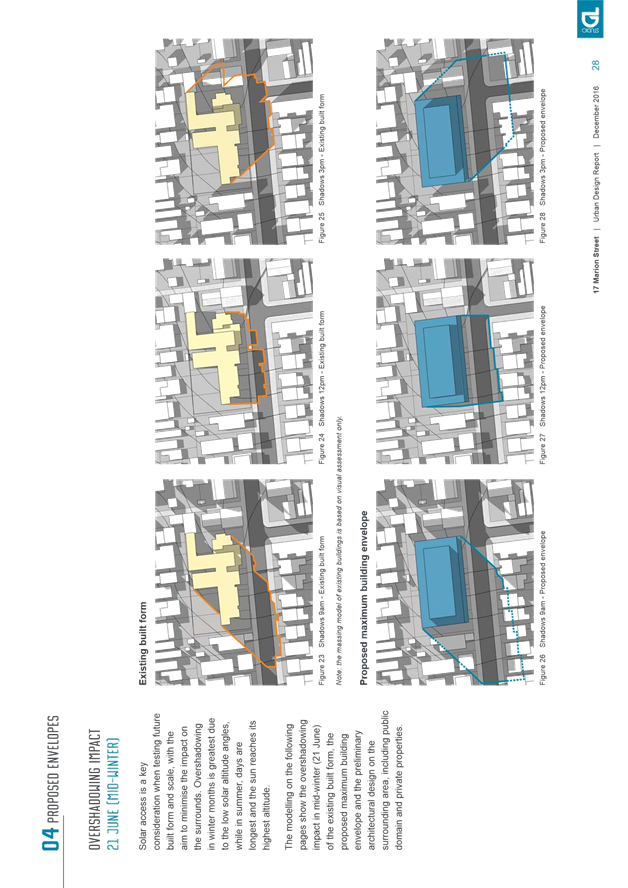
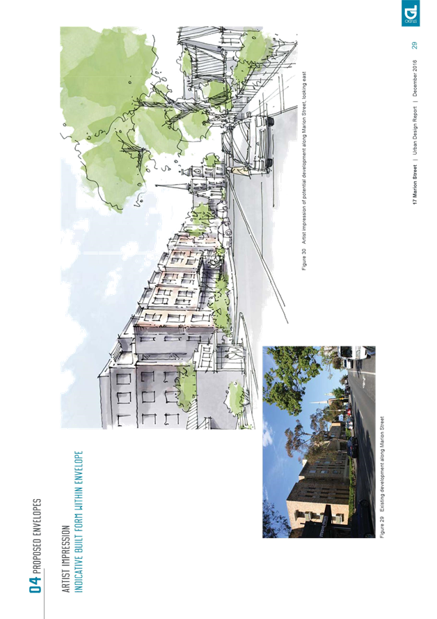
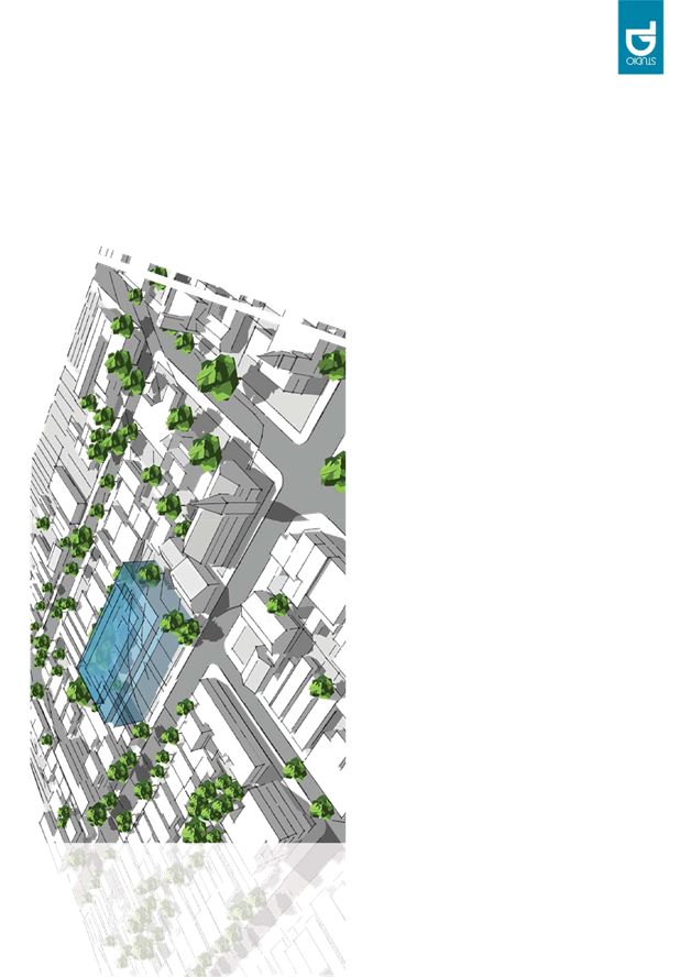
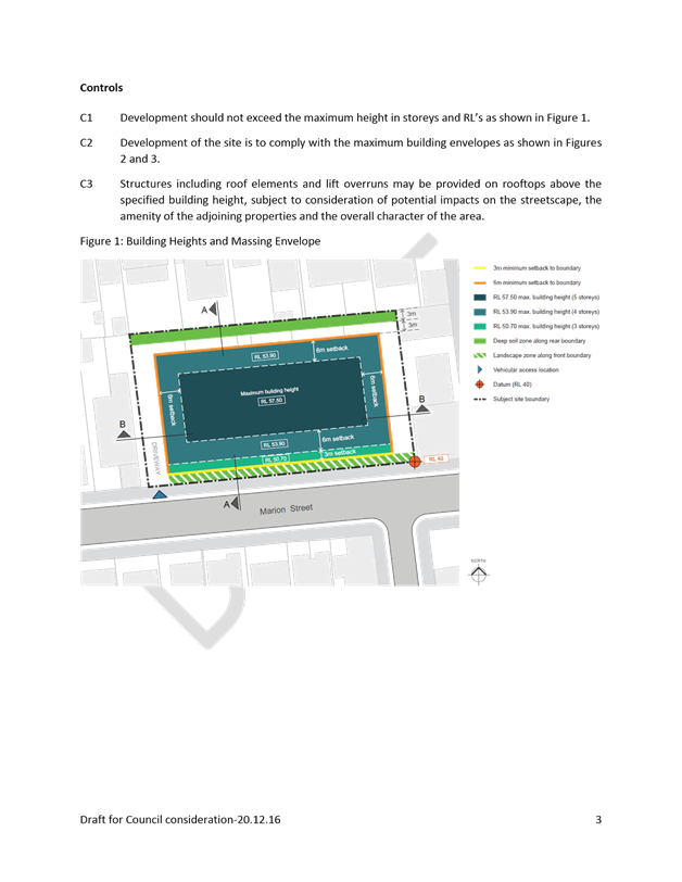
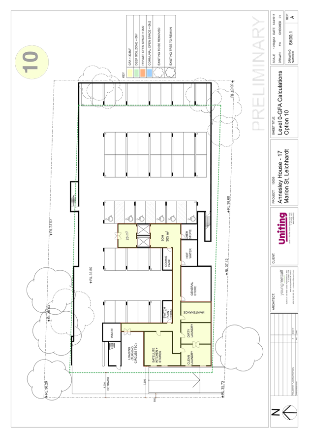
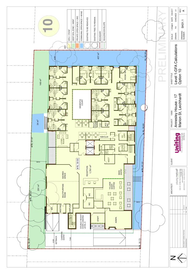
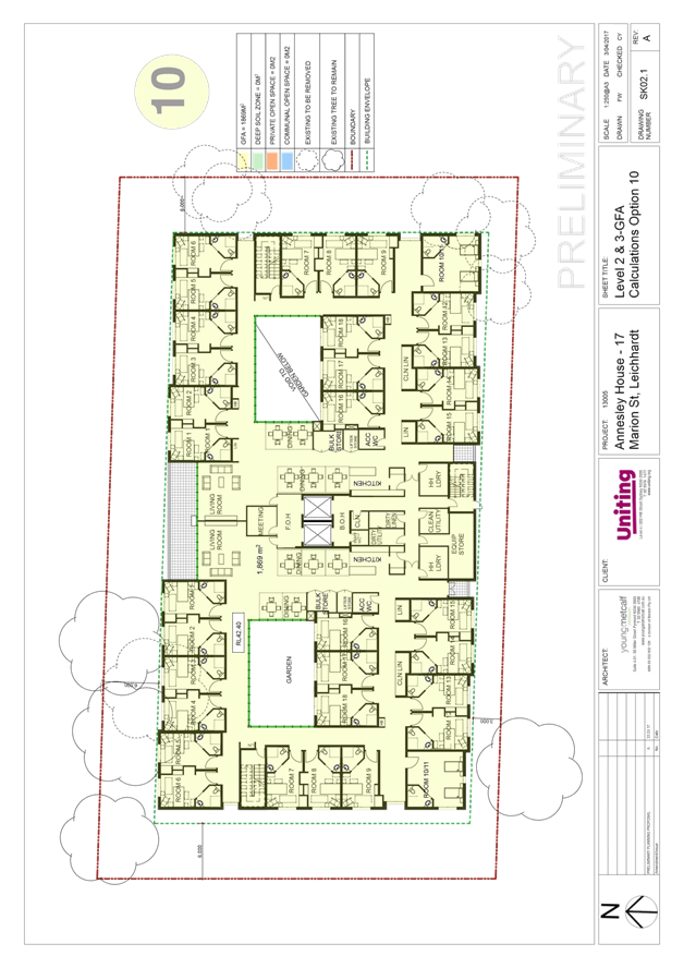
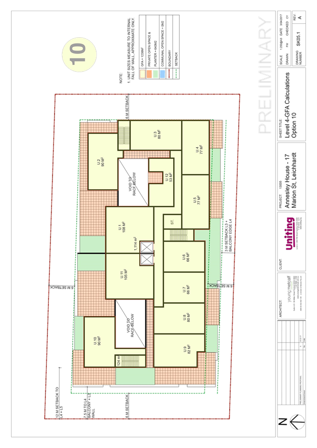
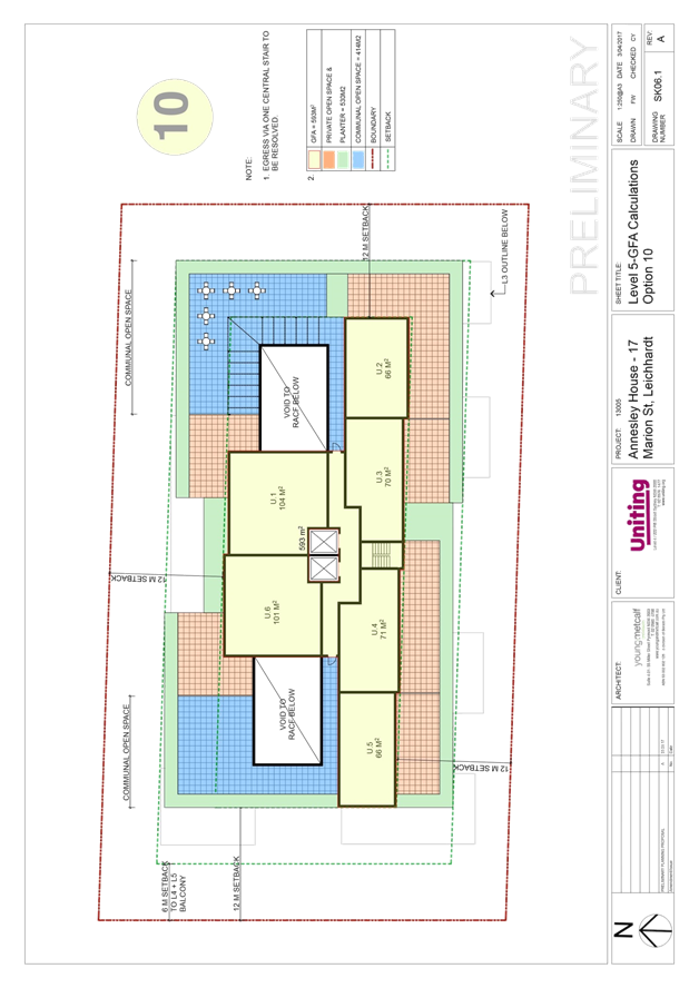
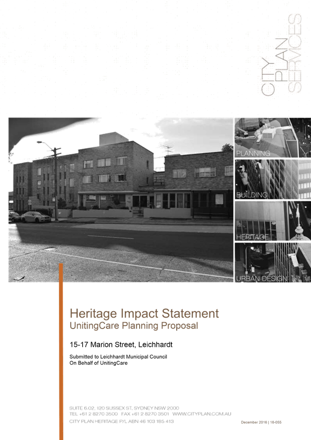
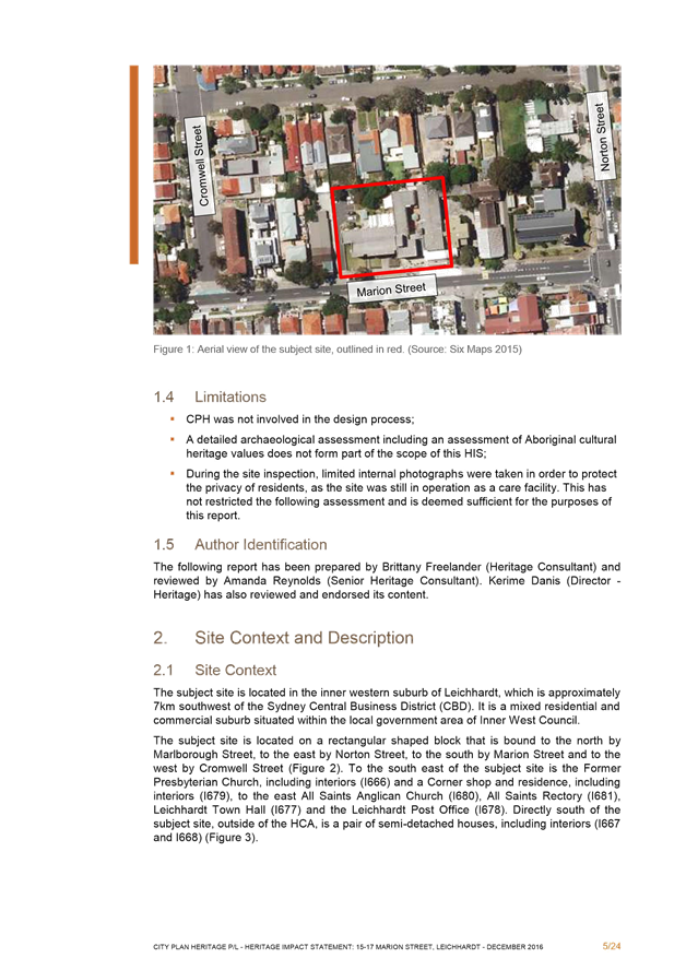
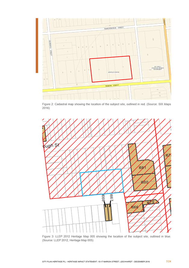
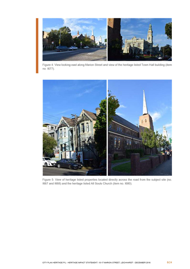
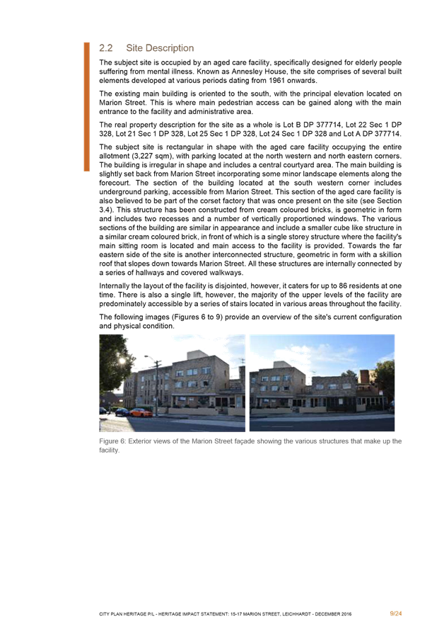
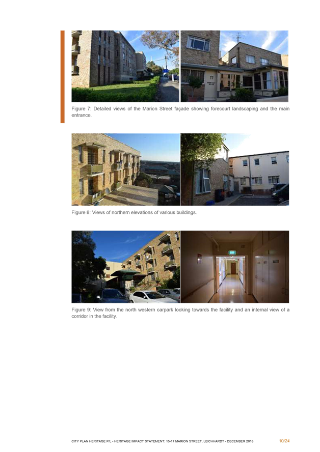
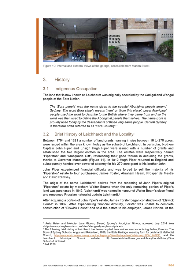
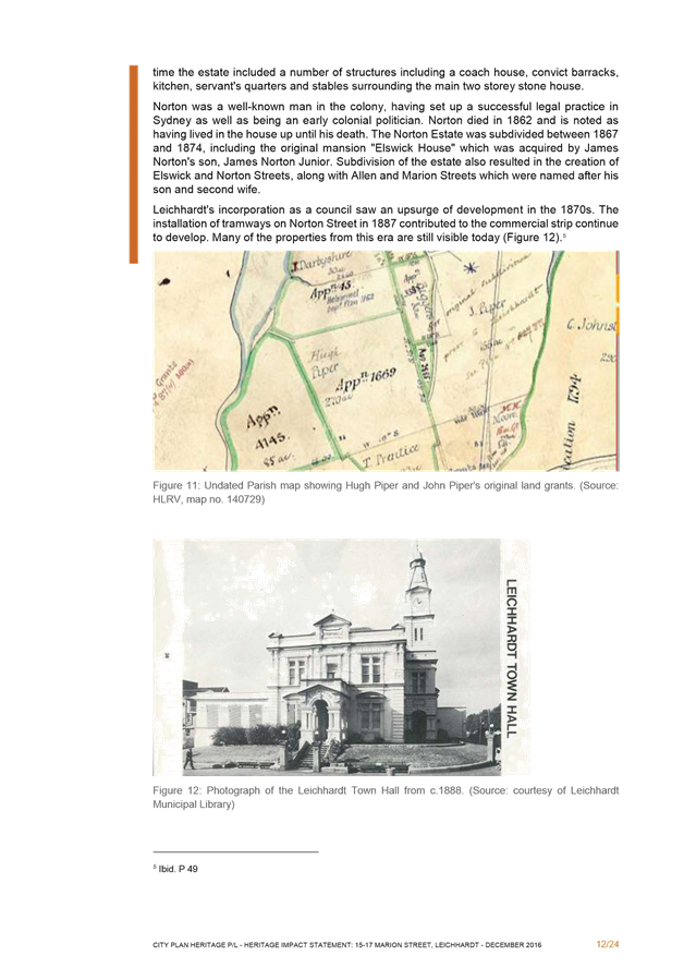
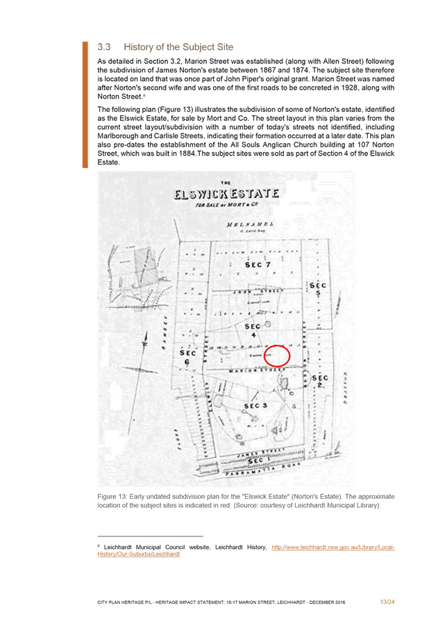
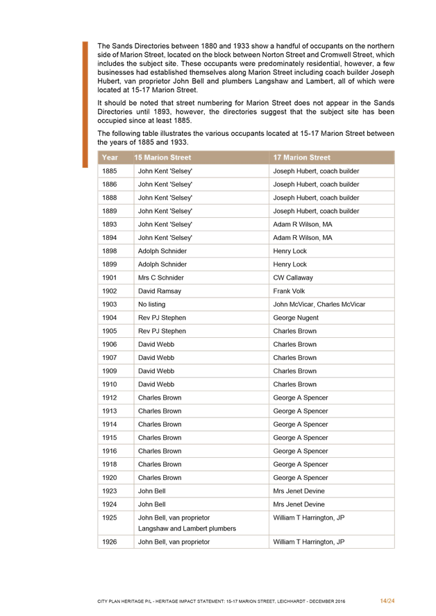
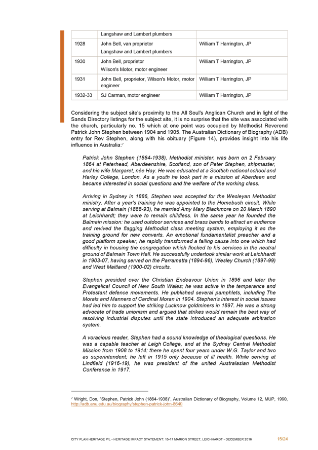
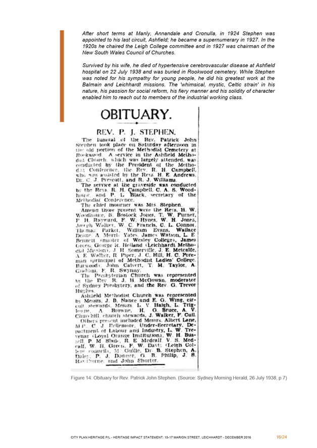
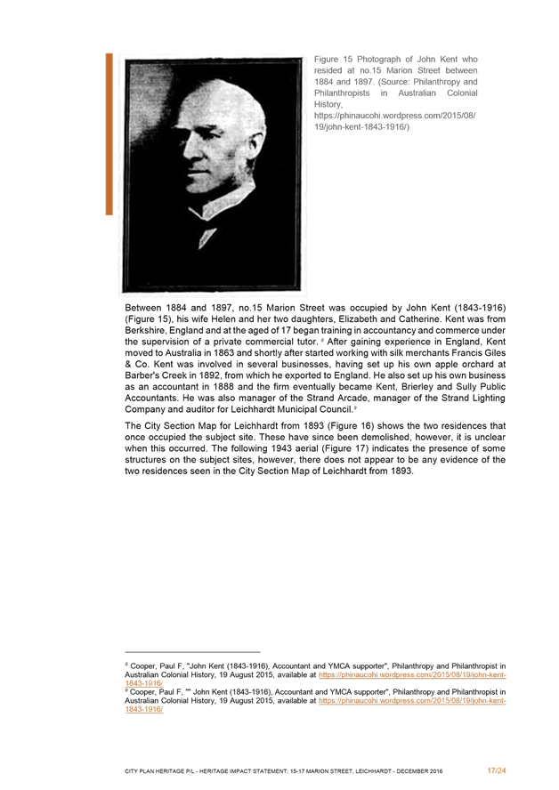
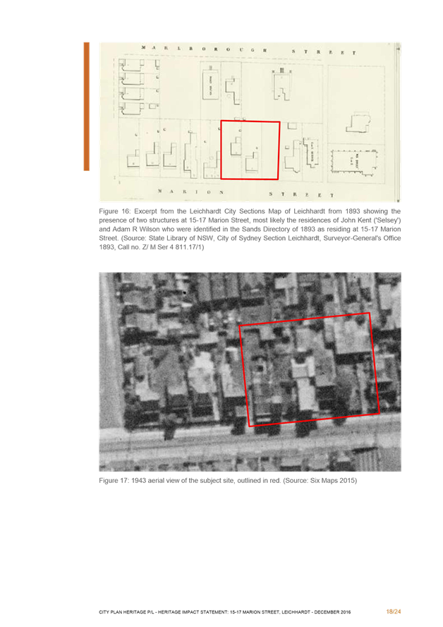
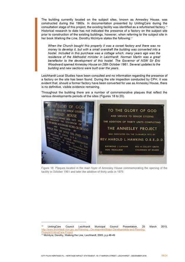
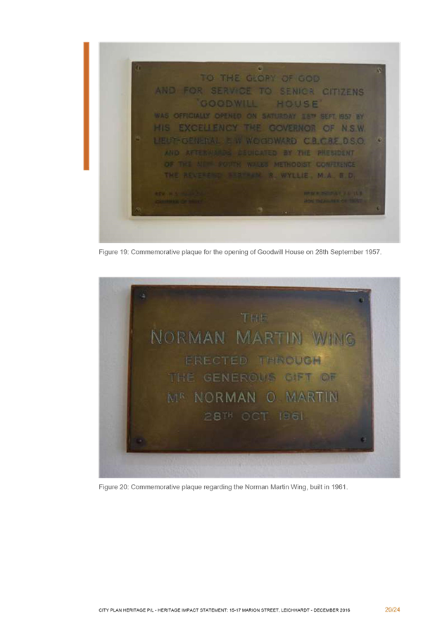


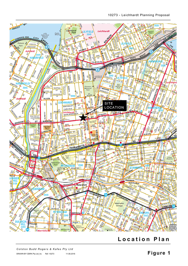
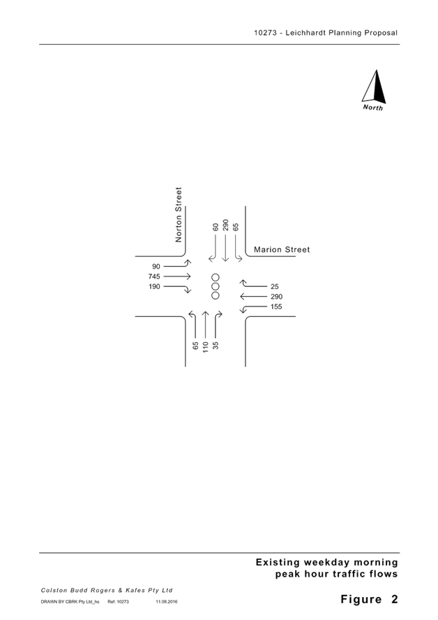
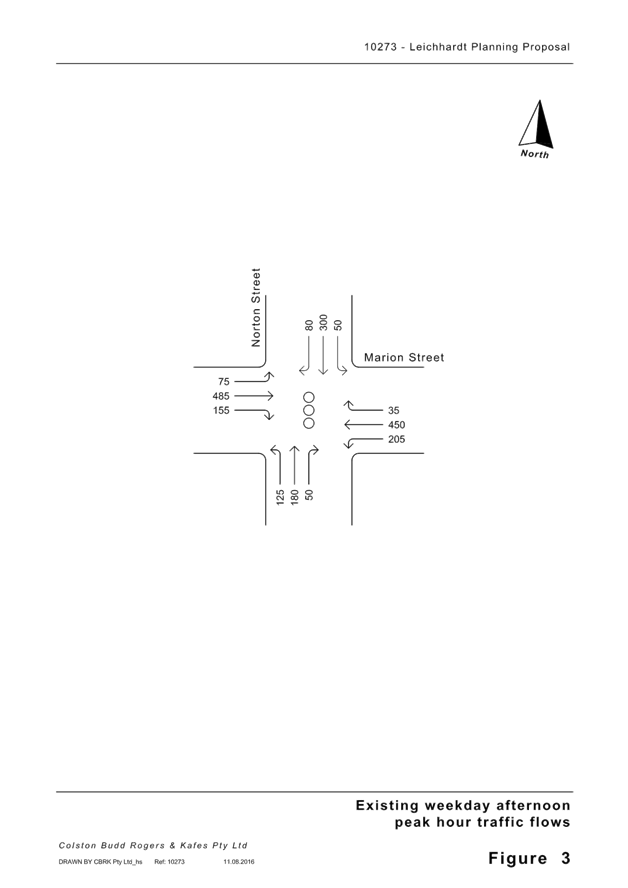

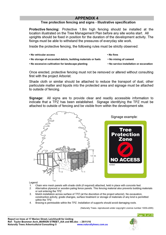
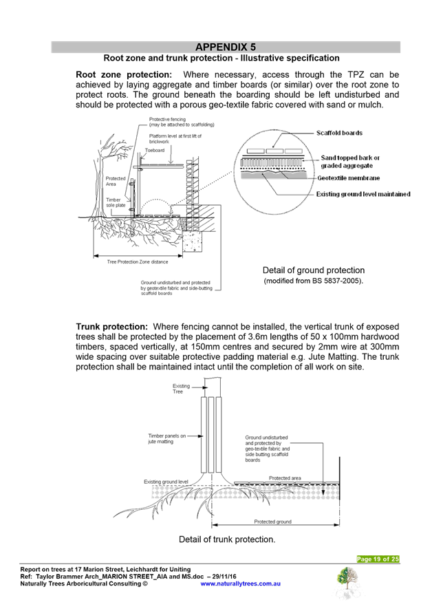
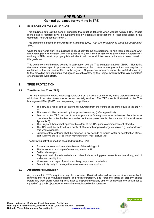


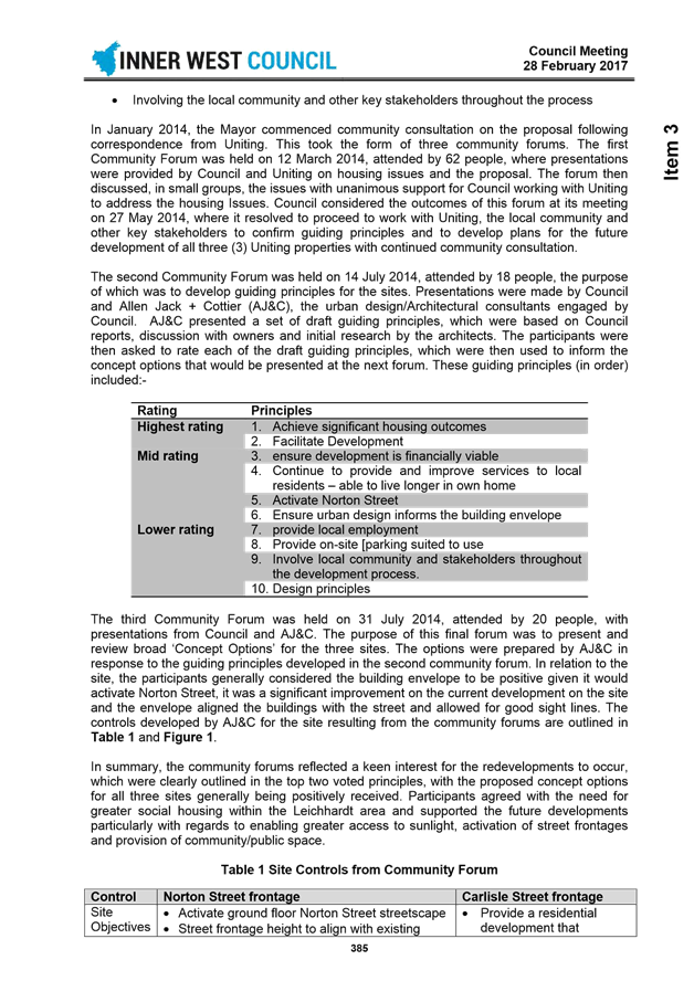
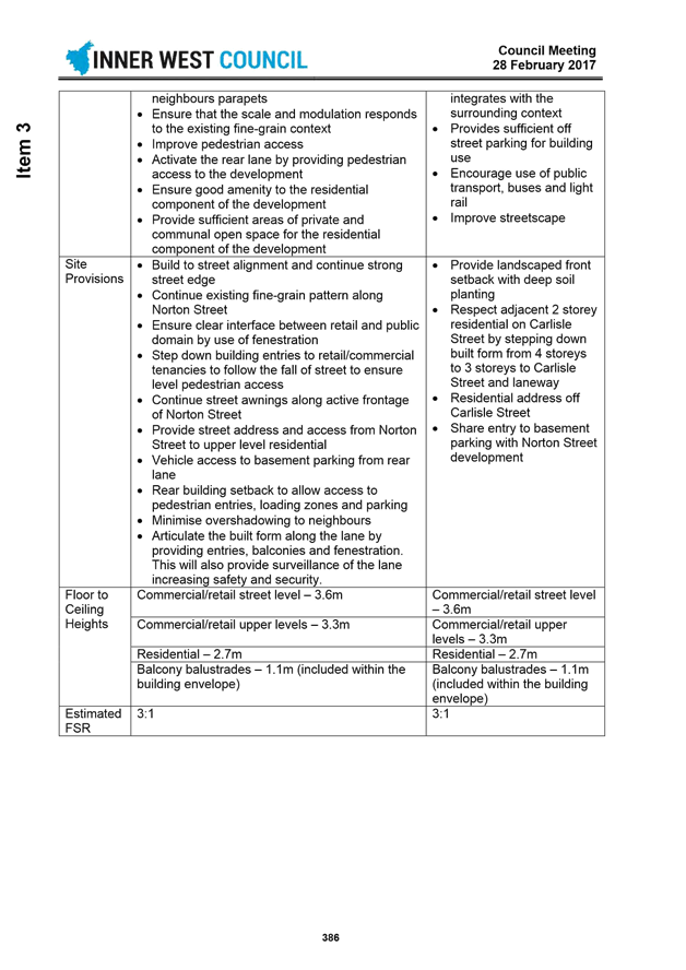
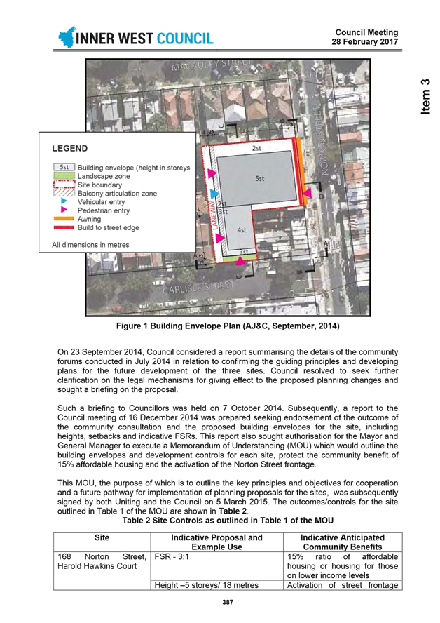
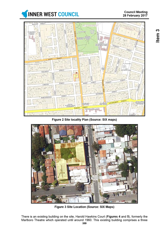
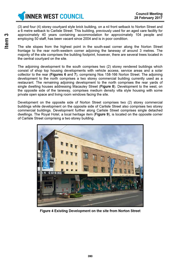
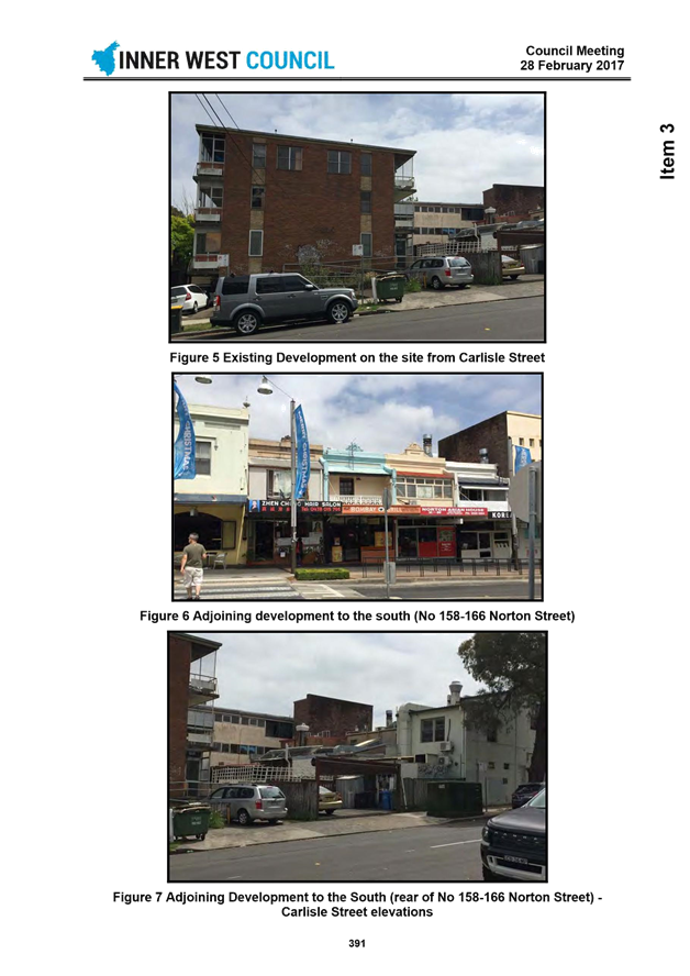
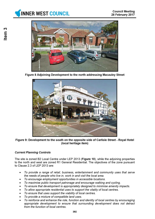
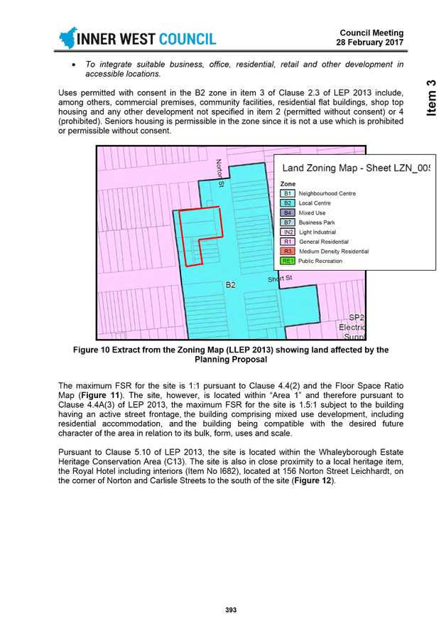
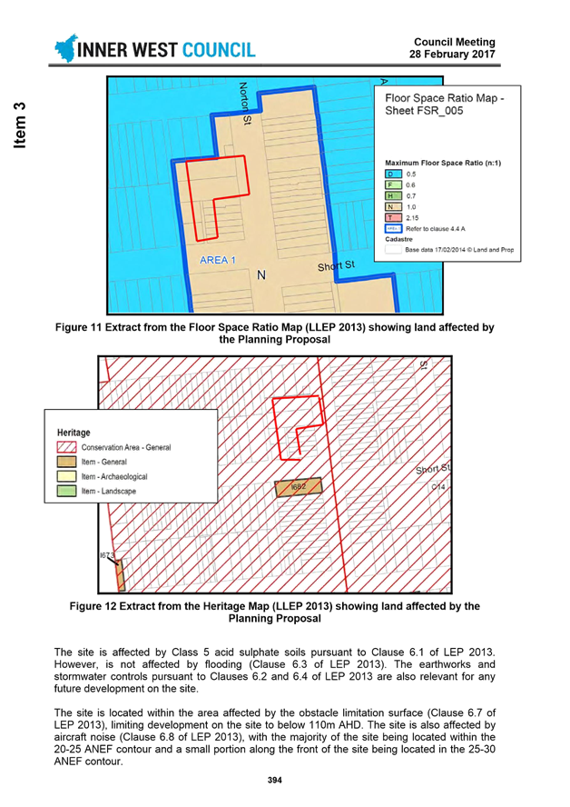
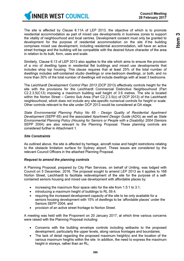
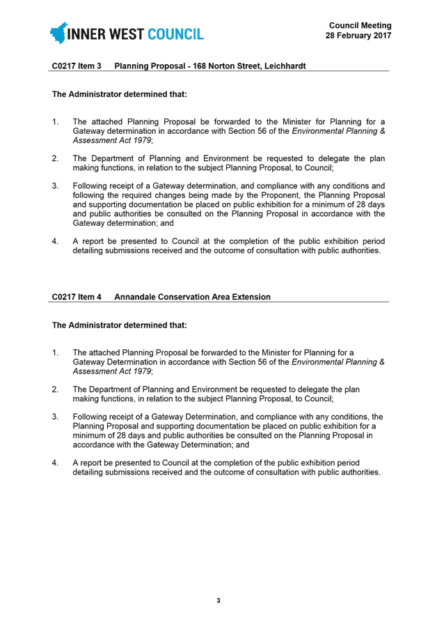
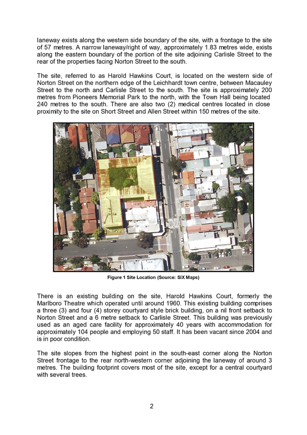
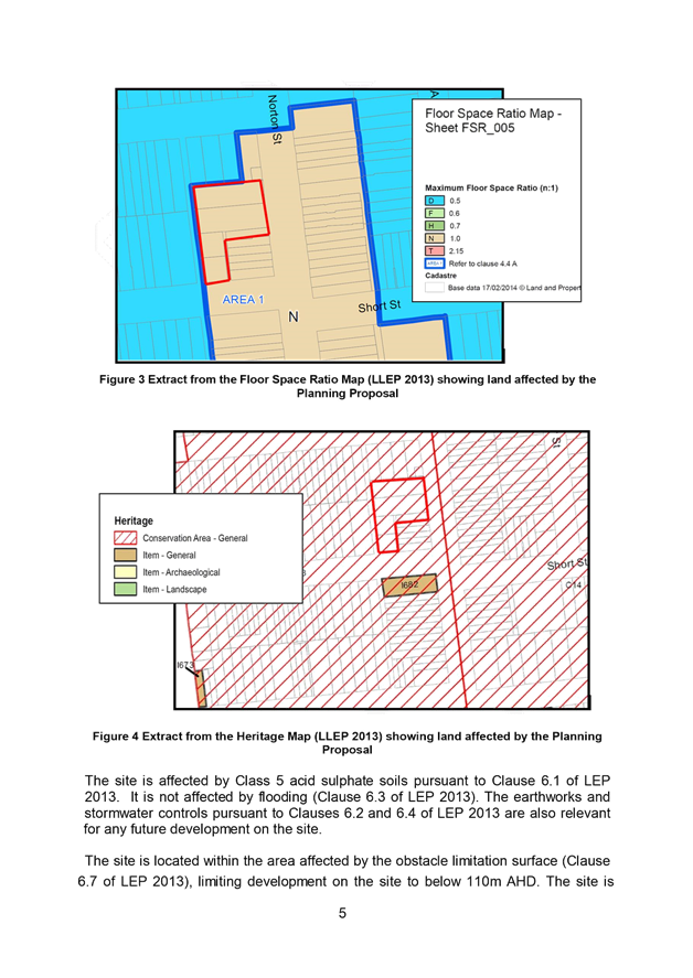
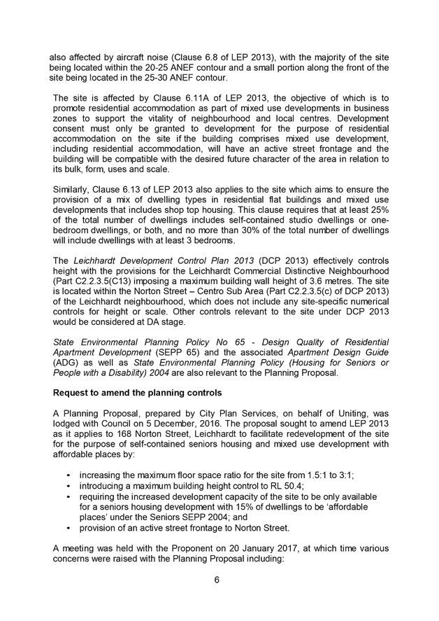

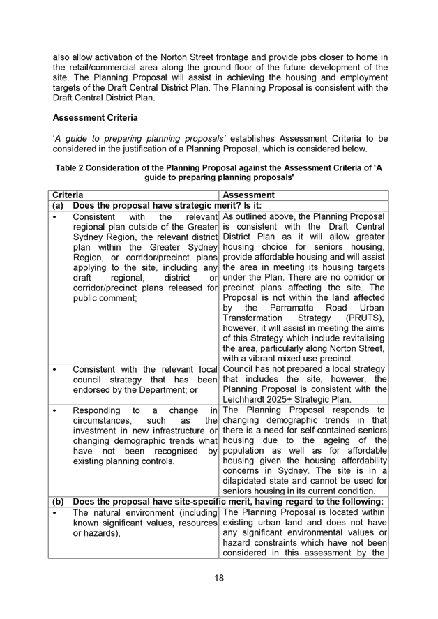
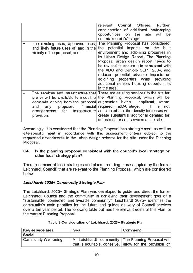
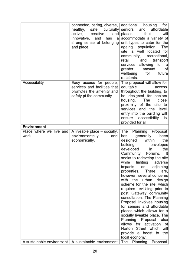
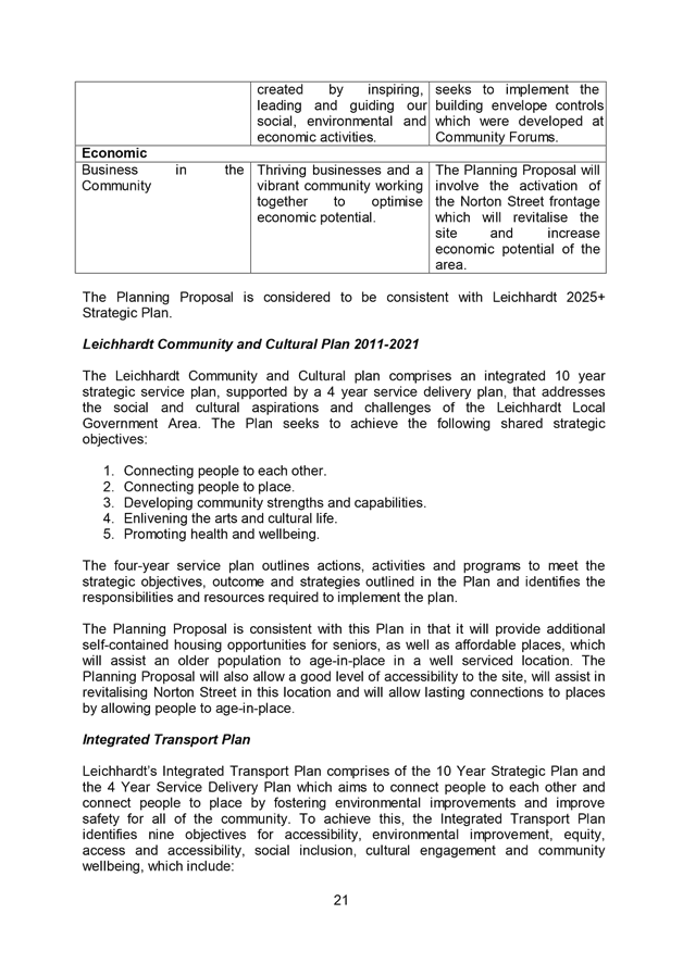
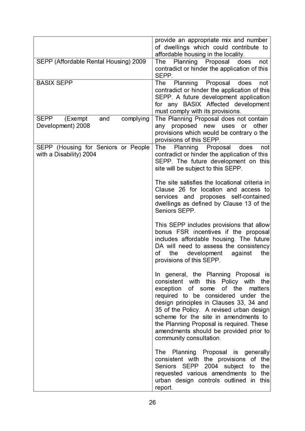
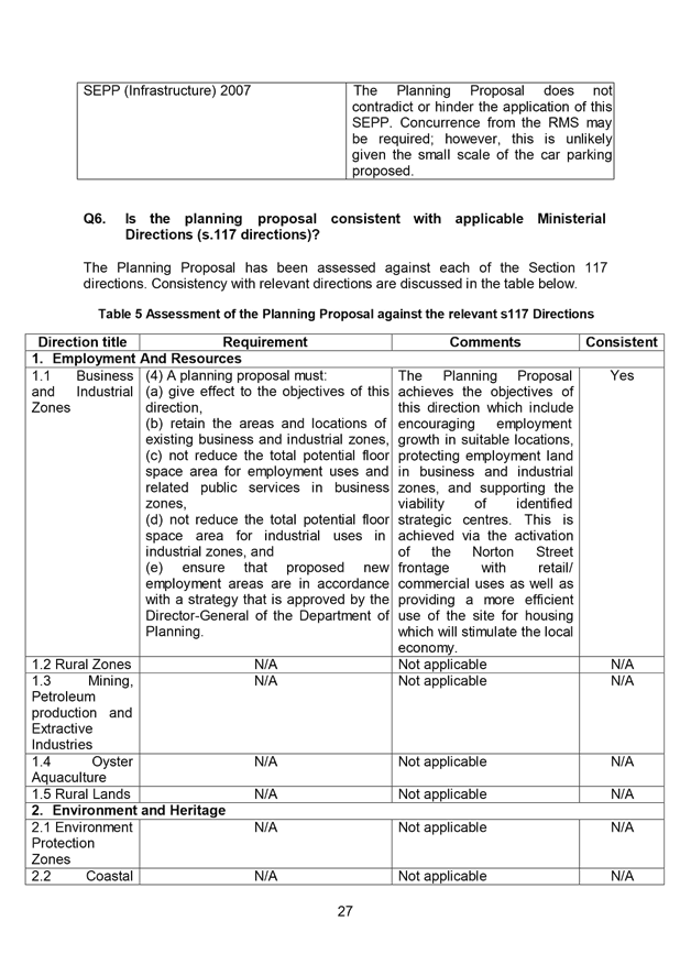
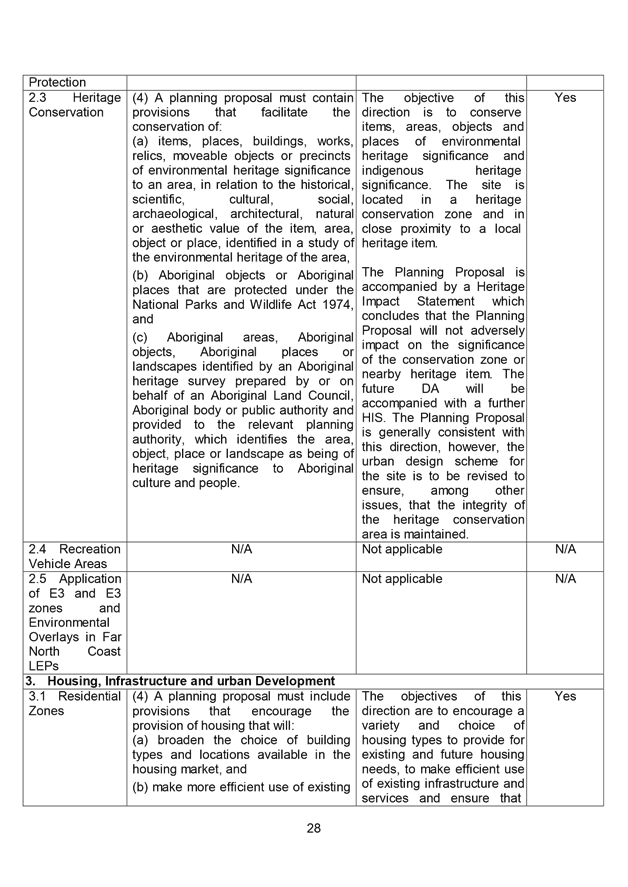
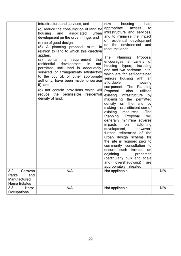
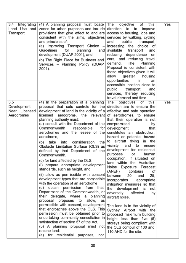
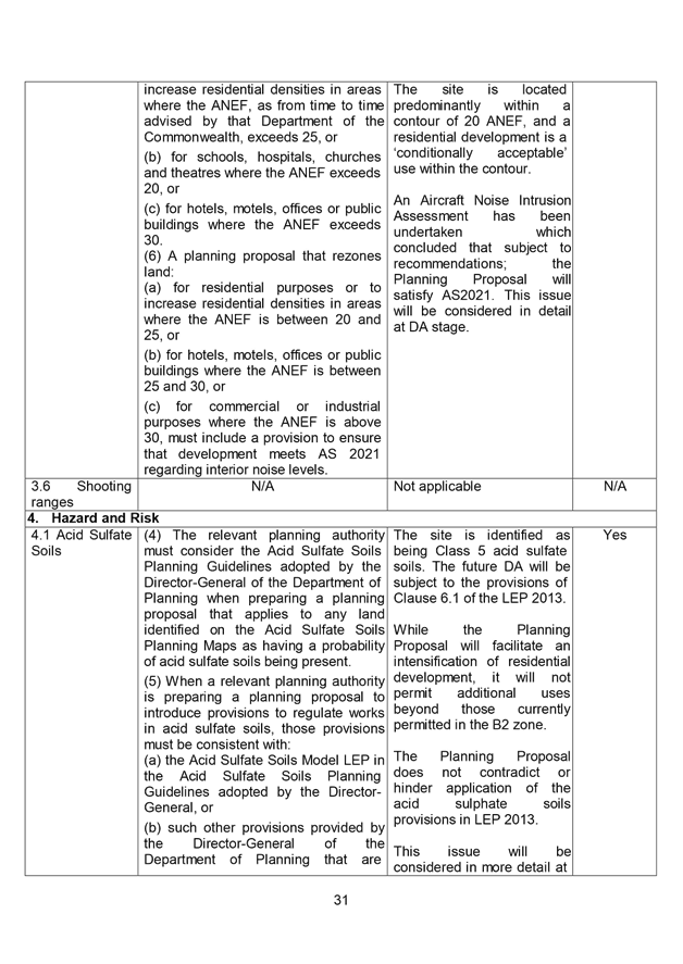
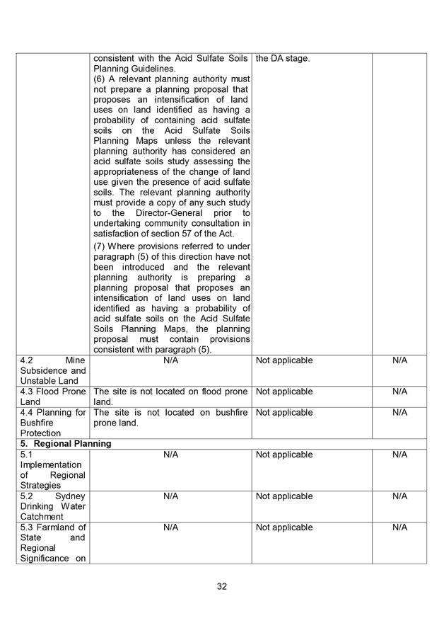
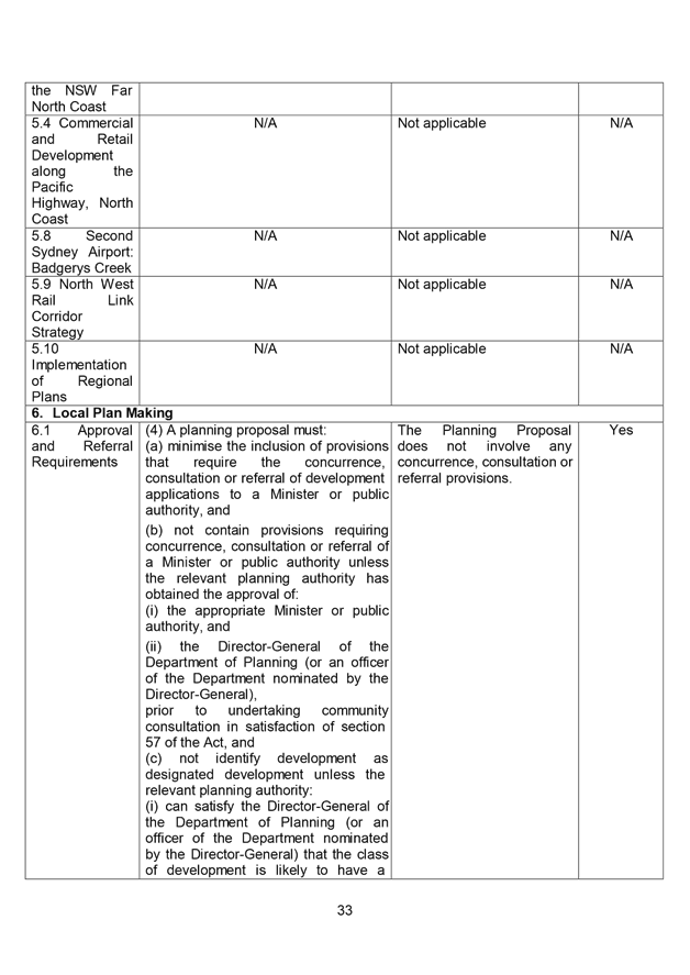

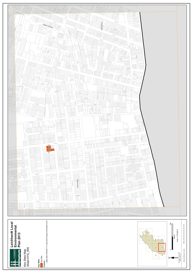


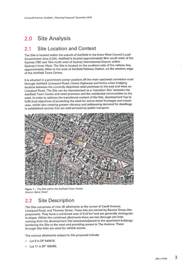
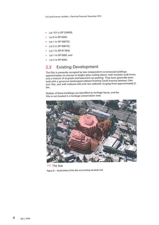
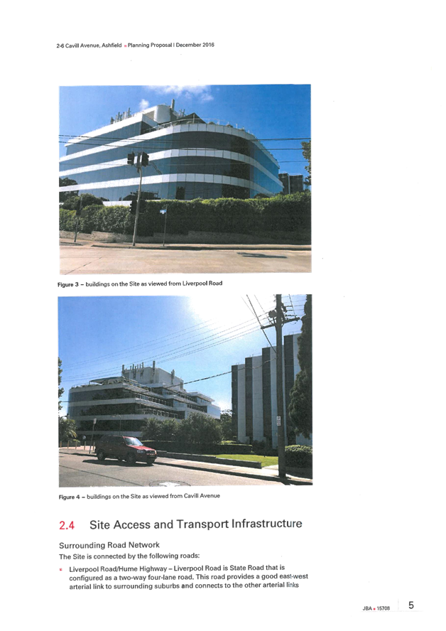
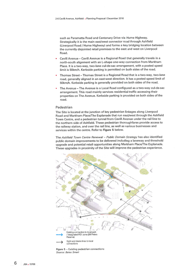
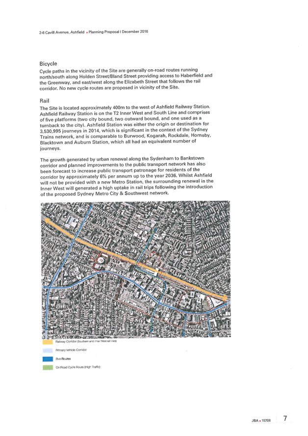
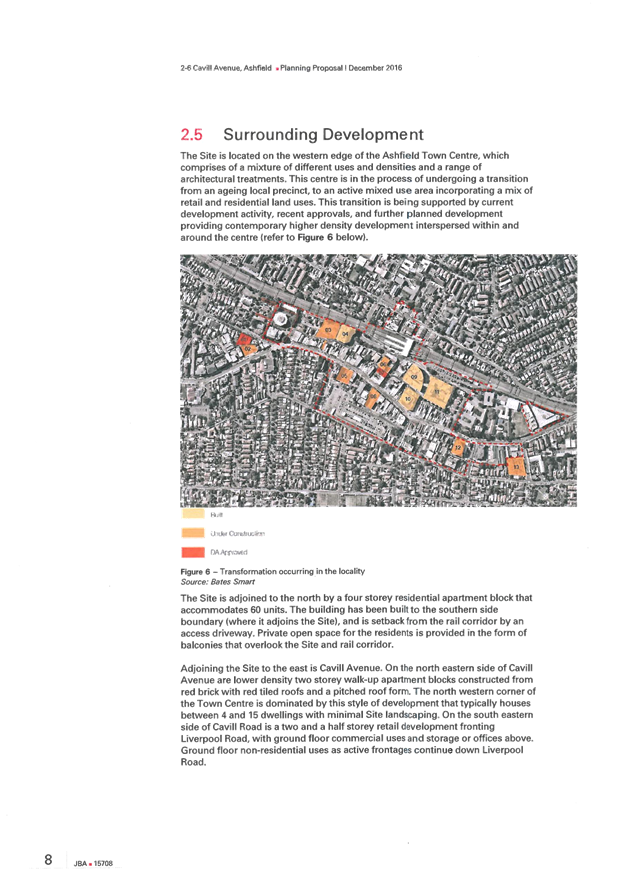
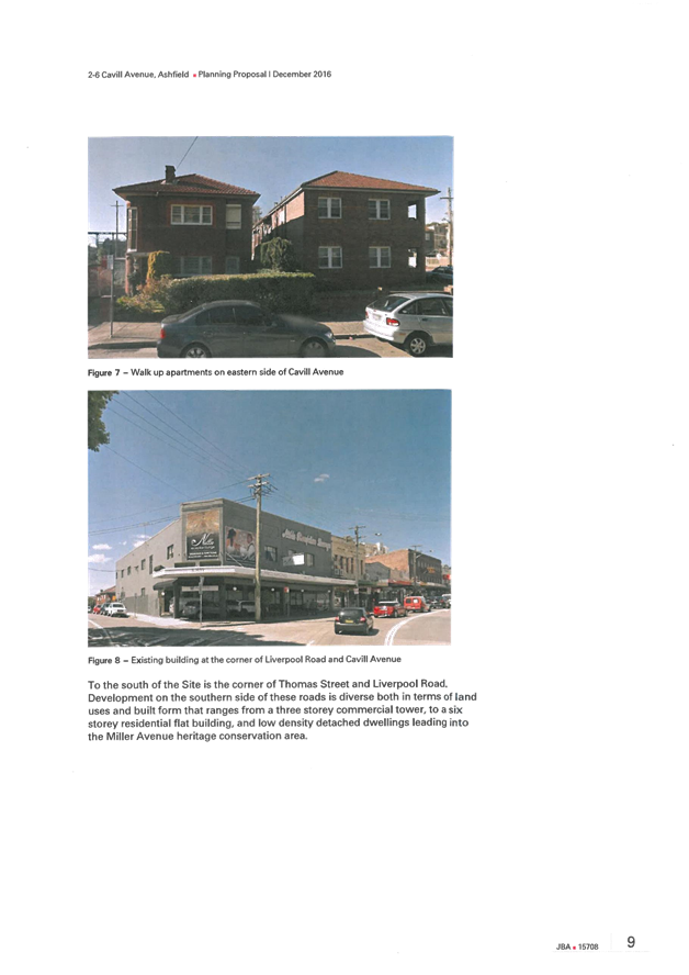
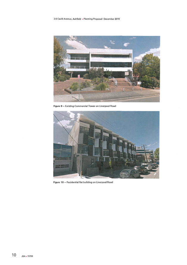
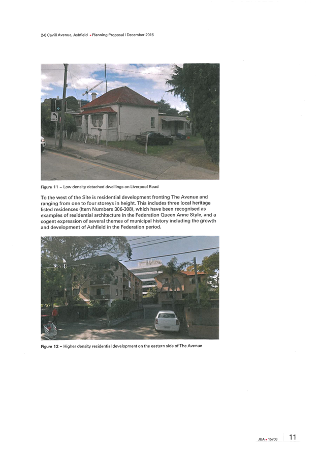
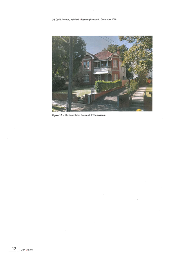
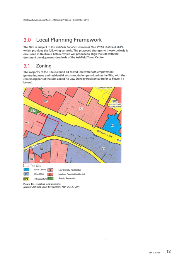
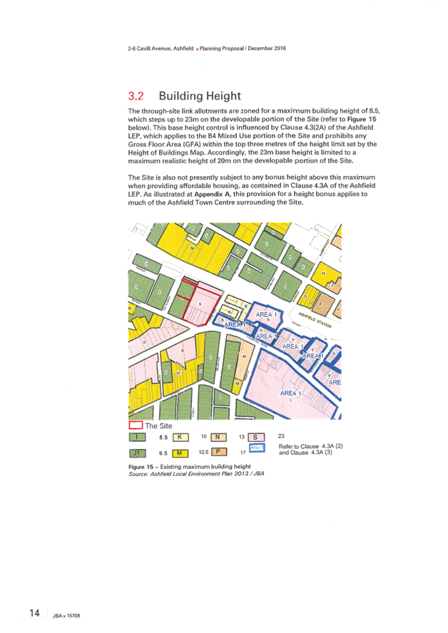
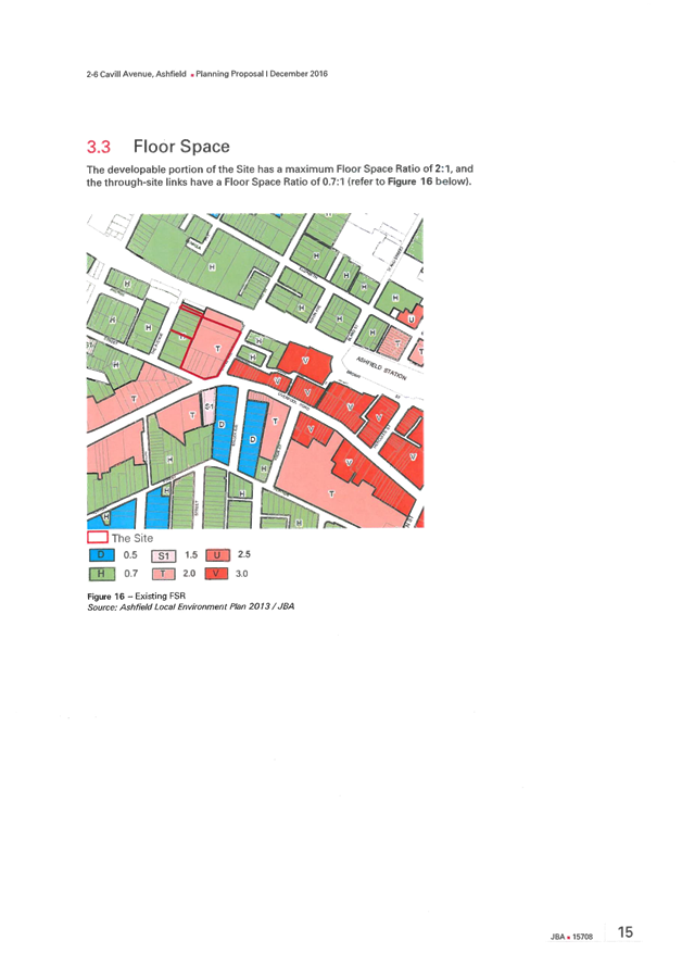
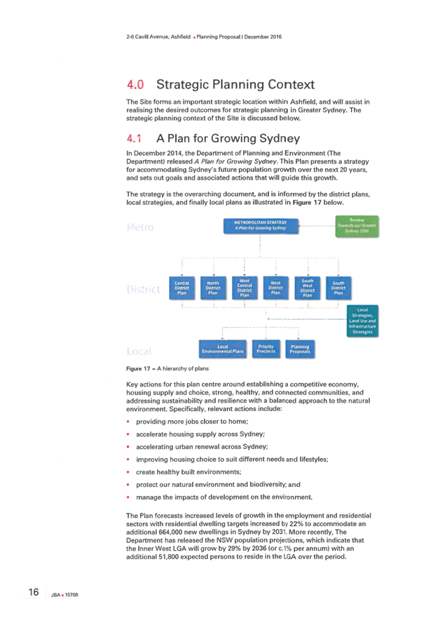
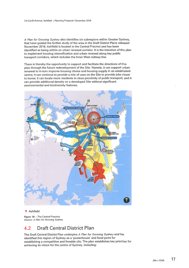
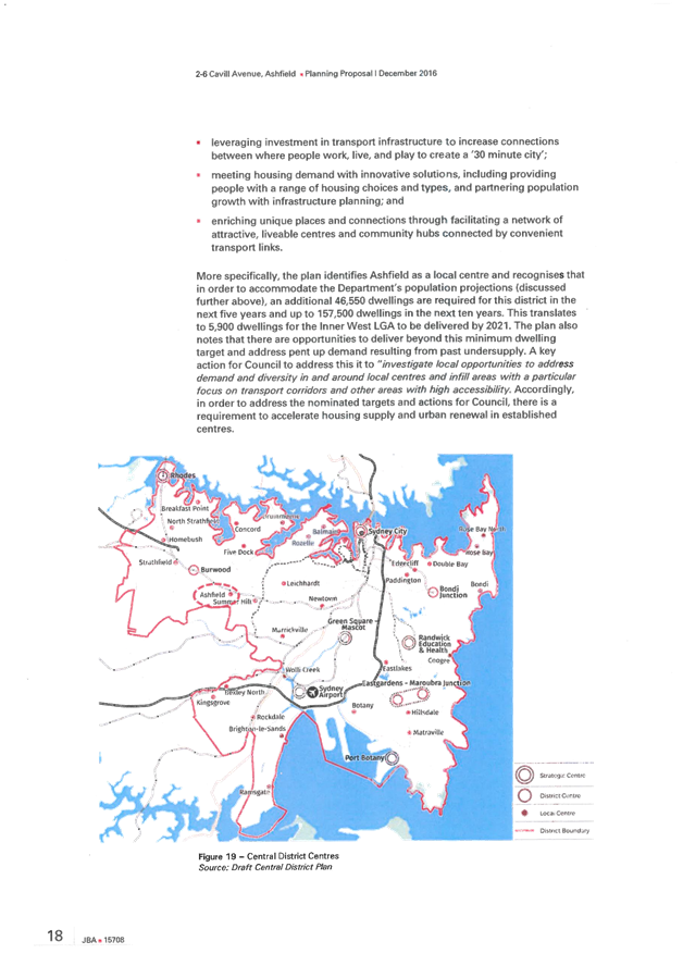
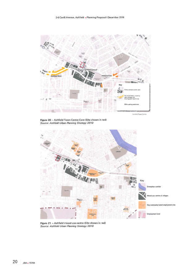
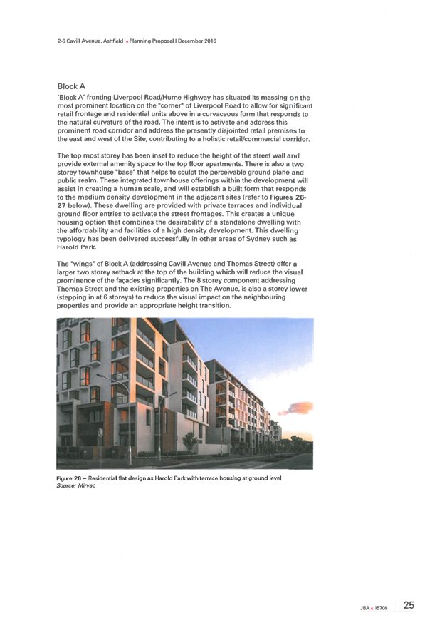
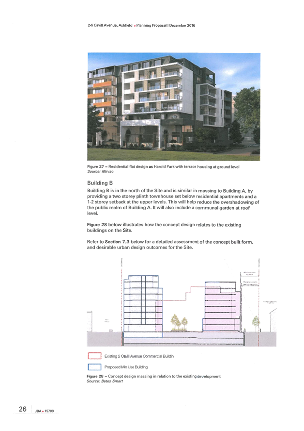
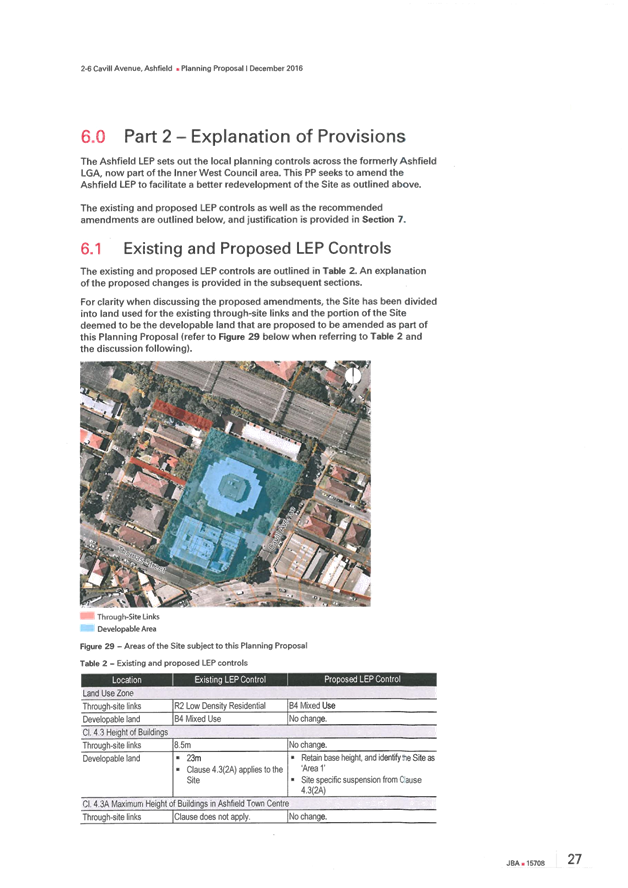

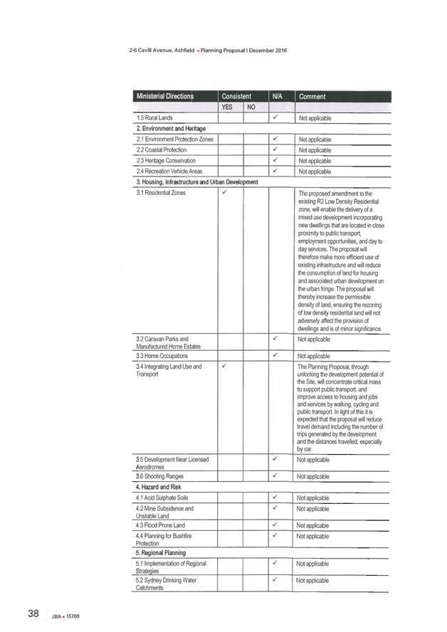
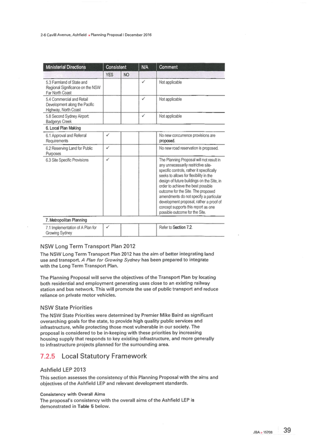
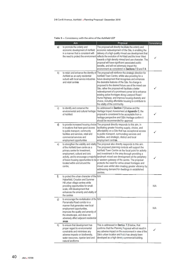
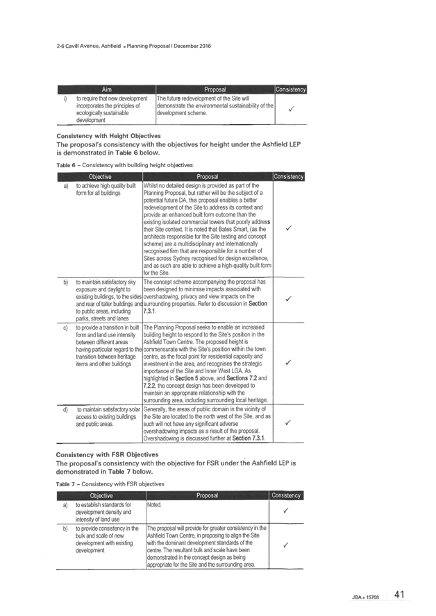
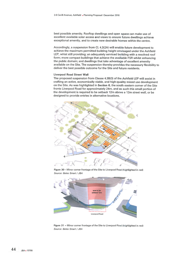
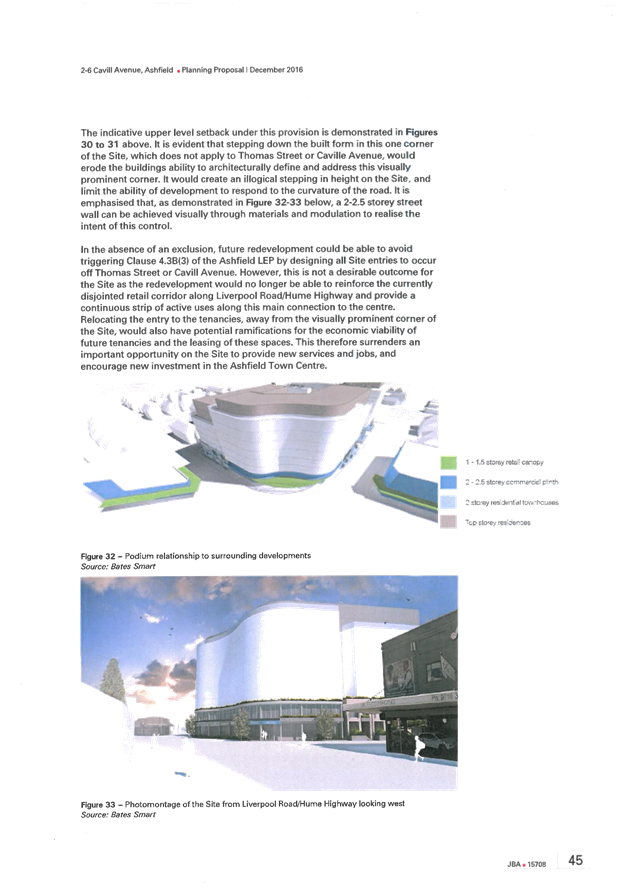
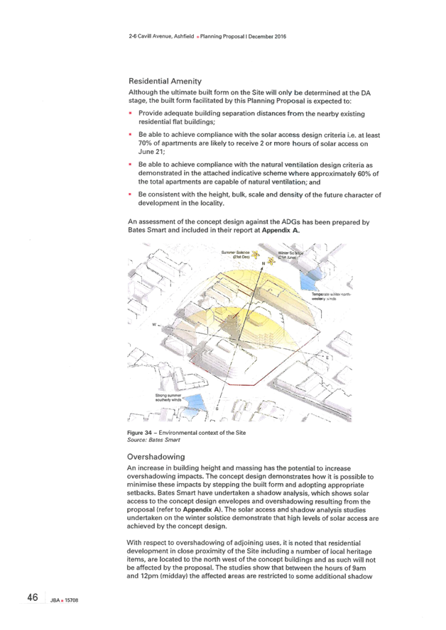
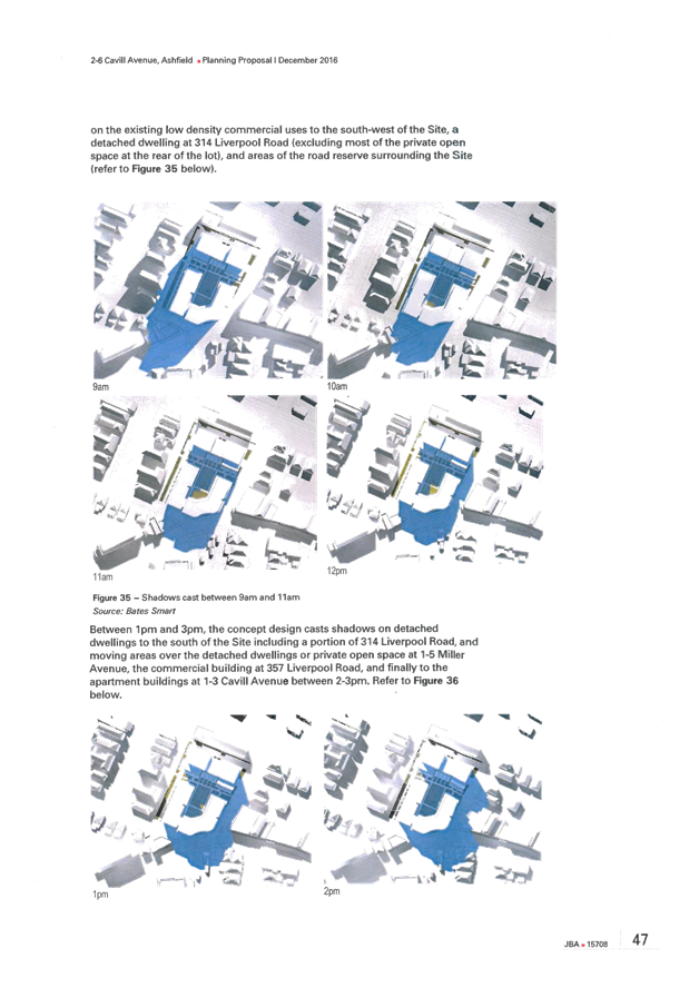
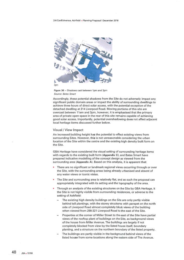
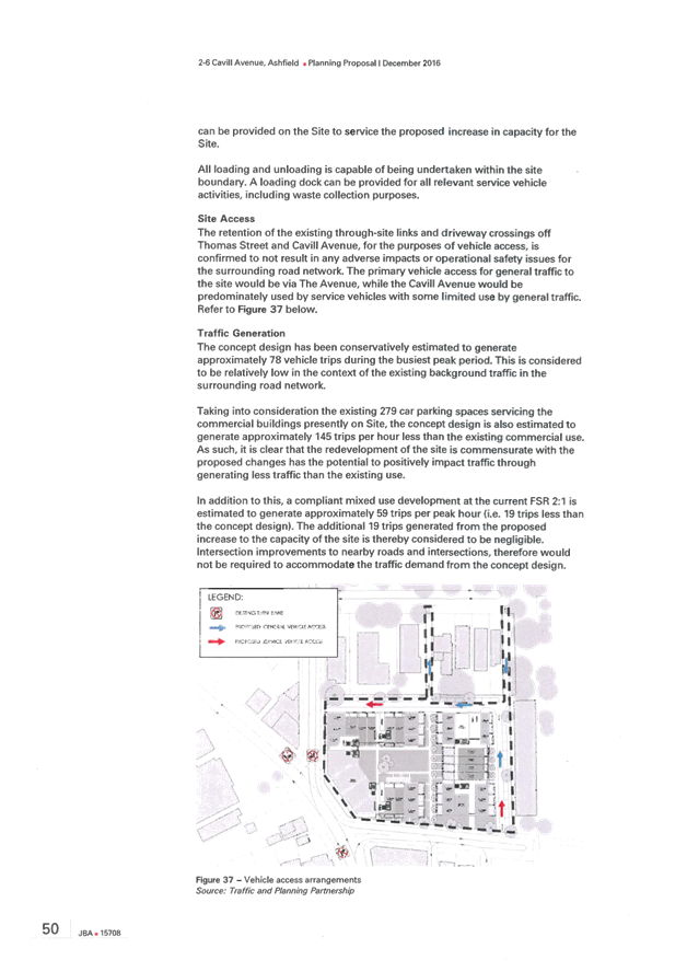
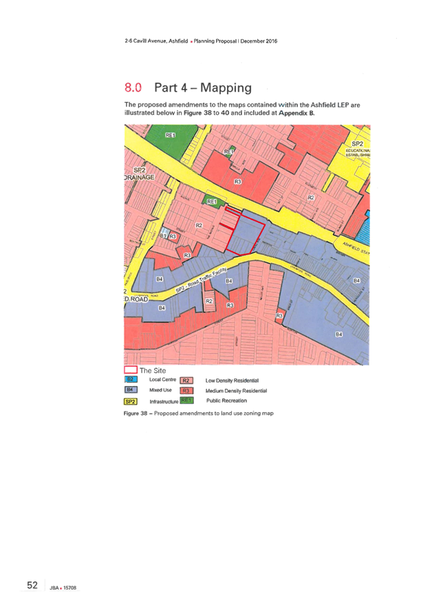
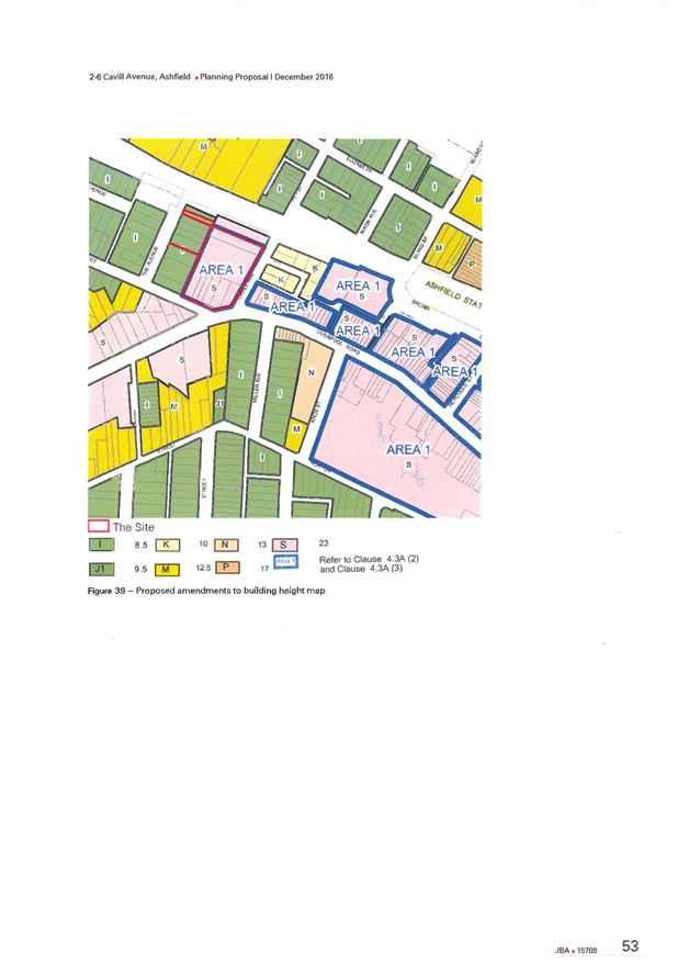
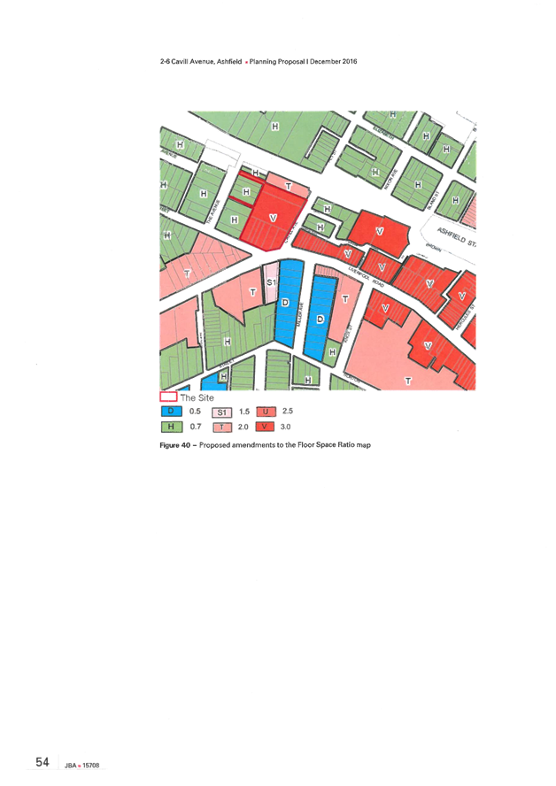

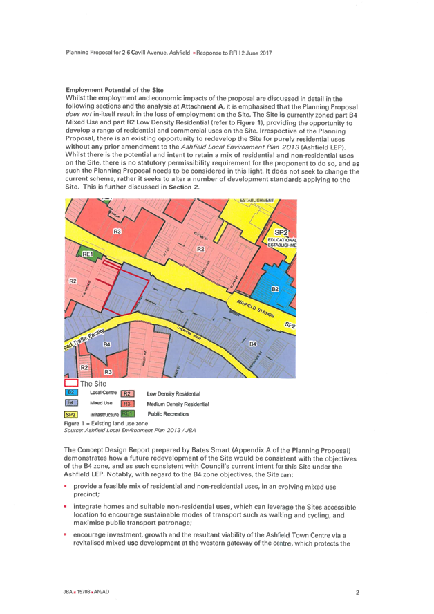
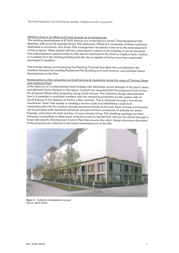
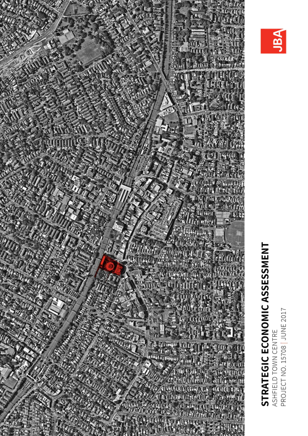

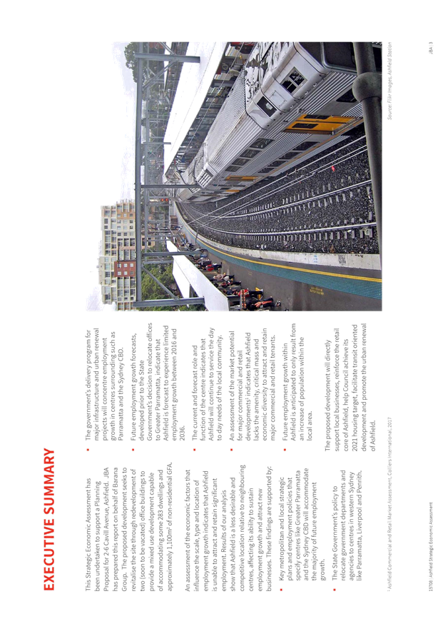
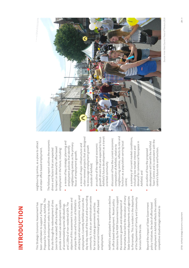
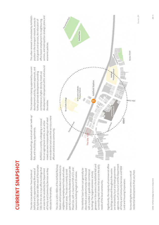
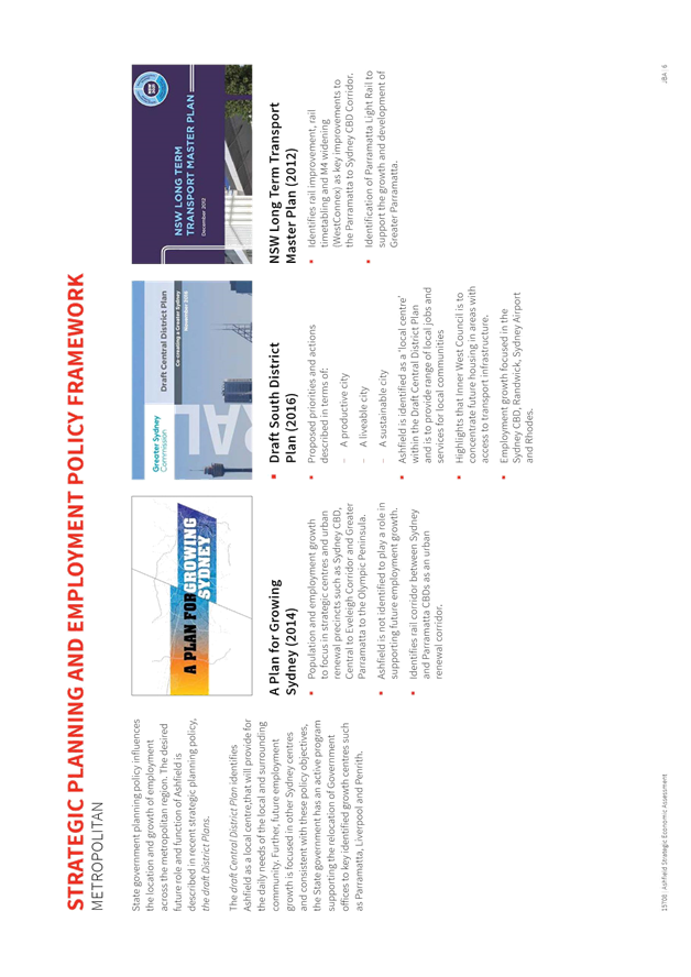

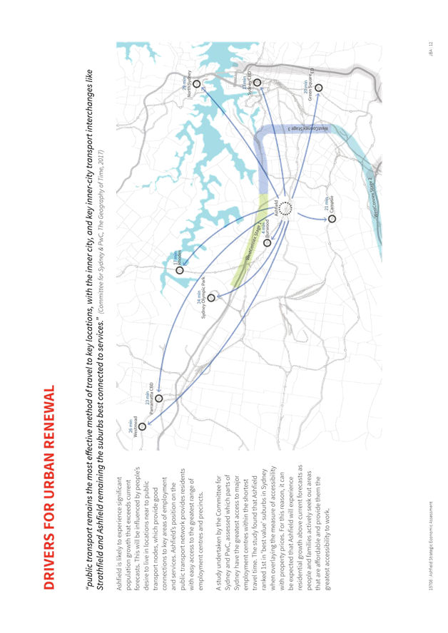
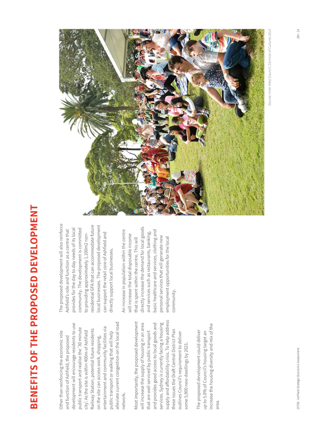

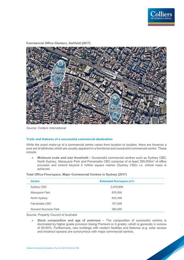
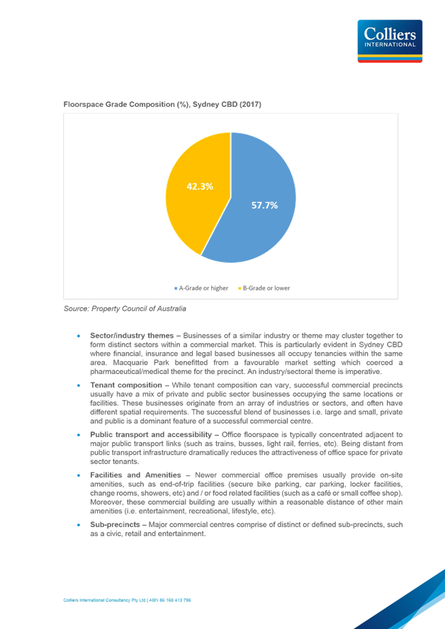
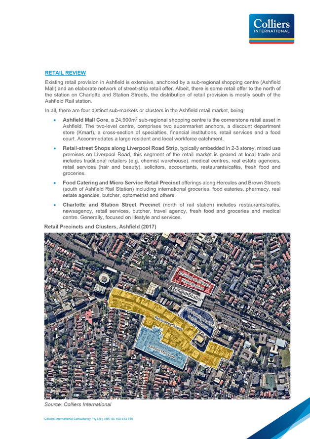


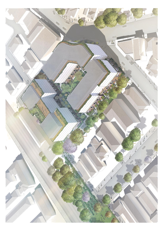
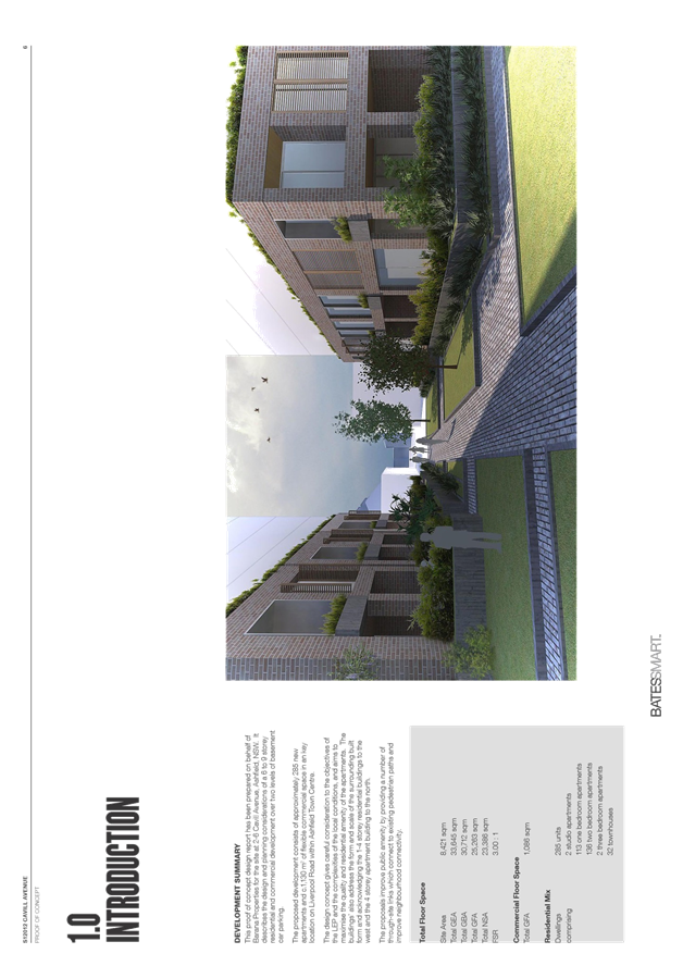
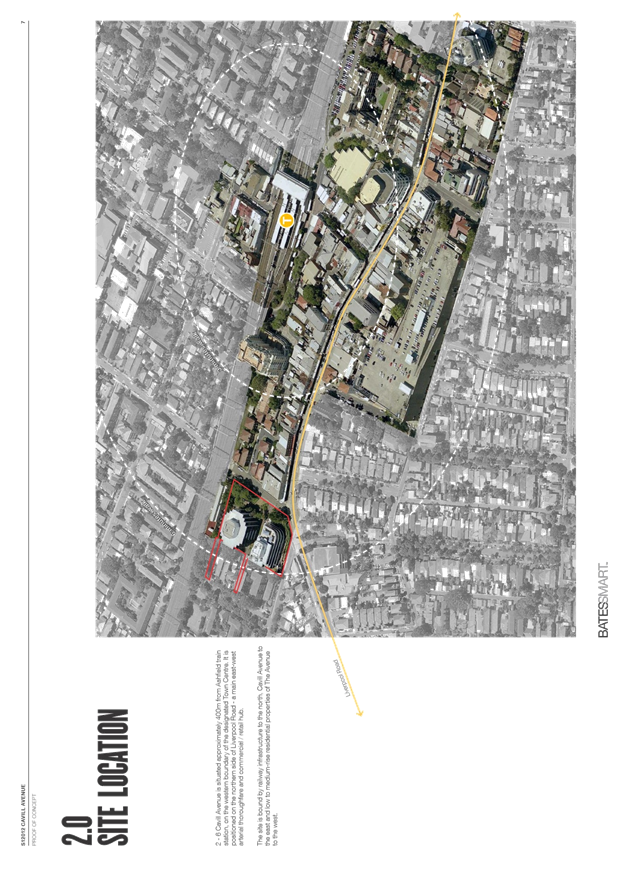
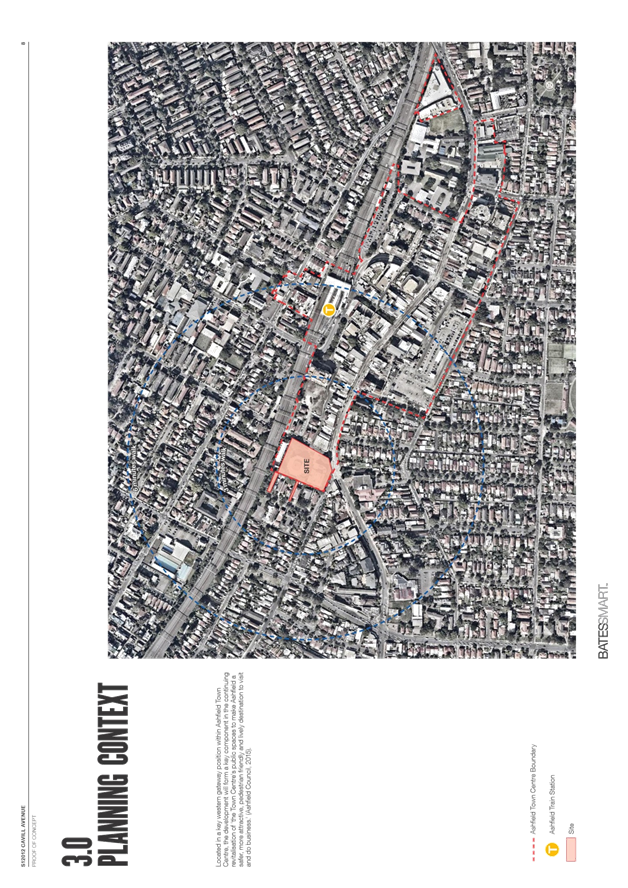
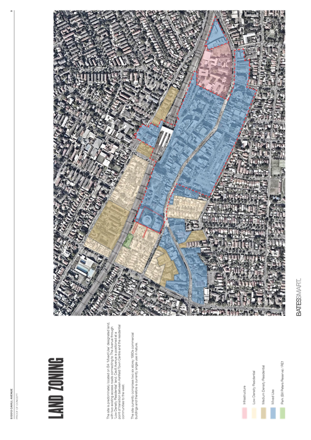
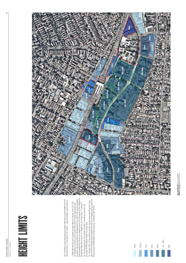
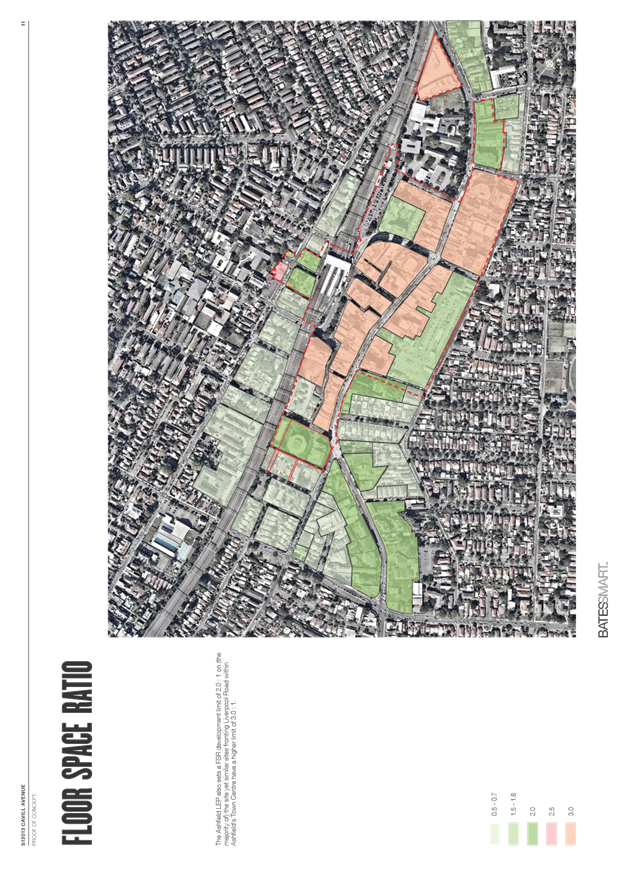
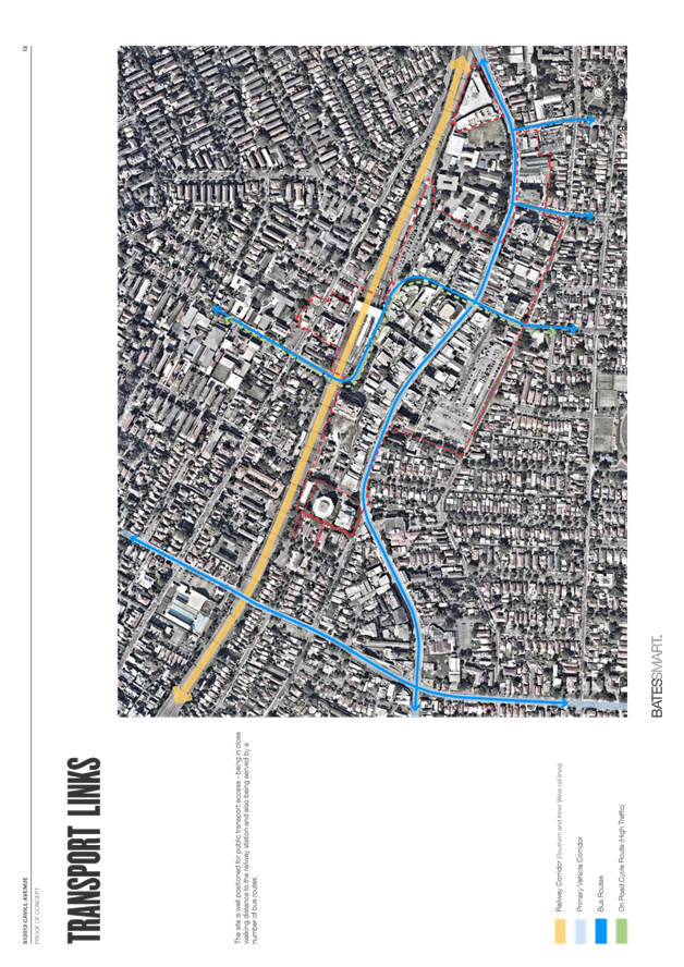
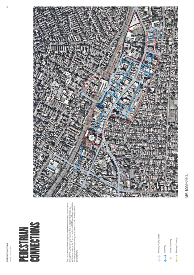
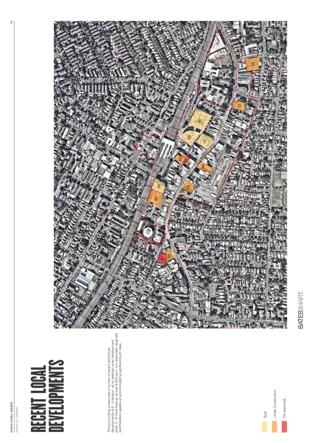
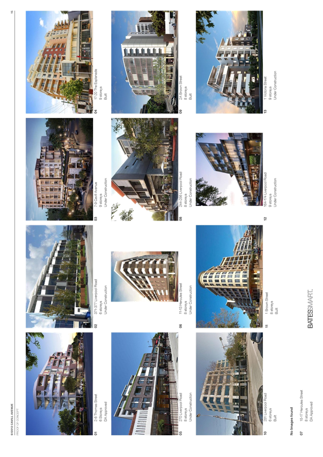
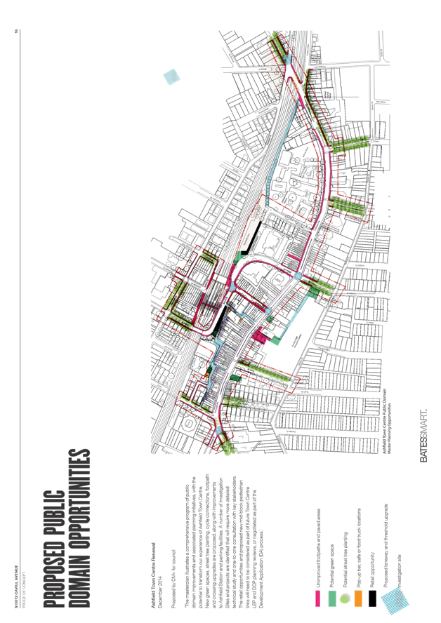
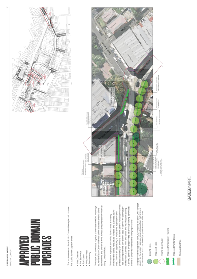
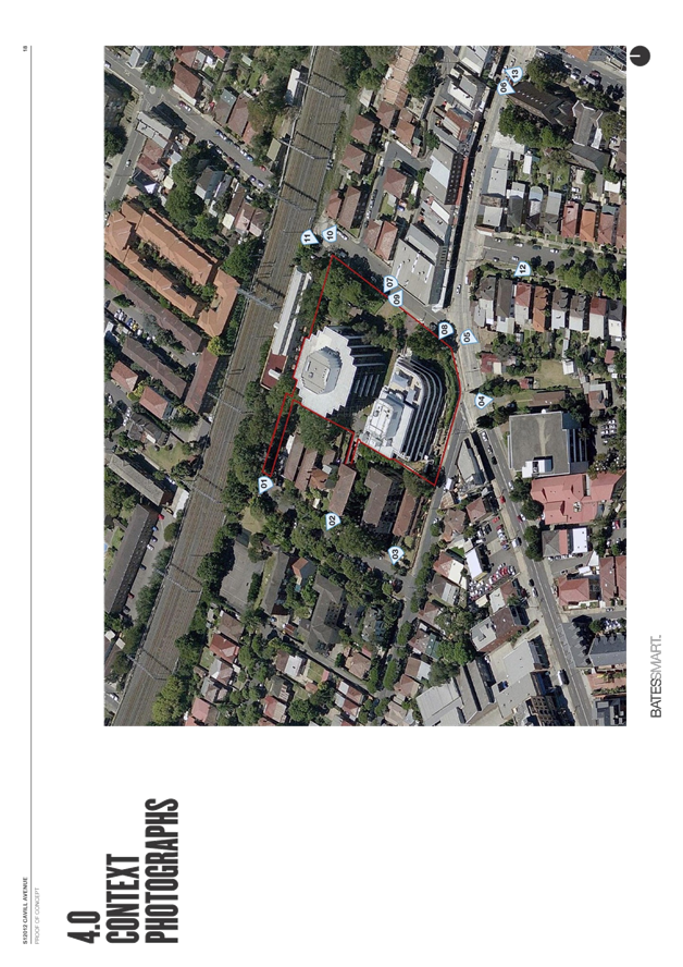
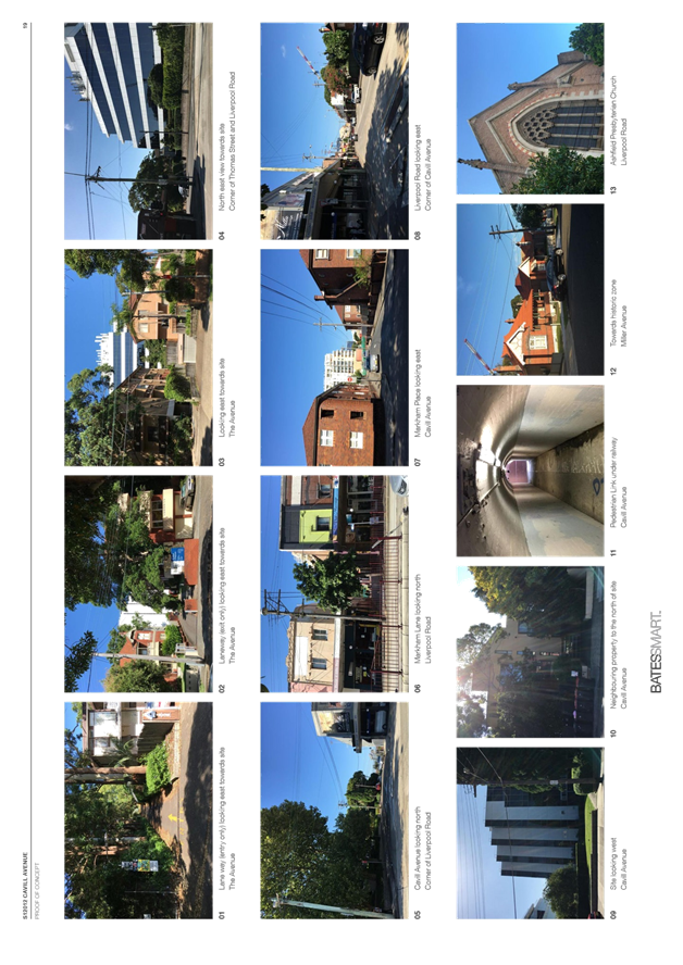
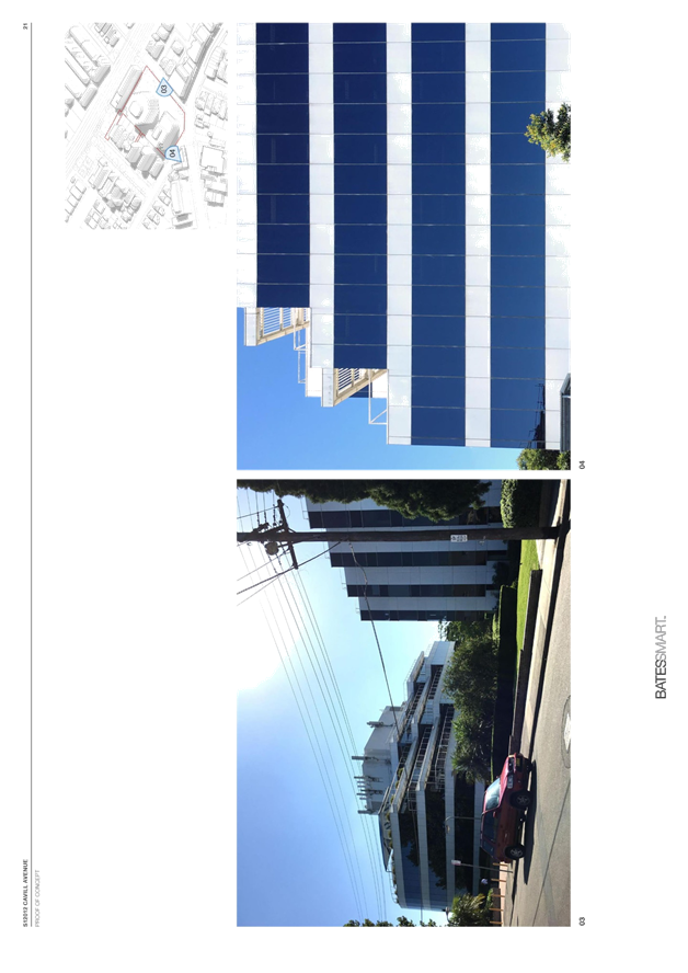
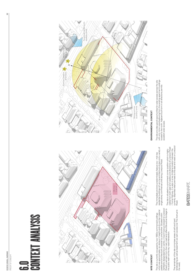
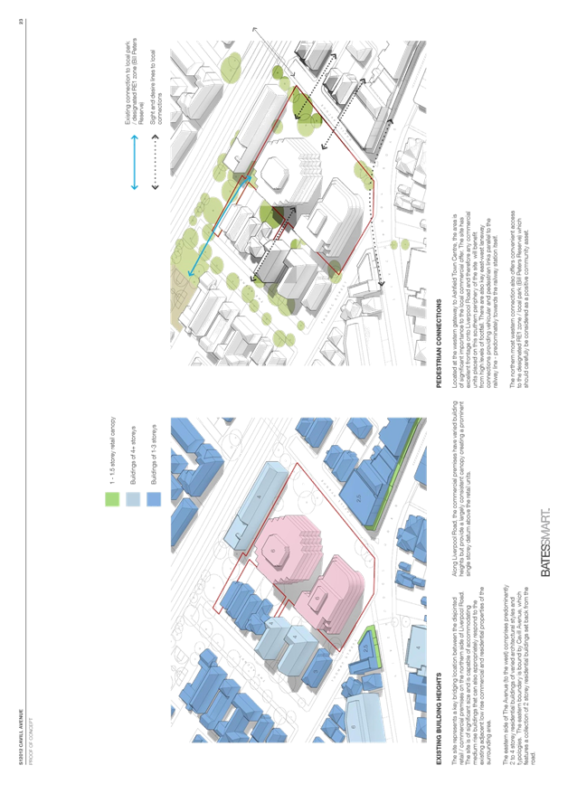
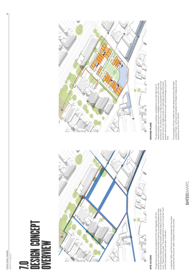
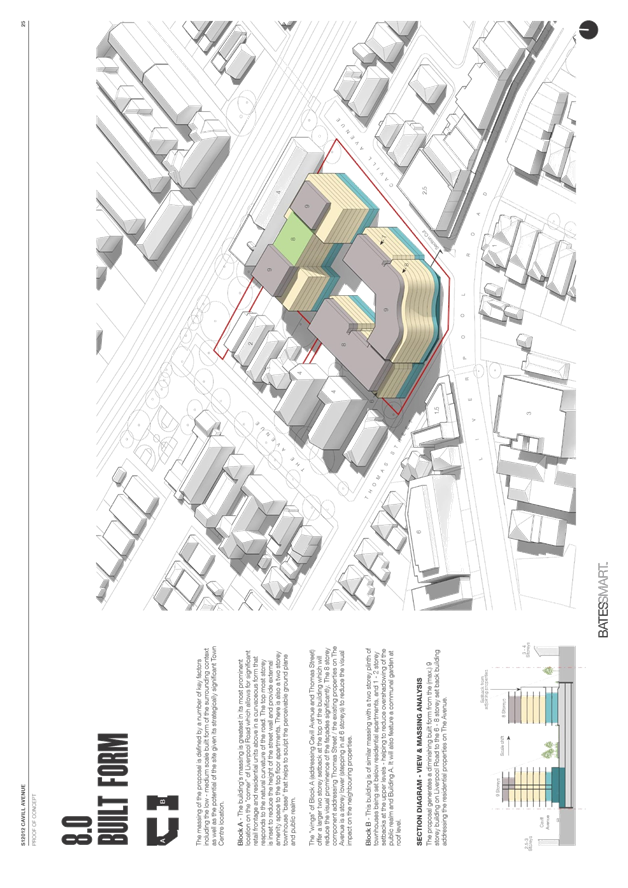
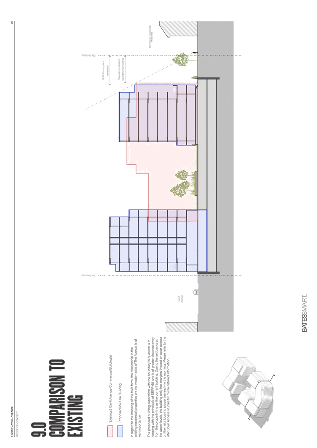
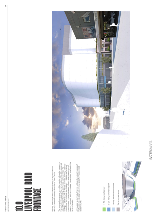
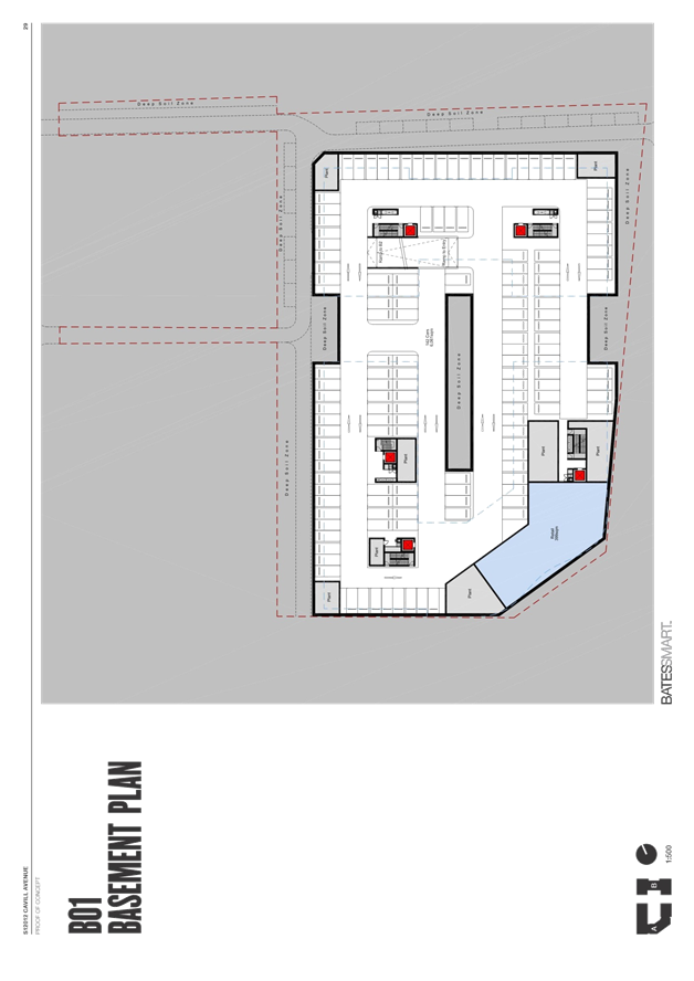
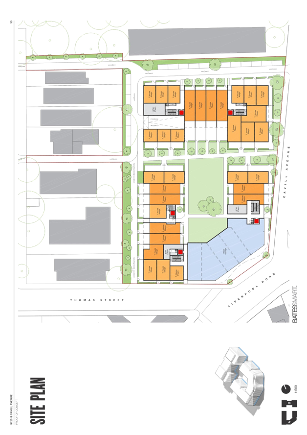
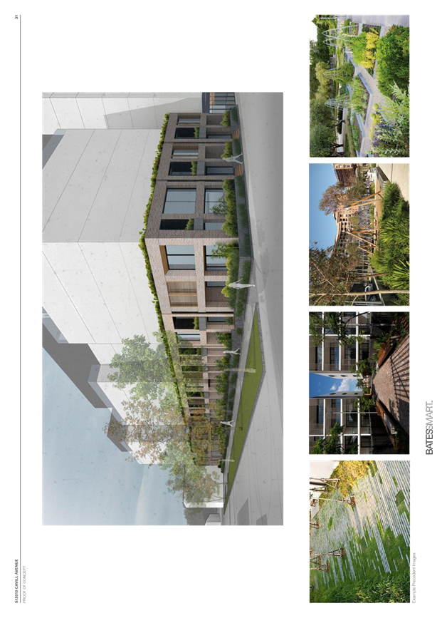
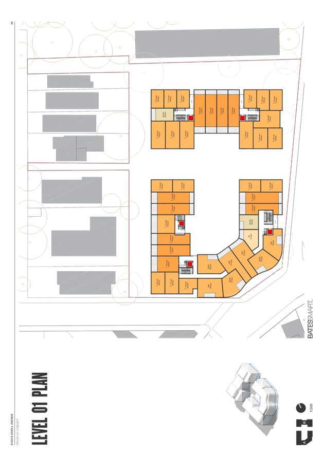
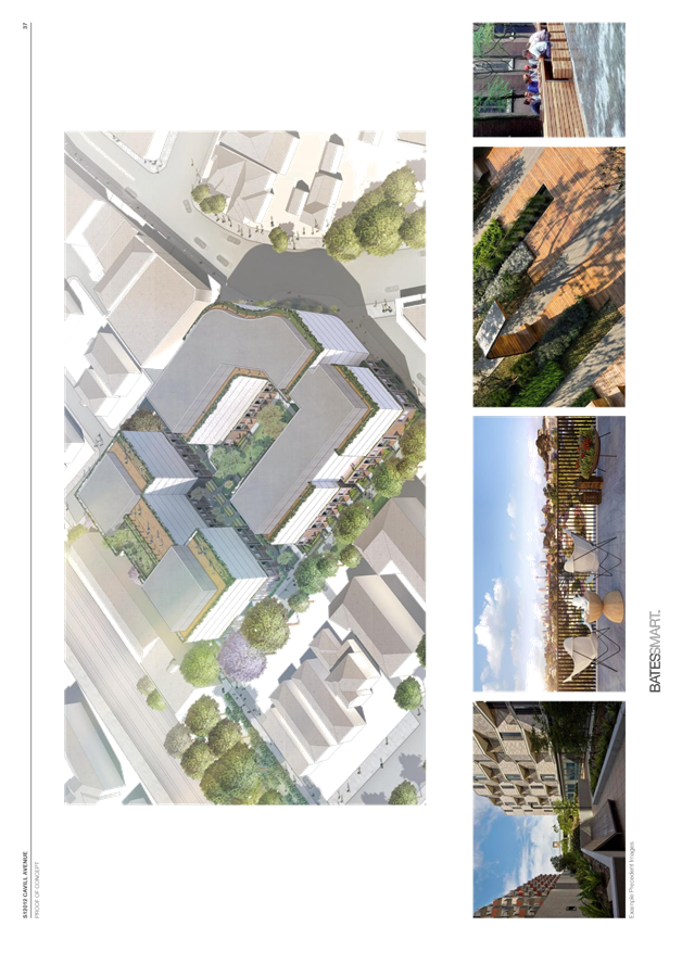
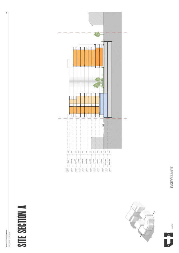
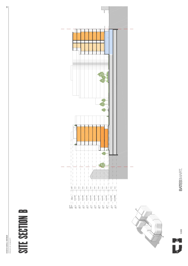
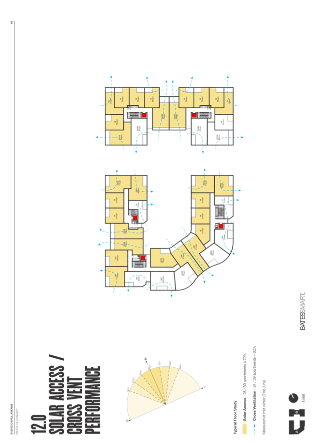
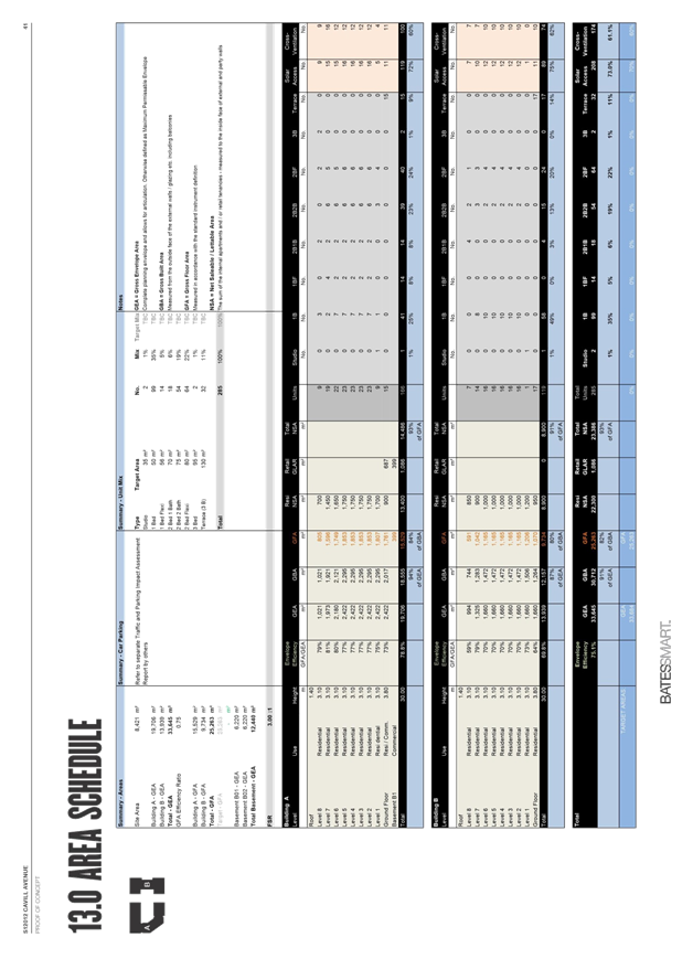
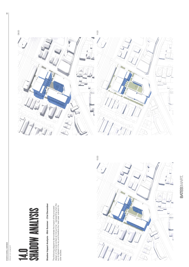
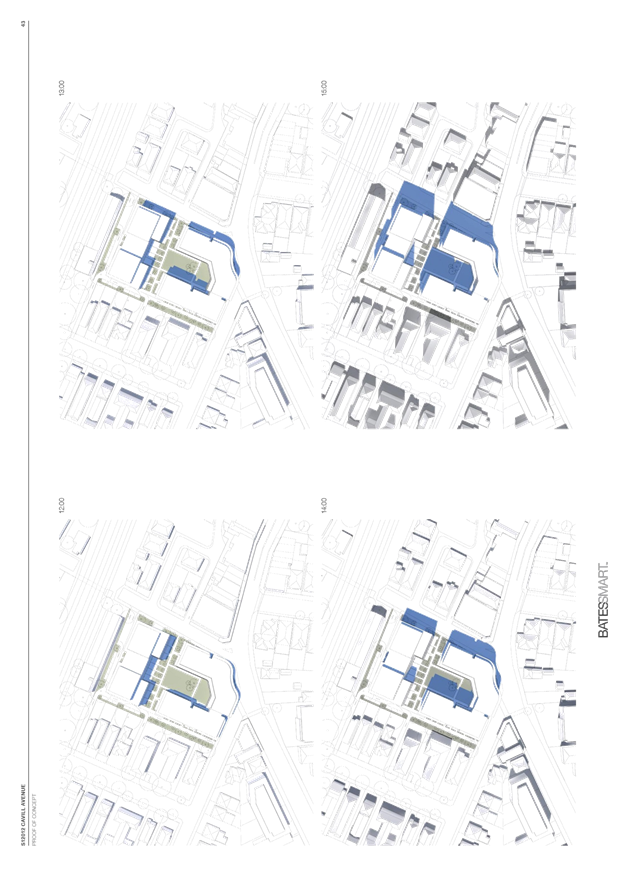
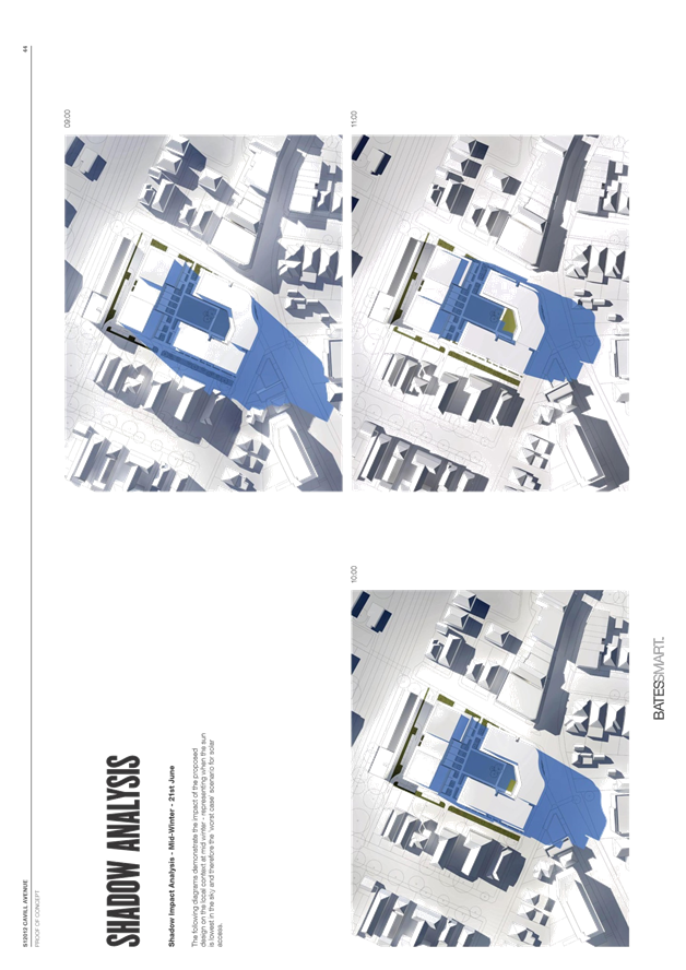
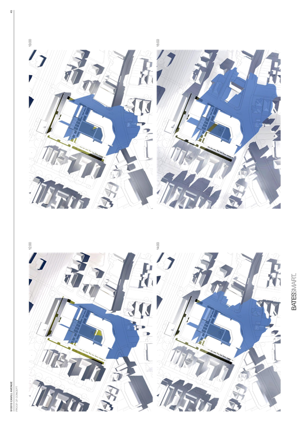


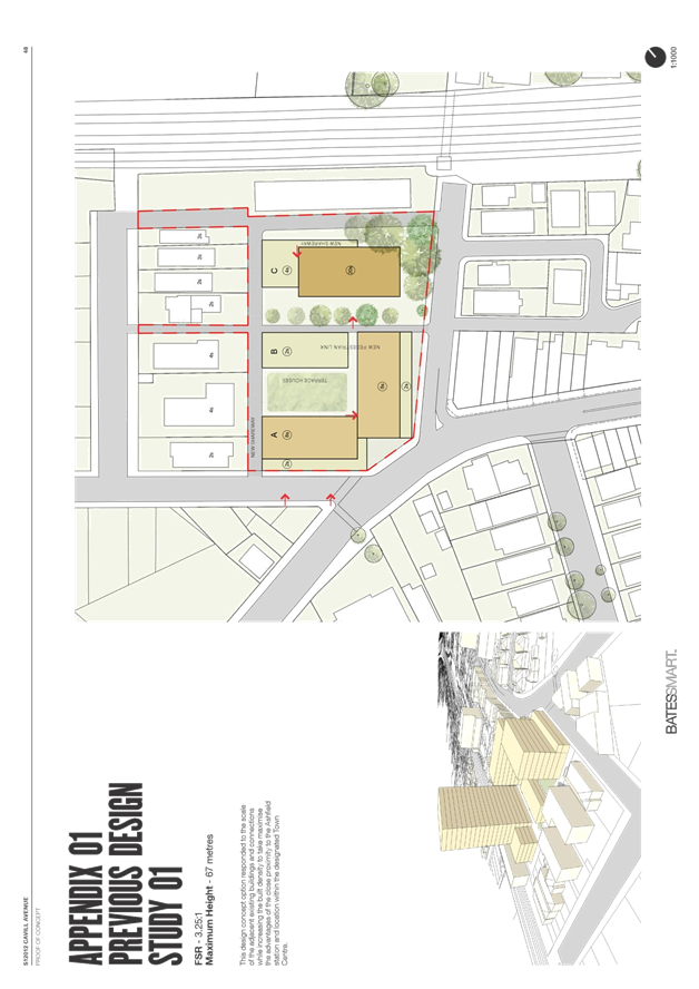
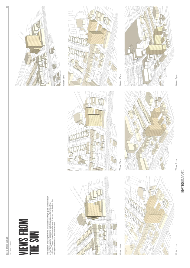
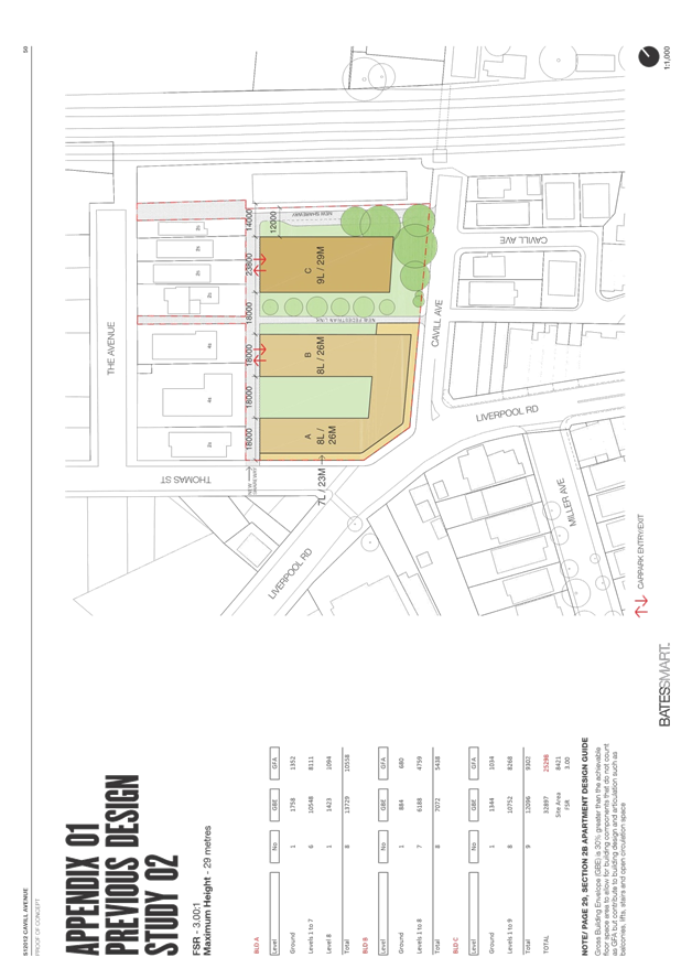
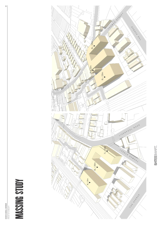

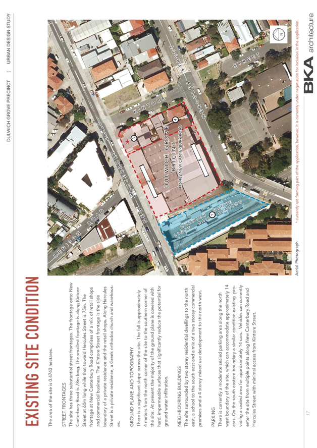
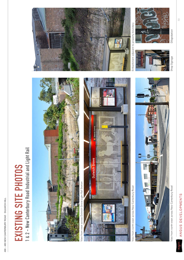
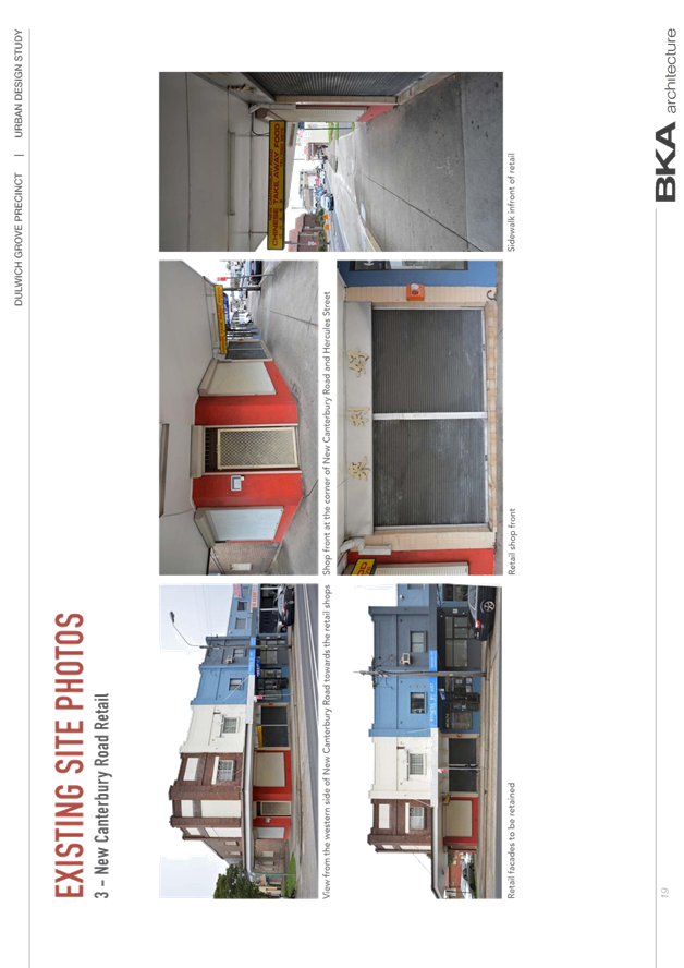
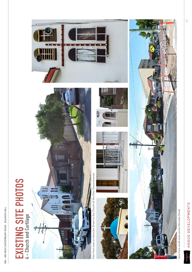
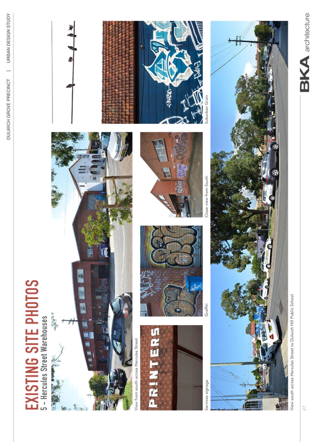
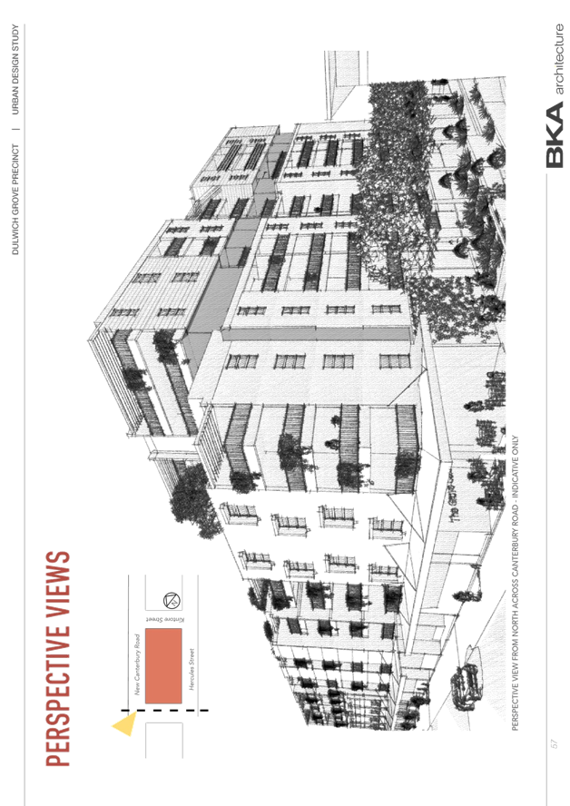
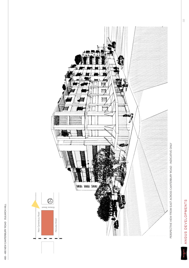

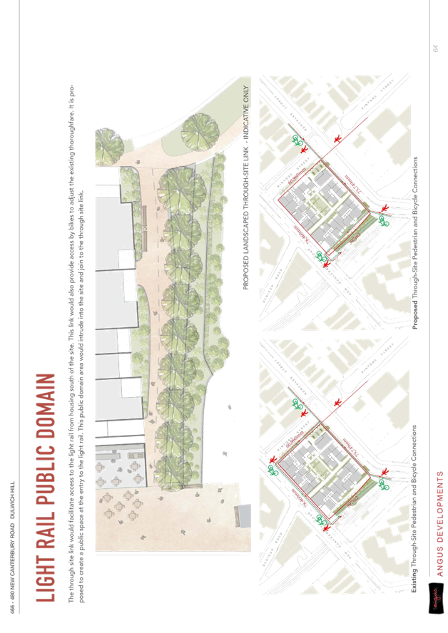
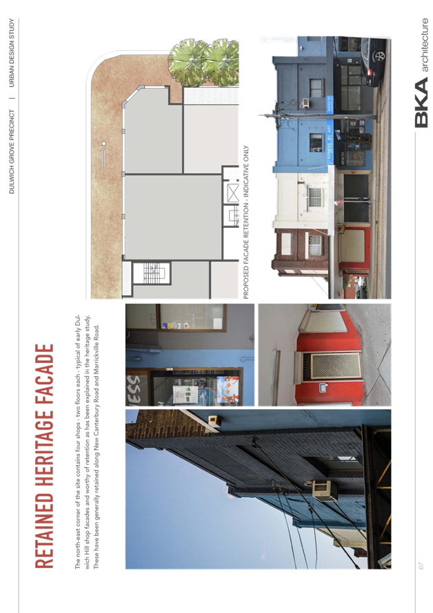
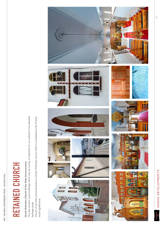
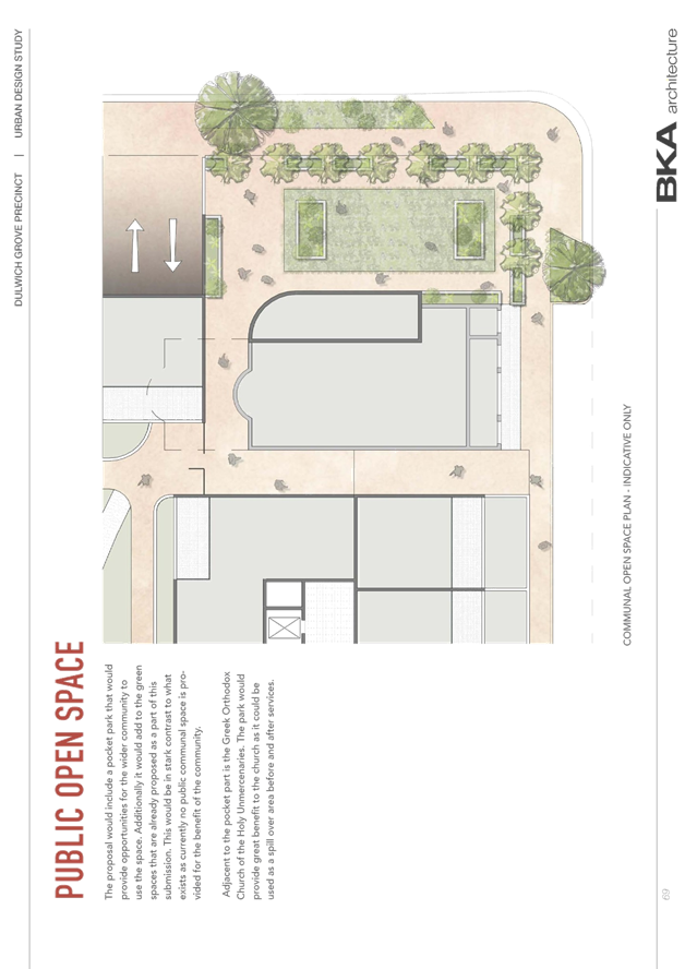
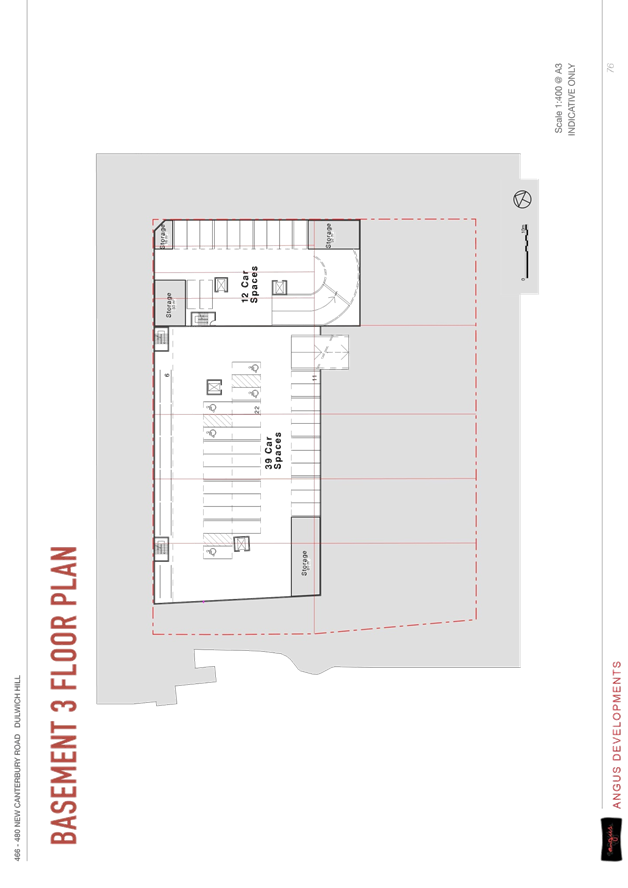
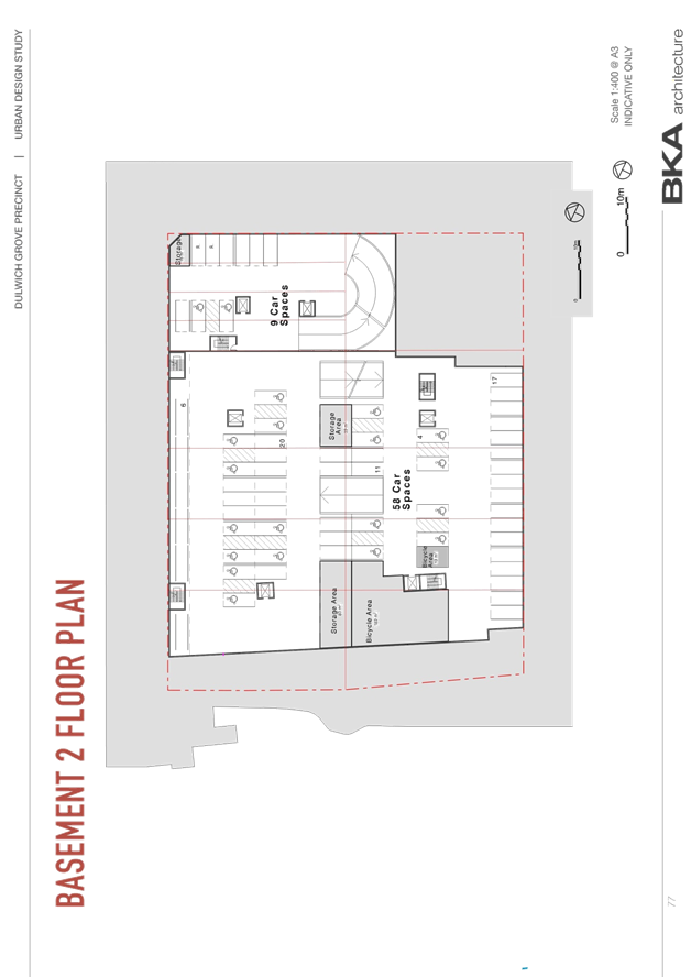
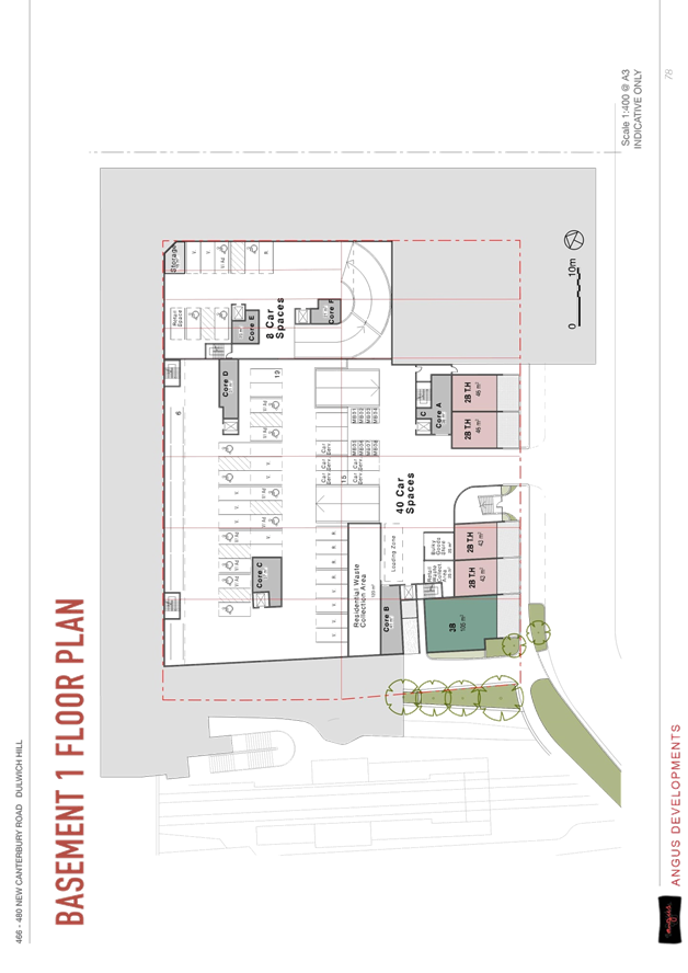
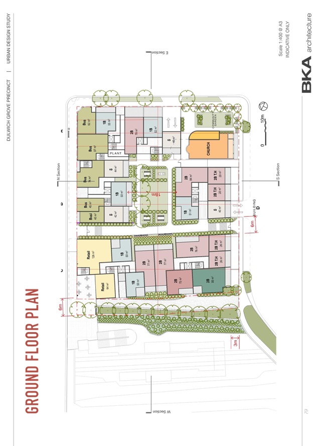
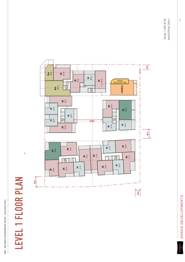
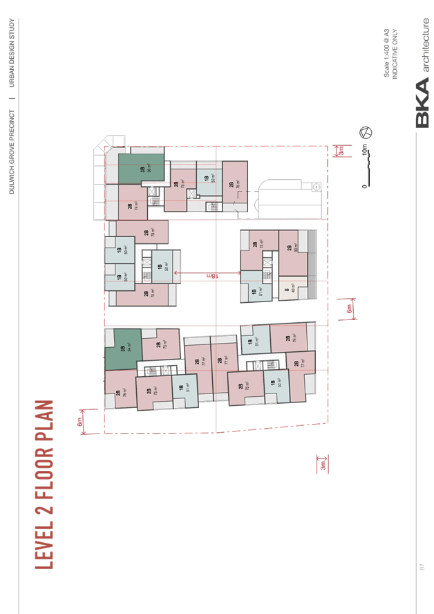
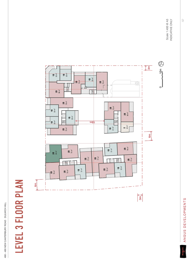
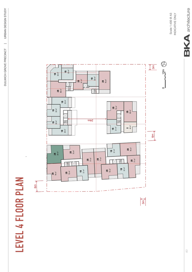
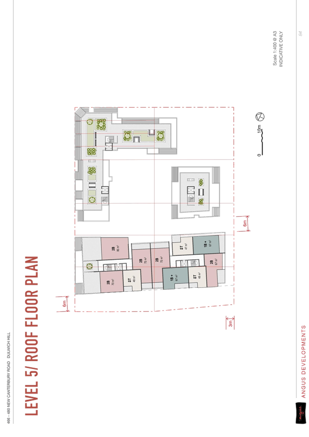
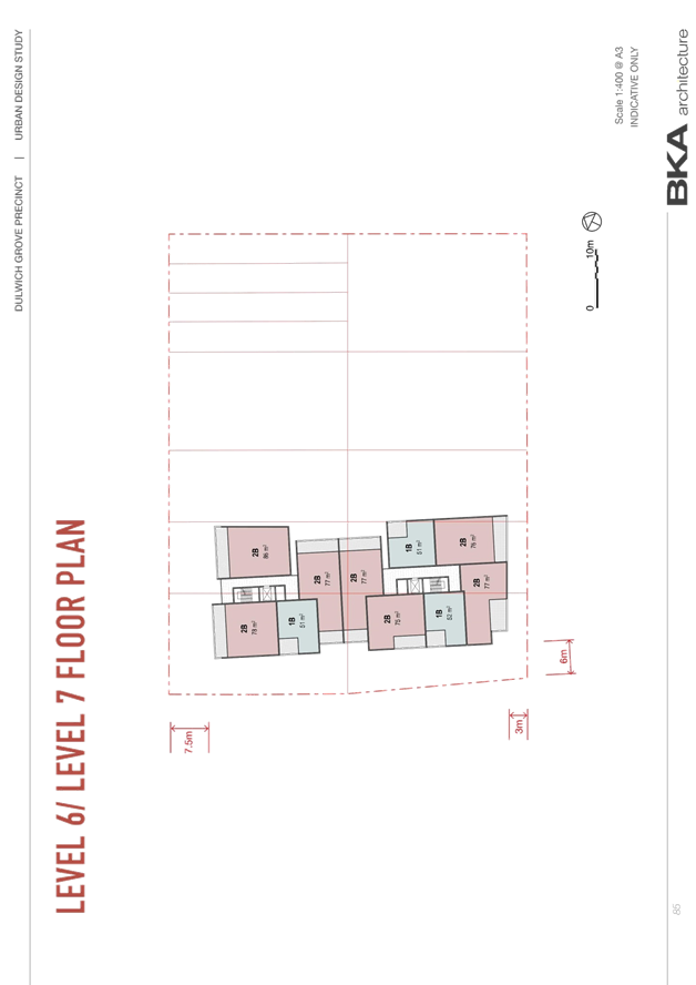
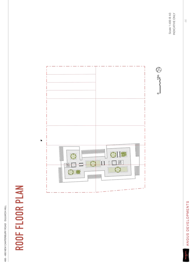
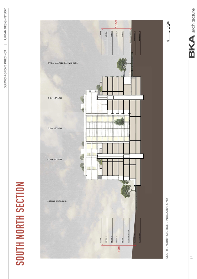
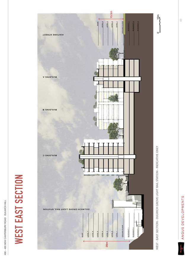
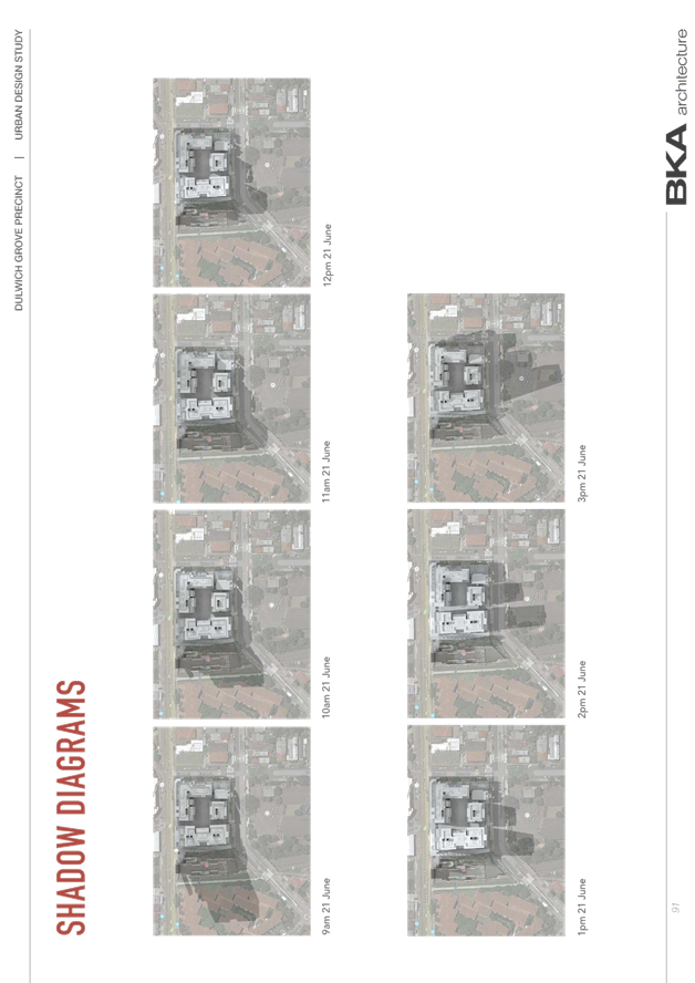
 As the site
is situated to the south of the rear dwellings on Garnet Avenue, that sit on
top of a prominent ridge line, their significant views east to the Sydney CBD
will not be impacted by this Planning Proposal. The property to the west of
the site at 105 Lilyfield Road’s existing views east are likely to be
obscured by the existing five to six storey public housing development and
any view obtained from the front of their dwelling will be maintained as the
front setback of the concept design is 6m, such that there will be no
significant view loss as a result of this Planning Proposal.
As the site
is situated to the south of the rear dwellings on Garnet Avenue, that sit on
top of a prominent ridge line, their significant views east to the Sydney CBD
will not be impacted by this Planning Proposal. The property to the west of
the site at 105 Lilyfield Road’s existing views east are likely to be
obscured by the existing five to six storey public housing development and
any view obtained from the front of their dwelling will be maintained as the
front setback of the concept design is 6m, such that there will be no
significant view loss as a result of this Planning Proposal. 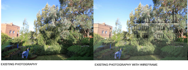
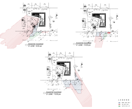
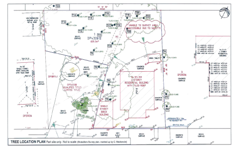
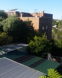 There will be
noise generated during construction of the development, however this will be
a short-term impact. Construction can only occur during limited daytime hours
that will be conditioned as part of any future Development Application.
There will be
noise generated during construction of the development, however this will be
a short-term impact. Construction can only occur during limited daytime hours
that will be conditioned as part of any future Development Application.