|
Supplementary AGENDA 1R |
Distributed on 4 December 2017
Local Traffic Committee Meeting
THURSDAY 7 DECEMBER 2017
10.00am
|
Supplementary AGENDA 1R |
Distributed on 4 December 2017
Local Traffic Committee Meeting
THURSDAY 7 DECEMBER 2017
10.00am
|
|
Local Traffic Committee Meeting 7 December 2017 |
Function of the Local Traffic Committee
Background
Roads and Maritime Services (RMS) is legislated as the Authority responsible for the control of traffic on all NSW Roads. The RMS has delegated certain aspects of the control of traffic on local roads to councils. To exercise this delegation, councils must establish a local traffic committee and obtain the advice of the RMS and Police. The Inner West Council Local Traffic Committee has been constituted by Council as a result of the delegation granted by the RMS pursuant to Section 50 of the Transport Administration Act 1988.
Role of the Committee
The Local Traffic Committee is primarily a technical review and advisory committee which considers the technical merits of proposals and ensures that current technical guidelines are considered. It provides recommendations to Council on traffic and parking control matters and on the provision of traffic control facilities and prescribed traffic control devices for which Council has delegated authority. These matters are dealt with under Part A of the agenda and require Council to consider exercising its delegation.
In addition to its formal role as the Local Traffic Committee, the Committee may also be requested to provide informal traffic engineering advice on traffic matters not requiring Council to exercise its delegated function at that point in time, for example, advice to Council’s Development Assessment Section on traffic generating developments. These matters are dealt with under Part C of the agenda and are for information or advice only and do not require Council to exercise its delegation.
Committee Delegations
The Local Traffic Committee has no decision-making powers. The Council must refer all traffic related matters to the Local Traffic Committee prior to exercising its delegated functions. Matters related to State Roads or functions that have not been delegated to Council must be referred directly to the RMS or relevant organisation.
The Committee provides recommendations to Council. Should Council wish to act contrary to the advice of the Committee or if that advice is not supported unanimously by the Committee members, then the Police or RMS have an opportunity to appeal to the Regional Traffic Committee.
Committee Membership & Voting
Formal voting membership comprises the following:
· one representative of Council as nominated by Council;
· one representative of the NSW Police from each Local Area Command (LAC) within the LGA, being Newtown, Marrickville, Leichhardt and Ashfield LAC’s.
· one representative from the RMS; and
· State Members of Parliament (MP) for the electorates of Summer Hill, Newtown, Heffron, Canterbury, Strathfield and Balmain or their nominees.
Where the Council area is represented by more than one MP or covered by more than one Police LAC, representatives are only permitted to vote on matters which effect their electorate or LAC.
Informal (non-voting) advisors from within Council or external authorities may also attend Committee meetings to provide expert advice.
Committee Chair
Council’s representative will chair the meetings.
Public Participation
Members of the public or other stakeholders may address the Committee on agenda items to be considered by the Committee. The format and number of presentations is at the discretion of the Chairperson and is generally limited to 3 minutes per speaker. Committee debate on agenda items is not open to the public.
|
MEETING AGENDA – PRECIS SUPPLEMENTARY ITEMS |
The following report/s appear as late item/s with approval as information required for the preparation of the report/s was not available at the time of distribution of the Business Paper.
1 Staff Reports
Traffic Matters
ITEM PAGE
LTC1217 Item 30 Local Route 7 (St Peters To Tempe) - Public Consultation Report And Revised Concept Plan 4
|
|
Local Traffic Committee Meeting 7 December 2017 |
Subject: Local Route 7 (St Peters To Tempe) - Public Consultation Report And Revised Concept Plan
Prepared By: Snezana Bakovic - Project Engineer Traffic
Authorised By: John Stephens - Traffic and Transport Services Manager
|
SUMMARY A revised concept plan for improvements to Local Route 7, a bicycle route identified in Council’s Marrickville Bicycle Strategy, has been developed following public exhibition of the draft concept plan. This report presents a summary of feedback received during consultation with the local community and other stakeholders, and recommends that the revised concept plan be approved and detailed designs for the route be developed. |
|
RECOMMENDATION
THAT:
1. The revised concept plan for Local Route 7 be approved; and
2. Detailed designs for the route be developed. |
BACKGROUND
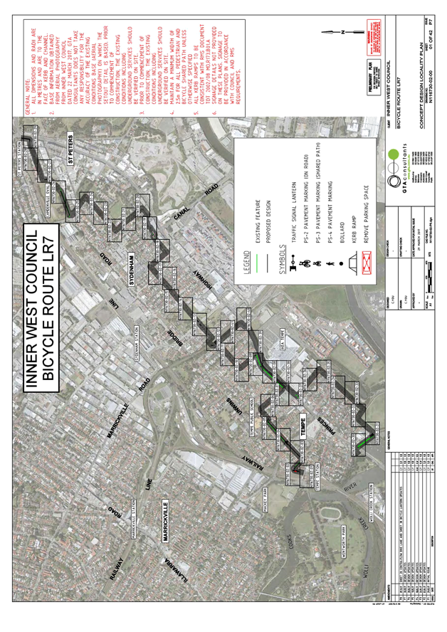
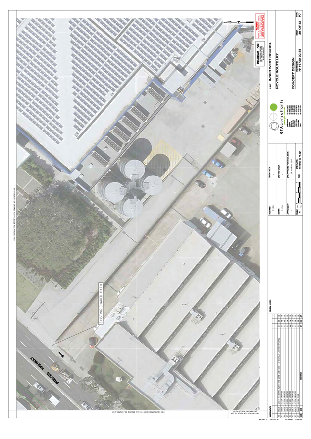
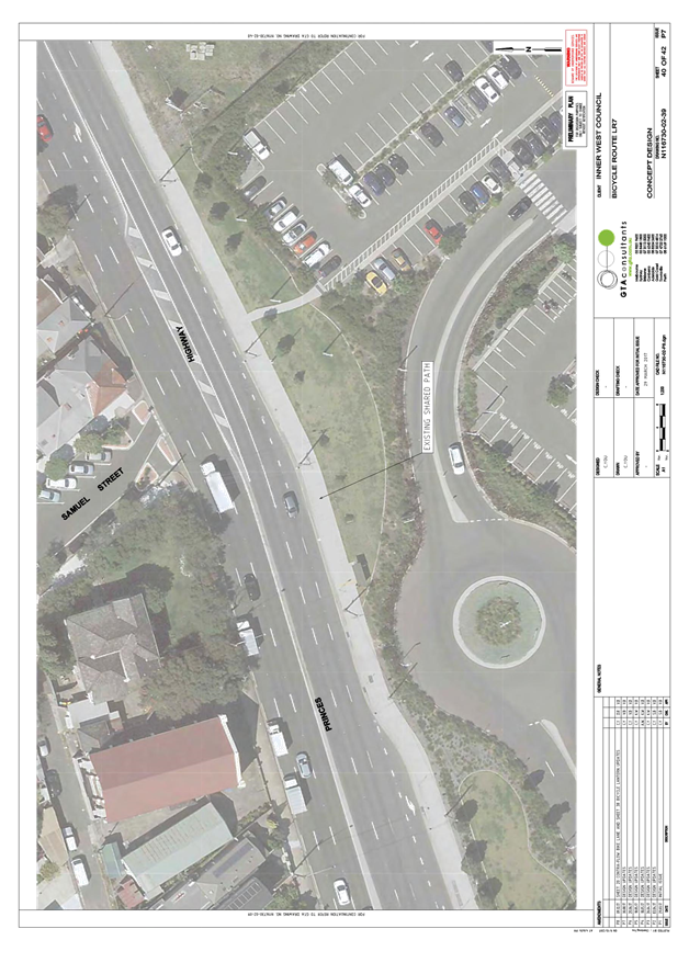
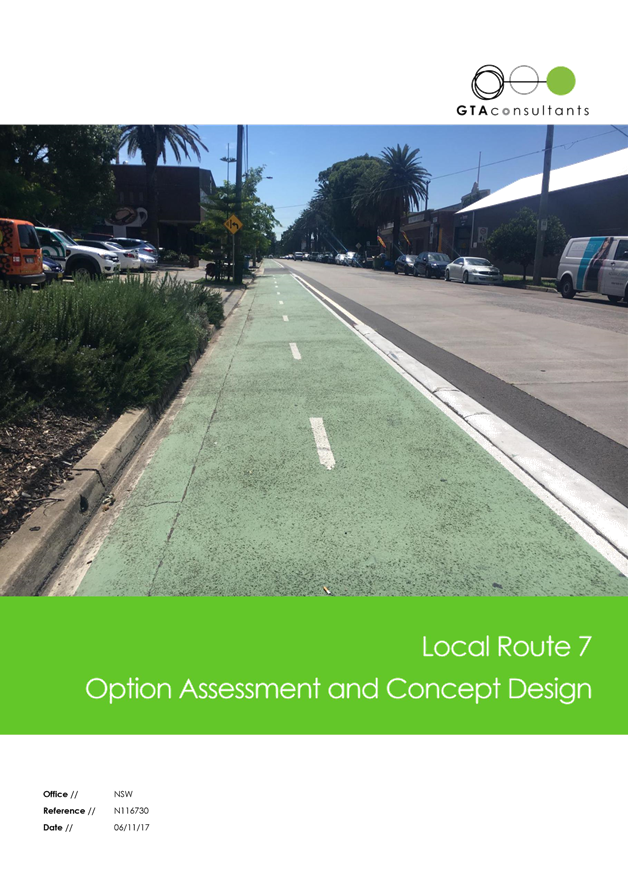
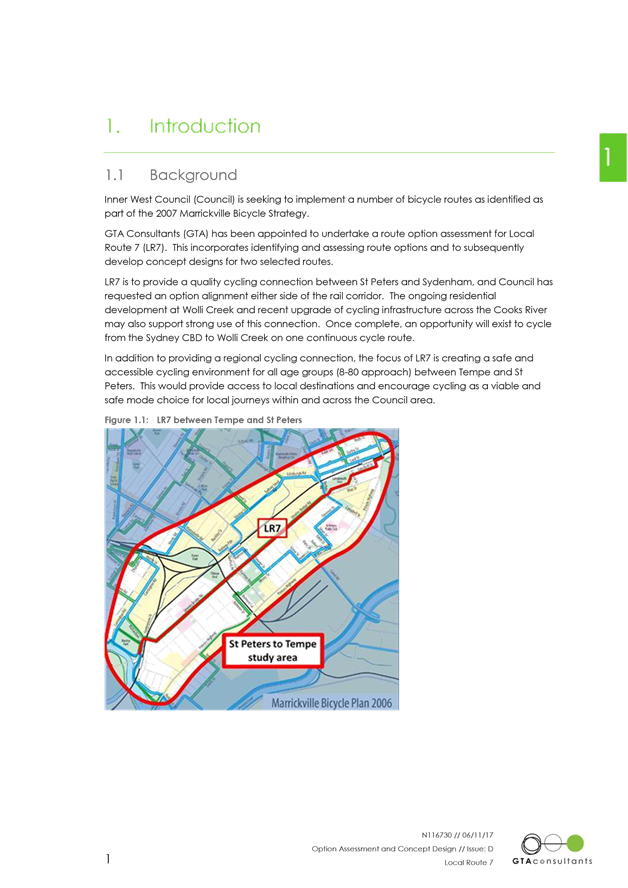
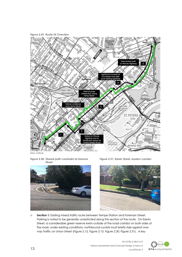
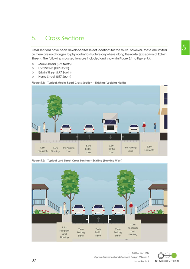
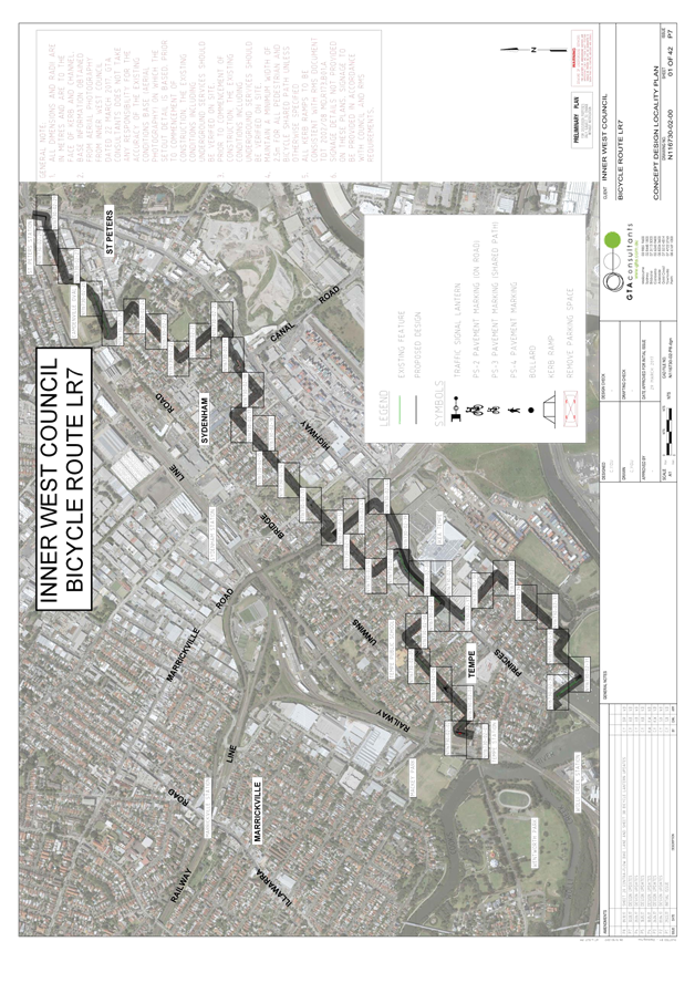
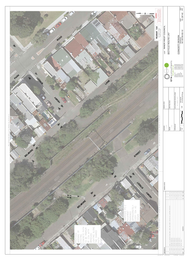
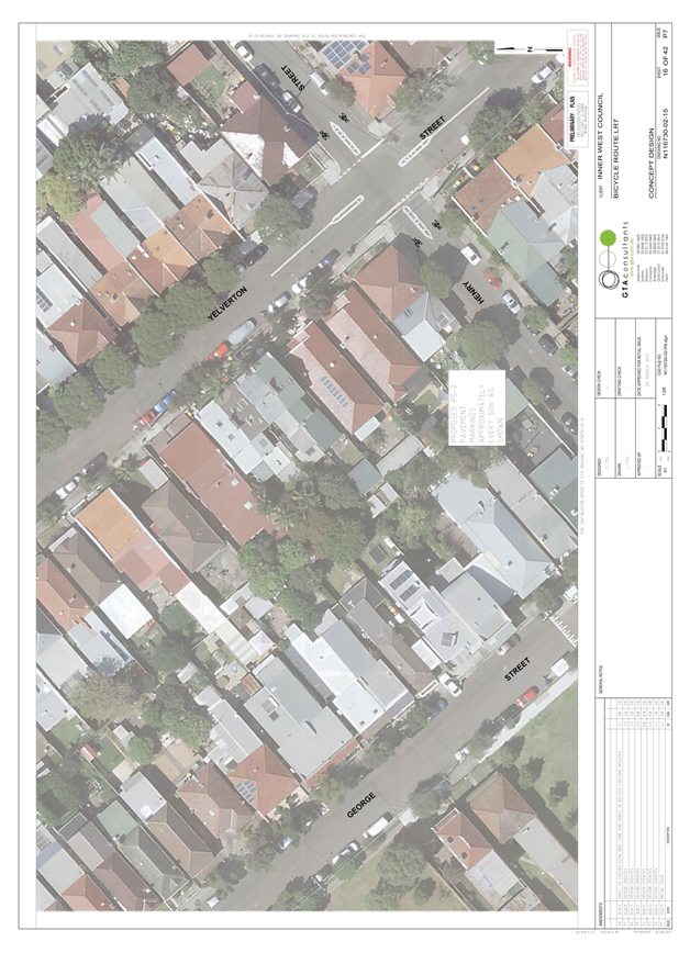
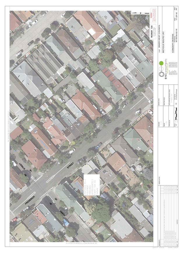
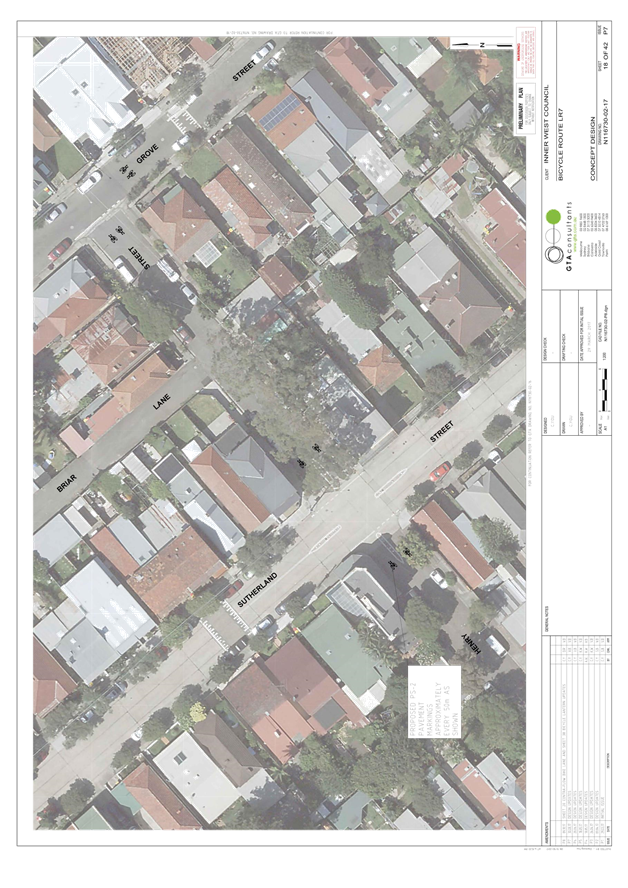
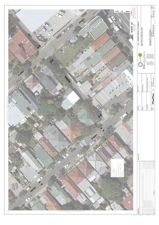
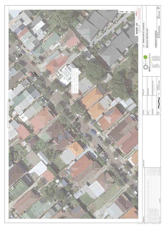
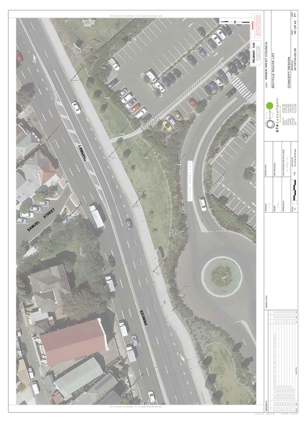
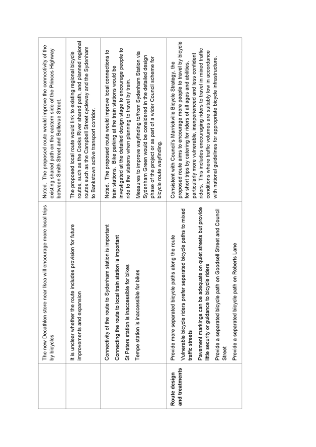
Consistent with Council’s stated commitment to encourage bicycle riding and improve bicycle paths and networks, Council’s Mauriceville Bicycle Strategy (adopted in 2007) aims to make riding a bicycle easier, safer and more attractive. Local Route 7 is a route from St Peters to Tempe identified in the Bicycle Strategy. It aims to improve connections to local destinations such as Tempe and St Peters Primary Schools, Camdenville Park, Sydenham Green and the Cooks River, and Tempe, Sydenham and St Peters train stations.
In 2016, Council received a grant from NSW Roads and Maritime Services (RMS) to develop a concept plan for improvements to LR7. This is consistent with the NSW Government’s objective of making bicycle riding a safe, convenient and enjoyable option for short trips.
In addition to providing a regional cycling connection, the focus on LR7 was to create a safe and accessible cycling environment for all age groups (8-80 approach) to encourage new people to cycle on a local basis to shops, schools and railway stations by formalizing and enhancing existing routes.
Following preliminary engagement with the local community and other stakeholders in January/February 2017, a draft concept plan was developed and endorsed for public exhibition in June 2017. Following public exhibition, a revised concept plan for approval (Attachment 1) and consultant’s report (Attachment 2) have been prepared.
FINANCIAL IMPLICATIONS
Detailed design and construction of the route are dependent on future budgets and grants.
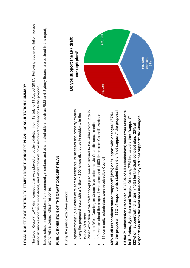
PUBLIC CONSULTATION
The draft concept plan was placed on public exhibition in July 2017. A summary of feedback received is presented in this section of the report together with a table of issues raised – and Council officer response ( refer to Attachment 3).
Following public exhibition, issues raised in submissions were considered, and where feasible informed modifications to the proposal. The local community and those that made submissions during public exhibition were then notified of the revised concept plan in October 2017, and further feedback from community members was received. Changes to the proposal following public exhibition, and the further feedback received by Council is addressed in the next section of this report.
Public exhibition of the draft concept plan (July/August 2017)
The draft concept plan was exhibited from 13 July to 13 August 2017. During this time:
· Public exhibition was advertised to the community in the Inner West Courier, on Council’s website and via Council’s social media channels;
· Approximately 1,500 letters were sent to residents, businesses and property owners in the vicinity of the proposed route, advising of the proposed changes and inviting comments;
· A further 4,500 letters were distributed to residents in the surrounding area;
· Information about the proposal was accessed from Council’s website 1,040 times.
Overview of community submissions during public exhibition
71 submissions from community members were received by Council during public exhibition:
· 68% of submissions indicated “support” (31%) or “support with changes” (37%) for the proposal;
· 32% of submissions indicated they did “not support” the proposal.
Overview of community submissions during public exhibition, by location
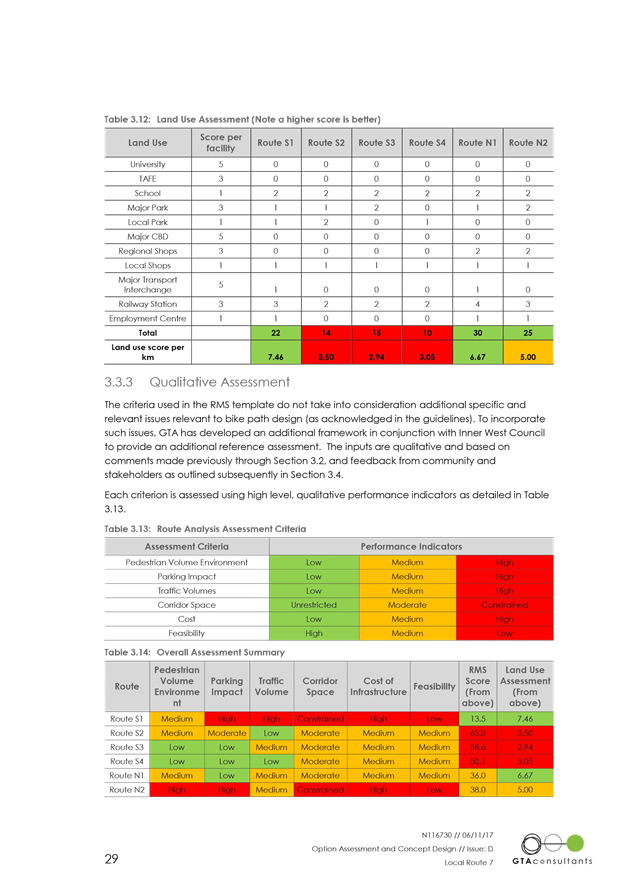
63% of submissions received during public exhibition were from community members in the vicinity of the proposed route (Table 1). Of these, 77% indicated “support” (45%) or “support with changes” (32%) for the proposal, with 23% indicating they did “not support” the proposal
|
Response, by location |
Total number of submissions |
Yes |
Yes, with changes |
No |
|
Vicinity of the route
|
40 (63%) |
13 (32%) |
18 (45%) |
9 (23%) |
|
Rest of Inner West LGA
|
9 (14%) |
3 (33%) |
1 (11%) |
5 (56%) |
|
Outside Inner West LGA
|
11 (17%) |
3 (27%) |
3 (27%) |
5 (45%) |
|
Not specified
|
11 (17%) |
3 (27%) |
4 (36%) |
4 (36%) |
|
Total |
71 |
22 (31%) |
26 (37%) |
23 (32%) |
Table 1: Community submissions received during public exhibition, response by location
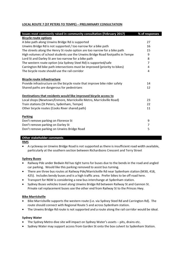
Issues raised in community submissions during public exhibition
31% of submissions by community members during the public exhibition period indicated support for the draft concept plan as shown.
The issues most frequently raised in other submissions by community members were:
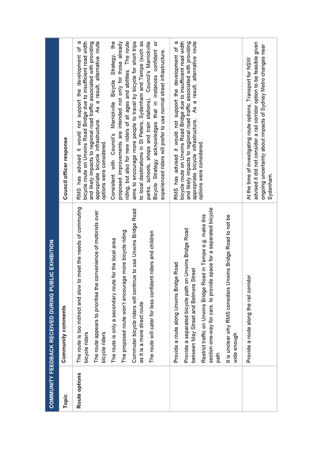
· The route is too indirect and slow to meet the needs of commuting bicycle riders
· More separated bicycle paths should be provided on the route
· Provide a shared path along the Princes Highway instead of using Henry Street
· The proposed shared path on Edwin Street will be unsafe for pedestrians
· Provide clear directional signage and markings along the route
A summary of issues raised – and Council officer response is provided in Attachment 3.
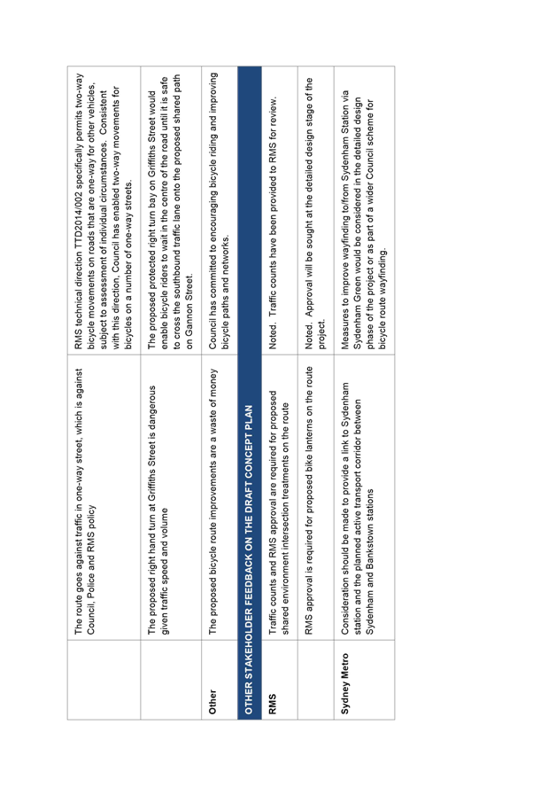
RMS comments about the draft concept plan
RMS indicated no objection to the draft concept plan, subject to RMS review and approval of the proposed bike lanterns on the route and proposed shared environment intersections.
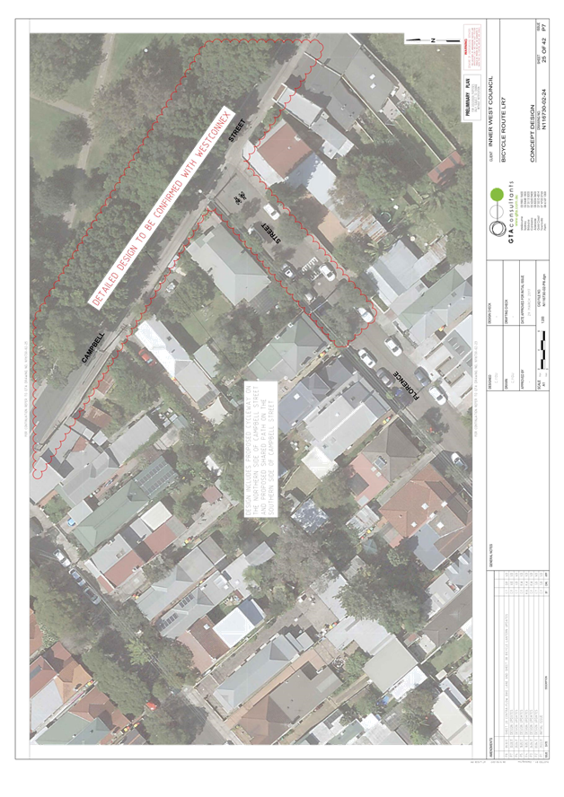
With regards to the option of a bicycle route on Unwins Bridge Road, RMS advised it would not support this due to likely traffic impacts given the narrow carriageway width on some sections of the road and intersection changes at Unwins Bridge Road and Campbell Street.
Following public exhibition, RMS indicated no objection to the revised concept plan.
Sydney Buses comments about the draft concept plan
Sydney Buses indicated no objection to the draft concept plan.
Following public exhibition, Sydney Buses indicated no objection to the revised concept plan.
Sydney Metro comments about the draft concept plan
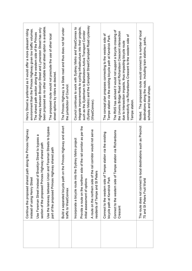
Sydney Metro indicated no objection to the draft concept plan. Sydney Metro also suggested further consideration of how to link the route to Sydenham station and the planned Sydney Metro active transport corridor.
Following public exhibition, Sydney Metro indicated no objection to the revised concept plan. WestConnex
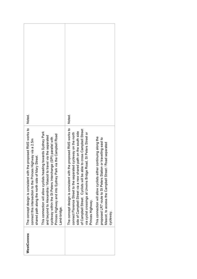
WestConnex comments about the draft concept plan
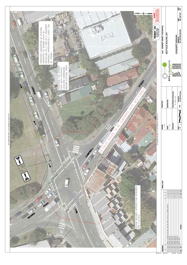
WestConnex indicated no objection to the draft concept plan. Westconnex also noted that the proposal is consistent with, and would connect to, its proposed bicycle route improvements at Mary Street (near the Princes Highway), Campbell Street, May Street and Bedwin Road.
Following public exhibition, WestConnex indicated no objection to the revised concept plan.
Bike Marrickville comments about the draft concept plan
Bike Marrickville reiterated its preference for a bicycle route to be developed on the northern side of the railway corridor, rather than as proposed through St Peters and Tempe.
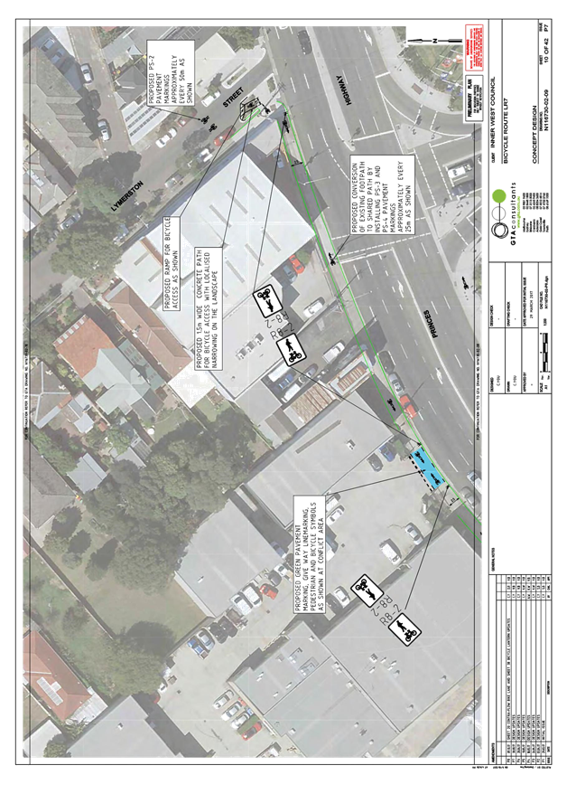
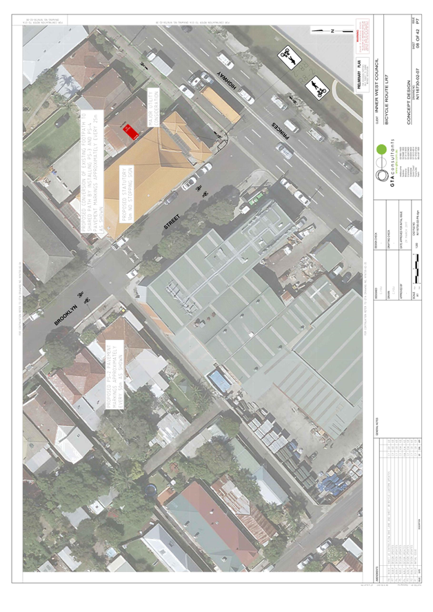
Bike Marrickville noted that the draft concept plan did not include an explicit connection to Sydenham station, and advised that the proposed shared path section on the western side of the Princes Highway (between Brooklyn Street and Lymerston Street) would be unpleasant for riders. Bike Marrickville, which consists of mainly experienced riders, also noted its preference for a mixed traffic route on Edwin Street with speed limit reduced to 40kph rather than the proposed shared path.
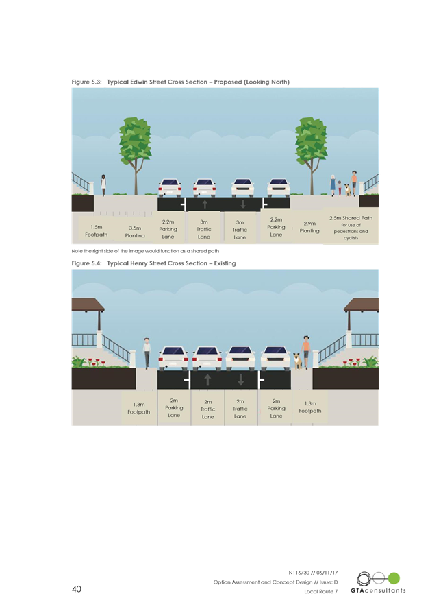
Council investigated the possibility of the recommended speed reduction with the RMS but unfortunately it didn’t meet the relevant criteria. As an alternative to existing on street traffic, Council proposed a shared path along the eastern side of Edwin Street for less experienced cyclists. This will be useful in trying to encourage new cyclists to adopt cycling. As they gain confidence, they may transition to the road. Currently, cyclists older than 12years must use the road which is an important consideration, particularly with Tempe High school nearby. With provision of shared path cyclist will now have an opportunity to ride on the road or the shared path.
Bike Marrickville also requested improved wayfinding to guide riders through the local streets along the route which would be considered in detail design stage.
OFFICER COMMENTS
Following public exhibition, issues raised in submissions were considered, and where feasible informed modifications to the proposal and the development of a revised concept plan. The issues most frequently raised during public exhibition, and Council officer response, are set out in the table below, and changes made to the concept plan following public exhibition are discussed thereafter.
|
Issues most frequently raised in public exhibition feedback |
Council officer response |
|
The route is too indirect and slow to meet the needs of commuting bicycle riders (21% of submissions) |
RMS has advised it would not support the development of a bicycle route on Unwins Road Bridge due to insufficient road width and likely impacts to regional road traffic associated with providing appropriate bicycle infrastructure. As a result, alternative route options were considered. Consistent with Council’s Marrickville Bicycle Strategy, the proposed improvements are intended not only for those already riding, but also for new riders of all ages and abilities. The route aims to encourage more people to travel by bicycle for short trips to local destinations in St Peters, Sydenham and Tempe (such as parks, schools, shops and train stations). Council’s Marrickville Bicycle Strategy acknowledges that in instances confident or experienced riders will prefer to use normal street infrastructure. |
|
More separated bicycle paths should be provided along the route (7% of submissions) |
The proposed treatments along the route are consistent with national guidelines for appropriate separated of bicycles and motor vehicles, and seek to acknowledge community concerns about on-street parking by minimising impacts. This includes utilising low volume streets and shared paths where appropriate. |
|
Provide a shared path along the Princes Highway instead of using Henry Street (7% of submissions)
|
Henry Street is preferred as it would offer a more pleasant riding environment than the Princes Highway given low traffic volumes. The shared path section along the western side of the Princes Highway between Brooklyn Street and Lymerston Street has only been proposed as no other suitable local street option is available. |
|
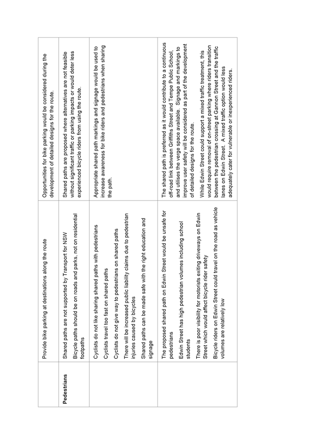
The proposed 2.5m shared path on Edwin Street will be unsafe for pedestrians (7% of submissions) |
The shared path is preferred as it would contribute to a continuous off-road link between Griffiths Street and Tempe Public School, and utilises the verge space available. Signage and markings to improve user safety will be considered as part of the development of detailed designs for the route. While Edwin Street could support a mixed traffic treatment, this would require removal of on-street parking where riders transition between the pedestrian crossing at Gannon Street and the traffic lanes on Edwin Street. A mixed traffic option would less adequately cater for vulnerable or inexperienced riders. |
|
Provide clear directional signage and markings (6% of submissions) |
Measures to improve wayfinding on the route will be considered in the detailed design phase of the project. |
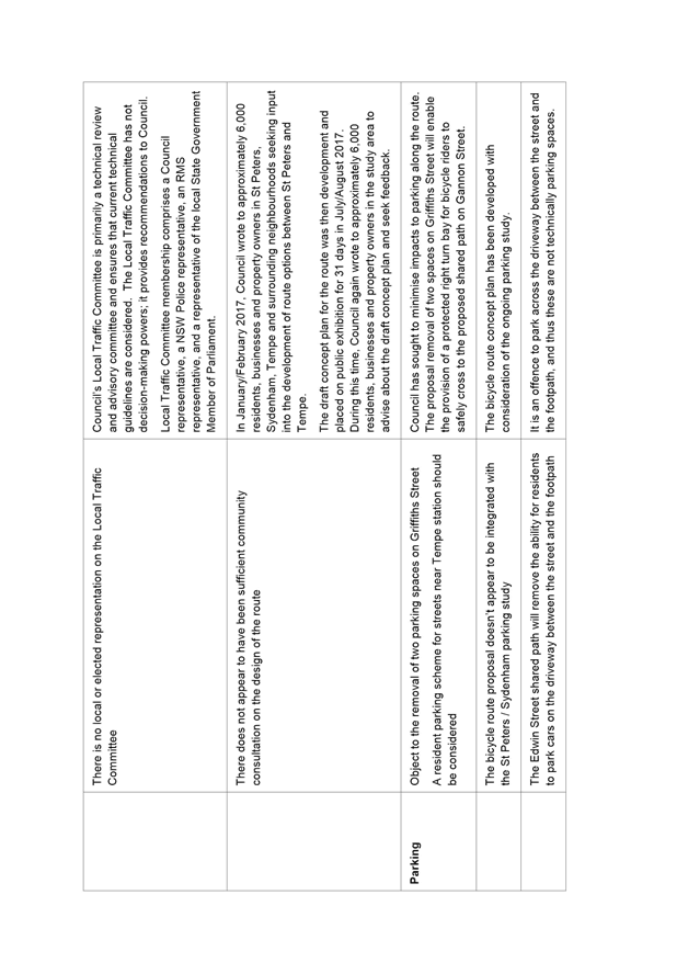
On-street parking
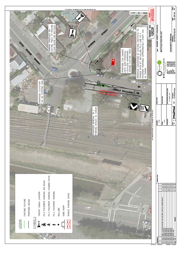
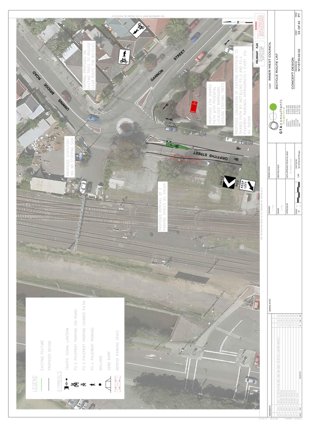
The draft concept plan proposed the removal of two on-street parking spaces in Griffiths Street adjacent to the rail corridor to enable the provision of a protected right turn bay for northbound riders turning on to the Gannon Street shared path. In response to resident concerns that the proposed removal of these two parking spaces would have flow on impacts to parking demand in surrounding streets including Edwin Street, an option to relocate the proposed right turn bay closer to the intersection to minimize the parking loss has been investigated. The investigation revealed that right turn bay cannot be relocated close to the roundabout due to existing facility pit and potential drainage issues.
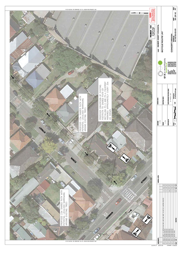
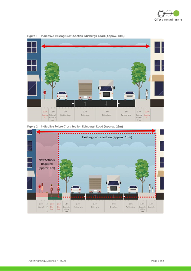
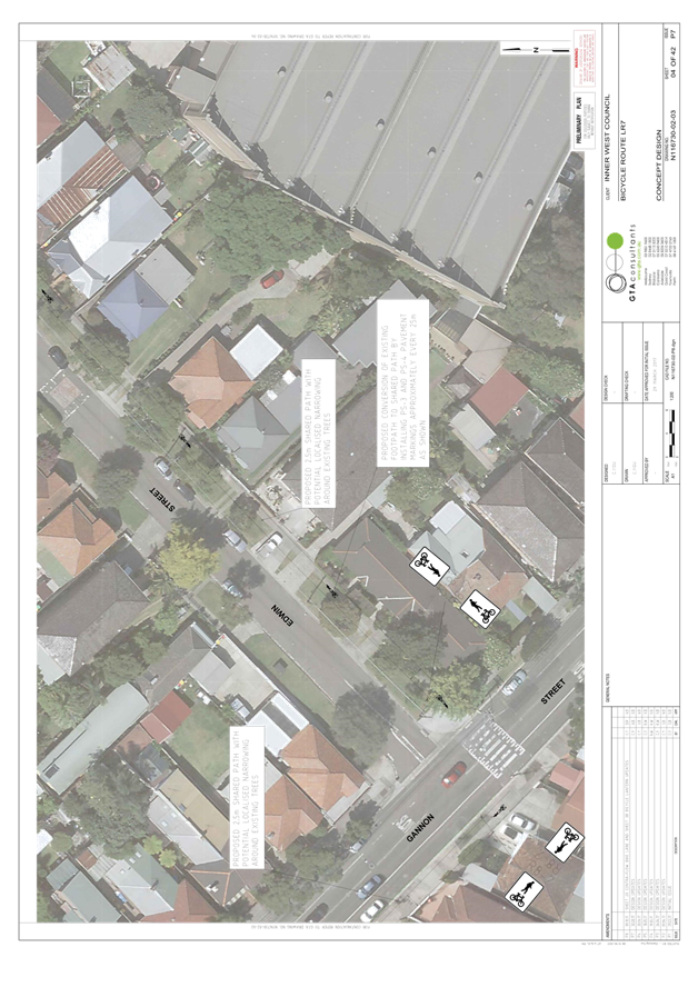
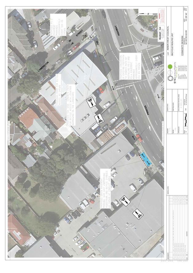
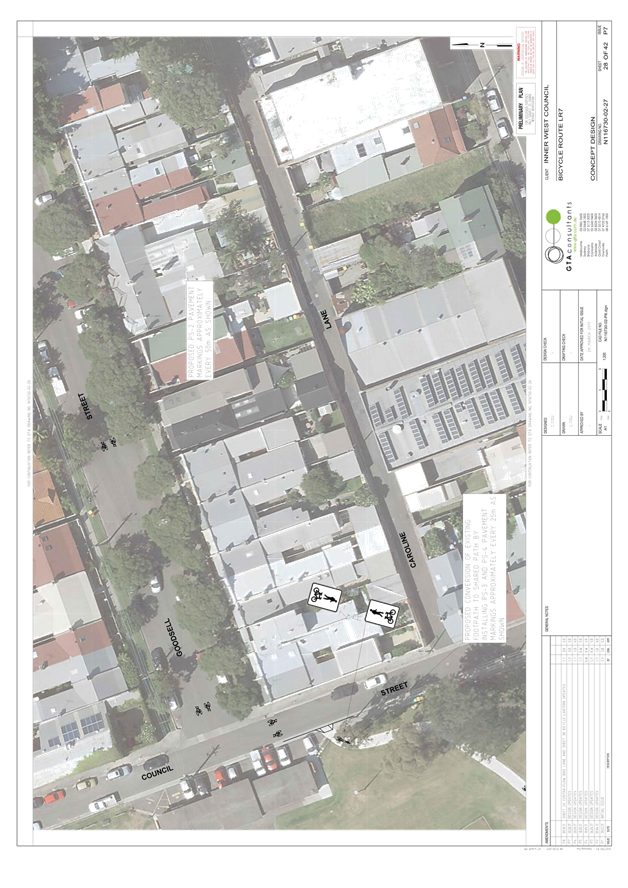
Edwin Street-Shared path
Along with providing a regional cycling connection, the project objective of LR7 concept plan is to create a safe and accessible cycling environment for all age groups (8-80 approach) to encourage new people to cycle on a local destinations including shops, schools and railway stations by formalizing and enhancing existing routes.
To achieve this, the draft concept plan proposed a 2.5m shared path along the east side of Edwin Street as an alternative option to existing on road cycling route for less experienced cyclists. Also, concealed, sloping or narrow streets and mixed traffic use are unsuitable for young or inexperienced bike riders.
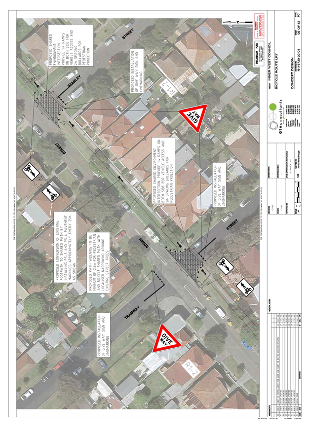
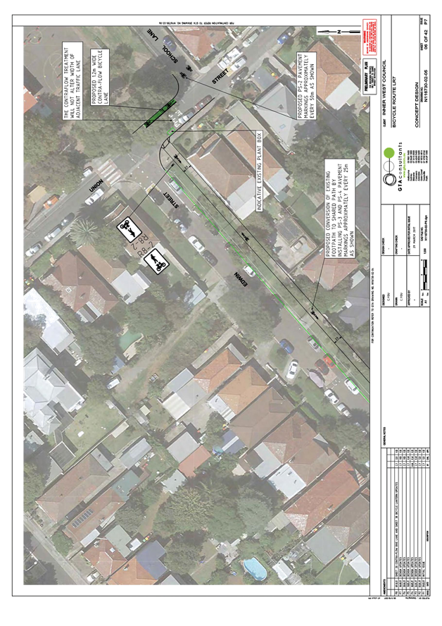
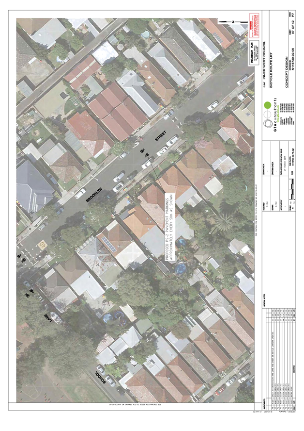
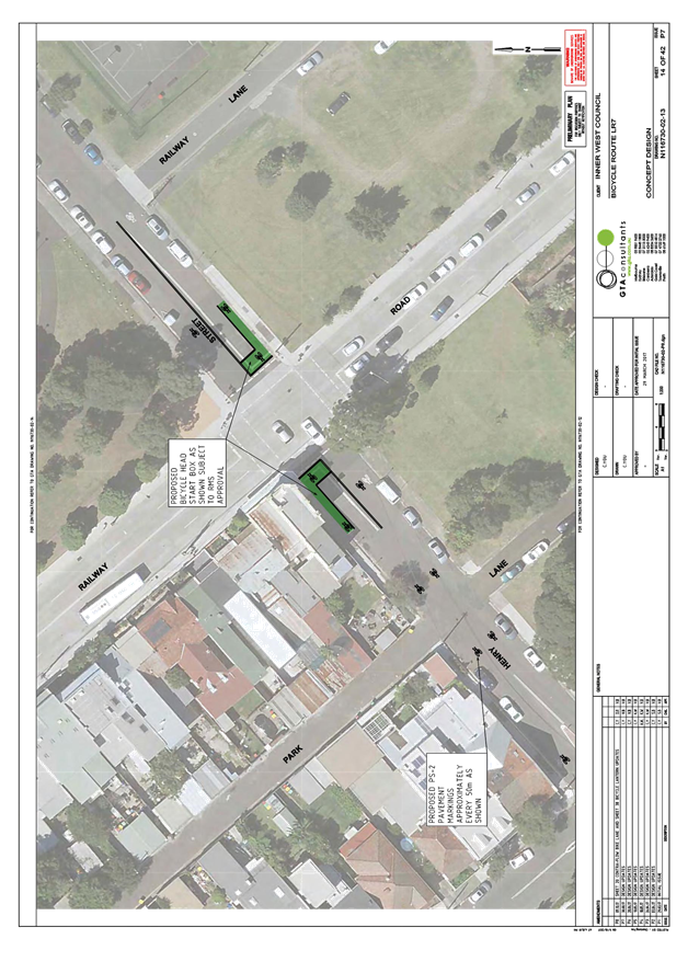
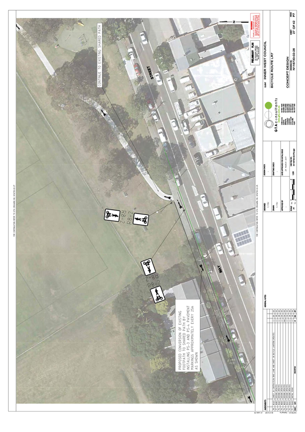
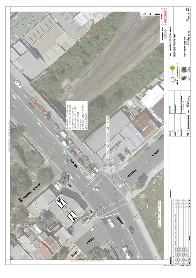
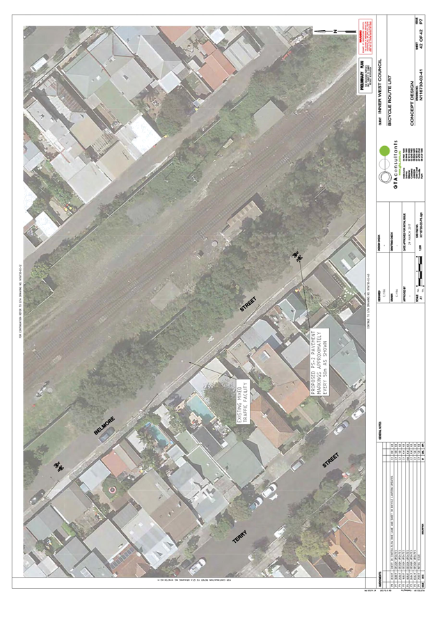
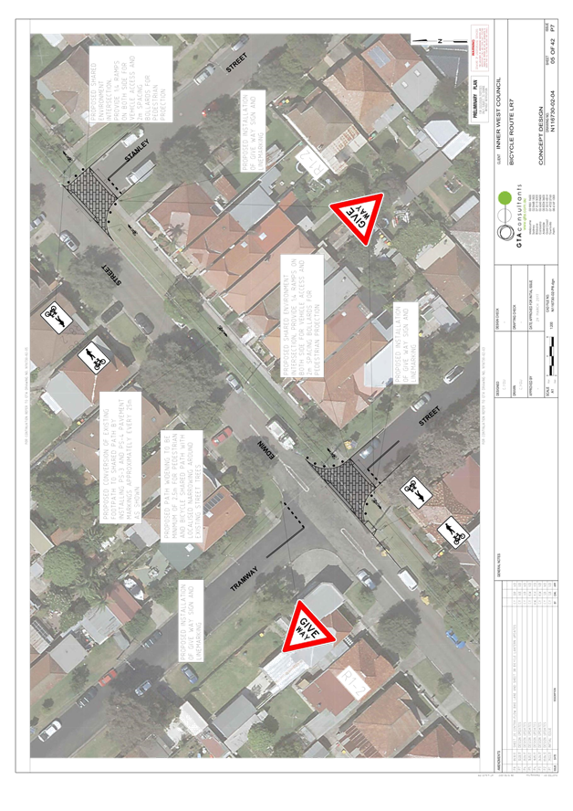
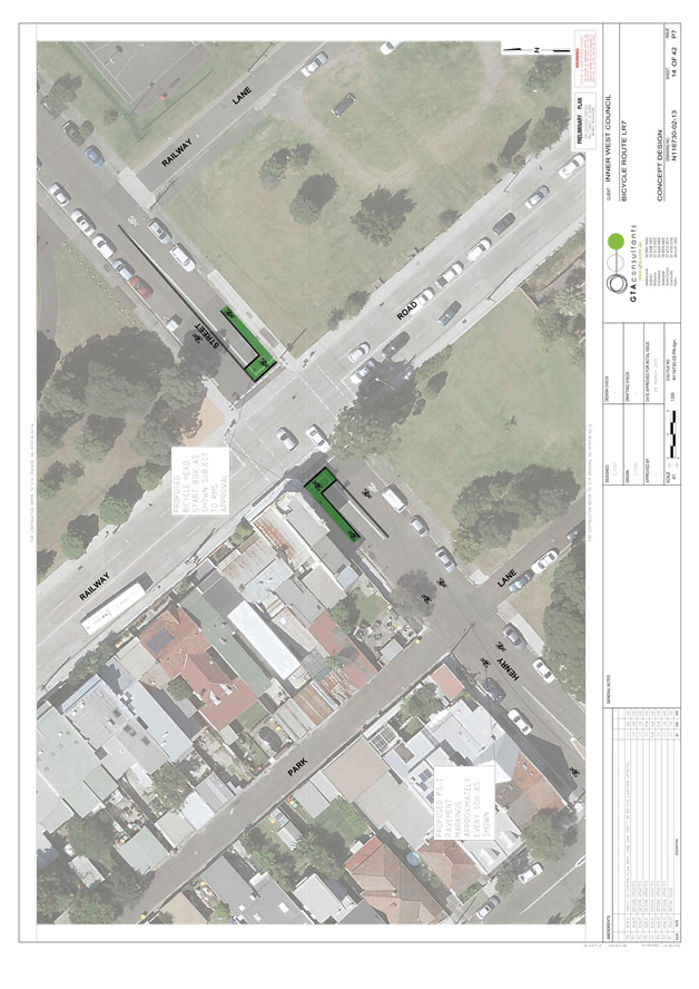
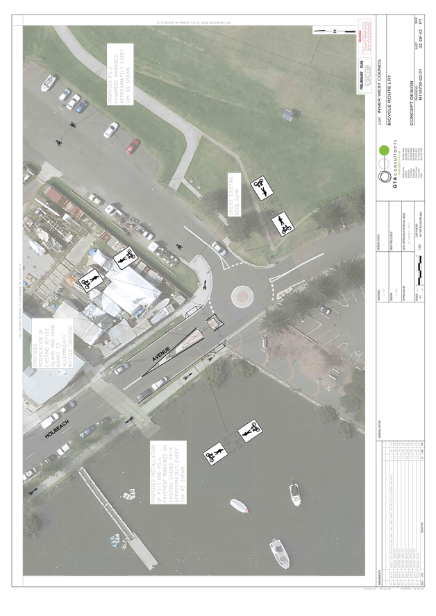
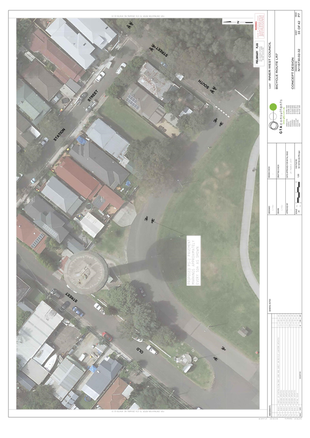
The proposed shared path goes from Gannon Street to Union Street with proposed shared environment at Tramway Street and Stanley Street giving pedestrians and cyclist priority at the new proposed shared environment intersections.
While Edwin Street could support a mixed traffic treatment, this would require removal of on-street parking where riders transition between the pedestrian crossing at Gannon Street and the traffic lanes on Edwin Street. A mixed traffic option would also less adequately cater for vulnerable or inexperienced riders.
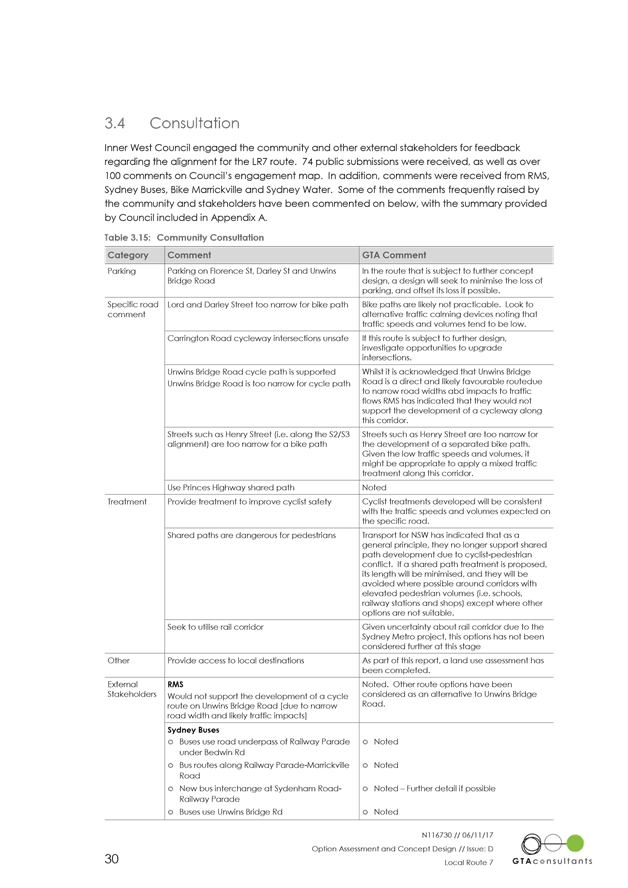
The shared path proposal received objection from some residents who park their vehicles on the driveway in front of their property which protrudes into the existing footpath. Provision of the shared path was perceived by these residents as parking lost in front of their property (refer to photo1).
Also some residents have safety concerns when reversing from their driveways because of poor visibility of cyclists, especially if riders are short and bikes are small. These residents also believe that cyclists may inadvertently intimidate or injure pedestrians.
At the moment, children under 12 years and adults who are supervising children can legally ride bike on the footpath. This means that they are already at risk of being not visible to residents reversing from their driveways. This risk is increased by the fact that the current footpath is narrow (1.7m) and only occasionally used by cyclists so drivers are less likely to expect them.
Providing a wide 2.5m shared path with signage, shared path road markings and treatment on driveways would improve safety for less confident or younger bike riders who are the people expected to use this route. Experienced riders and commuters are expected to prefer a direct, mix traffic route. Painting bike symbols in the middle of roads does little to make people feel safer or encourage people of all ages and abilities to take up cycling as a viable mode of transport.
It is also the drivers’ duty of care when reversing from driveway to look for pedestrians and cyclists and give them priorities on crossings. In the same manner, cyclists and pedestrians have to observe vehicles before approaching potential conflict points. Footpaths are to be safely shared for all road users with mutual respect and acceptance of all transport modes.
If the concept plan approved signage and markings to improve user safety will be considered as part of the development of detailed designs for the route.
The concept designs also went through preliminary road safety audit by a third party. The road safety assessment didn’t recognise proposed shared path unsafe for pedestrians and cyclists. The only concern related to the lighting along the proposed shared path. A lighting assessment would be organised in the detail design stage and adequate measures would be applied accordingly.
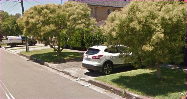
Photo1- Parking at driveways on Edwin Street
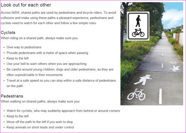
Also, according to the Transport for NSW (NSW Centre for Road Safety) there are some rules for using shared path;
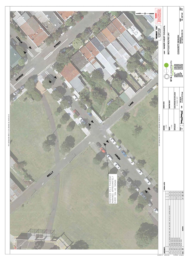
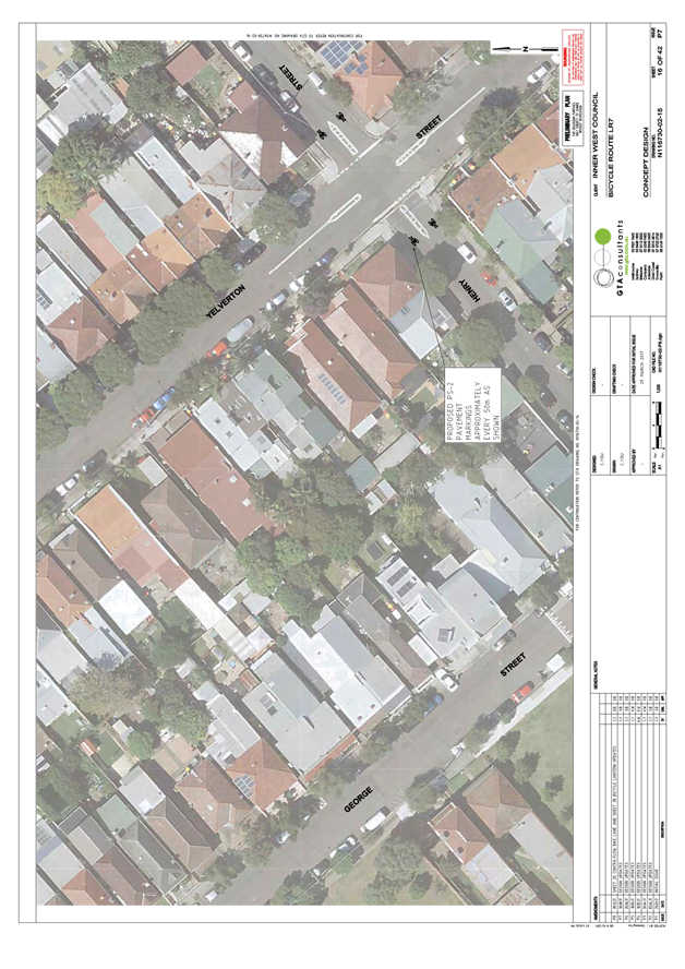
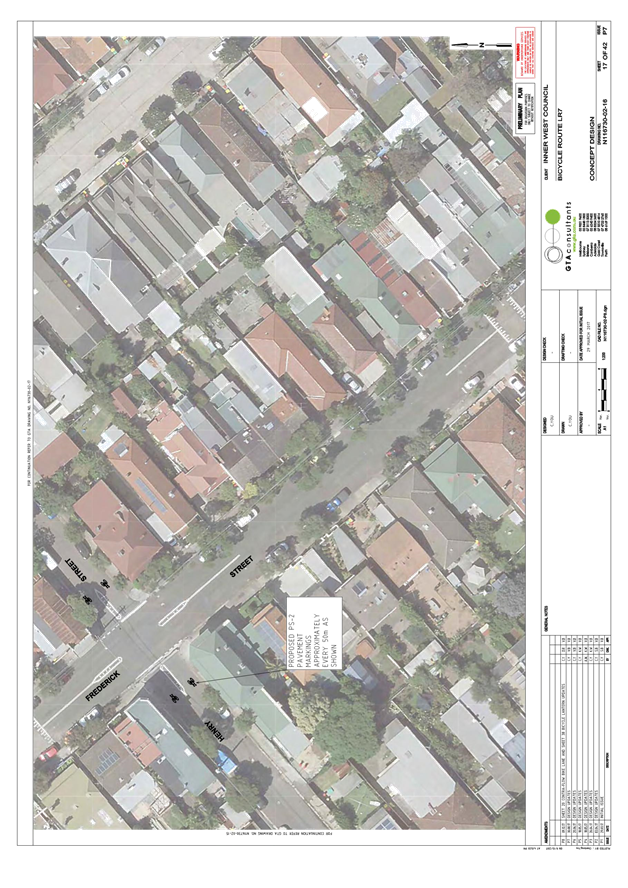
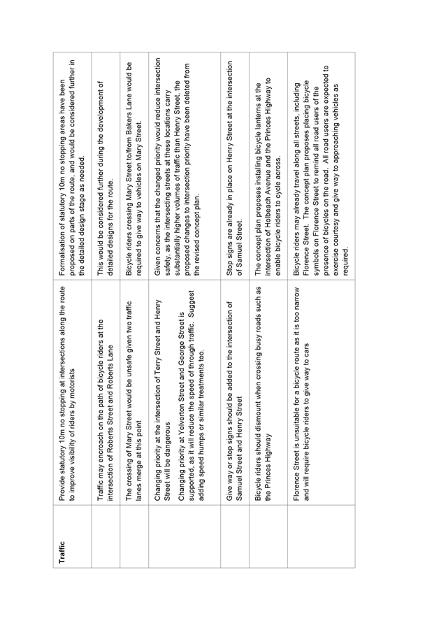
Priority at Henry Street intersections
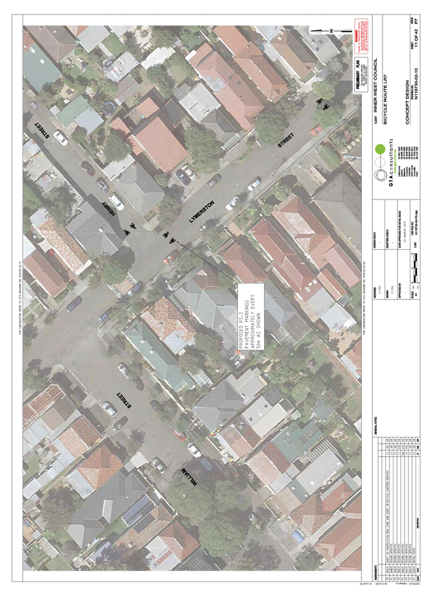
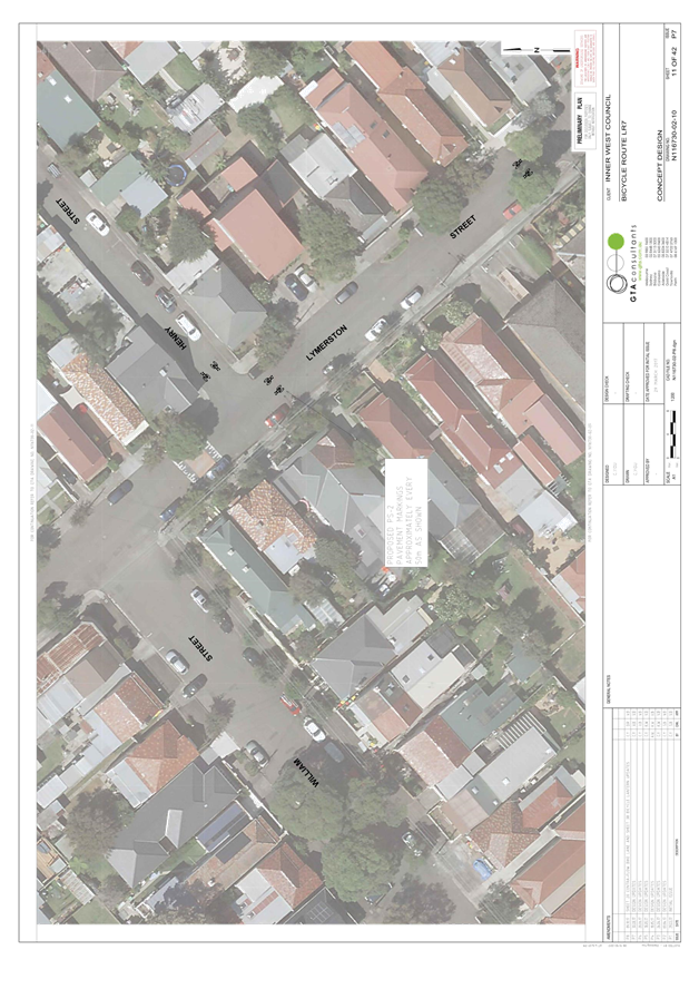
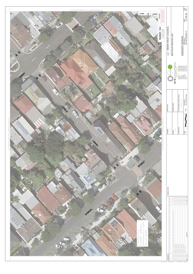
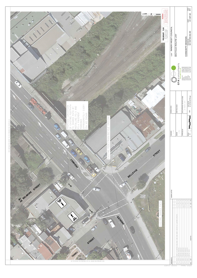
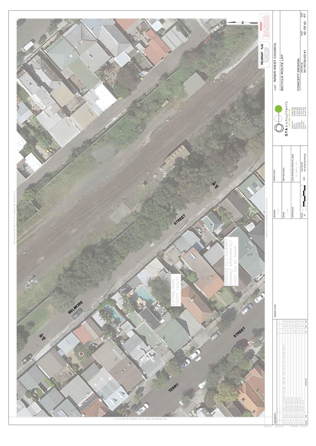
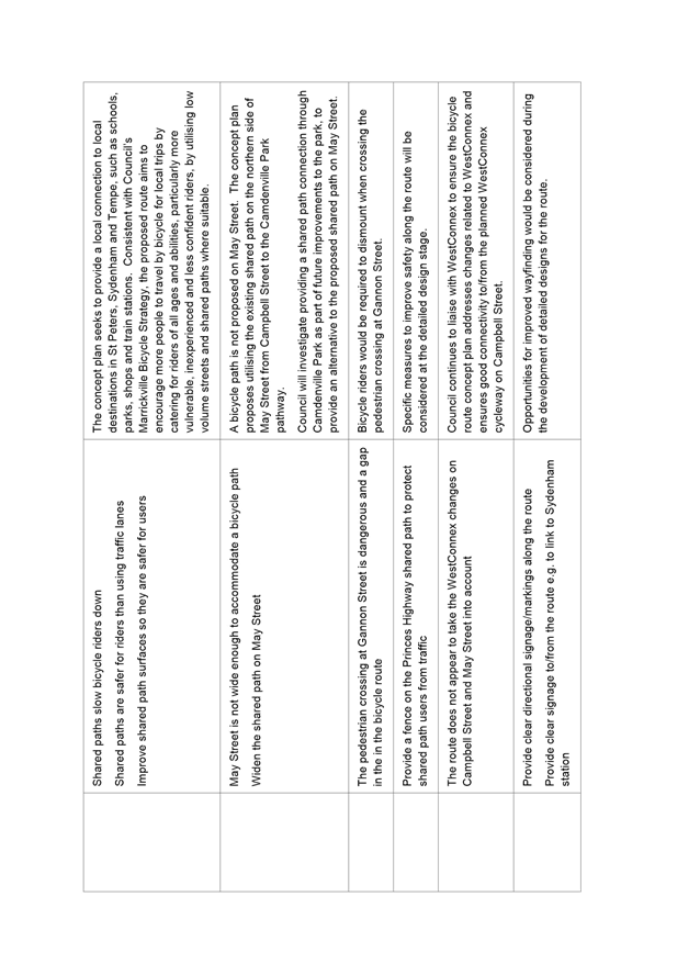
The draft concept plan proposed altering intersection priority along Henry Street at the intersections of Terry Street, George Street and Lymerston Street to improve the convenience of the route by reducing the number of times riders are required to stop or give way to traffic. Concerns were raised that the changed priority would reduce intersection safety, given the intersecting streets at these locations carry substantially higher volumes of traffic than Henry Street. As a result, the proposed changes to intersection priority have been deleted from the revised concept plan.
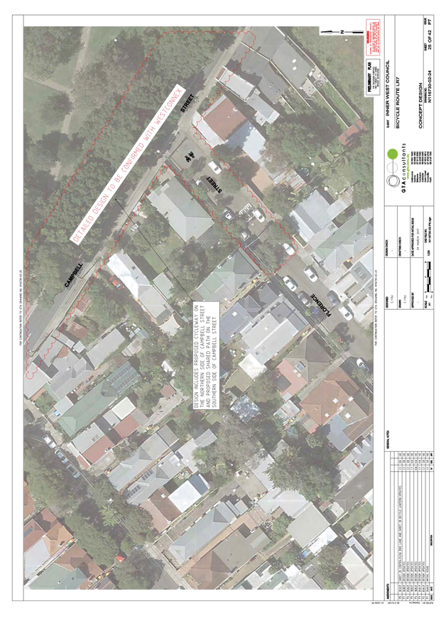
Campbell Street (WestConnex) bicycle connection
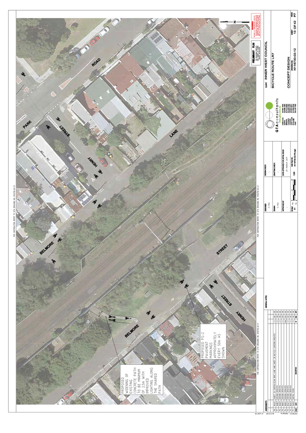
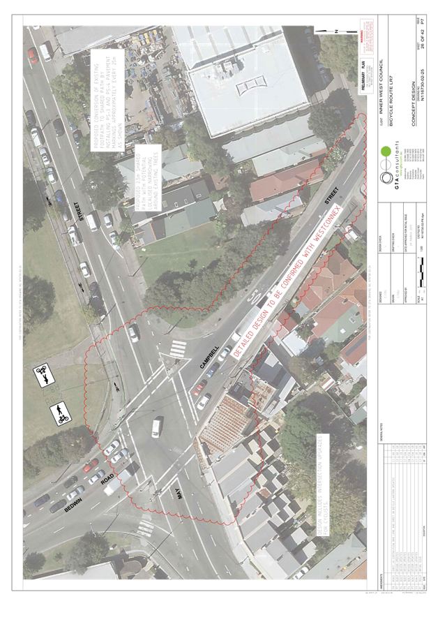
The draft concept plan noted that the section of the route between Florence Street and May Street was subject to WestConnex provision of cycling infrastructure on Campbell Street. WestConnex has since confirmed that it proposes to provide a separated bicycle path on the northern side of Campbell Street, a shared path on the southern side of Campbell Street, and bicycle lanterns at the intersection of Campbell Street and Unwins Bridge Road to cater for rider movements. These proposed changes have been incorporated into the revised concept plan to highlight proposed LR7 connectivity on this section of the route.
May Street / Camdenville Park
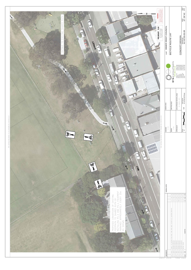
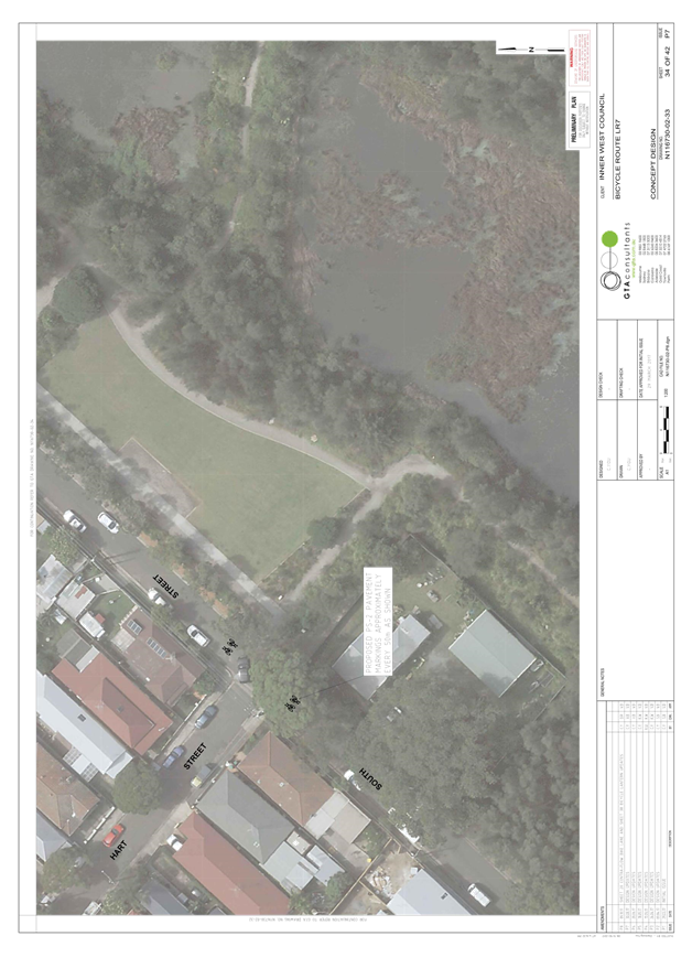
The draft concept plan proposed a 2.5m wide shared path connection on the western side of May Street from the intersection of May Street and Campbell Street to the existing shared path in Camdenville Park. While this would provide a shared path facility of suitable width, submissions noted that there are localised constraints to the path width due to street trees along this section of path. Council will thus investigate incorporating a potential shared path connection through Camdenville Park into any future improvements to the park, which would allow this section of path on May Street to be bypassed by riders. This has been noted on the revised concept plan.
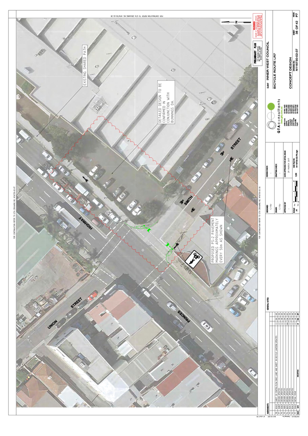
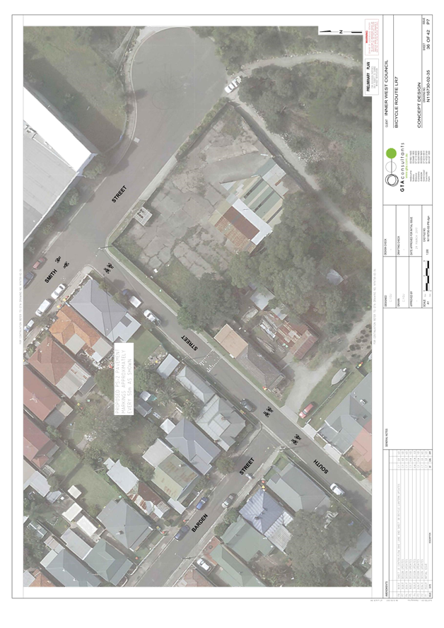
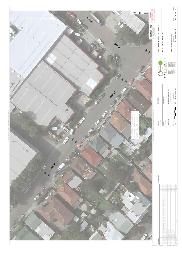
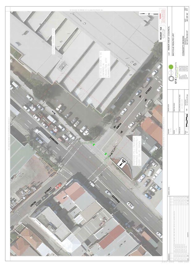
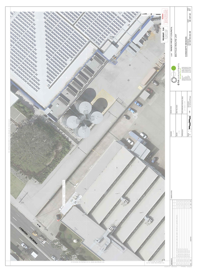
Bunnings DA / Smith Street, Tempe
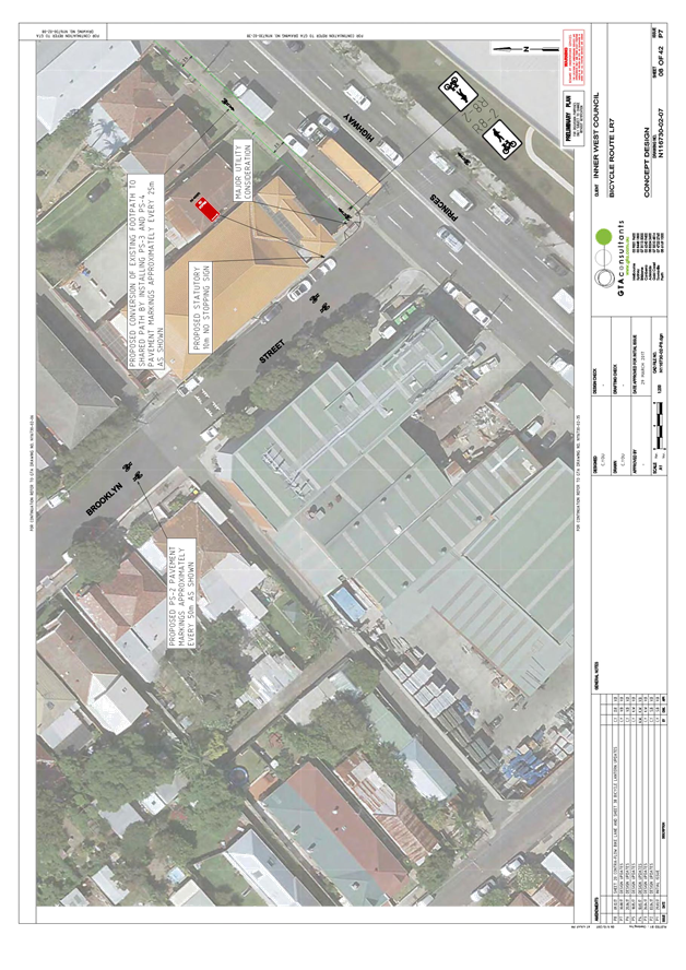
The draft concept plan proposed a mixed traffic treatment along Smith Street, to connect riders between the existing shared path on the eastern side of the Princes Highway and South Street. Given uncertainty about the impact of the proposed Bunnings development on the corner of Smith Street and the Princes Highway on traffic volumes on Smith Street, this section of the route has been clouded out pending further clarification of impacts and decision on the development application. It is noted that extension of the existing Princes Highway shared path into Smith Street as part of the Bunnings development would address concerns about the impact of traffic volumes on bicycle rider safety and amenity on Smith Street and improve route connectivity to/from South Street.
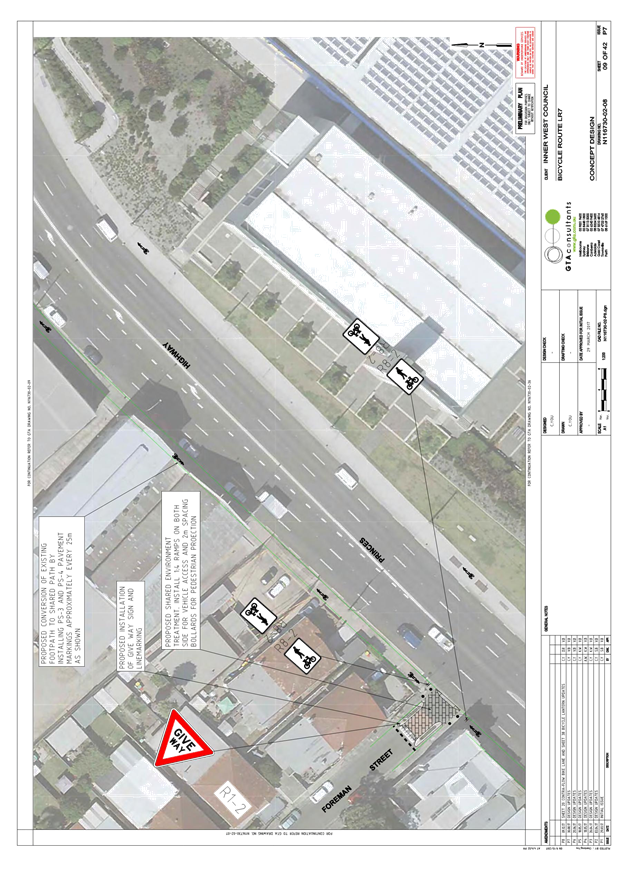
Shared environment intersections
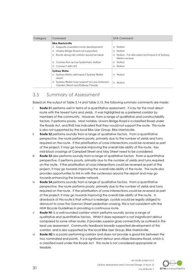
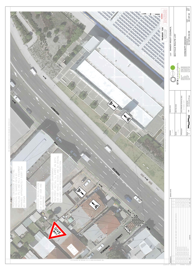
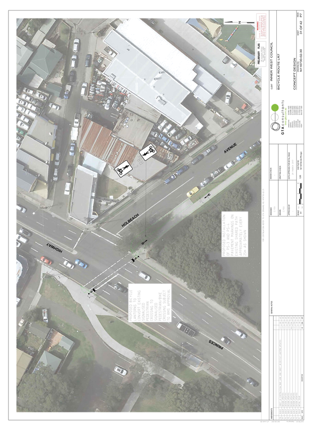
RMS requested traffic counts for the proposed shared environment intersection treatments on the route. Traffic counts were carried out to determine whether the proposed treatments met the RMS threshold and are summarised in the table below:
|
Location |
Ave. peak hour vehicles (V<30) |
Ave. peak ¼ hour vehicles (V<15) |
Comment |
|
Tramway St east of Edwin St |
8 (4-5pm) |
3 |
Within RMS threshold |
|
Stanley St at Edwin St |
37 (8-9am) |
14 |
Minor exceedance of RMS threshold |
|
Foreman Street at Princes Hwy |
32 (3-4pm) |
12 |
Minor exceedance of RMS threshold |
RMS subsequently indicated it had no objection to the proposed shared environment intersections.
Summary of proposed parking impacts in the revised concept plan
|
Location |
Estimated Gain/Loss |
Comment |
|
Griffiths Street, western side |
-2 |
The proposed route improvements would remove two on-street parking spaces on the western side of Griffiths Street to accommodate a right turn bay for bike riders to access the shared path on Gannon Street. |
|
Total |
Estimated overall change: -2 parking spaces |
|
Summary of changes made following public exhibition
In response to issues raised in public exhibition, the following changes have been made to the concept plan:
|
Change to concept plan |
Reason |
|
Henry Street · Remove the proposed change to intersection priority at Terry, George and Yelverton Streets.
· Include No Stopping signs 10 metres from intersections along this street to formalise the statutory rule |
· This addresses community members’ concerns that changing the priority would reduce safety because there are higher traffic volumes on Terry, George and Yelverton Streets than Henry Street.
· This will improve safety for all road users by increasing visibility at intersections. Location will be determined in detail design stage. |
|
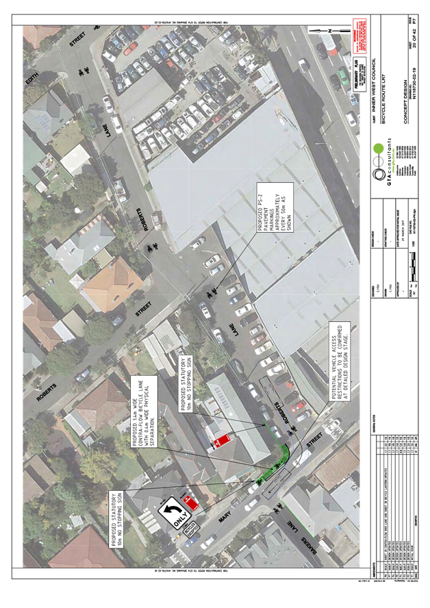
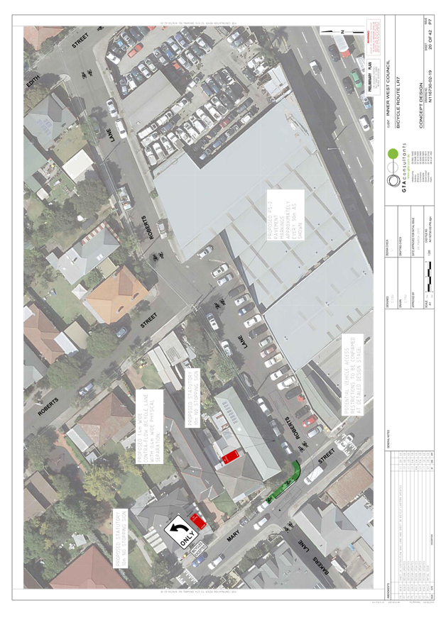
Mary Street · Include a barrier kerb to separate contraflow bicycle lanes from traffic.
|
· This addresses concerns that Mary Street has higher traffic volumes than many local roads along the route. This will improve safety by separating people riding a bike in the contraflow lane from passing traffic. |
Notification of the revised concept plan and further feedback (October 2017)
Following development of the revised concept plan, in October 2017 Council wrote to approximately 1,500 residents along the route and those that made submissions during public exhibition to notify about the revised concept plan and advise of the next steps for the project.
Council subsequently received three further submissions and two phone calls from community members.
Three out five of submissions reiterated objections to the proposed Edwin Street shared path. One summation support proposal and requested cycle way extension to Cooks River and one submission rejected proposal as it is not the most direct route for commuters.
|
Subsequently received residents comets |
Council officer response |
|
Support proposal and requesting Extension of bike path on Griffiths St all the way down to the end of Griffith St and constructing a proper ramp down to Kendrick Park. |
Noted. The requested bike path extension will be sent to Council’s Strategic Planner for future network improvement consideration. |
|
The proposed shared path on Edwin Street will be unsafe for people in wheelchairs.
|
The shared path would be widened to 2.5m which is in compliance with NSW Bicycle Guidelines for shared path (two-way) off-road width. Appropriate shared path markings and signage would be used to increase awareness for bike riders and pedestrians when sharing the path. It is anticipated that shared path would be used by novice and less experienced cyclist while experienced cyclist would prefer the mix traffic as faster option.
|
|
· The safest way to cycle on Edwin St already exists. It is a decent sized, well-maintained road with little auto traffic. It is regularly used by cyclists and skateboarders
· Riding on the bitumen of Edwin Street offers full right-of-way, all-round visibility for road and pavement users, excellent street lighting and a smooth surface. Digging up Edwin Street’s footpath, kerbs and nature strip would be redundant and wasteful as a decent cyclist alternative is already in place. Most cyclists will continue to favour and use Edwin St bitumen.
· Most cyclists would favour Edwin St bitumen over a mixed-use footpath with pedestrians. Changing the streetscape to build this footpath would be poor use of Council resources.
· Child, cyclist and pedestrian safety is higher priority than rapid completion of a bike route project.
· LR7 bike route includes roads that are more dangerous than Edwin St bitumen but shared path is not proposed.
· Council resources would be better invested towards future-proofing direct and safer connections for pedestrians and cyclists to the existing Cooks River cycle way and future Carrington Rd and Sydenham precincts than digging up Edwin St and aggravating the local community for unsafe, redundant and unclear purposes that will adversely affect the environment.
· Finding the relevant documents online at http://www.yoursayinnerwest.com.au/lr7 and navigating through 42 pages of the plans is very challenging.
|
· In addition to providing a regional cycling connection, the focus on LR7 was to create a safe and accessible cycling environment for all age groups (8-80 approach) to encourage new people to cycle on a local basis to shops, schools and railway stations by formalizing and enhancing existing routes. .A mix on street route id not safe as the proposed shared path. Also a loss of parking will result from on road option.
· Riding bike on mix- traffic Edwin Road have many issues for the less experience cyclists e.g. door opening problem, overtaking problem, impatient drivers behind a cyclist, lack of cyclist confident in mix traffic, not fit cyclist to ride in 50 km/h zone environment etc. On the other hand a wide shared path environment provides an environment where less confident cyclists could ride slowly with less friction between cyclists and motorists.
· Agree that commuters and experience cyclists would use mix traffic rather than slow shared path but proposed shared path would be benefit for less experience cyclist to gain confident in cycling and for all who are not confident to ride bike in the 50 km/h environment.
· Road Safety for all road users is one of Council priorities with design. The concept designs also went through preliminary road safety audit. The road safety assessment didn’t highlight the proposed shared path unsafe for pedestrians and cyclists. The only concern was related to the lighting along the proposed shared path. A lighting assessment would be organized in the detail design stage and adequate measures would be applied accordingly. Adequate signs, line markings cycleway shared path markings would be used to improve awareness and safety of all road users.
· Unfortunately in some other local roads wasn’t possible to provide shared path as existing footpath is already too narrow without opportunity to be widened and converted in a safe shared environment. Also the mixed traffic option at Edwin Street would require removal of on-street parking where riders transition between the pedestrian crossing at Gannon Street and the traffic lanes on Edwin Street. This would also increase parking demand on Edwin Street.
· Edwin Street shared path is a short section of proposed local route 7 which would connected Tempe station to St Peters. It aims to improve connections to local destinations such as Tempe and St Peters Primary Schools, Camdenville Park, Sydenham Green and the Cooks River, and Tempe, Sydenham and St Peters train stations.
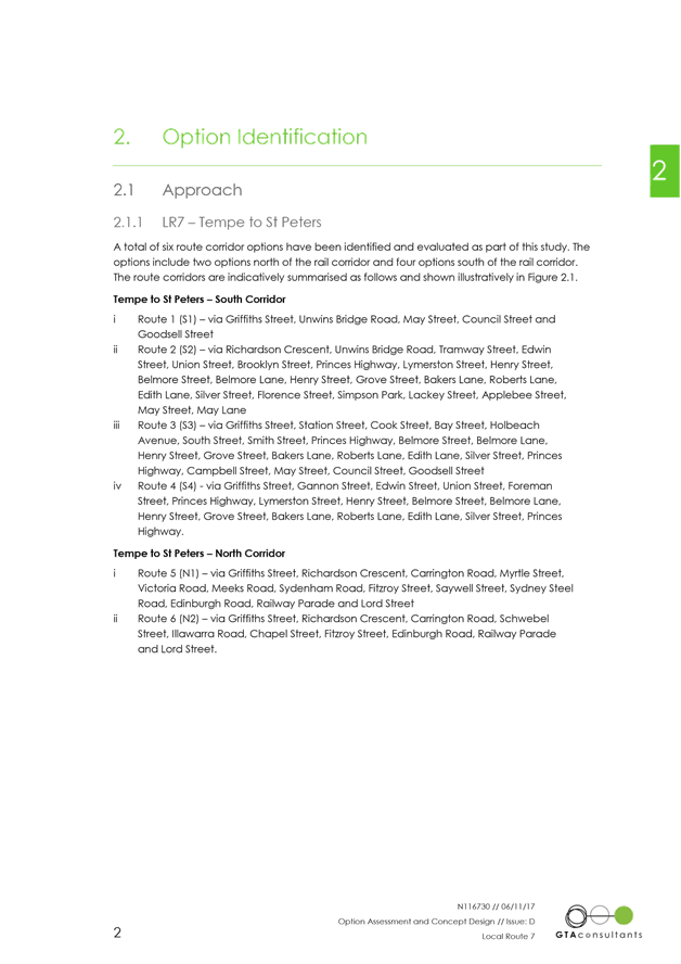
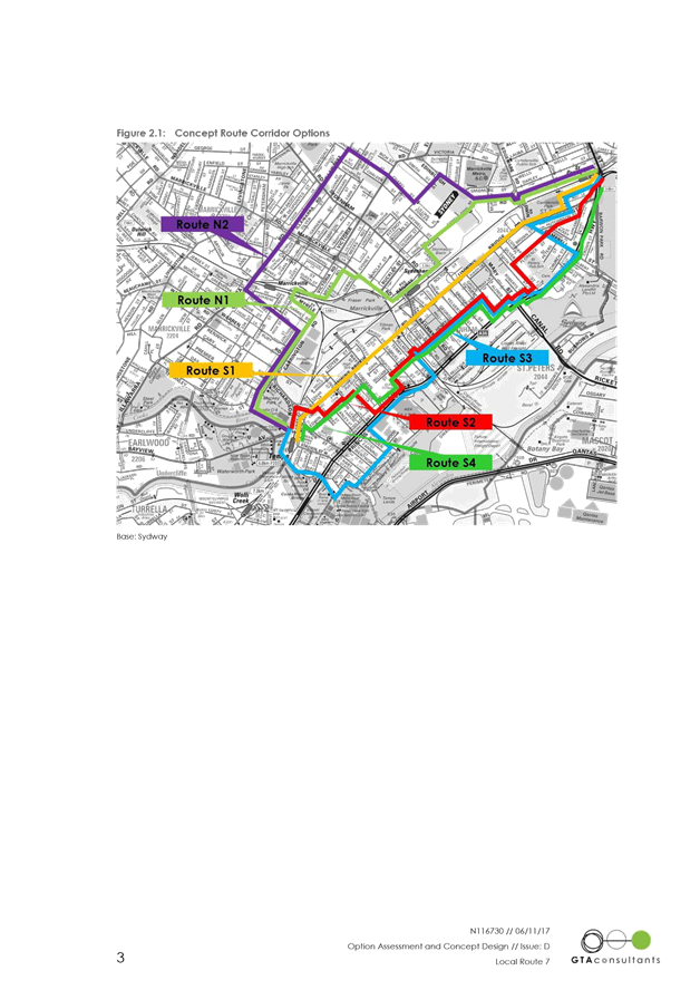
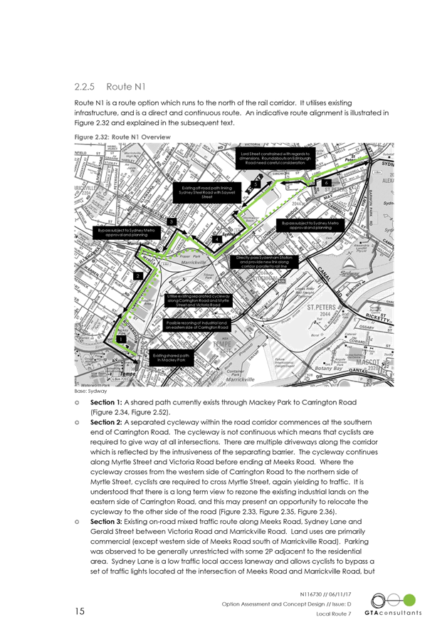
As part of the route assessment Council developed two LR7 options draft concept plans for two bicycle route options, a ‘Northern Route’ option via Sydney Steel Road connecting to Carrington Road and a ‘Southern Route’ option via Henry Street. However feasibility of the northern route is not reliable at this moment due to many uncertainties along the route.
· Although there is always room for improvement, we believe that the web page is user friendly. However, Council would continue to working on its improvement. |
|
The LR7 cycle way route is too slow for commuters and instead along Henry St should go along Unwins Bridge Rd.
|
RMS has advised it would not support the development of a bicycle route on Unwins Road Bridge due to insufficient road width and likely impacts to regional road traffic associated with providing appropriate bicycle infrastructure. As a result, alternative route options were considered. |
|
Why not instigate contra flow along Appleby Street for cyclists and therefore provide and easy and safe connection between station and school. |
Appleby Street has a narrow road, therefore, the introduction of a uni-directional cycleway (contra flow cycleway) would result in losing all parking along Appleby Street.
|
CONCLUSION
Although 68% of community submissions during public exhibition indicated support for proposed route improvements between St Peters and Tempe, it is acknowledged that not all community members along the route were supportive of the proposal, primarily due to concerns about the indirectness and legibility of the route, and pedestrian safety on proposed shared paths, particularly on Edwin Street. Council officers have sought to address the concerns raised through the consultation process, and issues raised during public exhibition have informed subsequent modifications to the concept plan.
The revised concept plan proposes bicycle route improvements that would encourage more local trips by bicycle by providing a safer and more pleasant link to local destinations including local schools, parks and train stations. The improvements also seek to acknowledge community concerns about on-street parking by minimizing impacts along the route. This report recommends that the revised concept plan be approved and detailed designs for the route be prepared.
|
1.⇩ |
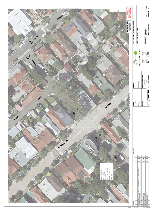
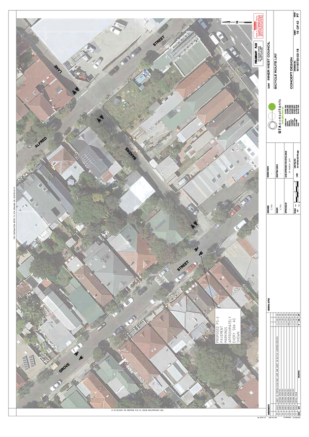
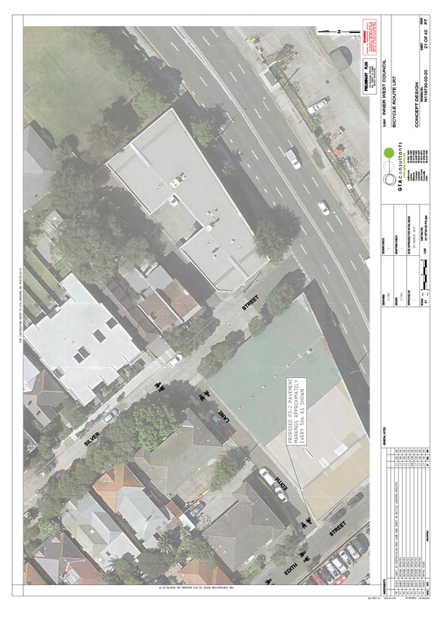
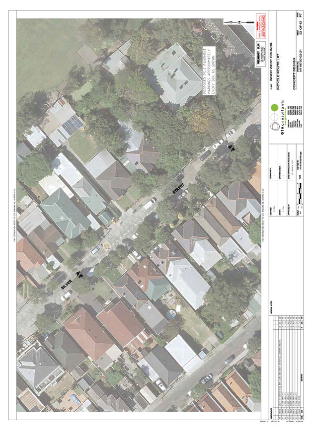
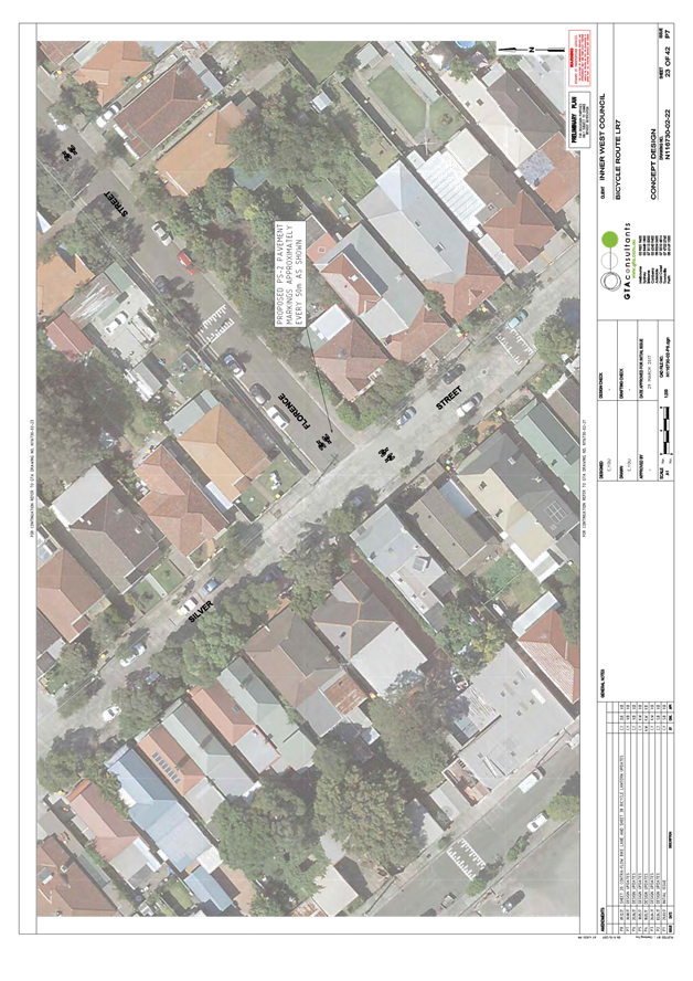
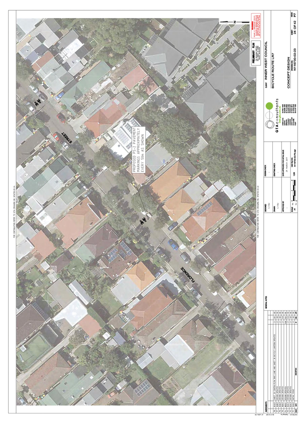
LR7- Revised plan 0.1-42 |
|
2.⇩ |
171106-N116730 Concept Design LR7 Final E |
|
3.⇩ |
LR7 - Public exhibition - CONSULTATION SUMMARY FOR TRAFFIC COMMITTEE REPORT |