|
AGENDA R |
Council Meeting
TUESDAY 27 MARCH 2018
6.30pm
|
|
Council Meeting 27 March 2018 |
Live Streaming of Council Meeting
In the spirit of open, accessible and transparent government, this meeting of the Inner West Council is being streamed live on Council’s website. By speaking at a Council meeting, members of the public agree to being recorded and must ensure their speech to the Council is respectful and use appropriate language. A person who uses defamatory, discriminatory or offensive language may be exposed to liability for which Council takes no responsibility. Any part of this meeting that is held in closed session will not be recorded
Pre-Registration to Speak at Council Meetings
Members of the public must register by 2pm of the day of the Meeting to speak at Council Meetings. If you wish to register to speak please fill in a Register to Speak Form, available from the Inner West Council website, including:
· your name;
· contact details;
· item on the Agenda you wish to speak to; and
· whether you are for or against the recommendation in the agenda.
Are there any rules for speaking at a Council Meeting?
The following rules apply when addressing a Council meeting:
· keep your address to the point, the time allowed for each speaker is limited to three minutes. This time limit applies, no matter how many items are addressed by the speaker;
· when addressing the Meeting you must speak to the Chairperson;
· only 3 speakers for and against an Agenda Item are allowed.
What happens after I submit the form?
Your request will then be added to a list that is shown to the Chairperson on the night of the meeting.
Where Items are deferred, Council reserves the right to defer speakers until that Item is heard on the next occasion.
Accessibility
Inner West Council is committed to ensuring people with a disability have equal opportunity to take part in Council and Committee Meetings. At the Ashfield Council Chambers there is a hearing loop service available to assist persons with a hearing impairment. If you have any other access or disability related participation needs and wish to know more, call 9392 5657.
Persons in the public gallery are advised that under the Local Government Act 1993, a person may NOT tape record a Council meeting without the permission of Council.
Any persons found recording without authority will be expelled from the meeting.
“Record” includes the use of any form of audio, video and still camera equipment or mobile phone capable of recording speech.
An audio recording of this meeting will be taken for the purpose of verifying the accuracy of the minutes.
|
|
Council Meeting 27 March 2018 |
|
PRECIS |
1 Acknowledgement of Country
2 Apologies
3 Notice of Webcasting
4 Disclosures
of Interest (Section 451 of the Local Government Act
and Council’s Code of Conduct)
5 Moment of Quiet Contemplation
6 Confirmation of Minutes PAGE
Minutes of 13 March 2018 Council Meeting 5
5 Mayoral Minutes
Nil at the time of printing.
6 Staff Reports
ITEM PAGE
C0318 Item 1 A Healthier Inner West 19
C0318 Item 2 Supporting Our Creative Communities 25
C0318 Item 3 Haberfield Town Centre - Notice of Motion 31
C0318 Item 4 Public Advocacy Callan Park 72
C0318 Item 5 Yeo Park & Gough Reserve, Ashfield - Plan of Management 83
C0318 Item 6 Draft Remediation of Land State Environmental Planning Policy and Guidelines (to replace SEPP No. 55 - Remediation of Lands) 122
C0318 Item 7 Bangla New Year's Day Festival - Request to Hold Event at Tempe Reserve - Further Report 215
C0318 Item 8 IWC Grants Program: Overview of Criteria and Processes 217
C0318 Item 9 Bulk Transfer of Nominated General Staff Update 258
C0318 Item 10 Inner West Council Position on the Cruise Ship Terminal 263
C0318 Item 11 Local Traffic Committee Meeting held on 6 March 2018 309
C0318 Item 12 Investment Report as at 28 February 2018 339
7 Notices of Motion
ITEM PAGE
C0318 Item 13 Notice of Motion: Planning 371
C0318 Item 14 Notice of Motion: Late Registration at Ordinary Council Meetings 372
C0318 Item 15 Notice of Motion: Listing of Policy Documents for Councillors 374
C0318 Item 16 Notice of Motion: Minister’s Award in Local Government 375
C0318 Item 17 Notice of Motion: Councillor Access to Media Services 376
C0318 Item 18 Notice of Motion: Marion Street Cottages 377
C0318 Item 19 Notice of Motion: Adani Coal Mine 379
C0318 Item 20 Notice of Motion: Impacts of Infrastructure Projects on Annandale 380
C0318 Item 21 Notice of Motion: Committees 382
C0318 Item 22 Notice of Motion: Multicultural Policy 384
8 Questions From Councillors
ITEM PAGE
C0318 Item 23 Question on Notice: Staffing Matters 385
9 Reports with Confidential Information
Reports appearing in this section of the Business Paper are confidential in their entirety or contain confidential information in attachments.
The confidential information has been circulated separately.
ITEM PAGE
C0318 Item 24 Balmain Telstra Building and Public Space Project 389
|
|
Council Meeting 27 March 2018 |
Minutes of Ordinary Council Meeting held on 13 March 2018
Meeting commenced at 6.33pm
|
Present: |
|
|
Darcy Byrne Julie Passas Marghanita Da Cruz Lucille McKenna OAM Colin Hesse Sam Iskandar Tom Kiat Pauline Lockie Victor Macri Rochelle Porteous Vittoria Raciti John Stamolis Louise Steer Anna York Elizabeth Richardson |
Mayor Deputy Mayor Councillor Councillor Councillor Councillor Councillor Councillor Councillor Councillor (6.42pm) Councillor Councillor Councillor Councillor General Manager A/Deputy General Manager Assets and Environment |
|
Michael Tzimoulas |
Deputy General Manager Chief Financial and Administration Officer |
|
John Warburton David Birds Wal Petschler Nellette Kettle |
Deputy General Manager Community and Engagement Group Manager Strategic Planning Group Manager Roads, Footpaths, Traffic and Stormwater Group Manager Civic and Executive Support, Integration, Customer Service and Business Excellence |
|
John Stephens Ian Naylor Darcie Huisman |
Manager Traffic and Transport Services Manager Civic and Executive Support Business Paper Support Officer (Minute Taker) |
APOLOGIES AND LEAVE OF ABSENCE:
Motion: (McKenna OAM/Steer)
THAT Council grant leave of absence for Clr Drury and accept apologies for lateness for Clr Porteous.
Motion Carried
For Motion: Crs Byrne, Da Cruz, Hesse, Iskandar, Kiat, Lockie, Macri, McKenna OAM, Passas, Raciti, Stamolis, Steer and York
Against Motion: Nil
Absent: Cr Porteous
DISCLOSURES OF INTERESTS:
Clr Lockie declared a non-significant, non-pecuniary conflict of interest in Item 9 - Notice Of Motion: Pride Seats - Celebrating Council’s Support Of Marriage Equality And LGBTQI Rights as she went to school with the Marketing Manager of Street Furniture Australia. Any benefit from this motion is by way of a donation to Council and the community.
Motion: (Hesse/Da Cruz)
That Council note the disclosures of interests.
Motion Carried
For Motion: Crs Byrne, Da Cruz, Hesse, Iskandar, Kiat, Lockie, Macri, McKenna OAM, Passas, Raciti, Stamolis, Steer and York
Against Motion: Nil
Absent: Cr Porteous
Clr Porteous entered the meeting 6.42pm
|
|
|
THAT Items 7 and 11 be brought forward and be dealt with at this time.
Motion Carried For Motion: Crs Byrne, Da Cruz, Hesse, Iskandar, Kiat, Lockie, Macri, McKenna OAM, Passas, Porteous, Raciti, Stamolis, Steer and York Against Motion: Nil |
|
|
|
THAT the speaker be given an extension of time of two minutes.
Motion Tied For Motion: Crs Da Cruz, Hesse, Kiat, Lockie, Porteous, Stamolis and Steer Against Motion: Crs Byrne, Iskandar, Macri, McKenna OAM, Passas, Raciti and York
The Mayor, Councillor Byrne, used his Casting Vote against the MOTION and the MOTION was lost. |
ADJOURNMENT
7.24pm – The Mayor, Councillor Byrne, adjourned the meeting for a short recess
7.29pm – The Mayor, Councillor Byrne, resumed the meeting
ADJOURNMENT
7.35pm – The Mayor, Councillor Byrne, adjourned the meeting for a short recess
7.42pm – The Mayor, Councillor Byrne, resumed the meeting
|
|
|
THAT standing orders be resumed. Motion Carried For Motion: Crs Byrne, Da Cruz, Hesse, Iskandar, Kiat, Lockie, Macri, McKenna OAM, Passas, Porteous, Raciti, Stamolis, Steer and York Against Motion: Nil |
Councillor Kiat left the Meeting.
Councillor Kiat returned to the Meeting.
Councillor Raciti left the Meeting.
Councillor Raciti returned to the Meeting
|
THAT Council:
a) Councillors and Mayor are elected representatives and as such are required to represent their constituents and communicate with them; b) Any media/social media policy will need different policies for staff than for the Councillors/Mayor. Volunteers should have also have different media protocol; c) Any media/social media policy needs to adhere to Freedom of political communications which are recognised under the Australian Constitution. These freedoms mean Councillors must be free to speak to the community through all communication channels including traditional and social media. They also mean Councillors have a right to express their own opinions on any decision of council and to talk freely to the media and constituents; d) Debate both inside and outside the council chambers is how democracy works. The Media/Social Media policies need to encourage that debate and engagement in local democracy in the media and social media not unintentionally shut it down; e) The Model Code of Conduct and newly adopted Code of Meeting practice sit alongside the Media/Social Media policies they should not sit within the Media/Social Media policies. Councillors are aware or should make themselves aware of their obligations under the Code of Conduct and Code of meeting practice and adhere to them as required; and f) Council’s Communication policies need to be focused on developing a rich, respectful democratic environment both inside and outside the council chambers which presents different points of view and encourages dialogue, debate and engagement of the community with Council.
Motion Carried For Motion: Crs Byrne, Iskandar, Lockie, Macri, McKenna OAM, Passas, Raciti, Stamolis and York Against Motion: Crs Da Cruz, Hesse, Kiat, Porteous and Steer
|
CONFIRMATION OF MINUTES
|
That the Minutes of the Council Meeting held on Tuesday, 27 February 2018 be confirmed as a correct record. Motion Carried For Motion: Crs Byrne, Da Cruz, Hesse, Iskandar, Kiat, Lockie, Macri, McKenna OAM, Passas, Porteous, Raciti, Stamolis, Steer and York Against Motion: Nil |
|
THAT:
1. The report be received and noted;
2. Council approves the budget adjustments required; and
3. That an executive summary be provided in future reports.
Motion Carried For Motion: Crs Byrne, Da Cruz, Hesse, Iskandar, Kiat, Lockie, Macri, McKenna OAM, Passas, Porteous, Raciti, Stamolis, Steer and York Against Motion: Nil |
Councillor Passas left the Meeting.
Councillor Passas returned to the Meeting.
|
|
|
The foreshadowed Motion lapsed. |
Clr Passas retired from the meeting 11.03pm.
Meeting closed 11.05pm.
CHAIRPERSON
The Mayor, Councillor Darcy Byrne
Public Speakers:
|
Item #
|
Speaker |
Suburb |
|
Item 7: |
John Lozano Cherie Thompson Alice Kershaw |
Haberfield Dulwich Hill Rozelle |
|
Item 11: |
Anne Picot Ngaire Worboys |
St Peters St Peters |
|
|
Council Meeting 27 March 2018 |
Subject: A Healthier Inner West
Prepared By: Cathy Edwards-Davis - Group Manager Trees, Parks and Sports Fields and Josephine Bennett - Group Manager Recreation and Aquatics
Authorised By: Elizabeth Richardson - Deputy General Manager Assets and Environment
|
SUMMARY This report addresses the Council resolution to investigate opportunities for the Inner West Council to improve the health of our residents by increasing opportunities to engage in community sport and recreation.
|
|
RECOMMENDATION
THAT:
1. Council invest $65 million in park and aquatic capital facilities over the next three years, subject to the development and adoption of the 2018/2019 Budget;
2. Council appoint an Office of Sport Coordinator to assist and partner local sporting clubs and organisations to strategically address community health and wellbeing and actively promote this service and that the position be funded as part of the 2018/2019 budget process;
3. The Recreation & Aquatics Service Unit and Office of Sport Coordinator strategically partner with the sporting clubs and key partners to increase participation of girls, women, people from lower socio economic backgrounds and people with disabilities as informed by the Recreation Needs Study: A Healthier Inner West;
4. Council progress the Recreation Needs Study: A Healthier Inner West to investigate the need and best location for hockey and netball facilities; and
5. Council progress the development of the Inner West Sporting Ground Allocation Policy, in consultation with the sporting clubs and that the draft Policy be reported back to Council for adoption.
|
BACKGROUND
At the Extraordinary Council Meeting on the 31 October 2017 it was resolved:
THAT for the February 2018 meeting the General Manager provide reports on how Council can:
1. Invest $65 million over the next 3 years in sporting fields, parks, playgrounds and pools to deliver the highest-quality facilities for local families and clubs and that this be informed by the results of the Inner West Council Recreation Needs Study;
2. Establish an Inner West Office of Sport to provide assistance to clubs and transform the Council’s relationship with sporting clubs from one based on ground hire only into a strategic partnership to improve the health and wellbeing of our community;
3. Work with clubs to identify bold targets for increasing the participation of women and girls across all sports and implement ways of increasing participation from people from lower socio-economic backgrounds;
4. Establish new netball courts, of which there are too few, and the first hockey field in the Inner West Council area; and
5. Provide for longer tenure on home grounds to allow clubs and Council to jointly apply for state and federal grants to upgrade sporting fields and to have a revised booking field system that acknowledges clubs have longer lead times in preparation for seasons.
These five matters are addressed in the report below.
1. Invest in High Quality Facilities
Council’s Operational Plan identifies the following investment in parks and recreation facilities over the next three years:
|
Capital Program |
2017/18 (‘000) |
2018/19 (‘000) |
2019/20 (‘000) |
2020/21 (‘000) |
|
Park Capital Program |
|
|
|
|
|
Parks Capital and Assets Capital |
6,418 |
6,482 |
4,592 |
7,484 |
|
Steel Park Priority 1 and 2, paths, lighting and landscaping |
0 |
450 |
0 |
0 |
|
Cooks River Foreshore and Warren Park water and biodiversity |
0 |
380 |
0 |
0 |
|
Petersham Park entry, path, seating and landscape upgrade |
316 |
0 |
0 |
0 |
|
Camperdown Park picnic, play area, basketball court upgrade |
280 |
0 |
0 |
0 |
|
Sydenham Green Stage 2 basketball court and lighting upgrade |
706 |
0 |
0 |
0 |
|
Glover Street Playing Field - Field and baseball Cage upgrade |
43 |
0 |
0 |
0 |
|
Illoura Reserve Upgrade |
356 |
93 |
75 |
0 |
|
Mort Bay park Upgrade |
215 |
130 |
0 |
0 |
|
Playground Upgrades and Improvements |
0 |
0 |
140 |
960 |
|
Waterfront Drive Upgrade |
440 |
1,260 |
0 |
0 |
|
Hammond Park - Fencing renewal/upgrade |
30 |
0 |
90 |
103 |
|
Darrel Jackson Gardens - New Irrigation/drainage |
170 |
0 |
0 |
0 |
|
Ashfield Park Lighting upgrade |
0 |
590 |
0 |
0 |
|
Petersham Park staged upgrade |
871 |
0 |
0 |
0 |
|
Greenway capital budget |
300 |
6,421 |
3,200 |
1,800 |
|
Greenway Missing Links N, J, H and I |
580 |
1,470 |
0 |
0 |
|
Skate Park in Callan Park - Construction |
484 |
400 |
0 |
0 |
|
Way Finding through the Gadigal-Wangal |
60 |
240 |
0 |
0 |
|
Camperdown Park seating terraces and bleacher renewal |
327 |
0 |
0 |
0 |
|
Sea Walls Capital |
241 |
69 |
614 |
554 |
|
Wharves Capital |
234 |
0 |
96 |
87 |
|
Total Parks |
12,071 |
17,985 |
8,807 |
10,988 |
|
Aquatic Capital Program |
|
|
|
|
|
Leichhardt Park Aquatic Centre redevelopment works |
0 |
0 |
300 |
2,808 |
|
Dawn Fraser Pool upgrade works |
534 |
1,082 |
758 |
41 |
|
Ashfield Aquatic Centre - Upgrade works |
5,000 |
14,000 |
4,500 |
0 |
|
Total Aquatic |
5,534 |
15,082 |
5,558 |
2,849 |
|
TOTAL Parks & Aquatic Recreation Facilities |
17,605 |
33,067 |
14,365 |
13,837 |
Over the next three years, Council intends to invest over $65 million in parks and aquatic recreation facilities. The above program of works may change somewhat, following community engagement and subject to Council adoption of future budgets.
2. Assistance and Partnership Development with Sporting Clubs
The Council resolution identifies the need for Council to lead the development of a Healthier Inner West by providing the following:
· Advance the health of our residents by increasing their opportunities to engage in community sport and recreation to combat the threat of increasing incidence of lifestyle related diseases such as diabetes, cardiovascular disease and obesity.
· Promote and encourage a healthy lifestyle for school age children specifically and the community generally through sports participation. Work with local community sporting bodies to increase participation levels in sport for people from lower socio-economic backgrounds to remove economic or social barriers.
· Transform the Council’s relationship with sporting clubs from one based on ground hire only into a strategic partnership to improve the health and wellbeing of our community. Work with local clubs to set ambitious targets for increasing the participation of women and girls in sport.
· Drive participation in community sport, which helps to build our community, community cohesion and social wellbeing. Encourage community sports clubs, which are the largest network of volunteers in our community, and ensure they get the recognition, support and investment they need.
It is proposed to create the position of Office of Sport Coordinator to work strategically with sporting clubs to achieve these operational and strategic objectives. The Office of Sport Coordinator will liaise with local sporting clubs and relevant Council officers, regarding:
· Using Parks and Sportsgrounds
- Seasonal Hire
- Casual Hire
- Commercial Fitness Training
- Lighting
- Sportsfield maintenance
- Building maintenance
· Assistance for Clubs
- Council grants
- Assistance applying for grants
- Club development including volunteer support, capacity building
· Sports Forum
· Policy and Planning
- Recreation Needs
- Sports Ground Allocation Policy
· Other resources
- ClubSpot
- RecPost
· A liaison point to Trees, Parks & Sportsfields – sportsfields allocations (seasonal and casual bookings), sportsfield lighting, parks planning and master planning, capital works within parks, assistance with the preparation of grant applications to external bodies.
· A liaison point to Recreation & Aquatics – water-based sports activities, strategic recreation matters including increasing participation in sports and the need for new facilities, and awareness of and assistance with grant funding opportunities.
· A liaison point to Properties, Major Building Projects & Facilities – maintenance matters for buildings within parks, cleaning of buildings/ facilities within parks, and leasing and licencing of parks/ sportsfields (greater than one season).
In order to promote the newly appointed Office of Sport Coordinator, , it is proposed that the Coordinator develop and implement a community engagement strategy, which will allow the Office of Sport to reconnect and build stronger relationships with the clubs, including:
· Dedicated section on Inner West Council website;
· Mail out to all local sporting and recreation organisations promoting the service in detail;
· Follow-up meetings with clubs;
· Updates through the Inner West Sports Forum, which meets at least twice per year; and
· Dedicated online resource providing email support, training for volunteers and template documents (checklists, letters etc.)
It is proposed that the Office of Sport Coordinator be temporarily appointed for a trial period of two years initially. The effectiveness and success of the Office of Sport will be evaluated at the end of the two year period to determine whether to continue the service.
3. Targets to Increase Participation
Council is currently working with CRED Consulting on the Inner West Recreation Needs Study. It is proposed that this study be titled ‘Inner West Recreation Needs Study: A Healthier Inner West’ and be used to provide the evidence base for the Inner West Recreation Policy: A Healthier Inner West. The Policy and Strategy would detail Council’s commitment to and plan for the development of programs and services to meet the needs of identified target groups including a focus on increasing participation for girls, women, people from lower socio economic backgrounds, people with disabilities.
In conjunction with the Recreation and Aquatics team, the Office of Sport Coordinator would work strategically with local sports clubs and other key partners to actively increase the participation of girls, women, people from lower socio economic backgrounds and people with disabilities.
The Office of Sport Coordinator will also develop a calendar of grant funding opportunities and promote awareness of this to sporting clubs and assist them with the development of applications for projects consistent with Council’s strategic objectives.
4. New Netball & Hockey Courts
There is $782,000 allocated in the budget for new netball courts at Richard Murden Reserve, Haberfield (formerly Darley Road). Community engagement on this project has been undertaken, and a report will be presented to Council shortly with a view to commence construction in early 2018/2019.
It is noted that the Tempe netball courts, within Tempe Reserve, are currently under-utilised. It is recommended the new Office of Sport Coordinator work with Netball NSW to investigate increased use of these facilities
The Inner West LGA does not currently have any hockey fields.
The Recreation Needs Study: A Healthier Inner West will include further investigation into the need and location for hockey fields and any additional netball courts.
Without wishing to foreshadow the outcome of the Recreation Needs Study, it is noted that rather than specialised hockey fields, a better outcome may be multi-purpose synthetic fields (hockey, soccer and other sports). This has been discussed with Hockey NSW who has indicated that this approach is consistent with their strategic direction and is supported by the Glebe Hockey Club. Staff will recommend that $200,000 be allocated in the 2018/2019 budget for the purposes of synthetic turf investigations.
5. Club Tenure on Home Grounds
There were various arrangements and policies across the three former Councils regarding the allocation of sportsfields. Some clubs have long term licences, including up to 21 years. Other clubs make park bookings on a seasonal basis. Some clubs in the Inner West have a history of playing at their home ground for over 100 years.
The Inner West has 297 hectares of open space (including Ballast Point and Callan Park) containing 29 publically accessible sporting grounds.
The Inner West Council has an average of 1.5 hectares per head of population. By comparison, the City of Sydney has 1.8 hectares per 1,000 residents and Canada Bay has 2.4 hectares per 1,000 residents.
The population of the Inner West is increasing, making it ever harder to meet the open space needs of the residents. This is of particular concern given the growing population living in high density housing and apartments.
In the context of the above statistics, there is a significant shortage of training space for clubs and a high level of demand for access. Many clubs have expressed that their desire for increased access to sporting grounds and this was expressed at the recent Sports Forum in November 2017 and through the recent winter allocation process.
Parks Planning & Engagement staff have commenced the preparation of an Inner West Sporting Ground Allocation Policy. The objective of the Policy is to provide the community with equitable access to sporting facilities through best practice governance standards, transparent decision making and a strong ethical culture. The first step in the development of this Policy is the development of a discussion paper which will outline the objectives. Councillors and the clubs will be engaged on this and a draft Policy developed and placed on public exhibition. Following the resulting amendments, it is intended that the Policy will go to Council for formal adoption.
The Inner West Sporting Ground Allocation Policy will look at issues such as club history at a ground, potential longer tenure for clubs and the process/ timing for seasonal bookings.
Former Marrickville Council had a Sports Ground Allocation Policy in place which allowed for longer club tenure proportionate to capital contribution toward facility upgrades. A similar provision will be investigated for the Inner West Policy.
FINANCIAL IMPLICATIONS
The position of Office of Sport Coordinator will cost approximately $120,000 including on costs per annum. It is recommended that the position be funded as part of the 2018/2019 budget process.
OTHER STAFF COMMENTS
This report has been prepared in collaboration by Trees, Parks and Sportsfields and Recreation and Aquatics staff. Properties, Major Building Projects and Facilities has been consulted in the development of this report.
PUBLIC CONSULTATION
As above, it is proposed that the Sports & Recreation Service Team meet individually with the various sports clubs and form strong collaborative relationships. There will be separate, specific engagement for the Recreation Needs Study: A Healthier Inner West and for the Inner West Sporting Ground Allocation Policy.
CONCLUSION
The report outlines a number of methodologies for Council to advance the health of Inner West residents by increasing their opportunities to engage in community sport and recreation. Some of these key methodologies include capital expenditure on park and aquatic recreation facilities, establishment of the Sport and Recreation Service Team, development and implementation of the Recreation Needs Study: A Healthier Inner West, and the Inner West Sporting Ground Allocation Policy.
|
|
Council Meeting 27 March 2018 |
Subject: Supporting Our Creative Communities
Prepared By: Amanda Buckland - Living Arts Manager
Authorised By: Erla Ronan - Group Manager Community Services and Culture
|
SUMMARY A Council resolution at the meeting of 31 October 2017 (C1017, Item 11) requested a report on Supporting Creative Communities addressing the following five items:
1. Bring Vivid Sydney to the Inner West; 2. Establish a Live Music Development Fund with $200 000 budget; 3. Bring arts and live music to the shop fronts, former factories, cafes and office blocks of the Inner West; 4. Make the Inner West Sydney’s street art capital with $500 000 budget; and 5. Expand the artist in residence program across the Inner West.
On 6 March 2018 officers briefed Council and presented EDGE as a framework to deliver this resolution and to showcase the Inner West as a creative community with a thriving economy and vibrant cultural sector. EDGE proposes whole of Council collaboration and partnerships with local arts and business sectors to pilot models for future legislative changes and area wide planning. EDGE is inclusive of all elements of the Supporting Creative Communities vision.
This report addresses Items 1 and 4. Items 2 and 3 will be the focus of a future report from Strategic Planning and Community Services and Culture. Item 5 will be addressed in a report from Property Services and Community Services and Culture as part of the Land and Property Strategy. |
|
RECOMMENDATION
THAT Council:
1. Endorse EDGE Inner West as a framework for authentic, collaborative, co curated programs unique to the Inner West;
2. Allocate $500,000 for EDGE street activations to seed and showcase strategic partnerships with local enterprises, create street activations and build sustainable partnerships across the Inner West;
3. Note that EDGE will showcase and sustain the creative economy as contributor to cultural diversity, social inclusion, environmental sustainability and technological advancement; and
4. Note that items 2, 3 and 5 of Resolution C 1017 item 11 will be addressed in forthcoming reports.
|
BACKGROUND
The inner west is the centre of Sydney’s independent arts scene with:
· the highest concentration of people working in the creative and cultural industries relative to population base in NSW (8.8%, profile.id, 2016)
· creative industries producing over $1.164 billion output in the inner west, which is 8% of output/ total sales, as compared to 5.2% in Greater Sydney (profile.id report, 2015)
· creative industries specialisations in a number of areas including the visual arts and music (2011 Census)
· over 100 creative spaces with artists, crafters, maker spaces, galleries and residencies and 15 music and performance venues
· Addison Road, Australia’s largest community centre supporting local arts and social justice activism.
1.Resolution C1017 Item 11: 1A. Bring Vivid Sydney to the Inner West
Council officers have consulted with senior staff in destination NSW to investigate operational and resource considerations. Expressions of Interest to participate in Vivid are submitted in November each year and require $500 000 to $800 000 financial commitment to Destination NSW. Additional in kind cost to Council for staff resourcing, planning approval, landowner consent, event management, infrastructure, insurance, waste and security would be in excess of $350 000 for a 23 day period in a single location. Vivid Music is $200 000 to activate a precinct and Vivid Ideas is $100 000 to host a talks program.
This approach is not recommended for Council and an alternative EDGE framework is proposed to achieve all elements of the resolution.
1. B Propose EDGE Inner West supporting creative communities
EDGE will see Council working collaboratively with the creative sector to develop initiatives, curate programs and produce lasting benefits. EDGE will
· connect existing activities, businesses and creatives to profile our distinct precincts and clusters.
· build partnerships that will sustain programs, enterprises, businesses and venues
· brand the inner west as the creative engine room of global Australia
· host more art, installations and projections on our streets, laneways and walls
· engage diverse demographics, multicultural and creative communities
· enhance the urban environment and stimulate night time economy
· highlight current creative spaces and secure more sustainable venues
· focus on our unique features to attract residents and visitors
· embed a shared vision across council to drive supportive legislation
· embody an authentic expression of the inner west
EDGE presents a series of activations across the LGA that respond to Council and community priorities. EDGE is responsive, place based, authentic and builds community and business partnerships through ongoing programs in key locations. EDGE will benefit local businesses and creatives, attract local audiences and expand the creative identity and profile for the Inner West. Activations may complement existing events or programs but will add a contemporary edge to engage local creatives, attract community participation, focus on assets and stories unique to the area and invite innovation in our iconic sites.
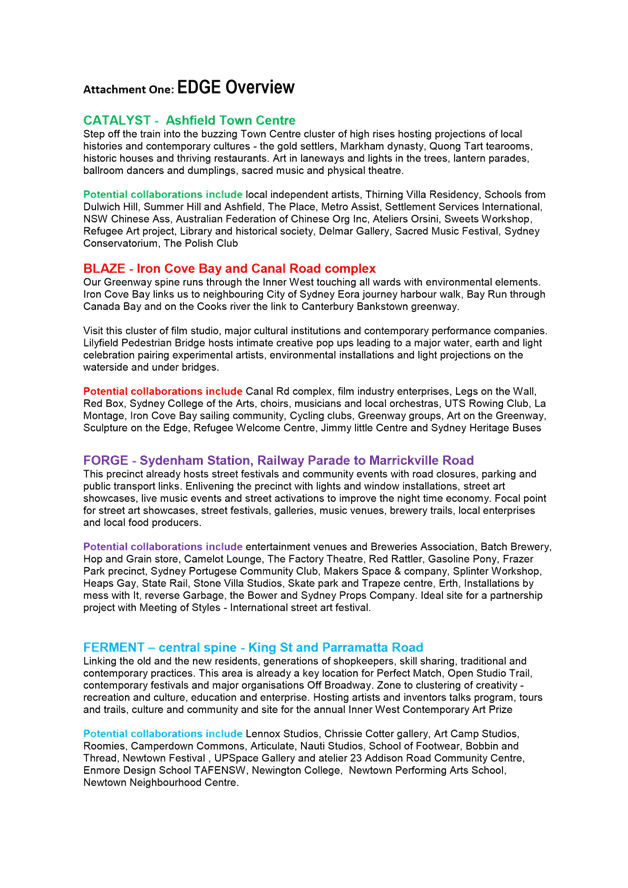
EDGE enables Council to collaborate in diverse precincts and formats. The first two year pilot proposes:
· CATALYST in Ashfield coinciding with the launch of the town centre upgrade and major residential and retail developments such as The PLACE. It links new programming, projection art, laneway activation and builds community content for signature events such as Carnival of Cultures.
· FORGE links Marrickville Road to Sydenham Station precinct highlighting music venues and community festivals, street art and activation, industrial and local heritage with contemporary practices, and music venues tours.
· BLAZE in Lilyfield Bridge, Iron Cove Bay links the Greenway with local venues and cultural sites of Red Box and Canal Road studios. Engaging community groups, bush care groups, local residents, arts venues, creative studios and leading edge creative organisations in the area.
· FERMENT King St and Parramatta Rd corridors of culture. Home to many venues, galleries, businesses, studios and the bubbling Off Broadway in the spine of the LGA. Focused artists and inventors talks program, tours and trails, education and enterprise culture and community and site for the annual Inner West Contemporary Art Prize.
Attachment One: EDGE Overview presents conceptual precinct based plans and indicative partnerships. These activations are fluid, flexible, more spontaneous and eclectic than the fixed date Council event program. They allow opportunities for groups and businesses to pop up and cluster activities for mutual benefit.
C1017 Item 11:2. Establish a Live Music Development Fund
EDGE proposes to partner with a range of local event organisers and venues on audience development, all ages activities and strategic programming during activations in each precinct. One constraint to live music delivery across a broader platform is planning regulation, which the forthcoming Inner West Council DCP offers the opportunity to address.
Strategic Planning, Economic Development and Community and Cultural Development will report on development and progressive implementation of the Live Music Development Fund, in the context of EDGE should Council adopt this proposal.
C1017 Item 11:3. Bring arts and live music to the shop fronts, former factories, cafes and office blocks of the Inner West.
EDGE proposes to trial activations in key precincts, which model partnerships that contribute to economic development and community cohesion. However, long term legislative change is required to effect sustainable creative industry activation.
A report from Strategic Planning and Community Services and Culture will address this item, in the context of EDGE as proposed.
C1017 Item 11:4. Make the Inner West Sydney’s street art capital.
EDGE positions Inner West as the leading cultural production incubator in Australia through its community curated programming and contemporary street activations.
EDGE will expand and promote the success of the highly acclaimed Perfect Match Contemporary Art program and Wall 2 Wall street art programs which requires increased investment and streamlined processes for approvals in conservation and heritage zones.
Current programs will expand into cutting edge street art in laneways and on rooftops with projections, international street artists, hip hop and parkour events, workshops, incubators and master classes. Council investment can build partnerships with State Rail, Transport NSW and Attorney General’s Department; as well as links to the International Meeting of Styles Festival which as yet has no official Australian partner.
Street art has become commonplace for many local governments and the Inner West as a pioneer has the expertise to lead the field and take our street activations to the next level. Light projections, virtual and augmented reality are cost effective options, which attract community engagement, cutting edge art forms and international attention.
C1017 Item 11:5. Expand the artist in residence program across the Inner West
As Greater Sydney is developed, industrial lands are being rezoned and artists are losing the multipurpose spaces they need to create, manufacture, transport, store and showcase their work. Affordable spaces are crucial to the continued incubation of creative businesses and individual artist in Sydney (Made in Marrickville, ARC project urban cultural policy and the changing dynamics of cultural production, August 2017)
Living Arts has identified potential spaces for short term co location of five artist spaces in Community and Cultural facilities. Potential for sharing of existing occupied and utilizing future vacant space is the subject of further investigation and longer term planning. This will be addressed in the Land and Property Strategy to be provided by Property, Major Building Projects and Facilities in consultation with Community and Cultural Services.
Council staff have identified that there is availability of vacant spaces suitable for art programs in non-council owned properties that are available to artists. Support programs from Council are being investigated. These options and any financial implications will be addressed in the forthcoming report to Council.
FINANCIAL IMPLICATIONS
EDGE will be delivered through the Living Arts Team in collaboration with other sections of council, realigning some existing programs as part of the service review. Contributions from aligning former council programs such as Perfect Match, Wall 2 Wall, Open Studio Trail, Open Festival, Site and Sound will contributing a current operational budget of $100,000.
Flagship Council projects such as the Greenway, Camperdown Commons, Marrickville Library, LPAC and other master planned areas will also benefit from EDGE creative input and community engagement. Realising the EDGE opportunity requires the investment of an additional $500 000 per annum proposed funding.
OTHER STAFF COMMENTS
Living Arts has undertaken preliminary consultation with staff and key stakeholders in Strategic Planning; Economic Development; Community Services and Culture; Parks and Recreation; Library and History Services; Communications, Engagement and Events; Destination NSW; Local creative and community sector.
PUBLIC CONSULTATION
Key stakeholder consultation to be undertaken following Council consideration.
CONCLUSION
EDGE provides impetus for activation of significant scale positioning the Inner West as a cultural leader in creative enterprise, community activation and local economic development.
EDGE provides:
· Strategic partnerships with local businesses, enterprises, community and cultural organisations
· Opportunity to lever funding and support from other major agencies both public and private
· Profiling and branding of Inner West’s unique creative enterprises and cultural innovations
A 2 year pilot EDGE will deliver
· two new activations run by Council linked to strategic projects and current funding and profiling local business
· two activations delivered in partnership with local businesses/associations with support from Council and other stakeholders
Comprehensive documentation and cross council input will review the EDGE models and programs in 2020.
|
1.⇩ |
Attachment One: EDGE Overview |
|
|
Council Meeting 27 March 2018 |
Subject: Haberfield Town Centre - Notice of Motion
Prepared By: Gill Dawson - Manager Strategy and Policy
Authorised By: David Birds - Group Manager Strategic Planning
|
SUMMARY The purpose of this report is to update on responses being developed to C0218 Item 10 Notice of Motion: Upgrade and Beautification of Haberfield Main Street / Shopping Village from the Council Meeting of 13 February 2018 which requested:
1. Council develop a holistic strategy for the Haberfield town centre, taking into account public domain master planning, streetscape improvements and economic sustainability. 2. Officers provide a report in March 2018 outlining process, timelines and indicative costs for the development and implementation of the strategy. 3. Council produce a report identifying the underlying local economic challenges and drivers of economic sustainability in Haberfield and other centres that are facing difficulties within the LGA. 4. That priority is given in the 2018/2019 budget for those strips which have received little or no upgrading in the last twenty years.
Council is developing an Economic Development Strategy for the whole of the Inner West LGA which will set the strategic context for the identification of specific Council work to support local centres and businesses. Council also seeks to take a strategic approach to the management and upgrading of public infrastructure in its centres through planning for infrastructure renewal. In this way Council aims to ensure that resource allocation is prioritised strategically and public infrastructure is upgraded or replaced when its asset life has expired. Consideration will continue to be given to the development of a holistic strategy for the Haberfield town centre in the context of this strategic work which will, in turn, inform the strategy.
This report refers to the potential process, timelines and indicative costs for a strategy for Haberfield town centre. No budget allocation has been made for a strategy at present. This report also refers to reports that consider the underlying local economic challenges and drivers of economic sustainability in Haberfield and other centres within the LGA. |
|
RECOMMENDATION
THAT the report be received and noted. |
BACKGROUND
This report responds to Council’s Notice of Motion resolution C0218 Item 10, dated 13 February 2018 which requested:
1. Council develop a holistic strategy for the Haberfield town centre, taking into account public domain master planning, streetscape improvements and economic sustainability.
2. Officers provide a report in March 2018 outlining process, timelines and indicative costs for the development and implementation of the strategy.
3. Council produce a report identifying the underlying local economic challenges and drivers of economic sustainability in Haberfield and other centres that are facing difficulties within the LGA.
4. That priority is given in the 2018/2019 budget for those strips which have received little or no upgrading in the last twenty years.
MATTERS FOR REVIEW – NOTICE OF MOTION
The matters requested in the Notice of Motion are addressed below.
1. Council develop a holistic strategy for the Haberfield town centre including public domain master planning, streetscape improvements and economic sustainability.
The Haberfield town centre is part of a network of town centres across the LGA. Council aims to take a strategic approach to the management and upgrading of public infrastructure in its centres through planning for infrastructure renewal. In this way Council seeks to ensure that resource allocation is prioritised strategically and public infrastructure is upgraded or replaced when its asset life has expired.
The Haberfield town centre is a heritage village, with limited public transport options and is not experiencing the substantial local population growth being experienced by many other centres, where medium to high density housing developments are occurring.
As part of its role of helping to support retail precincts to help attract more visitors and to support local business growth, Council carried out a $2.5 million upgrade to Haberfield town centre in 2015-16 to help enhance its appearance.
In 2017 Council allocated a one off business support package valued at $30,000 to help Haberfield business owners overcome the reduction of trade being experienced due to the impact of road closures from the Westconnex project. Council’s Economic Development Unit developed a marketing package in consultation with local businesses. This was rolled out over a number of months and included a range of components to help ensure the best possible outcomes were achieved to regenerate interest in the area. This initiative included rebranding the area as Haberfield Heritage Village.
Council is developing an Economic Development Strategy for the whole of the Inner West LGA which will set the strategic context for the identification of specific Council work to support local centres and businesses. The Economic Development Strategy will set the context for, and help inform, master planning for town centres in the Inner West, including Haberfield town centre. The masterplanning will, in turn, need to consider broader public domain planning.
Council is also aiming to develop a public domain study for the Inner West to present a framework for upgrading all public domain areas, including town centres. The strategy would address community needs including:
· socialisation;
· recreation;
· active transport;
· commerce; and
· changing use arising from increased population growth.
The strategic work noted above will provide the framework for the development of a detailed holistic strategy for Haberfield town centre and the consideration of its programming. The programming and other details of the strategy are examined in the following section.
2. Officers provide a report in March 2018 outlining process, timelines and indicative costs for the development and implementation of the strategy.
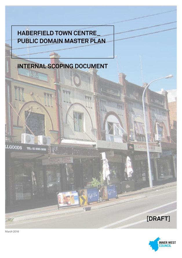
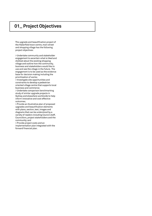
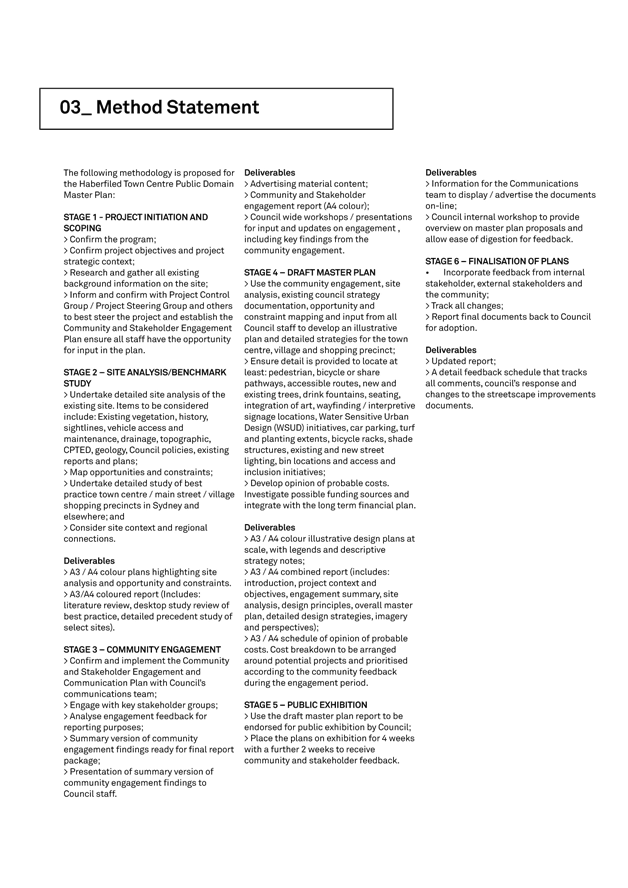
In response to the Notice of Motion, a document outlining an initial draft potential scope of work, proposed process, project deliverables, and project implementation for the development of a public domain masterplan for Haberfield town centre has been prepared (Attachment 1). This would include the development of streetscape and other potential improvements to enhance economic sustainability.
Preparation of the public domain masterplan would be likely to take approximately 12 months, including community engagement and public exhibition, and would require a budget of approximately $60,000. There is currently no budget allocation for this work. The implementation of works identified in the strategy would need to be the subject of a further budget allocation as there is no such allocation made at present.
Bringing forward this work for Haberfield town centre without additional funding being allocated would necessitate delaying the completion of a number of current established projects and would need to be the subject of a further report to Council.
3. Council produce a report identifying the underlying local economic challenges and drivers of economic sustainability in Haberfield and other centres that are facing difficulties within the LGA.
An analysis of the Inner West economy has been prepared by Council staff (Attachment 2). This analysis is not intended to critically examine individual business centres, but rather provide a snapshot of the economic drivers that determine the health of traditional main streets and strip shopping centres.
The economic analysis defines the drivers of retail as population, employment and low debt to earnings ratio. The Inner West has a growing population, strong employment figures and a high proportion of households (39%) with a weekly income of $2,000 or more. This translates into a strong customer base, people with jobs and good levels of disposable income as the key success factors for retail main street and strip shopping centres. The analysis notes that business growth and sustainability is most likely to occur through partnership working with multiple stakeholders, and when there is a willingness from business owners to embrace the ever changing landscape of retail and consumer demands.
In 2017 Council had an Inner West Economic Overview prepared by the Stafford Group (Attachment 3). This report acknowledged that the projected ongoing economic growth in the Inner West Council area is well supported by its strategic geographic location, which drives demand for residential property and is very appealing to a broad demographic sector looking for a place to live, work, and invest.
The report notes that the Inner West produces a GRP of $10.13 billion dollars, which represents 1.9% of the GSP. It has 18,155 local businesses registered for GST. Local businesses include a wide range of professional services, niche manufacturing and higher-value creative/technology providers that underpin a strong and diverse local economy.
The economy is driven by its diversity and the energetic business operators who are responding to the changing face of retail. The area attracts innovative and creative industries which are interspersed within traditional shopping strips and urban centres. Inner West industrial areas are going against national trends, with a thriving manufacturing sector that is still the largest employer in the suburb of Marrickville.
Haberfield
The Economic Development Unit undertook an audit of businesses in the Haberfield CBD (Ramsey & Dalhousie Streets) on 16 January 2018. There were 84 business premises of which 75 were occupied, 2 were leased and awaiting occupation and 7 were vacant. This equates to a vacancy rate of 8.3%. Another property with covered windows appeared to be occupied. If that property is removed the effective vacancy rate was 7%.
The generally accepted optimum vacancy rate for main street and strip shopping centres is considered to be around 5%, as it allows for the entry of new and diverse businesses.
Economic Development Strategy
Council is focused on providing a clear direction for the effective management of economic development across the LGA. Consequently, the Economic Development Unit, as part of its core operations, is developing an Economic Development Strategy to act as a framework to identify priorities that have the greatest potential for strengthening the local economy. A fundamental premise of the development of an Economic Development Strategy is to listen to and engage with existing businesses, local chambers and stakeholders to better understand and plan for their needs, to help enable the Inner West’s economic base to grow in a competitive and sustainable way.
Business growth and sustainability generally occurs when there is a willingness from business owners to understand and adapt to new ways retail operates and evolve to retain existing customers and attract new ones. Council’s Economic Development Unit supports economic sustainability by assisting businesses to develop and grow through a range of facilitation services, the development of partnerships with other levels of government and by supporting activation and promotion of local business centres.
The Economic Development Unit also offers to facilitate strategic planning sessions for local business chambers or associations to enable them to develop customised plans, thereby providing them with a framework to achieve the goals and objectives agreed upon for their individual business centres.
In the case of Haberfield town centre, or any other centre for which a new strategy is required, the Economic Development Unit would work with local businesses and their organisations to help develop a strategy that becomes a local solution tailored to build on the existing strengths and characteristics of the centre and related opportunities for business development that would be identified in collaboration.
4. That priority be given in the 2018/2019 budget for those strips which have received little or no upgrading in the last twenty years.
Council is currently undertaking the development of the 2018/19 budget and the prioritisation of centres that have received little or no upgrading in the last 20 years can be considered under this process.
FINANCIAL IMPLICATIONS
The development of a public domain masterplan for Haberfield town centre which would form the basis of a holistic strategy for the centre, including the development of streetscape and other potential improvements to enhance economic sustainability, would cost approximately $60,000. There are no funds allocated for this in the current 2017/18 budget and this would need to be the subject of a future budget allocation.
No current allocation exists for the implementation of any works that may be identified in a new strategy and these would also need to be the subject of a further new budget allocation.
OTHER STAFF COMMENTS
The Recreation and Aquatics Group, Finance Group and Footpaths, Roads, Traffic and Stormwater Group of Council have been consulted in the preparation of this report.
PUBLIC CONSULTATION
Nil.
CONCLUSION
Council is focused on providing a clear direction for the effective management of economic development across the LGA through the development of an Economic Development Strategy that will act as a framework to identify priorities that have the greatest potential for strengthening the local economy. A holistic strategy for Haberfield town centre will be developed in the context of this wider strategic work.
|
1.⇩ |
Haberfield Master Plan Scoping Document |
|
2.⇩ |
IWC Economic Driver Analysis Report |
|
3.⇩ |
IWC Economic Overview 2017 |
|
Council Meeting 27 March 2018 |
Subject: Public Advocacy Callan Park
Prepared By: Aaron Callaghan - Parks Planning and Engagement Manager
Authorised By: Cathy Edwards-Davis - Group Manager Trees, Parks and Sports Fields
|
SUMMARY This report provides Councillors with background information relating to the development of the Draft Callan Park Master Plan and Trust Model by the former Leichhardt Council and the current status of these plans.
The report provides Council with an update on the key themes resulting from the public meeting held on the 15th February 2018 and importantly the relationship of these key themes to the Draft Callan Park Master Plan.
The NSW Government has recently commenced work on the development of a Landscape Structure Plan for Callan Park. The scope and limitations of this project is also outlined in the report.
|
|
THAT Council:
1. Note the outcomes of the Callan Park Public meeting held on the 15th February 2018 and the community support for the adoption of the Callan Park Master Plan and Trust model;
2. Formally write to the NSW Government seeking clarification on the extent of the Landscape Structure Plan and request that Government extend any planning framework to include the whole of Callan Park and to encompass the recommendations from Council’s Draft Master Plan and Trust model;
3. Formally seek clarification from the NSW Government on those elements of the 2011 Master Plan which are not supported by Government and the rational for non-support;
4. Formally request that Government include in its Landscape Structure Planning framework a funding model with prioritised key development proposals within the park and consideration of a Community Trust model for the future management of Callan Park; and
5. Request that the development of the Landscape Structure Plan include extensive community engagement.
|
BACKGROUND
Callan Park is large parkland at Iron Cove in Lilyfield. Consisting of 61 hectares and equivalent to the size of the Sydney Botanical Gardens, Callan Park is one of the largest and most regionally significant public facilities in Sydney’s Inner west. Built as an enlightened hospital for the insane in 1885, it has a number of exceptional heritage buildings. Formally known as Rozelle Hospital, in 2008, all services and remaining patients were transferred to Concord Hospital. The Government agent responsible for day to day management of the site is the Office of Environment and Heritage.
Callan Park Master Plan
On 19 July 2011, the former Leichhardt Council approved the Callan Park Master Plan, the Callan Park Conservation Management Plan and the Callan Park Plan of Management. These Plans were formally presented to the State Government on 11 November 2011. The planning framework and the development of the Draft Callan Park Master Plan came about following the announcement in October 2008 by the previous State Government that it was proposing to transfer the management of approximately 40 hectares of the site to Leichhardt Council through a 99 year lease. At the time Council resolved that it did not support having separate leases for Callan Park as such arrangements were seen as negating the integrity of Callan Park and fragmenting the future governance of the site.
The former Leichhardt Council recognised the need for a Master Plan and asked the State Government to develop this for the entire site as is required under The Callan Park (Special Provisions) Act 2002 and the State Environmental Planning Policy No 56 –Sydney Harbour Foreshores and Tributaries.
The previous State Government was not prepared to fund the development of the Master Plan and as such Council resolved to take on the full financial responsibility for the development of the Callan Park Master Plan and Plan of Management. In the process of this work, it was also necessary to develop an updated Conservation Management Plan.
Overall half a million dollars was spent on developing the plan and 18 months of extensive community consultation was held on developing the Master Plan. The Plan won a prestigious award from the Australian Institute of Landscape Architects in 2012 when it was awarded the Planning Excellence Award. This award provided recognition of the Callan Park Master Plan’s balance of community, historical and health interests as well as noting the significance of an inclusive design that preserves open space and heritage, provides recreation space and develops health, community and education facilities. In making the award, the Institute stated that “The Callan Park Master Plan has captured the support of the community by facilitating a consultation process that allowed the community to take ownership and be truly involved.”
Since 2011 Council has strongly advocated and requested that Government adopt the Callan Park Master Plan and the Callan Park and Broughton Hall Trust model. Despite Council’s continued advocacy in this regard there has been no commitment by Government to adopt the Draft Master Plan or Trust model. In addition the fabric of Callan Park has continued to decline in what the community has termed demolition by neglect.
Landscape Structure Plan
On 3rd May 2017 in considering a Pre Development Application for the Waterfront Drive Sporting Ground upgrade, the NSW Heritage Council supported a recommendation from the Office of Environment and Heritage to proceed with the development of a landscape structure plan for the Waterfront precinct up to and including the Balmain Road frontage in the NSW Ambulance precinct. A key emphasis for the development of this plan is the development of planning principals on lighting, parking and the removal of intrusive buildings to create improved open space connections within the park.
The Office of Environment and Heritage commenced community engagement on the development of these plans in February 2018. Council has been advised by OEH that the Landscape Structure Plan for Callan Park incorporates and builds upon previous planning work undertaken at Callan Park, including the 2011 draft Master Plan for Callan Park developed by Leichhardt Council. It also builds on stakeholder engagement undertaken to date and during the Councils consultation in 2011.
A ‘pop up’ drop in session took place on the Bay Run on Sunday 11 February and another was held on Sunday 25 February. OEH has advised that these meetings are initial information seeking opportunities which will assist in informing the thinking of the design teams concept for the Landscape Structure Plan.
OEH has also held initial meetings to assist in developing the Landscape Structure Plan with specific interest groups including local sport clubs and the Friends of Callan Park. Council officers held an information session with OEH representatives and their appointed consultants on 17th January 2018 to gain an understanding of what was being proposed in terms of the development of a Landscape Structure Plan. At this meeting Council officers advised OEH that Council’s position is that the 2011 Master Plan and Trust Model is Council’s preferred model for the future of Callan Park. Council officers also highlighted the investment, time and energy that was afforded to the development of the Master Plan and more importantly the extensive community engagement which led to the formation of these important planning documents.
Council officers have also formally requested from OEH feedback on what elements of the Master Plan are not considered best practice and have requested that where parts of the Master Plan are not supported by Government that these are communicated with Council so that negotiations can be held on moving the Master Plan forward to a point where both Council the community and Government would support its adoption. Council officers have stressed the need for key stakeholder meetings/presentations with:
· Councillors (Inner West Council)
· Friends of Callan Park
· NSW Ambulance
· College of the Arts (This stakeholder is leaving ion 2019 so most likely not feasible)
· The full NGO Precinct
· The community as a whole
It is critical given the regional significance of Callan Park that any consultation process is robust and advertised widely. Council officers have highlighted that without a proper consultation process the landscape structure plan may lack community support and be open for public criticism.
Council Involvement and Advocacy
Council should work proactively with Government on any proposed new planning arrangements for Callan Park. This includes working closely with OEH on the development of a Landscape Structure Plan and encouraging a planning framework which examines the park as a whole and builds on previous planning studies including the 2011 Draft Master Plan and Callan Park and Broughton Hall Trust model.
Any new planning framework should include an extensive community engagement process. Council should be actively involved and participate in this planning not only as a major stakeholder but as a key representative of the community and community needs. By playing an active role in the future of the park and its future Council can advocate to prevent the continued neglect and decline in the park. Council can ensure that future works within the park are well designed and planned. Existing stakeholders need security of tenure and Council needs to play an active advocacy role in working for the community to secure Callan Park and its future.
FINANCIAL IMPLICATIONS
Nil at this stage.
OTHER STAFF COMMENTS
Staff from Council’s Community and Engagement team have assisted the Trees, Parks and Sportsfields team with the creation of this report.
PUBLIC CONSULTATION
Public Meeting-15th February 2018
On the 15th February 2018 Council held a public meeting to discuss the future of Callan Park and to encourage ongoing public support for the adoption of the Draft Callan Park Master Plan and Trust model by the NSW Government.
The public meeting was attended by approximately 200 members of the community. The meeting was opened by the Mayor and consisted of a presentation by Council’s Group Manager Trees, Parks and Sportsfields, followed by a community Question and Answer session. The community questions and comments with Council responses are summarised in Attachment 1.
The public meeting highlighted that the community supports the Council’s Draft Master Plan and Trust model for Callan Park. Importantly the public meeting highlighted key support for the following:
· Protection of natural values within Callan Park ,
· The need for community spaces and quality recreation facilities
· Support for the site as a modern and contemporary wellness center which provides for mental health facilities
· Majority support for the Skate Park
· Support for the Arts and key existing facilities on the site including the NSW Writers Centre
· Support for passive recreation including companion animal access and socialisation.
· Support for a funding model for the park.
· Support for the establishment of the Callan Park and Broughton Hall Trust.
It is important to note that all of the above issues are key components of the 2011 Draft Master Plan.
CONCLUSION
Callan Park is of regional significance to the Inner West. The 2011 Draft Master Plan and Callan Park and Broughton Hall Trust model which was developed following extensive community consultation by the former Leichhardt Council has wide community support as the guiding document for the Callan Park into the future. The public meeting held on the15th February 2018 reinforced this vision.
Any future planning for Callan Park needs to build on previous Master Planning and be integral to the park as a whole. Council has a key role to play in this respect in terms of advocacy and planning for community needs. As a key stakeholder and representative of the community, Council should work closely with Government on any new planning outcomes for the park. Council’s role in the planning process is integral to this process in working with the community to secure Callan Park and its future and prevent ongoing degradation of the park. Importantly advocacy is required on the establishment of a community Trust model which will provide for future governance of the park. Any adopted Trust model should include strong community representation in recognition of the community activism which has helped secure Callan Park in public ownership.
|
1.⇩ |
Attachment 1-Public Meeting Outcomes 15th February 2018 |
|
|
Council Meeting 27 March 2018 |
Callan Park Public Meeting – analysis of community Q&A
Thursday 15 February 2018 – Centurion Lounge Leichhardt Oval
The Callan Park public meeting, attended by 200 members of the community, was opened by Inner West Mayor Darcy Byrne, and consisted of a presentation by Council’s Group Manager Trees, Parks and Sports Fields, followed by a community Q&A session. The community questions and comments with Council responses are summarised below.
Overview
There were fifty-one community comments or questions on a wide range of subjects. The key themes were:
· Continue to push for State Government consideration of the Callan Park Master Plan 2011
· Concerns about the lack of a process for involving the community in the development of a Landscape Structure Plan by NSW Office of Environment and Heritage (OEH)
· Focus on the importance of mental health and wellbeing services at Callan Park
· Consider alternative sites for a skate park if Callan Park is not possible, taking into account skate parks planned by City of Sydney
· Additional themes were natural values, arts, recreation, memorialisation, community spaces and facilities, funding models and advocacy
Actions arising from meeting:
1. Formal report to Council summarising the community Q&A session
2. Formal submission to OEH by Council to inform the Landscape Structure Plan
3. Council will raise with OEH:
o Process for community involvement in the development of the Landscape Structure Plan including a timeline for submissions and expected exhibition of the Plan
o Importance of using the Master Plan to inform OEH’s work, and highlight community support for multiple uses of Callan Park including mental health and wellbeing, recreation and community facilities, open space and heritage preservation
o Tree management including heritage listed trees
o Success of revegetation of Callan Point
o Companion animals policy
o Need for seating such as benches for older people
o Investigation of unmarked graves
4. Council will:
o Update the presentation call to action to contact Gabrielle Upton MP to explicitly include mental health facilities
o Promote the OEH process for developing the Landscape Structure Plan once information received from OEH
5. Council will also consider other items arising including:
o Potential for registration of Callan Park on the National Heritage List
o Alternative location for skate park
o Advocating for Callan Park with the NSW Ministry of the Arts - Create NSW, Minister for Health and Minister for Arts and establishing a Callan Park Community Consultative Committee
o Advocating for artists’ spaces
o Educational resources for teachers
|
Summary of questions, comments and responses. (Similar subjects have been grouped) |
|
|
Question/Comment |
Council officer response |
|
OEH process for developing the Landscape Structure Plan · Community and Council should call on the Minister to hold public meeting; clarify process; and provide timeline of public exhibition of the Plan · Councillor will move a Council motion calling on State Government to clarify and publicise process. Council also has a role in informing our residents. · Details of OEH pop-up engagement on 25 Feb requested · Speaker attended last week’s pop-up and describes it as “dodgy”. Calls on Council to push for formal submission with headings and closing date · Requests Council upload closing date for OEH consultation and further information on the website when known · OEH consultation is insulting. · What is a Landscape Structure Plan? |
Noted
OEH pop-up Bay Run – Waterfront Drive bottom of Wharf Road - 8.30am to 12.30pm
Similar to a Master Plan though not as detailed – named by OEH.
|
|
Context · Two significant successes following the restructure of Sydney Harbour Foreshore Authority include: o Callan Park in the care, control and management of OEH rather than NSW Property and Finance o Ministerial guarantee that the State Government will not commercially develop or build apartments on this land. · NSW Health owns the site and argues against a trust model as a financial contribution would be required. Speaker understands the purpose of the OEH Landscape Structure Plan is to plan for the aspects of Callan Park within OEH control.
|
Noted |
|
Mental health and wellbeing · Mental health facilities not included in the call to action to Gabrielle Upton yet this was a key focus of the Master Plan and the extensive community engagement that informed it. · What is Council’s position on the establishment of mental health services at CP? · Historically mental health facilities have been lacking for young women – would like to see a wellness centre for women to the age of 45 years incorporated in the new plan · Council seems not to be focusing on mental health and wellness aspects of Master Plan; suggests using buildings for exhibitions and events such as the Anxiety Festival · Note that the Master Plan agreed a site of a Museum of the Mind compatible with mental and arts. · Mental health heritage has historical relevance at Callan Park; accept people with mental health as part of our community – series of social enterprises needed. Keep mental health at Callan Park central.
|
Council’s position is as per the Master Plan, an integral part of which is establishment of mental health facilities. The presentation will be updated to explicitly include mental health in the call to action.
|
|
Skate park · If you don’t get support for the second location, what will Council do in terms of providing desperately needed facilities in the area? · If OEH state it’s not good for the heritage of the site then suggests Council consider a site between Lilyfield Road and City West Link above the light rail workshops. · If the current location can’t be used what other skate park locations are proposed? What deems them suitable for use? · The LSP has several locations for a skate park, one of them near Waterfront Oval near the bowling green; one closer to the water and one further to the east. · Clover Moore is building a skate park at the Crescent less that 2km walk, there is Sydenham Green and City of Sydney is also building another large skate park in Sydenham near Mitchell Road; why should my rates pay for another one?
|
Council’s research has identified additional need for local facilities.
Locations need to take into account proximity of residents, noise associated with the skate park, be physically large enough and preferably on council-owned land.
There are pros and cons associated with alternative areas in Callan Park. Council has $1milion budgeted for a skate park at an alternative location if Callan Park is not possible. |
|
Memorialisation and heritage · Where are the unmarked grave on the site? · Locate the memorial sites, aboriginal heritage and where patients with mental illness are buried without names, and note these sites in the Landscape Structure Plan · Why is Callan Park on the State Heritage Register but not on the National Heritage List?
|
Council does not know; if substantive works were undertaken an archaeologist would be required to ensure nothing is damaged.
Raise with OEH
|
|
Natural values · Trees in conflict with heritage buildings – larger trees damaging building and a lot of saplings growing into buildings. · Hardly any trees opposite Cecily Road have survived – what happened to the original heritage listed trees? · Bush care group active on site for over twenty years and achieved beneficial change including revegetation of Callan Point. Requests Council put great weight on the value of this area in their submission and takes into account the detailed vision for these two hectares along the foreshore in the Master Plan. Notes Bay Run conflicts. · Reiterate Master Plan goal to triple the size of the community gardens. · No small birds in CP anymore as feral cats are lovingly fed by some people. Why is dealing with the feral cats such a difficult problem? · Exquisite unallocated, green spaces in Callan Park are not ‘leftover’ spaces for groups that don’t have a place elsewhere but are for services or people that need the sanctity of such open space
|
Noted Raise with OEH |
|
Arts · Inner West Council area has a higher than average proportion of practising artists. Keep alive the idea of renting of art spaces/studios managed by Council and continuing the work of the previous councils. · Concerns from Writers’ Centre about Sydney College of the Arts leaving. Inner West Council has one of the highest percentages of artists and creators; importance of affordable cultural space for artists and arts organisations |
Noted |
|
Funding models · Is there a problem with the Ambulance and nursing areas being left with Department of Health, and the rest of area being looked after by OEH? · In a trust model the ambulance service and nurses’ quarters could potentially provide a revenue stream. Issues is occupants who are a cost to Callan Park but make no contribution. · Were any of the models self-funding? · None of the models are fully self-funding from day one; all the models have elements of funding, moving from subsidised toward self-funding. Depends on activities - organisations are either paying no rent, or peppercorn rent, or paying rent to another government department rather than OEH – a lot of issues to be resolved there
|
Former Leichhardt Council appraisal on the rating base found there would be a $3000 increase to ratepayers if Callan Park were handed over to Council. Centennial Parklands is self-funding and to be financial has to generate revenue in a Trust Model. Four models were independently audited before the Master Plan was adopted by Leichhardt Council. None of the four models are fully self-funding. |
|
Advocacy · Calls on Council to partner with Create NSW · Requests Council advocate to Minister for Health and Minister for Arts before the state election. · Request for establishment of Community Consultative Committee as required by the Callan Park Act, bringing together community leaders, mental health consumer groups and local Aboriginal leaders. · Calls on Council to provide educational resources for local teachers to educate kids on the heritage cultural and sustainability of the area to get some great advocates on board.
|
Noted |
|
Community spaces and facilities · Requests benches placed for passive activities for older citizens · Were any reasons given for the refusal of the para-rowing and Men’s’ Shed?
· Has Council received a Development Application for the Wharf Road Cottages, and if so when will it be occupied, who is the tenant and what will be the use
· Bower Reuse Repair Centre may need to move from Addison Road Centre Marrickville and seeks information on possible reuse space in Callan Park |
Raise with OEH
Due to Landscape Structure Plan development
OEH has verbally informed Council of a NSW Health proposal to reactivate one of the cottages. Council has not received a DA at present and has no information on the proposed tenant or use.
Master Plan on display on the back wall. Master Plan has a number of layers - cultural overlay, artist precinct, sustainability etc. State Government should work with Council and the community.
|
|
Recreation · Improve the ovals we have before building more. · Balmain District Football Club 50-year anniversary in 2019, including 20 years at Callan Park’s Waterfront Oval. Provide active recreation with over 2600 community members, 1900 of them are under the age of 18. Will IWC recognise and advocate for heritage stakeholders such our Football Club, and the Cricket Club, and ensure our facilities and access to these facilities will not be diminished or restricted in anyway during the process and whatever comes from that? · How wide is the Bay Run? Rangers stopped people with dogs playing near the beach area at Callan Point as they said it is all part of the Bay Run. It is very unclear. |
Discuss ideas for improvements with Council.
Council is developing a sportsground allocation policy which will consider heritage and length of association of clubs with grounds.
Bay Run is 3 to 5 metres wide. Callan Point is part of Callan Park not King Georges Park. OEH has not issued a directive to make Callan Park off leash. Council has advocated for dog walkers to be the ‘eyes and ears’ of the park which would assist with security. Council will work with OEH toward a companion Policy for CP. |
|
General comments on Master Plan · Community wants multiple uses in Callan Park sporting grounds and heritage preserved · Refreshing that Council is reinforcing the vision of the MP and the importance of it as an arts, mental health and community owned concept. · Speaker requests that all communications and submissions about Callan Park include the message “Preserving every aspect of the mental health heritage of CP, Aboriginal, Council and historical, for recognition of the past, support of the present and benefit of the future.” · Is the State Govt failure to adopt the MasterPlan a deliberate subversion so the public land protections may be challenged?
|
Noted
Council can’t comment on State Government motives.
|
|
OEH recruitment · OEH has advertised for a “Senior Project Officer for Callan Park” (12 months temporary contract) - why is OEH resourcing a position like that for $120,000? · OEH is trying to build up resources to implement something.
|
Council has no information about this. |
|
Summary of meeting · Call for summary of Q&A to be reported to Council meeting · Call for summary of main points stated here tonight.
|
Noted. A report to Council will outline points made tonight. |
|
Council Meeting 27 March 2018 |
Subject: Yeo Park & Gough Reserve, Ashfield - Plan of Management
Prepared By: Cathy Edwards-Davis - Group Manager Trees, Parks and Sports Fields
Authorised By: Elizabeth Richardson - Deputy General Manager Assets and Environment
|
SUMMARY A draft Yeo Park and Gough Reserve and Gough Reserve, Ashfield Plan of Management has been prepared and it is recommended that this be placed on public exhibition. |
|
RECOMMENDATION
THAT:
1. The draft Yeo Park and Gough Reserve and Gough Reserve, Ashfield Plan of Management be placed on public exhibition for 28 days; and
2. The draft Yeo Park and Gough Reserve and Gough Reserve, Ashfield Plan of Management and any community comments received be the subject of a report back to Council.
|
BACKGROUND
Located within the suburb of Ashfield, Yeo Park and Gough Reserve and Gough Reserve is greatly valued by the community as an open space area that provides multiple uses including passive recreation, informal sporting opportunities, relaxation and play for children.
The Park is a triangular shaped allotment, bounded by Old Canterbury Road in the east and Victoria Street in the west. The Park adjoins Trinity Grammar School on the northern boundary and Yeo Park Infant’s School on the southern boundary.
Today, the Park comprises a central bandstand, amenities facility, BBQ shelters, garden beds and a children’s play area.
There has been no specific plan of management prepared for Yeo Park and Gough Reserve. A site specific plan is required to respond to a range of emerging issues including changing demographics, competing park uses, increased population and development.
Plans of Management must be prepared for all community land. An interim review should be conducted every 5 years and a major review every 10 years. This is a legal requirement under the Local Government Act 1993
A Plan of Management has been developed to guide Council and the community in the future objectives, maintenance and management of Yeo Park and Gough Reserve. The Plan of Management provides the basis for managing Yeo Park and Gough Reserve in a manner that respects the values and significance of the Park.
The Plan of Management is also needed to respond to increasing pressures associated with the Inner West’s population and the impacts this will have on open space usage.
Draft Plan of Management
Former Ashfield Council engaged a consultant to prepare a draft plan of management for Yeo Park and Gough Reserve. Due to the Council amalgamations in May 2016, the plan was not formally adopted.
Council staff are in the process of prioritising the review and updating of Plans of Management for parks across the Inner West. This is a substantial project which will take a number of years to resource.
The draft plan of management for Yeo Park and Gough Reserve identifies the potential for the former Baby Health Centre to become a café, subject to a Development Application. This DA has been approved and Council’s Properties, Major Building Projects & Facilities team has identified a potential tenant for the café. However, the café cannot be leased without an adopted plan of management.
FINANCIAL IMPLICATIONS
Community engagement of the draft Plan of Management will be undertaken by existing staff resources.
OTHER STAFF COMMENTS
Council’s Properties, Major Building Projects & Facilities team have been consulted in the preparation of this report.
PUBLIC CONSULTATION
A comprehensive stakeholder consultation process was undertaken for the broader Parks Strategy and Plans of Management by Tract Consultants and former Ashfield Council. The consultation process comprised:
1. Community Advisory Committee sessions with Seniors Committee, Access Committee and Youth Committee;
2. User/Resident Surveys at Drop in Sessions, online and mailed to Council;
3. Drop in Sessions at Richard Murden Reserve, Ashfield Park, Darrell Jackson Gardens and Yeo Park and Gough Reserve with interactive mapping exercises and surveys;
4. Briefings with key Council staff and information meetings; and
5. Stakeholder workshop with sporting groups, associations, clubs and societies.
It is recommended that the draft Yeo Park and Gough Reserve Plan of Management be placed on public exhibition.
|
1.⇩ |
Yeo Park and Gough Reserve Plan of Management |
EXECUTIVE SUMMARY
Background to the Plan
How the Plan was Undertaken
Structure of Plan
Implementation
1 INTRODUCTION
1.1 What is a Plan of Management?
1.2 Why Prepare a Plan of Management?
1.3 Relationship to Parks Strategy
1.4 Changes to Park Since 2005
1.5 Purpose of this Plan
1.6 Life of the Plan
2 BACKGROUND
2.1 Location and Description
2.2 History of the Park
2.3 Ownership and Management
2.4 Crown Lands Act
2.5 Local Government Act
2.6 State Environmental Planning Policy (Infrastructure) 2007
2.7 Ashfield Local Environmental Plan 2013
3 SITE ANALYSIS
3.1 Context
3.2 Demographic Analysis
3.3 Facilities and Assets
3.4 Landform and Topography
3.5 Existing Vegetation
3.6 Asset Inventory Assessment
4 BASIS FOR MANAGEMENT
4.1 Values
4.2 Objectives
4.3 Community Consultation
4.4 Existing and Potential Park Uses
4.5 Ecologically Sustainable Development
5 THEMES
5.1 Grounds, Leases and Infrastructure
5.2 Access
5.3 Landscape Character and Visual Amenity
5.4 Personal Trainers
5.5 Dogs in Parks
5.6 Children’s Playgrounds
5.7 The Arts
5.8 Culture and Heritage
6 ACTION PLAN
7 ANNEXURES
![]()
Figure 1: Yeo Park/Gough Reserve Location Map
Yeo Park and Gough Reserve Today
Located within the suburb of Ashfield, Yeo Park and Gough Reserve is greatly valued by the community as an open space area that provides multiple uses including passive recreation, informal sporting opportunities, relaxation and play for children.
The Park is a triangular shaped allotment, bounded by Old Canterbury Road in the east and Victoria Street in the west. The Park adjoins Trinity Grammar School on the northern boundary and Yeo Park Infant’s School on the southern boundary. .
Prior to the arrival of European settlers in 1788, the area of land now known as Ashfield was home to the Wangal and Cadigal people of the Eora Nation.
Yeo Park and Gough Reserve was officially opened in September 1925. It was part of the former Hurlstone Agricultural College, which was later bought by Trinity Grammar School in an exchange with the Department of Education.
It is part of the first land grant in the Municipality, made in 1793 to Richard Johnson and was named after former Mayor John Yeo (1917-1918).
Today, the Park comprises a central bandstand, amenities facility, BBQ shelters, garden beds and a children’s play area.
Why the Plan is Needed
There has been no plan of management prepared for Yeo Park and Gough Reserve. Therefore a plan is required to respond to a range of emerging issues including changing demographics, competing park uses, increased population and development.
Plans of Management must be prepared for all community land. An interim review should be conducted every 5 years and a major review every 10 years. This is a legal requirement under the Local Government Act 1993
A Plan of Management has been developed to guide Council and the community in the future objectives, maintenance and management of Yeo Park and Gough Reserve. The Plan of Management provides the basis for managing Yeo Park and Gough Reserve in a manner that respects the values and significance of the Park.
The Plan of Management is also needed to respond to increasing pressures associated with Ashfields population and the impacts this will have on open space usage.
What is a Plan of Management
A Plan of Management is the principle document that guides Council’s long-term future planning, design and management of public land.
Relationship to other Plans, Policies and Documents
The Plan of Management forms the overall guiding document for the future management and future directions for Yeo Park and Gough Reserve.
The Plan of Management reinforces the objectives and issues outlined in Ashfield Council’s Parks Strategy as well as supporting objectives identified in other Council policies that relate to planning open space and other initiatives to increase open space, enhance community wellbeing and improve the natural environment.
While the Parks Strategy provides the strategic framework and long-term direction for Ashfield’s open space areas, the Plan of Management provides specific objectives and direction for each individual Park.

Figure 2: Relationship to other Plans, Policies and Documents
Preparation of the Plan
The preparation of a Plan of Management has involved extensive fieldwork, document review and liaison with a wide range of stakeholders, members of the community and Council officers. The process is summarised below:
1) Extensive document and archive review, including Council and State archive searches;
2) Detailed site audit investigations in the park were carried out during weekdays;
3) Comprehensive stakeholder consultation including workshop with advisory committees, drop in sessions, stakeholder workshops and a park survey; and
4) Co-ordination meetings and workshops involving Council staff.
Stakeholder Consultation Undertaken for the Plan
A comprehensive stakeholder consultation process was undertaken for the broader Parks Strategy and Plans of Management by Tract Consultants and Council. The consultation process comprised:
1) Community Advisory Committee sessions with Seniors Committee, Access Committee and Youth Committee;
2) User/Resident Surveys at Drop in Sessions, online and mailed to Council;
3) Drop in Sessions at Richard Murden Reserve, Ashfield Park, Darrell Jackson Gardens and Yeo Park and Gough Reserve with interactive mapping exercises and surveys;
4) Briefings with key Council staff and information meetings; and
5) Stakeholder workshop with sporting groups, associations, clubs and societies.
The findings of the consultation have been summarised in a Community Consultation Outcomes Report, which is attached as an Annexure within the Parks Strategy.
The Plan of Management is set out in the following format:
Introduction – defines what a Plan of Management is and why it is needed. It also details changes and improvements made to Park over the past 10 years as well as identifying the purpose and life cycle of the Plan.
Background – describes the Park and its broader context. It outlines ownership of the Park and the legislative requirements impacting its management and usage.
Site Analysis – details the Park and its historical context including key demographic features and accessibility to key services. It explores the Park in detail and identifies existing facilities, vegetation and features.
Basis for Management – explains the management of the Park including objectives, values existing and proposed uses. It also outlines arrangements of leases and licenses of the Park.
Themes – explores the themes associated with the Park and details the issues, opportunities, constraints and directions to address these themes.
The Action Plan section of this Plan details the summary of proposed capital improvement works along with the recommended priorities for implementation. The recommended works will be costed based on Council’s capital expenditure and will permit Council to prepare a program and budget for progressive implementation of the works.
1 INTRODUCTION
![]()
1.1 What is a Plan of Management?
A Plan of Management (PoM) for a park is the principal document that guides Council’s future planning, design and management of the Park. It consolidates information about the park and its uses.
It provides directions and key actions to achieve what is envisioned for the Park. These actions are largely formed through research, site auditing and consultation with the community to identity future uses of the Park and management of the varied and changing needs of the users.
1.2 Why Prepare a Plan of Management?
A Plan of Management provides the basis for long-term management of Yeo Park and Gough Reserve in a manner that respects the values and significance of the Park. It also sets out directions and provides a framework for the strategic and operational use of the Park.
There has been no Plan of Management created for Yeo Park and Gough Reserve. As a result, there needs to be a document that outlines the framework for managing the Park and identifying appropriate uses for the Park.
Plans of Management must be prepared for all community land. An interim review should be conducted every 5 years and a major review every 10 years. This is a legal requirement under the Local Government Act 1993
As Ashfield’s population and housing increases so will the pressure on existing open space and the ability for Parks to cater for a range of growing user demands and needs. A Plan of Management therefore provides guidance as to how to best manage the Park in the long-term and promote equitable and fair use of the Park to meet community needs.
Factors influencing the need to prepare a Plan of Management include:
1. Increasing population and the need to balance expectations and fair use for open space;
2. Ageing population will impact the need to provide accessible and equitable open space for elderly;
3. Changes to local demographics and increases in medium-high residential will influence access to open space and facilities;
4. Expectations of quality recreational experiences; and
5. Ageing infrastructure and the need to provide a safe and high quality environment.
1.3 Relationship to Parks Strategy
A Plan of Management reinforces the vision, issues and recommendations stipulated in Ashfield’s Parks Strategy. While the Parks Strategy intends to provide the broad strategic framework and long-term direction for Ashfield’s open space, the Plans of Management provide specific management objectives and highlights issues specific to individual parks.
1.4 Changes to Park Since 2005
The following improvements have been made to Yeo Park and Gough Reserve over the past 10 years:
- Replaced one BBQ station;
- One new shelter;
- New playground and shade sail; and
- Refurbishment of toilet block.
1.5 Purpose of this Plan
The purpose of the Plan is to provide an integrated approach to the management of Yeo Park and Gough Reserve to ensure its place as a valued recreational space within Ashfield Council (former) and the Inner West Council.
The Plan seeks to recognise the significance of the Park, particularly its passive recreational significance in the local setting. Community consultation has indicated strong interest in the Park and how it is used and managed in the long-term.
The Plan aims to set out a way to appropriately manage the Park and improve recreational facilities to meet these demands over the next 10 years.
The Plan of Management has a number of purposes. These include:
1) Identification of Park values;
2) Detailed site analysis of the Park;
3) Broad management objectives for the Park;
4) Identification of existing and potential park uses; and
6) Identification of issues, opportunities and threats associated with Park uses.
1.6 Life of the Plan
The Plan of Management should be reviewed every 5 years and a major review and update should be taken every 10 years. However, it is noted that the nature and extent of changes to parks can vary within a time period shorter than the ones proposed.
Annual priorities should be determined and included in Council’s Annual Operational Plan. Progress on their implementation should be reviewed annually in conjunction with the review of the Annual Operation Plan.
The Plan of management may also be reviewed in the event that changes occur to the principles underpinning the management objectives or if matters arise that are not accounted for in this plan.
This Plan of Management constitutes the first for Yeo Park and Gough Reserve and provides guidance over the next 5 years.
With the recent amalgamation and formation of the new
Inner West Council (IWC), the Plan of Management will be reviewed in the
broader context of open space areas in the new local government boundary. This
may see revisions and amendments in park priorities according to the needs of
the broader community that are captured in future policies.
2 BACKGROUND
![]()
2.1 Location and Description
![]()

Figure 3: Yeo Park and
Gough Reserve - Location Map
Yeo Park/Gough Reserve is triangular in shape and is bound by Victoria Street in the west, Old Canterbury Road in the east and Trinity Grammar School in the north. The area of the park is 37,000 square metres.
Pedestrian pathways are provided along all Park boundaries. Pathways located in the northern portion of the Park provide an inner and outer pathway around the bandstand area, while a central pathway provides connections to the children’s play area and amenity building.
There is also a pathway dissecting the Park from Old Canterbury Road to Yeo Park Infants’ School.
The northern portion of the Park provides a formal landscape with flower beds, historic pathway layouts and a bandstand area. The bandstand was built in 1929 and was later refurbished in 1988 as part of the Australian Bicentenary Celebrations.
The playground area is located south of the main central pathway and north of the Infants’ School. The playground provides shade sails, swings, slippery slide and associated climbing equipment and is set within wood mulch bed.
The southern portion of the Park, which is also known as Gough Reserve, provides Yeo Park Infants’ School and an undersized active recreation area. The recreation area provides a mini cricket pitch. This portion of land is owned by the Department of Education and is not in the ownership or management of Council
Towards the southern tip of the Park is a community facility, which can be hired out for community events and functions. This land was a disused Baby Health Centre (approved by the then Minister for Education in July 1946).
The Park provides no onsite parking. Users park their vehicles around the perimeter of the Park.

Figure 4: Yeo Park and Gough Reserve
The Park comprises three individual allotments identified as:
|
Lot |
Deposited Plan (DP) |
|
7020 |
93165 |
Table 1: Lot and Deposited Plan
2.2 History of the Park
 Figure 5: Yeo Park/Gough Reserve in 1943
(Source: SixMaps)
Figure 5: Yeo Park/Gough Reserve in 1943
(Source: SixMaps)
Yeo Park and Gough Reserve was officially opened in September 1925. It was part of the former Hurlstone Agricultural College, which was later bought by Trinity Grammar School in an exchange with the Department of Education. It is part of the first land grant in the Municipality, made in 1793 to Richard Johnson and was named after former Mayor John Yeo (1917-1918).
The Bandstand, located centrally within the Park was built in 1929 and was later refurbished in 1988 as part of the Australian Bicentenary Celebrations. The bandstand is used today for occasional musical events and for special celebrations including weddings and concerts.
There is a plaque on the bandstand, commemorating Alderman Yeo, who served as an alderman for 18 years prior to becoming Mayor and obtained the Park for the people in November 1929.
In 1935, all the area south of the school site was excised and granted to Ashfield Council, in which the Council agreed to pay rent of £1 per year. Most of this became Gough Reserve.
Gough Reserve.
Most of the parks former pathways and buildings appear to be intact and are currently used as facilities and pathways within the Park. There also appears to be flower beds located adjacent to the pathways in the north, which have been retained to this present day.
2.3 Ownership and Management
Full details relating to the ownership of the Park are detailed in the table below:
|
Park |
Yeo Park and Gough Reserve |
|
Address |
Victoria Road and Old Canterbury Road, Ashfield |
|
Ownership |
State of NSW as dedicated land. Administered by Department of Lands |
|
Management |
Ashfield Council (former)/Inner West Council |
|
Trust Name |
D500212 - Reserve Trust |
|
Appointed Manager |
Ashfield Council (former)/Inner West Council |
|
Area |
3.7ha |
|
Lot |
Lot 7020 DP 93165, Lot 11 DP 1002099 |
|
Land Category |
Park |
|
Purpose |
Public Recreation |
|
Zoning |
RE1 Public Recreation – Ashfield Local Environmental Plan 2013 |
|
Leases |
None |
|
Park Hierarchy |
Neighbourhood Park |
Table 2: Ownership Summary
2.4 Crown Lands Act
On 9 November 2016 the NSW Parliament passed the Crown Land Management Bill 2016 which will deliver modern, streamlined and transparent management of the state’s vast Crown lands.
The Act introduces the requirement for a Community Engagement Strategy to be developed and adhered to for key decisions concerning Crown land. The Government will engage with community and stakeholders during the development of the Community Engagement Strategy in 2017, with the amendments to the legislation to commence in early 2018.
2.4.1 Principles
Part 1 Division 1.1 Section 1.4 of the Crown Lands management Act 2016 No 58 sets out principles of Crown Land management for all Crown Land Reserves and forms the basis for management of the Park by the reserve trust, Ashfield /Inner West Council as the Trust Manager.
The guiding principles of these are as follows:
a) that environmental protection principles be observed in relation to the management and administration of Crown land, and
b) that the natural resources of Crown land (including water, soil, flora, fauna and scenic quality) be conserved wherever possible, and
c) that public use and enjoyment of appropriate Crown land be encouraged, and
d) that, where appropriate, multiple use of Crown land be encouraged, and
e) that, where appropriate, Crown land should be used and managed in such a way that both the land and its resources are sustained in perpetuity, and
f) that Crown land be occupied, used, sold, leased, licensed or otherwise dealt with in the best interests of the State consistent with the above principles.
2.5 Local Government Act
The Local Government Act 1993 identifies that Council’s must prepare and adopt Plans of Management for all community land.
The Act states that the Plan must identify the following:
1) Category of land;
2) Objectives and performance targets of the Plan with respect to land;
3) Means by which Council proposes to achieve the plans objectives and performance targets;
4) Manner in which Council proposes to assess its performance with respect to the Plan’s objective and performance.
Yeo Park and Gough Reserve are classified as community land and categorised as Park.
The purpose of categorising land is to ensure the essential nature of the land and how that may best be managed. It also enables community land to be managed more appropriately as to achieve a responsible balance between protection of relevant values and use of the land by the community.
2.5.1 Objectives of Park
The core objectives for management of community land categorised as a park are:
a) to encourage, promote and facilitate recreational, cultural, social and educational pastimes and activities, and
b) to provide for passive recreational activities or pastimes and for the casual playing of games, and
c) to improve the land in such a way as to promote and facilitate its use to achieve the other core objectives for its management.
2.6 State Environmental Planning Policy (Infrastructure) 2007
Division 12 of ISEPP is provided in the Annexures.
2.7 Ashfield Local Environmental Plan 2013
Ashfield Local Environmental Plan (LEP) 2013 is the principle document that guides planning, development and sets the framework and land use structure for Ashfield. It ensures that land is appropriately used to meet the needs of the community through land zoning, development standards and heritage protection.
With the formation of the Inner West Council, it is anticipated that Ashfield Local Environmental Plan 2013 will need to be consolidated with both Leichhardt and Marrickville’s Local Environmental Plans.
Some of the Plans main aims and objectives are:
a) to promote the orderly and economic development of Ashfield in a manner that is consistent with the need to protect the environment,
b) to retain and enhance the identity of Ashfield as an early residential suburb with local service industries and retail centres,
c) to identify and conserve the environmental and cultural heritage of Ashfield,
d) to protect the urban character of the Haberfield, Croydon and Summer Hill urban village centres while providing opportunities for small-scale, infill development that enhances the amenity and vitality of the centres,
e) to ensure that development has proper regard to environmental constraints and minimises any adverse impacts on biodiversity, water resources, riparian land and natural landforms,
f) to require that new development incorporates the principles of ecologically sustainable development.
2.7.1 Zoning

![]()
 Figure 6: Yeo Park/Gough Reserve Land Zoning (Source:
Ashfield LEP 2013)
Figure 6: Yeo Park/Gough Reserve Land Zoning (Source:
Ashfield LEP 2013)
Pursuant to the Ashfield Local Environmental Plan 2013, Yeo Park and Gough Reserve are zoned RE1 Public Recreation.
The Land Use Table for the RE1 Public Recreation Zone provides objectives and types of development permitted without consent, permitted with consent and prohibited:
1 Objectives of zone
· To enable land to be used for public open space or recreational purposes.
· To provide a range of recreational settings and activities and compatible land uses.
· To protect and enhance the natural environment for recreational purposes.
· To ensure that development has proper regard to environmental constraints and minimises any adverse impacts on biodiversity, water resources, riparian land and natural landforms.
· To allow land to be used for a limited range of facilities that are compatible with or will complement the specific recreational use for which it is zoned.
2 Permitted without consent
Nil
3 Permitted with consent
Boat launching ramps; Boat sheds; Building identification signs; Child care centres; Community facilities; Emergency services facilities; Environmental facilities; Environmental protection works; Information and education facilities; Jetties; Kiosks; Markets; Recreation areas; Recreation facilities (indoor); Recreation facilities (major); Recreation facilities (outdoor); Research stations; Respite day care centres; Restaurants or cafes; Roads; Water recreation structures; Water recycling facilities; Water storage facilities
4 Prohibited
Any development not specified in item 2 or 3
In accordance with the land use table, works proposed within the Park must be
permissible with consent pursuant to Ashfield LEP 2013 and satisfy the
objectives of the RE1 Public Recreation Zone.
2.7.2 Heritage Conservation
Clause 5.10 of Ashfield LEP 2013 provides objectives and development standards to conserve the environmental heritage of Ashfield. The objectives of this clause are:
a) to conserve the environmental heritage of Ashfield,
b) to conserve the heritage significance of heritage items and heritage conservation areas, including associated fabric, settings and views,
c) to conserve archaeological sites,
d) to conserve Aboriginal objects and Aboriginal places of heritage significance.

![]()
 Figure 7: Yeo Park/Gough Reserve Heritage Map (Source:
Ashfield LEP 2013)
Figure 7: Yeo Park/Gough Reserve Heritage Map (Source:
Ashfield LEP 2013)
As shown in Figure 7, Yeo Park/Gough Reserve is an
item of local heritage significance, identified in Ashfield LEP 2013 as
“Yeo Park and Gough Reserve (public reserve)”.
3 SITE ANALYSIS
![]()
3.1 Context
![]()
![]()
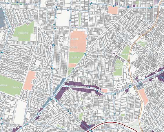
Figure 8: Yeo Park/Gough Reserve Context (Source: OneMap 2016)
Yeo Park and Gough Reserve is located in the suburb of Ashfield and is located south of Ashfield and Summer Hill Town Centres. The surrounding area comprises largely low residential suburban dwelling houses and medium density residential flats.
The Park is an item of local heritage significance, identified as “Yeo Park and Gough Reserve *public reserve” under Ashfield LEP 2013.
The Park is located approximately 1.19 kilometres south west of Summer Hill Station and 1.52 kilometres south east of Ashfield Station. Land to the south of the Park along Old Canterbury Road comprises mixed use and commercial development, while the Park adjoins Trinity Grammar School to the north.
The Park is accessible by public transport, with bus stops located around the perimeter of the Park along Old Canterbury Road.
The Park is located approximately 850 metres west of Dulwich Hill Town Centre, which provides a range of mixed use, commercial and residential development as well as light train transport and bus routes.
There are a number of schools located within the locality including Trinity Grammar School, Canterbury Boys’ High School and Summer Hill Public School.
3.2 Demographic Analysis
3.2.1 Dwelling Density

![]()
 Figure 9: Dwelling Density (Source:
OneMap 2016)
Figure 9: Dwelling Density (Source:
OneMap 2016)
Yeo Park and Gough Reserve is surrounded by a range of low and medium density residential development, with areas providing a mix of traditional suburban housing and apartments.
Areas to the west provide lower densities ranging between 12-14 dwellings per hectare. Land to the east towards Dulwich Hill Town Centre provides much higher densities, with densities ranging from 22-157 dwellings per hectare.
It is anticipated that increasing development in existing town centres will result in additional pressures relating to the use of open space in the area. This may result in the need to consider a passive recreational zone in association with the formal landscaping and bandstand to the north of the Park, and a more active recreational zone in Gough Reserve.
3.2.2 Household Size

![]()
 Figure 10: Household Size (Source: OneMap 2016)
The area of land surrounding Yeo Park and Gough Reserve has ranging household sizes. Land to the east provides lower household sizes of 2.2 and 2.4 persons, which would suggest couples without children, while land to the west provides more nuclear families up to 2.8 and 2.7 persons.
The implications for Yeo Park and Gough Reserve may include the need to maintain facilities and amenities including children play areas, benches and BBQ facilities and to ensure the Park provides quality passive recreational opportunities for its users.
3.2.3 Median Age

![]()
 Figure 11: Median Age (Source: OneMap 2016)
The area of land surrounding Yeo Park and Gough Reserve provides varying ages. Areas west provide age groups of 41 and 44, while areas east provide age groups of 33 and 34. Older age groups are located in more suburban environments, while younger age groups are located along major transport corridors and near town centres precincts.
The implications for Yeo Park and Gough Reserve are to ensure the Park provides appropriate accessibility for children, families and the ageing population including maintenance of footpaths, drinking fountains, seating and tables. It would also suggest the need to consider two clear zones within the Park, with an active zone in the south towards Gough Reserve and a passive zone in the northern portion.
3.3 Facilities and Assets
3.3.1 Bandstand
The Bandstand, located centrally within the Park was built in 1929 and was later refurbished in 1988 as part of the Australian Bicentenary Celebrations. The bandstand is used today for occasional musical events and for special celebrations including weddings and concerts.
There is a plaque on the bandstand, commemorating Alderman Yeo, who served as an alderman for 18 years prior to becoming Mayor and obtained the Park for the people in November 1929.
The Bandstand will require further maintenance to preserve its condition. Additionally, the clock and moat located at the rotunda does not function.
There is also a formal staircase in the north west portion of the Park that provides access to the bandstand area, which is located on a levelled plane.
Figure 12: Bandstand and Staircase
3.3.2 Playground Area
The playground area is an open playground shaded by two sails and is used by local families within the area and Yeo Park Infants’ School. Shrubs and garden beds are located around the playground.
The playground is located north of Yeo Park Infants’ School and provides a wood mulch bed, two slippery slides, forts, bridge, climbing structures and equipment. There are also two swings provided south of the children’s play area and north of the Infant’s School. The swings are set within synthetic turf and may require upgrading.
Figure 13: Playground Area
3.3.3 Garden Beds
A number of garden beds are located in the northern portion of the Park along major footpaths. These garden beds largely comprise rose beds and are generally in good condition and are well maintained.
Garden beds could introduce seasonal/companion planting to make them more vibrant and attractive throughout different times of the year. This would provide stronger delineation of the Park as well.
 Figure 14: Garden Beds
3.3.4 BBQ Area and Rotunda
Yeo Park and Gough Reserve has a BBQ area located in the northern portion of the Park. The BBQ has been recently installed and is y covered by a colourbond roof structure and are situated on a concrete pad.
There is a rotunda also located south of the children’s play area and provides seating and shelter for users.
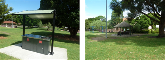 Figure 15: BBQ Area and Rotunda
3.3.5 Toilet Block
There is a toilet block located in the central portion of the Park, east of Yeo Park and Gough Reserve Infants’ School.
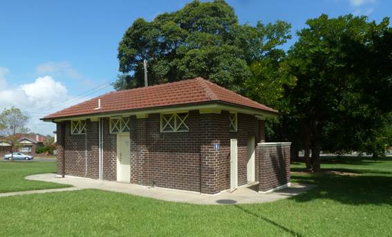 Figure 16: Amenity Block
3.3.1 Yeo Park Infants’ School
Yeo Park Infants’ School is located in the central portion of the Park adjoining Victoria Road. It is a small infants’ school, catering for the education of children from Kindergarten to Year 2.
The school occupies a brick building and is set within large mature trees and the children’s play area, located north of the school. South of the school is Gough Reserve and a undersized cricket pitch. This portion of land is owned by Department of Education.
3.3.1 Undersized Cricket Pitch
South of the Park towards Gough Reserve is an undersized cricket pitch, which appears to have been used by children and families in the local area for informal sporting games and recreation. This portion of land is owned by Department of Education.
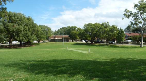 Figure 17: Undersized cricket pitch
3.3.2 Community Facility
There is a community facility located at the southern point of the Park in Gough Reserve. The facility was previously used as a Former Baby Health Centre. A Heritage Study Review prepared by Council in 2004 identifies the building as very good example, indeed one of the earliest, of professionally designed post-World-War II International-style architecture in Ashfield. It is an excellent and early example of a purpose-built Baby Health Centre.
The building is part of a Development Application prepared by Council for a proposed café.
Figure 18: Community Facility
3.4 Landform and Topography
Yeo Park and Gough Reserve provides a fall of approximately 8 metres from the northern boundary adjoining Trinity Grammar School to the central portion of the Park adjoining the Infants’ School.
The land is relatively flat in Gough Reserve and then gradually rises to the southern tip by approximately 6 metres towards the community facility.
Figure 19: Yeo Park and Gough Reserve Slope
3.5 Existing Vegetation
Yeo Park and Gough Reserve provides a range of flora and fauna, which is largely located along the perimeter of the Park.
Along Old Canterbury Road, species generally comprise Brush box (Lophostemon confertus) in avenues along the intentional paths.
New plantings of Brush box (Lophostemon confertus) is located at the cross paths.
Street trees along Victoria Street comprise Largerstroemia indica. The gardens beds include a range of species including ficus hillii, butia capitata, eucalyptus, plantanus orientalis, wisteria and roses.
The Park adopts a formal design, characterised by a rectangular path system, which connects to the street footpath network. A rotunda has been constructed within the central portion of the site and acts as a focal point.
Figure 20: Existing Vegetation
3.6 Asset Inventory Assessment
Yeo Park and Gough Reserve currently has a number of existing assets on site including seating, water fountains, play equipment and associated facilities, shade structures and pole top perimeter lighting throughout pedestrian areas.
The inventory assessment concluded that all facilities and amenities within the Park were in either excellent or good condition (refer to Annexure).
4 BASIS FOR MANAGEMENT
4.1 Values
The principal values of Yeo Park and Gough Reserve are:
· The aesthetic characteristic of the Park including the flower beds and bandstand;
· Well utilised destination for passive recreation and relaxation;
· Proximity to local residents, accessibility to bus routes and schools;
· Landscaping character and pathways contribute to historic fabric of the Park;
· Children’s play area to promote passive recreation;
· Presence of seating, BBQ and picnic shelters, which contribute to passive use of the Park; and
· Central meeting place and establishing a strong sense of community.
4.2 Objectives
The following objectives are designed to achieve the Purpose of the Plan of Management:
· Ensure Yeo Park and Gough Reserve maintains its role as a passive recreation destination, as well as investigate opportunities for active recreation;
· Ensure any active and passive use is clearly delineated in the northern and southern portions of the Park;
· Maximise public usage of the Park while maintaining a variety of uses and catering to a diversity of users;
· Improve and maintain existing facilities and amenities in accordance with need and funding availability;
· Provide an accessible environment within the Park that ensures physical and social equity of access;
· Develop policies and practices that promote the history of the Park;
· Have a safe and secure Park for visitors; and
· Improve and maintain the natural amenity of the Park.
4.3 Community Consultation
Basis of the Parks Plan of Management has considered the needs of the community. As described earlier, Ashfield Council undertook consultation with the community through a series of drop in sessions, user surveys and stakeholder workshops to identify aspects of the Park they would like improved.
Figure 21: Pin Board Exercise Example
Consultation also assisted with the creation of long-term strategies for the Park. Council’s annual Yardstick Survey was also reviewed as part of the consultation and indicated that most residents were satisfied with the quality of amenity and maintenance of the Park.
The outcomes of consultation suggested the following improvements could be made to Yeo Park and Gough Reserve:
· A dog park within the park, for example having an off-leash area;
· Fencing around the eastern side along Old Canterbury Road;
· More tables, seating and BBQ areas throughout the park;
· More taps and bubblers; and
· More tables and upgrade water features.
Figure 22: Community Consultation 'Have Your Say - Survey'
4.4 Existing and Potential Park Uses
Park activities and uses must be first and foremost, permissible within the Zone objectives of the RE1 Public Recreation Zone in accordance with Ashfield LEP 2013 and consistent with the objectives of Park categorisation under the Local Government Act 1993.
The following table provides a list of existing and potential uses for Yeo Park and Gough Reserve, which can be facilitated through the future directions of the Plan of Management.
|
Existing |
Potential |
|
Passive recreation |
Café (subject to DA approval at Community Facility) |
|
Children playground activities |
|
|
BBQ/Picnics |
|
|
Events (subject to Council booking) |
|
|
On leash dog walking |
|
|
Art and Cultural initiatives (Council booking) |
|
Table 3: Existing and Potential Park Uses
Yeo Park and Gough Reserve has been well utilised by the community and serves its main function as a Park. To ensure the Park continues to provide a range of uses and provide for the needs of increasing populations for passive use.
If a use is proposed by a community or organisation within the Park that does not fit the descriptions above, then they are to write to Council requesting clarification if a proposed use can be undertaken with the Park. Council will advise the person if that use is deemed acceptable within the Park.
Council will consider the objectives, values, zoning, categorisation and future directions of the Park outlined in this Plan of Management.
4.5 Ecologically Sustainable Development
The Plan of Management reflects, and is consistent with, Council’s Ecologically Sustainable Development Policy. This policy has as its vision statement:
“Ashfield as a community which protects and enhances its existing flora and fauna and contributes to the wider responsibilities for the whole community to preserve the earth’s environment.”
Under Ashfield 2023, the community acknowledges the need to promote public open spaces, reserves, bushland and ecological areas where necessary.
Towards 2023, Ashfield Council will focus efforts towards addressing ESD and resilient environmental planning strategies in the following key areas:
- The Built Environment – encouraging buildings to incorporate sustainable design features and energy efficient outcomes;
- Climate change – reducing energy consumption on Council facilities;
- Biodiversity – encouraging residents to use native species, supporting bushcare groups and increasing awareness; and
- Waste – reduce incidence of littering and illegal dumping and enable greater provision of local recycling.
5 thEMES
This chapter identifies the current status of Yeo Park and Gough Reserve in relation to a number of themes that are considered relevant to the Parks management and use. The themes were developed as part of the request from the community feedback and the input received during the consultation sessions. Under each theme there is a common format of analysis, which is structured as:
- Aims and Objectives – adopt goals and principles for each theme;
- Issues, Opportunities and Constraints – establish key issues that inform Plan of Management recommendations; and
- Future Directions – summarise plan moving forward and identify strategies for implementation.
If a future direction is proposed that is not identified in the Plan of Management, Council will consider whether or not it satisfies the aims and objectives of the relevant theme, as well as consider the Park’s values, objectives, zoning and categorisation.
Figure 23: Yeo Park and Gough Reserve - Management Map
5.1 Grounds, Leases and Infrastructure
5.1.1 Aims and Objectives
· Apply minimum standards to ensure grounds are properly maintained (mowing, weed removal, irrigation and aeration, building repairs, painting, rubbish collection and addressing vandalism);
· Ensure all pathways, facilities and associated amenities within the Park are accessible for People with Disabilities;
· Ensure appropriate allocation of leases and licenses within the Park to promote fair and equitable use;
· Maintain, preserve and promote the aesthetic, historic and social values of the Park; and
· Enhance the quality and safety of built structures, access and play surfaces.
5.1.2 Issues, Opportunities and Constraints
Currently dog walking, children activities, walking and cycling coexist satisfactorily. However, there is an increasing use of the Park by personal trainer, which will need monitoring in the future in terms of wear and tear on the grass and potential conflict of use with other users.
Currently, Trinity Grammar School uses the Park for sporting activities including fitness and sport training. The focus of this usage is largely along main pathways within the Park. This use is impacting on the park in the afterhours for local residents who use the pathways for cycling and walking.
The use of the Park by Trinity Grammar School has raised concerns from local residents in relation to potential conflicts of use with people who have children, walk dogs, cyclists and walkers who use the main paths, coming into conflict with these sporting users.
There is an opportunity in the long term to consider delineating the Park into two areas, which would comprise a passive recreational zone in Yeo Park and Gough Reserve, and an active recreational zone in Gough Reserve. This would enable Yeo Park and Gough Reserve to retain its passive recreational qualities, while ensuring there is space that allows for more active recreation away from these spaces.
The existing Infants’ School appears to coexist with the surrounding uses, particularly in relation to the children’s play area and Gough Reserve.
There may be opportunities to explore implementing additional BBQ shelters and picnic tables throughout the Park.
5.1.3 Future Directions
· Ensure use of the Park by Trinity Grammar School does not impact on passive recreation by introducing an appropriate Park use booking system;
· Continue to maintain lawns, edges, paths, seating, tables, buildings and shelters to maximise the Park as a safe and attractive place to visit and walk;
· Upgrade and maintain bandstand structure;
· Review leasing and licensing arrangements to ensure it provides fair and equitable use of sportsgrounds for new and existing clubs and informal users;
· Provide new seating and drinking fountains where considered appropriate;
· Conduct annual audits of the Park to inform management plans, budget and allocations;
· Design equipment and designate new facilities based on needs analysis and changing demographic; and
· Future leases and licenses to meet requirements of the Local Government Act 1993.
5.2 Access
5.2.1 Aims and Objectives
· Enhance access to and from the Park, as well as improve connections within the Park;
· Ensure footpaths and buildings comply with Disabilities Discrimination Act and AS1428;
· Minimise impact of local traffic generation and parking in surrounding streets; and
· Encourage access to the Park through public transport, cycle routes and street connections.
5.2.2 Issues, Opportunities and Constraints
Footpaths provide important connections and movement through the Park. Access is available along all Park boundaries, as well as paths connecting the northern area of the Park to the southern area. These pathways provide important connections to key features in the park including the children’s play area, amenities building and the Infants’ School.
Inspection of the pathways revealed they are in good condition however, there are areas that have cracks and damages. The Park should be inspected regularly for cracks, trips and damage by roots.
5.2.3 Future Directions
· Investigate existing pathways for cracks, trips and roots;
· Ensure emergency vehicles have unhindered access to the Park;
· Promote awareness of access to the Park via public transport;
· Design of access arrangements should consider the existing and future demographic users of the park;
· Park utilities and furniture should be located to ensure no obstructions to movement of pedestrians.
5.3 Landscape Character and Visual Amenity
5.3.1 Aims and Objectives
· Provide opportunities for perimeter landscape planting along the southern boundary of the Park;
· Provide consistent landscape palette across the Park;
· Improve visual presentation of the Park along pathways, street frontages and open areas;
· Manage the Park in accordance with Council’s principles of Ecologically Sustainable Development; and
· Plant additional vegetation to improve local amenity and shading where appropriate.
5.3.2 Issues, Opportunities and Constraints
Yeo Park and Gough Reserve is highly valued by the community as a place that provides high quality landscaping amenity and vegetation. This includes a combination of native mature perimeter trees, garden beds along the pathways as well as exotic within the Park.
5.3.3 Future Directions
· Avoid removing large trees that contribute to the heritage significance of the Park including trees that are home to birds, animals and nesting sites;
· Investigate where appropriate to provide seasonal plants in the garden beds;
· Priorities weed control programs; and
· Consider the impacts of events and activities on the Parks flora and fauna.
5.4 Personal Trainers
5.4.1 Aims and Objectives
· Ensure that personal trainers and boot camps operate in accordance with appropriate licenses and insurance;
· Undertake measures and practices to mitigate impacts associated with personal trainers and boot camps; and
· Provide appropriate guidelines to minimise park use conflicts with other users.
5.4.2 Issues, Opportunities and Constraints
Council currently does not have a formal leasing procedure in place for personal trainers, which has resulted in an unregulated use of public parks by personal trainers.
There is a potential conflict of use with personal trainers and other users of the Park. This can relate to noise control, occupied space and movement within the Park and displacement of casual and informal park users.
Personal trainers may also degrade existing grass cover and occupy key connection points or footpaths for exercise use.
There is opportunity for the Park to be used for personal training and boot camps. This could potentially be situated within Gough Reserve, which would ameliorate impacts associated with the passive and formal landscaping of Yeo Park and Gough Reserve.
5.4.3 Future Directions
· Investigate potential use of the Park for boot camps and personal trainers;
· Ensure that any use of the Park for personal trainers and boot camps adheres to Council requirements for relevant licenses and insurance;
· Personal trainers will need to apply for an application to use the Park for personal training and boot camp purposes;
· Council to permit personal trainers and boot camps in consideration of location within the Park to nearby residential zones, type of fitness activities, size of groups, frequency and relevant certification.
5.5 Dogs in Parks
5.5.1 Aims and Objectives
· Recognise the increase in off-leash and on-leash dog use in Parks; and
· Consider the rights and safety of other users in the Park when a dog is on-leash and off-leash.
5.5.2 Issues, Opportunities and Constraints
Increased demand for off-leash dog areas has potential to impact on existing grass cover and result in over-capacity spaces dedicated to existing off-leash and on-leash dog walking.
Yeo Park and Gough Reserve is an on-leash dog area. Problems can arise from dog waste being left on the Parks lawn, footpaths and flower beds. This creates potential of conflict between different users of the Park, as well as health and safety considerations. There has also been reported use of users having their dogs’ off-leash within the Park.
Appropriate penalties will be enforced for dog owners who do not keep their dogs leashed where required.
5.5.3 Future Directions
· Monitor the control of dogs in the Park;
· Install dog waste bins where needed; and
· Ensure dog bag dispensers have a constant supply of dog bags.
5.6 Children’s Playgrounds
5.6.1 Aims and Objectives
· Provide play areas that encourage children to learn, socialise, imagine, create and play;
· Ensure play areas provides a range of diverse activities and that incorporate both play facilities and natural play environments; and
· Inspect and maintain play equipment regularly to ensure equipment is safe and secure for use.
5.6.2 Issues, Opportunities and Constraints
The existing playground area is relatively large and provides a range of swings, climbing equipment, forts, slides and other interactive equipment. The play area overall is well integrated with the Infants’ School.
While there is a provision of adequate play facilities for the size and usage of Yeo Park and Gough Reserve, there appears to be an absence of play equipment and areas for children with a disability. Council should consider where possible, incorporation of play equipment for persons with a disability in any future upgrades.
Council should consider replacing the mulch ground cover with soft fall bark chips and upgrade the existing shade sails, which appear to be damaged.
5.6.3 Future Directions
· Maintain children’s playground in current location with improvements to play equipment;
· Ensure shade sail and appropriate shading is maintained around the playground;
· Investigate opportunity for accessible play equipment as part of future upgrades; and
· Repair, upgrade and provide a diverse range of additional play equipment in current playground location as required.
5.7 The Arts
5.7.1 Aims and Objectives
· Support artists and develop new ways to promote and sustain their practice in Parks; and
· Provide opportunities for cultural development for local artists and the broader community.
5.7.2 Issues, Opportunities and Constraints
Parks are venues for events, places for Public Art, homes for cultural venues and precincts, and opportunities for place making. Parks are for the people to create places of meaning and relevance alongside nurturing and supporting creatives to embellish place and space that is inclusive for all.
There may be opportunity to investigate integrating some Art programs or installations in the Park, when considered appropriate by Council. Public art should consider the artwork within the context of Ashfield and the suitability of the art for the Park.
5.7.3 Future Directions
· Encourage growth of public art where appropriate in line with Council’s Public Art Policy;
· Explore opportunities to integrate art installations within the Park, subject to Council approval;
· Support initiatives in the Park that enhance community cohesiveness.
5.8 Culture and Heritage
5.8.1 Aims and Objectives
· Recognise and maintain the significance of the Park, including existing features, facilities and vegetation;
· Recognise and reflect Park configuration dating back to its early history; and
· Interpret the Parks history through signage and education boards where appropriate.
5.8.2 Issues, Opportunities and Constraints
While there is not known to be any areas of high cultural or archaeological heritage significance within the boundary of the Park, the Park is located within an area that could have been a habitable place for the Cadigal and Wangal peoples.
Council should investigate ways to enhance the communities understanding of the Parks relationship to indigenous history and heritage. Specifically, the bandstand could be utilised as a focal point for conveying history of the Park to the visitors.
Additionally, the bandstand requires repairs and upgrades to a satisfactory condition. There are opportunities to use the bandstand for live music, events and festivals when deemed appropriate.
5.8.3 Future Directions
· Maintain all mature trees in the Park and engage Arborist to undertake health check on trees on a regular basis, as appropriate;
· Council will develop as a matter of urgency a Park Tree Strategy and Park Tree Management Plan;
· Upgrade and maintain the existing bandstand to a satisfactory condition;
· Investigate opportunities to utilise the bandstand as a focal point for live music, events and small festival, where deemed appropriate;
· Explore potential of the Park to host small events oriented towards enhancing and promoting the areas diverse culture; and
· Modify or relocate the rose gardens as appropriate from under the shade of the established trees, to improve the floral displays in Yeo Park and Gough Reserve.
6 ACTION PLAN
The Action Plan below identifies management objectives, strategies and associated actions and priorities. The actions aim to:
· Improve the Park;
· Repair past damage;
· Prevent further degradation;
· Maintain and enhance the amenity of the area;
· Continuously improve and maintain facilities;
· Manage the planned sharing of the Park by organisations involved in passive (and active) recreation; and
· Preserve the Park as a place for relaxation, passive recreation and a place of significant heritage.
The implementation of the actions in Action Plan will be coordinated on a yearly basis in accordance with the assigned priorities. These priorities are linked to the following time frame:
High Commenced within the next 2 years
Medium Commenced in 2 – 5 years
Low Commenced after 5 years
It should be recognised, however, that the commencement and completion of the actions will be dependent on available Council resources and funding and on Council priorities in its yearly program. The priority of each action will need to be reassessed annually to determine its continuing relevance.
|
Aims and Objectives |
Future Directions |
Priority |
|
Grounds, Leases and Infrastructure |
||
|
1. Apply minimum standards to ensure grounds are properly maintained (mowing, weed removal, irrigation and aeration, building repairs, painting, rubbish collection and addressing vandalism); 2. Ensure all pathways, facilities and associated amenities within the Park are accessible for People with Disabilities; 3. Ensure appropriate allocation of leases and licenses within the Park to promote fair and equitable use; 4. Maintain, preserve and promote the aesthetic, historic and social values of the Park; and 5. Enhance the quality and safety of built structures, access and play surfaces.
|
- Ensure use of the Park by Trinity Grammar School does not impact on passive recreation by introducing an appropriate Park use booking system; - Continue to maintain lawns, edges, paths, seating, tables, buildings and shelters to maximise the Park as a safe and attractive place to visit and walk; - Upgrade and maintain bandstand structure; - Review leasing and licensing arrangements to ensure it provides fair and equitable use of sportsgrounds for new and existing clubs and informal users; - Provide new seating and drinking fountains where considered appropriate; - Conduct annual audits of the Park to inform management plans, budget and allocations; - Design equipment and designate new facilities based on needs analysis and changing demographic; and - Future leases and licenses to meet requirements of the Local Government Act 1993 |
Ongoing
Ongoing
M Ongoing
|
|
Access |
||
|
6. Enhance access to and from the Park, as well as improve connections within the Park; 7. Ensure footpaths and buildings comply with Disabilities Discrimination Act and AS1428; 8. Minimise impact of local traffic generation and parking in surrounding streets; and 9. Encourage access to the Park through public transport, cycle routes and street connections.
|
- Investigate existing pathways for cracks, trips and roots; - Ensure emergency vehicles have unhindered access to the Park; - Promote awareness of access to the Park via public transport; - Design of access arrangements should consider the existing and future demographic users of the park; - Park utilities and furniture should be located to ensure no obstructions to movement of pedestrians.
|
Ongoing
Ongoing
M
Ongoing
Ongoing |
|
Landscape Character and Visual Amenity |
||
|
10. Provide opportunities for perimeter landscape planting along the southern boundary of the Park; 11. Provide consistent landscape palette across the Park; 12. Improve visual presentation of the Park along pathways, street frontages and open areas; 13. Manage the Park in accordance with Council’s principles of Ecologically Sustainable Development; and 14. Plant additional vegetation to improve local amenity and shading where appropriate.
|
- Avoid removing large trees that contribute to the heritage significance of the Park including trees that are home to birds, animals and nesting sites; - Investigate where appropriate to provide seasonal plants in the garden beds; - Priorities weed control programs; and - Consider the impacts of events and activities on the Parks flora and fauna.
|
Ongoing
M
Ongoing Ongoing |
|
Personal Trainers |
||
|
15. Ensure that personal trainers and boot camps operate in accordance with appropriate licenses and insurance; 16. Undertake measures and practices to mitigate impacts associated with personal trainers and boot camps; and 17. Provide appropriate guidelines to minimise park use conflicts with other users. |
- Investigate potential use of the Park for boot camps and personal trainers; - Ensure that any use of the Park for personal trainers and boot camps adheres to Council requirements for relevant licenses and insurance; - Personal trainers will need to apply for an application to use the Park for personal training and boot camp purposes; - Council to permit personal trainers and boot camps in consideration of location within the Park to nearby residential zones, type of fitness activities, size of groups, frequency and relevant certification. |
M
M
M
M
|
|
Dogs in Parks |
||
|
18. Recognise the increase in off-leash and on-leash dog use in Parks; and 19. Consider the rights and safety of other users in the Park when a dog is on-leash and off-leash.
|
- Monitor the control of dogs in the Park; - Install dog waste bins where needed; and - Ensure dog bag dispensers have a constant supply of dog bags.
|
Ongoing M
Ongoing |
|
Children’s Playgrounds |
||
|
20. Provide play areas that encourage children to learn, socialise, imagine, create and play; 21. Ensure play areas provides a range of diverse activities and that incorporate both play facilities and natural play environments; and 22. Inspect and maintain play equipment regularly to ensure equipment is safe and secure for use. |
- Maintain children’s playground in current location with improvements to play equipment; - Ensure shade sail and appropriate shading is maintained around the playground; - Investigate opportunity for accessible play equipment as part of future upgrades; and - Repair, upgrade and provide a diverse range of additional play equipment in current playground location as required. |
Ongoing
Ongoing
Low
Ongoing |
|
The Arts |
||
|
23. Support artists and develop new ways to promote and sustain their practice in Parks; and 24. Provide opportunities for cultural development for local artists and the broader community.
|
- Encourage growth of public art where appropriate in line with Council’s Public Art Policy; - Explore opportunities to integrate art installations within the Park, subject to Council approval; - Support initiatives in the Park that enhance community cohesiveness. |
Low
Low
Ongoing
|
|
Culture and Heritage |
||
|
25. Recognise and maintain the significance of the Park, including existing features, facilities and vegetation; 26. Recognise and reflect Park configuration dating back to its early history; and 27. Interpret the Parks history through signage and education boards where appropriate. |
- Maintain all mature trees in the Park and engage Arborist to undertake health check on trees on a regular basis; - Council will develop as a matter of urgency a Park Tree Strategy and Park Tree management Plan; - Upgrade and maintain the existing bandstand to a satisfactory condition; - Investigate opportunities to utilise the bandstand as a focal point for live music, events and small festival, where deemed appropriate; and - Explore potential of the Park to host small events oriented towards enhancing and promoting the areas diverse culture. |
Ongoing
M
M
M
|
7 ANNEXURES
Division 12 Parks and other public reserves
64 Definition
In this Division:
public reserve has the same meaning as it has in the Local Government Act 1993, but does not include a Crown reserve that is dedicated or reserved for a public cemetery.
65 Development permitted without consent
(1) Development for any purpose may be carried out without consent:
(a) on land reserved under the National Parks and Wildlife Act 1974, if the development is for a use authorised under that Act, or
(b) on land declared under the Marine Parks Act 1997 to be a marine park if the development is for a use authorised under that Act, or
(c) on land declared under the Fisheries Management Act 1994 to be an aquatic reserve if the development is for a use authorised under that Act.
(2) Development for any purpose may be carried out without consent:
(a) on Trust lands within the meaning of the Centennial Park and Moore Park Trust Act 1983, by or on behalf of the Centennial Park and Moore Park Trust, or
(b) on trust lands within the meaning of the Parramatta Park Trust Act 2001, by or on behalf of the Parramatta Park Trust, or
(c) (Repealed)
(d) in the case of land that is a reserve within the meaning of Part 5 of the Crown Lands Act 1989, by or on behalf of the Director-General of the Department of Lands, a trustee of the reserve or (if appointed under that Act to manage the reserve) the Ministerial Corporation constituted under that Act or an administrator,
if the development is for the purposes of implementing a plan of management adopted for the land under the Act referred to above in relation to the land.
(3) Development for any of the following purposes may be carried out by or on behalf of a council without consent on a public reserve under the control of or vested in the council:
(a) roads, cycleways, single storey car parks, ticketing facilities and viewing platforms,
(b) outdoor recreational facilities, including playing fields, but not including grandstands,
(c) information facilities such as visitors’ centres and information boards,
(d) lighting, if light spill and artificial sky glow is minimised in accordance with AS/NZS 1158: 2007, Lighting for Roads and Public Spaces,
(e) landscaping, including irrigation schemes (whether they use recycled or other water),
(f) amenity facilities,
(g) maintenance depots,
(h) environmental management works.
66 Exempt development
(1) Development for any of the following purposes is exempt development if it is carried out by or on behalf of a public authority in connection with a public reserve or on land referred to in clause 65 (1), and if it complies with clause 20:
(a) construction, maintenance and repair of:
(i) walking tracks, boardwalks and raised walking paths, ramps, minor pedestrian bridges, stairways, gates, seats, barbecues, shelters and shade structures,
(ii) viewing platforms with an area not exceeding 100m2, or
(iii) sporting facilities, including goal posts, sight screens and fences, if the visual impact of the development on surrounding land uses is minimal, or
(iv) play equipment where adequate safety provisions (including soft landing surfaces) are provided, but only if any structure is at least 1.2m away from any fence,
(b) routine maintenance (including earthworks associated with playing field regrading or landscaping and maintenance of existing access roads).
(2) Development of a kind referred to in subclause (1) is exempt development if it is carried out on land referred to in clause 65 (2) by or on behalf of the person specified in respect of that land in that subclause, if the development:
(a) complies with clause 20, and
(b) involves no greater disturbance of native vegetation than necessary, and
(c) does not result in an increase in stormwater run-off or erosion, and
(d) for the purposes of implementing a plan of management adopted for the land under the Act referred to in clause 65 (2) in relation to the land.
|
Council Meeting 27 March 2018 |
Subject: Draft Remediation of Land State Environmental Planning Policy and Guidelines (to replace SEPP No. 55 - Remediation of Lands)
Prepared By: Katie Miles - Strategic Planner
Authorised By: David Birds - Group Manager Strategic Planning
|
SUMMARY The purpose of this report is to seek endorsement of the attached submission (Attachment 1) to the Department of Planning & Environment (DPE) regarding the draft Remediation of Lands State Environmental Planning Policy (SEPP) and associated Guidelines that affects contaminated or potentially contaminated land across the Inner West LGA. This will replace the existing State Environmental Planning Policy No. 55 - Remediation of Lands (SEPP 55) and associated Contaminated Land Planning Guidelines published by the NSW Environmental Protection Authority (EPA) introduced in 1998. |
|
THAT Council:
1. Support the proposed Remediation of Land SEPP and Guidelines subject to minor changes being made, as outlined in the submission at Attachment 1, and that the submission be made to the DPE;
2. Endorse that the Inner West Development Control Plans be amended upon the finalisation of the proposed Remediation of Land SEPP to align with the SEPP requirements; and
3. Endorse Council's Strategic Planning Group to review Council's Section 149 Planning Certificate Policy (also known as 10.7 Planning Certificates under the amended EP&A Act 1979) in relation to the issues addressed in the proposed Remediation of Land SEPP and Guidelines.
|
BACKGROUND
Contaminated land is generally considered to be areas or sites that have high concentrations of substances which do not naturally occur in the area and it is anticipated have the potential that to harm the environment or human health. Environmental regulation aims to manage the remediation process of contaminated lands so that the risk of continued harm is removed or contained.
Council regularly encounters contaminated land through the assessment of environmental planning instruments (commonly known as planning proposals or rezoning applications) and development applications under the Environmental Planning and Assessment Act 1979 (EP&A Act). When carrying out planning and development functions Council must consider SEPP 55 and now the Draft Remediation of Lands SEPP regarding the potential for land to be contaminated and make decisions as to whether the land should be remediated, or have its intended future use restricted.
The Inner West LGA has large swathes of areas that were historically used for industrial activities and are, or potentially are, contaminated. Council's records indicate that there are around 100 Council-owned properties that are potentially affected by land contamination. Any disruption of the soil or potentially any other disturbance to the site will require consideration of environmental and human health impacts.
In NSW, there are a multiple pieces of legislation that establish the framework for considering land contamination issues and land remediation, such as:
· Sites that are known to be historically contaminated and likely to pose a 'significant' risk to human health or cause environmental harm are managed under the Contaminated Land Management Act 1997;
· Land use activities that are likely to pollute and potentially contaminate land are managed under the Protection of the Environment Operations Act 1997; and
· Contaminated lands that do not pose a significant risk to human health or environmental harm, but require land remediation works to be deemed suitable for the future intended use, are governed by the State Environmental Planning Policy No. 55 - Remediation of Land (SEPP 55).
In 1998, the NSW Environmental Protection Agency established SEPP 55 and the associated Contaminated Land Planning Guidelines. This is still the current planning framework for the management of contaminated land in NSW.
DRAFT REMEDIATION OF LANDS SEPP & GUIDELINES
On 25 January 2018, the Department of Planning and Environment (DPE) announced the proposed Remediation of Lands State Environmental Planning Policy (Remediation of Land SEPP) and Draft Contaminated Land Planning Guidelines to replace SEPP 55.
An Explanation of Intended Effect for the remediation of Land SEPP (EIE) and a draft version of the Contaminated Land Planning Guidelines are provided as Attachments 2 and 3 respectively. The DPE has placed the documents on exhibition until 31 March 2018.
The proposed key changes are detailed in the below sections and in summary are:
· The expansion of categories of remediation work which requires development consent;
· A greater involvement of principal certifying authorities, particularly in relation to remediation works that can be carried out without development consent;
· Inclusion of more comprehensive guidelines for councils and certifiers; and
· Clarification of contamination information to be included in section 149 Planning Certifications (known as 10.7 Certificates under the amended EP&A Act).
Changes to Category 1 and 2 Remediation Works
The new Remediation of Land SEPP will continue to make remediation work permissible under the existing SEPP 55 categories: Category 1 and Category 2 remediation works, although changes are proposed to each category. The draft SEPP & Guidelines propose a fuller post-notification process that will be required for both categories of remediation work. The notice of completion for these works must confirm that the works were carried out in accordance with the certified remediation plan, state whether the land is suitable for the proposed use, and whether it is subject to any restriction or ongoing management requirements following remediation.
Category 1 Remediation Works (Development Consent Required)
Category 1 remediation works require development consent and will continue to do so under the new SEPP. The works currently listed as Category 1 will be largely replicated in the new SEPP. However, an additional 16 types of remediation works are proposed to be added to Category 1 (because these works are typically complex requiring specialist expertise or there is significant risk of impact on adjacent land).
Additional categories have also been included where there is a long-term environmental management requirement, post-remediation monitoring or an on-site containment cell. There is no expressed threshold for such types of remediation works, meaning that very small remediation works could be captured by these categories in the future.
Category 2 Remediation Works (Development Consent Not Required)
Under the existing arrangements Category 2 remediation work does not require development consent, instead they require the applicant to notify council before works are carried out. A notice of completion is required for all remediation works. Category 2 remediation works exclude Category 1 remediation works and the draft SEPP will replicate this provision. The most significant change to Category 2 is the expansion of the pre-remediation notification and the introduction of standard operational requirements.
Those carrying out Category 2 remediation works are already required to notify Council with specific details, generally 30 days in advance of works commencing. These details include brief information about the property, the works and the timeline for their completion. In addition to this information, an applicant will now have to provide a remediation plan which must be certified by a certified contaminated land consultant (whose qualifications have been confirmed through a certification scheme recognised by the EPA). Remediation plans were previously only required for Category 1 remediation works.
A new clause will be introduced to specify the matters to be addressed in a remediation plan. Broadly, the remediation plan will need to contain specific details about the proposed remediation methods, procedures, any validation sampling and analysis proposed and plans for reinstatement. It must also include certification from the certified consultant that the remediation works are appropriate.
The draft SEPP will also introduce standardised operational requirements for Category 2 remediation works which will regulate site establishment practices, site and works management during remediation and validation procedures.
Development Applications Generally
The draft SEPP will still require consent authorities to consider contamination when determining applications more generally. The same tests and requirements in clause 7 of SEPP 55 will be replicated in the new SEPP. This includes the provision that states that consent authorities must not give consent to carry out any development on the land unless they have considered whether the land is contaminated. As part of this test, consent authorities must consider:
· Potentially land-contaminating past uses and activities on the land; and
· The extent to which land is proposed to be used for sensitive land uses such as residential, educational, recreational, child-care purposes or hospital purposes.
However, a key change in the draft SEPP is that it will give a new discretion to the consent authority to waive this requirement, if the consent authority has knowledge that allows them 'to be certain of the suitability of the land for the proposed use'. This is generally supported in scenarios where the proposed change of use does not disturb the soil structure, but will be dependent upon the assessment determination of the consent authority.
Local Council Policies
In the three Inner West Development Control Plans, there are separate policies on the treatment of contaminated land. Currently, remediation works that would otherwise be classified as Category 2, but do not meet the standard provisions outlined in the Inner West DCPs, are automatically classified as Category 1 works by virtue of section 9(f) of SEPP 55. This can encapsulate relatively minor remediation works that are then required to meet high regulatory standards required for the granting of development consent.
The proposed changes will have the effect of streamlining all works as either Category 1 or Category 2 works. The draft Remediation of Land SEPP alone will determine the categorisation of remediation works and provide a consistent framework statewide.
Strategic Planning
SEPP 55 requires planning authorities to consider matters relevant to contaminated land when preparing an environmental planning instrument to zone or rezone land (known as Planning Proposals or Rezoning Applications). The new SEPP proposes to remove this and provide the requirement in a specific Section 117 Ministerial Direction (known as Section 9.1 under the amended EP&A Act).
Contaminated Land Planning Guidelines
The new SEPP and guidelines place emphasis on the role of certified contaminated land consultants. It seems likely that the new SEPP will adopt the Environmental Protection Authority's (EPA) list of recognised certification schemes.
Key proposed changes to the Guideline include:
· Outlining the preliminary and detailed site investigation processes;
· Outlining the role of the principal certifying authority when dealing with contaminated land and site audits; and
· Providing guidelines on how to address possible contamination of near-by sites.
This Council and the three former Councils have tended to rely on site audits to validate remediation works. This is because Council usually does not have the in-house technical expertise to properly assess the information received from developers having carried out remediation works. The guidelines encourage councils to generally rely on the documentation provided by the certified contaminated land consultant. It further clarifies circumstances in which further review, including a possible site audit, may be requested.
REPORT
POLICY IMPLICATIONS FOR COUNCIL
Generally, the proposed Remediation of Land SEPP and Guidelines are supported as they update State policy that has been in place for over 20 years. Notwithstanding this, Council should be aware of the following policy implications including the potential need for additional staff resourcing to address a potential increase in data recording and related requirements.
INNER WEST DEVELOPMENT CONTROL PLANS (DCPS)
The proposed removal of section 9(f) of SEPP 55 and the introduction of standardised operational requirements for Category 2 works, whilst generally consistent with the Inner West DCPs, will require the revision of the following sections of the Inner West DCPs as Category 2 remediation works (defined by the new SEPP) will no longer be applicable:
· Section 2.24.11 Development Controls for Remediation Works of Marrickville DCP 2011; and
· Section C1.8.16 Development Controls for Remediation Works of Leichhardt DCP 2013.
The Draft SEPP and Guidelines also provide new guidance for councils on what best practice provisions should be included for Category 1 remediation works. The introduction of the new SEPP and Guidelines will require the amendment of the details found in these contamination sections of the Inner West DCPs:
· Section A14 Contaminated Land in Ashfield DCP 2013;
· Section 1.8 Contamination in Leichhardt DCP 2013; and
· Section 2.24 Contaminated Land in Marrickville DCP 2011.
It is recommended that Council review the contamination sections of the Inner West DCPs in accordance with the new SEPP and Guidelines once they are finalised to adjust them to be consistent with the new SEPP and Guidelines. The changes are likely to be administrative in nature however this is subject to final review and analysis.
STRATEGIC PLANNING ASSESSMENT
The purpose of section 6 of SEPP 55 is to specify contamination and remediation issues that are to be considered as part of a rezoning proposal. It states that in preparing an environmental planning instrument (EPI) a planning authority is not to permit a change of use of the land unless:
a) The planning authority has considered whether the land is contaminated;
b) If the land is contaminated, the planning authority is satisfied that the land is suitable in its contaminated state (or will be made suitable, after remediation); and
c) If the land requires remediation to be made suitable for any purpose for which land in that zone is permitted to be used, the planning authority is satisfied that the land will be so remediated before the land is used for that purpose.
The proposed removal of section 6 of SEPP 55 and its replacement with a new Section 117 Ministerial Direction appears to be a result of the recent Land and Environmental Court (LEC) decision of Moorebank Recyclers Pty Ltd v Tanlane Pty Ltd (No.2) [2017] NSWLEC 186 which highlighted an issue with the existing SEPP 55 framework and the relevant rezoning provisions under the Environmental Planning and Assessment Act 1979.
The LEC had to determine whether certain council resolutions and a Gateway Determination for a planning proposal were invalid on the basis that there was a purported failure to comply with section 6 of SEPP 55. However, the Court found that there was no intersection between the legal requirements of section 6 of SEPP 55, and sections 55 and 56 of the EP&A Act. The Court found that the scope of Clause 6 is confined to the preparation of an EPI. The Court held that, as neither of the procedures described in Section 55 (making of planning proposal) or Section 56 (make of a Gateway Determination) could properly be described as the preparation of an EPI as they fell outside of Clause 6 of SEPP 55.
The implication of this determination largely underscores the difficulty of successfully challenging the making of an amendment to an EPI. It highlighted that the procedures related to the making of a planning proposal and Gateway Determinations are relatively imprecise and allow considerable flexibility. The proposed Section 117 Direction aims to address this issue and will directly link the proposed Remediation of Land SEPP to s55 and 56 of the EP&A Act (now known as sections 3.33 and 3.34 respectively).
The proposed Section 117 Direction is generally supported as it will provide clarity and probity to decision-making made under sections 55 & 56 of the EP&A Act. However, Council's support is subject to the provision that no statement is included that provides for approval pathways if a proposal is inconsistent with the Direction. Additionally, it is recommended that a reiteration of section 6 of SEPP 55 be further included in the draft SEPP to strengthen the linkages between the proposed Section 117 Direction, Draft SEPP and Guidelines, and sections 55 and 56 under the EP&A Act to remove any ambiguity.
COMPLIANCE AND ENVIRONMENTAL HEALTH MONITORING AND ENFORCEMENT
Generally, no objections are raised in relation to the proposed 16 new types of Category 1 Remediation Works. However, Council should note that policy changes will increase the costs of these works, which now must include the cost of having a certified contaminated land consultant prepare, certify and validate a remediation plan. Improvements to site practices and management may also be required to conform to the new operational requirements.
As development applications will be required to disclose more detailed information about their works they can expect a higher level of oversight from consent authorities (such as Council). The use of a certified consultant is strongly supported as it is likely to improve the quality of information and provide legitimacy that enable consent authorities to rely on and accept the information provided. However, some proposed new types of development will require consent authorities to maintain long-term oversight when it is made a condition of consent, such as:
· Remediation where a long-term environmental management plan is or will be required;
· Remediation where confirmation of successful completion is dependent upon post-remediation monitoring; and
· Remediation that will result in on-site containment of contaminated soil or contaminated groundwater, or both.
The State Government states that it is desirable that consent authorities have oversight of the long-term management of these sites. There are record and data management issues that arise from a variety of persons being involved in the contamination and remediation process over long periods of time. Such processes would typically involve members from the following sections of Council: Development Assessment, Property, Strategic Planning, Building and Compliance, GIS and Environmental Health. Given the Inner West's industrial past, Council should expect that it will receive an increase in the amount of information required from, and provided by, accredited certifiers as part of the draft SEPP's new pre- and post-certification processes.
The change could impose additional resourcing burdens on Council and require the creation of a specialist role to have sole responsibility for contaminated land GIS data entry, development assessment initial evaluation/referrals and enforcement action/monitoring in relation to contaminated lands and associated land remediation works in the Inner West LGA.
SECTION 149 PLANNING CERTIFICATES (10.7 UNDER THE AMENDED EP&A ACT)
Under section 149 of the EP&A Act, a person may request a council to issue a planning certificate. The certificate must contain advice on matters about land that are prescribed by Schedule 4 of the Environmental Planning and Assessment Regulation 2000. A section 149(2) Planning Certificate must include information that states whether the land is affected by section 59 of the Contaminated Land Management Act 1997. Generally speaking, this section states whether it is known if the land is 'significantly contaminated' or not.
However, section 149(5) provides councils with the opportunity to record additional property information about the land. Councils do not incur liability for advice provided in good faith under section 149(5) in relation to contaminated lands. The draft Guidelines encourage councils to provide information relating to contamination and remediation of that land if aware of that information in section 149(5) Planning Certificates. The new SEPP will create an opportunity to improve Council's record and GIS management of contamination information on section 149(5) Planning Certificates.
Currently, there are three separate Council templates for section 149 Planning Certificates as a legacy of the former councils. The former Ashfield and Marrickville approach did not state any contamination information under section 149(5). Conversely, the former Leichhardt approach did include information on contamination and remediation works where it was lodged on the GIS data base. Only the former Leichhardt approach aligns with the draft Guidelines recommendations.
Acknowledging that all three former areas have vastly different approaches to their 149 Planning Certificate templates, there is an urgent need to review Council's Section 149 Planning Certificate policy and templates.
FINANCIAL IMPLICATIONS
Nil at this stage, but additional resourcing burdens as a result of the implementation of the proposed Remediation of Land SEPP may require the future creation of a Contaminated Lands Management Officer role to have responsibility for contaminated land GIS data entry, development assessment initial evaluation/referrals and enforcement action/monitoring in relation to contaminated lands and associated land remediation works.
OTHER STAFF COMMENTS
Environmental Health Officer:
· Comment – Generally, no objections to 16 new types of Category 1 Remediation Works.
Concern – Type (m), (n) and (o) remediation works require consent authority to maintain long term oversight when a condition of consent. Consent authority’s capacity to maintain long term data integrity of a contaminated sites database, and ability to adequately follow up with monitoring and enforcement action is questionable.
Reason – Variety and number of persons involved in the process, such as Planning, Property and Environmental Health Officers, who are likely to be responsible for contributing to database, will inevitably lead to corruption of database.
Suggestion – A Contaminated Lands Management Officer role be created within consent authority (Council), to have sole responsibility for contaminated lands GIS data entry, development assessment initial evaluation/referrals and enforcement action/monitoring in relation to contaminated lands.
· Comment – Generally, no objections relating to ‘Operational Requirements for Category 2 remediation’.
· Comment – Generally, no objections relating to the proposed new Contaminated Land Planning Guidelines.
PUBLIC CONSULTATION
Not applicable.
CONCLUSION
It is recommended that Council endorse the attached submission that requests DPE make minor changes to the proposed Remediation of Land SEPP and Guidelines prior to finalising the plans.
|
1.⇩ |
Draft Inner West Council Submission to Proposed Remediation of Land SEPP & Guidelines |
|
2.⇩ |
State Government's Proposed Explanation of Intended Effect for Remediation of Land SEPP Policy |
|
3.⇩ |
State Government's Draft Contaminated Land Planning Guidelines to be associated with the proposed Remediation of Land SEPP |
|
Council Meeting 27 March 2018 |
Subject: Bangla New Year's Day Festival - Request to Hold Event at Tempe Reserve - Further Report
Prepared By: Cathy Edwards-Davis - Group Manager Trees, Parks and Sports Fields
Authorised By: Elizabeth Richardson - Deputy General Manager Assets and Environment
|
SUMMARY Council has received an application for the Bangla New Year’s Day Festival to be held at Tempe Reserve. A decision on the request for owners consent was deferred by Council at its meetings of the 27th February and 13 March 2018 and insufficient time now exists to obtain necessary regulatory approvals. Council staff have advised the organiser that the event cannot be held in 2018. |
|
RECOMMENDATION
THAT the report be received and noted. |
BACKGROUND
Bangabandhu Porishad Sydney lodged an application with Council to hold the Bangla New Year’s Day Festival at Tempe Reserve on Saturday 7 April 2018. The Bangla New Year’s Day Festival is a community fair to celebrate the forthcoming Bengali New Year.
This event was considered at the Council meetings on the 27 February 2018 and 13 March 2018, where, contrary to officer recommendation, it was resolved to defer consideration of the matter.
Specifically, the resolution on Council on the 13 March was:
‘THAT this matter be deferred until the next council meeting.’
The event has now become unapprovable, as Council staff is unable to meet the necessary statutory processes associated with the event. There are just 11 days between the 27 March 2018 and 7 April 2018.
Road Closures
Council’s Traffic Management Staff have advised that should Council resolve to approve the Event the following would need to occur:
· Council’s resolution would be forwarded (in a letter) to the RMS and Police representatives, noting Council’s resolution differs from the advice of RMS and the Police in not supporting the Event; and
· Council must wait 14 days from the date of notification (in writing) to RMS and the Police and take no further action in the matter and await their advice whether an appeal will be lodged to the Regional Traffic Committee.
Council is required to advertise any temporary road closures in accordance with the required 28 day advertising period (Roads Act 1999). The advertising must be in the local newspaper. Insufficient time now exists to enact road closures for the event.
Section 68 Application
There is insufficient time for the event organiser to submit and have approved an application under s68 of the Local Government Act 1993.
It is now not possible for Council to approve the event having regard to Council’s other statutory obligations, including notification of the application to surrounding properties.
Council staff have advised the organiser that the Bangla Festival cannot proceed in 2018, and have requested that the organiser immediately cease advertising the event and that they send out notifications to the relevant people advising that the event has been cancelled.
Council staff have again offered to work with the organiser to find suitable alternative locations for the 2019 event.
FINANCIAL IMPLICATIONS
Council has already provided considerable “in kind” support to the 2018 event through the provision of staff time to advise and assist the event organiser.
OTHER STAFF COMMENTS
Traffic Management, Regulatory and Development Advisory Services staff were consulted in the preparation of this report.
PUBLIC CONSULTATION
Nil.
|
Council Meeting 27 March 2018 |
Subject: IWC Grants Program: Overview of Criteria and Processes
Prepared By: Sue Pym - Social Planning Coordinator
Authorised By: Erla Ronan - Group Manager Community Services and Culture
|
SUMMARY This report and associated attachments outlines the criteria, processes and guidelines for the Inner West Council grants program and recommends minor changes for the 2018/19 grant round. |
|
RECOMMENDATION
THAT:
1. The revised 2018/19 Inner West Grant Guidelines are noted; and
2. Each Inner West Grant Program assessment panel includes an external representative.
|
BACKGROUND
Council resolved on 31 October 2017 (C1017, Item 3) “that Council receive a further report on the criteria and process for the grants program and any proposed changes to the criteria for future grant programs”.
A Councillor briefing on 6 March 2018 outlined the 2017/18 processes and proposed changes for the 2018/19 Inner West Council Grants Program.
Eligibility Criteria
Each of the Inner West Council Grant Guidelines is tailored to the needs of the specific grant category. Criteria are outlined in each of the grant guidelines, with many common elements and consistent governance processes (see Attachment 1: proposed 2018/19 Grant Guidelines).
Assessment of Applications
Assessment criteria are listed in each of the grant guidelines to reflect the particular category, and generally reflect the benefits to the local community such as impact and quality of the project; nature and extent of social, cultural, historical, environmental and recreational benefits; extent to which the applicant addresses the grant objectives; capacity of the organisation to deliver a well-planned project and addressing Council’s broader strategic direction.
The assessment processes include an initial eligibility check of applicants and proposed projects; establishment of grant panels; analysis and assessment of each application and recommendations regarding funding (see attachment 2: grants management process diagram).
Proposed changes
Proposed changes for 2018/19 Inner West Grants Program include:
· Include external representative on all panels
· Increased editorial and design consistency
· Some minor name changes to reflect community priorities:
– Community Grants now Community Wellbeing Grants
– Local History Grants now Community History and Heritage Grants.
FINANCIAL IMPLICATIONS
Nil
OTHER STAFF COMMENTS
At a review meeting with the Internal Grants Program Working Party it was noted that two of the grant categories were not funded in all former council areas. These were:
– Recreation Grants: former Marrickville Council
– Community History and Heritage Grants: former Leichhardt Council.
This resulted in their respective budgets being spread across a significantly larger area in 2017/18 when the integrated grant program was implemented.
The Recreation Grants in 2017/18 received funding requests of $141,110 with $30,000 available for allocation, demonstrating high demand for the program. Any amendments to the Recreation Grants program will be considered as part of the development of the upcoming Recreation Policy and Strategy following the completion of the Recreation Needs Study: A Healthier Inner West.
PUBLIC CONSULTATION
Nil
|
1.⇩ |
Grant Guidelines and Process Map |
|
Council Meeting 27 March 2018 |
Subject: Bulk Transfer of Nominated General Staff Update
Prepared By: Melodie Whiting - Group Manager Human Resources
Authorised By: Rik Hart - Interim General Manager
|
SUMMARY This report provides an update on the bulk transfer of staff; employee harmonisation activities and summarises the previous best practices of Ashfield, Marrickville and Leichhardt Councils and the local government sector, in relation to equal opportunity employment practices as requested through the Mayoral Minute of Council meeting 21 November 2017. In total 511 staff were bulk transferred before the Christmas break in 2017 enabling Council to create certainty for general staff, particularly the outdoor workforce. Nominated general staff, where there was no change to the positions, including duties and responsibilities and immediate structure, were transferred across with current conditions and roles into the new organisation as either a direct appointment or bulk transfer. |
|
RECOMMENDATION
THAT Council note the update and information contained in the Report. |
BACKGROUND
Filling the new organisation structure for Inner West Council has been a protracted process to ensure due consultation with staff and unions, and compliance with legislative requirements regarding transferred staff of merged councils.
All staff were consulted on the new organisation structures and roles through mass and small section group meetings, the Staff Consultative Committee and the Unions, on numerous occasions, and advised of the recruitment process in applying for roles in the new Inner West structure which was developed through consultation with the Unions, LGNSW and the Staff Consultative Committee.
At Council’s direction the organisation was in a position by December 2017 to move ahead and authorise a bulk direct transfer of nominated general staff, including outdoor and key worker level staff into the new structure. This means that, where nominated, these key workers were transferred from their existing role in the structure of their former Council into a comparable role in the new Inner West organisation structure.
The bulk transfers occurred prior to the Christmas break in 2017 enabling Council to create certainty for general staff, particularly the outdoor workforce. Nominated general staff, where there was no change to the positions, including duties and responsibilities and immediate structure, were transferred across with current conditions and roles into the new organisation as either a direct appointment or bulk transfer. In total 511 staff were bulk transferred.
This transfer process did not require the staff member to go through a formal recruitment process. Those staff members are also still able to apply for other jobs in the organisation if they wish to do so.
The bulk direct transfer process was applied to a large number of staff in areas including, but not limited to:
· Footpaths, Roads, Traffic and Stormwater
· Trees, Parks, and Sportsfields
· Mechanical Services
· Resource Recovery
· Children and Family Services
· Community Operations
· Recreational and Aquatics
· Library and History Services
Staff were advised of the Council resolution for the five year employment protection, as a result of amalgamation, to be extended to all eligible staff from 12 May 2016, through a range of communication means including the Staff Update on the intranet, at the Joint Consultative Committee and through the Mayor's video address to staff.
Council has also begun the initial consultation process with unions and staff on harmonisation of working conditions. This process of workplace change is in the initial phase but is being conducted in a collaborative and consultative manner with goodwill intent by the parties.
The harmonisation of the staff performance process and a recognition and reward framework was presented and endorsed at the first 2018 Joint Staff Consultative Committee meeting in February. The proposed “My Achievement and Development” Framework and Staff Recognition and Reward Schemes were developed through the assistance of a number of working groups including the Joint Consultative Committee.
As part of the harmonisation activities, the Inner West Council’s EEO Management Plan will be developed and informed by best practices from the former Councils of Ashfield, Leichhardt and Marrickville. Input will also be taken from local government industry best practice and the public sector. The EEO Management Plan will provide a strategic link between the Local Government Act, the Workforce Management Strategy and Plan and other Council strategies and programs, such as the Inclusion Action Plan for people with a disability. These strategies and programs, together, provide a framework to ensure the inclusion of less advantaged people within our society.
Best practice in local government is informed by the Local Government Act 1993 requiring Council to have an EEO Management Plan.
The Act’s objectives are to:
a) eliminate and ensure the absence of discrimination in employment on the grounds of age, race, sex, marital or relationship status, impairment, sexual orientation and gender identity in councils.
b) promote equal employment opportunity for women, members of racial minorities and persons with disabilities in councils.
The development of the Inner West Council Equal Employment Opportunity (EEO) Management Plan 2018-2022 will outline our commitment to achieving a safe and rewarding workplace free from all forms of unlawful harassment and discrimination. Further, all employees and prospective employees are afforded equal access to opportunities and benefits relating to employment, promotion and training.
Better Practice Workforce Diversity Targets and Benchmarks
The NSW Public Service Commission has set the following specific employment targets for workforce diversity:-
· Aboriginal and Torres Strait Islander 2.6%
· Women 60%
· People with a disability requiring workplace adjustment 1.5 %
· People whose first language was not English 19%
Council Workforce Data:
Council employs approx. 1014 fulltime equivalent staff, consisting of full-time, part-time, casual and seasonal workers
Current Diversity Data
It is important that within a community, the diversity of the general public be reflected by those employed within its public sector, particularly local government, for a more cohesive, inclusive workforce that includes people of different genders, and cultural and linguistic backgrounds; Aboriginal people and people with a disability.
Challenges from the former council’s statistics remain in understanding and measuring the level of diversity at Council, due to the voluntary nature of identification. Data is identified on a voluntary basis, which typically leads to under-reporting as some employees may feel identifying with a diversity group may not be relevant to their role, fear of stigma or they may not have access to update their diversity status.
The best way to allow for self-identification differs based on several variables such as: the purpose and use of the data, the perceived overall acceptance of minority groups including LGBTQ employees, and the mode of self-identification. To improve benchmarking data, a program of education on the value of identification and increased opportunities for identification through not only EEO data for new starters but also through the use of staff surveys for current employees will be established to improve benchmark data for the Inner West Council (IWC).
EEO statistics:
At present, IWC EEO data is as follows:-:
· 3% staff indicate they have a disability
· 2.1% staff indicate an indigenous background, Aboriginal and Torres Strait Islander
Aboriginal and Torres Strait Islander employees: Council has greater representation at 2.1% compared with the local government area community representation of 1%. Council has also resolved to increase this representation through a targeted traineeship program and has dedicated positions for employees with Aboriginal and Torres Strait Islander background.
Employees identifying with a Disability: Staff identifying as having a disability total approximately 3%. Council has also resolved to increase this representation through a targeted traineeship program.
Culturally and linguistically diverse employees: Current data is not complete from the former Councils and is an area identified for data capture to inform people strategies. Identified data to date shows over 44 staff with English as a second language.
Current Gender Balance:
Inner West Council has a higher representation of female workers at 52% than NSW Local Government Urban Councils which is benchmarked at 44.21% as per the 2017 NSW Local Government HR Metrics Benchmarking Report.
· IWC Gender Leadership balance
o Leadership Group (Level 1 GM, Level 2 DGMs, Level 3 Group Managers – plus General Counsel): 57% (12) female; 43% (8) male.
o Within the Level 3 Group Managers: 75% (12) female; 25% (4) male.
More women are employed in management/ decision making roles. However, at the Executive level the are no permanent female representation and this is an area of focus for our people strategies, to develop the capability of our Level 3 Managers for succession planning and also consider a targeted recruitment campaign in the event of an Executive vacancy.
Former Council’s EEO best practices
All former Councils met the requirement of an EEO Management Plan in accordance with the local Government Act. Better practices across the former councils were comparable and included:-
· EEO, anti-bullying and harassment training and information
· EEO and demographic information collected and continue to improve data systems for EEO data collection,
· targeted employment of apprentices and trainees
· student and work experience opportunities
· identified Aboriginal positions within the establishment
· an Aboriginal Staff Network
· promote staff to understand the protocols of ‘Acknowledgement of Country’ and ‘Welcome to Country’ ceremonies.
· Aboriginal cultural appreciation training
· HR policies and procedures that comply with and support equity standards
· regular opportunities for staff consultation and input about change including Bi-Annual Staff Surveys to provide data on continuous improvement opportunities
· recruitment advertisement that meet accessibility standards
· recruitment and selection training workshops, to increase the numbers of trained staff and availability of mixed genders on panels.
· job application and interview techniques training for staff to improve and assist their career development in applying for vacant positions
· opportunities for CALD community language aid schemes where appropriate.
· partnering with key stakeholders to improve diversity and inclusion outcomes
· disability awareness training and information
· participation in the 50:50 Vision Councils for Gender Equity Award program - Bronze Award held by the three former Councils
· development opportunities for women appropriate to their employment and career progression within Council and in accordance with individual training plans.
· equality of access for staff to learning and development opportunities and all staff have equal access to career development opportunities
· flexible work arrangements including part-time and job share for parents return to working and mature workers
· provide and promote a culturally sensitive space for individual use in prayer, lactation, meditation or reflection
· provide seminars for mature workers on transitioning into retirement
The NSW Local Government Workforce Strategy 2016-2020 identifies that workplace diversity is about removing barriers to ensure all employees can perform to their highest ability. It also involves recognising the value of individual differences and managing them in the workplace. The strategy does recognise that diversity initiatives need to be tailored to each Council’s unique circumstances and be sustainable in order to make a real impact on the workforce, and potentially on the community they represent. Suggested initiatives include:-
· reduce procedural barriers to recruiting people from diverse backgrounds, without compromising any existing qualification, professional registration or Australian Standards requirements
· create a contemporary workplace, e.g. consideration to work arrangements sought by different segments of their workforce, to accommodate work/life balance requirements of employees, maximise staff engagement, address workplace stress and inappropriate behaviours, review and respond to changes in demand for skills and job roles, and retain critical knowledge within the organisation.
· increase opportunities to attract new and younger employees to address issues related to succession, age imbalance and corporate social responsibility.
· provide opportunities for the development of leadership teams and development of opportunities to increase women in leadership roles
These initiatives will be considered in development of the Inner West Council EEO Management Plan, taking into consideration the employment protections afforded transferred staff in a merger and the related legislative requirements.
FINANCIAL IMPLICATIONS
Nil - Harmonisation activities that are not funded have been identified and prioritised in the budget bidding process.
PUBLIC CONSULTATION
Not Applicable.
CONCLUSION
Council has engaged in an open, transparent and consultative manner with staff and unions in developing and filling the organisation structure, whilst meeting legislative requirements. It will continue this approach as we embark on the harmonisation of working conditions and development of our people strategies including the IWC EEO Management Plan.
|
Council Meeting 27 March 2018 |
Subject: Inner West Council Position on the Cruise Ship Terminal
Prepared By: Ryan Cole - A/ Group Manager Development Assessment and Regulatory Services
Authorised By: Elizabeth Richardson – A/ Deputy General Manager Assets and Environment
|
SUMMARY This report aims to respond to points 1 of Council resolution C0218 Item 10 adopted 27 February 2018, and outlines the current position of the Inner West Council in regard to the White Bay Cruise Ship Terminal and the work being done Council in relation to this matter.
|
|
THAT Council:
1. Note that since the White Bay Cruise Terminal commenced operations in 2013, Council has been advocating to NSW Government Ministers and state agencies to reduce, mitigate and monitor impacts on residents living and those working within the vicinity of the White Bay Cruise Terminal in terms of odour, noise and air quality associated with cruise ship exhaust fumes;
2. Note that there have been some initiatives implemented including: a) regular meetings with state agency officers with community members and Council representatives to discuss agency actions and resident concerns b) provision for ongoing noise and air quality monitoring c) mandating low sulphur fuel use (for limited times when ships are in port); and d) the implementation of a noise abatement strategy; and
3. Note that notwithstanding the measures implemented the number of cruise ships using the facility annually continues to rise and the concerns of residents living and those working within the vicinity of the White Bay Cruise Terminal in terms of odour, noise and air quality associated with cruise ship exhaust fumes remain. |
BACKGROUND
Council resolution C0218 Item 10 adopted 27 February 2018 stated:
“1. A report to be prepared for the March 2018 Ordinary Council Meeting detailing:
a) The current position of the Inner West Council in regard to the White Bay Cruise Ship Terminal; and
b) The work being done by the Inner West Council to try to resolve the impact of the cruise ships on its community.”
2. Council write to the Federal Minister for Infrastructure and Transport Michael
McCormack MP, NSW Minister for Roads, Maritime and Freight Melinda Pavey
MP, NSW Minister for the Environment Gabrielle Upton MP, Port Authority of
NSW and the NSW Environmental Protection Authority seeking the implementation of regulations mandating:
a) Cruise ships switch to low-sulphur fuel at least one hour prior to entering Sydney Harbour; and
b) All cruise ships that enter Sydney Harbour install scrubbers in exhaust stacks to reduce the impacts of fumes on the community; and
3. Write to the Port Authority of NSW and the NSW Department of Planning &
Environment seeking clarification about the implementation of the Noise Mitigation Strategy, including details on how many residents have been offered noise abatement measures and how many residents have accepted those measures.
This report addresses Point No.1 of the above resolution.
History
On 2 February 2011 the Minister for Planning granted approval under the former Part 3A of the Environmental Planning and Assessment Act 1979 to MP10_0069 for the construction and operation of a Cruise Passenger Terminal at White Bay.
In April 2013 the Cruise Passenger Terminal was completed and started operating. As there are no conditions on the consent for the number of ships permitted to berth, the number has been increasing annually.
Since the commencement of the Cruise Passenger Terminal, Council has played an active role advocating to NSW Government Ministers and agencies to reduce, mitigate and monitor impacts on residents living and those working within the vicinity of the White Bay Cruise Terminal in terms of odour, noise and air quality associated with cruise ship exhaust fumes.
Some of the key areas Council has been advocating include:
· Writing objections to the application that subsequently approved the construction and operation White Bay Cruise Terminal
· Writing to relevant State Ministers and Departments (EPA, Planning, Health, Ports) outlining ongoing community concerns
· Appearing before a Parliamentary Inquiry into the performance of the EPA which made specific reference to actions considered not to be taken by the department to address concerns over community concerns when ships are in port
· Making submissions on the NSW Protection of the Environment Operations (Clean Air) Regulation 2010 and the Noise Mitigation Strategy for the White Bay Cruise Ship Terminal
· Advocating for ongoing air quality and noise monitoring
· Advocating for the installation of shore to ship power
· Attending community meetings
· Council Officers attending regular agency meetings with local residents to discuss actions and concerns with the NSW EPA, Department of Planning & Environment, NSW Health and NSW Ports
· Council has established a dedicated webpage to outline actions and update for the community
It should be noted that there have been some initiatives implemented attempting to mitigate impacts, these include:
· the creation of a noise abatement strategy
· provision for ongoing noise and air quality monitoring; and
· mandating low sulphur fuel use (for limited times when ships are in port)
The key details of each of the above detailed initiative are outlined as follows:
Creation of a noise abatement strategy
The Port Authority's noise mitigation strategy has been developed in an attempt to address the ongoing issue of noise from ships when berthed at the terminal (i.e. engine noise, vibrations and passenger announcement / music).
The NSW Port Authority documentation outlines the elements of the program as follows:
1. Noise Attenuation Program: noise attenuation comprising of physical treatments to homes to a defined area of residences where noise modelling indicates that average noise levels reach or exceed 55 decibels at night (‘attenuation eligibility threshold’).
2. Noise Restriction Policy: a new policy restricting on-deck music and public announcements not related to safety and restrictions for ships which cause further exceedances of the attenuation eligibility threshold. Non-compliant ships will be given an initial warning to make improvements; a second non-compliance will result in a loss of priority booking status plus overnight relocation of the ship; and a third non-compliance will result in future bookings not being allowed
3. Noise Logging: continuous real-time logging to monitor noise levels and guide ongoing noise management.
Port Authority received approval from the Department of Planning and Environment in late 2017 for the strategy and is currently working to commence delivery of the three elements.
When notified of the proposed strategy Council engaged an expert acoustic consultant to review the proposal and make recommendations. Council further held a public meeting at the Balmain Town Hall to discuss the matter.
Details of the Noise Mitigation Strategy can be found in Attachment A.
Provision for ongoing noise monitoring
Under the approval there is a condition (D1) which outlines noise criteria. Between 2013 and 2017 the Port Authority have at times engaged acoustic consultants to undertake noise assessment for specific ships with higher volumes of complaints were received. These reports are available online. Some reports outline issues on ships associated with fans, engine noise which requires form of insulation etc.
As detailed above, the Port Authority seeks to implement a noise abatement strategy. In particular the Port Authority proposes to undertake continuous real-time logging noise logging to monitor noise levels and guide ongoing noise management.
Information on the Port Authority website is limited and the real time noise monitoring data is not available. As such, as per the Council resolution adopted 27 February 2018, Council will be seeking further details on the implementation of the strategy.
Provision for ongoing air quality monitoring
The NSW Port Authority has installed an air quality monitoring station at the corner of Grafton and Adolphus streets, Balmain to monitor the ambient air quality in the immediate vicinity of the White Bay Cruise Terminal. The station monitors Sulphur dioxide (SO2), particulate matter less than 2.5 microns diameter (PM2.5) and meteorological parameters including wind speed and direction. The information from the air quality monitoring station is available in close to real time on the Port Authority website.
Over the years, it has been argued that the station is incorrectly located, being situated adjacent to the terminal facility and significantly below the exhaust stacks of the ship when berthed. A secondary station is an alternate location has previously been requested. One was temporarily installed near Clontarf Cottage for approximately 3 weeks a number of years ago.
Mandating low Sulphur fuel use
On 1 October 2015 NSW Protection of the Environment Operations (Clean Air) Regulation 2010 was amended to put in place an environmental regulatory regime when cruise ships entered Sydney Harbour. The regulation was set up in two stages.
Stage 1 provided that from 1 October 2015 cruise ships to use low sulphur fuel (0.1% or less) when berthed. Essentially allowing a transition for cruise ships to start using fuel which provides exhaust with reduced toxins. The bunker fuel however was still permitted to be used for approximately 1 hour after berthing and 1 hours prior to departure whilst the fuel transition was occurring.
Stage 2 was set to commence from 1 July 2016 when the cruise ships were to use low sulphur fuel (0.1% or less) at all times when operating in Sydney Harbour. The second stage essentially required bunker fuel to be switched to low sulphur outside the harbour entrance.
Unfortunately, the Regulation was only in effect for a short period and the second stage of the regulation was never implemented. The cessation of the regulation was due to a conflict between NSW and Federal legislation. As a result, the state regulation was invalidated.
Upon the cessation of the NSW regulation and the Federal law being applicable, the Australian Maritime Safety Authority (AMSA) became the appropriate authority on fuel use. The Federal Government amended legislation to enable AMSA to issue directions under the Navigation Act 2012.
Currently Orders are in place which stipulate:
“From December 2016, cruise vessels capable of accommodating more than 100 passengers and at berth in Sydney Harbour will be issued with a Direction by AMSA. The Direction will require the vessel to limit sulphur emissions by using low sulphur fuel or an alternative measure that achieves an equivalent outcome, specifically:
A. using fuel with a sulphur content not exceeding 0.1% mass per cent concentration (0.1% m/m); or
B. using an exhaust gas cleaning system, certified and approved in accordance with the International Maritime Organization Guidelines for Exhaust Gas Cleaning Systems 2015; or
C. using a power source external to the vessel; or
D. using a combination of any of the above measures.”
The above order is similar to Stage 1 of the NSW Regulation however it does provide the Stage to component which would remove the additional hour (approximately 2 hours at berth and 1-2 hours manoeuvring up and down the harbour) of burning bunker fuel. Furthermore the order does provide additional options such ‘scrubbers’ in the exhaust systems or ‘shore to ship power’.
Details of AMSA Direction can be found in Attachment B.
Rejection of Shore Power by NSW Government
For a number of years Council has been advocating to the NSW Government for shore to ship power installation. The installation of would result in a reduction of toxic exhaust fumes being dispersed in close proximity to residential properties. The Parliamentary Inquiry into the performance of the NSW EPA listed this as a necessary consideration. It is also a permitted option for the reduction in air pollution in the Directions issued by the Federal Regulator AMSA for ships using Sydney Harbour.
Notwithstanding the above, the NSW Port Authority undertook a feasibility analysis into the installation of ‘shore to ship power’ for cruise vessels when berthed at the White Bay Cruise terminal.
The report concluded that: “Based on investigations and potential air emissions benefits, Port Authority of NSW does not recommend the installation of shore power at White Bay Cruise Terminal as a cost-effective solution.”
The key reasons provided was that the installation of the facility to enable ship to ‘plug in’ is expensive, the number of ships capable of connecting to the facility is relatively low and there are other technologies available to achieve the same outcome. As such, at this point the option for shore to ship power is not proceeding.
A copy of the NSW Port Authority reasons for Shore Power rejection is details in Attachment C
Consideration of Council’s Position
Council resolution C0218 Item 10 adopted 27 February 2018 required consideration of “The current position of the Inner West Council in regard to the White Bay Cruise Ship Terminal”
Essentially this requires Council to determine whether to:
a) Continue to advocate to NSW and Federal Governments to reduce, mitigate and monitor impacts on residents living and those working within the vicinity of the White Bay Cruise Terminal in terms of odour, noise and air quality from cruise ship exhaust fumes noting staff resources will be diverted from budgeted, planned and scheduled operations; or
b) Cease advocacy role in relation to the White Bay Cruise Terminal
In consideration of the above, since the White Bay Cruise Terminal commenced operations in 2013, Council has been advocating to NSW Government Ministers and agencies to reduce mitigate and monitor impacts on residents living and those working within the vicinity of the White Bay Cruise Terminal in terms of odour, noise and air quality associated with cruise ship exhaust fumes.
Some initiatives have been implemented, however resident concerns are still present. Shore to ship power is still a matter that can be advocated for, however additional mitigation measures can also be sought which could include:
· Mandating cruise ships switch to low-sulphur fuel at least one hour prior to entering Sydney Harbour
· Requiring all cruise ships that enter Sydney Harbour install scrubbers in exhaust stacks to reduce the impacts of fumes on the community
· Immediately implementing a ban on any ship that fails noise restriction criteria
· Advocating to the NSW Government to formulate better noise mitigation and abatement strategies and information on when the Abatement Strategy will be fully implemented
· Seeking a restriction on the number of ships permitted to use the facility annually in addition to limiting berthing at the facility to a single ship at any one time
FINANCIAL IMPLICATIONS
A resolution for continued advocacy would require resources being diverted from budgeted, planned and scheduled operations. The level at this point is unquantifiable and will be dependent on the level and type of advocacy required.
OTHER STAFF COMMENTS
Nil.
PUBLIC CONSULTATION
Nil.
CONCLUSION
Council has been seeking to address community concerns resulting from the operation of the terminal since 2013.
Consideration of continued advocacy is a matter for Council to determine with consideration given to the fact that despite the measures implemented, the number of cruise ships using the facility annually continues to rise and the concerns of residents living and those working within the vicinity of the White Bay Cruise Terminal in terms of odour, noise and air quality associated with cruise ship exhaust fumes remain.
|
1.⇩ |
A - WBCT Noise Abatement Strategy Fact Sheet |
|
2.⇩ |
B - AMSA Direction |
|
3.⇩ |
C - NSW Port Authority reasons for Shore Power outcomes |
|
Council Meeting 27 March 2018 |
Subject: Local Traffic Committee Meeting held on 6 March 2018
Prepared By: John Stephens - Traffic and Transport Services Manager
Authorised By: Wal Petschler - Group Manager Footpaths, Roads, Traffic and Stormwater
|
SUMMARY The minutes of the Local Traffic Committee Meeting held on 6 March 2018 are presented for Council consideration. |
|
RECOMMENDATION
THAT the Minutes of the Local Traffic Committee Meeting held on 6 March 2018 be received and the recommendations be adopted. |
BACKGROUND
The Inner West Council Local Traffic Committee met on 6 March 2018 at Petersham. The minutes of the March meeting are shown at ATTACHMENT 1.
FINANCIAL IMPLICATIONS
Projects proposed for implementation in 2017/18 are funded within existing budget allocations.
PUBLIC CONSULTATION
Specific projects have undergone public consultation as indicated in the respective reports to
the Traffic Committee. Members of the public attended the meeting to address the Committee
on specific items.
In respect of Item 18 of the Traffic Committee report it is noted that Council, at its 27 February 2018 meeting, resolved to organise a public meeting on the Lilyfield Road Cycleway proposal. This is currently being arranged. At the 6 March 2018 Local Traffic Committee meeting, an updated report was considered and the Committee recommended that, in recognition of the level of objection, the project not proceed to detailed design and a revised concept be developed with a number of options being investigated. Should Council adopt the Committee’s recommendation, it would be considered beneficial to coordinate the proposed public session at a time that coincides with public engagement for the scheme’s revision.
|
1.⇩ |
Minutes of the Local Traffic Committee meeting held on 6 March 2018 |
|
Council Meeting 27 March 2018 |
Minutes of Local Traffic Committee Meeting
Held at Chamber Room, Petersham Service Centre on 6 March 2018
Meeting commenced at 10.11am
ACKNOWLEDGEMENT OF COUNTRY BY CHAIRPERSON
I acknowledge the Gadigal and Wangal people of the Eora nation on whose country we are meeting today, and their elders past and present.
COMMITTEE REPRESENTATIVES PRESENT
|
Clr Marghanita Da Cruz |
Leichhardt Ward (Chair) |
|
Mr Bill Holliday |
Representative for Jamie Parker MP, Member for Balmain |
|
Mr Chris Woods |
Representative for Ron Hoenig MP, Member for Heffron |
|
Ms Sarina Foulstone |
Representative for Jo Haylen MP, Member for Summer Hill |
|
Mr Ryan Horne |
Roads and Maritime Services |
|
SC Anthony Kenny |
NSW Police – Inner West Area Command |
|
|
|
|
OFFICERS IN ATTENDANCE |
|
|
|
|
|
Mr Peter Whitney |
State Transit Authority |
|
Mr Tony Michalis |
State Transit Authority |
|
Mr Colin Jones |
Inner West Bicycle Coalition |
|
Mr Wal Petschler |
IWC’s Group Manager, Roads, Traffic and Stormwater |
|
Mr John Stephens |
IWC’s Traffic and Transport Services Manager |
|
Mr George Tsaprounis |
IWC’s Coordinator Traffic and Parking Services (South) |
|
Mr Manod Wickramasinghe |
IWC’s Coordinator Traffic and Parking Services (North) |
|
Ms Mary Bailey |
IWC’s Parking Planner |
|
Mr David Yu |
IWC’s Engineer – Traffic and Parking Services |
|
Mr Boris Muha |
IWC’s Engineer – Traffic and Parking Services |
|
Mr Emilio Andari |
IWC’s Engineer – Traffic and Parking Services |
|
|
|
|
VISITORS |
|
|
|
|
|
Mr Steven Burns |
Item 10 |
|
Mr Mike Samms |
Item 10 |
|
Ms Ann-Therese King |
Item 18 |
|
Mr Denis Doyle |
Item 18 |
|
Ms Natalie Lovett |
Item 18 |
|
Mr Joseph Atallah |
Item 18 |
|
Ms Elizabeth Avent |
Item 18 |
|
Mr Neil Tonkin |
Item 18 |
|
Mr Bob Moore |
Item 18 |
|
Ms Leonie Derwent |
Item 18 |
|
Ms Roslyn Burge |
Item 18 |
|
Mr Peter Haramis |
Item 18 |
|
Resident of Hornsey Street, Lilyfield |
Item 18 |
|
|
|
|
APOLOGIES: |
|
|
|
|
|
Ms Jo Haylen MP |
Member for Summer Hill |
|
Mr Jamie Parker MP |
Member for Balmain |
|
Sgt John Micallef |
NSW Police – Burwood & Campsie (emailed support) |
|
Sgt Dan Chilvers |
NSW Police – Leichhardt (emailed support) |
|
Clr Julie Passas |
Deputy Mayor – Ashfield Ward |
DISCLOSURES OF INTERESTS:
Nil.
CONFIRMATION OF MINUTES
|
The Minutes of the Local Traffic Committee Meeting held on Tuesday, 6 February 2018 were confirmed. |
MATTERS ARISING FROM COUNCIL’S RESOLUTION OF MINUTES
The Local Traffic Committee recommendations of its meeting held on 7 December 2017 and 6 February 2018 were adopted at Council’s meeting held on 27 February 2018.
Council at its meeting held on 27 February 2018 also resolved that:
Council as soon as possible organise a public meeting on the Lilyfield Road Cycleway proposal at which staff provide a full overview of the proposal and allow the community to ask questions in order to better understand what is being proposed. (Item 17 LTC0218)
|
LTC0318
Item 1 Croydon Road, Croydon - Proposed statutory ‘NO
STOPPING’ Restrictions at Intersection With Anthony Street |
|
SUMMARY
This report provides an update in response to Council's resolution dealing with Notice of Motion C1017 Item 14 – Pedestrian safety on Croydon Road, Croydon of its 12 October 2017 Council Meeting. An on-site meeting was conducted on 7 December 2017.
This report specifically looks at the installation of statutory ‘No Stopping’ restrictions at the intersection of Croydon Road and Anthony Street, Croydon as part of the local traffic calming measures identified to improve the safety of school children and pedestrians on Croydon Road, Croydon. A further report will be submitted following the completion of pedestrian surveys and traffic counts.
It is recommended that the statutory 'No Stopping' restrictions, in the form of unbroken yellow lines, be installed on both sides of all approaches to the intersection of Croydon Road and Anthony Street, Croydon for the distances as indicated in order to deter illegal parking, improve visibility and access and increase safety for all road users.
Officer’s Recommendation
THAT:
1. This report be received and noted;
2. Unbroken yellow lines (statutory ‘No Stopping’ lines) be approved for installation at the distances indicated on both sides of all approaches to the intersection of Croydon Road and Anthony Street, Croydon as follows in order to deter illegal parking, improve visibility and access and increase safety for all road users;
a) Install solid yellow line marking on Croydon Road (western side) for a distance of 10m north of Anthony Street; b) Install solid yellow line marking on Croydon Road (eastern side) for a distance of 20m north of Anthony Street; c) Install solid yellow line marking on Croydon Road (western side) for a distance of 20m south of Anthony Street; d) Install solid yellow line marking on Croydon Road (eastern side) for a distance of 15m north of Anthony Street; e) Install solid yellow line marking on Anthony Street (northern side) for a distance of 20m west of Croydon Road; f) Install solid yellow line marking on Anthony Street (southern side) for a distance of 20m west of Croydon Road; g) Install solid yellow line marking on Anthony Street (northern side) for a distance of 10m east of Croydon Road; and h) Install solid yellow line marking on Anthony Street (southern side) for a distance of 10m east of Croydon Road.
3. Council Rangers be advised of the decision and requested to include this location in their patrols, once the ‘No Stopping lines have been installed and affected residents notified.
DISCUSSION
The Committee members agreed with the Officer’s recommendation.
COMMITTEE RECOMMENDATION
THAT:
1. This report be received and noted;
2. Unbroken yellow lines (statutory ‘No Stopping’ lines) be approved for installation at the distances indicated on both sides of all approaches to the intersection of Croydon Road and Anthony Street, Croydon as follows in order to deter illegal parking, improve visibility and access and increase safety for all road users;
a) Install solid yellow line marking on Croydon Road (western side) for a distance of 10m north of Anthony Street; b) Install solid yellow line marking on Croydon Road (eastern side) for a distance of 20m north of Anthony Street; c) Install solid yellow line marking on Croydon Road (western side) for a distance of 20m south of Anthony Street; d) Install solid yellow line marking on Croydon Road (eastern side) for a distance of 15m north of Anthony Street; e) Install solid yellow line marking on Anthony Street (northern side) for a distance of 20m west of Croydon Road; f) Install solid yellow line marking on Anthony Street (southern side) for a distance of 20m west of Croydon Road; g) Install solid yellow line marking on Anthony Street (northern side) for a distance of 10m east of Croydon Road; and h) Install solid yellow line marking on Anthony Street (southern side) for a distance of 10m east of Croydon Road.
3. Council Rangers be advised of the decision and requested to include this location in their patrols, once the ‘No Stopping lines have been installed and affected residents notified.
For motion: Unanimous
|
|
LTC0318 Item 2 Railway Parade, Marrickville - Proposed Temporary Road Closure For Two Special Events On Friday 30 March 2018 & Saturday 31 March 2018 (Marrickville Ward/Summer Hill Electorate/Inner West LAC) |
|
SUMMARY
A Development Application has been received to use Railway Parade, Marrickville and hold two commercial special events known as ‘Bad Friday’, an 18+ music event showcasing upcoming Australian Rock and Roll acts on Friday 30 March 2018 between the hours of 12:00pm to 11.00pm, and ‘Good Saturday’, an all-ages community focused event that aims to promote local food, music and craft beer, including a live music stage and food/retail stalls on Saturday 31 March 2018 between the hours of 11:00am to 11:00pm. The erection of the stage, stalls and associated works will include a temporary full-road closure of Railway Parade, Marrickville between Sydenham Road and Buckley Lane from 7:00pm Thursday 29 March 2018 to 12:00pm Sunday 1 April 2018.
It is recommended that Council agree to the temporary road closure of the subject section of Railway Parade from 7:00pm Thursday 29 March 2018 to 12:00pm Sunday 1 April 2018 subject to complying with the following conditions; apply to the RMS for consent to close the subject road, subject to the event being advertised, a Traffic Management Plan be submitted to the RMS for approval, a Road Occupancy License be obtained from the Transport Management Centre and advice of the proposed event being forwarded to the appropriate authorities including emergency services.
Officer’s Recommendation
THAT:
1. The proposed temporary road closure of Railway Parade, Marrickville between Sydenham Road and Buckley Lane from 7:00pm Thursday 29 March 2018 to 12:00pm Sunday 1 April 2018, for the holding of the ‘Bad Friday’ and ‘Good Saturday’ events on Railway Parade, be APPROVED subject to the approval of the Development Application and the applicant complying with the following conditions:
a) A fee of $1,540.00 for the temporary road closure is payable by the applicant in accordance with Council’s Fees and Charges;
b) A fee of $10,000.00 for the occupation of the road reserve for the use of two commercial special events is payable by the applicant in accordance with Council’s Fees and Charges;
c) The temporary full road closure be advertised by the applicant in the local newspaper providing 28 days notice for submissions, in accordance with the Roads Act;
d) A Traffic Management Plan (TMP) be submitted by the applicant to the Roads and Maritime Services for consideration and approval;
e) A Traffic Control Plan (TCP) which has been prepared by a certified Traffic Controller, is to be submitted to Council for review with a copy of the Traffic Controller’s certification number attached to the plan, not less than 5 days prior to implementation of the closure;
f) A Road Occupancy License application be obtained by the applicant from the Transport Management Centre;
g) Notice of the proposed event is forwarded by the applicant to the NSW Police Local Area Commander, State Transit Authority, NSW Fire Brigades and NSW Ambulance Services;
h) Advance notifications signs advising of the proposed road closure and traffic diversions to be strategically installed and maintained by the applicant at least two (2) weeks prior to the event;
i) 'No Parking – Special Event' signs be affixed on both sides of Railway Parade, Marrickville between Marrickville Road and Sydenham Road on the afternoon of the day prior to the event date;
j) A 4-metre wide emergency vehicle access must be maintained through the closed road areas during the course of the event;
k) All affected residents and businesses shall be notified in writing by the applicant of the proposed temporary road closure at least two (2) weeks prior to the event, with the applicant making reasonable provision for residents and businesses;
l) Adequate vehicular traffic control shall be provided for the protection and convenience of pedestrians and motorists including appropriate signage and flagging. Workers shall be specially designated for this role (and carry appropriate certificates), as necessary to comply with this condition. This is to be carried out in accordance with the Australian Standard AS 1742.3 – Traffic Control Devices for works on roads; and
m) The applicant ensures hostile vehicle/errant vehicle mitigation measures at entry points and use concrete barricades.
2. The applicant be advised in terms of this report and that all costs for advertising the event and implementation of the road closure are to be borne by the applicant; and
3. Future event locations be submitted to the Traffic Engineering Section for consideration prior to a formal application being lodged with Council.
DISCUSSION
The Committee members agreed with the Officer’s recommendation.
COMMITTEE RECOMMENDATION
THAT:
1. The proposed temporary road closure of Railway Parade, Marrickville between Sydenham Road and Buckley Lane from 7:00pm Thursday 29 March 2018 to 12:00pm Sunday 1 April 2018, for the holding of the ‘Bad Friday’ and ‘Good Saturday’ events on Railway Parade, be APPROVED subject to the approval of the Development Application and the applicant complying with the following conditions:
a) A fee of $1,540.00 for the temporary road closure is payable by the applicant in accordance with Council’s Fees and Charges;
b) A fee of $10,000.00 for the occupation of the road reserve for the use of two commercial special events is payable by the applicant in accordance with Council’s Fees and Charges;
c) The temporary full road closure be advertised by the applicant in the local newspaper providing 28 days notice for submissions, in accordance with the Roads Act;
d) A Traffic Management Plan (TMP) be submitted by the applicant to the Roads and Maritime Services for consideration and approval;
e) A Traffic Control Plan (TCP) which has been prepared by a certified Traffic Controller, is to be submitted to Council for review with a copy of the Traffic Controller’s certification number attached to the plan, not less than 5 days prior to implementation of the closure;
f) A Road Occupancy License application be obtained by the applicant from the Transport Management Centre;
g) Notice of the proposed event is forwarded by the applicant to the NSW Police Local Area Commander, State Transit Authority, NSW Fire Brigades and NSW Ambulance Services;
h) Advance notifications signs advising of the proposed road closure and traffic diversions to be strategically installed and maintained by the applicant at least two (2) weeks prior to the event;
i) 'No Parking – Special Event' signs be affixed on both sides of Railway Parade, Marrickville between Marrickville Road and Sydenham Road on the afternoon of the day prior to the event date;
j) A 4-metre wide emergency vehicle access must be maintained through the closed road areas during the course of the event;
k) All affected residents and businesses shall be notified in writing by the applicant of the proposed temporary road closure at least two (2) weeks prior to the event, with the applicant making reasonable provision for residents and businesses;
l) Adequate vehicular traffic control shall be provided for the protection and convenience of pedestrians and motorists including appropriate signage and flagging. Workers shall be specially designated for this role (and carry appropriate certificates), as necessary to comply with this condition. This is to be carried out in accordance with the Australian Standard AS 1742.3 – Traffic Control Devices for works on roads; and
m) The applicant ensures hostile vehicle/errant vehicle mitigation measures at entry points and use concrete barricades.
2. The applicant be advised in terms of this report and that all costs for advertising the event and implementation of the road closure are to be borne by the applicant; and
3. Future event locations be submitted to the Traffic Engineering Section for consideration prior to a formal application being lodged with Council.
For motion: Unanimous
|
|
LTC0318 Item 3 Darling Street between Mort Street and Curtis Road, Balmain - Road Occupancy - ANZAC Day Dawn Service (Balmain Ward/ Balmain Electorate/ Leichhardt LAC) |
|
SUMMARY
In preparation to mark the ANZAC Day DAWN SERVICE 2018 on Wednesday, 25th April 2018, Inner West Council is organising an event at the Loyalty Square War Memorial, Balmain. To facilitate the event, it is proposed to close Darling Street between Mort Street and Curtis Road between 2:30am and 9:30am
Officer’s Recommendation
THAT the road closure application for the ‘ANZAC Day Dawn Service’ on Darling Street (Mort Street to Curtis Road), Balmain on Wednesday, 25th April 2018 between 2.30am and 9.30am be supported, subject to the following conditions:
a) That an unencumbered passage minimum 4.0m wide be available for emergency vehicles through the closed section of Darling Street, Balmain;
b) The occupation of the road carriageway must not occur until the road has been physically closed;
c) That the organiser be advised to arrange accredited traffic controllers to manage the road closure;
d) That the applicant notifies all affected businesses, residents and other occupants of the temporary road closure prior to the event. Any concerns or requirements in relation to the road closure raised by business proprietors, residents and other occupants must be resolved or accommodated. The notification shall involve at the minimum an information letterbox drop distributed one week prior to the commencement of the event.
e) The temporary full road closure be advertised in the local newspaper providing 28 days’ notice for submissions, in accordance with the Roads Act;
f) That the supported Traffic Control Plan (TCP) be implemented at the applicant’s expense;
g) That Fire and Rescue NSW (Balmain) be notified of the intended closure by the applicant;
h) That the applicant provide and erect barricades and signs, in accordance with the current Australian Standard AS 1742.3: Traffic Control Devices for Works on Roads. As a minimum the following must be erected at both ends of the road closure area:
i. Barrier Boards;
ii. ‘Road Closed’ (T2-4) signs; and
iii. ‘Detour’ (T5-1) signs.
i) All traffic controllers must hold RMS certification;
j) That the conduct of any activities or use of any equipment required in conjunction with the road occupancy and temporary road closure not results in any ‘offensive noise’ as defined by the Protection of the Environment Operations Act 1997;
k) That all advertising of the event must encourage the use of Public Transport;
l) That STA buses terminate all services either at Grove Street or in Mullens Street;
m) That three parking spaces on the northern side of Grove Street (even numbered side, No. 22, 24, 26A) near Deloitte Avenue be temporarily converted to a ‘Bus Zone’ and affected residents notified;
n) That NSW Police be requested to provide traffic control in Darling Street at Rowntree Street/Montague Street to restrict bus/truck access into Darling Street, east of Rowntree Street;
o) That Council’s Maintenance Services Manager must be notified of the clean-up arrangements;
p) Council and RMS must be indemnified against all claims for damage or injury that may result from either the activities or from the occupation of part of the public way during the road closures. The applicant must produce evidence of public risk insurance cover (under which the Council and RMS are indemnified) with a minimum policy value of at least $20,000,000;
q) That concrete barriers and/or heavy vehicles be used to protect against any possible errant vehicles;
r) That the applicant be advised of the Committee’s recommendation; and
s) That Fire and Rescue NSW (Balmain) be notified of the intended closure by the applicant.
DISCUSSION
The Committee members agreed with the Officer’s recommendation.
COMMITTEE RECOMMENDATION
THAT the road closure application for the ‘ANZAC Day Dawn Service’ on Darling Street (Mort Street to Curtis Road), Balmain on Wednesday, 25th April 2018 between 2.30am and 9.30am be supported, subject to the following conditions:
a) That an unencumbered passage minimum 4.0m wide be available for emergency vehicles through the closed section of Darling Street, Balmain;
b) The occupation of the road carriageway must not occur until the road has been physically closed;
c) That the organiser be advised to arrange accredited traffic controllers to manage the road closure;
d) That the applicant notifies all affected businesses, residents and other occupants of the temporary road closure prior to the event. Any concerns or requirements in relation to the road closure raised by business proprietors, residents and other occupants must be resolved or accommodated. The notification shall involve at the minimum an information letterbox drop distributed one week prior to the commencement of the event.
e) The temporary full road closure be advertised in the local newspaper providing 28 days’ notice for submissions, in accordance with the Roads Act;
f) That the supported Traffic Control Plan (TCP) be implemented at the applicant’s expense;
g) That Fire and Rescue NSW (Balmain) be notified of the intended closure by the applicant;
h) That the applicant provide and erect barricades and signs, in accordance with the current Australian Standard AS 1742.3: Traffic Control Devices for Works on Roads. As a minimum the following must be erected at both ends of the road closure area:
i. Barrier Boards;
ii. ‘Road Closed’ (T2-4) signs; and
iii. ‘Detour’ (T5-1) signs.
i) All traffic controllers must hold RMS certification;
j) That the conduct of any activities or use of any equipment required in conjunction with the road occupancy and temporary road closure not results in any ‘offensive noise’ as defined by the Protection of the Environment Operations Act 1997;
k) That all advertising of the event must encourage the use of Public Transport;
l) That STA buses terminate all services either at Grove Street or in Mullens Street;
m) That three parking spaces on the northern side of Grove Street (even numbered side, No. 22, 24, 26A) near Deloitte Avenue be temporarily converted to a ‘Bus Zone’ and affected residents notified;
n) That NSW Police be requested to provide traffic control in Darling Street at Rowntree Street/Montague Street to restrict bus/truck access into Darling Street, east of Rowntree Street;
o) That Council’s Maintenance Services Manager must be notified of the clean-up arrangements;
p) Council and RMS must be indemnified against all claims for damage or injury that may result from either the activities or from the occupation of part of the public way during the road closures. The applicant must produce evidence of public risk insurance cover (under which the Council and RMS are indemnified) with a minimum policy value of at least $20,000,000;
q) That concrete barriers and/or heavy vehicles be used to protect against any possible errant vehicles;
r) That the applicant be advised of the Committee’s recommendation; and
s) That Fire and Rescue NSW (Balmain) be notified of the intended closure by the applicant.
For motion: Unanimous
|
|
LTC0318 Item 4 Route EW14 (Thames Street & Curtis Road, Balmain) and Route NS08 (Mackenzie Street, Leichhardt) - Bicycle Facilities (Balmain & Leichhardt Wards / Balmain Electorate / Leichhardt LAC) |
|
SUMMARY
This report details an upgrade to bicycle facilities along Route EW14 (Thames Street & Curtis Road, Balmain) and Route NS08 (Mackenzie Street, Leichhardt).
Officer’s Recommendation
THAT:
1. the proposed bicycle facilities along Route EW14 (Thames Street & Curtis Road, Balmain) as detailed in Attachment 1 and 2 be supported 2. the proposed bicycle facilities along Route NS08 (Mackenzie Street, Leichhardt) as detailed in Attachment 3 be supported
DISCUSSION
The Committee members agreed with the Officer’s recommendation.
COMMITTEE RECOMMENDATION
THAT:
1. the proposed bicycle facilities along Route EW14 (Thames Street & Curtis Road, Balmain) as detailed in Attachment 1 and 2 be supported 2. the proposed bicycle facilities along Route NS08 (Mackenzie Street, Leichhardt) as detailed in Attachment 3 be supported
For motion: Unanimous
|
|
LTC0318 Item 5 Esk Lane, Marrickville - Implement 'No Stopping' (Marrickville Electorate/MarrickvilleWard/Inner West LAC) |
|
SUMMARY
Council has received representations from a resident, proposing the implementation a section of ‘No Stopping’ in Esk Street at Frede Lane, Marrickville in order to improve safety and access at that intersection.
Officer’s Recommendation
THAT a proposal to convert a 10m section of ‘unrestricted’ parking to ‘No Parking’ on the western side of Esk Lane where it intersects with Frede Lane be APPROVED.
DISCUSSION
The Committee members agreed with the Officer’s recommendation.
COMMITTEE RECOMMENDATION
THAT a proposal to convert a 10m section of ‘unrestricted’ parking to ‘No Parking’ on the western side of Esk Lane where it intersects with Frede Lane be APPROVED.
For motion: Unanimous
|
|
LTC0318 Item 6 Cambridge Street, Stanmore - Implement Permit Parking (Newtown Electorate/Stanmore Ward/Inner West LAC) |
|
SUMMARY
Council is proposing to install permit parking in a small section of Cambridge Street between the shops and the Newington Early Learning Centre. Providing permit parking in this section will provide a balance of parking types for the area and afford additional opportunities for residents to park in an area of high parking demand during the day and evening.
Officer’s Recommendation
THAT a proposal to convert ‘Unrestricted’ parking to ‘2P 8am-10pm Monday to Friday Permit Holders Excepted Area M8’ between property No.135 Cambridge Street and property No.145 Cambridge Street, Stanmore be SUPPORTED.
DISCUSSION
The Committee members agreed with the Officer’s recommendation.
COMMITTEE RECOMMENDATION
THAT a proposal to convert ‘Unrestricted’ parking to ‘2P 8am-10pm Monday to Friday Permit Holders Excepted Area M8’ between property No.135 Cambridge Street and property No.145 Cambridge Street, Stanmore be SUPPORTED.
For motion: Unanimous
|
|
LTC0318 Item 7 Whites Creek Lane, Leichhardt (Leichhardt Ward, Balmain Electorate, Leichhardt LAC) |
|
SUMMARY
Council has received a request to improve access to Whites Creek Lane to allow delivery vehicles to access the warehouse at the rear of Nos.21-35 John Street, Leichhardt.
Officer’s Recommendation
THAT a 15m ‘No Stopping’ zone be provided on the western side of Whites Creek Lane, opposite the Unnamed Laneway between Alfred Street and Whites Creek Lane.
DISCUSSION
The Committee members agreed with the Officer’s recommendation.
COMMITTEE RECOMMENDATION
THAT a 15m ‘No Stopping’ zone be provided on the western side of Whites Creek Lane, opposite the Unnamed Laneway between Alfred Street and Whites Creek Lane.
For motion: Unanimous
|
|
LTC0318 Item 8 Douglas Lane, Stanmore, Install 'No Parking' at rear of 31 Temple Street (Newtown Electorate/Stanmore Ward/Inner West LAC) |
|
SUMMARY
Council has received representations from a resident regarding obstructed access to their off-street parking because of parked vehicles in Douglas Lane at the rear of 31 Temple Street. It is recommended that a 7m section of ‘No Parking’ zone at the rear of 31 Temple Street be installed to allow for access to off-street parking for a resident of Douglas Street.
Officer’s Recommendation
THAT conversion of a 7m section of ‘unrestricted’ parking in Douglas Lane, at the rear of 31 Temple Street, Stanmore to ‘No Parking, be APPROVED.
DISCUSSION
The Committee members agreed with the Officer’s recommendation.
COMMITTEE RECOMMENDATION
THAT conversion of a 7m section of ‘unrestricted’ parking in Douglas Lane, at the rear of 31 Temple Street, Stanmore to ‘No Parking, be APPROVED.
For motion: Unanimous
|
|
LTC0318 Item 9 Morton Street, Lilyfied - Proposed 'No Parking' Restrictions (Balmain Ward/Balmain Electorate/Leichhardt LAC) |
|
SUMMARY
Council has received concerns regarding blocked vehicular access to the driveway of No. 3 and No. 5 Morton Street, Lilyfield due to vehicles over-hanging the driveway.
Officer’s Recommendation
THAT a 14.2m ‘No Parking’ zone be installed on the northern side of Morton Street, across the driveways of No. 3 and No. 5 Morton Street, Lilyfield and including the 3.5m of kerb space in between the driveways.
DISCUSSION
The Committee members agreed with the Officer’s recommendation.
COMMITTEE RECOMMENDATION
THAT a 14.2m ‘No Parking’ zone be installed on the northern side of Morton Street, across the driveways of No. 3 and No. 5 Morton Street, Lilyfield and including the 3.5m of kerb space in between the driveways.
For motion: Unanimous
|
|
LTC0318 Item 10 Elswick Street, Albert Street, National Street, Seale Street and Myrtle Street, Leichhardt - Resident Parking Scheme (Balmain Ward/Balmain Electorate/Leichhardt LAC) |
|
SUMMARY
Council has received correspondence from a number of residents of Elswick Street, Albert Street, National Street, Seale Street and Myrtle Street, requesting the extension of Area L1 Residential Parking Scheme (RPS) restrictions into their streets to deter commuter/long stay parking.
This report provides the results of a resident parking scheme investigation in Elswick Street, Albert Street, National Street, Seale Street and Myrtle Street, Leichhardt.
Officer’s Recommendation
THAT:
1. The proposed Resident Parking Scheme in Elswick Street, Albert Street, National Street, Seale Street and Myrtle Street not be supported at the present time due to less than 50% support received from the consulted residents; and
2. The matter be reviewed following the completion of construction works around the scheme area.
DISCUSSION
Public speaker: Mr Steven Burns, resident of Elswick Street, attended at 10.13am.
Mr Burns stated that he supports a Resident Parking Scheme in Elswick Street, Leichhardt and made the following comments:
· Local residents have difficulty parking in their street during the day due to commuters occupying spaces from 7am to 5pm. · Resident parking issues existed before construction works commenced in the area. · Low support for a Resident Parking Scheme may be due to some residents not owning a vehicle. · If resident parking were to be installed in Elswick Street, 2P restrictions could end at 6pm instead of 10pm as proposed in the survey.
(Mr Burns left at 10.19am)
Council Officers advised that a number of survey respondents had identified that the large developments under construction in the area were having impacts on parking in the surrounding streets and suggested reviewing the parking after construction concludes. Council Officers also advised that ‘2P 8am-10pm, Permit Holders Excepted’ was proposed to be consistent with adjacent schemes and due to area’s proximity to Marion Street restaurants. Respondents did not raise issues with the proposed times.
Public speaker: Mr Mike Samms, resident of Elswick Street, attended at 11.27am.
Mr Samms stated that he supports a Resident Parking Scheme in Elswick Street and made the following comments:
· Parking in Elswick Street during the day is often occupied by commuters and nearby construction workers and this has been happening for 18 months. · Myrtle Street is a narrow street that supports two-way traffic, parking and pedestrians. The street is a ‘rat run’ and it is not understood why Council requires 50% support from residents for this dangerous situation to be addressed. · The ‘rat run’ in Myrtle Street could be addressed by making the street one-way traffic or only permitting parking on one side of the street.
(Mr Samms left at 11.30am)
The Committee members agreed with Council Officers’ suggestion to investigate different options for resident parking and review the matter in 6 months.
COMMITTEE RECOMMENDATION
THAT:
1. The proposed Resident Parking Scheme in Elswick Street, Albert Street, National Street, Seale Street and Myrtle Street, Leichhardt not be supported at the present time due to less than 50% support received from the consulted residents; and
2. The matter be reviewed in 6 months following completion of major construction works in George Street, Leichhardt.
For motion: Unanimous
|
|
LTC0318 Item 11 Kensington Lane, Summer Hill - Request For 'No Parking' Restrictions (ASHFIELD WARD/SUMMER HILL ELECTORATE/ ASHFIELD LAC) |
|
SUMMARY Council has received a request to assist with access for delivery trucks which service 84-90 Parramatta Road via Kensington Lane. Currently, trucks attempting to manoeuvre around the bend in Kensington Lane are having difficulties due the vehicles being parked on or in close proximity to the bend. Council Officers have been advised that occasionally trucks are required to reverse back into Parramatta Road jeopardizing traffic safety in this area due the cars parked on or close to the bend.
It is recommended that this proposal be approved.
Officer’s Recommendation
THAT the installation of a 30 metre length ‘No Parking 8.00am-6.00pm Mon-Fri’ restrictions in Kensington Lane, Summer Hill at the bend of the lane, be APPROVED, in order to provide unobstructed vehicular access to the warehouse.
DISCUSSION
The Committee members agreed with the Officer’s recommendation.
COMMITTEE RECOMMENDATION
THAT the installation of a 30 metre length ‘No Parking 8.00am-6.00pm Mon-Fri’ restrictions in Kensington Lane, Summer Hill at the bend of the lane, be APPROVED, in order to provide unobstructed vehicular access to the warehouse.
For motion: Unanimous
|
|
LTC0318 Item 12 Macaulay Lane, Stanmore - Implement 'No Parking' rear of 111 Corunna Road (Newtown Electorate/Stanmore Ward/Newtown LAC) |
|
SUMMARY
Council has received representation from a resident proposing to convert a section of ‘unrestricted’ parking at the rear of 111 Corunna Road to ‘No Parking’, to allow for access to an off-street parking space. The proposal was distributed to affected owners/occupiers and revised after feedback. All affected owners/occupiers have been advised of the revision and invited to comment, either before or at the Local Traffic Committee meeting or subsequent Council meeting.
Officer’s Recommendation
THAT the proposal to convert a 7m section of ‘unrestricted’ parking to ‘No Parking’ at the rear of 111 Corunna Road opposite the rear of 112 Macaulay Road to allow access and egress for off-street parking be APPROVED
DISCUSSION
The Committee members agreed with the Officer’s recommendation.
COMMITTEE RECOMMENDATION
THAT the proposal to convert a 7m section of ‘unrestricted’ parking to ‘No Parking’ at the rear of 111 Corunna Road opposite the rear of 112 Macaulay Road to allow access and egress for off-street parking be APPROVED
For motion: Unanimous
|
|
LTC0318 Item 13 Sydenham Green Skate Park, Sydenham – Proposed Timed Angle Parking Restrictions (Marrickville Ward/Heffron Electorate/Inner West LAC) |
|
SUMMARY
The recently constructed Sydenham Green Skate Park in Sydenham includes a section of 90 degree angle car parking bays for visitors to use the skate park and other nearby facilities within Sydenham Green.
It is recommended that two ‘Mobility Parking’ 90 degree angle parking bays and seventeen ‘2P 8am–6pm’ 90 degree angle parking bays be implemented to ensure more equitable use of the car parking area.
Officer’s Recommendation
THAT the installation of two (2) ‘Mobility Parking’ 90 degree angle parking bays and seventeen (17) ‘2P 8am–6pm’ 90 degree angle parking bays within the car park of Sydenham Green Skate Park, Sydenham be APPROVED in order to ensure more equitable use of the car parking area.
DISCUSSION
The representative for the Member for Heffron advised that although the facility is not located in a residential area, the SES operates in the area as well as a number of businesses which may cause conflict over the use of the parking spaces. The SES and businesses in the area have not raised issues regarding the dedicated parking to the Member for Heffron, however it is noted that they may request to claim parking given that there was no consultation undertaken.
The representative was advised that the issue of consultation will be followed up with the appropriate Council Officer.
The Committee members agreed with the Officer’s recommendation.
COMMITTEE RECOMMENDATION
THAT the installation of two (2) ‘Mobility Parking’ 90 degree angle parking bays and seventeen (17) ‘2P 8am–6pm’ 90 degree angle parking bays within the car park of Sydenham Green Skate Park, Sydenham be APPROVED in order to ensure more equitable use of the car parking area.
For motion: Unanimous
|
|
LTC0318 Item 14 Minor Traffic Facilities (All Wards/ All Electorates/ All LACs) |
|
SUMMARY
This report considers minor traffic facility applications received by Inner West Council, and includes ‘Disabled Parking’ and ‘Works Zone’ requests.
Officer’s Recommendation
THAT:
1. A 6m ‘Disabled Parking’ zone be installed in front of No. 42 Hubert Street, Leichhardt with associated kerb ramp;
2. A 5.4m ‘Disabled Parking’ zone be installed in front of No.168 Beattie Street, Balmain;
3. A 11m 'Works Zone 7.00am - 5.30pm Mon- Sat' be installed in front of property no.22 Fisher Street, Petersham;
4. A 12m 'Works Zone 7.00am - 5.30pm Mon- Sat' be installed in front of No.327-329 Trafalgar Street, Stanmore;
5. A 40m 'Works Zone 7.00am - 5.30pm Mon- Sat' be installed in front of No.313-319 Marrickville Road (Livingstone Road Frontage), Marrickville ; and
6. A 12m 'Works Zone 7.00am - 5.30pm Mon- Sat' be installed in front of No.260-264 Wardell Road (Ewart Street frontage), Stanmore.
DISCUSSION
The Committee members agreed with the Officer’s recommendation.
COMMITTEE RECOMMENDATION
THAT:
1. A 6m ‘Disabled Parking’ zone be installed in front of No. 42 Hubert Street, Leichhardt with associated kerb ramp;
2. A 5.4m ‘Disabled Parking’ zone be installed in front of No.168 Beattie Street, Balmain;
3. A 11m 'Works Zone 7.00am - 5.30pm Mon- Sat' be installed in front of property no.22 Fisher Street, Petersham;
4. A 12m 'Works Zone 7.00am - 5.30pm Mon- Sat' be installed in front of No.327-329 Trafalgar Street, Stanmore;
5. A 40m 'Works Zone 7.00am - 5.30pm Mon- Sat' be installed in front of No.313-319 Marrickville Road (Livingstone Road Frontage), Marrickville ; and
6. A 12m 'Works Zone 7.00am - 5.30pm Mon- Sat' be installed in front of No.260-264 Wardell Road (Ewart Street frontage), Stanmore.
For motion: Unanimous
|
|
LTC0318 Item 15 Change Of Local Traffic Committee Meeting Date For April 2018 (All Wards/All Electorates/All LACs) |
|
SUMMARY
The proposed scheduled date of the Local Traffic Committee meeting held in April is Tuesday, 3 April 2018. It is recommended that the proposed meeting date be deferred from Tuesday, 3 April 2018 to Tuesday, 10 April 2018.
Officer’s Recommendation
THAT the report be received and noted.
DISCUSSION
The Committee members agreed with the Officer’s recommendation.
COMMITTEE RECOMMENDATION
THAT the report be received and noted.
For motion: Unanimous
|
|
LTC0318 Item 16 Livingstone Road, Marrickville – Temporary Road Closures For ‘Good Friday’ Processions On 30 March 2018 (Marrickville Ward/Summer Hill Electorate/Inner West LAC) |
|
SUMMARY
Council has been advised by the NSW Police that there will be a street procession taking place on Easter Good Friday 30 March 2018, between 7.15pm and 8.30pm for St Brigid's Catholic Church in Marrickville. This procession will require some temporary road closures which will be undertaken by the NSW Police. Council has been requested to provide barricades to assist the Police in implementing the proposed road closures.
It is recommended that this report be received and noted. It is also recommended that Council provide barricades at no cost to assist the Police in implementing the proposed temporary road closures as in previous years.
Officer’s Recommendation
THAT:
1. The report be received and noted; and
2. Council provide barricades at no cost to assist the Police implementing the proposed temporary road closures as in previous years.
DISCUSSION
The Committee members agreed with the Officer’s recommendation.
COMMITTEE RECOMMENDATION
THAT:
1. The report be received and noted; and
2. Council provide barricades at no cost to assist the Police implementing the proposed temporary road closures as in previous years.
For motion: Unanimous
|
|
LTC0318 Item 17 Livingstone Road, Marrickville – Temporary Road Closures For The Orthodox Easter Processions On 6 & 7 April 2018 (Marrickville Ward/Summer Hill Electorate/Inner West LAC) |
|
SUMMARY
Council has been advised by the NSW Police that there will be a street procession taking place on Orthodox Easter Good Friday 6 April 2018, between 8.30pm and 10.00pm and Orthodox Easter Saturday 7 April 2018, between 10.00pm and 12.30am for St Nicholas Greek Orthodox Church in Marrickville. This procession will require some temporary road closures which will be undertaken by the NSW Police. Council has been requested to provide barricades to assist the Police in implementing the proposed road closures.
It is recommended that this report be received and noted. It is also recommended that Council provide barricades at no cost to assist the Police in implementing the proposed temporary road closures as in previous years.
Officer’s Recommendation
THAT:
1. The report be received and noted; and
2. Council provide barricades at no cost to assist the Police implementing the proposed temporary road closures as in previous years.
DISCUSSION
The Committee members agreed with the Officer’s recommendation.
COMMITTEE RECOMMENDATION
THAT:
1. The report be received and noted; and
2. Council provide barricades at no cost to assist the Police implementing the proposed temporary road closures as in previous years.
For motion: Unanimous
|
|
LTC0318 Item 18 Route EW09 (Lilyfield Road, Lilyfield) - Separated Cycleway (Balmain Ward/ Leichhardt LAC/ Balmain Electorate) |
|
SUMMARY
This report details the revised concept plan, community engagement results and options for further investigation for the Lilyfield Road Separated Cycleway (Route EW09) that has been developed following public exhibition of the revised concept plans.
Officer’s Recommendation
THAT:
1. In recognition of the level of objection to the project in its current form, the project not proceed to detailed design at this time; 2. A revised concept plan be developed for the Lilyfield Road Separated Cycleway (Route EW09) following investigation into the following options: a. Investigation of an amendment to the proposed one-way restriction on Lilyfield Road between Gordon Street to Victoria Road from eastbound to westbound traffic. b. Investigation of further treatments to discourage ‘rat-running’. c. Investigation of opportunities to relocate bicycle crossing to the signalised crossing of Balmain Road and Lilyfield Road. d. Investigation of opportunities to increase parking supply. e. Investigation of opportunities to retain left turn slip lane from Mary Street into Lilyfield Road. f. Investigation of options to allow cyclists to enter mixed traffic treatment in the westbound direction from Mary Street to Canal Road whilst retaining the bidirectional bicycle treatment in this section. g. Investigation of increasing width of cyclepath where possible to 3.0m.
DISCUSSION
Public speakers: Ms Ann-Therese King, Mr Denis Doyle, Ms Natalie Lovett, Mr Joseph Atallah, Ms Elizabeth Avent, Mr Neil Tonkin, Mr Bob Moore, Ms Leonie Derwent, Ms Rosyln Burge, Mr Peter Haramis and a resident of Hornsey Street, Lilyfield attended at 10.33am.
Ms King made the following comments:
· The Mary Street slip lane is important as it relieves congestion at the Lilyfield Road intersection and removing it would worsen traffic flow. · Traffic at the intersection of Perry Street/Mary Street/Lilyfield Road often banks up to Orange Grove Public School and this congestion will increase with the removal of the Mary Street slip lane. · Construction for WestConnex will add further congestion to the intersection. · Buses use the slip lane and removing it would add to bus journey times.
The RMS representative advised that Council is aware that proposed changes to the intersection is subject to RMS approval and that RMS requires detailed analysis of the operation of the intersection due to issues concerning congestion.
A resident of Hornsey Street, Lilyfield stated the following:
· Grateful for the investigation into the westbound restriction, however the proposed one way section on Lilyfield Road between Gordon Street and Victoria Road will have impacts to Hornsey Street and Quirk Street whether the one way is eastbound or westbound. · Traffic calming treatments to reduce rat running in Hornsey Street and Quirk Street is likely to reduce amenity and parking in the street and increase noise. · Community consultation should be undertaken more effectively including email and letterbox drop,
Mr Doyle made the following comments:
· The establishment of the light rail depot at Catherine Street, Lilyfield will have impacts on the proposed Lilyfield Road cycleway and the local area and will mean an increase in traffic and parking demand to the precinct. · There will be an opportunity to create a cycleway in the Rozelle Rail Yards after the depot is established. · Installing a two way cycleway on the southern side of Lilyfield Road will create traffic chaos, however it could work on the northern side of Lilyfield Road. · Pedestrian safety at the Lilyfield Road/Catherine Street intersection needs to be reviewed and signage improved.
Ms Lovatt tabled a recent photo of traffic on Lilyfield Road between Norton Street and Balmain Road and made the following comments:
· She represents a group of residents whom are opposed to all aspects of the proposal. · She has a list of alternative routes that are safer and better for a cycleway. · She is particularly concerned with the one-way proposed between Norton Street and Balmain Road. The detour route via Perry Street/Mary Street/James Street is long and is prone to congestion, particularly at school times.
Mr Attala stated the following:
· There are four parking spaces which cater for the businesses on Lilyfield Road and allow for loading of goods. The proposed cycleway will create a barrier preventing businesses from stopping to load/unload. · Problems with parking already exist near his business.
Ms Avent stated that:
· She suffers from health issues and will have difficulty exiting her car across the proposed cycle path and across the verge into her home. · There are a number of older residents in the streets who would face similar problems. · There are also residents whose first language is not English and are intimidated by the process. · The value of homes in Lilyfield Road will decrease and residents cannot afford to move.
Mr Tonkin, Inner West Bicycle Coalition, made the following comments:
· The Inner West Bicycle Coalition supports the current recommendation for the project to not proceed to design phase and further investigations and consultation should take place to consider all issues, including route selection. · The western side of Lilyfield Road, from Hawthorne Canal to Mary Street has an average gradient of 8%. Austroads guidelines recommends that cycleway gradient should not exceed 3% with the exception of 5% for short sections. · Cycling down a steep hill on a confined bi-directional cycleway as proposed is likely to lead to head on crashes. · Improving the pedestrian and cyclist bridge over Victoria Road has not been included in the proposal. · Connection from the cycleway to or from the off-road cycleway adjacent to the bus depot on Balmain Road not addressed in the proposal. · The proposed bi-directional cycleway from Balmain Road to Victoria Road will offer some protection to cyclists and the Coalition supports the cycleway in this section. · The Coalition supports the introduction of a 40km/h speed limit. · The cycleway should be 3m wide throughout. · The project has attracted considerable criticism from residents, commuters and cyclists alike. The Coalition would like to work with the community to facilitate greater uptake of cycling for the benefit of everyone. · The WestConnex and the Western Harbour Tunnel projects will cause significant disruption to local roads over the construction life of these projects there is much uncertainty surrounding these projects. It would be prudent for this project to be put on hold pending the outcome of the WestConnex. · Funding from RMS will be wasted on this route as it will not attract new cyclists as people will not cycle up the hill on Lilyfield Road between May Street and Canal Road. Council should pursue other bicycle projects instead.
Mr Moore, Vice President of Bike Leichhardt, also expressed his support for the recommendation that the project not proceed to design phase and stated that all the issues with the proposal should be considered, including consideration of whether a bidirectional facility is suitable for Lilyfield Road and exploring alternate cycle routes. Ms Derwent made the following comments:
· The proposal will not encourage more people to take up cycling. The lack of ‘end of use’ facilities limits how many people take up cycling. · Traffic from Leichhardt Park Aquatic Centre travel through the bay area into the congested Lilyfield Road and Mary Street intersection. Diverting traffic from the Aquatic Centre to Glover Street could ease the congestion in Lilyfield Road. · Suggest limiting speeds in Lilyfield Road and surrounding streets to 40km/h. · Suggest installing a bicycle traffic signal at the intersection of Lilyfield Road and Mary Street.
(The speakers left at 11.25am)
The representative for the Member for Balmain tabled a petition objecting to the proposal as it poses significant safety risks for cyclists and local residents and will increase traffic significantly in local streets. The petition is signed by the Member for Balmain and contains 98 signatories. The representative requested that: · The second recommendation be amended to state that further planning regarding the Lilyfield Road cycleway be deferred until the proposed WestConnex cycle path through the Rozelle Rail Yards is confirmed. · A third recommendation be included to state that a committee be formed of interested Councillors, the Member for Balmain and residents, to consider other possible routes for this cycleway and to negotiate with the State Government.
The representative for the Inner West Bicycle Coalition made the following comments:
· The existing Lilyfield Road cycle path is mainly used by experienced cyclists who would not benefit anymore from an upgrade. · The biggest problem is the proposed cycleway going on the Lilyfield Road hill which could deter up to 70% of potential new cyclists. · RMS, Council and WestConnex should work together to explore alternative solutions to this route.
Council Officers stated that:
· Council staff met with Sydney Motorways Corporation a number of times and have not been able to see any detail on their plans for WestConnex at Lilyfield Road. · In its submission to the Sydney Motorways Corporation regarding WestConnex work in Lilyfield Road, Council requested that any future design in the Rozelle Rail Yards includes connections to Lilyfield Road. · In relation to the steep hill on Lilyfield Road, the former Leichhardt Council made submissions to the State Government in regards to the extension of the light rail and advised that there was an opportunity for cycleway tunnels to be built before the light rail was extended. The State Government did not take this on board and proceeded with their plan to extend and operate the light rail.
The RMS representative made the following comments: · RMS also do not know what WestConnex plans are near Lilyfield Road. · The 40km/h speed limit on Lilyfield Road is unlikely to happen as it does not meet the criteria for a high pedestrian activity area. · RMS disagrees with deferring the project until WestConnex plans are confirmed. · RMS has limited funding under the Active Transport Program and need to know whether or not Council is going to proceed to construction. If the project does not proceed, RMS would allocate the funding elsewhere. The Committee members agreed that the recommendation be amended to include investigation of alternative routes to address the issues raised during consultation and at this meeting. COMMITTEE RECOMMENDATION
THAT:
1. In recognition of the level of objection to the project in its current form, the project not proceed to detailed design at this time; 2. A revised concept plan be developed for the Lilyfield Road Separated Cycleway (Route EW09) following investigation into the following options: a. Investigation of an amendment to the proposed one-way restriction on Lilyfield Road between Gordon Street to Victoria Road from eastbound to westbound traffic. b. Investigation of further treatments to discourage ‘rat-running’. c. Investigation of opportunities to relocate bicycle crossing to the signalised crossing of Balmain Road and Lilyfield Road. d. Investigation of opportunities to increase parking supply. e. Investigation of opportunities to retain left turn slip lane from Mary Street into Lilyfield Road. f. Investigation of options to allow cyclists to enter mixed traffic treatment in the westbound direction from Mary Street to Canal Road whilst retaining the bidirectional bicycle treatment in this section. g. Investigation of increasing width of cyclepath where possible to 3.0m.
3. Alternative routes which address the issues raised during consultation be considered.
For motion: Unanimous
|
|
LTC0318 Item 19 Minor Traffic Facilities (Leichhardt Ward / Balmain Electorate / Leichhardt LAC) |
|
SUMMARY
This report considers a late minor traffic facility application received by Inner West Council.
Officer’s Recommendation
THAT a 5.4m ‘Disabled Parking’ zone be installed in front of Nos. 45-47 Susan Street, Annandale.
DISCUSSION
Clr Da Cruz asked whether the mobility parking space can be placed across the applicant’s disused driveway so that the mobility space does not remove existing parking in the street. Council Officers advised that this can be investigated during installation of the mobility space.
The RMS representative did not support locating the mobility space across the applicant’s driveway due to road rules that prohibit parking across driveways. The representative advised that anyone with a mobility parking permit would be allowed to use the mobility space and the applicant may not like members of the community parking acorss their driveway.
The Committee members agreed with the Officer’s recommendation.
COMMITTEE RECOMMENDATION
THAT a 5.4m ‘Disabled Parking’ zone be installed in front of Nos. 45-47 Susan Street, Annandale.
For motion: Unanimous
|
|
LTC0318 Item 20 Northumberland Lane East, Stanmore - Proposal to convert 'No Parking' to 'Unrestricted' Parking (Newtown Electorate/Stanmore Ward/Inner West LAC) |
|
SUMMARY
Council has received representation from a resident of Northumberland Avenue seeking to change parking restrictions in Northumberland Lane East to allow for parking in the laneway. Council undertook consultation with the affected properties and subsequent to that consultation, is now proposing to remove the existing ‘No Parking’ restriction.
Officer’s Recommendation
THAT the ‘No Parking’ in Northumberland Lane East (western side) between Macaulay Road and Macaulay Lane be converted to ‘unrestricted’ parking be APPROVED.
DISCUSSION
The Committee members agreed with the Officer’s recommendation.
COMMITTEE RECOMMENDATION
THAT the ‘No Parking’ in Northumberland Lane East (western side) between Macaulay Road and Macaulay Lane be converted to ‘unrestricted’ parking be APPROVED.
For motion: Unanimous
|
LATE ITEMS
|
LTC0318 Item 21 Lilyfield Road, Lilyfield - Road Occupancy (Balmain Ward/Balmain Electorate/Leichhardt LAC)
|
|
Prepared by: Manod Wickramasinghe – Coordinator Traffic Engineering Services
Authorised by: John Stephens – Traffic and Transport Services Manager
SUMMARY This report considers a request received from the developer of No.107-109 Lilyfield Road, Lilyfield for the temporary relocation of the bus zone on the northern side of Lilyfield Road east of Trevor Street, Lilyfield to facilitate stormwater works.
Officer’s Recommendation
THAT: 1. The existing 30m ‘Bus Zone’ on the northern side of Lilyfield Road, Lilyfield, on the side boundary of No.24 Trevor Street be temporarily relocated 40m east of its current position to facilitate stormwater works for one week from 2 April 2018, this relocation would result in the temporary removal of 30m of ‘10P 6am-8pm Wednesday’ restrictions; 2. All affected residents and businesses be notified in writing, by the applicant, of the proposed temporary bus stop relocation at least 7 days in advance of the relocation with the applicant making reasonable provision for residents; 3. The applicant erect notices outlining the temporary relocation of the existing bus stop at least 7 days in advance of the relocation.
BACKGROUND Council has received a request from the developer undertaking works at No.107-109 Lilyfield Road, Lilyfield to relocate the existing bus stop on the northern side of Lilyfield Road, on the side boundary of No.24 Trevor Street 40 metres to the east from it’s original location for a week starting from 2nd of April 2018. This relocation would result in the temporary removal of 30m of ‘10P 6am-8pm Wednesday’ restrictions.
The relocation would facilitate stormwater work on the northern side of Lilyfield Road between Trevor Street and No.107-109 Lilyfield Road. It should be noted that the developer has contacted Sydney Buses and has received support for the temporary relocation of the bus stop.
The bus stop relocation and traffic control associated with the stormwater works is shown on the following traffic control plan.
FINANCIAL IMPLICATIONS Nil.
CONCLUSION In order to facilitate stormwater works along Lilyfield Road, Lilyfield it is recommended that the temporary relocation of the bus zone on Lilyfield Road to be supported.
DISCUSSION
The Committee members agreed with the Officer’s recommendation.
COMMITTEE RECOMMENDATION
THAT: 1. The existing 30m ‘Bus Zone’ on the northern side of Lilyfield Road, Lilyfield, on the side boundary of No.24 Trevor Street be temporarily relocated 40m east of its current position to facilitate stormwater works for one week from 2 April 2018, this relocation would result in the temporary removal of 30m of ‘10P 6am-8pm Wednesday’ restrictions; 2. All affected residents and businesses be notified in writing, by the applicant, of the proposed temporary bus stop relocation at least 7 days in advance of the relocation with the applicant making reasonable provision for residents; 3. The applicant erect notices outlining the temporary relocation of the existing bus stop at least 7 days in advance of the relocation.
For motion: Unanimous
|
|
LTC0318 Item 22 Leichhardt and Haberfield - Pedestrian Safety Measures (Balmain Ward/Balmain Electorate/Leichhardt LAC)
|
||||||||||||
|
Prepared by: David Yu – Traffic Engineer
Authorised by: Manod Wickramasinghe – Coordinator Traffic Engineering Services
SUMMARY Council officers have been requested to investigate pedestrian safety measures at several intersections in Haberfield and Leichhardt as an outcome of a Council resolution. Local businesses and residents raised pedestrian safety concerns regarding vehicles narrowly missing pedestrians, buses clipping the footpath endangering pedestrians, and “Road Rage” incidents.
Officer’s Recommendation
THAT: 1. this report be received and noted. 2. a further report be prepared detailing the investigation of 40km/h speed limits on Marion Street, Leichhardt and Ramsay Street, Haberfield.
BACKGROUND At the Council Meeting held 24 October 2017, Council resolved that the following matters be referred to the Traffic Committee for consideration: 1. Investigate pedestrian safety measures including the introduction of 40km speed limits and associated traffic calming for the commercial areas approaching the intersection of Dalhousie and Ramsay Streets, Haberfield;
2. Investigate pedestrian safety measures including the introduction of 40km speed limits and associated traffic calming on Marion Street at the intersections with Norton Street, Elswick Street and Flood Street, Leichhardt; and 3. Investigate pedestrian safety measures including the introduction of 40km speed limits and associated traffic calming on the approaches to the intersection of Flood Street and Lords Road, Leichhardt.
FINANCIAL IMPLICATIONS Nil.
OTHER STAFF COMMENTS Council sought advice from RMS for introducing 40km/h speed limits in the vicinity of the following intersections: · Dalhousie and Ramsay Streets, Haberfield; · Marion Street at the intersection with Norton Street, Leichhardt; · Marion Street at the intersection with Elswick Street, Leichhardt; · Marion Street at the intersection with Flood Street, Leichhardt; and · Flood Street and Lords Road, Leichhardt.
RMS has recently specified the requirements for introducing 40km/h speed limits. Council will further investigate the subject streets based on these requirements and bring an additional report back to the Traffic Committee. The crash data for the subject streets are summarised in the table below (5 year data):
It should also be noted that Council previously submitted the following project to RMS under the RMS 2016/2017 Grants Applications:
· Marion Street at Flood Street, Leichhardt – Install right turn holding arrow for pedestrian safety or flashing orange as proposed on new RMS program (100% funding) – Submission Reference No. 210306868.
It should also be noted that Council previously submitted the following project to RMS under the RMS 2015/2016 Grants Applications:
· Lords Road/Flood Street, Leichhardt – Construction of kerb extensions at roundabout (ID 10041) (completed). · The intersection of Marion Street and Elswick Street, Leichhardt – for northbound and southbound traffic turning right from Elswick Street into Marion Street across the signalised pedestrian crossing. (4 reported collisions in 5 years none pedestrian related).
PUBLIC CONSULTATION Nil.
CONCLUSION To improve pedestrian safety at the locations outlined in this report, it is recommended that 40km/h speed limits be further investigated on Marion Street, Leichhardt and Ramsay Street, Haberfield.
DISCUSSION
The Committee members agreed with the Officer’s recommendation.
COMMITTEE RECOMMENDATION
THAT: 1. this report be received and noted. 2. a further report be prepared detailing the investigation of 40km/h speed limits on Marion Street, Leichhardt and Ramsay Street, Haberfield.
For motion: Unanimous
|
GENERAL BUSINESS
|
Item 23 Frederick Street, Ashfield - Pedestrian Crossing
|
|
The RMS representative advised that distribution of community notification letters for the construction of the Frederick Street pedestrian crossing was delayed due issues raised regarding noise impact. The representative advised that the notifications will be distributed when the noise issues are resolved. The representative also advised that the project is on track and the facility will be constructed by the end of the financial year. |
|
Item 24 Darley Road and Allen Street, Leichhardt - Pedestrian Crossing
|
|
The RMS representative advised that RMS are waiting to hear back on an application for funding submitted under the Active Transport Program for the construction of a pedestrian crossing at the intersection of Darley Road and Allen Street.
The Inner West Bicycle Coalition suggested that funding be obtained to construct a footpath between Darley Road and Allen Street intersection and the light rail station where the unpaved path is eroding.
|
|
Item 25 Lonsdale Street, Lilyfield - Maintenance of Bicycle Logos
|
|
The representative for the Inner West Bicycle Coalition advised that bicycle logos on Lonsdale Street, Lilyfield require maintenance. Council Officers advised that a maintenance request was received from a representative of the Bicycle Coalition regarding bicycle logos in Lonsdale Street and this request has been referred to the relevant area in Council for action. Council Officers stated that issues also raised by the Bicycle Coalition regarding the closure of Lonsdale Street will be addressed at a site meeting with the representative.
|
Meeting closed at 12.42pm.
|
Council Meeting 27 March 2018 |
Subject: INVESTMENT REPORT AS AT 28 FEBRUARY 2018
Prepared By: Brendhan Barry - Manager Financial Services
Authorised By: Michael Tzimoulas - Deputy General Manager Chief Financial and Administration Officer
|
SUMMARY In accordance with the requirements of clause 212 of the Local Government (General) Regulation 2005, Council is provided with a listing of all investments made pursuant to section 625 of the Local Government Act 1993 and reported for period ending 28 February 2018. |
|
RECOMMENDATION
THAT the report be received and noted. |
BACKGROUND
Clause 212 of the Local Government (General) Regulation 2005 requires that a report be presented to Council each month listing all investments with a certification from the Responsible Accounting Officer. Attached to this report are further reports from Council’s Investment Advisors, Prudential Investment Services.
FINANCIAL IMPLICATIONS
The Investment Holdings report (Attachment 1) for the period ending 28 February 2018 reflects Council’s holding in various investment categories these are listed in the table below. Council’s portfolio size sits at $228m, of which 87% was rated A rated or above.
Council’s annualised return of continues to exceed the bank bill index benchmark. The period ending 28 February 2018, the portfolio for Inner West Council had a One-Month Portfolio Investment Return (2.55%) above the UBSWA Bank Bill Index Benchmark (1.76%).
Council has a well-diversified portfolio with 87% of the portfolio spread among the top three credit rating categories (A long term / A2 short term and higher).
Council has a well-diversified portfolio invested among a range of term deposits and
floating rate notes from highly rated Australian ADIs. The graph above shows Council’s individual institution exposure compared with the investment policy limits.
The graph above demonstrates the term to maturity for Council’s investments compared to Council’s approved investment policy limits.
Environmental Commitments
The graph above illustrates the gap between yields received from Fossil Fuel (FF) versus Non Fossil Fuel (NFF) Investments. The Big 4 banks (which comprise the FF investments) continue to provide a higher interest rate yield in the current economic environment within Council’s investment portfolio.
Council’s holdings in Non-Fossil investments were $158.5m with the relative total portfolio percentage of 70% in Non-Fossil investments. The attachments to this report summarise all investments held by Council and interest returns for periods ending 28 February 2018.
The Current Market value is required to be accounted for by the accounting. The Current Market Value is a likely outcome if Council were to consider recalling the investment prior to its due date.
All investments made for the month of February 2018 have been made in accordance with the Local Government Act, Local Government Regulations and the Inner West Council Investment Policy.
|
1.⇩ |
IWC Feb18 - summary |
|
2.⇩ |
IWC Feb18 |
|
3.⇩ |
IWC Economic and Investment Portfolio Commentary Feb18 |
|
Council Meeting 27 March 2018 |
Subject: Notice of Motion: Planning
From: Councillor Colin Hesse
|
THAT Council express the strong view that the Local Environment Plans (LEP) and Development Control Plans (DCP) of each of the precursor Councils be strictly adhered to by Council planners, and by planning bodies authorised to make planning decisions for Inner West Council. |
Background
In 2007 the NSW Department of Planning required each local government area in NSW to develop a new Local Environment plan. These plans were consulted with the communities of Ashfield, Leichhardt and Marrickville at significant expense, and in line with directives from the Department of Planning to meet certain objectives. In the case of Marrickville Council the LEP was approved by the Minister for Planning in 2011.
Councillors will be well aware that residents are continually shocked by planning decisions of both previous Councils and the new planning panels that exceed the LEP and DCPs of the previous Councils. Residents have the right to expect consistency in planning decisions which treat all applicants in the same manner, and that planning approvals will not exceed the LEP or DCP. The Land and Environment Court is looking for consistency, and this motion should be noted by all planning bodies as a statement by the new Inner West Council that all rules and regulations that apply development should be applied equally and and within the LEP and DCP so as not to bring Local, State and Court actions into disrepute.
Officer’s Comments:
Comment from Group Manager Legal:
Decisions with respect to development applications are not able to be applied in the manner being proposed – ie. “strict adherence” to planning controls. As a general rule, it is the expectation of consent authorities that planning controls will be complied with. Non-compliances, however, are permitted as a matter of law where they are meritorious having regard to the circumstances of any one case. In particular, clause 4.6 of the 3 LEPs in the Inner West LGA establishes a mechanism that allows exceedances of numerical development standards (eg/ FSR, Height) to be assessed and determined in a principled manner. With respect to standards in DCPs, section 4.15(3A)(b) of the Environmental Planning and Assessment Act 1979 mandates that the consent authority be “flexible in applying [DCP] provisions and allow reasonable alternative solutions that achieve the objects of [the relevant standard]”.
Whilst the community may have expectations of strict adherence to planning controls, any such expectations cannot override the legal requirements imposed on consent authorities to make lawful decisions. If this resolution is passed, it will not have any bearing on decisions made by a consent authority (ie. Land and Environment Court, Sydney Central Planning Committee, Inner West Planning Panel, a delegate of Council). It is a fundamental principle of administrative law that consent authorities exercise their own judgment when making decisions and apply the law properly.
|
Council Meeting 27 March 2018 |
Subject: Notice of Motion: Late Registration at Ordinary Council Meetings
From: Councillor John Stamolis
|
Motion:
THAT:
1. At the beginning of each Ordinary Council meeting the Mayor to remind people in the gallery that they should have registered to speak and to ask for a show of hands for people who forgot to register to speak;
2. The Mayor to consider allowing late registration, in particular, for items where there is no registered speaker and for leaders of community groups;
3. Where the Mayor has invited late registration, the General Manager to provide a supplementary list of speakers, along with item numbers, to the Mayor; and
4. Council to use its website, newsletters, social media and other means to remind people that registration is necessary if they wish to speak at an Ordinary Council Meeting.
|
Background
The new Council meeting practice which requires people who wish to address the Ordinary Council meeting to register before 2.00pm on the day of the meeting generally captures the majority of people who wish to speak and it provides Councillors with a guide as to how many people will be speaking.
As the registration process is still new, in some cases, people have failed to register for an item and have attended the meeting to find that they will not be speaking. They sometimes find this out several hours into the meeting. This causes disappointment for the person and it also causes a loss of valid input for Councillors which may be vital to debate or producing a better Council resolution.
In the case of representatives of community groups, it would be counterproductive for Council and for the community group not to allow these people to speak simply on the basis of failure to register for the meeting.
Some ways to remedy this might be:
· At the beginning of each meeting, the Mayor reminds people in the gallery that they should have registered to speak (and hence they won’t sit around for hours if they cannot speak). Also, by doing this, people will be regularly reminded of the need to register.
· The Mayor
could ask for a show of hands for people who have not registered to speak but
wish to do so and further consider inviting late registration for items where
no registered speaker is included on Councils speaker list and for leaders of
community groups who have not registered for items (whether there are already
registered speakers or not). As such, the Mayor will direct people to an
officer at the back of the gallery or outside the gallery to register to speak.
The staff member will provide a supplementary list of speakers to the General
Manager prior to it being given to the Mayor.
By having this procedure at the beginning of the meeting, this will ensure that
all speakers who attended with the purpose of speaking may be given the chance
to register. All normal Council procedures will still be followed in
regard to the number of speakers for and against an item, and only registered
speakers will be heard.
It would be expected that a late registration process would add no more than 3
or 4 additional speakers at an Ordinary Council meeting, at most. It
would also demonstrate that the Inner West Council is reasonable and values the
input of its community. Again, if the numbers are significantly more than
3 or 4, the Mayor could exercise discretion to limit numbers or not to invite
late registration.
|
Council Meeting 27 March 2018 |
Subject: Notice of Motion: Listing of Policy Documents for Councillors
From: Councillor John Stamolis
|
THAT at each Ordinary meeting, a report be provided listing Council policy documents which are being drafted, revised or recently approved. Brief information about the reasons for redrafting or revising of the policy documents as well as the key changes should be provided. |
Background
Councillors need to be aware of policy change occurring within Council regardless of whether Councillors approve these policy documents.
While each of the previous three Councils had its own approach as to whether or not Councillors received this information in the past, it would be regarded as standard practice that decision makers are informed when key policy documents are being drafted or changed, along with a summarisation of the new policy or changes.
It is expected that this report to Council would not exceed 3 to 4 pages at each meeting.
Officer’s Comments:
Comment from Executive Manager Enterprise Risk and Policy Services:
The implementation of this motion would involve 2 days of staff time prior to every Council Meeting and cost approximately $3,000 per meeting and $72,000 per annum (this excludes staff time of the Civic and Executive Support Unit to prepare the Agenda) and would delay the implementation of the project to harmonise the policies of the former councils.
|
Council Meeting 27 March 2018 |
Subject: Notice of Motion: Minister’s Award in Local Government
From: Councillor Anna York
|
Motion:
THAT Council congratulate Councillor Lucille McKenna OAM, on receiving the Minister’s Award in Local Government in the Elected Representative (Metro) category on International Women’s Day. |
|
Council Meeting 27 March 2018 |
Subject: Notice of Motion: Councillor Access to Media Services
From: Councillor John Stamolis
|
Motion:
THAT Councillors be provided with access to media services that are needed for their work and role as a Councillor. These include:
· Sydney Morning Herald (week day and weekend); · Daily Telegraph; and · Courier - Inner West and other regions.
|
Background
Councillors need access to weekly and weekend media for their duties.
Council should investigate if there is an opportunity for Councillors to have a cost effective digital subscription to media services (or other means for Councillors who were prefer another method) through a multi-user subscription or by expanding existing access to services that Council currently has.
Officer’s Comments:
Comment from Group Manager Civic and Executive Support, Customer Service, Integration and Business Excellence:
The Councillor Expenses and Facilities Policy does not make provision for access to media services for Councillors. If this motion is supported, Council would need to amend the Expenses and Facilities Policy and place it on public exhibition for public comment and then report back to Council with the submissions received and approve the Policy prior to Council granting access to media services for Councillors.
As an indication of cost, the digital subscription to the Sydney Morning Herald for all Councillors would be $4,524 per year and the digital subscription to the Daily Telegraph (incorporating the Inner West Courier) for all Councillors would be $3,900 per year.
|
Council Meeting 27 March 2018 |
Subject: Notice of Motion: Marion Street Cottages
From: Councillor Rochelle Porteous
|
Motion:
THAT with regards to the demolition assessment and consent for 9 and 11 Marion Street cottages Council seek legal advice as soon as possible on the following: 1. The Review of Environmental Factors (REF) is statutorily obliged to take into account to the fullest extent possible all matters affecting or likely to affect the environment by reason of that activity (see Section 111 of the EPA Act). Therefore it is to be expected that the REF would take into account the current and contemporary aesthetic and cultural values established by the significant artworks including the aboriginal artwork present (in fact commissioned by Council) on the cottages. As the REF does not make assessment of these values does the assessment therefore comply with Council's obligations under Part 5 of the Act? 2. The Consultants have been provided with limited information on the history of plans for the cottages and are relying on a 2006 Masterplan which has been overridden on many occasions by more recent resolutions of council. They were not, for example, made aware of the fact that Leichhardt Council had allocated into their 2012/2013 budget 2.1 million to retain the cottages and convert them to a community centre for young people. Clearly none of this information was provided to the consultants. Does the assessment with this information not provided therefore comply with Council's obligations under Part 5 of the Act? 3. Is there a valid consent for the demolition? Where is it? 4. If there are found to be any errors or breaches in the process of assessment and consent that Council asks that these be addressed by council staff as soon as possible. 5. That any funds required be identified in the next quarterly budget review. |
Background
I have raised what I consider very serious concerns with staff about the legality of the assessment and the consent to demolish the Marion Street cottages. I first raised them in the council meeting of 13 March but there was no legal officer in attendance to respond; I therefore raised them in a written request to the General Manager and the General Counsel where I requested independent legal advice to respond to my areas of concern. My concerns go to the legitimacy of the process undertaken to assess the demolition of the cottages and the validity of the assessment and the consent. I believe that the assessment may not have been carried out in accordance with planning legislation and that there may not be legal consent for the demolition. I had asked the General Counsel to tell me if he felt he was confident that assessment was properly carried out; that the aboriginal artwork did not need to be considered as part of assessment process; that the consultants were provided with all the relevant information to be able to assess the proposal to demolish these cottages and that there is a valid consent to undertake the demolition.
As I have repeatedly pointed out to General Counsel and the General Manager I am not seeking a review of the rescission that was voted on at the last council meeting. I am asking council's legal officer to address legitimate concerns that I have about the legality of the assessment and consent for the demolition of the cottages.
Officer’s Comments:
Comment from Group Manager Legal Services:
The Notice of Motion is silent on whether the advice requested is to be provided internally or externally. If internal resources are utilised, the cost is estimated to be approximately $3,000. Performing the work would have no measurable impact on the existing program of work being provided. If external, the cost is estimated to be approximately $8,000
|
Council Meeting 27 March 2018 |
Subject: Notice of Motion: Adani Coal Mine
From: Councillor Colin Hesse
|
Motion:
THAT Council support the nationwide Stop Adani campaign by providing banners to be placed on the Ashfield, Balmain, Leichhardt, Marrickville and Newtown Town Halls. That the banners carry slogan "Inner West Council says Stop Adani.” |
Background
Stopping the Adani coalmine is of vital importance to ensuring that the Galilee coal basin is not developed. If the Adani coal mine goes ahead many involved with efforts to reduce carbon emissions believe it will fuel catastrophic climate change.
Emissions from the proposed Adani coalmine threaten the atmosphere of the planet, and will contribute significantly to global warming with devastating consequences:
o on developing nations which are least to blame and least able to adjust, e.g. Papua New Guinea;
o warming the oceans and spelling the end of natural wonders such as the Great Barrier Reef; and
o robbing future generations of a livable world.
· The Adani mine is repugnant for a range of other reasons including:
o the devastation of water resources, including the Great Artesian Basin,
o the associated ruination of agriculture;
o the trashing of Aboriginal rights - many don't want the mine on their land; and
o the destruction of the reef in association with shipping of the coal.
· Recent polling has found that 2/3 of Australians do not support the Adani Mine – this includes people of all political persuasions.
Officer’s Comments:
Comment from Group Manager Communciation, Engagement and Events:
If this motion is supported it would cost $2,100 including production of the banners and installation and removal of banners.
Please note it is not possible to hang Council banners on Ashfield or Balmain town halls. Ashfield Civic Centre could be used for the Ashfield area. Another location would have to be found for the Balmain area. If this was somewhere like Victoria Road the cost would increase by around $400, in which case the total cost estimate would be approx. $2500.
If this was a Council resolution we could do targeted social media posts at $100 per post as a more cost effective alternative.
|
Council Meeting 27 March 2018 |
Subject: Notice of Motion: Impacts of Infrastructure Projects on Annandale
From: Councillor Marghanita Da Cruz
|
Motion:
THAT Council holds a local public meeting in Annandale to inform the community about the current plans and proposals for major infrastructure projects, and their expected impacts on the health, safety and amenity of people living and working in the local area.
|
Background
On Wednesday 14th March a meeting of 25 residents (almost all from Annandale) discussed the likely impacts of proposed state government infrastructure projects currently at various stages of approval on the villages of Annandale, Leichhardt, Lilyfield, Rozelle, Balmain, Pyrmont and Glebe. These projects and impacts include, but are not confined to:
1. WestConnex Stages 1, 2 and 3 and its worksites, including Darley Road, the Balmain Leagues Club site, Rozelle Goods Yard;
2. the Multi-User Port Facility to unload, store and distribute bulk building materials on Glebe Island. Described as being "in close proximity to CBD construction, urban renewal and a construction boom driven by $70 billion of major infrastructure projects", it would seem this site is also to be the destination for tunnel spoil transferred by barge from the Sydney Metro tunnel's dive site at Blues Point Park;
3. Hanson’s’ Concrete Batching Plant relocation to Glebe Island by June 2018 on a 20 year lease;
4. the Civil Site at White Bay, to be used initially as a staging area for trucks and light vehicles working on the three WestConnex tollways and other infrastructure projects as part of the new port facilities; and
5. the Western Harbour Tunnel & Beaches Link "main construction site" at White Bay, at which it is proposed to transfer and store harbor sediment and manufacture the large concrete tunnel tubes for the Western Harbour Tunnel and Beaches Link.
While there was a WestConnex M4-M5 Link information session
for Annandale residents conducted by Council at Petersham Town Hall four weeks
prior, the meeting noted the briefing was not widely advertised and timing and
location made attendance difficult for some workers and parents of young
children to attend. Residents were also not aware that WestConnex had
changed the design of the project to create a vehicle staging area at White Bay
that will send at least 80 trucks and trailers per day up Johnston Street.
But even these concerns are dwarfed by the likely impacts of an extraordinary
book of related projects centred around White Bay and Glebe Island, now coming
to light. The recent media leak of the preliminary EIS for the Western Harbour
Tunnel & Beaches Link makes it clear the "Working Port"
developments planned for White Bay and Glebe Island - the geographic
centre of the villages in the bays precinct - is set to become the hub of a
major, long term facility for Sydney's construction industry and the source of
major disruption from noise and particle pollution and the cause of traffic
chaos in the area.
The meeting of Annandale residents passed the following resolution:
This meeting of Annandale residents, parents of children and business
owners, has very strong concerns about the impacts on our health, safety and
amenity from the accumulating number of state government sponsored major
infrastructure projects in Annandale and surrounding areas.
The meeting demanded our Inner West Council publicise and hold a public
meeting, in Annandale, to inform the community about the progress of current
plans and proposals for major infrastructure projects, and their expected impacts
on the health, safety and amenity of people living and working in the area.
Officer’s Comments:
Comment from Group Manager Strategic Planning:
If this motion is supported it would cost $1000 including hall hire and 9 hours of staff time for preparation and attendance at the public meeting. This cost does not include any advertising of the public meeting.
An alternative way would be for the Strategic Planning Team to prepare a document summarising this information for distribution, thus saving the time and costs associated with the public meeting.
I am also mindful of the subject matter being relevant to other areas including Leichhardt, Lilyfield, Rozelle and Balmain. A document on this could be made available more widely to address the needs of residents of those areas, avoid the costs associated with the public meeting and potential costs of other public meetings that may be called for on the same issue in other suburbs.
|
Council Meeting 27 March 2018 |
Subject: Notice of Motion: Committees
From: Councillor Colin Hesse
|
THAT Council: 1. Reinstate the Cooks River Committee run by the former Marrickville Council; and 2. Reinstate the Environment Committee run by the former Marrickville Council. |
Background
The former Marrickville Council hosted numerous active and high performing committees comprising members of the local community, including:
· Youth Council
· Aboriginal Consultative Committee
· Safety in Marrickville Committee
· Access Committee
· Gay and Lesbian Liaison Committee
· Heritage Committee
· Sister Cities Committee
· Traffic Committee
· Affordable Housing Committee
· Multicultural Committee
· The Green Living Centre Steering Committee
· Marrickville Cooks River Committee
· Marrickville Council Multicultural Committee
· Seniors Reference Group
Additionally, in the former Leichhardt Council there were Precinct Committees, among others.
When the forced Council amalgamations were enacted by the NSW State government in May 2017 these committees were summarily dissolved by the Administrator. The committee members were advised that the committees would be reconsidered and potentially reinstated by the newly formed Inner West Council after the administration period, once the new Councillors were in place. The new Council was elected six months ago now and the members of the former Cooks River Committee and the Environment Committee are seeking to have their committees restored to enable them to have input on important local issues.
These committees provided an important link between the community and Council. The elected community members represented the broader community. They initiated proposals to Council, and provided feedback on Council policies and strategies. For example, The Sustainable Building Awards were initiated by the Marrickville Environment Committee. Now that Councillors have been elected, it is vital that these committees be reinstated as a matter of priority. The Inner West Council covers a huge area with a variety of distinct areas, communities and issues. The Committees can assist Council by providing input on specific issues that affect the wider community.
The reinstatement of the Marrickville Cooks River and the Environment Committee is of particular import. The local environment of Marrickville, including the Cooks River, is under extreme pressure with accelerated high-rise development, the proposed re-zoning of the Sydenham to Bankstown Line and Carrington Road areas. It is important that community have a say in what is happening and have the opportunity to influence the Council's management and response to these changes and future planning.
Officer’s Comments:
Comment from Group Manager Communication, Engagement and Events:
Following the report to Council in December 2017 (C1217 Item 8 Local Participatory Democracy) and the subsequent Councillor briefing on Thursday, 15 March 2018, a report is scheduled for Council’s 24 April meeting which will address the recommended structure for Committees/Strategic Reference Groups in Council’s Community Engagement Framework.
|
Council Meeting 27 March 2018 |
Subject: Notice of Motion: Multicultural Policy
From: Councillor Sam Iskandar and Councillor Mark Drury
|
THAT Council prepare a report on ways to support our multicultural communities including: a. Delivering the largest Lunar festival in the history of the Inner West to celebrate our Chinese and Vietnamese communities; b. Establishing an Inner West Anti-Racism Film Festival with entries to come from local residents, community groups and schools; c. Creating a Multicultural Advisory Committee and Inter-Faith Reference Group to inform Council decision making; d. Instituting Civic Receptions to celebrate the national days of local ethic communities including the Chinese, Vietnamese, Greek, Portuguese, Italian and Lebanese communities; e. Making sure important Council information is available and easily accessible in community languages; f. Reestablishing international community to community relationships which existed under the former councils; and g. Appointing a dedicated multicultural development officer to support local organisations. |
Background
The inner west is the birthplace of multiculturalism in Australia, having been enriched by waves of migration from nations such as Greece, Italy, Lebanon, Vietnam, China, Portugal and many other nations. We must make sure that the Inner West Council does everything it can to celebrate our unique and diverse community.
We must bring our community leaders to the table to ensure that our ethnic communities have a voice and are empowered by Council. And as a community leader, Council must tackle the resurgence of racism in the Australia community head on. There are a range of initiatives Council could undertake to further enrich and support our local multicultural community.
Officer’s Comments:
Comment from Group Manager Communication, Events and Engagement:
The event costs alone are estimated to be in the vicinity of $500,000. A more detailed costing could be provided with additional information such as concept/brief, event size, location, reach, capacity, programming, etc. Consideration would also need to be given to hiring more events staff as our current team are only resourced to deliver the existing program but not additional major events.
|
Council Meeting 27 March 2018 |
Subject: Question on Notice: Staffing Matters
From: Councillor Rochelle Porteous
Comment by the General Manager:
Staff have provided answers to the questions below where the information is immediately available. The answers to the remaining questions require a considerable amount of time in accessing the three former systems and consolidating data. In addition to normal operating functions HR staff are currently engaged in a significant project to harmonise the payroll systems of the former councils. A response to the remaining questions will be provided by June 2018.
Questions:
Staff employments before and after the forced amalgamation:
What was the effective full time staff number at Leichhardt Council at the time of amalgamation?
What was the effective full time staff number at Marrickville Council at the time of amalgamation?
What was the effective full time staff number at Ashfield Council at the time of amalgamation?
What was the staff headcount at Leichhardt Council at the time of amalgamation?
What was the staff headcount at Marrickville Council at the time of amalgamation?
What was the staff headcount at Ashfield Council at the time of amalgamation?
What is the current effective full time staff level at Inner West Council?
What is the current staff headcount at the Inner West Council?
Outdoor staff:
What was the outdoor staff headcount at Leichhardt Council at the time of amalgamation?
What was the outdoor staff headcount at Marrickville Council at the time of amalgamation?
What was the outdoor staff headcount at Ashfield Council at the time of amalgamation?
What is the current outdoor staff headcount at the Inner West Council?
How many of the current outdoor staff at the Inner West Council are casual?
How many of the current outdoor staff at Inner West Council are on fixed contracts?
Redundancies and resignations:
How many staff have been made redundant in the Inner West Council since May 12 2016?
How many staff have left their employment through early retirement, resignation or redundancy in the Inner West Council since May 12 2016?
Since May 2016, how many staff in the Inner West Council have been told that their current position no longer exists and that they will have to apply for new positions in the organisation?
Answer:
All staff were consulted on the new organisation structures and roles through mass and small section group meetings, the Staff Consultative Committee and the Unions on numerous occasions and advised of the recruitment process in applying for roles in the new Inner West structure, which was developed through consultation with the Unions, LGNSW and the Staff Consultative Committee. Nominated general staff, where there was no change to the positions, responsibilities and immediate structure, were transferred across with current conditions and roles into the new organisation as either a direct appointment or bulk transfer.
Since May 2016, how many staff in the Inner West Council have been told that they need to reapply for their jobs?
Answer:
As stated above all staff were consulted on the new organisation structures and roles and advised of the recruitment process in applying for roles in the new Inner West structure, inherent in this was the fact that staff would have to apply for new positions in the new structure. A three stage process of recruitment was agreed unanimously by the Staff Consultative Committee as the fairest and most equitable process to assist staff moving to the new structure. Only nominated general staff were transferred across with current conditions and roles into the new organisation (see above).
Consultants and Labor Hire firms:
How much was spent on consultants by the Inner West Council in the 16/17 FY?
How much has been spent on consultants by the Inner West Council so far in the 17/18 FY?
In the draft budget for 18/19 what is planned to be spent on consultants in 18/19?
Does the IWC use a labour hire company or more than one?
If so how many staff are currently working for Council from a labor hire company?
In the last three months how many new staff have been hired and in which departments?
Answer:
This response is in relation to hiring of permanent staff, not labour hire:- 32 permanent employees have been recruited in the past 3 months within the following service areas:- Community Services and Culture; Development Assessment and Regulatory Services; Environment and Sustainability; Footpaths, Roads, Traffic and Stormwater; Human Resources; ICT; Integration, Customer Service and Business Excellence; Policy and Enterprise Risk; Trees Parks and Sportsfields. This excludes any agency/temporary staff.
Office of the Mayor:
Question
It has been reported to Councillors that the Office of the Mayor has 4.6 full time equivalent employees working in his office. These include 2.6 full time equivalent Executive Assistants / Projects and 2 full time equivalent policy / media. What is he headcount for the number of staff employed in the Office of the Mayor?
Answer:
5
Question:
What are the specific role titles of each position?
Answer:
Mayoral Policy and Media Relations Manager
Mayoral Media and Communications Coordinator
Executive Assistant x 2.6
Question:
Where is the policy which allows for these staff members to be employed in the Office of the Mayor? The council has not endorsed the employment of the 4.6 FTE in the Office of the Mayor, therefore under what authority have these staff been employed?
Answer:
Clause 10.6 of the Councillor’s Expenses and Facilities Policy provides that the General Manager can determine the number of staff required to provide administrative and secretarial support for the Mayor and Councillors. A review of the workload in supporting the new Council has been undertaken and staff have been allocated to ensure an efficient and effective service is provided in terms of Councillor requests, Councillor Support and the effective operation of the Office of the Mayor. It has been reported to Council previously that the new Council has an increased workload compared to the former councils as each Councillor is now required to represent a significantly higher population base.
Section 332 of the Local Government Act states that it is the Councils role to determine the senior staff positions within the structure, roles and reporting lines to senior staff and resources for the employment of staff. Section 335 states that it is the General Manager’s role to appoint staff. The staff in the Office of the Mayor have been appointed under the authority of Section 335 of the Act and the Councillor Expenses and Facilities Policy
Question:
When was each role advertised and what was the selection process for each role?
Answer:
Mayoral Policy and Media Relations Manager – advertised internally from 22 Nov to 1 December 2017, appointed in December by merit selection through a three person interview panel.
Mayoral Media and Communications Coordinator - advertised internally and externally from 10 November to 26 November 2017, appointed in December 2017 by merit selection through a three person interview panel.
Executive Assistants – one Executive Assistant was temporarily appointed to their position in June 2017. A second staff member was temporarily appointed to this position in October 2017 due to the increase in workload as a result of the return of the Council.
A recruitment process was commenced in November last year to make these roles permanent and were advertised internally from 22 November to 1 December. These positions were appointed in December by merit selection through a three person interview panel.
In December 2017, a review of the workload and resources of the Office of the Mayor was undertaken and the General Manager determined an additional resource of 0.6 FTE of a Personal Assistant was required to manage the increased workload. This position was advertised internally from 19 January to 28 January 2018 and appointed in February by merit selection through a three person interview panel.
|
Council Meeting 27 March 2018 |
Subject: Balmain Telstra Building and Public Space Project
Prepared By: Patrick Ceran - Manager Urban Design & Project Management
Authorised By: Brooke Martin - Group Manager Properties, Major Building Projects and Facilities
|
SUMMARY The 2004 Darling Street Balmain Masterplan vision is to demolish the front of the Telstra exchange building and open up the public space to improve the presence of the heritage post office. In 2016 Council and Telstra agreed to a partial demolition of the building and public space improvements. The DA for the demolition is approved and Council has engaged with the community on the public space design. The draft design is now ready for final comments from the community. Telstra have recently identified to council that the tender costs for the demolition of the building is much higher than expected and they have approached council to agree a way forward. This report investigates options for the project. |
|
RECOMMENDATION
THAT Council:
1. Note the alternative option offered by Telstra to occupy the space in the building until the NBN project is complete, then demolish a larger part of the building, providing a larger public space and an improved presence for the Heritage Post Office;
2. Continue with the original Telstra building demolition and public space improvements as described in this report;
3. Finalise the community engagement and concept for the project as described in this report; and
4. Further negotiate with Telstra and provide budget as described in confidential attachment 3;
|
BACKGROUND
The original Balmain telephone exchange was opened in 1914. The front section of the current building was built by the Commonwealth in about 1957. It was built against the heritage post office building, damaging some decorative features and removing a balcony. The Telstra building prevents the view of the heritage post office from areas around the Darling, Rowntree and Montague Streets intersection.
The 2004 Darling Street Balmain Masterplan vision is to demolish the front of the Telstra exchange building and open up the public space to improve the presence of the heritage post office. The Balmain Association and local residents identified that this was an important project for the local area and have held regular discussions with both Council and Telstra.
Deed between Telstra and Council
Council and Telstra prepared a draft deed following negotiations, engineering investigations and cost assessments by Telstra. The former Leichhardt Council resolved 8th December 2015, “That Council enter into the agreement with Telstra for an easement over the front section of 366C Darling Street Balmain, as outlined in the Report.”
On 24 March 2016, Council and Telstra entered into a formal agreement: “Deed: Works and Easement.” Under this agreement:
· Telstra is to demolish the front section of the Exchange Building. It will require other changes to the building including a new entry at the rear and internal alterations.
· Telstra is then to grant to Council an easement for the front of its site where the building has been demolished. This easement will allow Council to convert the area into urban open space and will allow the public to walk across the area, sit and gather on the area. This easement is not limited in time but gives rights that continue indefinitely.
· Council is to reimburse Telstra for the costs of demolition and alterations to its building in an agreed amount based on estimated costings. Telstra has agreed to grant the easement to Council for free, without requiring Council to pay a purchase cost.
· Council is then to embellish the site for public use.
Telstra achieved Development Application approval for the demolition in March 2017 and procured quotes through their processes. The Deed identifies that Telstra must make all reasonable efforts to complete the demolition within a year of DA approval. In October 2017 Telstra and Council met to workshop value engineering opportunities as the costs they received were higher than expected. In February 2018 Telstra and Council met to discuss options to progress the project considering the costs were still higher than expected.
Telstra have confirmed that the project is on hold due to the increased unexpected costs and that they want to work through the issues to deliver the project as agreed with council. The commercial in confidence cost and scope analysis is included in the Confidential Attachment 3. Once the budget issues are worked out between the parties Telstra has confirmed they will endeavor to undertake the demolition within 3 months.
Public Space Design
The draft design combines 160m2 of Telstra’s site with the footpath to create a larger public space. The wall at the rear of the open space is part of Telstra’s building and any treatment must be agreed by Telstra. Due to underground cables and wires, there is a depth limit which prevents the planting of trees. The size of the area is limited by the building and the scope to make alterations to meet Telstra’s operational requirements.
Council has engaged with the community on the design of the public space and the concept design will now be placed on councils ‘yoursay’ website for further comments and finalisation. See attachment 1 for the design.
The public space design encourages people to sit on the sandstone and timber benches, incorporates a bubbler and green landscaping. The wall of the Telstra building incorporates a mural and green wall.
Alternative Option To Increase the Public Space
On the 7th February 2018, Telstra identified an opportunity to expand the easement footprint after the NBN rollout, and enable a larger public space in the future. Telstra have offered council the opportunity to occupy or sub lease part of the space within the building.
Council staff including Property, Major Projects and Facilities and Community Services and Culture inspected the space on the 5th March to identify potential uses. The space could be improved and offered to artists in residence or not for profit organisations. The cost to improve the internal of the building to suit either use is estimated at $50,000. The building will be ready to utilise within 6 weeks of possession from Telstra. The Telstra site is zoned B2 as local centre where industries are prohibited. It can be used for not for profit or a community facility.
The cost to demolish the building will increase along with the cost to make the public space improvements.
Telstra have confirmed that the timeline for the NBN rollout in the area is atleast after 2022.
The increased size of the building demolition will enable an improved public space and presence of the heritage post office. See ATTACHMENT 2.
Comparison of original project versus alternative option
|
Option |
Cost |
Pros |
Cons |
|
1. Proceed as per signed Deed for Works and Easement Premises |
$800K* demolition $500K public space improvements |
Works completed by June 2019. The increase in demolition and public space can be done in the future.
|
Cost has increased. A larger space available in the future. |
|
2. Defer the project post NBN roll out and utilise the building with community service programs and undertake a new design process for the future larger public domain space |
$2M demolition $900K public space improvements |
Immediate access to approximately 100m2 of floor space including toilets; Long term access to a bigger public domain;
|
NBN roll out date is atleast past 2022, can not confirm timeline for delivery of the public space improvements; |
* Depending on negotiations with Telstra this could be increased.
It is recommended to continue with the current project and provide additional budget to complete the demolition works. The future expansion of the area can be considered once the NBN rollout has been completed.
FINANCIAL IMPLICATIONS
Council allocated $800,000 in the 2017/18 budget for the demolition of the building and $500,000 is in 2018/19 draft budget for the public space improvements. Provide for additional budget as per Confidential Attachment 3 funded from reprioritizing the capital program for 18/19.
If council prefer the alternative option to defer the public space improvements only $50,000 is required in the current year budget.
OTHER STAFF COMMENTS
Staff from across council have been consulted including Community Services and Culture, Recreation, Public Domain Planning, Trees, Parks and Sportsfields and Property, Roads, Footpaths, Stormwater and Sustainability and Environment.
PUBLIC CONSULTATION
Council engaged with the community on the draft design for the proposed public space in March 2017. This included 2 on site drop-in sessions, advertising in The Courier, notices in the Balmain Library, Leichhardt Administration Building and various noticeboards in Rozelle, Balmain and Birchgrove, Balmain Association and owners of the adjacent buildings. Residents were invited to complete a short on-line survey at “Your Say” Inner West and written comments/submissions were made to Council by email.
92% of the respondents supported the concept including 32% submitting suggestions. These inputs were reviewed with all Council's stakeholders/ officers including Trees & Parks, Sustainability, Property, Civil works, Public Domain and the design was finalised (see Attachment 1).
The final design will be placed on councils ‘yoursay’ website and reviewed based on the comments.
CONCLUSION
In 2016 Council and Telstra agreed to a partial demolition of the building and public space improvements. The DA for the demolition is approved and Council has engaged with the community on the public space design. Council and Telstra have investigated ways to decrease the cost to demolish and alternative options including utilisation of the current building. It is recommended that the project continue with the current partial demolition and concept design.
|
1.⇩ |
Balmain Telstra Site - Public Space Improvement Design |
|
2.⇩ |
Balmain Telstra Site - Alternative Option delayed demolition |
|
Confidential Attachment 3 Balmain Telstra Demolition project - Confidential |