|
AGENDA R |

Local Transport Forum Meeting
MONDAY 16 FEBRUARY 2026
11:00 AM
|
|
Local Transport Forum Meeting 16 February 2026 |
Function of the Local Transport Forum
Background
Transport for NSW (Transport) is legislated as the Authority responsible for the control of traffic on all NSW Roads. Transport has delegated certain aspects of the control of traffic on local roads to councils.
Transport’s (2025) Authorisation and Delegation Instrument authorises councils to use prescribed traffic control devices under s122 of the Road Transport Act 2013 and delegates Transport’s power under s115 of the Roads Act 1993 to regulate traffic for any purpose.
The (2025) Authorisation and Delegation Instrument revokes and replaces both the (2011) Delegation to Councils and the (2023) Temporary Delegation to Councils No.2.
One of the conditions of the Instrument is that councils establish a Local Transport Forum (LTF - formerly known as Local Traffic Committee). The LTF provides advice, technical review, and coordination of works and events. It does not vote, issue approvals, or make decisions.
Role of the Local Transport Forum
The LTF is primarily a technical review and advisory forum which considers the technical merits of proposals and ensures that current technical guidelines are considered. It provides advice to Council on traffic and parking control matters and on the provision of traffic control facilities and prescribed traffic control devices for which Council has delegated authority. These matters are dealt with under Part A of the agenda.
In addition to its formal role as the LTF, Forum members may also be requested to provide informal traffic engineering advice on traffic matters not requiring Council to exercise its delegated function at that point in time, for example, advice to Council’s Development Assessment Section on traffic generating developments. These matters are dealt with under Part C of the agenda and are for information or advice only and do not require Council to exercise its delegation.
LTF Delegations
The LTF has no decision-making powers. Council must refer all relevant traffic related matters to the LTF prior to exercising its delegated functions. Matters related to State Roads or functions that have not been delegated to Council must be referred directly to the Transport or relevant organisation.
The LTF provides advice to Council. Where Transport has concerns about a proposal and the concerns are not resolved in discussion, Transport may inform the LTF that it intends to issue a Statement of Concern (SoC) within seven days.
Forum Membership
The LTF comprises the following Members:
· one representative of Council as nominated by Council;
· one representative of the NSW Police from each Local Area Command (LAC) within the LGA, being Newtown, Marrickville, Leichhardt and Ashfield LAC’s.
· one representative from Transport for NSW ; and
· State Members of Parliament (MP) for the electorates of Summer Hill, Newtown, Heffron, Canterbury, Strathfield and Balmain or their nominees.
· Operator of any public passenger service likely to be affected by the proposal.
Informal advisors from within Council or external authorities may also attend the LTF to provide expert advice.
LTF Chair
Council’s representative will chair the meetings.
Public Participation
Members of the public or other stakeholders may address the LTF on agenda items to be considered by the Members. The format and number of presentations is at the discretion of the Chairperson and is generally limited to 3 minutes per speaker. LTF debate on agenda items is not open to the public.
Local Transport Forum
8 December 2025
Minutes of Local Transport Forum held on 8 December 2025 at
Ashfield Service Centre
Meeting commenced at 11:01 AM
Attendance
Forum Members Present
Clr Victor Macri - Councillor –Midjuburi - Marrickville Ward (Chair)
Vinoth Srinivasan - Transport for NSW (TfNSW)
Graeme McKay - Representative for Jo Haylen MP, Member for Summer Hill
Rebecca Fernandez - Representative for Kobi Shetty MP, Member for Balmain
Colin Jones - Representative for Inner West Bicycle Coalition (IWBC)
Miriama Tamata - Representative for Jenny Leong MP, Member for Newtown
Manod Wickramasinghe - IWC’s Traffic and Transport Planning Manager
Felicia Lau- IWC’s Acting Coordinator Traffic Engineering Services (North)
George Tsaprounis - IWC’s Coordinator Traffic Engineering Services (South)
Jason Scoufis - IWC’s Coordinator Traffic Investigations & Road Safety
Amir Falamarzi - IWC's Traffic Engineer
Christy Li - IWC’s Business Administration Officer
Visitors
Sander Ottes - Item 1
Henri Allen-Narker - Item 3
Wayne O’Mara - Item 3
Beatrice Claflin - Item 5
Rob Nelson Williams - Item 5
Fred Randall - Item 5
Kenneth Macdonald - Item 9
Acknowledgement of Country
Acknowledgment of Country conducted by Chairperson Clr Victor Macri.
Apologies
Clr Liz Atkins - Councillor – Damun - Stanmore Ward
Julius Vuillanueva - Representative for Transit Systems
Disclosures of Interest (Part 4 (Pecuniary Interests) and Part 5 (non-pecuniary conflicts of
interest) of Council’s Code of Conduct)
Nil.
Local Transport Forum
8 December 2025
Confirmation of Minutes
The minutes of the Local Transport Forum meeting held on 17 November 2025 were confirmed.
Staff Reports
Item 1 Annandale LATM Study Final Report (Baludarri-Balmain & Gulgadya-
Leichhardt Ward/Balmain Electorate/Leichhardt PAC)
SUMMARY
This report outlines the findings of the Final Annandale LATM Study report. Council
undertook Public Exhibition of the Final Draft Annandale North LATM Study through
Yoursay Inner West in June/July 2025.
The response results indicate that the community generally supported the proposed
changes. After considering the Public Exhibition feedback, a review on the proposed
scheme was undertaken with minor adjustments made to the LATM Study
recommendations and some additional recommendations added and removed.
The recommended treatments will be included for consideration for funding in
Council’s Capital Works Program and submitted for State/Federal Government
Funding Programs where possible. Minor changes to signs and linemarking will be
funded out of Council’s Operational Budgets.
Officers Recommendation:
1. That the treatments listed below from the Annandale LATM be approved and be
listed for consideration in Council’s Traffic Facilities program and operational
linemarking/signposting program and prioritised as identified in the attached report.
a. Install a 10 km/h Shared Zone including conversion to one way northbound in
Wells Street subject to TfNSW approval.
b. Convert the full length of Whites Creek Lane and Macquarie Street between
Albion Street and Whites Creek Lane to a 10 km/h Shared Zone subject to TfNSW
approval.
c. Install pedestrian/cyclist crossing in Styles Street at Whites Creek Lane.
d. Install pedestrian/cyclist crossing in Piper Street at Whites Creek.
e. Install pedestrian/cyclist crossing in Brenan Street at Whites Creek (between
White Street and Railway Parade).
f. The existing sections of linemarked median island in Styles Street between
Alfred Street and Mackenzie Street be remarked and infilled with a painted
treatment.
g. Install kerb blisters in Annandale Street at Parramatta Road.
h. Install kerb extensions and widen median islands in Reserve Street at
Annandale Street.
i. Install raised pedestrian (zebra) crossing in Piper Street west of Annandale
Street.
j. Install kerb extensions on all 4 legs of the Annandale Street/Albion Street
intersection.
k. Undertake kerb realignment works in Hutchinson Street at Pritchard Street.
l. Widen existing median islands at the Collins Street/Annandale Street
intersection.
Local Transport Forum
8 December 2025
m. Widen existing pedestrian refuge islands in all 4 legs of the Rose
Street/Trafalgar Street intersection.
n. Realign the kerb extensions and square off the View Street/The Crescent
intersection.
o. Widen the existing median island in Trafalgar Street at The Crescent to provide
a wider gap for pedestrians and modify the adjacent kerb extensions.
p. Install a roundabout at Young Street/Albion Street.
q. A raised pedestrian (zebra) crossing be provided on the eastern leg (Styles
Street) of the Leichhardt Street/Mackenzie Street/Styles Street intersection.
r. Install a road closure in Nelson Street at The Crescent (cyclists excepted)
subject to TfNSW approval.
s. Install a raised pedestrian (zebra) crossing in Piper Street South immediately
west of View Street.
t. Replace the two rubber speed humps in Brenan Street between Catherine Street
and Percival Street.
u. Install a continuous footpath treatment to cross Prospect Street at Balmain
Road.
v. Install a raised pedestrian (zebra) crossing in Trafalgar Street (southern leg) at
Albion Street.
w. Convert Piper Lane between Piper Street and Rose Street to a 10km/h Shared
Zone subject to TfNSW approval.
x. Continuous footpath treatments be provided to cross Johnstons Lane at Collins
Street (both sides) including kerb extensions at the intersection.
y. Install a roundabout at Young Street/Reserve Street intersection.
z. Install No Stopping in John Street at both unnamed laneways.
aa. Undertake audit of signs to reduce signs and stems impacting on footpaths in
Styles Street.
bb. Install No Parking on northern side of Bungay Street.
cc. Convert Hutchinson Lane to a 10kmh Shared Zone subject to TfNSW approval.
dd. Convert Prospect Street & Pine Square to a 10kmh Shared Zone subject to
TfNSW approval.
ee. Install continuous footpath treatments at Albion Lane intersections with
Johnston Street, Annandale Street, Young Street and Macquarie Street.
ff. Request TfNSW investigate improvements to vehicle and pedestrian safety in
The Crescent between View Street and William Street.
gg. Linemark angled parking bays in Trafalgar Street between Booth Street and
Rose Street.
hh. Install raised pedestrian crossing in Trafalgar Street between Piper Street
South and Piper Street North.
ii. Install raised pedestrian crossing in Piper Street North at Johnston Street.
jj. Install kerb extensions in Rose Street at Piper Lane.
kk. Install 3 tonne load limit restriction in John Street, Hill Street and Emma Street
subject to TfNSW approval.
ll. Install kerb extensions in Emma Street at Styles Street.
mm. Upgrade median island in Alfred Street at Styles Street.
nn. Install a Continuous Footpath Treatment in Bayview Crescent at Pritchard
Street.
oo. Install kerb extensions Piper Street North and View Street.
pp. Install 90-degree angle parking in Annesley Street between Mackenzie Street
and Catherine Street.
qq. Request TfNSW install a 6-metre length of No Stopping 7am-10am, 3pm-6pm
Mon-Fri.
rr. Install raised pedestrian crossings on the northern leg and eastern leg of the
Rose Street/Annandale Street intersection.
Local Transport Forum
8 December 2025
ss. Install Give Way signs and line markings at the Mayes Street/Ferris
Street/Reserve Street intersection with Reserve Street given priority.
2. That further investigation be undertaken into the following:
a. installing a raised pedestrian (zebra) crossing at the Collins Street/Annandale
Street intersection.
b. installing a raised pedestrian (zebra) crossing(s) at the Young Street/Albion
Street intersection.
3. That concerns and suggestions raised for strategic cycling improvements be
forwarded to Councils Strategic Transport Planning team for inclusion in Council’s
Cycling Action Plan review.
LTF Advice:
Public Speaker Sander Ottes entered the meeting at 11.04am.
Mr Ottes noted he supported most of the changes proposed by Council, however
raised concerns regarding the lack of plans to create safe bike routes throughout the
Annandale precinct, as he is a bike user himself. Mr Ottes noted that the proposed
changes do not substantially improve the safety for cyclists and noted that there
have been recent accidents on Sydney roads involving bike riders due to the lack of
protected infrastructure for active transport users. Mr Ottes suggested that Council
review the feasibility of implementing protected bike lanes in the area to enhance the
safety of cyclists.
Public Speaker Sander Ottes left the meeting at 11.07am.
Council Officers tabled comments from a resident of Reserve Street between Young
Street and Annandale Street, advising their general support for the proposed
changes and noting their concerns with the loss of parking should the proposed
traffic calming devices be implemented. The resident noted that there is already a
lack of parking within the Annandale precinct and questioned if Council could
investigate ‘Resident Parking Schemes (RPS)’ to improve parking in the area.
Council Officers noted that ‘RPS’ are not investigated as part of Council’s LATM
studies and are usually investigated as a separate matter. It was noted that Council
has a specific criterion that needs to be met before they can initiate an ‘RPS’
investigation.
Council Officers noted that Transport for NSW has requested to remove points ff:
‘Request TfNSW investigate improvements to vehicle and pedestrian safety in The
Crescent between View Street and William Street’ from the Officers'
recommendation and qq. ‘Request TfNSW install a 6-metre length of No Stopping
7am-10am, 3pm-6pm Mon-Fri in Johnson Street north of Piper Street South,
Annandale’, as Transport for NSW will investigate those matters separately. It was
agreed to amend the recommendation to reflect this.
Council Officers noted the public speakers' queries regarding additional separate
cycleways are reviewed through the Cycling Action Plan. Council Officers noted that
there is an action plan review ongoing for the cycleways program, and that Council
will identify priority separated cycleways across the LGA to put forward and bring
back plans to Council for consideration.
The Representative for the Member for Balmain queried if the proposed road closure
with landscaping at Nelson Street/The Crescent in point r. of the officer’s
Local Transport Forum
8 December 2025
recommendation could be modified to allow for better sightlines between pedestrians
and cyclists and more space for cyclists to manoeuvre around that corner.
Council Officers noted the Representative for the Member for Balmain comments
and advised that they will take those comments into consideration for the detailed
design phase. It was noted that the detailed design will come back to the Local
Transport Forum for review and discussion.
No further advice provided by LTF members.
RECOMMENDATION:
1. That the treatments listed below from the Annandale LATM be approved
and be listed for consideration in Council’s Traffic Facilities program and
operational linemarking/signposting program and prioritised as identified in
the attached report.
a. Install a 10 km/h Shared Zone including conversion to one way
northbound in Wells Street subject to TfNSW approval.
b. Convert the full length of Whites Creek Lane and Macquarie Street
between Albion Street and Whites Creek Lane to a 10 km/h Shared Zone
subject to TfNSW approval.
c. Install pedestrian/cyclist crossing in Styles Street at Whites Creek Lane.
d. Install pedestrian/cyclist crossing in Piper Street at Whites Creek.
e. Install pedestrian/cyclist crossing in Brenan Street at Whites Creek
(between White Street and Railway Parade).
f. The existing sections of linemarked median island in Styles Street between
Alfred Street and Mackenzie Street be remarked and infilled with a painted
treatment.
g. Install kerb blisters in Annandale Street at Parramatta Road.
h. Install kerb extensions and widen median islands in Reserve Street at
Annandale Street.
i. Install raised pedestrian (zebra) crossing in Piper Street west of Annandale
Street.
j. Install kerb extensions on all 4 legs of the Annandale Street/Albion Street
intersection.
k. Undertake kerb realignment works in Hutchinson Street at Pritchard
Street.
l. Widen existing median islands at the Collins Street/Annandale Street
intersection.
m. Widen existing pedestrian refuge islands in all 4 legs of the Rose
Street/Trafalgar Street intersection.
n. Realign the kerb extensions and square off the View Street/The Crescent
intersection.
o. Widen the existing median island in Trafalgar Street at The Crescent to
provide a wider gap for pedestrians and modify the adjacent kerb extensions.
p. Install a roundabout at Young Street/Albion Street.
q. A raised pedestrian (zebra) crossing be provided on the eastern leg
(Styles Street) of the Leichhardt Street/Mackenzie Street/Styles Street
intersection.
r. Install a road closure in Nelson Street at The Crescent (cyclists excepted)
subject to TfNSW approval.
s. Install a raised pedestrian (zebra) crossing in Piper Street South
immediately west of View Street.
t. Replace the two rubber speed humps in Brenan Street between Catherine
Local Transport Forum
8 December 2025
Street and Percival Street.
u. Install a continuous footpath treatment to cross Prospect Street at
Balmain Road.
v. Install a raised pedestrian (zebra) crossing in Trafalgar Street (southern
leg) at Albion Street.
w. Convert Piper Lane between Piper Street and Rose Street to a 10km/h
Shared Zone subject to TfNSW approval.
x. Continuous footpath treatments be provided to cross Johnstons Lane at
Collins Street (both sides) including kerb extensions at the intersection.
y. Install a roundabout at Young Street/Reserve Street intersection.
z. Install No Stopping in John Street at both unnamed laneways.
aa. Undertake audit of signs to reduce signs and stems impacting on
footpaths in Styles Street.
bb. Install No Parking on northern side of Bungay Street.
cc. Convert Hutchinson Lane to a 10kmh Shared Zone subject to TfNSW
approval.
dd. Convert Prospect Street & Pine Square to a 10kmh Shared Zone subject
to TfNSW approval.
ee. Install continuous footpath treatments at Albion Lane intersections with
Johnston Street, Annandale Street, Young Street and Macquarie Street.
ff. Linemark angled parking bays in Trafalgar Street between Booth Street
and Rose Street.
gg. Install raised pedestrian crossing in Trafalgar Street between Piper
Street South and Piper Street North.
hh. Install raised pedestrian crossing in Piper Street North at Johnston
Street.
ii. Install kerb extensions in Rose Street at Piper Lane.
jj. Install 3 tonne load limit restriction in John Street, Hill Street and Emma
Street subject to TfNSW approval.
kk. Install kerb extensions in Emma Street at Styles Street.
ll. Upgrade median island in Alfred Street at Styles Street.
mm. Install a Continuous Footpath Treatment in Bayview Crescent at
Pritchard Street.
nn. Install kerb extensions Piper Street North and View Street.
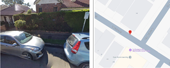
Item 2 Leichhardt Oval Special Event Parking Scheme 2026 (Baludarri-Balmain
Ward/Balmain Electorate/Leichhardt PAC)
SUMMARY
It is proposed to activate the Special Event Parking Scheme (SE) in the roads
surrounding Leichhardt Oval for the following NRL Games:
1. Round 2 Tigers vs Cowboys Saturday 14th March 2026 Kick off 3:00pm
2. Round 8 Tigers vs Raiders Thursday 23rd April 2026 Kick off 7:50pm
3. Round 15 Tigers vs Titans Sunday 14th June 2026 Kick off 4:00pm
Officers Recommendation:
That the Special Event Parking Scheme (SE) in the roads surrounding Leichhardt
Oval be activated for the following days during the times of 12:00pm-10:00pm for
NRL Fixtures in 2026:
1. Round 2 Tigers vs Cowboys Saturday 14th March 2026 Kick off 3:00pm
2. Round 8 Tigers vs Raiders Thursday 23rd April 2026 Kick off 7:50pm
3. Round 15 Tigers vs Titans Sunday 14th June 2026 Kick off 4:00pm
Local Transport Forum
8 December 2025
LTF Advice:
No advice provided by LTF members.
RECOMMENDATION:
That the Special Event Parking Scheme (SE) in the roads surrounding
Leichhardt Oval be activated for the following days during the times of
12:00pm-10:00pm for NRL Fixtures in 2026:
1. Round 2 Tigers vs Cowboys Saturday 14th March 2026 Kick off 3:00pm
2. Round 8 Tigers vs Raiders Thursday 23rd April 2026 Kick off 7:50pm
3. Round 15 Tigers vs Titans Sunday 14th June 2026 Kick off 4:00pm
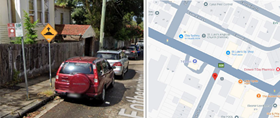
Item 3 Iron Cove Traffic Review Final Report (Baludarri-Balmain Ward/Balmain
Electorate/Leichhardt PAC)
SUMMARY
This report outlines the findings of the Final Iron Cove Traffic Review report. Council
undertook Public Exhibition of the draft Iron Cove Traffic Review Study through
Yoursay Inner West in June and July 2025. The Final report was developed based
on the feedback and review of the public exhibition.
The engagement responses indicated that the community generally supported all the
proposed changes.
After considering the Public Exhibition feedback, a review on the proposed scheme
was undertaken with minor adjustments made to the Traffic Review
recommendations and some additional recommendations added.
The recommended treatments will be included for consideration for funding in
Council’s Capital Works Program and submitted for State/Federal Government
Funding Programs where possible. Minor changes to signs and line marking will be
funded out of Council’s Operational Budgets.
Officers Recommendation:
1. That the treatments listed below from the Iron Cove Traffic Review Study be
approved and be listed for consideration in Council’s Traffic Facilities program and
operational line marking/signposting program and prioritised as identified in the
attached report:
a. That a Continuous Footpath Treatment with a median island be installed on
Toelle Street at the intersection with Victoria Road;
b. That a Continuous Footpath Treatment with a median island be installed on
Callan Street at the intersection with Victoria Road;
c. That a Continuous Footpath Treatment with a footpath widening be installed on
Springside Street at the intersection with Victoria Road;
d. That two speed humps be installed at No.39 and No.20 Moodie Street;
e. That a One-Way traffic arrangement be installed on Park Street northbound and
Oxford Street southbound;
f. That a Continuous Footpath Treatment be installed on Park Street at the
intersection with Darling Street; and
g. That a Continuous Footpath Treatment be installed on Oxford Street at the
Local Transport Forum
8 December 2025
intersection with Darling Street.
2. That further investigation be undertaken into the following:
a. Investigating a raised pedestrian and bicycle crossing on Moodie Street near
Victoria Road, including kerb extensions on both sides of the street; and
b. Additional consultation on the installation of a raised pedestrian crossing with
kerb extension on Cambridge Street at the intersection with Darling Street.
LTF Advice:
Public Speakers Henri Allen-Narker and Wayne O’Mara entered the meeting at
11.08am.
Mr Allen-Narker advised that the Moodie Street exit on Victoria Road is an essential
movement to ensure traffic flows smoothly in the area. Mr Allen-Naker noted that
there are current traffic flow issues in the nearby streets, which will be further
exacerbated if the ‘No Left Turn’ restriction were to be implemented for traffic turning
onto Victoria Road.
Mr O’Mara raised concerns regarding vehicles speeding down Callan Street from
Victoria Street, even though Callan Street is a ’10 k/m Shared Zone.’ Mr O’Mara
noted that there are currently limited traffic calming treatments on the street to deter
motorists from speeding and suggested that Council investigate additional traffic
calming treatments for the street. Mr O’Mara suggested the possibility of widening
the kerbs at the corner of McCleer Street and Callan Street so that it narrows the
entry point into Callan Street and acts as a visual deterrent for motorists speeding.
Mr O’Mara noted that recent changes allow for cars on both sides of Callan Street to
park on the footpath, and that this has opened up the road for vehicles to speed. Mr
O’Mara also suggested that additional police patrols or having mobile speed
cameras in the street may assist with deterring motorists from speeding down the
street.
Council Officers noted that the proposed ‘No Left Turn’ restriction from Moodie
Street into Victoria Road was not recommended to proceed and that the current
access will be retained.
Public Speakers Henri Allen-Narker and Wayne O’Mara left the meeting at
11.20am.
The Representative for the Member for Balmain queried whether the proposed ‘One-
Way’ traffic arrangement on Park Street would generate additional traffic on Park
Street and whether additional traffic calming measures would be implemented for
Park Street, Rozelle.
Council Officers noted that with ‘One Way’ traffic arrangements, there is a chance
that there will be an increase in local traffic movements as motorists will have to
circulate in the local road network. It was noted that, as there is already a ‘No Right
Turn’ restriction from Moodie Street into Park Street, the proposed changes would
further reduce southbound movements in the street. It was noted that in Council’s
review, traffic queues on Darling Street south of Victoria Road tend to terminate
before getting to Park Street, so Council does not anticipate a significant increase of
vehicles using Park Street to by pass the queue. Council Officers noted Council will
review the area after the implementation of the ‘One Way’ restrictions. Council
Officers noted that Transport for NSW have requested an additional report with
Local Transport Forum
8 December 2025
further analysis on the Traffic Management Plans (TMP) be brought back to the
Forum for review before implementation.
The Representative for the Member for Balmain queried if there was consideration
for an additional crossing on Darling Street at Denison Street, as the closest
crossing would be in Belmore Street, Rozelle. The Representative for Transport for
NSW requested that the Representative for the Member for Balmain send through
the request details to Transport for NSW to review and investigate.
No further advice provided by LTF members.
RECOMMENDATION:
1. That the treatments listed below from the Iron Cove Traffic Review Study
be approved and be listed for consideration in Council’s Traffic Facilities
program and operational line marking/signposting program and prioritised as
identified in the attached report:
a) That a Continuous Footpath Treatment with a median island be installed
on Toelle Street at the intersection with Victoria Road;
b) That a Continuous Footpath Treatment with a median island be installed
on Callan Street at the intersection with Victoria Road;
c) That a Continuous Footpath Treatment with a footpath widening be
installed on Springside Street at the intersection with Victoria Road;
d) That two speed humps be installed at No.39 and No.20 Moodie Street;
e) That a One-Way traffic arrangement be installed on Park Street
northbound and Oxford Street southbound;
f) That a Continuous Footpath Treatment be installed on Park Street at the
intersection with Darling Street; and
g) That a Continuous Footpath Treatment be installed on Oxford Street at the
intersection with Darling Street.
2. That further investigation be undertaken into the following:
a) Investigating a raised pedestrian and bicycle crossing on Moodie Street
near Victoria Road, including kerb extensions on both sides of the street; and
b) Additional consultation on the installation of a raised pedestrian crossing
with kerb extension on Cambridge Street at the intersection with Darling
Street.
Item 4 Percy Street, Rozelle - Proposed One Way Restriction (Baludarri-Balmain
Ward/Balmain Electorate/Leichhardt PAC)
SUMMARY
Council has received concerns from several residents about the narrow road width
with frequent reports of near miss incidents in Percy Street between Albion and
Evans Street in Rozelle. Residents have also reported the increase in traffic flows
from patrons of Totti's Restaurant in Rozelle further exacerbating this issue.
In response, investigation and consultation was undertaken for a one-way
southbound traffic flow, including associated signage and linemarking in Percy
Street, Rozelle as illustrated in Attachment 1.
Traffic analysis has indicated that Percy Street has a low volume of traffic, and that
the proposed one way will have minimal impact on the road network. Community
Local Transport Forum
8 December 2025
engagement indicated strong support for the proposal.
Officers Recommendation:
That the proposed one-way southbound traffic movement in Percy Street between
Albion and Evans Street, Rozelle including the associated signage and line marking
be approved.
LTF Advice:
The Representative for the Member for Balmain requested that a ‘Bicycles Excepted’
sign be installed at Percy Street, Rozelle, to allow for contraflow movement for
bicycles. Council Officers advised that an investigation and safety review will need to
be undertaken prior to the installation of the ‘Bicycles excepted’ signage.
No further advice provided by LTF members.
RECOMMENDATION:
That the proposed one-way southbound traffic movement in Percy Street
between Albion and Evans Street, Rozelle including the associated signage
and line marking be approved.
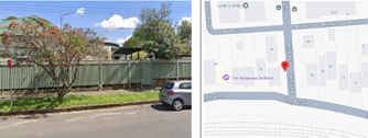
Item 5 Curtis Road and McDonald Street, Balmain - Proposed Pedestrian Crossing,
Continuous Footpath and One-Way Treatment (Baludarri-Balmain
Ward/Balmain Electorate/Leichhardt PAC)
SUMMARY
Council has received Get NSW Active Funding from Transport for NSW to improve
safety in Curtis Road and McDonald Street by constructing a raised pedestrian
crossing, continuous footpath treatment and implementing a partial One-Way
Treatment northbound restriction in McDonald Street between Hoffmans Lane and
Curtis Road, Balmain. The proposal aims to improve pedestrian and motorist safety
by better defining safe pedestrian crossing points and addressing pedestrian safety
and driver behaviour at this location.
The existing 'No Stopping' sign on the northern side of Curtis Road is required to be
relocated by approximately 3 metres as per attached plan. Six (6) parking spaces
will still be retained to the nearest driveway.
Officers Recommendation:
That the attached detailed design plan (Plan No.10358) for the proposed raised
pedestrian crossing and continuous footpath treatment in Curtis Road Balmain and
the proposed partial one-way northbound restriction McDonald Street between
Hoffmans Lane and Curtis Road, Balmain as per attached plan be approved.
LTF Advice:
Public Speakers Rob Nelson Williams, Beatrice Claflin and Fred Randall entered the
meeting at 11.28am.
Mr Williams raised concerns regarding the detailed design proposed and suggested
Local Transport Forum
8 December 2025
additional traffic calming measures, such as speed cushions on either side of the
pedestrian crossing to further restrict the road and reduce speeds. Mr Williams noted
that Curtis Road is a common ‘rat run’ and speeding is a common issue experienced
on the street. It was noted that additional traffic calming measures can be
investigated as part of the Birchgrove, Balmain East LATM however, Mr Williams
requests that potential traffic calming measures be investigated as a part of this
project.
Ms Claflin agreed with Mr Williams suggestion for additional traffic calming
measures to be investigated and raised concerns regarding the proposal being a
solution to one component of the various issues experienced in the area. Ms Claflin
questioned why additional traffic calming treatments were not included as part of the
proposal. Ms Claflin noted her concerns regarding the proposed removal of the
existing concrete refuge island, as it assists with pedestrian safety in the area and
requested a safety audit to be undertaken. It was noted that the refuge island has
been acting as a buffer between pedestrians and vehicles, and that since the
installation of the island, cars have been hitting into the island instead of
pedestrians. Ms Claflin noted that the removal of the island and without the
installation of additional traffic calming treatments to make cars physically slow down
before the corner, and the raised crossing will likely result in a vehicle/pedestrian
accident. Ms Claflin suggested applying the same design and plan of the crossing
implemented at Curtis Street and Church Street, and that having speed bumps on
the street will deter drivers from speeding. Ms Claflin also noted that the proposed
‘One Way’ treatment on McDonald Street will cause accessibility issues for
emergency vehicles trying to service the area and push additional traffic onto Curtis
Road. It was also noted that Ms Claflin had concerns regarding leaf litter and
possible flooding should the proposed pedestrian crossing and curbs be
implemented.
Mr Randall agreed that Curtis Street is a rat run and requires additional traffic
calming measures to ensure the design works and to treat the speeding issues in
the street. Mr Randall also noted that there was a ‘Pedestrian Refuge’ sign on the
western side of Curtis Road approaching Thames Street that needs to be attended
to as the 2 concrete islands on the road do not fall into the guidelines of a pedestrian
refuge.
Public Speakers Rob Nelson Williams, Beatrice Claflin and Fred Randall left the
meeting at 11.48am.
Council Officers noted that the project was initiated through a meeting with the
Mayor, staff and residents from Curtis Road regarding concerns of speeding
vehicles and pedestrian safety. It was noted that the subsequent proposal for two (2)
raised pedestrian crossings was previously supported by the Local Transport Forum
and were subsequently adopted by Council to address these issues. It was noted
that Council was also able to successfully obtain grant funding for the project under
the Get NSW Active program. Council Officers noted the residents' comments
regarding the existing refuge island and noted that the current refuge is substandard
in size and unable to safely store pedestrians. It was noted that there was no
opportunity to widen the island as traffic would not be able to pass through. It is
noted that the geometry of the intersection is quite tight, which is why there are often
vehicles hitting into the refuge island. It was noted that the proposed crossing will
replace the existing refuge island and as part of that the proposed crossing will have
to move slightly into the McDonald Street intersection. It was noted Council had
proposed to convert McDonald Street into a ‘One-Way’ as the throat of that
Local Transport Forum
8 December 2025
intersection will have to be reduced to make space for the pedestrian crossing.
Council Officers noted that the proposed pedestrian crossing will be raised so it will
provide a traffic calming impact for both the approach and departure sides of the
intersection. It was noted that a review of the safety of the pedestrian crossing has
been undertaken and that the sight lines are adequate to allow vehicles approaching
that corner to see pedestrians. Council Officers noted that speed cushions on
approach to a raised crossing has been used in limited circumstances; however, not
as a first option. It was noted that Council usually implements speed cushions on the
approach to pedestrian crossing at locations where there are continued safety
issues and is typically at locations with older crossing designs or very high volumes
of pedestrian and vehicle movements. Council Officers noted that the current
proposal is sufficient to address the concerns. Council Officers noted that they will
continue to review the area and that the area will also fall into the
Birchgrove/Balmain East, Local Area Traffic Management study. It was noted that
there is another raised pedestrian crossing getting installed on Curtis Road at the
intersection with Darling Street, which will provide a traffic calming function, and it
will be installed before the proposed project is scheduled for completion.
Council Officers noted that it was necessary to convert McDonald Street into a ‘One
Way’ movement as the road geometry requires that the raised crossing be pushed
slightly east because of the existing driveways, so there's not enough width at the
intersection of McDonald Street and Curtis Road to allow for two-way traffic.
Council Officers tabled comments from a resident requesting that the ‘One Way’
restriction was to go ahead that the restriction be placed in McDonald Street
between Curtis Road and Darling Street. The resident also noted that they were
opposed to the proposed installation of the speed bumps at the halfway point
between the two pedestrian crossings.
No further advice provided by LTF members.
RECOMMENDATION:
That the attached detailed design plan (Plan No.10358) for the proposed raised
pedestrian crossing and continuous footpath treatment in Curtis Road
Balmain and the proposed partial one-way northbound restriction McDonald
Street between Hoffmans Lane and Curtis Road, Balmain as per attached plan
be approved.
Item 6 Flood Street, Leichhardt - Proposed Motor Bike Only Parking (Gulgadya-
Leichhardt/Balmain Electorate/Leichhardt PAC)
SUMMARY
Council has received several requests to improve visibility at the driveway of 141
Allen Street located on Flood Street, Leichhardt. To improve visibility for drivers
when exiting the driveway, it is proposed to convert 3m of unrestricted parking space
immediately south of the driveway on Flood Street into ‘Motor Bike Only’ parking.
Officers Recommendation:
That a 3m length ‘Motor Bike Parking’ zone be installed on the south side of the
driveway for 141 Allen Street on Flood Street Leichhardt.
Local Transport Forum
8 December 2025
LTF Advice:
The Representative for the Member of Balmain questioned if the ‘Motor Bike
Parking’ zone could be converted to bicycle parking.
Council Officers noted that they are looking into opportunities to provide more
bicycle parking; however, as the proposed ‘Motor Bike Parking’ zone is on the road,
it would be unsafe for bikes to be left on the road without providing additional
protection.
No further advice provided by LTF members.
RECOMMENDATION:
That a 3m length ‘Motor Bike Parking’ zone be installed on the south side of
the driveway for 141 Allen Street on Flood Street Leichhardt.
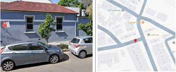
Item 7 Palace Street at Brighton Street, Petersham - Proposed Raised Pedestrian
Crossings - Design Plan 10356-1 (Damun-Stanmore Ward / Newtown
Electorate / Inner West PAC)
SUMMARY
This report details the design plan (No.10356-1) for the construction of two raised
pedestrian crossings and the result of community consultation at the intersection of
Palace Street and Brighton Street, Petersham. Following a local traffic area
management (LATM) study in 2023 for the Petersham North Precinct, consultation
responses and site observation raised concerns to improve pedestrian safety and
speeding issues. The study recommended that a raised pedestrian crossing be
installed on the southern leg of Palace Street, and the western leg of Brighton Street
to improve pedestrian connectivity to local businesses, Fort Street High and
Petersham Station. The design and construction of the proposed raised pedestrian
crossings have received fifty percent contribution from the Federal Government
Active Transport Fund and will be included in Council's Traffic Facilities Capital
Works Program for funding in 2025/2026 financial year.
Officers Recommendation:
That the detailed design plan (No.10356-1) for the construction of two raised
pedestrian crossings at the intersection of Palace Street and Brighton Street,
Petersham be approved in order to improve pedestrian safety at this intersection.
LTF Advice:
Council Officers tabled comments from residents questioning when and and why
Council chooses to apply the TfNSW guideline instead of the reduced warrant used
earlier in the same LATM. Council Officers noted that the reduced warrant and
Pedestrian Crossing Guideline (PCG) are both supplied by TfNSW. The Petersham
North LATM study was conducted during the time where the PCG was being
developed and superseded the previous reduced warrant guideline. The pedestrian
crossing on Palace Street south of Brighton Street meets the warrant provided in the
PCG (equal or greater than 20 pedestrian movements) as it did not require a specific
vehicle volume to be met. It is also noted that the location is a significant walking
Local Transport Forum
8 December 2025
route connecting pedestrians to Petersham Station, Fort Street High School, local
cafes and businesses. Hence, it is recommended that a crossing be installed at this
location to provide better and safer opportunities for pedestrians to cross Palace
Street.
Council Officers tabled comments from residents questioning whether any policy
exists guiding how these different warrant systems are selected and prioritised.
Council Officers noted that Council currently uses the Inner West Pedestrian
Crossing Warrant Policy (2024) which states: “A pedestrian (zebra) crossing may
also be considered at locations where there is a deviation from meeting the warrant,
such as where the pedestrian crossing would serve as an essential link to an overall
network of pedestrian facilities, or for a vulnerable group such as children, the
elderly or mobility impaired.”
Council Officers tabled comments from residents questioning why the consultation
material for Plan 10356-1 did not clearly explain that the proposed southern crossing
relies on an entirely different warrant test than the one used on page 18 of the
Petersham North LATM plan. Council Officers noted that the Petersham North LATM
study has outlined Council’s recommendation to install a pedestrian crossing on
Palace Street south of Brighton Street. The consultation letter mailed out was
completed by Council’s Design Team to provide residents with the opportunity to
comment on the detailed design proposal as opposed to the study into the merits of
a crossing at this location. Concerns and other matters raised regarding the
proposed crossings have been included in the Local Transport Forum report, with
comments provided.
The Chairperson questioned whether the proposed landscaping and garden beds
could be altered to retain more parking. Council Officers note that the proposed
garden beds reduce the amount of parking that needs to be removed, as a typical
‘No Stopping’ on approach to a pedestrian crossing without kerb extensions is 20
metres; however, with the proposed garden beds in place, the ‘No Stopping’ can be
reduced to approximately 7.5 metres.
Council Officers also noted that they have met with the principal of Fort Street High
School and that they were supportive of the proposal.
No further advice provided by LTF members.
RECOMMENDATION:
That the detailed design plan (No.10356-1) for the construction of two raised
pedestrian crossings at the intersection of Palace Street and Brighton Street,
Petersham be approved in order to improve pedestrian safety at this
intersection.
Item 8 Palace Street at Andreas Street, Petersham - Proposed Raised Pedestrian
Crossings - Design Plan 10356-2 (Danum-Stanmore Ward / Newtown
Electorate / Inner West PAC)
SUMMARY
A local traffic area management (LATM) study for the Petersham North Precinct was
undertaken in 2023. The study, in part, recommended that a raised pedestrian
crossing be installed on the northern leg of Palace Street, and the western leg of
Local Transport Forum
8 December 2025
Andreas Street to improve pedestrian connectivity to local businesses, Fort Street
High and Petersham Station.
This report details the design plan (No.10356-2) for the construction of two raised
pedestrian crossings and the result of community consultation at the intersection of
Palace Street and Andreas Street, Petersham. The design and construction of the
proposed raised pedestrian crossings have received fifty percent contribution from
the Federal Government Active Transport Fund and is included in Council's Traffic
Facilities Capital Works Program for the 2025/2026 financial year.
Officers Recommendation:
That the detailed design plan (No.10356-2) for the construction of two raised
pedestrian crossings at the intersection of Palace Street and Andreas Street,
Petersham be approved in order to improve pedestrian safety at this location.
LTF Advice:
Council Officers tabled comments from a resident who considered that the proposal
is unnecessary and not fit for purpose as the volume of students will not funnel into a
single pedestrian crossing. Council Officers noted that pedestrian volumes are
expected to increase when the crossings are installed, as they will provide better
and safer opportunities for pedestrians to cross. It was also noted that the data
collected shows that the intersection experiences peak pedestrian traffic of 413
movements per hour, indicating that there is significant use of the intersection
currently.
Council Officers table comments regarding resident concerns in relation to loss of
parking and the need for the pedestrian crossing for Palace Street.
Council Officers tabled comments from a resident requesting additional speed
calming measures on Brighton Street approaching Palace Street.
No further advice provided by LTF members.
RECOMMENDATION:
That the detailed design plan (No.10356-2) for the construction of two raised
pedestrian crossings at the intersection of Palace Street and Andreas Street,
Petersham be approved in order to improve pedestrian safety at this location.
Item 9 Holmwood Lane, Newtown - Proposed installation of a short section of 'No
Parking' restrictions (Damun-Stanmore Ward / Newtown Electorate / Inner
West PAC)
SUMMARY
A request has been received from a resident of Holmwood Street, Newtown for the
provision of a short section of ‘No Parking’ restrictions on the southern side of
Holmwood Lane, to improve vehicular access to the rear of their property.
Consultation was undertaken with surrounding residents to determine the level of
community support for the installation of a short section of full-time ‘No Parking’
restrictions. The results of the survey are presented in this report for the Committee
Local Transport Forum
8 December 2025
to consider.
In view of the low level of support from residents it is recommended that no changes
be made to the existing parking restrictions in Holmwood Lane, Newtown at this time
and that Council Rangers be requested to undertake regular enforcement of the
current parking restrictions in the area.
Officers Recommendation:
1. That Council not accede to the request for the provision of a short section of ‘No
Parking’ signage along the southern side of Holmwood Lane, Newtown east of Pearl
Lane due to the low level of community support, and
2. That Council's Rangers be requested to undertake regular enforcement of the
current parking restrictions in the area.
LTF Advice:
Public Speaker Kenneth Macdonald entered the meeting at 11.49am
Mr Macdonald opposed the proposed recommendation and requested that the
proposed ‘No Parking’ signage along the southern side of Holmwood Lane,
Newtown east of Pearl Lane be approved. Mr Macdonald noted that 2 properties
opposite his property have off-street parking and driveways, and that they often
cannot park their vehicles on their properties due to their driveways being
obstructed. Mr Macdonald also noted that he and his neighbours' gates are often
obstructed, causing difficulty for them to take their bins out as well as get their
motorbikes and pushbikes in and out of their properties. Mr Macdonald advised that
reporting dangerous parking to Council often leads to altercations and that he has
had his property damaged in retaliation for reporting illegal parking.
Public Speaker Kenneth Macdonald left the meeting at 11.53am
Council Officers tabled comments from a resident, noting their concerns regarding
the parking situation in Dickson Street, Newtown and requested a review of the
parking arrangements as the parking issues in Dickson Street negatively impact
Holmwood Street. Council Officers noted that Council will be consulting with the
residents of Dickson Street early next year on proposed angled parking restrictions.
Council Officers noted that the ‘No Parking’ signs were not requested across a
driveway but rather a rear gate and that the resident may need construct a driveway
in the first instance.
No further advice provided by LTF members.
RECOMMENDATION:
1. That Council not accede to the request for the provision of a short section
of ‘No Parking’ signage along the southern side of Holmwood Lane, Newtown
east of Pearl Lane due to the low level of community support, and
2. That Council's Rangers be requested to undertake regular enforcement of
the current parking restrictions in the area.
Item 10 Amendment to Sydenham Station Parking Study Recommendation
Local Transport Forum
8 December 2025
SUMMARY
This report outlines the updated recommendation for the Sydenham Station Parking
Study that was reported to the September 2025 Local Transport Forum. Council has
received notice that recommendation item 2 recommended Sutherland Street to be
consulted for ‘2P 8am-10pm Permit Holders Excepted Area M4’s instead of Samuel
Street, despite being included in the proposed plan. Council proposes to update the
recommendation to include the southern side of Samuel Street between Henry
Street and Unwins Bridge Road.
Officers Recommendation:
That consultation be undertaken into installing new "2P 8am-10pm Permit Holders
Excepted Area M4" on the southern side of Samuel Street between Henry Street
and Unwins Bridge Road in order to fully address the proposals within the
Sydenham Parking Study which was presented to the September 2025 Local
Transport Forum.
LTF Advice:
No advice provided by LTF members.
RECOMMENDATION:
That consultation be undertaken into installing new "2P 8am-10pm Permit
Holders Excepted Area M4" on the southern side of Samuel Street between
Henry Street and Unwins Bridge Road in order to fully address the proposals
within the Sydenham Parking Study which was presented to the September
2025 Local Transport Forum.
Item 11 Charlotte Avenue, Marrickville - Request for a residential parking scheme
(Midjuburi-Marrickville Ward / Summer Hill Electorate / Inner West PAC)
SUMMARY
Upon receiving another petition from residents of Charlotte Avenue, Marrickville
Council initiated a further investigation for implementing a Residential Parking
Scheme (RPS) on the western side of Charlotte Avenue between Myrtle Street and
Riverdale Avenue. Recent parking occupancy surveys conducted by Council
Officers indicated a high parking demand in the street during peak hours of the day.
This report provides the results of the recent resident parking scheme investigation
in Charlotte Avenue, Marrickville.
Officers Recommendation:
That the proposal to implement Resident Parking Scheme restrictions ‘2P 8.30am –
6.00pm Monday – Friday Permit Holders Excepted Area M2’ in Charlotte Avenue on
the western side between Myrtle Street and Riverdale Avenue, Marrickville is not
supported at this time due to insufficient resident support.
LTF Advice:
No advice provided by LTF members.
Local Transport Forum
8 December 2025
RECOMMENDATION:
That the proposal to implement Resident Parking Scheme restrictions ‘2P
8.30am – 6.00pm Monday – Friday Permit Holders Excepted Area M2’ in
Charlotte Avenue on the western side between Myrtle Street and Riverdale
Avenue, Marrickville is not supported at this time due to insufficient resident
support.
Item 12 Depot Lane, Marrickville - Proposed installation of 'No Parking' restrictions
(Midjuburi-Marrickville Ward / Summer Hill Electorate / Inner West PAC)
SUMMARY
Council has received concerns that vehicles are parking in a manner that limits the
ability of residents accessing their driveways. In order to alleviate this issue, it is
proposed to signpost an additional section of 'No Parking’ restrictions along the
western side of Depot Lane, Marrickville
Officers Recommendation:
That the installation of a 12-metre extension to the existing 8 metre length of full-time
‘No Parking’ restrictions on the western side of Depot Lane, Marrickville opposite the
rear of No.12 Cecilia Street to the north boundary line of No.16 Cecilia Street be
approved, in order to improve vehicular access to off-street parking for adjacent
residents in the laneway.
LTF Advice:
No advice provided by LTF members.
RECOMMENDATION:
That the installation of a 12-metre extension to the existing 8 metre length of
full-time ‘No Parking’ restrictions on the western side of Depot Lane,
Marrickville opposite the rear of No.12 Cecilia Street to the north boundary line
of No.16 Cecilia Street be approved, in order to improve vehicular access to
off-street parking for adjacent residents in the laneway.
Item 13 Livingstone Road, Marrickville – Pedestrian Crossing Review (Midjuburi-
Marrickville Ward /Summer Hill Electorate /Inner West LAC)
SUMMARY
At the Council Meeting held 23 September 2025 a Notice of Motion (NoM) for
‘Review of Pedestrian Crossing – Livingstone Road, Marrickville’ was considered. It
noted that residents have raised repeated concerns that despite the raised design,
the Livingstone Road pedestrian crossing continues to pose risks for pedestrians
and reports of several near misses highlight the need to review whether additional
measures dash; such as improved sightlines, signage, lighting, or traffic calming
dash; are necessary to ensure the crossing functions as intended. Noting also that a
review of this crossing would be consistent with Council’s commitment to road
safety, active transport, and creating safer streets for all users, particularly the most
vulnerable.
Local Transport Forum
8 December 2025
Officers Recommendation:
1. That the installation of kerb blisters on the southern side of Livingstone Road,
Marrickville at the pedestrian crossing outside St Nicholas Church be approved and
included in Council’s Traffic Facilities Forward Works Program with these kerb
blisters being provided initially as a painted treatment.
2. That the missing section of 'zig zag' lines on the northbound approach to the
crossing commencing mid-way across the railway bridge up to Hollands Avenue be
reinstated in order to alert approaching motorists of the crossing.
LTF Advice:
No advice provided by LTF members.
RECOMMENDATION:
1. That the installation of kerb blisters on the southern side of Livingstone
Road, Marrickville at the pedestrian crossing outside St Nicholas Church be
approved and included in Council’s Traffic Facilities Forward Works Program
with these kerb blisters being provided initially as a painted treatment.
2. That the missing section of 'zig zag' lines on the northbound approach to
the crossing commencing mid-way across the railway bridge up to Hollands
Avenue be reinstated in order to alert approaching motorists of the crossing.
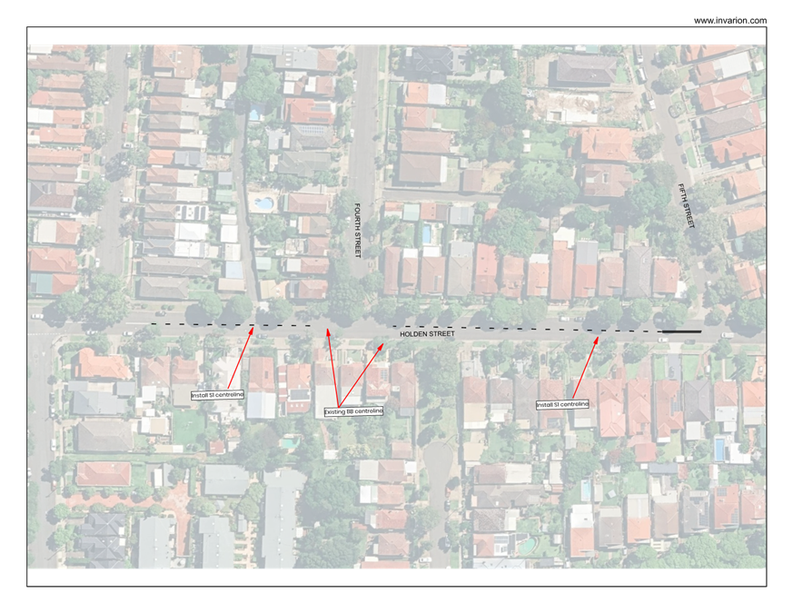
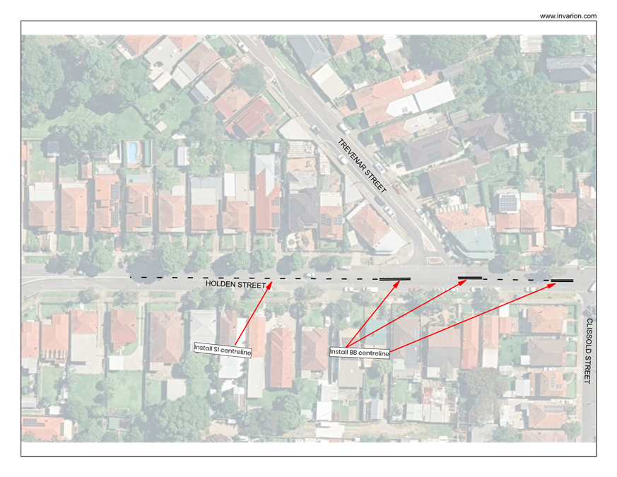
Item 14 Holden Street, south of Trevenar Street, Ashbury-New raised pedestrian
(zebra) crossing (Djarrawunang-Ashfield Ward/Summer Hill
Electorate/Burwood PAC).
SUMMARY
Holden Street south of Clissold Street, Ashfield is the boundary line between Inner
West Council (IWC) to the eastern side and Canterbury Bankstown Council (CBC) to
the western side. Both Councils have collaborated and proposed that a new raised
pedestrian (zebra) crossing be installed in Holden Street south of Trevenar Street.
This is in response to various community and councillor/State member requests for a
safe road crossing to be installed in Holden Street, between Clissold Street and
Armstrong Street.
Canterbury Bankstown Council has carried out the design of the crossing as shown
in Attachment 1 and has conducted the necessary consultation with effected
residents and shops owners on both sides of the street through discussions with
Inner West Council. It has also reported the matter to its Local Transport Forum
dated 14 October 2025 recommending to approve the crossing based on road
safety. See report shown in Attachment 2, and Attachment 3 for the Local Transport
Forum minutes-item 26. Canterbury Bankstown Council has subsequently approved
the proposal at its meeting on 28 October 2025.
Approval is therefore sought from Inner West Council for the installation of a raised
pedestrian (zebra) crossing in Holden Street, south of Trevenar Street, Ashbury, as
shown in Attachment 1 based on the reported information as provided in Attachment
2 and supplementary information as provided under this report.
Local Transport Forum
8 December 2025
The crossing is aimed to be built in the 2026/2027 financial year subject to funding
from Transport for NSW under the NSW Get Active Program.
Officers Recommendation:
1. That the Canterbury Bankstown Council report to its Local Transport Forum
dated 14 October 2025 as shown in Attachment 2 be received and noted.
2. That the detailed design of the new raised pedestrian (zebra) crossing in
Holden Street, south of Trevenar Street, Ashbury, with landscape kerb
extensions and footpath, drainage inclusions, adjacent driveway modifications,
and associated signs and line marking as shown in the Canterbury Bankstown
Council (drawing no. CBC03193 in Attachment 1), be approved.
LTF Advice:
No advice provided by LTF members.
RECOMMENDATION:
1. That the Canterbury Bankstown Council report to its Local Transport
Forum dated 14 October 2025 as shown in Attachment 2 be received and
noted.
2. That the detailed design of the new raised pedestrian (zebra) crossing in
Holden Street, south of Trevenar Street, Ashbury, with landscape kerb
extensions and footpath, drainage inclusions, adjacent driveway
modifications, and associated signs and line marking as shown in the
Canterbury Bankstown Council (drawing no. CBC03193 in Attachment 1),
be approved.
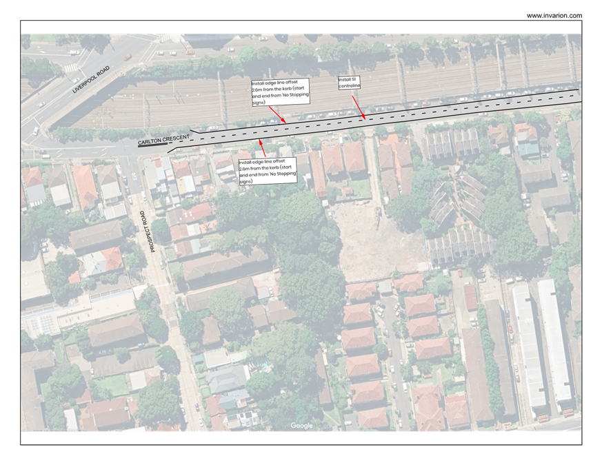
Item 15 Murrell Street, Ashfield- Optional treatments for improved road safety
(Djarrawunang-Ashfield Ward/Summer Hill Electorate/Burwood PAC)
SUMMARY
A Notice of Motion was raised at the Council meeting on the 11 March 2025 to carry
out a traffic study or investigative measures to improve road safety and
management, with particular focus on pedestrian (school child) safety and speeding
in Murrell Street, Ashfield.
This report identifies traffic management and safety improvements made to date,
and addresses issues as raised in the Notice of Motion. It further establishes (3)
optional design treatments (in concept) to address continued concerns raised by the
Ashfield Public School regarding pedestrian safety, particularly with school children,
and speeding in the street.
These treatments (in plan) are shown in Attachment 3, 4 and 5 and range from
establishing pedestrian (zebra) crossings, kerb extensions, footpath widening and
shared zone.
A description, with advantages and disadvantages to each option, together with an
approximate cost estimate to carry out the work to each option is explained in the
report.
Local Transport Forum
8 December 2025
The proposed treatments are provided for the Local Transport Forum to consider
with a view to consult and propose Option 1 which includes a midblock raised
crossing in Murrell Street and kerb extension-road narrowing of Murrell Street at
Liverpool Road.
Officers Recommendation:
1. That the Forum notes the actions and road safety improvements made to date
in Murrell Street.
2. That Option 1 as shown in Attachment 3 (under concept design) with a midblock
raised pedestrian (zebra) crossing in Murrell Street and a kerb extension
facility in Murrell Street at Liverpool Road, Ashfield, be supported in principle and
that community engagement be undertaken on this option with the results being
bought back to the Forum for consideration.
LTF Advice:
The Representative for the Member of Summer Hill questioned if it would be
possible to create a road to connect Orchard Crescent to Brown Street, Ashfield.
Council Officers advised that it would not be feasible as the land is privately owned.
No further advice provided by LTF members.
RECOMMENDATION:
1. That the Forum notes the actions and road safety improvements made to
date in Murrell Street.
2. That Option 1 as shown in Attachment 3 (under concept design) with a
mid-block raised pedestrian (zebra) crossing in Murrell Street and a kerb
extension facility in Murrell Street at Liverpool Road, Ashfield, be supported in
principle and that community engagement be undertaken on this option with
the results being bought back to the Forum for consideration.
Item 16 Proposed EV Kerbside Charging Locations (All Wards / All Electorates / All
PACs)
SUMMARY
Council is committed to supporting and encouraging the use of electric vehicles
(EVs) in the Inner West. Following the adoption of “Powering Ahead”, Council's
Electric Vehicle Encouragement Strategy (2023), Council has partnered with several
kerbside public charging providers and has been successful in gaining State
Government funding for the provision of kerbside EV charging.
The current rollout of chargers will be installed by EVX and Plus ES. This work is
being delivered under the Transport and Infrastructure State Environmental Planning
Policy, which allows them to install chargers without Council approval.
To ensure EV owners can easily use the chargers, Council is proposing to change
parking restrictions to "No Parking 8am - 10pm EV excepted while charging" at a
number of charging sites. Targeted engagement has been undertaken and a
summary of the engagement outcomes has been provided with associated
Local Transport Forum
8 December 2025
recommendations and signage/line marking plans.
Officers Recommendation:
That the EV charging sites identified in Table 2. be supported and signposted as a
dedicated EV kerbside charging space as per the signage and line marking plans
provided in Attachment 1.
LTF Advice:
The Representative for the Member for Summer Hill questioned how Council
concluded that the proposed EV charger at 113 Dobroyd Parade, Haberfield, will
result in no loss of parking space. Council Officers noted that the space will be
reallocated to EV’s rather than removed and the placement of the signs will not
result in a loss of a further parking space. Additionally, it was noted that this space is
currently approved as a ‘No Stopping’ area but this restriction is no longer required
as it extended over a now redundant driveway.
The Representative for the Member for Summer Hill questioned why the location of
the proposed EV charger was labelled as 99 Ramsay Street, Haberfield when the
actual charging unit will be installed on the corner of Kingston Street, Haberfield.
Council Officers noted that the EV suppliers provide the coordinates and name the
location and often name it after the closest property rather than the street of the
charger.
Council Officers tabled comments from a resident opposing the installation of EV
chargers on Merchant Street, Stanmore, noting that there are already existing
parking issues on the street that make parking difficult and that the installation of the
proposed EV chargers on Merchant Street will only worsen the situation.
The Chairperson noted that the report noted that there were 2 votes received, 1 for
and 1 against the recommendation and questioned how Council decided to support
the EV charger installation. Council Officers noted that there was a total of 7
submissions received for this proposal, with 5 submissions from nearby residents in
support of the proposal and that the 2 votes noted were from residents on Merchant
Street.
The Representative for the Member for Summer Hill suggested that the proposed
installation on the EV charger at 99 Ramsay Street be relocated further up Ramsay
Street, outside the BP petrol station.
No further advice provided by LTF members.
RECOMMENDATION:
1. That the EV charging sites identified in Table 2. be supported and
signposted as a dedicated EV kerbside charging space as per the signage and
line marking plans provided in Attachment 1.
2. That Council investigate the relocation of the proposed EV charging
station at 99 Ramsay Street further south of Ramsay Street.
General Business Items:
Local Transport Forum
8 December 2025
Item 17: Council’s new business papers system- The Representative for the
Inner West Bicycle Coalition noted that Council’s new business paper system does
not provide item numbers or page numbers against attachments in the agenda,
which makes it difficult to look through the agenda to find the page they are looking
for, especially when there are large attachments like what was in this month’s
agenda. Council Officer’s advised they will pass on the feedback to the relevant
team to review.
Item 18: Bill Holliday retirement from the Forum- The Chairperson advised Bill
Holliday, Representative for the Member for Balmain, has retired from the
Committee after 10 years of service and requested that Council formally write to Bill
to express the Committee’s gratitude and thank him for his efforts over the years.
Meeting closed 1.00pm
|
|
Local Transport Forum Meeting 16 February 2026 |
|
AGENDA |
1 Apologies
2 Disclosures of Interest
3 Confirmation of Minutes Page
Minutes of 8 December 2025 Local Transport Forum 23
4 Matters Arising from Council’s Resolution of Minutes
5 Part A – Items Where Council May Exercise Its Delegated Functions
Traffic Matters
ITEM Page
LTF0226(1) Item 1 Inner West LGA - Proposal for GoGet car share parking spaces (All wards, all electorates, all PACs) 45
LTF0226(1) Item 2 InnerWest@40 - Area 4 Leichhardt and Annandale; Area 9 Dulwich Hill North and Lewisham; Area 10 South Ashfield and Summer Hill West - Proposed speed limit reduction from 50km/h to 40km/h (Damun - Stanmore, Djarrawunang - Ashfield and Gulgadya - Leichhardt Wards / Balmain, Summer Hill, Newtown and Strathfield Electorates / Burwood, Leichhardt and Inner West PAC) 73
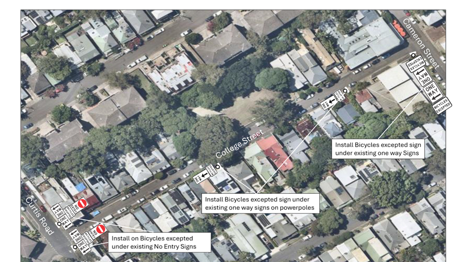
LTF0226(1) Item 3 College Street, Balmain - Proposed Bicycles Excepted Signage(Baludarri-Balmain Ward/Balmain Electorate/Leichhardt PAC) 107
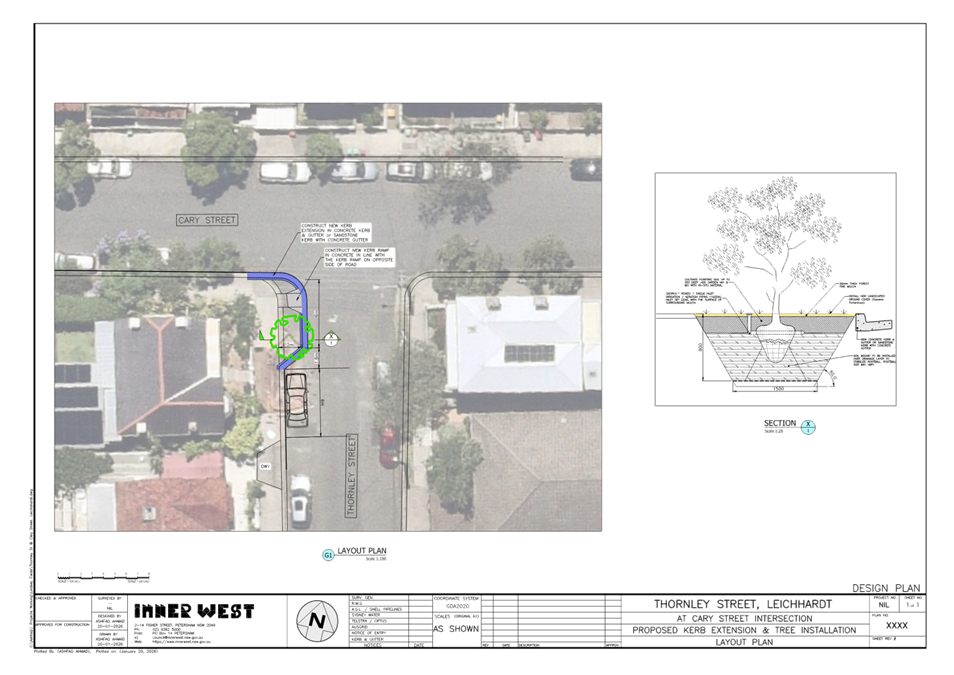
LTF0226(1) Item 4 Thornley Street, Leichhardt - Proposed Kerb Extension (Leichhardt-Gulgadya Ward / Balmain Electorate / Leichhardt PAC) 110
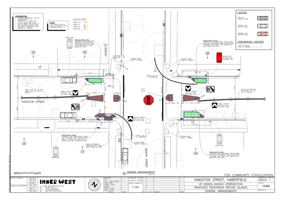
LTF0226(1) Item 5 Kingston Street, Haberfield - Proposed Traffic Calming Works (Gulgadya-Leichhardt Ward/Summer Hill Electorate/Burwood PAC) 113
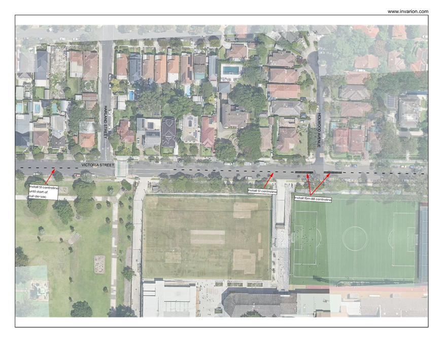
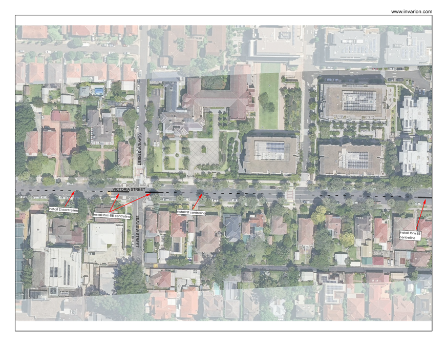
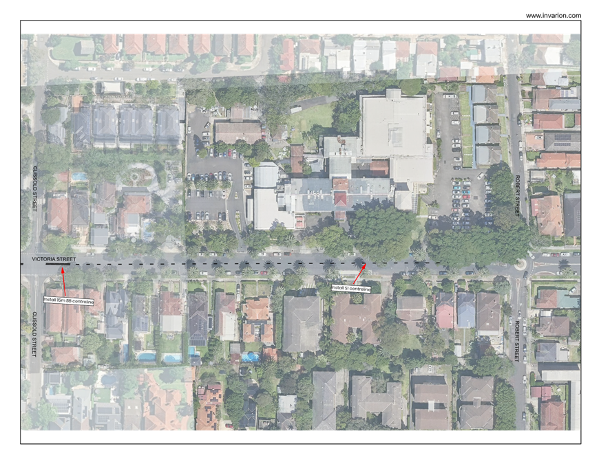
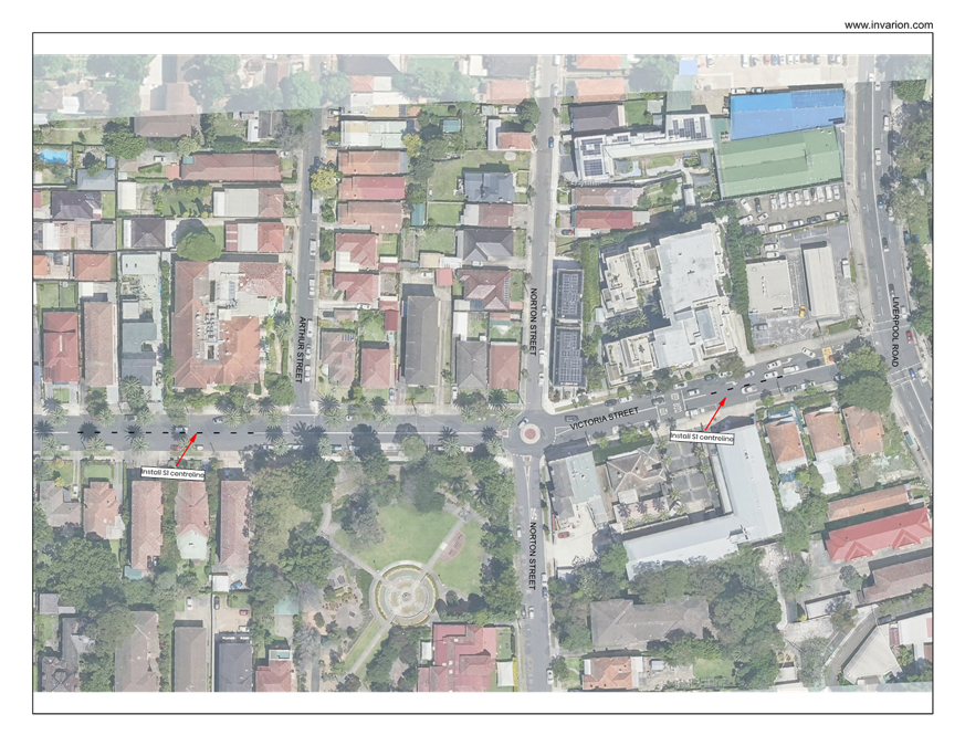
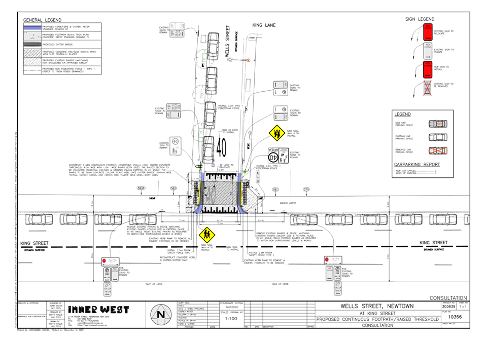
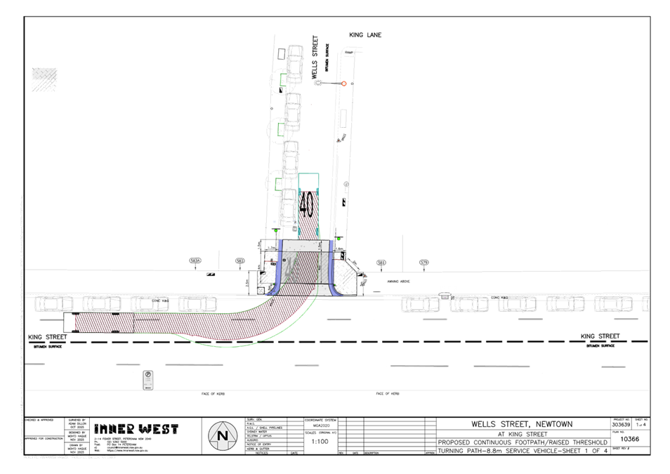
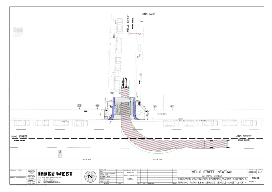
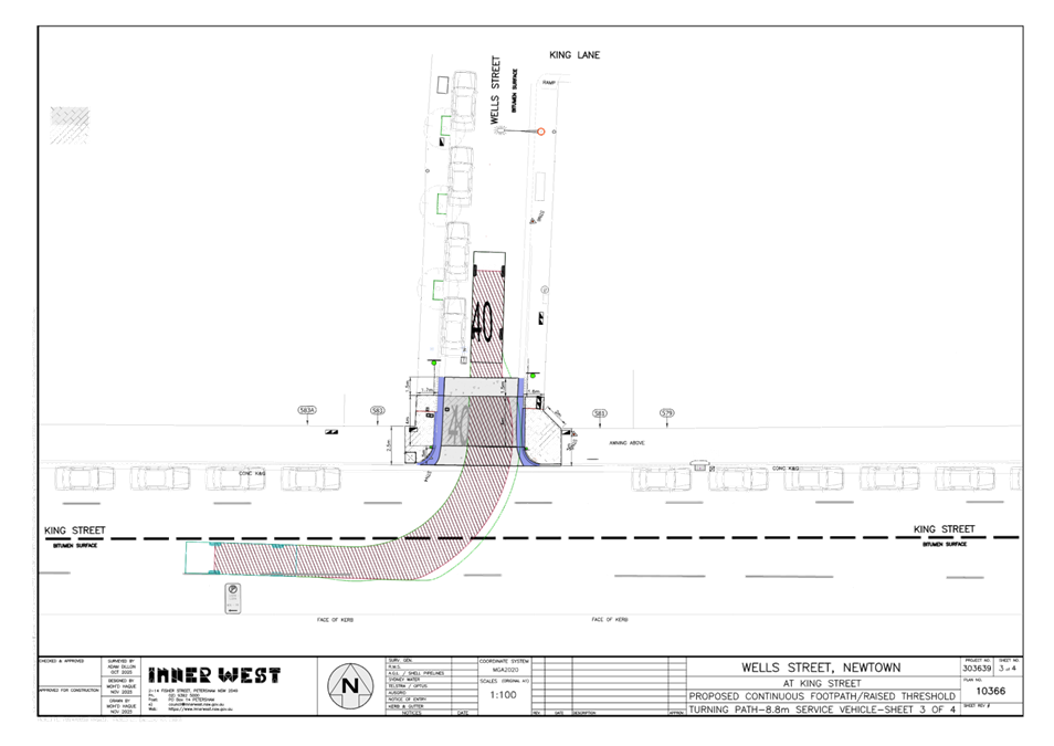
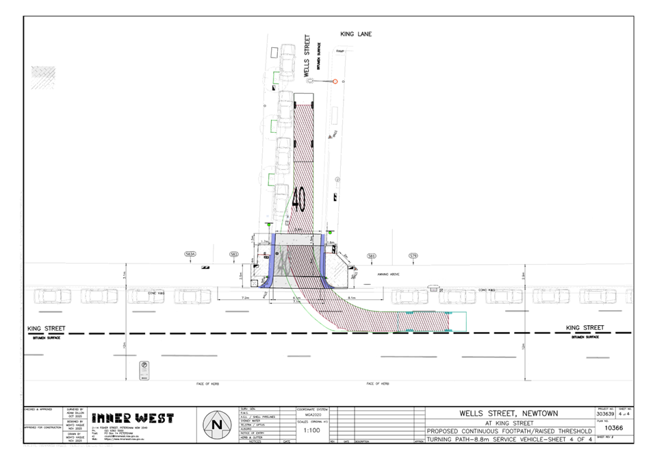
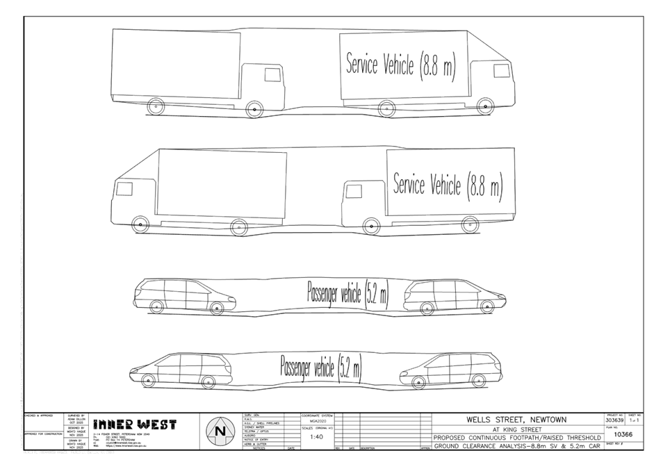
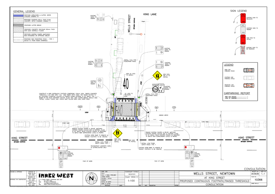
LTF0226(1) Item 6 Wells Street, Newtown - Proposed Raised Continuous Footpath Treatment (Damun - Stanmore Ward / Newtown Electorate / Inner West PAC) 116
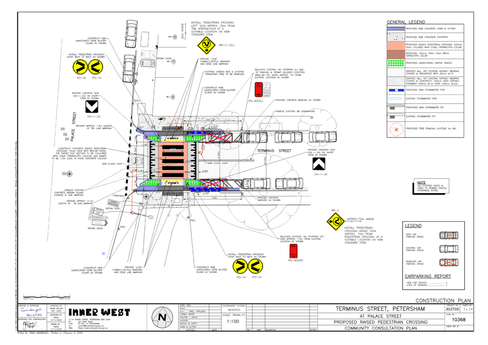
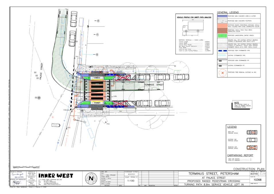
LTF0226(1) Item 7 Terminus Street, Petersham - Proposed Raised Pedestrian Crossing - Design Plan No.10368 - (Danum-Stanmore Ward / Newtown Electorate / Inner West PAC) 126
LTF0226(1) Item 8 Dickson Street at King Street, Newtown – Redesign of existing refuge island - Design Plan 10365 (Damun-Stanmore Ward / Newtown Electorate / Inner West PAC) 132
LTF0226(1)
Item 9 Hardie Avenue (at Smith Street), Summer Hill-Proposed
upgrade of an existing at level road crossing to a new raised pedestrian
crossing.
(Djarrawunang-Ashfield Ward/Summer Hill Electorate/Burwood PAC). 138
LTF0226(1)
Item 10 Robert Street at Queen Street, Ashfield- Proposed short-term road
safety improvements.
(Djarrawunang-Ashfield Ward/Summer Hill Electorate/Burwood PAC). 143
LTF0226(1) Item 11 Arthur Street, Marrickville - Proposed Raised Continuous Footpath Treatment - Design Plan No.10361 (Midjuburi-Marrickville Ward / Summer Hill Electorate / Inner West PAC) 148
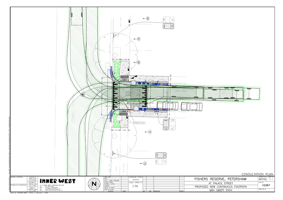
LTF0226(1) Item 12 Fishers Reserve, Petersham - Proposed Raised Continuous Footpath Treatment (Midjuburi - Marrickville Ward / Summer Hill Electorate / Inner West PAC) 156
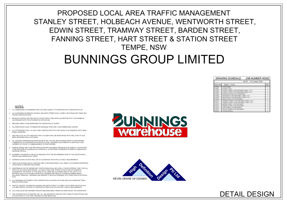
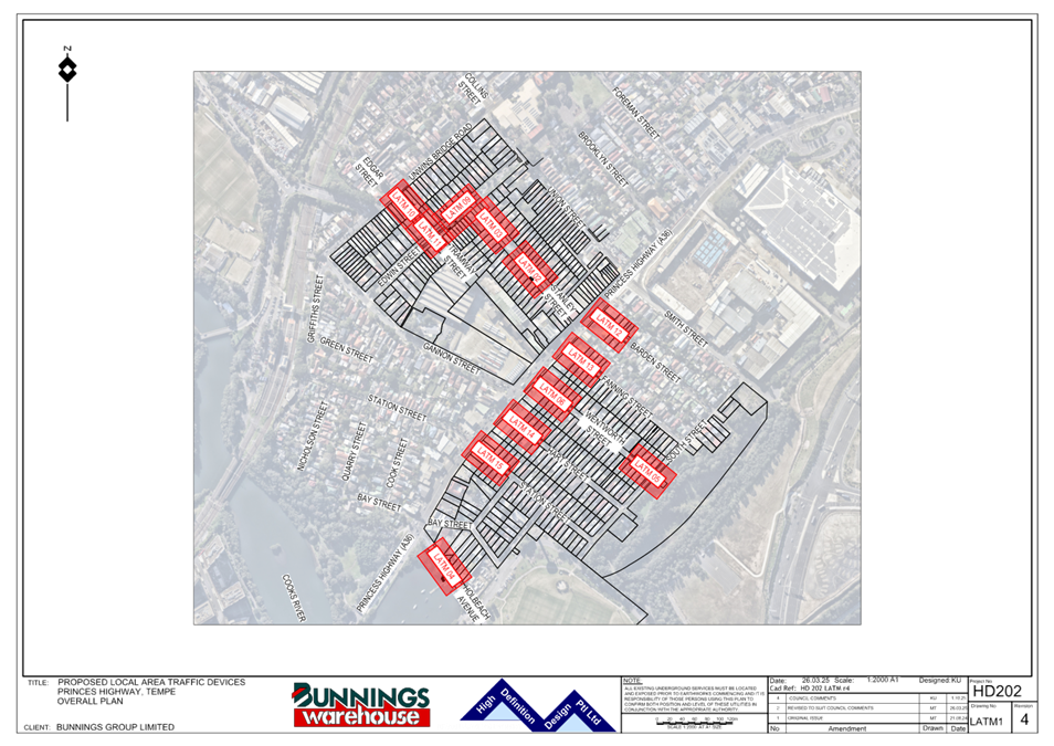
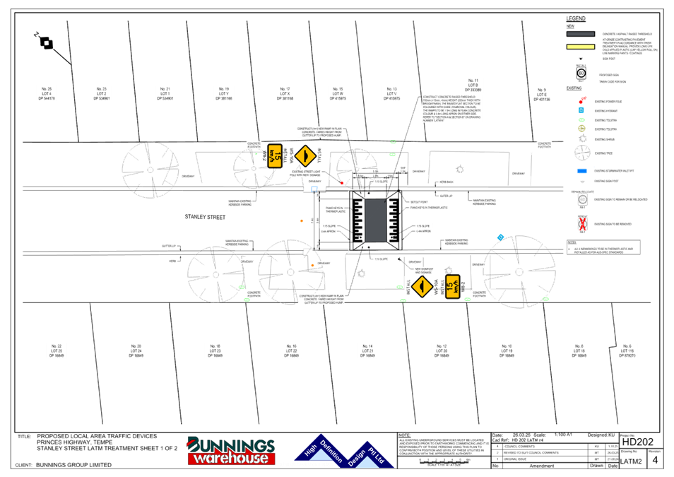
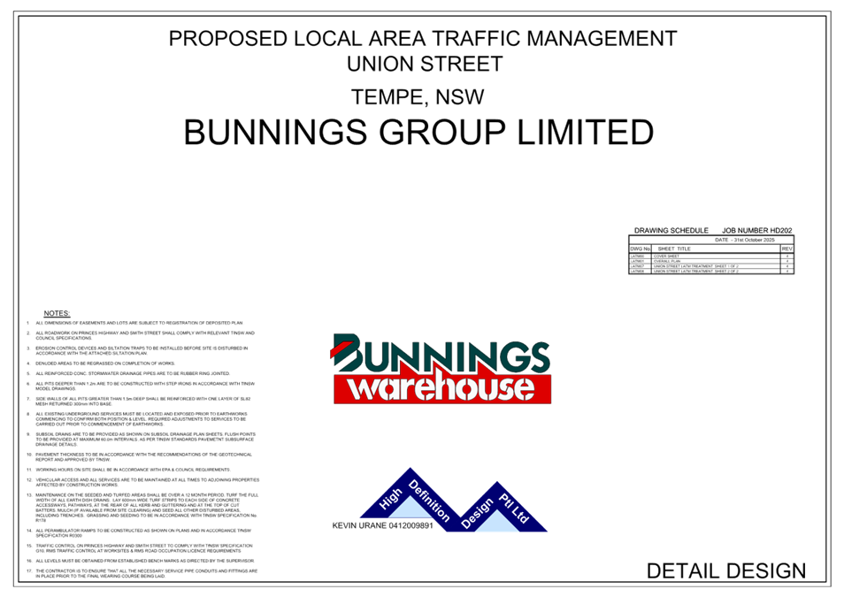
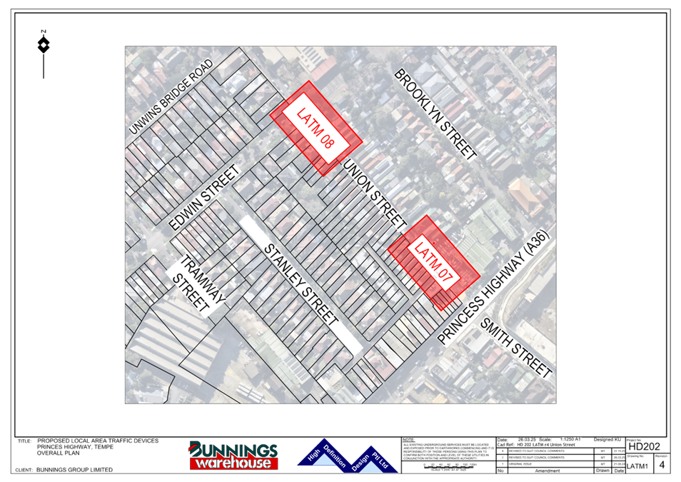
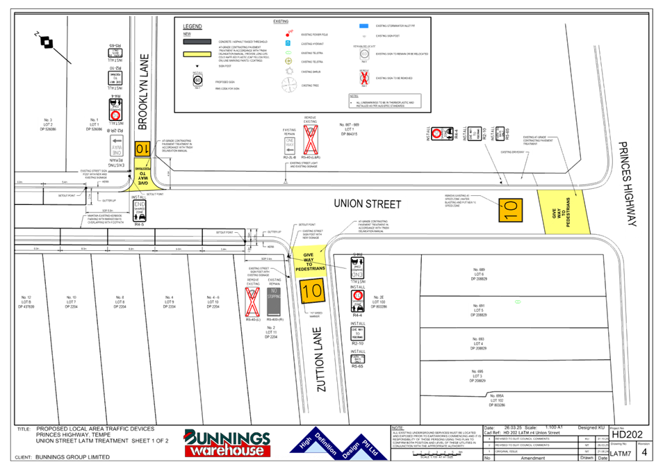
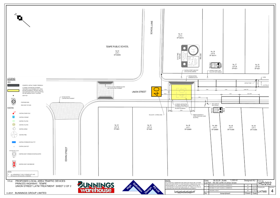
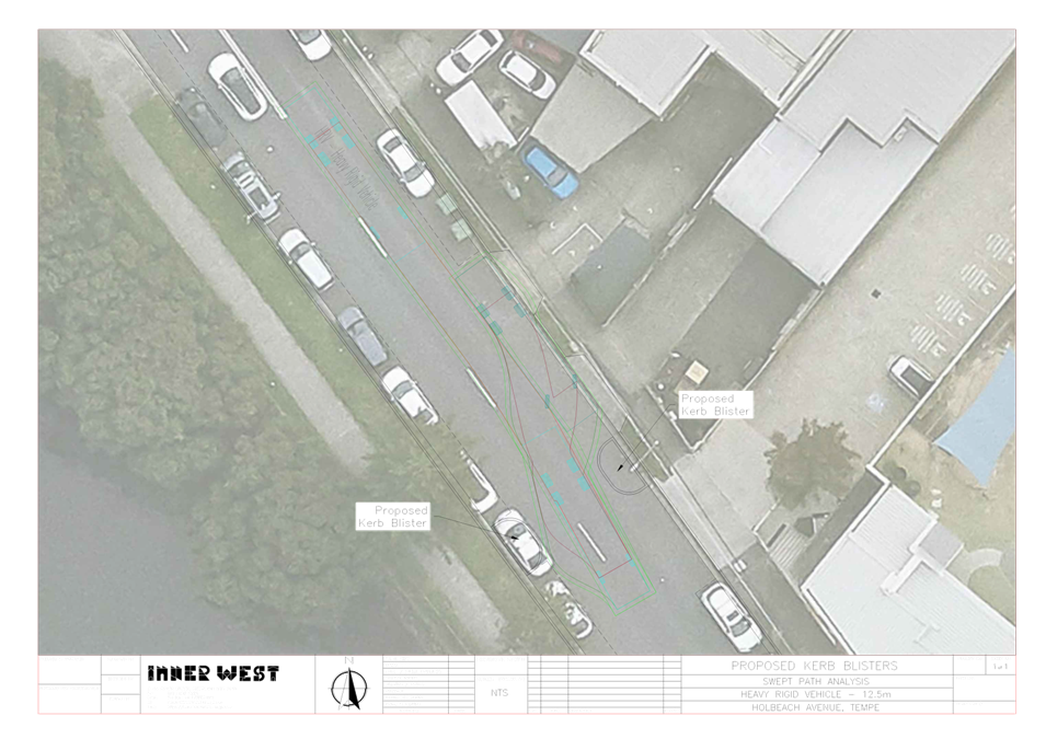
LTF0226(1) Item 13 Bunnings Tempe Local Area Traffic Management - Design Plan No. HD202 (Midjuburi-Marrickville Ward / Heffron Electorate / Inner West PAC) 162
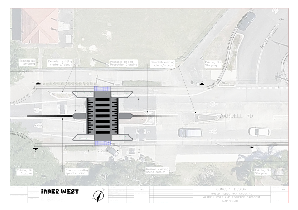
LTF0226(1) Item 14 Wardell Road, Marrickville - Proposed Raised Pedestrian Crossing (Midjuburi-Marrickville Ward / Summer Hill Electorate / Inner West PAC) 190
Parking Matters
ITEM Page
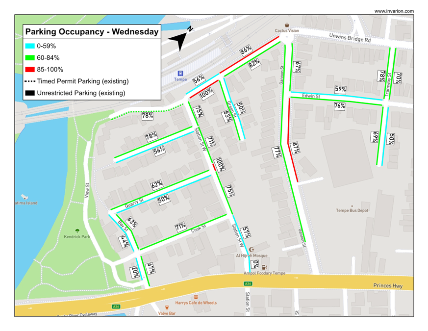
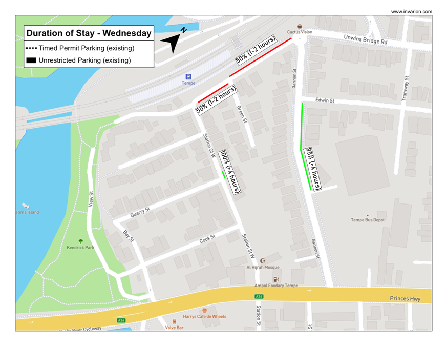
LTF0226(1) Item 15 Tempe Station Parking Study 194
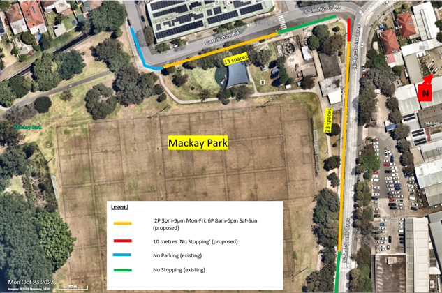
LTF0226(1) Item 16 Mackey Park Resident Parking Scheme (Midjuburi - Marrickville Ward / Summer Hill Electorate / Inner West PAC) 205
LTF0226(1) Item 17 Unnamed Laneway, Marrickville rear of Church Street and Warren Road - Adjustment to No Parking Restriction (Midjuburi-Marrickville Ward / Summer Hill Electorate / Inner West PAC) 215
Late Items
Nil at time of printing.
6 Part B - Items for Information Only
Nil at the time of printing.
7 Part C - Items for General Advice
Nil at the time of printing.
8 General Business
9 Close of Meeting
Minutes of Local Transport Forum held on 8 December 2025 at
Ashfield Service Centre
Meeting commenced at 11:01 AM
Attendance
Forum Members Present
Clr Victor Macri - Councillor –Midjuburi - Marrickville Ward (Chair)
Vinoth Srinivasan - Transport for NSW (TfNSW)
Graeme McKay - Representative for Jo Haylen MP, Member for Summer Hill
Rebecca Fernandez - Representative for Kobi Shetty MP, Member for Balmain
Colin Jones - Representative for Inner West Bicycle Coalition (IWBC)
Miriama Tamata - Representative for Jenny Leong MP, Member for Newtown
Manod Wickramasinghe - IWC’s Traffic and Transport Planning Manager
Felicia Lau- IWC’s Acting Coordinator Traffic Engineering Services (North)
George Tsaprounis - IWC’s Coordinator Traffic Engineering Services (South)
Jason Scoufis - IWC’s Coordinator Traffic Investigations & Road Safety
Amir Falamarzi - IWC's Traffic Engineer
Christy Li - IWC’s Business Administration Officer
Visitors
Sander Ottes - Item 1
Henri Allen-Narker - Item 3
Wayne O’Mara - Item 3
Beatrice Claflin - Item 5
Rob Nelson Williams - Item 5
Fred Randall - Item 5
Kenneth Macdonald - Item 9
Acknowledgement of Country
Acknowledgment of Country conducted by Chairperson Clr Victor Macri.
Apologies
Clr Liz Atkins - Councillor – Damun - Stanmore Ward
Julius Vuillanueva - Representative for Transit Systems
Disclosures of Interest (Part 4 (Pecuniary Interests) and Part 5 (non-pecuniary conflicts of interest) of Council’s Code of Conduct)
Nil.
Confirmation of Minutes
The minutes of the Local Transport Forum meeting held on 17 November 2025 were confirmed.
Staff Reports
Item 1 Annandale LATM Study Final Report (Baludarri-Balmain & Gulgadya-
Leichhardt Ward/Balmain Electorate/Leichhardt PAC)
SUMMARY
This report outlines the findings of the Final Annandale LATM Study report. Council undertook Public Exhibition of the Final Draft Annandale North LATM Study through Yoursay Inner West in June/July 2025.
The response results indicate that the community generally supported the proposed changes. After considering the Public Exhibition feedback, a review on the proposed scheme was undertaken with minor adjustments made to the LATM Study recommendations and some additional recommendations added and removed.
The recommended treatments will be included for consideration for funding in Council’s Capital Works Program and submitted for State/Federal Government Funding Programs where possible. Minor changes to signs and linemarking will be funded out of Council’s Operational Budgets.
Officers Recommendation:
1. That the treatments listed below from the Annandale LATM be approved and be listed for consideration in Council’s Traffic Facilities program and operational
linemarking/signposting program and prioritised as identified in the attached report.
a. Install a 10 km/h Shared Zone including conversion to one way northbound in Wells Street subject to TfNSW approval.
b. Convert the full length of Whites Creek Lane and Macquarie Street between
Albion Street and Whites Creek Lane to a 10 km/h Shared Zone subject to TfNSW
approval.
c. Install pedestrian/cyclist crossing in Styles Street at Whites Creek Lane.
d. Install pedestrian/cyclist crossing in Piper Street at Whites Creek.
e. Install pedestrian/cyclist crossing in Brenan Street at Whites Creek (between
White Street and Railway Parade).
f. The existing sections of linemarked median island in Styles Street between
Alfred Street and Mackenzie Street be remarked and infilled with a painted
treatment.
g. Install kerb blisters in Annandale Street at Parramatta Road.
h. Install kerb extensions and widen median islands in Reserve Street at
Annandale Street.
i. Install raised pedestrian (zebra) crossing in Piper Street west of Annandale
Street.
j. Install kerb extensions on all 4 legs of the Annandale Street/Albion Street
intersection.
k. Undertake kerb realignment works in Hutchinson Street at Pritchard Street.
l. Widen existing median islands at the Collins Street/Annandale Street
intersection.
m. Widen existing pedestrian refuge islands in all 4 legs of the Rose
Street/Trafalgar Street intersection.
n. Realign the kerb extensions and square off the View Street/The Crescent
intersection.
o. Widen the existing median island in Trafalgar Street at The Crescent to provide
a wider gap for pedestrians and modify the adjacent kerb extensions.
p. Install a roundabout at Young Street/Albion Street.
q. A raised pedestrian (zebra) crossing be provided on the eastern leg (Styles
Street) of the Leichhardt Street/Mackenzie Street/Styles Street intersection.
r. Install a road closure in Nelson Street at The Crescent (cyclists excepted)
subject to TfNSW approval.
s. Install a raised pedestrian (zebra) crossing in Piper Street South immediately
west of View Street.
t. Replace the two rubber speed humps in Brenan Street between Catherine Street
and Percival Street.
u. Install a continuous footpath treatment to cross Prospect Street at Balmain
Road.
v. Install a raised pedestrian (zebra) crossing in Trafalgar Street (southern leg) at
Albion Street.
w. Convert Piper Lane between Piper Street and Rose Street to a 10km/h Shared
Zone subject to TfNSW approval.
x. Continuous footpath treatments be provided to cross Johnstons Lane at Collins
Street (both sides) including kerb extensions at the intersection.
y. Install a roundabout at Young Street/Reserve Street intersection.
z. Install No Stopping in John Street at both unnamed laneways.
aa. Undertake audit of signs to reduce signs and stems impacting on footpaths in
Styles Street.
bb. Install No Parking on northern side of Bungay Street.
cc. Convert Hutchinson Lane to a 10kmh Shared Zone subject to TfNSW approval.
dd. Convert Prospect Street & Pine Square to a 10kmh Shared Zone subject to
TfNSW approval.
ee. Install continuous footpath treatments at Albion Lane intersections with
Johnston Street, Annandale Street, Young Street and Macquarie Street.
ff. Request TfNSW investigate improvements to vehicle and pedestrian safety in
The Crescent between View Street and William Street.
gg. Linemark angled parking bays in Trafalgar Street between Booth Street and
Rose Street.
hh. Install raised pedestrian crossing in Trafalgar Street between Piper Street
South and Piper Street North.
ii. Install raised pedestrian crossing in Piper Street North at Johnston Street.
jj. Install kerb extensions in Rose Street at Piper Lane.
kk. Install 3 tonne load limit restriction in John Street, Hill Street and Emma Street
subject to TfNSW approval.
ll. Install kerb extensions in Emma Street at Styles Street.
mm. Upgrade median island in Alfred Street at Styles Street.
nn. Install a Continuous Footpath Treatment in Bayview Crescent at Pritchard
Street.
oo. Install kerb extensions Piper Street North and View Street.
pp. Install 90-degree angle parking in Annesley Street between Mackenzie Street
and Catherine Street.
qq. Request TfNSW install a 6-metre length of No Stopping 7am-10am, 3pm-6pm
Mon-Fri.
rr. Install raised pedestrian crossings on the northern leg and eastern leg of the
Rose Street/Annandale Street intersection.
ss. Install Give Way signs and line markings at the Mayes Street/Ferris
Street/Reserve Street intersection with Reserve Street given priority.
2. That further investigation be undertaken into the following:
a. Installing a raised pedestrian (zebra) crossing at the Collins Street/Annandale
Street intersection.
b. Installing a raised pedestrian (zebra) crossing(s) at the Young Street/Albion
Street intersection.
3. That concerns and suggestions raised for strategic cycling improvements be
forwarded to Councils Strategic Transport Planning team for inclusion in Council’s
Cycling Action Plan review.
LTF Advice:
Public Speaker Sander Ottes entered the meeting at 11.04am.
Mr Ottes noted he supported most of the changes proposed by Council, however
raised concerns regarding the lack of plans to create safe bike routes throughout the
Annandale precinct, as he is a bike user himself. Mr Ottes noted that the proposed
changes do not substantially improve the safety for cyclists and noted that there
have been recent accidents on Sydney roads involving bike riders due to the lack of
protected infrastructure for active transport users. Mr Ottes suggested that Council
review the feasibility of implementing protected bike lanes in the area to enhance the
safety of cyclists.
Public Speaker Sander Ottes left the meeting at 11.07am.
Council Officers tabled comments from a resident of Reserve Street between Young
Street and Annandale Street, advising their general support for the proposed
changes and noting their concerns with the loss of parking should the proposed
traffic calming devices be implemented. The resident noted that there is already a
lack of parking within the Annandale precinct and questioned if Council could
investigate ‘Resident Parking Schemes (RPS)’ to improve parking in the area.
Council Officers noted that ‘RPS’ are not investigated as part of Council’s LATM
studies and are usually investigated as a separate matter. It was noted that Council
has a specific criterion that needs to be met before they can initiate an ‘RPS’
investigation.
Council Officers noted that Transport for NSW has requested to remove points ff:
‘Request TfNSW investigate improvements to vehicle and pedestrian safety in The
Crescent between View Street and William Street’ from the Officers'
recommendation and qq. ‘Request TfNSW install a 6-metre length of No Stopping
7am-10am, 3pm-6pm Mon-Fri in Johnson Street north of Piper Street South,
Annandale’, as Transport for NSW will investigate those matters separately. It was
agreed to amend the recommendation to reflect this.
Council Officers noted the public speakers' queries regarding additional separate
cycleways are reviewed through the Cycling Action Plan. Council Officers noted that
there is an action plan review ongoing for the cycleways program, and that Council
will identify priority separated cycleways across the LGA to put forward and bring
back plans to Council for consideration.
The Representative for the Member for Balmain queried if the proposed road closure
with landscaping at Nelson Street/The Crescent in point r. of the officer’s recommendation could be modified to allow for better sightlines between pedestrians and cyclists and more space for cyclists to manoeuvre around that corner.
Council Officers noted the Representative for the Member for Balmain comments
and advised that they will take those comments into consideration for the detailed
design phase. It was noted that the detailed design will come back to the Local
Transport Forum for review and discussion.
No further advice provided by LTF members.
RECOMMENDATION:
1. That the treatments listed below from the Annandale LATM be approved
and be listed for consideration in Council’s Traffic Facilities program and
operational linemarking/signposting program and prioritised as identified in
the attached report.
a. Install a 10 km/h Shared Zone including conversion to one way
northbound in Wells Street subject to TfNSW approval.
b. Convert the full length of Whites Creek Lane and Macquarie Street
between Albion Street and Whites Creek Lane to a 10 km/h Shared Zone
subject to TfNSW approval.
c. Install pedestrian/cyclist crossing in Styles Street at Whites Creek Lane.
d. Install pedestrian/cyclist crossing in Piper Street at Whites Creek.
e. Install pedestrian/cyclist crossing in Brenan Street at Whites Creek
(between White Street and Railway Parade).
f. The existing sections of linemarked median island in Styles Street between
Alfred Street and Mackenzie Street be remarked and infilled with a painted
treatment.
g. Install kerb blisters in Annandale Street at Parramatta Road.
h. Install kerb extensions and widen median islands in Reserve Street at
Annandale Street.
i. Install raised pedestrian (zebra) crossing in Piper Street west of Annandale
Street.
j. Install kerb extensions on all 4 legs of the Annandale Street/Albion Street
intersection.
k. Undertake kerb realignment works in Hutchinson Street at Pritchard
Street.
l. Widen existing median islands at the Collins Street/Annandale Street
intersection.
m. Widen existing pedestrian refuge islands in all 4 legs of the Rose
Street/Trafalgar Street intersection.
n. Realign the kerb extensions and square off the View Street/The Crescent
intersection.
o. Widen the existing median island in Trafalgar Street at The Crescent to
provide a wider gap for pedestrians and modify the adjacent kerb extensions.
p. Install a roundabout at Young Street/Albion Street.
q. A raised pedestrian (zebra) crossing be provided on the eastern leg
(Styles Street) of the Leichhardt Street/Mackenzie Street/Styles Street
intersection.
r. Install a road closure in Nelson Street at The Crescent (cyclists excepted)
subject to TfNSW approval.
s. Install a raised pedestrian (zebra) crossing in Piper Street South
immediately west of View Street.
t. Replace the two rubber speed humps in Brenan Street between Catherine
Local Transport Forum
8 December 2025
Street and Percival Street.
u. Install a continuous footpath treatment to cross Prospect Street at
Balmain Road.
v. Install a raised pedestrian (zebra) crossing in Trafalgar Street (southern
leg) at Albion Street.
w. Convert Piper Lane between Piper Street and Rose Street to a 10km/h
Shared Zone subject to TfNSW approval.
x. Continuous footpath treatments be provided to cross Johnstons Lane at
Collins Street (both sides) including kerb extensions at the intersection.
y. Install a roundabout at Young Street/Reserve Street intersection.
z. Install No Stopping in John Street at both unnamed laneways.
aa. Undertake audit of signs to reduce signs and stems impacting on
footpaths in Styles Street.
bb. Install No Parking on northern side of Bungay Street.
cc. Convert Hutchinson Lane to a 10kmh Shared Zone subject to TfNSW
approval.
dd. Convert Prospect Street & Pine Square to a 10kmh Shared Zone subject
to TfNSW approval.
ee. Install continuous footpath treatments at Albion Lane intersections with
Johnston Street, Annandale Street, Young Street and Macquarie Street.
ff. Linemark angled parking bays in Trafalgar Street between Booth Street
and Rose Street.
gg. Install raised pedestrian crossing in Trafalgar Street between Piper
Street South and Piper Street North.
hh. Install raised pedestrian crossing in Piper Street North at Johnston
Street.
ii. Install kerb extensions in Rose Street at Piper Lane.
jj. Install 3 tonne load limit restriction in John Street, Hill Street and Emma
Street subject to TfNSW approval.
kk. Install kerb extensions in Emma Street at Styles Street.
ll. Upgrade median island in Alfred Street at Styles Street.
mm. Install a Continuous Footpath Treatment in Bayview Crescent at
Pritchard Street.
nn. Install kerb extensions Piper Street North and View Street.
Item 2 Leichhardt Oval Special Event Parking Scheme 2026 (Baludarri-Balmain
Ward/Balmain Electorate/Leichhardt PAC)
SUMMARY
It is proposed to activate the Special Event Parking Scheme (SE) in the roads
surrounding Leichhardt Oval for the following NRL Games:
1. Round 2 Tigers vs Cowboys Saturday 14th March 2026 Kick off 3:00pm
2. Round 8 Tigers vs Raiders Thursday 23rd April 2026 Kick off 7:50pm
3. Round 15 Tigers vs Titans Sunday 14th June 2026 Kick off 4:00pm
Officers Recommendation:
That the Special Event Parking Scheme (SE) in the roads surrounding Leichhardt
Oval be activated for the following days during the times of 12:00pm-10:00pm for
NRL Fixtures in 2026:
1. Round 2 Tigers vs Cowboys Saturday 14th March 2026 Kick off 3:00pm
2. Round 8 Tigers vs Raiders Thursday 23rd April 2026 Kick off 7:50pm
3. Round 15 Tigers vs Titans Sunday 14th June 2026 Kick off 4:00pm
LTF Advice:
No advice provided by LTF members.
RECOMMENDATION:
That the Special Event Parking Scheme (SE) in the roads surrounding
Leichhardt Oval be activated for the following days during the times of
12:00pm-10:00pm for NRL Fixtures in 2026:
1. Round 2 Tigers vs Cowboys Saturday 14th March 2026 Kick off 3:00pm
2. Round 8 Tigers vs Raiders Thursday 23rd April 2026 Kick off 7:50pm
3. Round 15 Tigers vs Titans Sunday 14th June 2026 Kick off 4:00pm
Item 3 Iron Cove Traffic Review Final Report (Baludarri-Balmain Ward/Balmain
Electorate/Leichhardt PAC)
SUMMARY
This report outlines the findings of the Final Iron Cove Traffic Review report. Council
undertook Public Exhibition of the draft Iron Cove Traffic Review Study through
Yoursay Inner West in June and July 2025. The Final report was developed based
on the feedback and review of the public exhibition.
The engagement responses indicated that the community generally supported all the
proposed changes.
After considering the Public Exhibition feedback, a review on the proposed scheme
was undertaken with minor adjustments made to the Traffic Review
recommendations and some additional recommendations added.
The recommended treatments will be included for consideration for funding in
Council’s Capital Works Program and submitted for State/Federal Government
Funding Programs where possible. Minor changes to signs and line marking will be
funded out of Council’s Operational Budgets.
Officers Recommendation:
1. That the treatments listed below from the Iron Cove Traffic Review Study be
approved and be listed for consideration in Council’s Traffic Facilities program and
operational line marking/signposting program and prioritised as identified in the
attached report:
a. That a Continuous Footpath Treatment with a median island be installed on
Toelle Street at the intersection with Victoria Road;
b. That a Continuous Footpath Treatment with a median island be installed on
Callan Street at the intersection with Victoria Road;
c. That a Continuous Footpath Treatment with a footpath widening be installed on
Springside Street at the intersection with Victoria Road;
d. That two speed humps be installed at No.39 and No.20 Moodie Street;
e. That a One-Way traffic arrangement be installed on Park Street northbound and
Oxford Street southbound;
f. That a Continuous Footpath Treatment be installed on Park Street at the
intersection with Darling Street; and
g. That a Continuous Footpath Treatment be installed on Oxford Street at the
intersection with Darling Street.
2. That further investigation be undertaken into the following:
a. Investigating a raised pedestrian and bicycle crossing on Moodie Street near
Victoria Road, including kerb extensions on both sides of the street; and
b. Additional consultation on the installation of a raised pedestrian crossing with
kerb extension on Cambridge Street at the intersection with Darling Street.
LTF Advice:
Public Speakers Henri Allen-Narker and Wayne O’Mara entered the meeting at
11.08am.
Mr Allen-Narker advised that the Moodie Street exit on Victoria Road is an essential
movement to ensure traffic flows smoothly in the area. Mr Allen-Naker noted that
there are current traffic flow issues in the nearby streets, which will be further
exacerbated if the ‘No Left Turn’ restriction were to be implemented for traffic turning
onto Victoria Road.
Mr O’Mara raised concerns regarding vehicles speeding down Callan Street from
Victoria Street, even though Callan Street is a ’10 k/m Shared Zone.’ Mr O’Mara
noted that there are currently limited traffic calming treatments on the street to deter
motorists from speeding and suggested that Council investigate additional traffic
calming treatments for the street. Mr O’Mara suggested the possibility of widening
the kerbs at the corner of McCleer Street and Callan Street so that it narrows the
entry point into Callan Street and acts as a visual deterrent for motorists speeding.
Mr O’Mara noted that recent changes allow for cars on both sides of Callan Street to
park on the footpath, and that this has opened up the road for vehicles to speed. Mr
O’Mara also suggested that additional police patrols or having mobile speed
cameras in the street may assist with deterring motorists from speeding down the
street.
Council Officers noted that the proposed ‘No Left Turn’ restriction from Moodie
Street into Victoria Road was not recommended to proceed and that the current
access will be retained.
Public Speakers Henri Allen-Narker and Wayne O’Mara left the meeting at
11.20am.
The Representative for the Member for Balmain queried whether the proposed ‘One-
Way’ traffic arrangement on Park Street would generate additional traffic on Park
Street and whether additional traffic calming measures would be implemented for
Park Street, Rozelle.
Council Officers noted that with ‘One Way’ traffic arrangements, there is a chance
that there will be an increase in local traffic movements as motorists will have to
circulate in the local road network. It was noted that, as there is already a ‘No Right
Turn’ restriction from Moodie Street into Park Street, the proposed changes would
further reduce southbound movements in the street. It was noted that in Council’s
review, traffic queues on Darling Street south of Victoria Road tend to terminate
before getting to Park Street, so Council does not anticipate a significant increase of
vehicles using Park Street to by pass the queue. Council Officers noted Council will
review the area after the implementation of the ‘One Way’ restrictions. Council
Officers noted that Transport for NSW have requested an additional report with
further analysis on the Traffic Management Plans (TMP) be brought back to the
Forum for review before implementation.
The Representative for the Member for Balmain queried if there was consideration
for an additional crossing on Darling Street at Denison Street, as the closest
crossing would be in Belmore Street, Rozelle. The Representative for Transport for
NSW requested that the Representative for the Member for Balmain send through
the request details to Transport for NSW to review and investigate.
No further advice provided by LTF members.
RECOMMENDATION:
1. That the treatments listed below from the Iron Cove Traffic Review Study
be approved and be listed for consideration in Council’s Traffic Facilities
program and operational line marking/signposting program and prioritised as
identified in the attached report:
a) That a Continuous Footpath Treatment with a median island be installed
on Toelle Street at the intersection with Victoria Road;
b) That a Continuous Footpath Treatment with a median island be installed
on Callan Street at the intersection with Victoria Road;
c) That a Continuous Footpath Treatment with a footpath widening be
installed on Springside Street at the intersection with Victoria Road;
d) That two speed humps be installed at No.39 and No.20 Moodie Street;
e) That a One-Way traffic arrangement be installed on Park Street
northbound and Oxford Street southbound;
f) That a Continuous Footpath Treatment be installed on Park Street at the
intersection with Darling Street; and
g) That a Continuous Footpath Treatment be installed on Oxford Street at the
intersection with Darling Street.
2. That further investigation be undertaken into the following:
a) Investigating a raised pedestrian and bicycle crossing on Moodie Street
near Victoria Road, including kerb extensions on both sides of the street; and
b) Additional consultation on the installation of a raised pedestrian crossing
with kerb extension on Cambridge Street at the intersection with Darling
Street.
Item 4 Percy Street, Rozelle - Proposed One Way Restriction (Baludarri-Balmain
Ward/Balmain Electorate/Leichhardt PAC)
SUMMARY
Council has received concerns from several residents about the narrow road width
with frequent reports of near miss incidents in Percy Street between Albion and
Evans Street in Rozelle. Residents have also reported the increase in traffic flows
from patrons of Totti's Restaurant in Rozelle further exacerbating this issue.
In response, investigation and consultation was undertaken for a one-way
southbound traffic flow, including associated signage and linemarking in Percy
Street, Rozelle as illustrated in Attachment 1.
Traffic analysis has indicated that Percy Street has a low volume of traffic, and that
the proposed one way will have minimal impact on the road network. Community
engagement indicated strong support for the proposal.
Officers Recommendation:
That the proposed one-way southbound traffic movement in Percy Street between
Albion and Evans Street, Rozelle including the associated signage and line marking
be approved.
LTF Advice:
The Representative for the Member for Balmain requested that a ‘Bicycles Excepted’
sign be installed at Percy Street, Rozelle, to allow for contraflow movement for
bicycles. Council Officers advised that an investigation and safety review will need to
be undertaken prior to the installation of the ‘Bicycles excepted’ signage.
No further advice provided by LTF members.
RECOMMENDATION:
That the proposed one-way southbound traffic movement in Percy Street
between Albion and Evans Street, Rozelle including the associated signage
and line marking be approved.
Item 5 Curtis Road and McDonald Street, Balmain - Proposed Pedestrian Crossing, Continuous Footpath and One-Way Treatment (Baludarri-Balmain Ward/Balmain Electorate/Leichhardt PAC)
SUMMARY
Council has received Get NSW Active Funding from Transport for NSW to improve
safety in Curtis Road and McDonald Street by constructing a raised pedestrian
crossing, continuous footpath treatment and implementing a partial One-Way
Treatment northbound restriction in McDonald Street between Hoffmans Lane and
Curtis Road, Balmain. The proposal aims to improve pedestrian and motorist safety
by better defining safe pedestrian crossing points and addressing pedestrian safety
and driver behaviour at this location.
The existing 'No Stopping' sign on the northern side of Curtis Road is required to be
relocated by approximately 3 metres as per attached plan. Six (6) parking spaces
will still be retained to the nearest driveway.
Officers Recommendation:
That the attached detailed design plan (Plan No.10358) for the proposed raised
pedestrian crossing and continuous footpath treatment in Curtis Road Balmain and
the proposed partial one-way northbound restriction McDonald Street between
Hoffmans Lane and Curtis Road, Balmain as per attached plan be approved.
LTF Advice:
Public Speakers Rob Nelson Williams, Beatrice Claflin and Fred Randall entered the
meeting at 11.28am.
Mr Williams raised concerns regarding the detailed design proposed and suggested
additional traffic calming measures, such as speed cushions on either side of the
pedestrian crossing to further restrict the road and reduce speeds. Mr Williams noted
that Curtis Road is a common ‘rat run’ and speeding is a common issue experienced
on the street. It was noted that additional traffic calming measures can be
investigated as part of the Birchgrove, Balmain East LATM however, Mr Williams
requests that potential traffic calming measures be investigated as a part of this
project.
Ms Claflin agreed with Mr Williams suggestion for additional traffic calming
measures to be investigated and raised concerns regarding the proposal being a
solution to one component of the various issues experienced in the area. Ms Claflin
questioned why additional traffic calming treatments were not included as part of the
proposal. Ms Claflin noted her concerns regarding the proposed removal of the
existing concrete refuge island, as it assists with pedestrian safety in the area and
requested a safety audit to be undertaken. It was noted that the refuge island has
been acting as a buffer between pedestrians and vehicles, and that since the
installation of the island, cars have been hitting into the island instead of
pedestrians. Ms Claflin noted that the removal of the island and without the
installation of additional traffic calming treatments to make cars physically slow down
before the corner, and the raised crossing will likely result in a vehicle/pedestrian
accident. Ms Claflin suggested applying the same design and plan of the crossing
implemented at Curtis Street and Church Street, and that having speed bumps on
the street will deter drivers from speeding. Ms Claflin also noted that the proposed
‘One Way’ treatment on McDonald Street will cause accessibility issues for
emergency vehicles trying to service the area and push additional traffic onto Curtis
Road. It was also noted that Ms Claflin had concerns regarding leaf litter and
possible flooding should the proposed pedestrian crossing and curbs be
implemented.
Mr Randall agreed that Curtis Street is a rat run and requires additional traffic
calming measures to ensure the design works and to treat the speeding issues in
the street. Mr Randall also noted that there was a ‘Pedestrian Refuge’ sign on the
western side of Curtis Road approaching Thames Street that needs to be attended
to as the 2 concrete islands on the road do not fall into the guidelines of a pedestrian
refuge.
Public Speakers Rob Nelson Williams, Beatrice Claflin and Fred Randall left the
meeting at 11.48am.
Council Officers noted that the project was initiated through a meeting with the
Mayor, staff and residents from Curtis Road regarding concerns of speeding
vehicles and pedestrian safety. It was noted that the subsequent proposal for two (2)
raised pedestrian crossings was previously supported by the Local Transport Forum
and were subsequently adopted by Council to address these issues. It was noted
that Council was also able to successfully obtain grant funding for the project under
the Get NSW Active program.
Council Officers noted the residents' comments
regarding the existing refuge island and noted that the current refuge is substandard
in size and unable to safely store pedestrians. It was noted that there was no
opportunity to widen the island as traffic would not be able to pass through. It is
noted that the geometry of the intersection is quite tight, which is why there are often
vehicles hitting into the refuge island. It was noted that the proposed crossing will
replace the existing refuge island and as part of that the proposed crossing will have
to move slightly into the McDonald Street intersection. It was noted Council had
proposed to convert McDonald Street into a ‘One-Way’ as the throat of that
intersection will have to be reduced to make space for the pedestrian crossing.
Council Officers noted that the proposed pedestrian crossing will be raised so it will
provide a traffic calming impact for both the approach and departure sides of the
intersection. It was noted that a review of the safety of the pedestrian crossing has
been undertaken and that the sight lines are adequate to allow vehicles approaching
that corner to see pedestrians. Council Officers noted that speed cushions on
approach to a raised crossing has been used in limited circumstances; however, not
as a first option. It was noted that Council usually implements speed cushions on the
approach to pedestrian crossing at locations where there are continued safety
issues and is typically at locations with older crossing designs or very high volumes
of pedestrian and vehicle movements. Council Officers noted that the current
proposal is sufficient to address the concerns. Council Officers noted that they will
continue to review the area and that the area will also fall into the
Birchgrove/Balmain East, Local Area Traffic Management study. It was noted that
there is another raised pedestrian crossing getting installed on Curtis Road at the
intersection with Darling Street, which will provide a traffic calming function, and it
will be installed before the proposed project is scheduled for completion.
Council Officers noted that it was necessary to convert McDonald Street into a ‘One
Way’ movement as the road geometry requires that the raised crossing be pushed
slightly east because of the existing driveways, so there's not enough width at the
intersection of McDonald Street and Curtis Road to allow for two-way traffic.
Council Officers tabled comments from a resident requesting that the ‘One Way’
restriction was to go ahead that the restriction be placed in McDonald Street
between Curtis Road and Darling Street. The resident also noted that they were
opposed to the proposed installation of the speed bumps at the halfway point
between the two pedestrian crossings.
No further advice provided by LTF members.
RECOMMENDATION:
That the attached detailed design plan (Plan No.10358) for the proposed raised
pedestrian crossing and continuous footpath treatment in Curtis Road
Balmain and the proposed partial one-way northbound restriction McDonald
Street between Hoffmans Lane and Curtis Road, Balmain as per attached plan
be approved.
Item 6 Flood Street, Leichhardt - Proposed Motor Bike Only Parking (Gulgadya-
Leichhardt/Balmain Electorate/Leichhardt PAC)
SUMMARY
Council has received several requests to improve visibility at the driveway of 141
Allen Street located on Flood Street, Leichhardt. To improve visibility for drivers
when exiting the driveway, it is proposed to convert 3m of unrestricted parking space
immediately south of the driveway on Flood Street into ‘Motor Bike Only’ parking.
Officers Recommendation:
That a 3m length ‘Motor Bike Parking’ zone be installed on the south side of the
driveway for 141 Allen Street on Flood Street Leichhardt.
LTF Advice:
The Representative for the Member of Balmain questioned if the ‘Motor Bike
Parking’ zone could be converted to bicycle parking.
Council Officers noted that they are looking into opportunities to provide more
bicycle parking; however, as the proposed ‘Motor Bike Parking’ zone is on the road,
it would be unsafe for bikes to be left on the road without providing additional
protection.
No further advice provided by LTF members.
RECOMMENDATION:
That a 3m length ‘Motor Bike Parking’ zone be installed on the south side of
the driveway for 141 Allen Street on Flood Street Leichhardt.
Item 7 Palace Street at Brighton Street, Petersham - Proposed Raised Pedestrian
Crossings - Design Plan 10356-1 (Damun-Stanmore Ward / Newtown
Electorate / Inner West PAC)
SUMMARY
This report details the design plan (No.10356-1) for the construction of two raised
pedestrian crossings and the result of community consultation at the intersection of
Palace Street and Brighton Street, Petersham. Following a local traffic area
management (LATM) study in 2023 for the Petersham North Precinct, consultation
responses and site observation raised concerns to improve pedestrian safety and
speeding issues. The study recommended that a raised pedestrian crossing be
installed on the southern leg of Palace Street, and the western leg of Brighton Street
to improve pedestrian connectivity to local businesses, Fort Street High and
Petersham Station. The design and construction of the proposed raised pedestrian
crossings have received fifty percent contribution from the Federal Government
Active Transport Fund and will be included in Council's Traffic Facilities Capital
Works Program for funding in 2025/2026 financial year.
Officers Recommendation:
That the detailed design plan (No.10356-1) for the construction of two raised
pedestrian crossings at the intersection of Palace Street and Brighton Street,
Petersham be approved in order to improve pedestrian safety at this intersection.
LTF Advice:
Council Officers tabled comments from residents questioning when and and why
Council chooses to apply the TfNSW guideline instead of the reduced warrant used
earlier in the same LATM. Council Officers noted that the reduced warrant and
Pedestrian Crossing Guideline (PCG) are both supplied by TfNSW. The Petersham
North LATM study was conducted during the time where the PCG was being
developed and superseded the previous reduced warrant guideline. The pedestrian
crossing on Palace Street south of Brighton Street meets the warrant provided in the
PCG (equal or greater than 20 pedestrian movements) as it did not require a specific
vehicle volume to be met. It is also noted that the location is a significant walking
route connecting pedestrians to Petersham Station, Fort Street High School, local
cafes and businesses. Hence, it is recommended that a crossing be installed at this
location to provide better and safer opportunities for pedestrians to cross Palace
Street.
Council Officers tabled comments from residents questioning whether any policy
exists guiding how these different warrant systems are selected and prioritised.
Council Officers noted that Council currently uses the Inner West Pedestrian
Crossing Warrant Policy (2024) which states: “A pedestrian (zebra) crossing may
also be considered at locations where there is a deviation from meeting the warrant,
such as where the pedestrian crossing would serve as an essential link to an overall
network of pedestrian facilities, or for a vulnerable group such as children, the
elderly or mobility impaired.”.
Council Officers tabled comments from residents questioning why the consultation
material for Plan 10356-1 did not clearly explain that the proposed southern crossing
relies on an entirely different warrant test than the one used on page 18 of the
Petersham North LATM plan. Council Officers noted that the Petersham North LATM
study has outlined Council’s recommendation to install a pedestrian crossing on
Palace Street south of Brighton Street. The consultation letter mailed out was
completed by Council’s Design Team to provide residents with the opportunity to
comment on the detailed design proposal as opposed to the study into the merits of
a crossing at this location. Concerns and other matters raised regarding the
proposed crossings have been included in the Local Transport Forum report, with
comments provided.
The Chairperson questioned whether the proposed landscaping and garden beds
could be altered to retain more parking. Council Officers note that the proposed
garden beds reduce the amount of parking that needs to be removed, as a typical
‘No Stopping’ on approach to a pedestrian crossing without kerb extensions is 20
metres; however, with the proposed garden beds in place, the ‘No Stopping’ can be
reduced to approximately 7.5 metres.
Council Officers also noted that they have met with the principal of Fort Street High
School and that they were supportive of the proposal.
No further advice provided by LTF members.
RECOMMENDATION:
That the detailed design plan (No.10356-1) for the construction of two raised
pedestrian crossings at the intersection of Palace Street and Brighton Street,
Petersham be approved in order to improve pedestrian safety at this
intersection.
Item 8 Palace Street at Andreas Street, Petersham - Proposed Raised Pedestrian
Crossings - Design Plan 10356-2 (Danum-Stanmore Ward / Newtown
Electorate / Inner West PAC)
SUMMARY
A local traffic area management (LATM) study for the Petersham North Precinct was
undertaken in 2023. The study, in part, recommended that a raised pedestrian
crossing be installed on the northern leg of Palace Street, and the western leg of
Andreas Street to improve pedestrian connectivity to local businesses, Fort Street
High and Petersham Station.
This report details the design plan (No.10356-2) for the construction of two raised
pedestrian crossings and the result of community consultation at the intersection of
Palace Street and Andreas Street, Petersham. The design and construction of the
proposed raised pedestrian crossings have received fifty percent contribution from
the Federal Government Active Transport Fund and is included in Council's Traffic
Facilities Capital Works Program for the 2025/2026 financial year.
Officers Recommendation:
That the detailed design plan (No.10356-2) for the construction of two raised
pedestrian crossings at the intersection of Palace Street and Andreas Street,
Petersham be approved in order to improve pedestrian safety at this location.
LTF Advice:
Council Officers tabled comments from a resident who considered that the proposal
is unnecessary and not fit for purpose as the volume of students will not funnel into a
single pedestrian crossing. Council Officers noted that pedestrian volumes are
expected to increase when the crossings are installed, as they will provide better
and safer opportunities for pedestrians to cross. It was also noted that the data
collected shows that the intersection experiences peak pedestrian traffic of 413
movements per hour, indicating that there is significant use of the intersection
currently.
Council Officers table comments regarding resident concerns in relation to loss of
parking and the need for the pedestrian crossing for Palace Street.
Council Officers tabled comments from a resident requesting additional speed
calming measures on Brighton Street approaching Palace Street.
No further advice provided by LTF members.
RECOMMENDATION:
That the detailed design plan (No.10356-2) for the construction of two raised
pedestrian crossings at the intersection of Palace Street and Andreas Street,
Petersham be approved in order to improve pedestrian safety at this location.
Item 9 Holmwood Lane, Newtown - Proposed installation of a short section of 'No
Parking' restrictions (Damun-Stanmore Ward / Newtown Electorate / Inner
West PAC)
SUMMARY
A request has been received from a resident of Holmwood Street, Newtown for the
provision of a short section of ‘No Parking’ restrictions on the southern side of
Holmwood Lane, to improve vehicular access to the rear of their property.
Consultation was undertaken with surrounding residents to determine the level of
community support for the installation of a short section of full-time ‘No Parking’
restrictions. The results of the survey are presented in this report for the Committee
to consider.
In view of the low level of support from residents it is recommended that no changes
be made to the existing parking restrictions in Holmwood Lane, Newtown at this time
and that Council Rangers be requested to undertake regular enforcement of the
current parking restrictions in the area.
Officers Recommendation:
1. That Council not accede to the request for the provision of a short section of ‘No
Parking’ signage along the southern side of Holmwood Lane, Newtown east of Pearl
Lane due to the low level of community support, and
2. That Council's Rangers be requested to undertake regular enforcement of the
current parking restrictions in the area.
LTF Advice:
Public Speaker Kenneth Macdonald entered the meeting at 11.49am
Mr Macdonald opposed the proposed recommendation and requested that the
proposed ‘No Parking’ signage along the southern side of Holmwood Lane,
Newtown east of Pearl Lane be approved. Mr Macdonald noted that 2 properties
opposite his property have off-street parking and driveways, and that they often
cannot park their vehicles on their properties due to their driveways being
obstructed. Mr Macdonald also noted that he and his neighbours' gates are often
obstructed, causing difficulty for them to take their bins out as well as get their
motorbikes and pushbikes in and out of their properties. Mr Macdonald advised that
reporting dangerous parking to Council often leads to altercations and that he has
had his property damaged in retaliation for reporting illegal parking.
Public Speaker Kenneth Macdonald left the meeting at 11.53am
Council Officers tabled comments from a resident, noting their concerns regarding
the parking situation in Dickson Street, Newtown and requested a review of the
parking arrangements as the parking issues in Dickson Street negatively impact
Holmwood Street. Council Officers noted that Council will be consulting with the
residents of Dickson Street early next year on proposed angled parking restrictions.
Council Officers noted that the ‘No Parking’ signs were not requested across a
driveway but rather a rear gate and that the resident may need construct a driveway
in the first instance.
No further advice provided by LTF members.
RECOMMENDATION:
1. That Council not accede to the request for the provision of a short section
of ‘No Parking’ signage along the southern side of Holmwood Lane, Newtown
east of Pearl Lane due to the low level of community support, and
2. That Council's Rangers be requested to undertake regular enforcement of
the current parking restrictions in the area.
Item 10 Amendment to Sydenham Station Parking Study Recommendation
SUMMARY
This report outlines the updated recommendation for the Sydenham Station Parking
Study that was reported to the September 2025 Local Transport Forum. Council has
received notice that recommendation item 2 recommended Sutherland Street to be
consulted for ‘2P 8am-10pm Permit Holders Excepted Area M4’s instead of Samuel
Street, despite being included in the proposed plan. Council proposes to update the
recommendation to include the southern side of Samuel Street between Henry
Street and Unwins Bridge Road.
Officers Recommendation:
That consultation be undertaken into installing new "2P 8am-10pm Permit Holders
Excepted Area M4" on the southern side of Samuel Street between Henry Street
and Unwins Bridge Road in order to fully address the proposals within the
Sydenham Parking Study which was presented to the September 2025 Local
Transport Forum.
LTF Advice:
No advice provided by LTF members.
RECOMMENDATION:
That consultation be undertaken into installing new "2P 8am-10pm Permit
Holders Excepted Area M4" on the southern side of Samuel Street between
Henry Street and Unwins Bridge Road in order to fully address the proposals
within the Sydenham Parking Study which was presented to the September
2025 Local Transport Forum.
Item 11 Charlotte Avenue, Marrickville - Request for a residential parking scheme
(Midjuburi-Marrickville Ward / Summer Hill Electorate / Inner West PAC)
SUMMARY
Upon receiving another petition from residents of Charlotte Avenue, Marrickville
Council initiated a further investigation for implementing a Residential Parking
Scheme (RPS) on the western side of Charlotte Avenue between Myrtle Street and
Riverdale Avenue. Recent parking occupancy surveys conducted by Council
Officers indicated a high parking demand in the street during peak hours of the day.
This report provides the results of the recent resident parking scheme investigation
in Charlotte Avenue, Marrickville.
Officers Recommendation:
That the proposal to implement Resident Parking Scheme restrictions ‘2P 8.30am –
6.00pm Monday – Friday Permit Holders Excepted Area M2’ in Charlotte Avenue on
the western side between Myrtle Street and Riverdale Avenue, Marrickville is not
supported at this time due to insufficient resident support.
LTF Advice:
No advice provided by LTF members.
RECOMMENDATION:
That the proposal to implement Resident Parking Scheme restrictions ‘2P
8.30am – 6.00pm Monday – Friday Permit Holders Excepted Area M2’ in
Charlotte Avenue on the western side between Myrtle Street and Riverdale
Avenue, Marrickville is not supported at this time due to insufficient resident
support.
Item 12 Depot Lane, Marrickville - Proposed installation of 'No Parking' restrictions
(Midjuburi-Marrickville Ward / Summer Hill Electorate / Inner West PAC)
SUMMARY
Council has received concerns that vehicles are parking in a manner that limits the
ability of residents accessing their driveways. In order to alleviate this issue, it is
proposed to signpost an additional section of 'No Parking’ restrictions along the
western side of Depot Lane, Marrickville.
Officers Recommendation:
That the installation of a 12-metre extension to the existing 8 metre length of full-time
‘No Parking’ restrictions on the western side of Depot Lane, Marrickville opposite the
rear of No.12 Cecilia Street to the north boundary line of No.16 Cecilia Street be
approved, in order to improve vehicular access to off-street parking for adjacent
residents in the laneway.
LTF Advice:
No advice provided by LTF members.
RECOMMENDATION:
That the installation of a 12-metre extension to the existing 8 metre length of
full-time ‘No Parking’ restrictions on the western side of Depot Lane,
Marrickville opposite the rear of No.12 Cecilia Street to the north boundary line
of No.16 Cecilia Street be approved, in order to improve vehicular access to
off-street parking for adjacent residents in the laneway.
Item 13 Livingstone Road, Marrickville – Pedestrian Crossing Review (Midjuburi-
Marrickville Ward /Summer Hill Electorate /Inner West LAC)
SUMMARY
At the Council Meeting held 23 September 2025 a Notice of Motion (NoM) for
‘Review of Pedestrian Crossing – Livingstone Road, Marrickville’ was considered. It
noted that residents have raised repeated concerns that despite the raised design,
the Livingstone Road pedestrian crossing continues to pose risks for pedestrians
and reports of several near misses highlight the need to review whether additional
measures dash; such as improved sightlines, signage, lighting, or traffic calming
dash; are necessary to ensure the crossing functions as intended. Noting also that a
review of this crossing would be consistent with Council’s commitment to road
safety, active transport, and creating safer streets for all users, particularly the most
vulnerable.
Officers Recommendation:
1. That the installation of kerb blisters on the southern side of Livingstone Road,
Marrickville at the pedestrian crossing outside St Nicholas Church be approved and
included in Council’s Traffic Facilities Forward Works Program with these kerb
blisters being provided initially as a painted treatment.
2. That the missing section of 'zig zag' lines on the northbound approach to the
crossing commencing mid-way across the railway bridge up to Hollands Avenue be
reinstated in order to alert approaching motorists of the crossing.
LTF Advice:
No advice provided by LTF members.
RECOMMENDATION:
1. That the installation of kerb blisters on the southern side of Livingstone
Road, Marrickville at the pedestrian crossing outside St Nicholas Church be
approved and included in Council’s Traffic Facilities Forward Works Program
with these kerb blisters being provided initially as a painted treatment.
2. That the missing section of 'zig zag' lines on the northbound approach to
the crossing commencing mid-way across the railway bridge up to Hollands
Avenue be reinstated in order to alert approaching motorists of the crossing.
Item 14 Holden Street, south of Trevenar Street, Ashbury-New raised pedestrian
(zebra) crossing (Djarrawunang-Ashfield Ward/Summer Hill
Electorate/Burwood PAC).
SUMMARY
Holden Street south of Clissold Street, Ashfield is the boundary line between Inner
West Council (IWC) to the eastern side and Canterbury Bankstown Council (CBC) to
the western side. Both Councils have collaborated and proposed that a new raised
pedestrian (zebra) crossing be installed in Holden Street south of Trevenar Street.
This is in response to various community and councillor/State member requests for a
safe road crossing to be installed in Holden Street, between Clissold Street and
Armstrong Street.
Canterbury Bankstown Council has carried out the design of the crossing as shown
in Attachment 1 and has conducted the necessary consultation with effected
residents and shops owners on both sides of the street through discussions with
Inner West Council. It has also reported the matter to its Local Transport Forum
dated 14 October 2025 recommending to approve the crossing based on road
safety. See report shown in Attachment 2, and Attachment 3 for the Local Transport
Forum minutes-item 26. Canterbury Bankstown Council has subsequently approved
the proposal at its meeting on 28 October 2025.
Approval is therefore sought from Inner West Council for the installation of a raised
pedestrian (zebra) crossing in Holden Street, south of Trevenar Street, Ashbury, as
shown in Attachment 1 based on the reported information as provided in Attachment
2 and supplementary information as provided under this report.
The crossing is aimed to be built in the 2026/2027 financial year subject to funding
from Transport for NSW under the NSW Get Active Program.
Officers Recommendation:
1. That the Canterbury Bankstown Council report to its Local Transport Forum
dated 14 October 2025 as shown in Attachment 2 be received and noted.
2. That the detailed design of the new raised pedestrian (zebra) crossing in
Holden Street, south of Trevenar Street, Ashbury, with landscape kerb
extensions and footpath, drainage inclusions, adjacent driveway modifications,
and associated signs and line marking as shown in the Canterbury Bankstown
Council (drawing no. CBC03193 in Attachment 1), be approved.
LTF Advice:
No advice provided by LTF members.
RECOMMENDATION:
1. That the Canterbury Bankstown Council report to its Local Transport
Forum dated 14 October 2025 as shown in Attachment 2 be received and
noted.
2. That the detailed design of the new raised pedestrian (zebra) crossing in
Holden Street, south of Trevenar Street, Ashbury, with landscape kerb
extensions and footpath, drainage inclusions, adjacent driveway
modifications, and associated signs and line marking as shown in the
Canterbury Bankstown Council (drawing no. CBC03193 in Attachment 1),
be approved.
Item 15 Murrell Street, Ashfield- Optional treatments for improved road safety
(Djarrawunang-Ashfield Ward/Summer Hill Electorate/Burwood PAC)
SUMMARY
A Notice of Motion was raised at the Council meeting on the 11 March 2025 to carry
out a traffic study or investigative measures to improve road safety and
management, with particular focus on pedestrian (school child) safety and speeding
in Murrell Street, Ashfield.
This report identifies traffic management and safety improvements made to date,
and addresses issues as raised in the Notice of Motion. It further establishes (3)
optional design treatments (in concept) to address continued concerns raised by the
Ashfield Public School regarding pedestrian safety, particularly with school children,
and speeding in the street.
These treatments (in plan) are shown in Attachment 3, 4 and 5 and range from
establishing pedestrian (zebra) crossings, kerb extensions, footpath widening and
shared zone.
A description, with advantages and disadvantages to each option, together with an
approximate cost estimate to carry out the work to each option is explained in the
report.
The proposed treatments are provided for the Local Transport Forum to consider
with a view to consult and propose Option 1 which includes a midblock raised
crossing in Murrell Street and kerb extension-road narrowing of Murrell Street at
Liverpool Road.
Officers Recommendation:
1. That the Forum notes the actions and road safety improvements made to date
in Murrell Street.
2. That Option 1 as shown in Attachment 3 (under concept design) with a midblock
raised pedestrian (zebra) crossing in Murrell Street and a kerb extension
facility in Murrell Street at Liverpool Road, Ashfield, be supported in principle and
that community engagement be undertaken on this option with the results being
bought back to the Forum for consideration.
LTF Advice:
The Representative for the Member of Summer Hill questioned if it would be
possible to create a road to connect Orchard Crescent to Brown Street, Ashfield.
Council Officers advised that it would not be feasible as the land is privately owned.
No further advice provided by LTF members.
RECOMMENDATION:
1. That the Forum notes the actions and road safety improvements made to
date in Murrell Street.
2. That Option 1 as shown in Attachment 3 (under concept design) with a
mid-block raised pedestrian (zebra) crossing in Murrell Street and a kerb
extension facility in Murrell Street at Liverpool Road, Ashfield, be supported in
principle and that community engagement be undertaken on this option with
the results being bought back to the Forum for consideration.
Item 16 Proposed EV Kerbside Charging Locations (All Wards / All Electorates / All PACs)
SUMMARY
Council is committed to supporting and encouraging the use of electric vehicles
(EVs) in the Inner West. Following the adoption of “Powering Ahead”, Council's
Electric Vehicle Encouragement Strategy (2023), Council has partnered with several
kerbside public charging providers and has been successful in gaining State
Government funding for the provision of kerbside EV charging.
The current rollout of chargers will be installed by EVX and Plus ES. This work is
being delivered under the Transport and Infrastructure State Environmental Planning
Policy, which allows them to install chargers without Council approval.
To ensure EV owners can easily use the chargers, Council is proposing to change
parking restrictions to "No Parking 8am - 10pm EV excepted while charging" at a
number of charging sites. Targeted engagement has been undertaken and a
summary of the engagement outcomes has been provided with associated
recommendations and signage/line marking plans.
Officers Recommendation:
That the EV charging sites identified in Table 2. be supported and signposted as a
dedicated EV kerbside charging space as per the signage and line marking plans
provided in Attachment 1.
LTF Advice:
The Representative for the Member for Summer Hill questioned how Council
concluded that the proposed EV charger at 113 Dobroyd Parade, Haberfield, will
result in no loss of parking space. Council Officers noted that the space will be
reallocated to EV’s rather than removed and the placement of the signs will not
result in a loss of a further parking space. Additionally, it was noted that this space is
currently approved as a ‘No Stopping’ area but this restriction is no longer required
as it extended over a now redundant driveway.
The Representative for the Member for Summer Hill questioned why the location of
the proposed EV charger was labelled as 99 Ramsay Street, Haberfield when the
actual charging unit will be installed on the corner of Kingston Street, Haberfield.
Council Officers noted that the EV suppliers provide the coordinates and name the
location and often name it after the closest property rather than the street of the
charger.
Council Officers tabled comments from a resident opposing the installation of EV
chargers on Merchant Street, Stanmore, noting that there are already existing
parking issues on the street that make parking difficult and that the installation of the
proposed EV chargers on Merchant Street will only worsen the situation.
The Chairperson noted that the report noted that there were 2 votes received, 1 for
and 1 against the recommendation and questioned how Council decided to support
the EV charger installation. Council Officers noted that there was a total of 7
submissions received for this proposal, with 5 submissions from nearby residents in
support of the proposal and that the 2 votes noted were from residents on Merchant
Street.
The Representative for the Member for Summer Hill suggested that the proposed
installation on the EV charger at 99 Ramsay Street be relocated further up Ramsay
Street, outside the BP petrol station.
No further advice provided by LTF members.
RECOMMENDATION:
1. That the EV charging sites identified in Table 2. be supported and
signposted as a dedicated EV kerbside charging space as per the signage and
line marking plans provided in Attachment 1.
2. That Council investigate the relocation of the proposed EV charging
station at 99 Ramsay Street further south of Ramsay Street.
General Business Items:
Item 17: Council’s new business papers system- The Representative for the
Inner West Bicycle Coalition noted that Council’s new business paper system does
not provide item numbers or page numbers against attachments in the agenda,
which makes it difficult to look through the agenda to find the page they are looking
for, especially when there are large attachments like what was in this month’s
agenda. Council Officer’s advised they will pass on the feedback to the relevant
team to review.
Item 18: Bill Holliday retirement from the Forum- The Chairperson advised Bill
Holliday, Representative for the Member for Balmain, has retired from the
Committee after 10 years of service and requested that Council formally write to Bill
to express the Committee’s gratitude and thank him for his efforts over the years.
Meeting closed 1.00pm
|
|
Local Transport Forum Meeting 16 February 2026 |
Subject: Inner West LGA - Proposal for GoGet car share parking spaces (All wards, all electorates, all PACs)
Prepared By: Jennifer Adams - Traffic Engineer
Authorised By: Manod Wickramasinghe - Traffic and Transport Planning Manager
|
RECOMMENDATION
That the following ‘No Parking Authorised Car Share Vehicle Expected, Area GOGET’ restrictions be approved:
1. A 5.5m restriction in the first parking space after statutory 10m ‘No Stopping’ restriction distance on the eastern side of Young Street north of Reserve Street, Annandale;
2. A 5.5m restriction in the first parking space after the statutory 10m ‘No Stopping’ restriction sign on the western side of Trafalgar Street south of Booth Street, Annandale;
3. A 5.5m restriction in the last parking space before the statutory 10m ‘No Stopping’ restriction sign on the eastern side of Lapish Avenue (southbound one-way) north of Norton Street, Ashfield;
4. A 5.5m restriction in the first legal parking space after the statutory 10m ‘No Stopping’ distance on northern side of Palace Street east of Shepherd Lane, Ashfield;
5. A 5.5m restriction in the first parking space after the statutory 10m ‘No Stopping’ restriction sign on the northern side of Hercules Street east of Beach Road, adjacent to side boundary of No.7 Beach Road, Dulwich Hill;
6. A 5.5m restriction in the first parking space adjacent to Salvation Army’s driveway on the southern side of Lewisham Street east of The Boulevarde, Dulwich Hill;
7. A 5.5m restriction in the first parking space just north of the ‘Bus Zone’ on the western side of Myra Road north of Myra Lane, outside 36-40 Myra Road, Dulwich Hill;
8. A 5.5m restriction in the first parking space after the statutory 10m ‘No Stopping’ sign on the northern side of Charles Street west of Phillip Street, outside 36-38 Phillip Street, Enmore;
9. A 5.5m restriction in the first space adjacent to the eastern end of Louisa Lawson Reserve (westward from the power pole) on the northern side of Harnett Avenue, Marrickville;
10. A 5.5m restriction in the first legal parking space after the statutory 10m ‘No Stopping’ distance on the eastern side of John Street north of Lord Street, Newtown;
11. A 5.5m restriction in the first parking space after the statutory 10m ‘No Stopping’ sign on the northern side of Trade Street west of St Marys Street, Newtown;
12. A 5.5m restriction in the first parking space just east of the speed hump on the northern side of Chester Street adjacent to mid-point of Petersham Reservoir west of Shaw Street, Petersham; and
13. A 5.5m restriction in the first parking space on the southern side of Clarendon Road west of Northumberland Avenue, Stanmore (measured back from the power pole to the awning of the adjacent commercial premises). The statutory 10m ‘No Stopping’ sign will also be included 10m from the intersection of Clarendon Road and Northumberland Avenue.
|
STRATEGIC OBJECTIVE
This report supports the following strategic directions contained within Council’s Community Strategic Plan:
|
2: Liveable, connected neighbourhoods and transport |
|
|
EXECUTIVE SUMMARY
A request has been received from a GoGet Car Share representative for the installation of Fifteen (15) on-street dedicated ‘Car Share’ parking spaces for existing floating car share vehicles around the Inner West. Due to community feedback and opposition to two locations only thirteen of the fifteen nominated car share spaces are recommended for installation.
BACKGROUND
Car sharing is well established in the Inner West. Car sharing services provide an additional transport option for the growing population in the Inner West LGA.
Car share parking is an efficient use of parking space because one shared vehicle can replace several private vehicles that would otherwise compete for local parking. Car share also reduces overheads for residents who don't need to own a car.
Council supports car sharing as a part of its drive to:
· Reduce greenhouse gas emissions;
· Reduce on-street parking demand;
· Reduce congestion and the competition for parking spaces; and
· Encourage active lifestyles by reducing dependency on private cars.
Users of car share schemes in the Inner West report reduced car ownership and greater use of other transport options including public transport, walking and cycling.
The following hierarchy of preferred locations for designated car share spaces will be considered when assessing suitability of locations:
1. Within immediate proximity to public transport services such as a rail/metro station/stop.
2. Adjacent to public land such as a park.
3. Adjacent to a public facility such as a leisure centre or library.
4. Within high/medium density residential areas.
5. In or immediately adjacent to retail / commercial streets.
6. Adjacent to the side boundary of single dwellings.
7. Other locations.
Car share parking spaces located in front of single dwellings will be given low priority and avoided in most circumstances.
Consultation will be carried out with residents and businesses in the immediate vicinity of a proposed parking space.
Inner West Council reserves the right to reject, or determine by refusal, any application for a car share parking space.
A request has been received from GoGet representative for the installation of on-street dedicated car share parking spaces within Inner West. The nominated GoGet locations are:
1. Annandale – Young Street eastern side north of Reserve Street – GoGet notes that the current floating location on Mayes Street is highly utilised, with an average of 3.6 hours of use per day during January-March 2025. The location has been in use approximately 73 months and there are 422 members within 400m of the site.
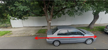
|
Proposed original location on Mayes Street near Reserve Street was not supported due to it being in a low-medium density area; located on the frontage of a property and also within the statutory 10m ‘No Stopping’ area of an intersection. Young Street location was suggested as an alternative location – side boundary of 35 Reserve Street I first space after driveway. |
|
2. Annandale - Trafalgar Street western side south of Booth Street. - GoGet notes that the current floating location on the street is highly utilised, with an average use of 2.9 hours per day between January-March 2025. The location has been in use approximately 25 months and there are 577 members within 400m of the site.
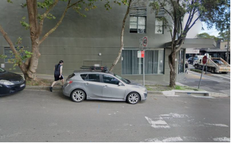
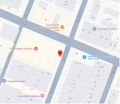
3. Ashfield – Lapish Avenue eastern side north of Norton Street - GoGet notes that the current floating location on King Street is highly utilised, with an average use of 7.0 hours per day between January-March 2025. The location has been in use approximately 89 months and there are 256 members within 400m of the site.
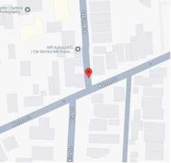
4. Ashfield – Palace Street north side east of Shepherd Lane - GoGet notes that this is a new location and that the current floating location on King Street is highly utilised, with an average use of 7.0 hours per day between January-March 2025. The age of the nearest GoGet bay is approximately 89 months and there are 111 members within 400m of the site.
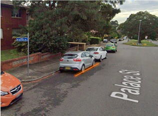
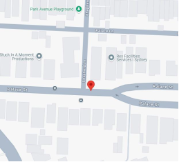
5. Dulwich Hill – Hercules Street on northern side east of Beach Road – GoGet notes that this is a new location and that the current floating location in the area is highly utilised, with an average use of 6.5 hours per day between January-March 2025. The age of the nearest GoGet bay is approximately 66 months and there are 444 members within 400m of the site.
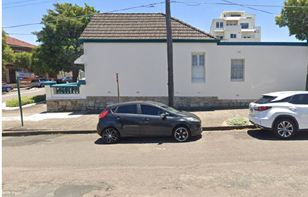
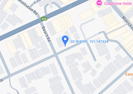
|
Proposed original location in Hercules Street on southern side east of Beach Street was not supported due to it being in a residential parking scheme location. The other side of the road opposite the originally proposed location was suggested as an alternative location in first unrestricted parking space after ‘No Stopping’ sign. |
|
6. Dulwich Hill – Lewisham Street south side east of The Boulevarde - GoGet notes that the current floating location on Lewisham Street is highly utilised with an average use of 3.7 hours per day between January-March 2025. The age of the location is approximately 99 months and there are 449 members within 400m of the site.
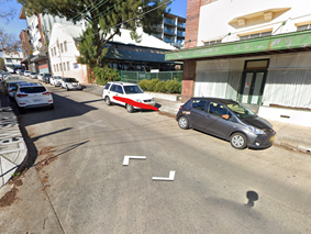
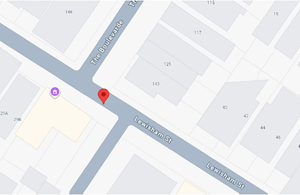
|
|
7. Dulwich Hill – Myra Road western side north of Myra Lane - The current floating location on Myra Road is highly utilised, with an average use of 7.3 hours of use per day between January-March 2025. The location has been in use approximately 138 months and there are 273 members within 400m of the site.
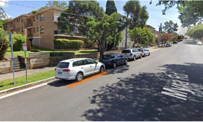
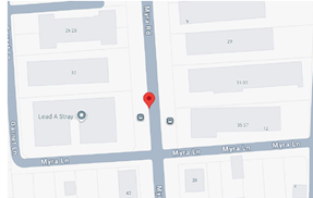
|
Proposed original location in Myra Road on the western side north of The Parade south of Myra Lane was not supported due to it being adjacent to a residential property. Alternative location suggested was 60m further north to outside 36-40 Myra Road block of units – first space north of Bus Zone. |
|
8. Enmore – Charles Street near Philip Street north side outside 36-38 Phillip Street - GoGet notes that the current floating location on Charles Street is highly utilised, with an average use between 4.6 and 10.7 hours per day between January-March 2025. The location has been in use approximately 190 months and there are 850 members within 400m of the site.
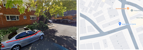
|
Proposed original location on Charles Street south side west of Philip Street was not supported due to it being in a currently ‘1P 6pm-10pm’ restricted zone. The opposite side of the street was suggested as an alternative location being in an unrestricted parking area. |
|
9. Enmore – Fotheringham Street west side south of Stanmore Road - GoGet notes that this is a new location and that the floating location on Liberty Street is highly utilised, with an average use of 4.9 hours per day between January-March 2025. The nearest GoGet bay has been in use approximately 185 months and there are 714 members within 400m of the site.
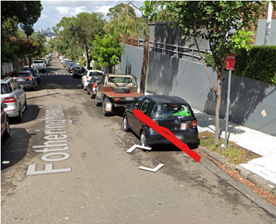
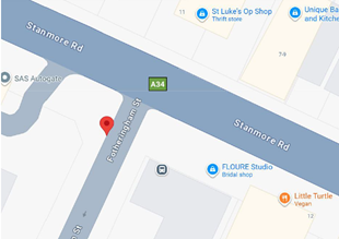
|
Proposed original location in Fotheringham Street was on eastern side south of Stanmore Road was not supported due to it being in a residential parking scheme location. The other side of the road opposite the originally proposed location was suggested as an alternative location in the first unrestricted parking space after ‘No Stopping’ sign. |
|
10. Marrickville – Harnett Avenue north side near Louisa Lawson Memorial Park – GoGet notes that the current floating location on Harnett Avenue is highly utilised, with an average use of 3.7 hours per day between January-March 2025. The location has been in use approximately 152 months and there are 427 members within 400m of the site.
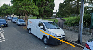
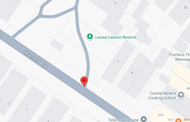
|
Proposed original location on Harnett Avenue north side west of Illawarra Road was not supported due to it being in a restricted short term parking location. The alternative location suggested was on the northern side of Harnett Avenue approximately 40m westward adjacent to Louisa Lawson Memorial Park. |
|
11. Marrickville – Middle Street south side east of Bright Street - GoGet notes that this is a new location and that the floating location on England Avenue is highly utilised, with an average use of between 4-7.6 hours per day between January-March 2025. The location has been in use approximately 185 months and there are 300 members within 400m of the site.
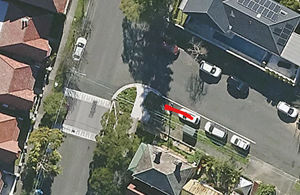
12. Newtown – John Street east side north of Lord Street - GoGet notes that the current floating location on John Street is highly utilised, with an average use of 4.3 hours per day between January-March 2026. The location has been in use approximately 72 months and there are 673 members within 400m of the site.
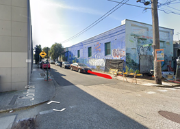
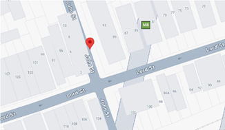
|
Proposed original location in John Street on the west side north of Lord Street was not supported due to it being in a residential parking scheme location – M14. The other side of the road opposite the originally proposed location was suggested as an alternative location in first legal unrestricted parking space (10m north) |
|
13. Newtown – Trade Street north side west of St Marys Street - GoGet notes that the current floating location on Trade Street is highly utilised, with an average use of 6.0 hours per day between January-March 2025. The location has been in use approximately 197 months and there are 812 members within 400m of the site.
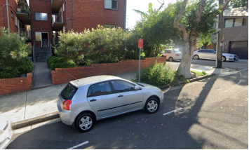
14. Petersham – Chester Street near Audley Street - GoGet notes that the current floating location on Oxford Street is highly utilised, with an average use of 4.2 hours per day between January-March 2025. The location has been in use approximately 90 months and there are 517 members within 400m of the site.
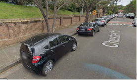
|
Proposed original location on Chester Street on the south side east of Audley Street was not supported due to it being in a residential parking scheme location (M11). The other side of the road about 1000m east of the originally proposed location was suggested as an alternative location adjacent to Petersham Reservoir. |
|
15. Stanmore – Clarendon Road north side west of Northumberland Avenue - GoGet notes that this current floating location on Northumberland Avenue is highly utilised, with an average use of 2.5 hours per day between January-March 2025. The location has been in use approximately 126 months and there are 354 members within 400m of the site.
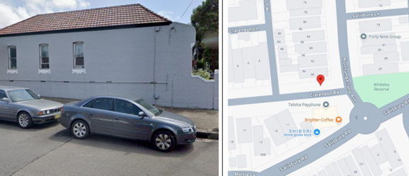
PUBLIC CONSULTATION
OFFICERS COMMENTS
Aer summary of each location is presented below.
|
|
Location |
Letters sent - Responses |
Representatively selected resident comments |
Supported / not supported |
|
1 |
Annandale – Young Street eastern side north of Reserve Street
Currently unrestricted parking.
-33.8841, 151.1666
|
30 letters sent
8 responses
Response rate = 26%
3 support (37%)
4 support but in alternative location (50%)
1 objection (13%)
|
The more options for car share the better
The intersection of Young and Reserve streets where the car share is proposed is extremely dangerous and does not need more vehicle movements. There are regular accidents and near misses at this intersection. Speed on Young Street is a serious issue and speed monitoring is probably required.
Very convenient location
|
Proposed site meets Council’s car share Policy – on side boundary and within medium density residential area
Supported – first space after statutory 10m ‘No Stopping’ distance on eastern side of Young Street north of Reserve Street |
|
2 |
Annandale - Trafalgar Street western side south of Booth Street
Currently – ‘2P 8am-6pm Mon-Fri’ restrictions
-33.8821 151.172
|
100 letters sent
8 responses
Response rate = 8%
5 support (62%)
2 support but in alternative location (25%)
1 objection (13%) |
There was a GoGet car in Chester St Annandale, but a pod was set up some distance away and the car moved there. I would support a pod at or near Chester St at Nelson St or nearby.
More car sharing is better - and this is a good location for a bay
Parking spaces in the block concerned, between Booth St and Collins St, are mostly (not always) heavily used. It is rare for me to be able to park within 50 m of my house. There are times when there are no vacant spots on the whole block. The situation is particularly inconvenient when we have shopping to unload. I am therefore opposed to the proposal in its current form. |
Proposed site meets Council’s car share Policy - In or immediately adjacent to retail / commercial street
Supported – Trafalgar Street south of Booth Street, Annandale first parking space on western side after the ‘No stopping’ sign |
|
3 |
Ashfield – Lapish Avenue eastern side north of Norton Street
Currently – ‘2P 8am-6pm Mon-Fri’ restrictions
-33.889250 151.120218
|
30 letters sent
5 responses
Response rate = 17%
5 support (100%)
No objections |
This will help people to get around when they don't have a car. We need to support alternatives to everyone having their own car due to lack of parking.
We need more spot for rideshare easy and nearby when we need it
It is my local pod and it is sometimes hard to find the car or a spot to return the car to due to not having a dedicated bay. A dedicated bay would make it easier to find the car and will have no net reduction in car spaces as there are already forget vehicles there |
Proposed site meets Council’s car share Policy – on side boundary and within medium density residential area
Supported – Lapish Avenue last space before the ‘No Stopping’ sign on the eastern side of Lapish Avenue north of Norton Street, Ashfield.
Note: Lapish Avenue is one-way southbound. |
|
4 |
Ashfield - Palace Street north side east of Shepherd Lane
Currently – unrestricted
-33.894930 151.120819
|
30 letters sent
5 responses
Response rate = 17%
2 support (40%)
2 support but in alternative location (40%)
1 objection (20%) |
…there are a number of apartments with limited parking, and street parking is at a premium. The space proposed is used 24 hours a day by apartment occupants. .. Shepherd Lane …. support…if the space is moved from the current proposed location.
Parking in this location is already at a premium. The residents/ratepayers should have priority over a private entity
Sometimes we have to park our car almost near Holden street because there is not availability around our house.
Very convenient for me and many others nearby |
Proposed site meets Council’s car share Policy – on side boundary and within medium density residential area
Supported - Palace Street north side east of Shepherd Lane, Ashfield first legal space |
|
5 |
Dulwich Hill – Hercules Street on northern side east of Beach Road
Currently – unrestricted
-33.9044 151.1415 |
22 letters sent
10 responses
Response rate = 45%
7 support (70%)
2 support but in alternative location (20%)
1 objection (10%) |
This would be a great help as I use Go get frequently and would be nearby my house.
Well located, nothing there now, convenient to light rail
There is a bay near by on Hercules street
As a resident without off-street parking, I already have to pay the council about $150 year annually just to park my car. And this by no means guarantees there will actually be a spot anywhere near my house….. Parking is already at a premium in Hercules St …I strongly oppose losing further spaces for the benefit of a business. Parking should be for residents.
The car space in the photo is not suitable for car share- it takes up an untimed space and residents like me value these. A better idea to have a car share spot in the car park nearby |
Proposed site meets Council’s car share Policy – on side boundary and within medium density residential area
Supported - Hercules Street on northern side east of Beach Road, Dulwich Hill - first space after statutory 10m ‘No Stopping’ sign |
|
6 |
Dulwich Hill – Lewisham Street south side east of The Boulevarde
Currently unrestricted
-33.9023 151.1423
|
30 letters sent
0 responses
Response rate = 0%
|
|
Proposed site meets Council’s car share Policy – in other location – outside Salvation Army premises and also near commercial centre and medium-high density housing
Supported – first space next to driveway into Salvation Army premises |
|
7 |
Dulwich Hill – Myra Road western side north of Myra Lane
Currently unrestricted
-33.9081 151.1361 |
100 letters sent
10 responses
Response rate = 10%
5 support (50%)
3 support but in alternative location (30%)
2 objections (20%) |
I use this GoGet regularly, it is a great location
Lots of units in the area, sometimes hard to park the goget located in this area
It’s much needed by those in the area who don’t own a car and need to access GoGet. At the moment, it can be hard to find the car as it is not consistently in the same place.
Myra Road predominantly have a host of multiple dwelling buildings that can go up to 3 stories high with residents who have multiple cars due to their own personal needs.
The car spots directly in front of the proposed location were recently converted to EV charging spots, therefore 2-3 parking options have already been removed for local residents…..
…. GoGet just wants their own spot. Dont allocate public land to private companies. Public land should be used for the public only.. |
Proposed site meets Council’s car share Policy – within medium density residential area
Supported – first space north of the Bus Stop on the western side of Myra Road north of Myra Lane |
|
8 |
Enmore – Charles Street near Philip Street north side outside 36-38 Phillip Street
Currently unrestricted
-33.8973 151.1732 |
35 letters sent
8 responses
Response rate = 23%
7 support (88%)
1 support but in alternative location (12%)
No objections |
This spot is one of only a few untimed car spots near my house…privacy issues…I don’t think that public parking spaces that are untimed should be replaced for use by private companies that require payment to use their services…..
I use GoGet cars in this area but am reluctant to book any without a dedicated space, as it can be too hard to find a spot to park in when returning them at the end of the booking.
It is a central location for this precinct |
Proposed site meets Council’s car share Policy – within medium density residential area
Supported – first space after the ‘No Stopping’ sign on the northern side of Charles Street just west of Phillip Street |
|
9 |
Enmore – Fotheringham Street west side south of Stanmore Road
Currently unrestricted
-33.8993 151.1701 |
15 letters sent
17 responses
Response rate = 113%
5 support (29%)
1 support but in alternative location (6%)
11 objections (65%) |
We do not have enough parking for residents as it is.. many are unable to park in our street and need to park more than a block away.
We do not have enough parking for residents as it is.. many are unable to park in our street and need to park more than a block away.
Insufficient residential parking in the street already.
Dedicated bay is essential given increased difficulty to find car parking on the street due to increased dwellings (townhouses).
We are in the process of requesting both sides of the street to be residents only we can barely find a park these days there’s no way we can lose another one!!.....
Absolutely no! We live on the street and it's already hard enough for us to find a parking spot from Wednesday night onwards until Sunday……
I am totally opposed to this proposal. Parking is already a significant challenge in our street…. |
Not Supported – due to the number of concerns raised by the community it is recommended that this location not be supported at this time |
|
10 |
Marrickville – Harnett Avenue north side near Louisa Lawson Memorial Park
Currently unrestricted
-33.9161 151.1489 |
45 letters sent
6 responses
Response rate = 13%
6 support (100%)
No objections |
Dedicated spots make this system work and I’m supportive of allocating spots to make people use car share more
Because the street gets congested with residential parking due to all the apartment blocks on the street, driving around looking for an adequate carport currently results in the inability to return the vehicle on time or to a suitable nearby spot.
It is close to my own home, as well as many apartments and houses. |
Proposed site meets Council’s car share Policy - Adjacent to public land such as a park and also within a medium density residential area
Supported – first space outside the eastern end of Louisa Lawson Reserve on northern side of Harnett Avenue (60m west of Illawarra Road) |
|
11 |
Marrickville – Middle Street south side east of Bright Street
Currently unrestricted
-33.8999 151.1596 |
20 letters sent
7 responses
Response rate = 35%
3 support (43%)
4 objections (57%) |
Middle Street offers a good location for a dedicated car space close to Addison Rd but not taking away a car spot actually on Addison Rd where many houses do not have access to off street parking and compete for available spaces.
The volume of residents in middle street does not support a carshare space.
The residents of Bright Street and Middle Street have a constant battle to find parking in the street or nearby due to competing with Newington College, markets and sporting events plus other residents from surrounding streets including Addison Road…. Middle and Bright streets do not have timed permit parking so people use our streets to park here all day… I would support a car share space otherwise this will only add to our frustrations and upset on a daily basis.
As a resident of Middle Street for over 25 years, the street struggles to accommodate residential parking as it is…… |
Not Supported – due to the number of concerns raised present and past by the community regarding the current parking pressures in the street and locality. Therefore, it is recommended that this location not be supported at this time |
|
12 |
Newtown – John Street east side north of Lord Street
Currently unrestricted
-33.9075 151.1779 |
35 letters sent
10 responses
Response rate = 29%
8 support (80%)
2 support but in alternative location (20%)
No objections |
Whilst I am supportive of car share and understand the desire for more locations. I do not believe the location is suitable… John Street is a short two-way street either side of two one way streets..the parking is limited…and have to circulate to find a park….and location is proposed for townhouses…
Great location, really helps to have bay, hard to park on weekday evenings
It is close to my house and this car is used all the time by many locals. Parking is extremely difficult and often the car is hard to locate when parked streets away given limited parking.
I hired a Go Get and it was so frustrating trying to return it as there was nowhere |
Proposed site meets Council’s car share Policy – on side boundary and within medium density residential area
Supported - first legal unrestricted parking space (10m) on John Street north of Lord Street
|
|
13 |
Newtown – Trade Street north side west of St Marys Street
Currently unrestricted
-33.895 151.17386 |
30 letters sent
14 responses
Response rate = 47%
12 support (86%)
1 support but in alternative location (7%)
1 objection (7%) |
This is a very handy spot we use regularly, and it would be great to have it reliably in one spot as this is a busy residential road.
Dedicated parking places make for a better more consistent location. This bay is a good option for where I live.
Sometimes a parking space is not available on Trade St when returning the car - or can be hard to locate if the previous driver was unable to secure a park on Trade St.
Trade Street is not a resident parking area, which it should be, so there are already enough parking spaces alienated by commercial vehicles parking in our street
I am writing to formally object to the proposed installation of a GoGet Car Bay directly outside 9 Trade Street… Parking availability on Trade Street is already extremely limited…. Dedicating a bay to GoGet in an unregulated area would unfairly privilege a commercial operator at the direct expense of local residents…. |
Proposed site meets Council’s car share Policy – within medium density residential area
Supported - first space after ‘No Stopping’ sign on north side of Trade Street west of St Marys Street |
|
14 |
Petersham – Chester Street near Audley Street
Currently unrestricted
-33.8966 151.1557 |
20 letters sent
8 responses
Response rate = 40%
4 support (50%)
3 support but in alternative location (38%)
1 objection (12%) |
Chester St only has unlimited parking on one side of the road, making the parking difficult for residents visitors
Parking in Chester St is already difficult. There are car spaces near the post office on audley st (45 degree) angle parking that would be more suitable. I am a plumber and getting my big van in and out of the driveway is already difficult, especially cars are parked in the proposed spot. My wife a has a disability and the current parking in Chester st already makes it difficult for carers to park. There is also a nursing home on the street that requires staff and visitor parking
Parking is already next to impossible on Chester St and this would make parking even harder……
Chester Street is too narrow; concern expressed about the loss of existing parking space for the residents; and worried that more traffic would result…. |
Proposed site meets Council’s car share Policy - Adjacent to public land - Petersham Reservoir.
Supported - first space on north side of Chester Street immediately east of speed hump |
|
15 |
Stanmore – Clarendon Road south side west of Northumberland Avenue
Currently unrestricted
-33.8915 151.168015 |
12 letters sent
0 responses
Response rate = 0%
|
Officer comment - After reconsideration it was thought to be more practical to have the dedicated car share space on the southern side of Clarendon Road adjacent to business premises opposed to being on the side boundary of a residential house as it would have been on the northern side. The recommendation then is not the location specified in the consultation process, however due to no responses it is considered viable. |
Proposed site meets Council’s car share policy – other location
Supported - first space on south side of Clarendon Road west of Northumberland Avenue between awning and power pole |
CONCLUSION
As a result of council officer review and community feedback thirteen of the fifteen nominated GoGet car share spaces are recommended for installation. Both the Fotheringham Street west side south of Stanmore Road, Enmore and Middle Street south side east of Bright Street, Marrickville car share locations are recommended not to proceed and these two sites received a higher percentage of objections from the local residents.
It is recommended that the installation of the proposed other thirteen on-street dedicated GoGet car share parking spaces be approved in order to provide improved parking opportunities for local residents who participate in the car share scheme.
FINANCIAL IMPLICATIONS
Costs associated with the installation, removal, maintenance and administration of dedicated car share bays/spaces including non-statutory features such as painted road markings will be met by the relevant car share company in accordance with the Schedule of Fees and Charges.
|
1.⇩ |
CONCEPT DIAGRAMS |
|
2.⇩ |
Inner West Consultation Report - Nov 2025 |
|
Local Transport Forum Meeting 16 February 2026 |
Subject: InnerWest@40 - Area 4 Leichhardt and Annandale; Area 9 Dulwich Hill North and Lewisham; Area 10 South Ashfield and Summer Hill West - Proposed speed limit reduction from 50km/h to 40km/h (Damun - Stanmore, Djarrawunang - Ashfield and Gulgadya - Leichhardt Wards / Balmain, Summer Hill, Newtown and Strathfield Electorates / Burwood, Leichhardt and Inner West PAC)
Prepared By: Daniel Li - Student/Graduate Traffic Engineer and Felicia Lau - Acting Coordinator Traffic Engineering Services North
Authorised By: Manod Wickramasinghe - Traffic and Transport Planning Manager
|
RECOMMENDATION
That the proposed signage and line marking plans to support the reduction in posted speed limit from 50km/h to 40km/h in local roads in Areas 4, 9 and 10 of the Innerwest@40 study including areas of Leichhardt, Annandale, Dulwich Hill, Lewisham, Ashfield and Summer Hill, be approved.
|
STRATEGIC OBJECTIVE
This report supports the following strategic directions contained within Council’s Community Strategic Plan:
|
2: Liveable, connected neighbourhoods and transport |
|
|
EXECUTIVE SUMMARY
At Council’s meeting on Tuesday 5 March 2024, Council adopted the InnerWest@40 “Investigation in Potential Local Road Speed Limit Reductions” Study and requested that Council officers seek approval and funding from Transport for NSW to expedite the implementation of 40km/h speed limits on local streets within the Local Government Area (LGA).
As part of the Australian Government Blackspot Program (AGBS), Council received funding to
implement the reduced speed limits in Area 6 (Enmore & Marrickville East) and Area 7 (Marrickville & Tempe). Both areas were completed in mid-2025 with the subsequent Area 5 (Stanmore & Petersham) and Area 8 (Dulwich Hill South and Marrickville West) being scheduled for implementation in early 2026.
Funding has been approved to continue the implementation of reduced speed limits in 2025/26 with Area 4 (Leichhardt & Annandale), Area 9 (Dulwich Hill North and Lewisham) and Area 10 (South Ashfield and Summer Hill West) currently proposed for a speed limit reduction. The remaining areas of the Inner West including Area 1 (Haberfield), Area 2 (Rozelle and Lilyfield) and Area 11 (Ashfield North) is also scheduled to be reviewed this financial year.
BACKGROUND
Council’s Integrated Transport Strategy, ‘GOING PLACES’, has identified a key project of reducing the speed limit from 50 km/h to 40 km/h on the local road network within the Inner West Council Area. Accordingly, Council commissioned Beca Consulting to prepare the Innerwest@40 Study. The study found that reductions in signposted speed limits are likely to significantly improve safety with only minimal impacts on travel times.
The Innerwest@40 Study was adopted by Council in March 2024. This study has identified priority areas for the staged implementation of the area-wide 40km/h limit in the Council area. This is shown in Figure 1.
Following the implementation of reduced speed limits in Area 6 and 7 and the scheduled implementation of Area 5 and 8, it is proposed to expand the reduced speed limits to Area 4, 9 and 10. These areas have existing street environments that are self-enforcing to the proposed 40km/h speed limit in line with TfNSW’s expectation for the rollout.
Figure 1: Prioritisation of 40km/h speed limit reduction (source: Innerwest@40 study)
DISCUSSION
The InnerWest@40 report has presented that 60% of roads within the LGA were recorded to have 85th percentile speeds of below 40km/h, this is due to the narrowness of streets which are commonly found in the Inner West as well as the presence of traffic calming devices to reduce vehicle speeds.
The 85th percentile speeds for Area 4, 9 and 10 are shown in the following figures.
Figure 2. 85th percentile speed profile for Area 4
Figure 3. 85th percentile speed profile for Area 9
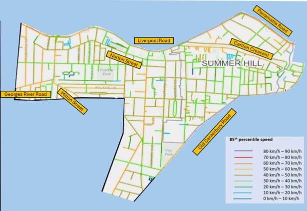
Figure 4. 85th percentile speed profile for Area 10
Any local street that has a recorded 85th percentile speed of less than 45km/h falls within acceptable limits and is considered self-enforcing. It is proposed to install entry treatments in the form of new R4-240n ‘Local Traffic Area 40’ signs and pavement patches to these local roads (shown in Figures 5,6,7 and 8).
It should be noted that as part of the implementation of the next phases of InnerWest@40, Transport for NSW is reviewing speed reduction on regional and state roads to ensure a consistent application of speed limits throughout the LGA. This review is still underway.
A small number of local streets have been identified to be marginally higher than the benchmark of 45km/h and will require additional speed reduction treatments to provide an environment that will be self-enforcing. These streets are listed in Table 1 below and the line marking plans are provided in Attachment 1. It is expected that these linemarking treatments along with associated signage will reduce vehicles to an acceptable level.
|
Street |
Between |
Suburb |
Area |
Treatment |
|
Ainsworth St |
Moore St & Piper St |
Leichhardt |
4 |
Centre line and give-way intersection |
|
Flood St |
William St & Allen St |
Leichhardt |
4 |
Centre line and edge line |
|
Kentville Ave |
Annandale St & Johnston St |
Annandale |
4 |
Centre line |
|
Hampstead Rd |
Old Canterbury Rd & Windsor Rd |
Dulwich Hill |
9 |
Edge line |
|
Maddock St |
Old Canterbury Rd & Gelding St |
Dulwich Hill |
9 |
Edge line |
|
Armstrong St |
Holden St & Queen St |
Ashfield |
10 |
Edge line |
|
Arthur St |
Greenhills St & Milton St |
Ashfield |
10 |
2x edge lines and centre line |
|
Hardy St |
Princess St & Queen St |
Ashfield |
10 |
Centre line |
|
Holborrow St |
Georges River Rd & Liverpool Rd |
Ashfield |
10 |
2x edge line and centre line |
|
Holden St |
Fourth St & Clissold St |
Ashfield |
10 |
Centre line |
|
Milton St |
Dougan St & Canterbury-Bankstown Council boundary |
Ashfield |
10 |
2x edge lines and centre line |
|
Norton St |
Milton Ln & Carlisle St |
Ashfield |
10 |
Edge line and give-way TB line. |
|
Victoria St |
Liverpool Rd & Harland St |
Ashfield |
10 |
Centre line |
|
Carlton Cres |
Prospect Rd & Lackey St |
Summer Hill |
10 |
2x edge lines and centre line |
|
Edward St |
Smith St & Old Canterbury Rd |
Summer Hill |
10 |
Centre line |
|
Kensington St |
Liverpool Rd & Dover St |
Summer Hill |
10 |
Centre line |
Table 1. Streets requiring additional speed reduction treatments
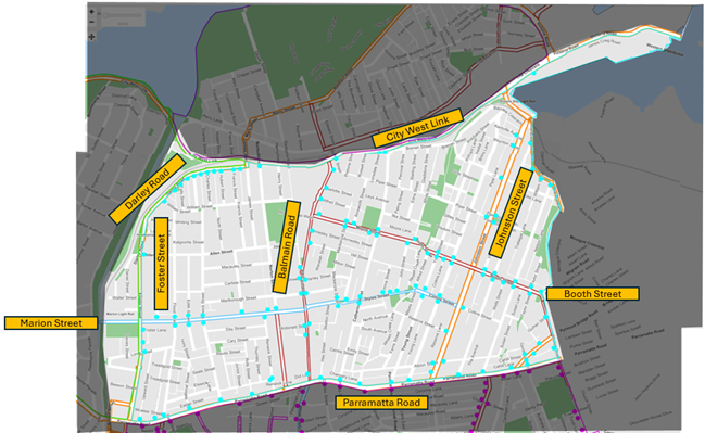
Figure 5. Proposed entry treatment locations for Area 4 (Leichhardt – Annandale)
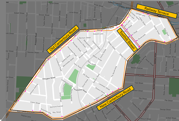
Figure 6. Proposed entry treatment locations for Area 9 (Dulwich Hill North – Lewisham West)
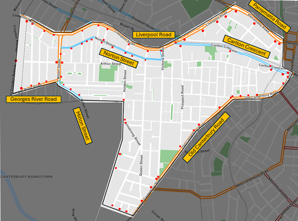
Figure 7. Proposed entry treatment locations for Area 10 (South Ashfield and Summer Hill West)
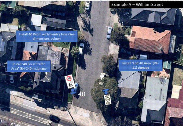
Figure 8 – Example of Entry Treatment Signages
FINANCIAL IMPLICATIONS
Grant funding has been provided for approximately $1.8M received under the Safe Speed Program from Transport for NSW (TfNSW) for the project over the 2024/25 and 2025/26 financial years.
|
1.⇩ |
IW40 - Area 4 Leichhardt & Annandale Linemarking Plans |
|
2.⇩ |
IW40 - Area 9 Dulwich Hill Linemarking Plans |
|
3.⇩ |
IW40 - Area 10 - Ashfield Linemarking Plans |
|
4.⇩ |
IW40 - Area 10 - Summer Hill Linemarking Plans |
|
Local Transport Forum Meeting 16 February 2026 |
Subject: College Street, Balmain - Proposed Bicycles Excepted Signage(Baludarri-Balmain Ward/Balmain Electorate/Leichhardt PAC)
Prepared By: Charbel El Kazzi - Traffic Engineer
Authorised By: Manod Wickramasinghe - Traffic and Transport Planning Manager
|
RECOMMENDATION
That ‘bicycles excepted’ signage be installed under the existing one-way westbound signs at College Street between Cameron Street and Curtis Road, Balmain as shown in the attached plan. |
STRATEGIC OBJECTIVE
This report supports the following strategic directions contained within Council’s Community Strategic Plan:
|
2: Liveable, connected neighbourhoods and transport |
|
|
EXECUTIVE SUMMARY
Council has received requests from several residents in College Street, Balmain for a ‘bicycle excepted’ signage for the recently implemented one-way westbound restriction within College Street between Cameron and Curtis Road, Balmain. Under the NSW Road Rules, it is illegal for cyclists to travel against the one-way restriction.
Due to the low traffic volume and speeds within College Street, it is proposed that ‘bicycles excepted’ signage to supplement the existing one-way restriction be supported.
BACKGROUND
College Street is a local road consisting of a 6m width between kerbs surrounded by predominantly residential houses, a playground and a commercial property at its eastern end (the Dry Dock Hotel). Parking is permitted on both sides of the street and comprises of a mix of kerbside and footpath parking which provides sufficient passing space for one-way travel.
A one-way westbound restriction was implemented in early December 2025 following requests from residents to improve safety. At the Local Transport Forum meeting in September, it was suggested that Council investigate a bicycle excepted restriction to improve connectivity for cyclists.
DISCUSSION
Midblock traffic counts were captured within College Street between Cameron and Curtis Road, Balmain. The results show that on average 118 vehicles travel westbound each day which is relatively low and can accommodate passing opportunities for bidirectional cyclists travel.
The table below provides a summary of the features of College Street between Cameron and Curtis Road, Balmain.
|
Street Name |
College Street |
|
Kerb to Kerb Width (m) |
6m |
|
Carriageway Type |
One-way westbound direction |
|
Classification |
Local Road |
|
Speed Limit |
40km/h |
|
85th Percentile Speed |
31.3km/h |
|
Average Traffic Volume |
118 veh/day |
|
Available TfNSW recorded crash history last 5 years (2018-2023) |
No reported crashes
|
|
Parking Arrangements |
Parking permitted on both sides. Mix of footpath and kerbside. |
Due to the inconsistency of the footpath parking arrangement, the carriageway varies between 3-4m throughout the street. Despite the narrow width of College Street, the volume and speed generally remain very low and therefore could provide sufficient opportunity for cyclists to negotiate passing space with an opposing vehicle. It is worth noting that a 10km/h shared zone with marked footpath parking bays is also being investigated in College Street as part of the Birchgrove/Balmain East Local Area Traffic Management study currently underway.
FINANCIAL IMPLICATIONS
The proposed works are to be funded under Council’s signage and line marking budget.
|
1.⇩ |
College Street, Balmain - Bicycles Excepted Plan |
|
|
Local Transport Forum Meeting 16 February 2026 |
Subject: Thornley Street, Leichhardt - Proposed Kerb Extension (Leichhardt-Gulgadya Ward / Balmain Electorate / Leichhardt PAC)
Prepared By: Sunny Jo - Coordinator Traffic Engineering Services (North)
Authorised By: Manod Wickramasinghe - Traffic and Transport Planning Manager
|
RECOMMENDATION
That the design plan for the kerb extension on Thornley Street at Cary Street, Leichhardt (Attachment 1) be APPROVED. |
STRATEGIC OBJECTIVE
This report supports the following strategic directions contained within Council’s Community Strategic Plan:
|
2: Liveable, connected neighbourhoods and transport |
|
|
EXECUTIVE SUMMARY
Council is planning to improve the intersection of Thornley Street at Cary Street, Leichhardt by constructing a kerb extension.
The proposal will improve pedestrian safety by reducing the pedestrian crossing distance and will also provide sufficient space for replacement tree planting at the location.
BACKGROUND AND DISCUSSION
Council is planning to improve safety for all road users at the intersection of Thornley Street at Cary Street, Leichhardt. The intersection upgrade proposes the following works:
· Construction of 2m kerb extension on the western side of Thornley Street, south of Cary Street including kerb access ramps
· Replacement tree planting within the kerb extension
The proposal will improve pedestrian safety by reducing the pedestrian crossing distance, preventing illegal parking in the ‘No Stopping’ zone and will also provide sufficient space for replacement tree planting at the location without impacting on pedestrian accessibility.
The proposed design is presented in Attachment 1.
Consultation was not required as there is no impact on parking conditions based on the proposal.
FINANCIAL IMPLICATIONS
The project is estimated to cost $40,000 and will be funded from Council’s 2025/26 capital works budget.
|
1.⇩ |
Design - Kerb Extension - Thornley Street, Leichhardt
|
|
|
Local Transport Forum Meeting 16 February 2026 |
Subject: Kingston Street, Haberfield - Proposed Traffic Calming Works (Gulgadya-Leichhardt Ward/Summer Hill Electorate/Burwood PAC)
Prepared By: Amir Falamarzi - Traffic Engineer
Authorised By: Manod Wickramasinghe - Traffic and Transport Planning Manager
|
RECOMMENDATION
That the proposed two (2) pedestrian refuge islands on Kingston Street at Deakin Avenue, including four (4) kerb blister islands, kerb ramps, and signage as shown in the attached design plan No.10382.
|
STRATEGIC OBJECTIVE
This report supports the following strategic directions contained within Council’s Community Strategic Plan:
|
2: Liveable, connected neighbourhoods and transport |
|
|
EXECUTIVE SUMMARY
Council is planning to improve safety for all road users on Kingston Street, Haberfield, at Deakin Avenue by constructing kerb blister islands and pedestrian refuge islands. The proposal aims to enhance safety by better defining pedestrian crossing points, reducing conflicts between vehicles and pedestrians, and encourages a low-speed environment. These measures will help address concerns regarding pedestrian and motorist behavior in the area, particularly during busy periods.
BACKGROUND
Council is planning to improve safety for all road users at the intersection of Kingston Street and Deakin Avenue, Haberfield. The intersection upgrade proposes the following works:
· Construction of pedestrian refuge islands along Kingston Street, including kerb blister islands and kerb access ramps
· Edge line markings at the intersection of Kingston Street and Deakin Avenue, double barrier line markings along Kingston Street to better define vehicle travel paths
· Reinstatement of the Stop line marking on Kingston Street and installation of a ‘No Stopping’ sign on the north-east corner of the intersection
The proposed design is presented in Attachment 1.
DISCUSSION
Council undertook community consultation with affected residents regarding the proposed traffic calming plan in January 2026. A total of 20 letters has been mailed to the residents. At the close of the consultation period, one (1) submission was received. The feedback, along with the officer’s response, is tabulated below:
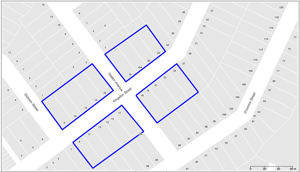
|
Community comments |
Officer’s response |
|
Kerb Blister islands are not necessary |
The kerb blister islands will improve road safety by reducing vehicle speeds through the intersection, improve sight distances and reduce the crossing distance. In the absence of kerb blisters, a 20m ‘No Stopping’ zone would be required, resulting in the loss of additional on-street parking spaces. |
FINANCIAL IMPLICATIONS
The proposed traffic calming project is expected to cost approximately $45,000 which will funded as part of the Council’s Capital Work Program for upgrading stormwater facilities on Kingston Street.
|
1.⇩ |
Proposed Pedestrian Refuge Islands Design Plan (10382) |
|
|
Local Transport Forum Meeting 16 February 2026 |
Subject: Wells Street, Newtown - Proposed Raised Continuous Footpath Treatment (Damun - Stanmore Ward / Newtown Electorate / Inner West PAC)
Prepared By: Daniel Li - Student/Graduate Traffic Engineer
Authorised By: Manod Wickramasinghe - Traffic and Transport Planning Manager
|
RECOMMENDATION
That the detailed design plan (10366) for a proposed continuous footpath treatment on Wells Street intersecting with King Street, Newtown be approved.
|
STRATEGIC OBJECTIVE
This report supports the following strategic directions contained within Council’s Community Strategic Plan:
|
2: Liveable, connected neighbourhoods and transport |
|
|
EXECUTIVE SUMMARY
Council has prepared a design plan to provide a continuous footpath for the intersection of Wells Street and King Street, Newtown. The intention of the proposal is to improve safety for pedestrians and motorists by better defining and prioritising movements across Wells Street whilst also reducing traffic speeds. The proposal will also address concerns regarding pedestrian and driver behaviour at this location.
BACKGROUND
Council in the October 2024 meeting, has adopted the Newtown South Local Area Traffic Management Plan (LATM). This LATM plan aims to reduce traffic volumes and speeds in local roads to increase liveability and improve safety and access for pedestrians. In this LATM, Wells Street at King Street was identified as a street of concern and it was recommended that a continuous footpath treatment be installed at this location. As such, this project has been included as part of the 2025/2026 Traffic Facilities Capital Program for design and construction.
DISCUSSION
The following information is provided in discussion.
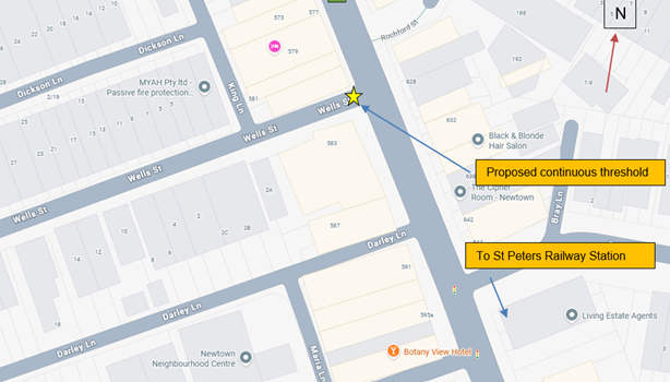 Figure 1. Locality plan
|
Street Name |
Wells Street at King Street |
|
Carriageway width (m) kerb to kerb |
Approx 6.7m |
|
Carriageway type |
Two-way with vehicles utilizing available parking areas to pass oncoming vehicles |
|
Classification |
Local |
|
Speed Limit km/h |
Currently 40 km/h as part of InnerWest@40 speed reduction program. |
|
85th percentile speed km/h |
25 |
|
Vehicles per day (vpd) |
555 |
|
Last available 5 years of TfNSW recorded crash history |
NIL in last 5 years in Wells Street intersecting with King Street |
|
Parking arrangements |
2P 8am – 10pm Monday – Friday, Permit Holders Excepted Area M14 on the southern side |
Table 1. Road
network detail
The Plan
Council proposes to undertake the following
works in Wells Street, Newtown (Plan No. 10366)
· Construct a new continuous footpath comprising a 150mm high concrete raised threshold (4m long) with 1.5m long ramps. The 4m flat-top section will be coloured concrete (charcoal colour) with stamped paving pattern to resemble existing footpath pavers (as best as possible). Ramps to be 1.5m long and in plain concrete colour;
· Reconstruct some existing kerb and gutter in new concrete kerb and gutter;
· Provide heel safe grating to allow safe cross over for pedestrians from the footpath on to the new continuous footpath across the road;
· Provide tactile indicators and <LOOK> logos either side of the new continuous footpath;
· Re-lay existing footpath pavers and reconstruct the footpath as needed to match any new levels and the new works;
· Provide signage and line marking associated with the works and as shown on the attached plans.
Parking Changes
This proposal will not result in the loss of any
on-street parking spaces as it is contained within the existing ‘No
Stopping’ zones of Wells Street.
Streetlighting
There are no proposed changes to the existing
street lighting in Wells Street near King Street as a result of the proposed
treatment.
Consultation
A letter outlining the above proposal was
distributed to the directly affected properties (18 properties) in Wells Street
as shown in Figure 2. No responses were received regarding the proposed
continuous footpath treatment.
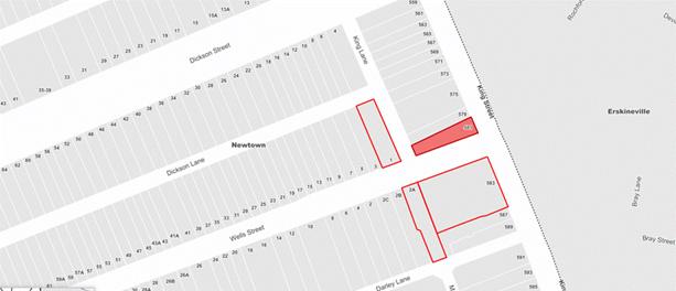 Figure 2. Consultation area
FINANCIAL IMPLICATIONS
The project is estimated to be around $51,000 and will be listed for construction as part of the 2025/2026 Traffic Facilities Capital Program.
|
1.⇩ |
10366 - Detailed Design Plan |
|
2.⇩ |
Swept Path Diagram |
|
Local Transport Forum Meeting 16 February 2026 |
Subject: Terminus Street, Petersham - Proposed Raised Pedestrian Crossing - Design Plan No.10368 - (Danum-Stanmore Ward / Newtown Electorate / Inner West PAC)
Prepared By: Jackie Ng - Traffic Engineer
Authorised By: Manod Wickramasinghe - Traffic and Transport Planning Manager
|
RECOMMENDATION
That the detailed design plan (No. 10368) for the construction of a raised pedestrian crossing at the intersection of Terminus Street and Palace Street, Petersham be approved in order to improve pedestrian safety at this location. |
STRATEGIC OBJECTIVE
This report supports the following strategic directions contained within Council’s Community Strategic Plan:
|
2: Liveable, connected neighbourhoods and transport |
|
|
EXECUTIVE SUMMARY
This report details the design plan (No. 10368) for the construction of a raised pedestrian crossing and result of community consultation at the intersection of Terminus Street and Palace Street, Petersham. The Local Area Traffic Management (LATM) study in 2023 for the Petersham North Precinct indicated through collected data that a significant pedestrian desire line exists at this location. The study recommended that a raised pedestrian crossing be installed on Terminus Street to improve pedestrian connectivity to local businesses, Fort Street High School and Petersham Station. The design and construction of the proposed raised pedestrian crossing has received fifty percent contribution from the Federal Government Active Transport Fund and is included in Council’s Traffic Facilities Capital Works Program for the 2025/2026 financial year.
BACKGROUND
A report went to Council’s
Local Traffic Committee on 17 June 2024 detailing proposed treatments
recommended after the Petersham North Local Area Traffic Management (LATM)
Scheme Review. It is noted that the location has a significant pedestrian desire
line and has recorded one crash involving a cyclist head westbound resulting in
a minor injury.
At the Local Traffic Committee meeting held on 17 June 2024, the following was
resolved in part:
t. That a raised pedestrian (zebra) crossing be installed at Terminus Street east of Palace Street.
Council has since applied and received fifty percent contribution from the Federal Government Active Transport Fund for design and construction of the proposed raised pedestrian crossings. The works are expected to be undertaken during the 2025/2026 financial year, subject to final approvals. No firm construction date is yet available, however residents will be notified prior to any work starts in the street.
DISCUSSION
The following works are proposed and are illustrated on the attached Consultation Plan (Plan No. 10368). The proposed works aim to improve pedestrian and motorist safety by better defining safe pedestrian crossing points, improving sight distances, reducing traffic speeds and conflicts with traffic movements at this location.
Specifically, the proposed scope of the work includes the following:
In Terminus Street
· Construct a new raised concrete pedestrian crossing with ‘gutter bridge’ crossings and landscape kerb blister. Tactile indicators will be installed on both sides of the new pedestrian crossing;
· Provide new stormwater drainage pits and pipes to cater for the stormwater flows and improve drainage in the vicinity of the new raised pedestrian crossing;
· Reconstruct kerb and gutter with new concrete kerb & gutter (generally where shown on the plans);
· Remove existing kerb ramps and provide concrete footpath;
· Remove existing landscape area & frangipani tree outside 89 Palace Street and provide footpath;
· Reconstruct some sections of the concrete footpath;
· Resurface the road pavement with new asphalt as shown in the plan (final extent of any resurfacing will be subject to final funding allocations);
· Install signage and line marking associated with the works as required and where shown on the plans;
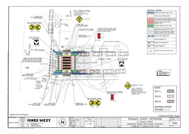
PARKING CHANGES
The existing ‘No Stopping’ zone in Terminus Street on the east side will be extended by approximately 13m to comply with minimum sight distance requirements on the approach side and 7m to the departure side of the new pedestrian crossing. This will result in a loss of three (3) existing on-street parking spaces in Terminus Street.
TREE REMOVAL
As stated above, it is proposed to remove one (1) existing garden bed and the small frangipani tree which currently exists. This is required to provide space for the new raised pedestrian crossing and to allow enough room for pedestrian movement.
STREETLIGHTING
The new raised pedestrian crossing will require new lighting for it to meet the minimum lighting safety and compliance standards. This may involve either 1 or 2 new flood lights provided on either side of the new raised pedestrian crossing (on either existing or new power poles). The final location of poles and lights will be confirmed during the lighting design development phase of the project by a Lighting Design Consultant.
CONSULTATION
Consultation was conducted between 26 November 2025 and 17 December 2025. A letter along with a copy of the design plan was sent to residents / businesses in the immediate locality. A total of 19 letters were distributed. There was one (1) response received in support of the proposal, however raised concerns regarding other aspects of the design. A summary of the main concerns is tabled below.
|
Summary of main concerns: |
Council response: |
|
Our main concern is light from the two proposed flood lights entering our house. The existing streetlamp on the south side of Terminus Street already shines directly into our living room and to a lesser extent into our kitchen |
The proposed new raised pedestrian crossing requires to be illuminated with the standard level of lighting in compliance with Australian standard AS/NZS 1158.4:2024 Lighting for roads and public spaces, Part 4: Lighting of pedestrian crossings. The lighting will be directed specifically onto the pedestrian crossing, with measures taken to limit any light spill to surrounding residential properties. |
|
The existing stormwater drains on Terminus Street are the only drain pits on the block. The drains are routinely blocked with leaves and debris, and during mild rain events, stormwater floods the footpath on the northern side of the street. |
A request has been created for Council’s maintenance section to clear the blocked drainage pits. The proposed works will provide new stormwater drainage pits and pipes to cater for the stormwater flows and improve drainage in the vicinity of the new raised pedestrian crossing. |
|
The loss of the garden bed and frangipani tree is unfortunate but seems inevitable. Perhaps a landscaped kerb blister could be installed on Palace Street near the corner with Terminus Street. |
While the existing garden bed and frangipani tree will be removed to facilitate the construction of the raised pedestrian crossing, Council has included four (4) landscaped kerb blister islands as part of the works to increase green space in the area. |
MODIFICATION TO THE PLAN
Council has modified the original plan to reduce the length of ‘No Stopping’ on southern approach side to the raised pedestrian crossing. The reduction in length will reduce the loss of parking from three (3) spaces to two (2) spaces.
Additionally, line marking will be introduced between the kerb blisters and the ‘No Stopping’ restriction to minimise illegal and non-compliant parking.
CONCLUSION
It is recommended that the detailed design plan (No. 10368) for the proposed new raised pedestrian crossing in Terminus Street and Palace Street, Petersham (as shown in the Attachments) be approved.
FINANCIAL IMPLICATIONS
The cost of the works is estimated at $150,000 and the project is included in Council’s Traffic Facilities Capital Works Program 2025/26 for funding. Fifty percent of the project cost will be funded by the Federal Government Active Transport Fund.
|
1.⇩ |
Terminus Street and Palace Street, Petersham - Proposed Raised Pedestrian Crossing |
|
2.⇩ |
Terminus Street and Palace Street, Petersham - Swept Path |
|
|
Local Transport Forum Meeting 16 February 2026 |
Subject: Dickson Street at King Street, Newtown – Redesign of existing refuge island - Design Plan 10365 (Damun-Stanmore Ward / Newtown Electorate / Inner West PAC)
Prepared By: Jennifer Adams - Traffic Engineer
Authorised By: Manod Wickramasinghe - Traffic and Transport Planning Manager
|
RECOMMENDATION
That the detailed design plan for the proposed redesign of the existing refuge island in Dickson Street at King Street, Newtown and associated signs and line markings (as per Design Plan No.10365) be APPROVED. |
STRATEGIC OBJECTIVE
This report supports the following strategic directions contained within Council’s Community Strategic Plan:
|
2: Liveable, connected neighbourhoods and transport |
|
|
EXECUTIVE SUMMARY
Council is planning to improve safety of pedestrians and motorists in Dickson Street (at King Street), Newtown by re-constructing the existing pedestrian refuge island to meet current standards. The proposal aims to improve pedestrian safety by providing a more effective and compliant pedestrian refuge island to ensure pedestrian movements across Dickson Street are made safer whilst also reducing traffic speeds. The proposal will address concerns regarding
pedestrian and driver behaviour at this location.
BACKGROUND
A recommendation from the Newtown South LATM Study report included that a widen median island be installed to cross Dickson Street at King Street, Newtown. A report detailing the findings of the Newtown South LATM report went to Council’s Local Traffic Committee meeting on 16 September 2024 (Item 4). Originally it was proposed that a continuous footpath treatment with kerb blisters be installed at the intersection however after the final draft report was placed on public exhibition in May 2024 the recommendation was changed to an upgraded wider median island due to feedback received.
This report details the design plan for the improvement works and its related consultation results.
OTHER STAFF COMMENTS
The following works are proposed and are illustrated on the attached Consultation Plan (Plan No. 10365). The proposed works aim to improve pedestrian safety by better defining and prioritising pedestrian movements across Dickson Street whilst also reducing traffic speeds.
Specifically, the proposed scope of work includes the following:
· Remove the existing sub-standard pedestrian refuge island; and construct a new pedestrian refuge island (compliant with existing standards) with a non-mountable kerb. The new pedestrian refuge island will have a faux brick finish in terracotta colour;
· Provide one new landscaped kerb blister island on the north side of the road to integrate with the new refuge island. The plant species for garden bed are to be native grasses as appropriately specified by Council’s landscape team;
· Re-lay existing pavers as needed and provide new kerb ramps to new locations to align with new pedestrian refuge island;
· Reconstruct some concrete kerb and / or gutter as required to suit the works
· Partially reconstruct one (1) existing driveway to property No.558 King Street, Newtown to allow one (1) existing parking space to be maintained on Dickson Street (south side), property 559 King Street, Newtown;
· Install signage and line markings associated with the works and as shown on the attached plan.
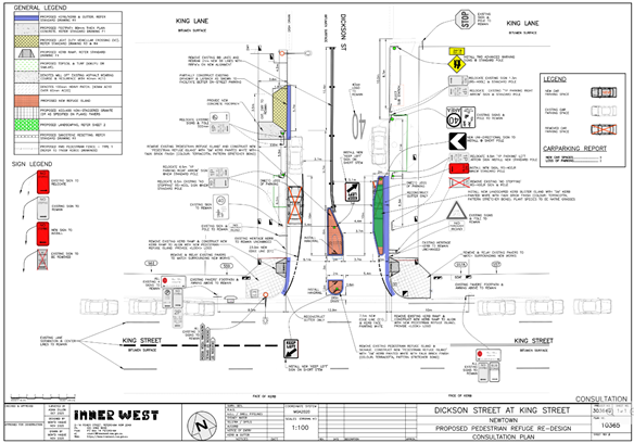
Parking Changes
To satisfy the standards for all new pedestrian refuge islands, the ‘No Stopping’ zones in Dickson Street need to be adjusted to provide the minimum clearances required for vehicular movements and pedestrian safety sight lines. This will result in the loss of two (2) existing on-street carparking spaces – one (1) on the north side of Dickson Street (where the new landscaped kerb blister island is located) and one (1) on the south side of Dickson Street.
Streetlighting
There are no proposed changes to the existing street lighting in Dickson Street near King Street due to this proposal.
Swept Path Analysis
Swept path analysis has been completed to assess the turning movements of a design vehicle – 8.8m medium rigid vehicle (MRV) and is reproduced below.
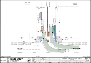
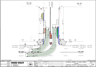
PUBLIC CONSULTATION
Consultation was conducted between 2 December 2025 and 18 December 2025. A letter along with a copy of the design plan was sent to residents / businesses in the immediate locality. A total of 18 letters were distributed. No submissions were received.
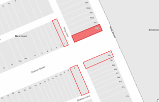
CONCLUSION
It is recommended that the detailed design plan of the proposed traffic treatment and associated signs and line markings be supported to improve pedestrian safety at this location.
FINANCIAL IMPLICATIONS
The project is listed on Council’s 2025/2026 Capital Works Program for construction and estimated cost is $53,000. Project number is 303640.
|
1.⇩ |
303640-10365-Plan |
|
2.⇩ |
303640-10365-Turning-Path-Analysis |
|
Local Transport Forum Meeting 16 February 2026 |
Subject: Hardie Avenue (at Smith Street), Summer
Hill-Proposed upgrade of an existing at level road crossing to a new raised
pedestrian crossing.
(Djarrawunang-Ashfield Ward/Summer Hill Electorate/Burwood PAC).
Prepared By: Boris Muha - Traffic Engineer
Authorised By: Manod Wickramasinghe - Traffic and Transport Planning Manager
STRATEGIC OBJECTIVE
This report supports the following strategic directions contained within Council’s Community Strategic Plan:
|
2: Liveable, connected neighbourhoods and transport |
|
|
EXECUTIVE SUMMARY
Council is planning to improve safety in Hardie Avenue, Summer Hill by constructing a new Raised Pedestrian Crossing near Smith Street to replace the existing ‘at-grade’ flat pedestrian crossing. The proposal aims to improve pedestrian and motorist safety by better defining safe pedestrian crossing points and addresses pedestrian safety and driver behaviour at this location.
BACKGROUND
DISCUSSION
The following information is provided in discussion.
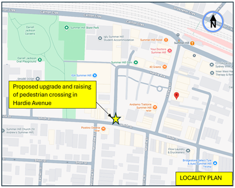
|
Street Name |
Hardie Avenue |
|
Carriageway width (m) kerb to kerb |
Approx. 7.8-7.9m |
|
Carraigeway type |
Two-way, one travel lane each direction. |
|
Classification |
Local |
|
Speed Limit km/h |
40 HPAA |
|
85th percentile speed km/h |
<40 |
|
Vehicles per day (vpd) |
Approx. 2500 |
|
TfNSW available reported crash history (last 5 years) |
1x 2020, Rum 39- Smith Street at Moonbie Street- vehicles hit both in easterly direction-minor/other injury.
1 x 2022, Rum 0- Smith Street crossing, west of Hardie Avenue- pedestrian hit near side (vehicle heading east- serious injury. |
|
Parking arrngements |
3 parking spaces to the western side of Hardie Avenue, north of Smith Street, other wise ‘No Stopping/No Parking’ else where on both sides. |
|
Side intersecting street |
Smith Street |
Table 1. Road Network detail.
The Plan
The following works are proposed and are illustrated on the plans in Attachment 1.
· Construct a new raised concrete pedestrian crossing to replace the existing ‘at grade’ flat pedestrian crossing.
· Construct landscaped kerb blister islands.
· Undertake drainage works to accommodate the new raised crossing including 2 new pits and lintels and a channel to divert overland stormwater flows through the new kerb blisters.
· Remove pedestrian fencing adjacent to the existing crossing in Smith Street.
· Replace some pavers within existing kerb blisters in Smith Street with landscaping.
· Install associated signage and line marking associated with the works as required and where it is shown on the plans.
Parking Changes
The proposal will not impact on existing parking arrangements in the street. Please refer to the attached plans.
Streetlighting
The new raised pedestrian crossing will most likely require new flood lighting to be provided in order for it to comply with current standards. This will involve the provision of at least 1 (or 2) floodlight(s) on existing or new power poles typical of other locations with pedestrian crossings. At this stage, this design is not complete and will be undertaken by a specialist lighting consultant at a later stage.
Additional Information
Hardie Avenue generally provides access to commercial and shopping premises in the street and the Summer Hill public open-air car park. The proposed raising of the crossing in Hardie Avenue is consistent with other raised crossings within this High Pedestrian Activity Area of Summer Hill.
CONSULTATION
A letter outlining the proposal was mailed to (24) properties (49 letters) in Hardie Avenue and Smith Street, Summer Hill. (see also map of consultation area Figure 2).
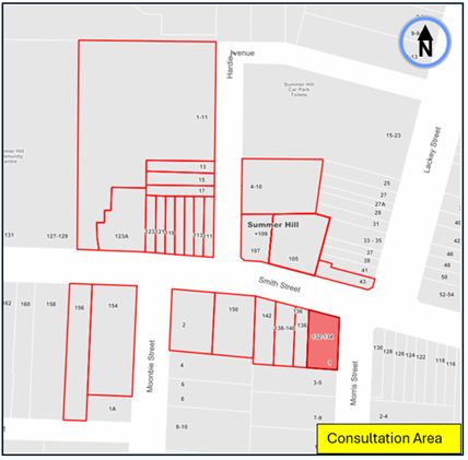
Figure 2- Consultation Area
No responses were received.
CONCLUSION
It is recommended that the detailed design plan (10335) to up-grade an existing road level crossing to a proposed new raised crossing, with associated kerb blister extension, signs and line marking in Hardie Avenue at Smith Street, Summer Hill (as shown in Attachment 1) be approved.
FINANCIAL IMPLICATIONS
The project is listed in Council’s Traffic Facilities Capital Works program to be carried out in 2025/2026. The work is estimated to be around $60,000.
|
1.⇩ |
Proposed raised crossing in Hardie Avenue at Smith Street, Summer Hill. |
|
|
Local Transport Forum Meeting 16 February 2026 |
Subject: Robert Street at Queen Street, Ashfield-
Proposed short-term road safety improvements.
(Djarrawunang-Ashfield Ward/Summer Hill Electorate/Burwood PAC).
Prepared By: Boris Muha - Traffic Engineer
Authorised By: Manod Wickramasinghe - Traffic and Transport Planning Manager
|
RECOMMENDATION
1. That the existing ‘No Stopping’ on the northern side of Robert Street, east of Queen Street, be extended 6 metres in length to an approximate distance of 19.0 metres east of Queen Street,
2. That ‘No Parking’ be sign posted across the dual driveway of 44 Queen Street and 21 Robert Street,
3. That the existing ‘GIVE WAY’ line marking at the Robert Street (east)/Queen Street intersection be removed and a new ‘STOP’ line be marked out and bought forward from the intersection.
4. That a painted island be marked out on the northern side of the Robert Street (east)/Queen Street intersection to align with the new ‘STOP’ line (item2), and
5. That additional ‘children’ warning signs be provided in Queen Street on the approaches to the intersection of Queen Street and Robert Street (east).
|
STRATEGIC OBJECTIVE
This report supports the following strategic directions contained within Council’s Community Strategic Plan:
|
2: Liveable, connected neighbourhoods and transport |
|
|
EXECUTIVE SUMMARY
Council has received varying concerns from residents regarding road safety around the Queen Street Early Learning Child-Care Centre in Robert Street at Queen Street. These concerns/requests range from changed traffic conditions (e.g. one-way), traffic conflict/sight view from the intersection, child/pedestrian safety to that of parking in the area.
The extent of these concerns and requests for improvements for road safety can have a broader wide impact upon the community and would normally be addressed under a Local Area Traffic Management (LATM) scheme. It is proposed in the short term that the following safety improvements be implemented in Robert Street as per the recommendation and shown in figure 1.
BACKGROUND
Concerns have been raised regarding road safety around the intersection of Queen Street and Robert Street, particularly noting the presence of a Child Care Centre located on the corner of the intersection.
DISCUSSION
Robert Street is a 2-way local street, width of approximately 6.4m kerb to kerb. Only one (1) recorded accident has been identified in the last 5 years at the intersection, that being in 2020 with a vehicle turning left from Queen Street hitting a vehicle in Robert Street westbound. Injury was of a minor nature.
The following short-term measures at this point of time are proposed in Robert Street.
1. Extend the existing ‘No Stopping’ on the northern side of Robert Street by 6 metres to improve visibility and reduce congestion. This provides additional holding area for vehicles turning in from Queen Street and properly allowing opposing vehicles to pass. This would result in the loss of one parking space.
Any car parking remaining on the northern side of Robert Street west thereof and opposite the Child-Care Centre, in this case, will be controlled with the inclusion of ‘No Parking’ over the driveways to 44 Queen Street and 21 Robert Street.
2. Extend the existing ‘GIVE WAY’ line marking at the Robert Street/Queen Street intersection further west and converting it to a ‘STOP’ line to enhance safety of turning movements at the intersection.
The northern kerb side corner of Queen Street is proposed to be a painted island to assist in the alignment of the new extended STOP line.
3. Provide additional ‘children’ warning signs in Queen Street on the approaches to the intersection of Queen Street and Robert Street (east).
See locality and proposed treatment plan below:
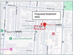
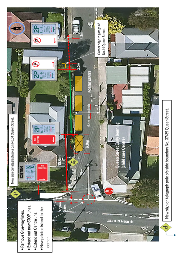
Figure 1 – Proposed changes
CONSULTATION
A letter outlining the proposal was mailed to (13) properties (20 letters) in Queen Street and Robert Street, Ashfield as shown in the consultation area map.
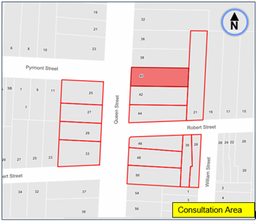
2 responses were received with one (1) in support of the short-term proposal with concern to investigate further road safety improvements in the area. (1) was in objection to the loss of parking and that the matter be best resolved primarily through changed traffic conditions (e.g. one-way or part-time No right turn (AM and PM peak hours) from Queen Street into Robert Street).
The comments with concerns are further tabled with officer responses below.
|
residents Comments |
Officers Response |
|
Resident No.1. · Object to the loss of one parking space. There is no parking directly out front of our house. · The short- term solution would not fix the problem. The only way to solve the congestion issue and mitigating true risk is by making this street one-way east to west and preserve resident parking. · The kerb space to the northern corner of the intersection should not be painted but an island should be constructed. Painting will not do anything to prevent vehicles parking at the corner. · Have no objection to the no parking sign near our garage being shifted as we struggle with double parking and being able to get out safely. |
· The short-term solution removing one parking space aims to improve visibility and reduce congestion by extending the holding area for vehicles turning in from Queen Street to stand whilst in view of opposing vehicles to pass. Council attempts to reduce the loss of parking when considering the installation of traffic facilities or traffic safety measures. It accepts that sometimes parking will be lost and balances this loss against the gains in safety as a result of these measures. · Further investigation will be undertaken to determine if further road/pedestrian safety/parking improvements could be made in consideration to changing traffic conditions as requested. · The island to the northern side of the intersection is painted out and may in time be physically constructed under further investigation. The painted island reinforces the ‘No Stopping’ restriction to the corner and assists with bringing out the proposed STOP line in view of traffic. · ‘No Parking’ signposting is provided across the driveway in this case to assist and control remaining parking between the garage and Queen Street. |
|
Resident No.2. · The proposal is a good start to solving what is currently a significant concern around the movement of traffic and pedestrians in what is a hazardous location. · A more permanent solution should include: - relocate the current bus stop outside the Child Care on the corner of Queen Street further south. Buses do not properly pull up into the space causing hazard and vehicle bank up. - Make Robert Street (east of Queen Street) one-way eastbound to prevent commuter rat-running and doglegging from Robert Street west of Queen Street. |
· Noted.
· Further investigation will be made to determine if further road/pedestrian safety/parking improvements could be made in consideration to changing traffic conditions and Bus Stop relocation as requested.
|
FINANCIAL IMPLICATIONS
Work will be carried out under the signs and line marking budget.
Nil.
|
|
Local Transport Forum Meeting 16 February 2026 |
Subject: Arthur Street, Marrickville - Proposed Raised Continuous Footpath Treatment - Design Plan No.10361 (Midjuburi-Marrickville Ward / Summer Hill Electorate / Inner West PAC)
Prepared By: Jackie Ng - Traffic Engineer
Authorised By: Manod Wickramasinghe - Traffic and Transport Planning Manager
|
RECOMMENDATION
That the detailed design plan (No. 10361) for the construction of a raised continuous footpath treatment, redesign of garden beds, and adjustment to existing parking arrangements at the intersection of Arthur Street and Illawarra Road, Marrickville be approved in order to improve pedestrian safety at this location.
|
STRATEGIC OBJECTIVE
This report supports the following strategic directions contained within Council’s Community Strategic Plan:
|
2: Liveable, connected neighbourhoods and transport |
|
|
EXECUTIVE SUMMARY
This report details the design plan (No. 10361) for the construction of a raised continuous footpath treatment, redesign of garden beds, adjustment to existing parking arrangements and result of community consultation at the intersection of Arthur Street and Illawarra Road, Marrickville. Council’s Pedestrian Access and Mobility Plan (PAMP) identified a ‘high’ priority opportunity to install a raised continuous footpath treatment across Arthur Street, Marrickville. The intersection is located along a key pedestrian link connecting pedestrians to the Marrickville Train Station and Marrickville Town Centre. Council has subsequently completed detail design and community consultation for the proposal.
BACKGROUND
A report went to the Local Traffic Committee on 11 December 2023, following requests received from the community asking that consideration be given to improve pedestrian safety at the intersection of Arthur Street and Illawarra Road, Marrickville.
The Inner West Council’s Pedestrian Access and Mobility Plan identified this intersection to be of ‘high’ priority for pedestrian safety improvements and recommended the installation of a raised continuous footpath treatment.
At the Local Traffic Committee meeting held on 11 December 2023, the following was resolved:
That the following be approved in principle and subject to the detailed design:
a) Installation of a raised continuous footpath treatment across Arthur Street at Illawarra Road;
b) Widening of the kerb extension on the southern side of Arthur Street from 2 metres to 5 metres
c) Reduction of the kerb extension width on the northern side of Arthur Street from 5 meters to 2 metres;
d) Conversion of the 90-degree angle parking on the northern side of Arthur Street, between Illawarra Road and Ann Street to parallel parking and;
e) Conversion of the parallel parking on the southern side of Arthur Street, between Illawarra Road and Ann Street to 90-degree rear to kerb angle parking.
DISCUSSION
The following works are proposed and are illustrated on the attached Consultation Plan (Plan No. 10361). The proposed work aims to improve pedestrian and motorist safety by better defining and prioritising pedestrian movements across Arthur Street whilst also reducing traffic speeds.
Specifically, the proposed scope of the works includes the following:
In Arthur Street
· Construct 90mm high and 2.0m wide concrete threshold of continuous footpath in plain concrete colour across Arthur Street at the intersection of Illawarra Road;
· Construction 90mm high and 2.0m wide concrete threshold with 1.5m wide ramps in charcoal (oxide) colour;
· Install micro mesh gutter bridge, in place of existing concrete gutter at the west side of Arthur Street to provide safe access over new continuous raised footpath;
· Provide tactile indicators, <LOOK> logos and 2.0m long yellow lines either side of the new continuous raised footpath;
· Reconstruct and redesign the four (4) existing landscaped kerb blister islands on either side of the road adjacent to the new continuous footpath;
· Provide landscaping of garden beds with suitable species of native grasses (subject to final design);
· Reconstruct garden beds’ sections of kerb only and face to be painted white;
· Install new “90 degrees parking”, “Speed Hump” and “Uni-directional” signs as shown on plan;
· Two “90 degrees parking” signs to be removed, as shown on plan;
· Install two one-way symbols;
· Install new signage and line marking associated with the works as required and where shown on the plan.
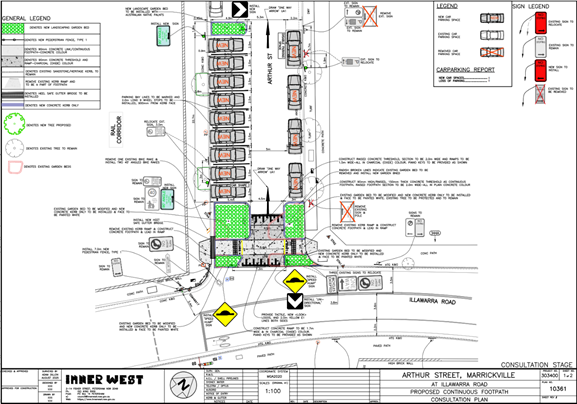
PARKING CHANGES
The proposal will result in no parking loss despite new parking arrangements on both sides of Arthur Street. The proposed parking changes ensure minimum site distances are met according to standards and will provide additional safety for motorists turning left from Illawarra Road.
STREETLIGHTING
Preliminary investigation reveals that there is sufficient lighting at the location due to existing streetlights in the vicinity. There, no additional streetlights have been proposed.
SWEPT PATH ANALYSIS
Swept path analysis has been completed to assess the turning movements of a design vehicle - 8.8m medium rigid vehicle (MRV) and is reproduced below.
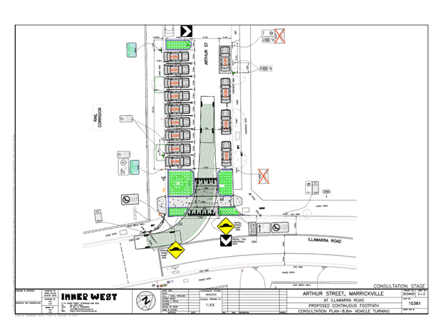
CONSULTATION
Consultation was conducted between 10 November 2025 and 28 November 2025. A letter along with a copy of the design plan was sent to residents / businesses in the immediate locality and also separately to the Inner West Council Bicycle Group. A total of 118 letters were distributed. There were three (3) responses received, one (1) supporting the proposal, one (1) objecting the proposal and one (1) raising other concerns. A summary of the main concerns is tabled below.
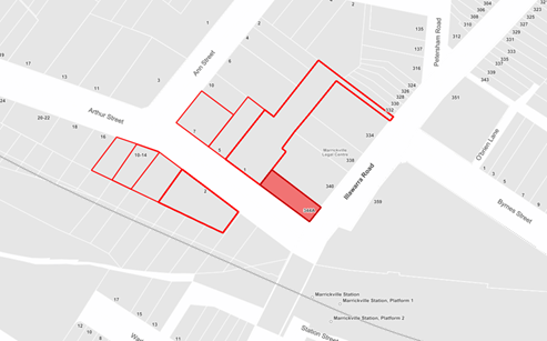
|
Summary of main concerns: |
Council response: |
|
2 similar comments |
There is existing signage at the intersection of Arthur Street and Illawarra Road, as well as Arthur Street and Ann Street indicating that the section of road is a one-way restriction. There are no plans to remove any signs or restrictions in the proposal. The proposed works are aimed to improve pedestrian and motorist safety by better defining and prioritising pedestrian movement across Arthur Street. The high wall on the southern side of Arthur Street at Illawarra Road restricts pedestrian sight lines for motorists turning left from Illawarra Road. Inverting the existing kerb extensions is expected to provide better sight lines for pedestrians crossing Arthur Street and motorists turning left into Arthur Street.
The design
shortens the existing crossing width, whilst providing improved visibility
for both pedestrians and motorists by increasing the sight distance for
northbound movement. |
|
The area to the immediate west of the works site has been the site of frequent and ongoing illegal dumping, including by council contractors. Earlier this year council removed a dead tree from the location and provided more room for dumping. I am requesting that council include plans to re-plant a tree and native grasses in this area to deter illegal dumping. |
Noted. |
|
This area is subject to frequent flooding due to stormwater drainage issues outside the driveway to 1-3 Arthur Street. This set of proposed works would be a fantastic opportunity for council to investigate a permanent solution to the drainage and flooding issues. |
Noted. There is currently no proposed works to existing stormwater and drainage concerns within the raised continuous footpath treatment. However, the proposal has taken into consideration stormwater concerns and has been designed accordingly. |
|
The changes will make driving through the street more hazardous for cars and pedestrians due to the change in car movement from one side of the road to the other side. The parallel parking lane and 90-degree angle parking spaces are not continuous along the first part of Arthur Street. |
Council understands the change in angle parking from the northern side on Arthur Street to the southern side may result in an adjustment period for residents and visitors. The proposed parking changes does not reduce the width of the road and is expected to have minimal impact on vehicles navigating the road. |
|
The proposed changes will increase traffic congestion when garbage trucks must stop to pick up weekly rubbish at the beginning of 1-3 Arthur Street. You will be removing possible road space for the garbage bins that would have usually been stacked on the road and making the footpath impenetrable. |
The proposed work does not result in any parking loss and is expected to not affect the existing arrangement of bin storage and weekly bin collection. Additionally, the new arrangement provides adequate road width for vehicles to pass a garbage truck should it be stopped in the road during garbage collection. |
|
You are removing a beautiful mature tree at the top of Arthur Street that many people have stopped to take photos of when it is blooming. |
Council has not proposed the removal of any trees due to the works. The tree at the intersection of Arthur Street and Illawarra Road is proposed to be protected and remain. |
|
The complete overhaul of the street parking situation at the beginning of Arthur Street for marginal improvement to the street safety is not needed. For the same outcome to safety and a more cost-effective proposal is to only update the raised footpath/speed hump and leave parking as existing. |
The high wall on the southern side of Arthur Street at Illawarra Road restricts pedestrian sight lines for motorists turning left from Illawarra Road. Inverting the existing kerb extensions is expected to provide better sight lines for pedestrians crossing Arthur Street and motorists turning left into Arthur Street. Council’s PAMP identified this intersection to be of ‘high’ priority to improve pedestrian movement and safety and recommended the installation of a continuous footpath treatment. The intersection is a key location connecting pedestrians from Marrickville Train Station and Marrickville Town Centre. |
|
Noise pollution from the local upgrades to Marrickville Metro, months of underground digging for fibre optical cables, resurfacing, and footpath works. |
Noted. |
CONCLUSION
It is recommended that the detailed design plan (No. 10361) for the proposed new continuous footpath treatment and other associated works at Arthur Street and Illawarra Road, Marrickville (as shown in Attachment 1) be approved.
FINANCIAL IMPLICATIONS
The cost of the works is estimated at $84,000 and will need to be included in Council’s Traffic Facilities Capital Works Program for funding.
|
1.⇩ |
Arthur Street and Illawarra Road, Marrickville - Proposed Raised Continuous Footpath Treatment |
|
2.⇩ |
Arthur Street and Illawarra Road, Marrickville - Swept Path |
|
|
Local Transport Forum Meeting 16 February 2026 |
Subject: Fishers Reserve, Petersham - Proposed Raised Continuous Footpath Treatment (Midjuburi - Marrickville Ward / Summer Hill Electorate / Inner West PAC)
Prepared By: Daniel Li - Student/Graduate Traffic Engineer
Authorised By: Manod Wickramasinghe - Traffic and Transport Planning Manager
|
RECOMMENDATION
That the detailed design plan (10367) for a proposed continuous footpath treatment in Fishers Reserve at its intersection with Palace Street, Petersham be approved. |
STRATEGIC OBJECTIVE
This report supports the following strategic directions contained within Council’s Community Strategic Plan:
|
2: Liveable, connected neighbourhoods and transport |
|
|
EXECUTIVE SUMMARY
Council has prepared a design plan to provide a continuous footpath for the intersection of Fishers Reserve and Palace Street, Petersham. The intention of the proposal is to improve safety for pedestrians and motorists by better defining and prioritising movements across Fishers Reserve whilst also reducing traffic speeds. The proposal will also address concerns regarding pedestrian and driver behaviour at this location.
The design and construction of the proposed continuous footpath treatment has received fifty percent contribution from the Federal Government Active Transport Fund and is included in Council’s Traffic Facilities Capital Works Program for the 2025/2026 financial year.
BACKGROUND
Council in the September 2024 meeting, has adopted the Petersham North Local Area Traffic Management Plan. This LATM plan aims to reduce traffic volumes and speeds in local roads to increase livability and improve safety and access for pedestrians. In this LATM, Fishers Reserve at Palace Street was identified as a street of concern and it was recommended that an entry threshold and shared zone treatment be installed at this location. As such, this project has been included as part of the 2025/2026 Traffic Facilities Capital Program for design and construction.
DISCUSSION
The following
information is provided in discussion.
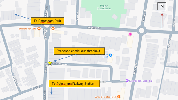
Figure 1.
Locality plan
|
Street Name |
Fishers Reserve at Palace Street |
|
Carriageway width (m) kerb to kerb |
Approx 5.8m |
|
Carriageway type |
Two-way with vehicles utilizing available parking areas to pass oncoming vehicles |
|
Classification |
Local |
|
Speed Limit km/h |
Currently 50 km/h, proposed to be reduced to 10 km/h. |
|
85th percentile speed km/h |
N/A |
|
Vehicles per day (vpd) |
N/A |
|
Last available 5 years of TfNSW recorded crash history |
NIL in last 5 years in Fishers Reserve at the intersection of Palace Street |
|
Parking arrangements |
2P 8am – 10pm Monday – Friday, Permit Holders Excepted Area M5 on the southern side. |
Table 1. Road network detail
The Plan
Council proposes to undertake the following
works in Fishers Reserve, Petersham (Plan No. 10367)
· Construct a new continuous footpath comprising a new 150mm high concrete raised threshold (4.5m long) with 1.7m long ramps on both sides across Fishers Reserve. The 2.5m flat-top section is in plain concrete colour and the 2m flat-top section with the ramps are in charcoal oxide colour;
· Remove existing concrete footpath and construct new concrete footpath (min. 1.65m wide) with new landscaped verge garde (of remaining width) on both sides of Fishers Reserve (where shown on plan);
· Reconstruct existing concrete kerb and gutter on both sides of Fishers Reserve (where shown on plan);
· Install four new stormwater kerb inlet pits as new junction pits and provide cast iron lids matching new surface level (where shown on plan);
· Raise existing junction pit lid matching new surface level (where shown on plan);
· Install new “LOOK” logos and tactiles on both sides of the new continuous footpath treatment (where shown on plan);
· Reinstate and resurface some of the existing roadway with new asphalt adjacent to the new continuous footpath (subject to final funding allocations);
Parking Changes
This proposal will not result in the loss of any
on-street parking spaces as it is contained within the existing ‘No
Stopping’ zones of Fishers Reserve.
Consultation
A letter outlining the above proposal was
distributed to the directly affected properties (25 properties) in Fishers
Reserve as shown in Figure 2. No responses were received regarding the proposed
continuous footpath treatment.
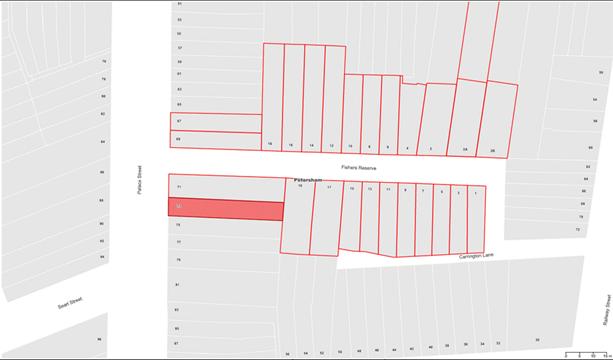
Figure 2. Consultation area
FINANCIAL IMPLICATIONS
The project is estimated to be around $108,000 and will be listed for construction as part of the 2025/2026 Traffic Facilities Capital Program. Fifty percent of the project cost will be funded by the Federal Government Active Transport Fund.
|
1.⇩ |
10367 - Detailed Design Plan |
|
2.⇩ |
Swept Path Diagram |
|
Local Transport Forum Meeting 16 February 2026 |
Subject: Bunnings Tempe Local Area Traffic Management - Design Plan No. HD202 (Midjuburi-Marrickville Ward / Heffron Electorate / Inner West PAC)
Prepared By: Jackie Ng - Graduate Traffic Engineer
Authorised By: Manod Wickramasinghe - Traffic and Transport Planning Manager
|
RECOMMENDATION
1. That the detailed design plans (No. HD202, revision 4) be approved for the: a) Construction of landscaped kerb blisters and speed cushions on Holbeach Avenue, Tempe (Drawing No. LATM4). b) Construction of a raised concrete threshold with the inclusion of bollards and chains (on footpath) near South Street on Wentworth Street, Tempe (Drawing No. LATM5). c) Construction of a raised concrete threshold with the exclusion of bollards and chains (on footpath) near Princes Highway on Wentworth Street, Tempe (Drawing No. LATM6). d) Construction of a raised concrete threshold and renewal of linemarking with the exclusion of rumble bars on Edwin Street, Tempe (Drawing No. LATM9 and LATM11). e) Construction of a raised concrete threshold, installation of an at-grade contrasting pavement treatment, and renewal of linemarking with the exclusion of rumble bars on Tramway Street, Tempe (Drawing No. LATM10 and LATM11). f) Installation of an at-grade contrasting pavement treatment on Barden Street, Tempe (Drawing No. LATM12). g) Installation of an at-grade contrasting pavement treatment on Fanning Street, Tempe (Drawing No. LATM13). h) Installation of an at-grade contrasting pavement treatment on Hart Street, Tempe (Drawing No. LATM14). i) Installation of an at-grade contrasting pavement treatment on Station Street, Tempe (Drawing No. LATM15).
2. That Council in principle support a 10km/h shared zone on Union Street, Tempe between Princes Highway and School Lane (Drawing No. LATM7 and LATM8) subject to approval from TfNSW.
|
STRATEGIC OBJECTIVE
This report supports the following strategic directions contained within Council’s Community Strategic Plan:
|
2: Liveable, connected neighbourhoods and transport |
|
|
EXECUTIVE SUMMARY
The 2021 Tempe South Local Area Traffic Management (LATM) study was re-exhibited in 2022 due to safety and amenity concerns raised by the community regarding the study and the Bunnings Tempe development. Further examination on alternate access arrangements from the Bunnings Tempe development have been conducted and in September 2022, Council approved the Local Area Traffic Management study. Subsequently, design plans were finalised with consideration of community feedback.
This report details the design plans for traffic treatments in the Tempe South Precinct and recommends approval with changes due to the results of community consultation.
BACKGROUND
A report went to Council’s Local Traffic Committee on 20 June 2022 recommending that the Tempe South Local Area Traffic Management Study be endorsed for a second public exhibition, based on the original approved vehicle access arrangements for 728-750 Princes Highway, Tempe. The intention of re-exhibiting the final Tempe South LATM was to finalise the treatments based on community feedback from the initial public exhibition.
At the Local Traffic Committee held on 19 September 2022, the following was resolved in part:
3. 10km/h Shared Zone be supported for Union Street, between Princes Highway and School Lane subject to Transport for NSW approval, and this has been included in the adopted LATM;
4. Detailed design of the recommended treatments in Attachment 1 be reported back to the Traffic Committee prior to construction;
DISCUSSION
The following works are proposed and are illustrated on the attached design plan (No. HD202, Drawing No. LATM2 to LATM16, Revision 4). The proposed works aim to improve pedestrian and motorist safety by reducing traffic speeds.
Specifically, the proposed scope of the work includes the following:
In Stanley Street (Drawing No. LATM2 and LATM3)
· Construct raised threshold in concrete with the raised flat section to be coloured with oxide (charcoal colour);
· Construct new ramp in plain concrete, varying in height from gutter lip to proposed hump;
· Install new signage associated with the works as required and shown on the plan;
In Holbeach Avenue (Drawing No. LATM4)
· Install asphalt speed cushion or similar approved treatment;
· Construct landscaped kerb blister with concrete mountable kerb and reflective paint on edge of blister;
· Install new signage associated with the works as required and shown on the plan;
In Wentworth Street (Drawing No. LATM5 and LATM6)
· Construct raised threshold in concrete with the raised flat section to be coloured with oxide (charcoal colour);
· Construct new ramp in plain concrete, varying in height from gutter lip to proposed hump;
· Construct new bollard and chain barrier
· Install new signage associated with the works as required and shown on the plan;
In Edwin Street (Drawing No. LATM9 and LATM11)
· Construct raised threshold in concrete with the raised flat section to be coloured with oxide (charcoal colour);
· Construct new ramp in plain concrete, varying in height from gutter lip to proposed hump;
· Install new signage associate with the works as required and shown on the plan;
· Reinstate median rumble bars and linemarking
In Tramway Street (Drawing No. LATM10 and LATM11)
· Construct raised threshold in concrete with the raised flat section to be coloured with oxide (charcoal colour);
· Construct new ramp in plain concrete, varying in height from gutter lip to proposed hump;
· Install new signage associate with the works as required and shown on the plan;
· Install at-grade contrasting pavement treatment in accordance with TfNSW delineation manual;
· Reinstate median rumble bars and linemarking, leaving a gap for pedestrian crossing;
In Barden Street (Drawing No. LATM12)
· Install at-grade contrasting pavement treatment in accordance with TfNSW delineation manual;
In Fanning Street (Drawing No. LATM13)
· Install at-grade contrasting pavement treatment in accordance with TfNSW delineation manual;
In Hart Street (Drawing No. LATM14)
· Install at-grade contrasting pavement treatment in accordance with TfNSW delineation manual;
In Station Street (Drawing No. LATM15)
· Install at-grade contrasting pavement treatment in accordance with TfNSW delineation manual;
In Union Street (Drawing No. LATM7 and LATM8)
· Install a 10km/h shared zone with kerbside marked bays overlapping footpath;
· Install at-grade contrasting pavement treatment in accordance with TfNSW delineation manual;
· Install new signage associate with works as required and shown on the plan.
PARKING CHANGES
It is proposed that the landscaped kerb blisters between No.14 and No.16 Holbeach Avenue (Drawing No. LATM4) on the western and eastern side will result in a loss of two (2) parking spaces. All other treatments will not reduce the available on-street parking.
CONSULTATION
Consultation was conducted between 10 November 2025 and 24 November 2025. A letter detailing the proposed works was sent to residents and businesses in the immediate locality for feedback. A total of 332 letters were distributed, and a total of 23 responses were received. A summary of the main concerns is tabled below.
|
Summary of main concerns: |
Council response: |
|
Hart Street – one (1) unsure |
|
|
What is an At-Grade entry pavement treatment? How much will it cost and how much evidence do you have that it will change driver behaviour? |
An At-Grade entry pavement treatment is a section of road, generally near an intersection that has contrasting colour to visually alert drivers to a change in environment, a need to reduce speed, or the presence of a pedestrian zone.
|
|
Have you considered making Hart Street and Station Street one-way going northwest bound? |
Council is in the process of developing a draft LATM Plan for the Tempe and Sydenham precinct. Your comments for a one-way in Hart Street and Station Street will be considered as part of the study. |
|
Holbeach Avenue – one (1) conditional support |
|
|
Supports the proposal on the condition that the kerb blisters be relocated as it will affect delivery trucks serving the businesses. |
Existing parking conditions indicate that a heavy rigid vehicle cannot be parked between the driveways of No.12 and No.14 Holbeach Avenue, Tempe unless the parking spaces have been blocked off.
|
|
Stanley Street – one (1) support, six (6) objections |
|
|
Supports the proposed raised thresholds with suggestion to install parking bay lines in Stanley Street to make parking more efficient. |
Council understands that while marked bays may assist with orderly parking and maximise available on-street spaces, installation of linemarking in such areas may lead to unintended consequences such as reduced parking capacity due to fixed bay sizes that may not suit all vehicle types.
|
|
(6 similar comments)
|
Noted.
Noting the concerns, the proposed raised thresholds have been removed in the recommendation.
It is also noted that the speed limit in Stanley Street has been reduced from 50km/h to 40km/h which will assist in the reduction of speed.
|
|
Concerns regarding availability of on-street parking due to nearby businesses and bus depot. |
Investigation of a resident parking scheme requires at least 10 requests from individual properties before consideration will be given to the introduction of new or extension of existing schemes. |
|
(4 similar comments)
|
Stanley Street is a short and isolated section which would make it difficult to monitor and enforce speeds. Council has recently introduced speed limit reductions in the area of Tempe through the InnerWest@40 project. The project is aimed to reduce travelling speeds to 40km/h in local roads to improve safety for all road users. Council has considered consultation specifically from Stanley Street and based the decision on feedback provided. It is noted that the 85th percentile speed was 45.5km/h and this was recorded prior to the implementation of InnerWest@40. |
|
Additional traffic control measures are required to control the additional traffic volume generated by the Bunnings Development. |
Control measures have been taken at the intersection of Princes Highway and Union Street to limit vehicles travelling into area. |
|
Tramway Street – fourteen (14) objections, twelve (12) objections via petition |
|
|
(14 similar comments)
|
Noted
Initial consultation only allowed residents to provide feedback on the proposed contrasting pavement threshold in Tramway Street although reinstatement of the rumble bars was included in the plan. A total of 61 responses were received, 24 (39%) were dissatisfied or completely dissatisfied, 19 (31%) were neutral, and 18 (29%) were satisfied or completely satisfied with the proposal. It should be noted that the consultation survey did not break up support by residents of individual streets, rather a wholistic support on the LATM devices.
Noting the concern, the rumble bars have been removed from the final recommendation. |
|
Union Street – three (3) support, three (3) unsure |
|
|
(4 similar comments)
|
The proposed “Shared Zone” on Union Street between Princes Highway and School Lane is aimed to address the issue of narrow roads and cars parking on the footpath. It is acknowledged that going from a 10km/h “Shared Zone” to a 40km/h “School Zone” appears unusual, however, the extension of the “Shared Zone” would have additional implications including the potential need to remove the School Zone flashing lights and the removal of the existing pedestrian crossing to reduce confusion regarding pedestrian priority. Consideration of an extension would therefore require further discussion with TfNSW. |
|
(3 similar comments)
|
Linemarking of parking bays in a “Shared Zone” is required by Transport for NSW technical directions and NSW Road Rules. The absence of parking bays would make it illegal to park in a “Shared Zone”. |
|
(2 similar comments)
|
The permanent road closure of Union Street at Princes Highway would reduce through traffic in Union Street but would cause redistribution of traffic in the local precinct. The alternative access via Brooklyn Street and laneways will only serve to transfer traffic to Brooklyn Street. It should be noted that traffic volume in Union Street have been drastically reduced since the implementation of the ‘No Right Turn’ from Princes Highway. Further measures have been taken at the intersection to limit vehicles travelling into the area from Bunnings. |
|
Concerns regarding trucks over 6m length ignoring “No Entry” sign from Smith Street into Union Street. Additionally, trucks are observed turning into Brooklyn Street from Princes Highway, turning left into School Lane and then turning right into Union Street. I regularly watch them get wedged against the telegraph pole and causing damage to parked vehicles and property. |
There are existing restrictions along Princes Highway into side streets banning vehicles over 3t GVM from entering. However, these restrictions do not prevent truck drivers from entering if they are servicing a location within the street. Council can consider further treatment during the review of the LATM in that area. |
|
Wentworth Street – one (1) support, two (2) objections, two (2) unsure |
|
|
Concerns regarding the inclusion of bollards and chains which will negatively affect residents and street usability. The proposal will in practice restrict maneuverability and reduce usable parking space, which contradicts the statement that no parking loss will occur. Furthermore, the bollards and chains can hinder access to driveways, loading/unloading, temporary stopping for deliveries, trades people, carers and service providers, and safe movement for residents with mobility issues. |
The raised threshold near Princes Highway is located approximately 13.5m from the intersection. The exclusion of bollards and chains for this threshold has been recommended as it is unlikely that pedestrians will use the treatment as a crossing due to the existence of kerb ramps at the intersection and the detour they would be required to take to cross Wentworth Street.
The raised threshold near Smith Street is located approximately 7m from the intersection. Council recommends the bollards and chains remain at this location as there is a lack of connecting kerb ramps at this location, and the proximity of the threshold may likely be perceived as a crossing for pedestrians. |
|
(3 similar comments)
|
The raised thresholds will control the entry and exit speeds into Wentworth Street to indicate it is a slower speed environment. Given that Wentworth Street is already narrow (approx. 6.5m) the 85th percentile speed is likely to be low and having midblock speed humps is unlikely to have an additional effect on additional speeds. It is acknowledged that occasionally vehicles will go over the 85th percentile speed, however, the vast majority of vehicles will not be travelling at higher speeds. |
|
Reducing the speed limit to 30km/h may have better results. The speed is currently 40km/h, which is too fast for a narrow street. |
Noted. |
|
I support the proposal in principle, however, a solution needs to address the traffic volumes from Tempe Tyres as well as from Bunnings. Traffic management on South Street is the main issue as it is a single lane thoroughfare with parked cars and two-way traffic flow. |
Noted.
|
CONCLUSION
Based on the response received for the proposals, it is recommended that the detailed design plan (No. HD202, Drawing No. LATM2 to LATM16, Revision 4) for the proposed treatments in the following streets be approved:
1. That Council approve the detailed design plan (No. HD202, Drawing No. LATM2 to LATM16, Revision 4) for the:
i. Construction of landscaped kerb blisters and speed cushions on Holbeach Avenue, Tempe (Drawing No. LATM4).
ii. Construction of a raised concrete threshold with the inclusion of bollards and chains (on footpath) near South Street on Wentworth Street, Tempe (Drawing No. LATM5).
iii. Construction of a raised concrete threshold with the exclusion of bollards and chains (on footpath) near Princes Highway on Wentworth Street, Tempe (Drawing No. LATM6).
iv. Construction of a raised concrete threshold, renewal of linemarking and exclusion of rumble bars on Edwin Street, Tempe (Drawing No. LATM9 and LATM11).
v. Construction of a raised concrete threshold, installation of an at-grade contrasting pavement treatment, renewal of linemarking and exclusion of rumble bars on Tramway Street, Tempe (Drawing No. LATM10 and LATM11).
vi. Installation of an at-grade contrasting pavement treatment on Barden Street, Tempe (Drawing No. LATM12).
vii. Installation of an at-grade contrasting pavement treatment on Fanning Street, Tempe (Drawing No. LATM13).
viii. Installation of an at-grade contrasting pavement treatment on Hart Street, Tempe (Drawing No. LATM14).
ix. Installation of an at-grade contrasting pavement treatment on Station Street, Tempe (Drawing No. LATM15).
2. That Council in principle support a 10kmh shared zone on Union Street, Tempe between Princes Highway and School Lane (Drawing No. LATM7 and LATM8) subject to approval from TfNSW.
It is also noted that the following treatments will be excluded from the proposals:
1. Construction of two (2) raised concrete thresholds in Stanely Street, Tempe (Drawing No. LATM5 and LATM6).
FINANCIAL IMPLICATIONS
The cost of the works is estimated at $260,000 and will be funded/completed by Bunnings Group Limited.
|
1.⇩ |
Detailed Design Plans - HD202 - LATM Devices |
|
2.⇩ |
Detailed Design Plan - HD202 - Union Street Shared Zone |
|
3.⇩ |
Holbeach Avenue, Tempe - Swept Path Analysis |
|
|
Local Transport Forum Meeting 16 February 2026 |
Subject: Wardell Road, Marrickville - Proposed Raised Pedestrian Crossing (Midjuburi-Marrickville Ward / Summer Hill Electorate / Inner West PAC)
Prepared By: Jackie Ng - Traffic Engineer
Authorised By: Manod Wickramasinghe - Traffic and Transport Planning Manager
|
RECOMMENDATION
1. That a raised pedestrian crossing be approved in principle on Wardell Road to replace the existing pedestrian refuge island on Wardell Road near Riverside Crescent, Marrickville. 2. That the proposed raised pedestrian crossing on Wardell Road be included for consideration in Council’s Traffic Facilities Capital Works Program for funding in 2026/2027 financial year. 3. That a detailed design for the proposed pedestrian crossing be brought back to the Local Transport Forum for consideration, including the results of community engagement.
|
STRATEGIC OBJECTIVE
This report supports the following strategic directions contained within Council’s Community Strategic Plan:
|
2: Liveable, connected neighbourhoods and transport |
|
|
EXECUTIVE SUMMARY
At the Council
Meeting held on 18 November 2025, a Notice of Motion (NoM) for “Wombat
Crossing or Other Pedestrian Improvements for Wardell Road” (C1025(1)
Item 31) was considered. The subsequent resolution stated that Council review
pedestrian and cyclist safety at the crossing point on Wardell Road, just north
of the Cooks River Bridge, and to assess the feasibility of installing a wombat
crossing or other appropriate pedestrian safety measures.
Council has collected traffic, and pedestrian counts at the location, and the
results reveal that a pedestrian crossing facility at this location would
comply with Council’s Pedestrian Crossing Warrant Policy. The location of
the proposal is located along a straight stretch of Wardell Road and there are
no geometric concerns with the location. Therefore, it is recommended that a
raised pedestrian crossing be approve in principle on Wardell Road,
Marrickville just north of the Cooks River Bridge and that a detailed design be
undertaken and brought back to the Local Transport Forum for consideration.
BACKGROUND
At the Council meeting held on 18 November 2025, Council resolved the following in part:
3. That Council requests staff to review pedestrian and cyclist safety at the crossing point on Wardell Road, just north of the Cooks River Bridge, and to assess the feasibility of installing a wombat crossing or other appropriate pedestrian safety measures.
It was noted that community concerns were raised about pedestrian and cyclist
safety on Wardell Road, particularly at the crossing point near 80 Riverside
Crescent, Dulwich Hill, where pedestrians and golfers frequently cross between
the Cooks River path, Marrickville Golf Course, and the Dulwich Hill rail
precinct.
DISCUSSION
Wardell Road is a regional road that links the Inner West Council with Canterbury Bankstown Council. Due to the proximity of existing facilities and amenities such as the Cooks River Cycleway, Marrickville Golf Course and Dulwich Hill Station, high pedestrian and vehicular traffic raise concerns for pedestrian access and safety.
Council has subsequently collected traffic, and pedestrian counts at the at-grade pedestrian islands just north of the Cooks River Bridge to determine if the location warranted an upgrade in pedestrian infrastructure. Data collected demonstrates that the site meets Council’s Pedestrian Crossing Warrant Policy.
A summary of the data collected is shown in the tables below:
|
Wardell Road at Riverside Crescent, Marrickville – Weekday Count |
||||
|
Count Type |
AM
Count |
PM
Count |
Pedestrian Crossing Warrant |
Warrant Met |
|
Pedestrian |
30 |
34 |
≥20 |
Yes |
|
Vehicle |
1104 |
1233 |
≥200 |
Yes |
Table 1 – Wardell Road at Riverside Crescent,
Marrickville – Weekday Count
|
Wardell Road at Riverside Crescent, Marrickville – Weekend Count |
||||
|
Count Type |
AM
Count |
PM
Count |
Pedestrian Crossing Warrant |
Warrant Met |
|
Pedestrian |
60 |
35 |
≥20 |
Yes |
|
Vehicle |
742 |
807 |
≥200 |
Yes |
Table 2 – Wardell Road at Riverside Crescent,
Marrickville – Weekend Count
An on-site inspection was undertaken, and it was determined that the existing crossing point on Wardell Road, just north of the Cooks River Bridge is a suitable location to establish a pedestrian crossing with adequate sightlines and no geometric concerns given it is on a straight stretch of Wardell Road.
CRASH HISTORY
A crash was reported in 2023 involving a daylight cross traffic accident (RUM - code 10) causing serious injury at the intersection of Wardell Road and Riverside Crescent.
CONCLUSION
Based on Council’s Pedestrian Crossing Warrant Policy, there are no concerns raised in relation to constructing a raised pedestrian crossing on Wardell Road north of the Cooks River Bridge.
A concept plan is shown in Attachment 1 depicting the preferred location of installation. There is no loss of parking spaces as there are already existing ‘No Stopping’ restrictions along this stretch of Wardell Road.
Consultation of the proposal is to be undertaken as part of the detailed design stage.
FINANCIAL IMPLICATIONS
The cost of the works is initially estimated at $150,000 and the project will need to be included in Council’s Traffic Facilities budget for future funding.
|
1.⇩ |
Wardell Road, Marrickville - Proposed Raised Pedestrian Crossing - Concept Design |
|
|
Local Transport Forum Meeting 16 February 2026 |
Subject: Tempe Station Parking Study
Prepared By: Jackie Ng - Traffic Engineer
Authorised By: Manod Wickramasinghe - Traffic and Transport Planning Manager
|
RECOMMENDATION
That the Local Transport Forum Committee receive and note the report. |
STRATEGIC OBJECTIVE
This report supports the following strategic directions contained within Council’s Community Strategic Plan:
|
2: Liveable, connected neighbourhoods and transport |
|
|
EXECUTIVE SUMMARY
This report outlines the investigation completed in the residential streets surrounding Tempe Station to assess parking impacts due to the opening of the Metro at Sydenham Station and closure of the T3 Bankstown Line. It provides an assessment of parking occupancy rates on a typical weekday and weekend, and if the results warrant any further parking restrictions in the area.
BACKGROUND
At the Council meeting held on 22 October 2024, Council resolved the following in part:
1. That Council urgently undertake parking studies in suburbs around Tempe, St Peters and Sydenham stations with the view to implementing parking controls to better support residents facing additional parking pressures with the opening of the Metro at Sydenham and closure of the T3 Bankstown Line.
The study has been split into areas of investigation, with Area A (Sydenham Station residential side) and Area B (Sydenham Station industrial side) undertaken initially and reported to the Local Transport Forum meeting held on 15 September 2025.
Subsequently, Area C (Tempe Station) and Area D (St Peters Station) were reviewed. This report provides the outcome to the Area C investigation.
DISCUSSION
Area C – Tempe Station
The parking study assessed parking utilisation on a weekday and weekend on residential streets near Tempe Station as shown in Figure 1 below, with a 350-metre radius nominated for the extent of the study.
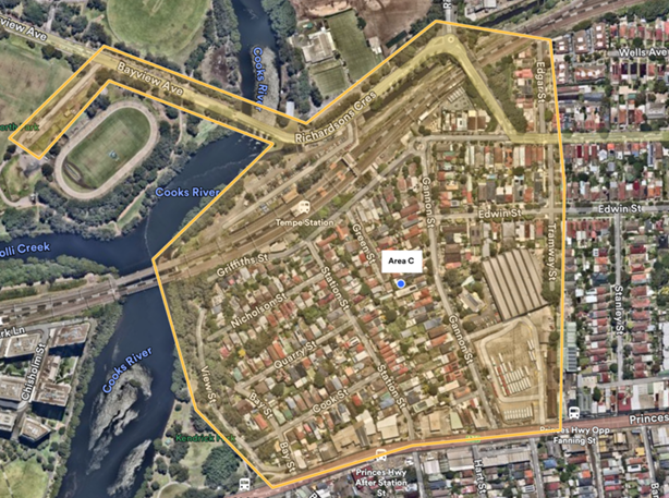 Figure 1 – Tempe
Station Parking Study Area
Figure 1 – Tempe
Station Parking Study Area
Parking occupancy and duration of stay of these unrestricted parking and timed parking spaces to determine if they were in excess 85 per cent capacity, that would warrant consideration of installing timed permit parking restrictions to streets without restrictions.
It should be noted that Council has previously completed a parking occupancy study for Griffiths Street, Nicholson Street and Station Street, prior to the opening of the Metro at Sydenham and closure of the T3 Bankstown Line. A report was considered on the 9 December 2024 Local Traffic Committee and it was subsequently recommended that the implementation of a resident parking scheme on the eastern side of Griffiths Street be approved with signposted ‘2P, 8.30am-10pm, Mon-Fri, Permit Holders Excepted, Area M18’ restrictions.
Weekday parking assessment
Parking surveys were completed on these streets on Wednesday 2 April 2025 between 6am and 10am to assess occupancy and duration of stay to determine if there are high levels of commuter parking in the unrestricted spaces. Commuter parking generation is generally at its highest during 7am-9am, with maximum peak saturation estimated to occur at 10am.
For the weekday assessment, 10am was prescribed as the hour which commuter parking has reached maximum peak saturation (additional commuter parking after this period is likely to be low).
Two (2) key indicators were used to assess whether it is warranted to install timed permit parking spaces:
1. For streets where both sides are unrestricted, the occupancy rate on both sides of the section of street must be greater than 85% at 10am.
2. There must be a low percentage of vehicles recorded on the section of street, with a duration of stay greater than 4 hours (i.e. vehicles that stayed within the same parking space between 6am and 10am are likely to be resident parked vehicles)
The parking occupancy rates recorded for the unrestricted parking and timed permit parking spaces in residential streets are shown in Figure 2 below:
 Figure 2 – Parking
occupancy in unrestricted and timed permit parking areas – Wednesday
Figure 2 – Parking
occupancy in unrestricted and timed permit parking areas – Wednesday
Only certain sections of Griffiths Street and Gannon Street recorded high occupancy rates (greater than 85 per cent) that would warrant the implementation of parking restrictions. However, the duration of stay within these unrestricted parking spaces (which have greater than 85 per cent utilisation rate) indicates that they are mostly used by residents shown in Figure 3.
 Figure 3 – Duration of
stay in unrestricted and timed permit parking spaces with occupancy greater
than 85%
Figure 3 – Duration of
stay in unrestricted and timed permit parking spaces with occupancy greater
than 85%
Figure 3 (above) categorises the duration of stay surveys into two classifications:
· >4 hours; vehicles that were parked in the same space between 6am-10am and did not move. Vehicles within this category are likely to be residential vehicles which did not move at 6am (before the start of commuter parking generation) and remained within the same space until 10am (the end of the survey).
· 1-2 hours; vehicles that were parked within the space for 1-2 hours and could either be resident vehicles leaving the space, commuters, or other works parking in the space between 8am-10am.
Data collected shows that Griffiths Street on the eastern side between Green Street and Station Street, and the western side between Gannon Street and Green Street recorded half (50%) of the parked vehicles at 10am were likely due to commuter parking. It is expected that this section of Griffiths Street would experience high commuter traffic as it is directly adjacent to the rail line.
Weekend parking assessment
Parking surveys were completed in the study area (Figure 1) on Saturday 5 April 2025 between 8am and 6pm, and Sunday 6 April 2025 between 8am and 6pm at 1-hour intervals, to assess parking utilisation on residential streets near Tempe Station.
The survey seeks to assess whether there is a need to extend existing and new timed permit parking restrictions that are signposted as ‘2P, 8:30am-10pm, Mon-Fri, Permit Holders Excepted, Area M18’ to include Saturday and Sunday.
To consider extension of the permit parking restrictions to weekends, a high occupancy rate greater than 85% for either Saturday or Sunday must be recorded within the existing unrestricted and timed permit parking restrictions. The parking occupancy rates used are averages of the 1-hour intervals between 11am-2pm.
 Figure 4 –
Parking occupancy in unrestricted and timed permit parking areas –
Saturday
Figure 4 –
Parking occupancy in unrestricted and timed permit parking areas –
Saturday
 Figure 5 –
Parking occupancy in unrestricted and timed permit parking areas - Sunday
Figure 5 –
Parking occupancy in unrestricted and timed permit parking areas - Sunday
Data collected on the weekend indicates that residential streets near Tempe Station has not experienced a significant increase in parking due to the opening of the Metro at Sydenham and closure of the T3 Bankstown Line. Hence, implementation of parking controls is not warranted.
It is noted that Edwin Street experiences high occupancy rates on Saturday and Sunday on the western side. Parking surveys reveal that occupancy reaches maximum peak at 8am and reduces between 11am to 2pm on Saturday and remains stagnant between 8am to 6pm on Sunday.
CONCLUSION
In conclusion, the parking occupancy and duration of stay surveys collected on a typical weekday and weekend near Tempe Station suggest that the opening of the Metro at Sydenham and closure of the T3 Bankstown Line has had no significant impact upon the on-street parking in the study area. It is recommended that Council notes the results of the Tempe Station Parking Study with no changes to parking controls in the area.
FINANCIAL IMPLICATIONS
There are no financial implications associated with the implementation of the proposed recommendations outlined in the report.
|
1.⇩ |
Tempe Station Parking Study - Parking Occupancy Wednesday |
|
2.⇩ |
Tempe Station Parking Study - Duration of Stay Wednesday |
|
3.⇩ |
Tempe Station Parking Study - Parking Occupancy Saturday |
|
4.⇩ |
Tempe Station Parking Study - Parking Occupancy Sunday |
|
|
Local Transport Forum Meeting 16 February 2026 |
Subject: Mackey Park Resident Parking Scheme (Midjuburi - Marrickville Ward / Summer Hill Electorate / Inner West PAC)
Prepared By: Daniel Li - Student/Graduate Traffic Engineer
Authorised By: Manod Wickramasinghe - Traffic and Transport Planning Manager
|
RECOMMENDATION
1. That the proposed ‘2P 8am-6pm Monday-Friday, Permit Holders Excepted Area M2’ restrictions on Thornley Street not be supported.
2. That the proposed 90-degree angled parking between no. 89 and no.103a Cary Street with Resident Parking Scheme restrictions stating ‘2P 8am-6pm Mon-Fri, Permit Holders Excepted Area M2’ on the northern side of Cary Street (between Carrington Road and Johnston Lane) be approved.
3. That the community engagement results for the proposed ‘2P 3pm-9pm Monday-Friday; 6P 8am-6pm Saturday-Sunday’ restrictions on the southern side of Carrington Road be noted and that these results be combined with further community engagement to be undertaken with residents north of Cary Street.
4. That the community engagement results for the proposed ‘2P 3pm-9pm Monday-Friday; 6P 8am-6pm Saturday-Sunday’ restrictions on the western side of Richardson’s Crescent be noted and that these results be combined with further community engagement to be undertaken with residents north of Cary Street.
|
STRATEGIC OBJECTIVE
This report supports the following strategic directions contained within Council’s Community Strategic Plan:
|
2: Liveable, connected neighbourhoods and transport |
|
|
EXECUTIVE SUMMARY
Council resolved to undertake community consultation to extend the Resident Parking Scheme Area M2 to the industrial precinct around Carrington Road, Cary Street and Renwick Street. This report presents the results of the first phase of consultation completed in the following streets:
· Thornley Street, south of Premier Street;
· Richardson Crescent, east of Carrington Road;
· Carrington Road between Premier Street and Richardson Crescent; and
· Cary Street between Carrington Road and Johnston Lane
The results from the community consultation between July and
August 2024 indicated a low response rate from the area of consultation with a
high support rate for resident parking schemes within the area. Due to the low
response rate, the proposed parking restrictions were not recommended for
installation. To address concerns regarding the low response rate but high
support rate received from the respondents, Council officers have followed up
with a separate community consultation that focuses on the streets that
provided a high support rate for a resident parking scheme and to ensure that
the response rate was not affected by neighbouring streets.
Based on the breakdown of support rate, it is
recommended that parking restrictions with angled parking be approved in Cary
Street and that no parking restrictions be installed in Thornley Street,
Richardson’s Crescent and Carrington Road at this time.
BACKGROUND
Council previously resolved to undertake community consultation on extending the Resident Permit Parking Scheme Area M2 to the industrial precinct around Carrington Road, Cary Street and Renwick Street.
Following community consultation and a parking survey between July and August 2024, a report detailing the results was submitted to Council. The results of the survey indicated a low response rate from the area of consultation with a high support rate from respondents, especially from Cary Street for the proposed parking restrictions, and as such, Council was unable to recommend the installation of parking restrictions within the Marrickville South region.
To address concerns regarding the response and support rate received from the respondents, Council officers have followed up with a separate community consultation that focuses on streets that responded with a high support rate for a Resident Parking Scheme (RPS) including:
· Thornley Street, south of Premier Street;
· Cary Street between Carrington Road and Johnston Lane;
· Richardson's Crescent, east of Carrington Road; and
· Carrington Road between Premier Street and Richardson's Crescent.
DISCUSSION
Residents were consulted on the below proposals:
· Thornley Street – introduction of an RPS ‘2P 8am-6pm Mon-Fri, Permit Holders Excepted Area M2’ on the eastern side of Thornley Street (between Premier Street to number 68 Thornley Street);
· Cary Street
o Option 1: Introduction of an RPS with ‘2P 8am-6pm Mon-Fri, Permit Holders Excepted Area M2’ restrictions on the northern side of Cary Street (between Carrington Road and Johnston Lane);
o Option 2: Introduction of 90-degree angled parking between no. 89 and no.103a Cary Street with the same RPS restrictions from option 1 on the northern side of Cary Street (between Carrington Road and Johnston Lane);
o Option 3: No changes to Cary Street
· Richardsons Crescent – Introduction of timed parking restrictions ‘2P 3pm-9pm Mon-Fri; 6P 8am-6pm Sat-Sun’ on the southern side of Richardsons Crescent (east of Carrington Road, next to Mackey Park);
· Carrington Road – Introduction of timed parking restrictions ‘2P 3pm-9pm Mon-Fri; 6P 8am-6pm Sat-Sun’ on the eastern side of Carrington Road (between Richardsons Crescent and Premier Street)
Survey Results
Table 1 below presents a summary of the parking survey results and investigations into determining which streets may benefit from timed permit parking restrictions. It should be noted that parking utilisation thresholds were in most cases close but did not meet Council's requirement of 85% occupancy.
|
Street |
Average Parking Occupancy (both sides) |
Remarks |
|
Carrington Road between Premier Street and Cary Street |
79% |
· Average for both sides less than 85% utilisation requirement · Parking utilisation on eastern side adjacent to the park was 88% · Timed parking restrictions adjacent to the park may transfer demand to adjacent streets |
|
Richardson Crescent, south of Carrington Road |
86% |
· Parking utilisation on the southern side adjacent to the park was 91% · Timed parking restrictions adjacent to the park may transfer demand to adjacent streets |
|
Thornley Street, south of Premier Street |
82% |
· Average for both sides slightly less than 85% utilisation requirement · Some households on eastern side have no off-street parking and transfer of parking demand may affect these households |
|
Cary Street, between Carrington Road and Johnston Lane |
78% |
· Average for both sides slightly less than 85% utilisation requirement · Some households on eastern side have no off-street parking and transfer of parking demand may affect these households |
Table 1. Parking occupancy rates in the proposed areas for parking restrictions
Public Consultation
A total of 142 consultation letters outlining the proposal
was mailed out to residents and businesses residing in Thornley Street, Cary
Street, Richardson's Crescent and Carrington Road in accordance with the below
consultation area. The consultation period was from 20 November 2025 to
Thursday 18 December 2025. Table 2 provides a summary of the support rate
received and table 3 provides a summary of comments that were received
during consultation. 
Figure 1. Consultation area of proposed parking restrictions
Additionally, Council's adopted Policy for the introduction of Permit Parking Areas states "that before implementing a resident parking scheme in any area, a survey of residents be undertaken to ascertain the level of support for such a scheme and that such support should be in excess of 65% of submissions received provided that the rate of return of submissions is reasonable (higher than 30%).
Based
on the results, all of the surveyed streets have met the required return of
submissions of 30%, however only Cary Street with angled parking (option 2) has
met the required criteria of 65% support rate for RPS implementation.
Notwithstanding, while Carrington Road and Richardson’s Crescent did not
meet the criteria to date. Further consultation is required from residents of
Renwick Street, Warren Road, Ruby Street and Schwebel Street as it is
anticipated that parking restrictions along Mackey Park will impact on-street
parking availabilities in the surrounding streets. Stakeholder consultation
with the clubs will also be undertaken at this point.
|
Proposal |
Total responses received |
Number of votes supporting |
Number of votes against |
|
Thornley Street |
21/44 (41%) |
3 (14%) |
18 (86%) |
|
Cary Street – Option 1 |
24/46 (52%) |
2 (8%) |
N/a |
|
Cary Street – Option 2 |
16 (67%) |
||
|
Cary Street – Option 3 |
6 (25%) |
||
|
Richardson’s Crescent & Carrington Road |
38/106 (36%) |
23 (61%) |
15 (39%) |
Table 2. Public consultation results
|
Street |
Theme |
Resident Comments |
Officer’s Response |
|
Thornley Street |
Resident Parking Scheme |
Creating a Resident Parking Scheme on only one side of the street will push parking to the opposite side of the street, creating even more pressure on residents, caregivers, trades people and visitors to find street parking when this is already an issue. |
Council offers visitor, trades and caregiver permits as part of any Resident Parking Scheme to eligible properties. |
|
The main congestion times are on the weekend and the evening, not the proposed times. |
Council officers have performed a parking occupancy survey and have found that the surrounding streets have high parking occupancies due to commuters from Tempe Station. |
||
|
Most residents have more than two cars and will create conflict with residents. It is suggested that the land on Richardson’s Crescent be used as a carpark. |
Noted. Council currently does not have any plans to install a carpark on parklands. |
||
|
Cary Street |
Taxi’s, abandoned vehicles and long-term vehicle parking |
These changes will improve the lives of our community but still provide options for visitors to the parks and surrounds. |
Noted. |
|
Pushing vehicles onto other streets with unrestricted parking is not a solution. Without installing any restrictions, please address the fleets of rental vehicles and/or taxis. |
Parking restrictions provide the most effective means to enforce fleets of rental vehicles and taxis. |
||
|
Parking scheme |
Timed parking will only push cars further up Cary St where there are no restrictions. There is a shortage of parking on the entire plan. |
Council records indicate that majority of the properties on Cary Street between Illawarra Road and Excelsior Parade contain off-street parking. The parking occupancy survey also indicates that there is capacity for vehicles that are not eligible for permits. |
|
|
Angle parking |
Recommended to install 45-degree angled parking on both sides of Cary St between Carrington Rd and Excelsior Pde to create a chicane and slow the traffic. |
Council is unable to support the installation of 45-degree angled parking on both sides of Cary Street as it has been identified that Cary Street is a flood affected area in which stormwater may flow into the kerb and gutter. The width of the street not wide enough to support angle parking on both sides and two travel lanes, albeit 45 degree angle parking. |
|
|
Richardson’s Crescent & Carrington Road |
Taxi’s, abandoned vehicles and long-term vehicle parking |
Timed parking will help reduce people parking on the streets for business in the city as well as travel. |
Noted. |
|
Timed parking restrictions |
It’s all or nothing. Zone the entire area or don’t do anything at all. By “solving” this problem, it’s creating worse problems for neighbouring streets. |
Council has scheduled for consultation in Renwick Street to Schwebel Street in the next phase of Mackey Park parking changes |
|
|
The proposed restrictions are too generous allowing up to 6 hours on a weekend day. This will increase parking spillover into neighbouring streets. |
6P parking is only applicable on the weekends and 2P parking is proposed during the weekdays. This has been designed to prevent long stay vehicles from commuters and taxis. |
||
|
This area of Marrickville does not need restrictions. Only abandoned and unregistered vehicles should be removed. |
Noted. Council is already undertaking enforcement of abandoned and unregistered vehicles however, parking restrictions allow for more efficient enforcement. |
Table 3. Summary of feedback received from public consultation.
Conclusion
To address concerns of high support rates received during the July and August
2024 community consultation to extend the RPS Area 2 zone, Council has
undertaken further consultation in Thornley Street, Cary Street,
Richardson’s Crescent and Carrington Road, Marrickville.
Based on the community consultation, it is recommended that ‘2P 8am-6pm Mon-Fri Permit Holders Excepted Area M2’ with angled parking between number 89 and 103a be approved in Cary Street. It is also recommended that the proposed restrictions on Richardson’s Crescent and Carrington Road be noted and that further consultation with sporting clubs of Mackey Park and surrounding streets of Renwick Street, Warren Road, Ruby Street and Schwebel Street be undertaken prior to making a final decision.
FINANCIAL IMPLICATIONS
The proposed restrictions and angled parking will be funded with Council's signs and line marking budget.
|
1.⇩ |
Thornley Street - Proposed RPS |
|
2.⇩ |
Cary Street - Proposed RPS Option 1 |
|
3.⇩ |
Cary Street - Proposed RPS Option 2 |
|
4.⇩ |
Richardson's Crescent & Carrington Road - Proposed Parking Restrictions |
|
Local Transport Forum Meeting 16 February 2026 |
Subject: Unnamed Laneway, Marrickville rear of Church Street and Warren Road - Adjustment to No Parking Restriction (Midjuburi-Marrickville Ward / Summer Hill Electorate / Inner West PAC)
Prepared By: Jackie Ng - Traffic Engineer
Authorised By: Manod Wickramasinghe - Traffic and Transport Planning Manager
|
RECOMMENDATION
1. That the existing ‘No Parking’ restriction on the southern side of the laneway (at the rear of Church Street and Warren Road, Marrickville) be extended west by 2m, up to the gate of No.43 Warren Road (Option 1).
2. That if access issues continue, further consideration be given to extending the ‘No Parking’ restriction on the southern side of the laneway by a further 9m (Option 2).
|
STRATEGIC OBJECTIVE
This report supports the following strategic directions contained within Council’s Community Strategic Plan:
|
2: Liveable, connected neighbourhoods and transport |
|
|
EXECUTIVE SUMMARY
This report outlines the existing parking challenges within an unnamed laneway at the rear of Church Street and Warren Road, Marrickville. Concerns have been raised regarding access to the rear garage of No.12 Church Street in the northbound direction when cars are parked partially across the driveway No.43 Warren Road. Vehicles parked in this arrangement block access to the rear garage of No.12 Church Street due to insufficient road width to accommodate the turning circle of a car. Two options have been proposed to alleviate the access issue at the location with a preference for Option 1, and further consideration be given to Option 2 should access issues continue. Option 1 proposes extending the existing ‘No Parking’ restriction on the southern side of the unnamed laneway by a further 2m to the rear gate of No.43 Warren Road. Option 2 proposes extending the ‘No Parking’ restriction a further 9m to the power pole at the rear of No.43 Warren Road.
BACKGROUND
Concerns have been raised regarding driveway access at the unnamed laneway at the rear of Church Street and Warren Road, Marrickville. A report on this matter was previously considered by the Local Traffic Committee.
At the Local Traffic Committee meeting held on 15 September 2025, the Council officer’s recommendation was as follows:
That the relocation of the ‘No Parking’ restriction a further 2-metres north in the laneway at the rear of Church Street and Warren Road, Marrickville be approved.
It was noted during the meeting that the residents from No.43 Warren Road, Marrickville raised concerns about the loss of parking and that they frequently use the laneway to access their work vehicle to load and unload equipment. Additionally, concerns regarding the number of car accidents and car damage on Warren Road resulted in the residents using the laneway to park their vehicles.
Furthermore, written comments from the residents from No.19 Church Street, Marrickville advised that the recommendation did not resolve their concerns regarding accessing their property as the proposed adjustment of the ‘No Parking’ restriction did not provide adequate space to access their garage.
It was subsequently recommended by the committee that no changes be made to the existing ‘No Parking’ restriction on the unnamed laneway at the rear of Church Street and Warren Road, Marrickville.
The recommendation of the Traffic Committee was considered by Council at its meeting held on 28 October 2025. Council subsequently resolved to defer the matter for further consideration at the Local Transport Forum after further engagement with affected residents.
DISCUSSION
The existing parking arrangement (Figure 1) currently allows unimpeded access to the driveway of No.12 Church Street, Marrickville in the southbound direction. However, vehicles have been observed to park in the 2m kerb space at the rear of 43 Warren Road. This parking behaviour overhangs the off-street parking of 43 Warren Road or overhangs into the ‘No Parking area’.
![]() It is
understood that when cars are parked in this location, vehicle movement from
the driveway of 12 Church Street is impacted in the northbound direction.
It is
understood that when cars are parked in this location, vehicle movement from
the driveway of 12 Church Street is impacted in the northbound direction.
Figure 1 – Existing arrangement
Further consultation with affected residents has been undertaken and Council has proposed two options with preference for option 1.
Option 1 (Figure 2) proposes that the existing ‘No Parking’ restriction on the southern side of the unnamed laneway (at the rear of Church Street and Warren Road) be extended 2m to the rear gate of No.43 Warren Road, Marrickville. This is expected to minimise overhanging vehicles into the existing ‘No Parking’ restriction which impacts the vehicle turning path from the rear access garage of No.12 Church Street, Marrickville.
Figure 2 – Option 1
Option 2 (Figure 3) proposes that the ‘No Parking’ restriction be extended by a further 9m to the power pole at the rear of No.43 Warren Road, Marrickville. This would provide unimpeded access in both directions for the rear access garage of No.12 Church Street, Marrickville.
As parking in front of driveway is not permitted, this option simply clarifies the statutory parking requirements and would minimise overhanging in front of the garages of No.43 Warren Road.
Figure 3 – Option 2
SWEPT PATH
A swept path analysis of the existing arrangement has been completed and is shown in the figure below.
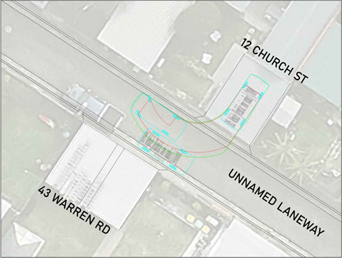
Figure 4 – Swept Path
CONSULTATION
Consultation with both affected residents has been conducted and their comments have been tabled below.
|
Resident comments |
Council response |
|
· Would prefer that there be no change to the existing location of the ‘No parking’ sign. However, Option 1 is the better option, noting that this would still interfere greatly with parking capacity. · It appears the crux of the issue aligns closer to a neighborhood dispute rather than a significant and material concern. |
Noted.
|
|
· Option 1 still restricts access if vehicles park across the driveway due to the turning circle needed. We will be requesting option 2. · Under the current arrangement, there are still occasional issues with overhanging vehicles in the ‘No Parking’ zone. · When cars are parked in spaces at the rear of No.43 and No.41 Warren Road, we cannot access our garage at all. These situations usually occur on weekends and after hours. · Medical emergencies have become stressful when there are cars blocking access to the rear garage. |
Noted. |
CONCLUSION
In order to provide unobstructed driveway access to No.12 Church Street, it is recommended to extend the existing ‘No Parking’ restriction on the southern side of the unnamed laneway (rear of Church Street and Warren Road, Marrickville) by 2m to the rear gate of No.43 Warren Road (Option 1). Further consideration should be given to extending the ‘No Parking’ restriction by a further 9m if access issues continue (Option 2).
FINANCIAL IMPLICATIONS
The cost of installation of signs as recommended can be funded by Council’s signs and line marking budget.